England Ireland Find Havens
England Ireland Find Routes
Boat
Maintenance
Comfort
Operations
Safety
Other


NextPrevious

Coastal Overview for Cork Harbour to Mizen Head

Tides and tools
Overview


What is the route?
This provides a set of waypoints that lead between Cork Harbour and Mizen Head. It also provides a detailed coastal description for the entire distance to support local navigation for those intending to come close inshore or approach one of the havens along its length. The sequence of description is from east to west or coastal clockwise, as follows:

  • • Close South of the Old Head of Kinsale

  • • South of The Stags

  • • South Of Clear Island
The preceding southern coast's set of waypoints and coastal description is available by clicking 'Previous', above, and vessels planning on continuing northwards, past Mizen Head and beyond, can find the following sets of waypoints and coastal descriptions by clicking 'Next'.

Why sail this route?
This is a coastal sequence for cruisers who want to stay in inshore waters to enjoy the coastal scenery that this simply beautiful sailing area has to offer. It is also conveniently close to the many listed passage havens in the islands, bights and estuaries described along the way.

What are the navigational notes?
Please use our integrated Navionics chart to appraise the route. Navionics charts feature in premier plotters from B&G, Raymarine, Magellan and are also available on tablets. Clicking the 'Expand to Fullscreen' icon opens a larger viewing area in a new tab.

Expand to
new tab or fullscreen
Please zoom out (-) if all of the waypoints are not displayed.
The above plots are not precise and are indicative only.

CORK HARBOUR TO MIZEN HEAD
OVERVIEW

The sixty-three miles of coast between Cork Harbour and Mizen Head is one of the countries prime leisure sailing destinations as well as being the normal landfall for vessels approaching Ireland from the Atlantic Ocean.

The section of coast is characterised by rock cliffs interspersed by numerous headlands and peninsulas. The area near Clear Island, the south-westernmost corner of Ireland, is high and bold with the northerly mainland increasing in height in the backdrop. To the east of Clear Island, the shore retains its bold aspect but is less indented.

The southwest portion of the coast takes the full violence of the North Atlantic’s prevailing westerly gales and is subject to heavy seas and swell. This has created the irregular broken aspect particularly within the area between Mizen Head and Cape Clear Island. Here the coast is indented with a broken bay that abounds in islands, bights and estuaries. It offers a host of safe and beautiful anchorages. The seas become less turbulent as a vessel progresses to the east and likewise the coastline.

The coastline is relatively free of hidden dangers. Fastnet Rock, with a lighthouse, lies about nine miles east-southeast of Mizen Head. It has a Traffic Separation Scheme established to the southeast of the rock. Inshore the well covered but breaking Daunt Rock, off the entrance of Cork Harbour, and the 20 metres high Stag Rocks, off Toe Head, are the principal dangers. There are a few additional off-lying dangers that lie off the salient points.

Tides are weak in this area with spring rates seldom exceeding a maximum of 1 to 1.5 knots offshore although they can run stronger off headlands.

Cruisers should pay particular attention to the areas excellent weather forecasting and not risk a gale at sea over what would most likely be a lee shore here. On the first appearance of a change, seek shelter in one of the many havens the coast has to offer. Marine farming in and around this coastal area is rapidly growing. Large steel-jointed fish cages with tubular rubber sides, are marked on the charts but may be placed anywhere, and the structures are hardly visible. Each cage is required to be marked by two yellow flashing lights and a radar reflector.


LISTED WAYPOINTS

The complete course is 63.17 miles from the waypoint '½ a mile east of the Cork Sea Buoy' to '½ a mile southwest of Mizen Head' tending in a west south westerly direction (reciprocal east north easterly).

½ a mile east of the Cork Sea Buoy, 51° 42.935' N, 008° 14.910' W
The Cork Sea Buoy has LFl 10s and is situated 5 miles south of the Cork Harbour entrance. The waypoint is in the alignment 354°T of the leading lights at Dogsnose situated about 1½ miles within the entrance and on the east side of Cork Harbour.

       Next waypoint: 12.62 miles, course 237.38°T (reciprocal 57.38°T)

250 metres south of the Old Head of Kinsale headland, 51° 36.113' N, 008° 32.018' W
This is close in under the Old Head Of Kinsale headland where there stands a lighthouse, black with two white bands, Fl (2) 10s 72m 20M. The southern side of projecting headland has steep cliffs. Comming in close under the headland passes to the north of a race, or overfalls, that extend for nearly a mile southward of the head, that set on the ebb tide it in a south-westerly direction, and on the flood to a south-easterly direction.

       Next waypoint: 27.42 miles, course 251.56°T (reciprocal 71.56°T)

¼ south of Kowloon Bridge South Cardinal (The Stags), 51° 27.323' N, 009° 13.735' W
This passes south of Toe Head and The Stag Rocks, a cluster of rugged, precipitous rocks, 20 metres high, that lies ¾ of a mile south of the headland. A wreck lies about 0.2 of a mile southwest of The Stags and it is marked by Kowloon Bridge south cardinal buoy, Q(6)+L Fl.15s which is moored 800 metres southward of The Stags.

       Next waypoint: 10.99 miles, course 256.16°T (reciprocal 76.16°T)

½ a mile south of the southernmost point of Cape Clear (Clear Island), 51° 24.675' N, 009° 30.830' W
This is south of Clear Island's southernmost extremity Blananarragaun.

       Next waypoint: 12.14 miles, course 279.16°T (reciprocal 99.16°T)

½ a mile southwest of Mizen Head, 51° 26.580' N, 009° 50.040' W
This is immediately outside the races that form, in both directions, of Mizen Head. The headland is made conspicuous lighthouse on a concrete platform Iso.W 4s 44m 15M with the lantern visible 313°-133°.


CORK TO THE OLD HEAD of KINSALE

Residing between Cork Head on the west side and Power Head to the East, Cork Harbour Click to view haven is moulded into the lower reaches of the River Lee. Reportedly the second largest natural harbour in the world and Ireland's second-largest port, it is one of the most secure and easily accessed harbours in Ireland. Having the separate ports of Cork, Cobh, Whitegate and Ringaskiddy, within its confines, it is the principal south coast commercial harbour and a key centre for leisure craft sailing. The harbour offers a host of berthing opportunities with shelter from all winds and seas. Ireland’s second-largest city, Cork, is situated on both sides of the river about fifteen miles above the entrance.
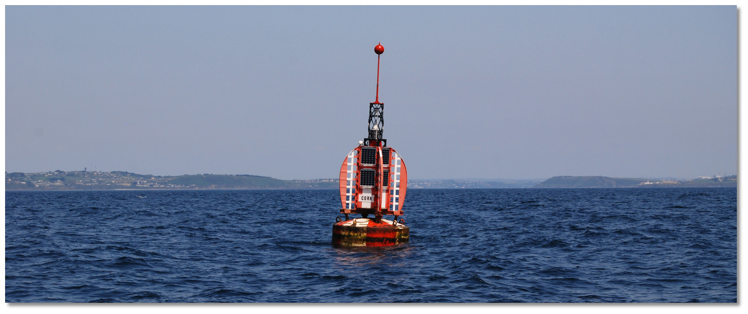

Cork Sea Buoy with Cork Harbour entrance in the backdrop
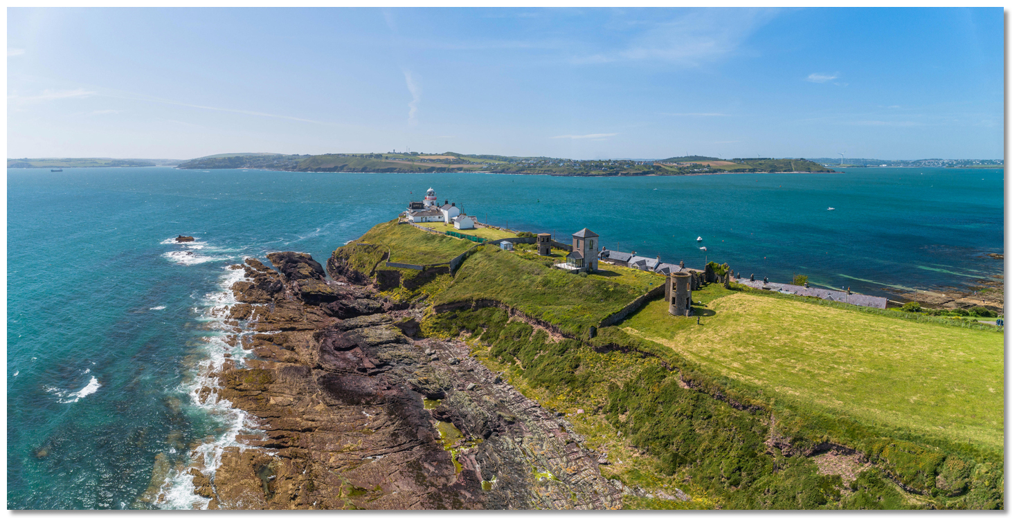
Photo: Burke Corbett


The principal features that first present themselves to a vessel approaching Cork Harbour from the sea are the high bluffs of Dogsnose on the east side of the entrance, and Ram’s Head, about 0.6 of a mile north of Weaver’s Point, on the entrance’s western side. On the summit of the Dogsnose, where Fort Carlisle, renamed Fort Davis, will be seen with a notable double-wall immediately east, running down the face of the hill to the sea. Fort Camden, renamed Fort Meagher, faces Fort Davis will be also seen on opposite sides of the harbour entrance on the summit of Ram’s Head. One mile south-southwest of Fort Meagher the ruined Templebreedy Abbey, with a spire, stands on high land and a notable water tower, with a radio mast, will be seen close north of the Abbey.


Roche’s Point Light and the disused signal towers on the eastern entrance
point

Image: Michael Harpur


Upon a closer approach, Roche’s Point Light, the disused signal towers and Roche’s Tower, about 410 meters to the east, comes into view. The entrance to the harbour lies 0.8 of a mile south of the forts, between Roche’s Point and Weaver’s Point. The surrounding land on each side of the entrance is relatively low. A light is shown from Roche’s Point. Upon rounding Roche’s Point the entrance to the harbour opens, and the entrance channel is well marked by lighted buoys.


The entrance to Ringabella
Image: Michael Harpur


Ringabella Bay is a large and remote coastal bay situated slightly over 1½ miles southwest of the entrance to Cork Harbour. Within the bay is the drying Ringabella Creek that is overlooked by the coastal village of Fountainstown. Channels through the creek are navigable on the tide for a distance of about 2¾ miles, as far as Minane Bridge.


Ringabella Creek overlooked by Fountainstown
Image: Michael Harpur


Ringabella Bay provides an anchorage close outside its entrance but becomes shallow from a line drawn northward across the entrance to the creek from Ringabella Point. Vessels that can take to the bottom will find ample opportunity to dry inside Ringabella Creek on its extensive hard sand flats.


Robert's Cove
Image: Michael Harpur


Four miles to the west of the entrance to Cork Harbour, and eleven miles east-northeast from the Old Head of Kinsale, is the bluff Roberts Head that is made conspicuous by an old telegraph tower about ½ a mile to the north of it. In Carrigadda Bay, at the west side of the head, there is a reef called Long Rock, that uncovers out to the distance of 600 metres from the shore. An anchorage can be had in Robert’s Cove Click to view haven inlet ½ a mile to the north.


Robert's Cove opening up
Photo: Burke Corbett


The pinnacle of Daunt Rock, with 3.5 metres of water over it, rises from a rocky bed of about 200 metres in diameter. Situated ¾ of a mile to the southwest of Roberts Head the area frequently breaks in bad weather. Its position is marked by a port marker, moored to the east of the rock.

Daunt – port buoy Fl (2) R 6s 4M position: 51°43.531'N, 008°17.665'W


Roche Point light on the east side of the entrance to Cork Harbour
Photo: Charles W. Bash via CC BY-SA 2.0


By night the red light sector of Roche Point lighthouse, on the east side of the entrance to Cork Harbour, covers Daunt Rock. Roche’s Point light sectors are as follows: (Red. Vis.) Red shore-292°. White 292°-016° (84°). Red 016°-033° (17°).White (unintensified) 033°-159° (126°). Red 159°- shore.

Roche’s Point - Fl WR 3s position: 51° 47.586'N, 008° 15.287'W


There is a clear passage between Daunts Rock and Robert’s Head, with 12 and 16 metres of water that cruisers may take advantage in moderate weather. Approaching from the south the alignment 008° T of Templebreedy Church, located four miles north-northeast, and Morris Head 1½ miles north-northeast. From the north, the alignment 241° T of Little Sovereign, 5½ miles west-southwest and Reanies Point, 1½ miles to the southwest – as best seen on Admiralty 1765.
Please note

In unsettled weather this cut must not be attempted, as the sea sometimes breaks right across from the rock to the headland.


Oyster Haven with Kinsale Harbour in the backdrop
Image: Erik Sykora


Nine miles to the southwest, from Cork Harbour to Oyster Haven, the coast is high, bold, and rocky, with the only danger being Daunt Rock. The most projecting part of the land, between here and the Old Head of Kinsale, is Reanies Point. Bold and precipitous, it rises perpendicularly to the height of about 43 metres and is conspicuous when approaching from the east for a number of gateposts and pillars on it.


The Sovereigns as seen from a vessel approaching Oyster Haven
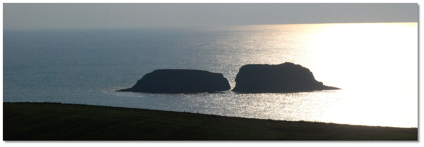
Image: Burke Corbett


Two remarkable rocky islets called The Sovereigns reside in front of Oyster Haven. The westernmost called Big Sovereign, 22 metres high, at ½ a mile to the south of the haven, is precipitous, inaccessible, and bold too. A cleft, through which a small boat may pass at high water, divides it into nearly equal portions.


Big Sovereign shows its distinctive shape in silhouette
Photo: Michael Harpur


Little Sovereign is about 300 metres from the east point of the entrance to Oysterhaven. Between Little Sovereign and the mainland is a rock with 2.1 metres of water. The islets are otherwise clear of danger and may be passed at 100 metres off.


Little Sovereign laying off the east point of Oyster Haven
Photo: Michael Harpur


Just within the Sovereign Islands, is the very pleasant and sheltered inlet of Oyster Haven Click to view haven. It is entered between Ballymacus Point and an unnamed point situated about ¾ of a mile east-northeast of Little Sovereign. To the northwest of this eastern entry point is Kimure Point on the east shore of Oyster Haven, about 0.6-mile northeast of Ballymacus Point.

Oyster Haven within the entrance
Image: Michael Harpur


The only danger in the haven is Harbour Rock, with a depth of 0.9 metres, situated about ½ a mile within the entrance and midway between Ferry Point and the east shore. The best channel to avoid this danger is the western side of the haven.


Kinsale Harbour as seen over James's Fort
Image: Michael Harpur


Situated 1½ miles within the mouth of the Bandon River, about 11 miles southwest of Cork Harbour’s entrance, is the key leisure sailing destination of Kinsale Harbour Click to view haven. Entered between Shronecan Point and Preghane Point, about 0.6-mile east-southeast, the harbour is set into the River Bandon estuary. Set in the fjordlike valley river estuary, and in a virtually landlocked natural harbour, the harbour offers complete protection to leisure vessels against all winds and seas; albeit subject to a bit of a chop in strong south-easterlies.


Kinsale Quay with its flanking marinas
Image: Michael Harpur


The harbour entrance is easily distinguished from seaward by the well its defined river valley. Ardbrack Church, on the east side of the Harbour about a mile within the entrance, stands out conspicuously white. Likewise, Charles Fort will be seen, standing ½ a mile south of the church. At night Charles Fort light leads to the entrance with sectored light coverage: W 358°-004° (6°T). R 004°-168° (164°T). G 348°-358° (10°T).

Charles Fort - Fl WRG 5s position: 51°41.752'N, 008°29.984'W


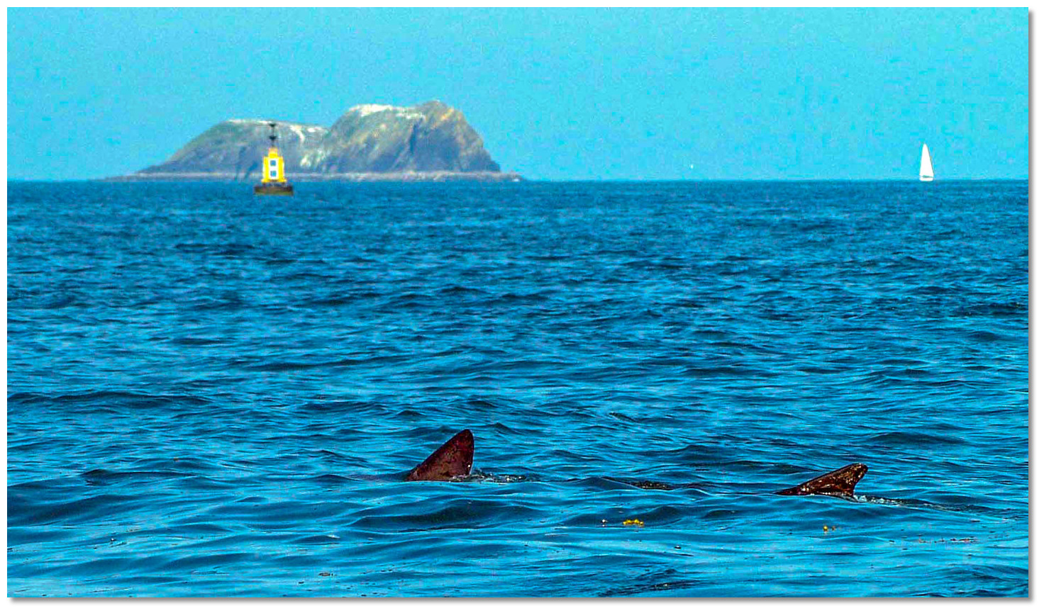
Entering Kinsale Harbour with a basking shark, Bulman and Big Sovereign to
starboard

Image: Karl Gabe via CC BY SA 2.0


The key Kinsale danger is the Bulman Rock, with 0.9 metres of water, situated 400 metres south from Preghane Point, the eastern point of the entrance. It is bold too, always breaks in bad weather, is marked by a south cardinal buoy and the previously discussed marks for clearing it are well defined.

Bulman - south cardinal buoy Q (6) + LFl 15s position: 51°40.136'N, 008°29.739'W

There is a clear inshore passage for vessels approaching from the east between the Bulman Rock and Preghane Point. The leading mark for which is the north end of Big Sovereign Island, closing with Frower Point – the clearing line as best seen on Admiralty Chart 2053.


Charles Fort with its light on the eastern shore
Image: Michael Harpur


The channel in the vicinity of Blockhouse Point, about 1.2 miles north of Shronecan Point, is marked by three lighted buoys that must be adhered to. The busy commercial and fishing port provides a large scale marina, visitor moorings and the option to anchor, if a little further off, a thriving historic town.

Kinsale
Photo: Tourism Ireland


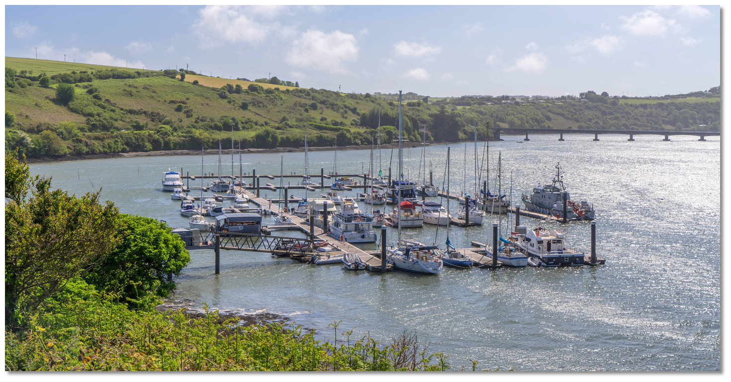
A further marina, Castlepark Marina Click to view haven lies ⅓ of a mile above the town of Kinsale on the east bank of the River Bandon on the Castlepark peninsula. It is a full service 130 berth marina that can cater for vessels of up to 50 metres LOA and carrying up to 6 metres of water.

Castlepark Marina close upriver and opposite Kinsale
Image: Michael Harpur


Continuing westward from Kinsale Harbour, Sandy Cove Click to view haven and located 500 metres east of Shronecan Point, offers an anchorage immediately outside the entrance on the western shoreline.

Sandy Cove
Image: Michael Harpur


The coast between Sandy Cove and the Old Head of Kinsale is of moderate elevation and free from danger.


OLD HEAD OF KINSALE TO GALLEY HEAD


Old Head of Kinsale Headland and Holeopen East
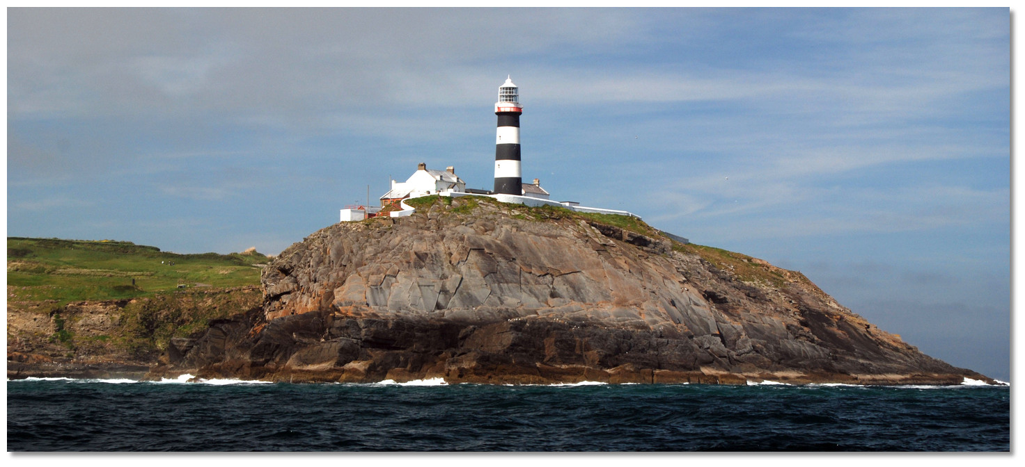
Photo: Tourism Ireland


Located 4½ miles to the south of the Old Head of Kinsale the bold projecting Old Head Of Kinsale headland is bounded by steep cliffs with a lighthouse. The head’s outer portion rises to a height of 76 metres and is almost isolated except for a narrow isthmus, about 120 metres across, that connects it to the mainland. The isthmus was penetrated by subterranean passages that a tender could pass through and hence the titles Hole Open bays either side. This passage, after many centuries, sadly collapsed in 2008. The ruin of De Courcy Castle stands over the isthmus, and a short distance to the north of it there is an old telegraph tower.


Old Head of Kinsale Lighthouse
Photo: Burke Corbett


On the extreme southern point of the head is a lighthouse. The 30 metres high tower is painted black with two white belts and is visible in clear weather for up to 20 miles. There is a disused light structure standing about ½ a mile north of the light on the eastern side of the headland

Old Head of Kinsale - lighthouse Fl (2) 10s 72m 20M position: 51°36.287'N, 008°32.018'W


Bream Rock as seen from Holeopen Bay East
Image: Burke Corbett


On the east side of the head, ½ a mile north of the lighthouse, there is a low-lying flat rock called the Bream. It extends out 200 metres from the shore and is steep-to. Apart from that, the head is quite clear of danger.
Please note

On the ebb tide there is a race or overfalls setting from it in a south-westerly direction, for nearly a mile, and on the flood to the south-east for about same distance.


Temporary anchorages can be had during west winds about ¾ of a mile to the north in Hole Open Bay East Click to view haven. Likewise, and on the west side of the head, in Holeopen Bay West Click to view haven in the right wind conditions and the absence of Atlantic swell. Neither bays provide any landing point.


Holeopen Bay West on the west side of the Old Head of Kinsale
Image: Dr. David J. Otway


Between Old Head of Kinsale and Seven Heads, a distance of 7 miles in a west-by-south direction is Courtmacsherry Bay. The east shore of Courtmacsherry Bay is fringed with rocky ledges, extending up 400 metres from the shore. In its eastern bend is a long sandy beach with foul ground in front of it. Barrel Rock is the bay's main drying rocky area. It is over 1 mile out from the shore and was marked by a beacon that is now unmaintained and cannot be relied upon.


The head of Coolmain Bay
Image: Rob O'Connor


Set in northeast corner of Courtacsherry Bay fronting the entrance of Courtmacsherry Harbour is Coolmain Bay Click to view haven. Entered between Wood Point and Coolmain Point and on the approaches to Courtmacsherry it extends about ¾ of a mile northward. Although mostly used as a tide wait location for Courtmacsherry Harbour, Coolmain Bay offers a good anchorage in its own right. The gradually shelving bay is well sheltered, from the west round through north to east, and is of itself clear of outlying dangers.


Courtmacsherry Harbour
Image: Michael Harpur


Locally known as Courtmac, Courtmacsherry Harbour Click to view haven adjoins the northwestern side of Coolmain Bay and is set within the estuary of the Argideen River. The small seaside village of Courtmacsherry consists of a single long street on the south side of the river that is situated a mile to the west of Wood Point with thick woods on rising ground behind. The village has a pier, slipway and visitor pontoon in the centre of the village. The harbour is somewhat restricted by a sand bar that has 1.8 metres LAT, about 2 metres at LWS, which makes it accessible by most vessels at all states of the tide. Vessels carrying significant draft will need to enter with half a following tide and will be navigating whilst being carried in by a significant tidal flow. From here a narrow and well-marked channel increases in depth to 2.4 metres as it passes close off the southern shore, westward of Wood Point, to the town quays where depths in excess of 4 metres can be found.
Please note

The sand on the bar and channel shift so it is worth checking in advance and it breaks in strong south and south-easterly winds when it should not be attempted.


Courtmacsherry's pier and visitor pontoon
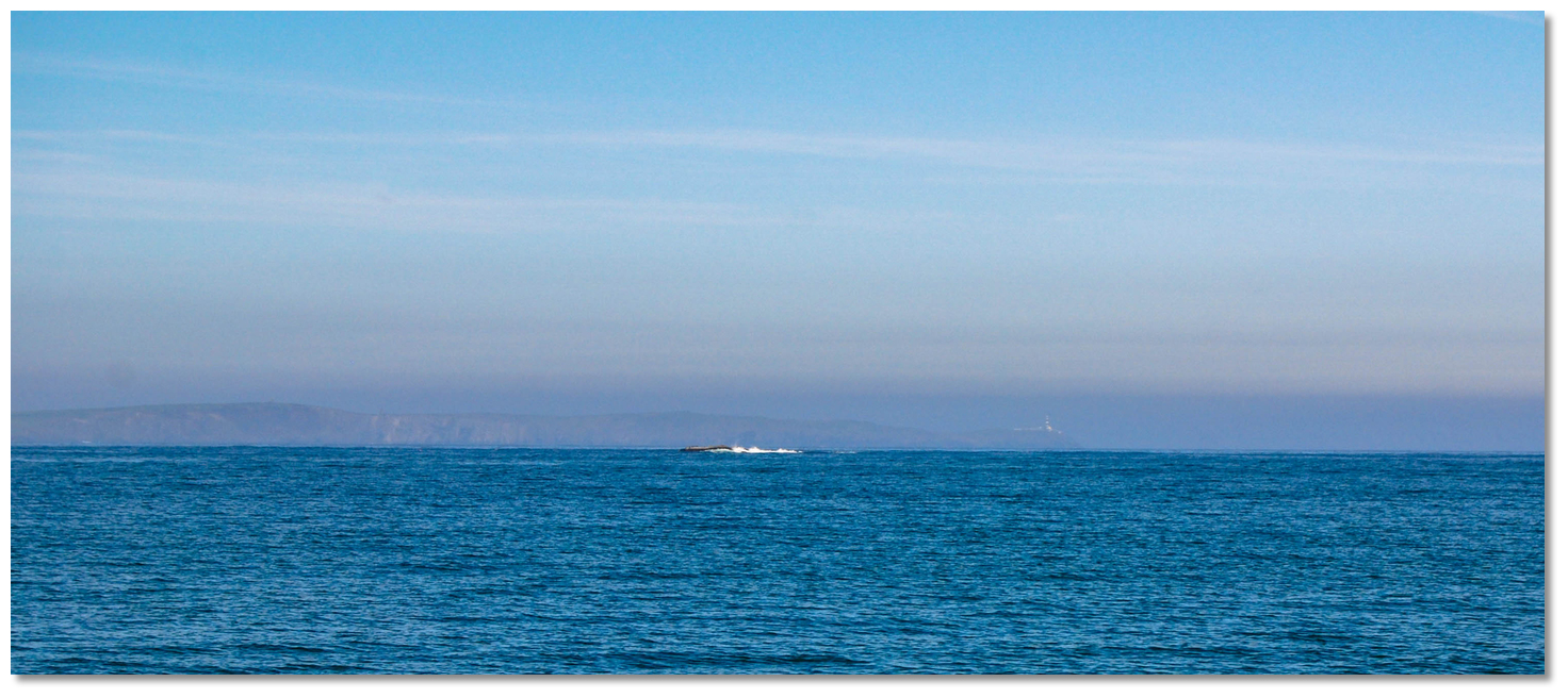
Image: Michael Harpur


Both are approached through Courtmacsherry Bay, which lies between Seven Heads and Old Head of Kinsale with the river entered about 6 miles to the northwest of the latter. The bay has an exposed aspect and is encumbered with dangerous rocks. The outermost is Horse Rock.


Horse Rock as seen from Blindstrand Bay with the Old Head just visible in the
backdrop

Image: Burke Corbett


Awash at high water Horse Rock is situated 600 metres to the east of Barry Point, with a deep and clear passage of 11 to 15 metres of water between them.

Horse Rock (& Foal Rock) – unmarked position: 51° 36.630’N, 008° 40.000’W


Horse Rock
Image: The Pink Elephant


Near the middle of the bay, the Barrel Rocks consist of two patches. The outer rock, 1.2 miles out from the north shore, covers on last quarter flood, when its position has in the past been marked by a south cardinal beacon. Its south side is steep-to, but it is foul for some distance to the northeast of the perch.
Please note

Although noted on Admiralty charts this marker has been planned for dis-establishment by the Commissioner of Irish Lights.


Barrel Rock – south cardinal beacon position: 51° 37.006’N, 008° 37.298’W


Between this rock and the north shore, there is another large patch of foul ground that rarely uncovers called the Inner Barrels. There is a passage between these rocks, and the well covered straggling Breen Rock, with 4.5 metres of cover over it, and the foul ground skirting the north shore.


Black Tom with the Barrel Rocks and beacon in the backdrop
Image: Burke Corbett


The final key rocks of the Courtmacsherry Bay are the pinnacle rocks of Blueboy and Black Tom. Blueboy has 0.2 metres of water over it and is just under ½ a mile east of the Barrel Rock.

With 2.3 metres of water Black Tom is situated ½ a mile west southwest of the Barrel Rock. Black Tom is marked by a port maker located ½ a mile south by east of the cover rock.

Black Tom – starboard buoy Fl G 5s position: 51° 36.408'N, 008°37.959'W

The bay appears unappealing for cruisers observing its exposed aspect plus the dangerous rocks and shoals that impede it. But it is well marked and easily accessed. The best course into the bay is to pass to the southwest of the Black Tom buoy to safely keep clear of the Barrel Rocks. This is because, with the exceptions of the outer Cotton Rock, close to Seven Heads, and Horse Rock, all the dangers are in the centre of Courtmasherry Bay and there are no obstructions between the headlands.


Wood Point Directional Light
Image: The Pink Elephant


A directional light is shown from a white column standing on Wood Point, Red shore to 315°, White 315°- 332°, Red 332° to the shore, plus there is a starboard buoy moored off the spit extending from the north shore.

Wood Point - Fl (2) WR 58, 15m, 6M - position: 51° 38.000’N, 008° 41.000’W

Courtmacsherry – starboard buoy Fl G 3s position: 51° 38.287’N, 008° 40.897’W


This described alignment, or white sector at night, pass through the most outlying dangers in Courtmacsherry Bay which are the Horse, Black Tom, Barrel, and Blueboy rocks.


Barry's Point, Wood Point and the Courtmacsherry Buoy
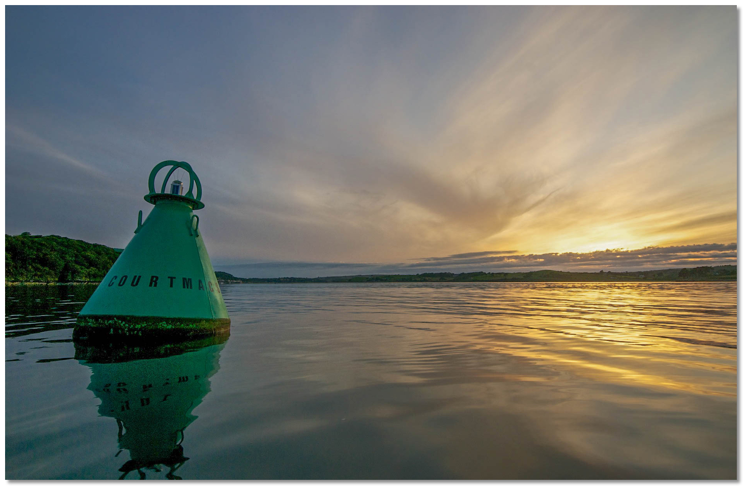
Image: Michael Harpur


On closer approach pass 300 metres east of Wood Point, the west entrance point, and south of Courtmacsherry Lighted Buoy to enter Courtmacsherry Harbour or proceed into Coolmain Bay.


Courtmacsherry Buoy
Image: The Pink Elephant


Those looking for shelter during wester winds need not penetrate deep into the bay. Three bays on Courtmacsherry Bay's western shore provides good shelter in these winds. Coastal clockwise, working from inside the bay out, these are Broadstrand Bay, Blindstrand Bay and Seven Heads Bay.


Broadstrand Bay
Image: Charles McCarthy Estate Agents


The east-facing ½ a mile wide Broadstrand Bay Click to view haven is located ½ a mile to the north of Barry’s Point and entered to the north of Quarry Point. Half of the bay dries but good depths will be found in the outer half. It provides good shelter from southwesterly round to northwesterly winds, in good depths and fine sand holding.


Blindstrand Bay
Image: Michael Harpur


Immediately adjacent is Blindstrand Bay Click to view haven, 2¾ miles northward of Seven Heads and is entered between Barry’s Point and Quarry Point situated 800 metres southeast of the former. Tucked in under the steep-too Barry’s Point, Blindstrand Bay offers better protection from southwesterly winds.


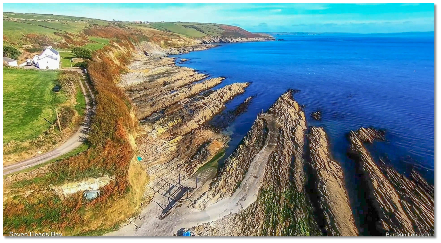
Seven Heads Bay seen over its small slip and pier
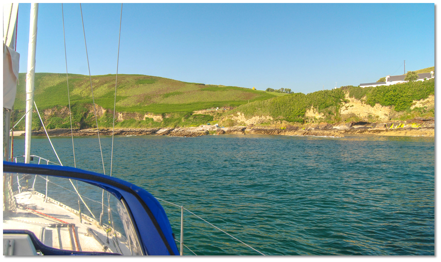
Image: Bart Lohuizen


Seven Heads Bay, 11 miles to the north of Seven Heads, affords shelter from westerly and northerly winds, in from 6 to 7 metres of water with good holding ground. Its north shore rises almost perpendicularly to the height of 102 metres, from which it sinks rather abruptly to Barry Point.


Seven Heads Bay with its small pier and slip seen from the anchorage
Image: Burke Corbett


Bold and bluff the 40 metre high Seven Heads is also made conspicuous by an old signal tower upon it and a pair of smaller World War II watch stations. The bottom around the head is uneven and rocky, causing overfalls during the full run of the tide.

Seven Heads with Cotton Rock seen breaking (right)
Image: Burke Corbett


½ a mile to the east of Seven Heads is the Baun Bank, with 11 metres of water, and Carrigroar Rock with 8.7 metres, 1½ miles from the shore in the same direction, that break heavily in bad weather. Cotton Rock, awash at high water, is 300 metres from the shore on the east side of the head.


Seven Heads with its World War II watch stations and Signal Tower
Image: Burke Corbett


Between Galley Head and the Seven Heads, a distance of 9½ miles in an east-by-south direction is Clonakilty Bay. With the exception of a ½ mile of sandy beach with a conspicuous hotel, that marks the entrance to Clonakilty Harbour, the shores of Clonakilty Bay are generally high, rocky, and fringed with outlying rocks and foul ground.
Please note

The bay has irregular depths in its outer part that almost break in southerly gales and in thick weather it is best to stay well outside of it.


South Ring, Clonakilty
Image: Michael Harpur


Clonakilty Harbour (Ring) Click to view haven is entered from the northwest part of Clonakilty Bay, between Muckruss Head and Ring Head. The vast majority of the area being occupied by Inchydoney Island and the remainder almost completely dries.


The channel leading in from Ring Head as seen at low water
Image: Michael Harpur


On the east side of the Inchydoney island, there is a narrow channel that is only suitable only for small, shallow craft to enter under power with the benefit of local knowledge. This leads into South Ring and on a rise of the tide to the provincial town of Clonakilty at the head of the harbour.


Dunworley Bay as seen from the southwest
Image: Henry O'Leary


Two miles west-northwest of Seven Heads, the small bight Dunworley Bay is full of rocks and foul ground, has the Cow Rock, that dries to 2.6 metres, about ½ a mile from the shore. Directly north of this, there is Horse Rock approximately halfway between it and the shore.


Dunworley Bay
Image: Mark Murray via CC BY-SA 2.0


Between Dunworley Bay and Clonakilty Harbour, the shore becomes very foul. The well covered Sloop Rock, with 3.2 metres, is about 600 metres off, but drying rocks exist between it and the shore.


A ½ mile to the east of Clonakilty Harbour is Sheep Rock, with 0.9 metres of water, is 400 metres offshore.


Dunnycove Bay
Image: Michael Harpur


Seven hundred metres northeast from Duneen Head is Anchor Rock, with 2.3 metres of water, in the track of vessels east and westbound to and from Clonakilty Harbour.


The slipway in the southwest end of Dunnycove Bay
Image: Michael Harpur


On the west side of Clonakilty Bay, is Dunnycove Bay offers depths from 6 to 8 metres of fine sand and is clean and level. It provides a good anchorage, with westerly winds but is open to the southwest. A conspicuous water tower stands 700 metres west of the shore of the bay at an elevation of 107 metres.


Dirk Bay as seen from the southwest
Image: Michael Harpur


Immediately to the east of Galley Head, on the west side of the entrance of Clonakilty Bay, is Dirk Bay Click to view haven. The bay affords good anchorage in fine sand with westerly winds, abreast of a house with a slip that was formally a coastguard station located on the west side of the bay.


Dirk Bay's old coastguard slip
Image: Michael Harpur


On the eastern side of the bay is the Carrigduff Rock, which is covered at half-tide and has foul ground 200 metres to the west of it. The Bream Rock, another small patch off the eastern side of the bay and marked on the Admiralty Chart, has not less than 6.9 metres over it at low water.


GALLEY HEAD TO BALTIMORE

Galley Head Lighthouse
Photo: Tourism Ireland


Viewed from the east or west the 37 metres high Galley Head, appears like an island. The ruin of Dundeady Castle can be seen on the low neck that connects it with the mainland. A prominent lighthouse, 21-metre high white tower, stands on the extremity of the headland.

Galley Head – lighthouse Fl (5) 20s 53m 23M position: 51°31.798'N, 008°57.210'W

A ½ mile southwest of Galley Head, and awash at high water, is the head's principal danger of Doolic Rock. The rock is steep-to on the north and east, but foul ground extends 300 metres to the southwest of it. It is therefore advisable to keep at least ½ a mile south of the Galley Head.


Galley Head with Doolic Rock as seen from the east
Image: Burke Corbett


Other deeper dangers worth noting are the Clout Rocks located a ½ a mile to the southeast of the head with plenty of cover for leisure vessels in moderate conditions. 800 metres to the southwest is the well covered Clout Rock that has 9.6 metres of water and halfway between that and the headland there is another shoal called the Inner Clout, with 5.5 metres of water. Around these rocks, there is from 11 to 20 metres of water.

Passing south of Galley Head
Image: Burke Corbett


It is advisable to keep at least ½ a mile from the coast at Galley Head. In good weather, leisure craft can use the channel between Doolic Rock and Galley Head. There is a transit that clears both Cloghna Rock, in Glandore Bay, and Doolic Rock.


Rosscarbery Inlet and the Cathedral spire just open of Creggan Point
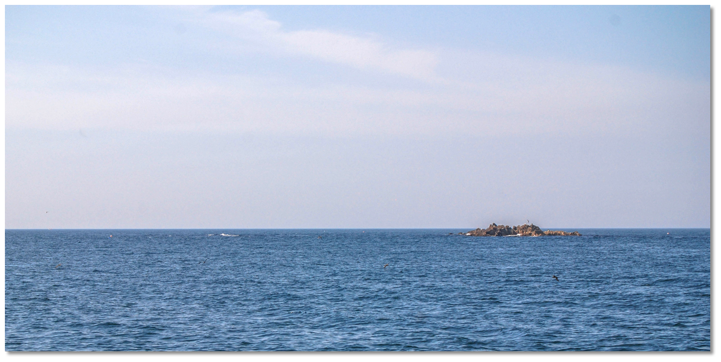
Image: Burke Corbett


This is a line of bearing of 320°T of the pointed spire of Rosscarbery Cathedral just open of Creggan Point situated 1 mile to the southeast of the cathedral, and it leads between the Doolic Rock and Galley Head in from 16 to 20 metres of water.
Please note

Wind-against-tide situations develop heavy seas close to the head. Strong currents are experienced off Galley Head and Doolic Rock with the ebb tide setting on to the rock with great velocity. In these circumstances, it is advised a vessel stays offshore.


Passing north of Doolic Rock on transit
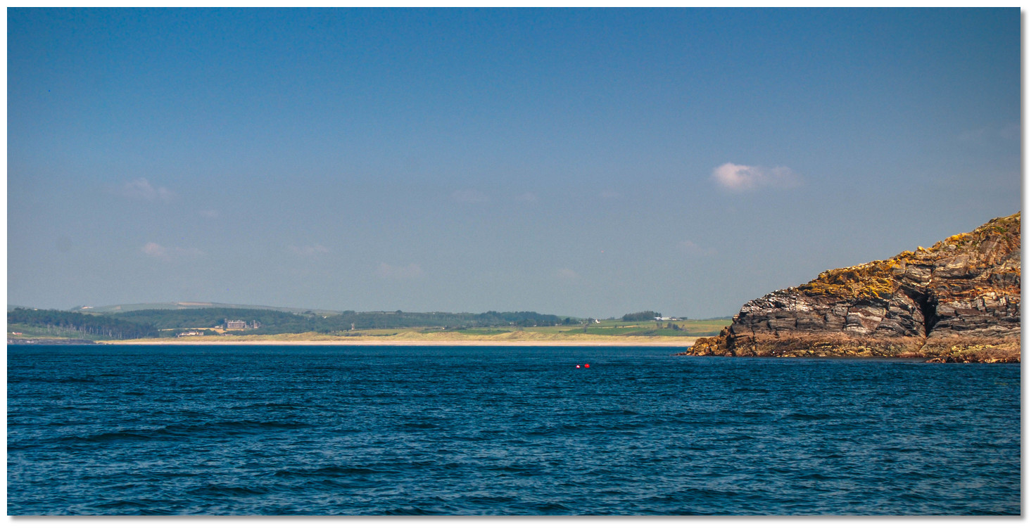
Image: Burke Corbett


Situated between Galley Head and High Island, just over 6 miles to the west, is Glandore Bay, which embraces Glandore Harbour and several small inlets. It is generally foul and rocky near the shore. The western side of the bay consists of steep barren cliffs rising to hills inland whilst the eastern side is made up of two sandy beaches separated by the rugged cliffs of Cloghna Head.


The conspicuous Long Strand opening around Galley Head
Image: Burke Corbett


To the northwest of Galley Head, there are the two sandy beaches, separated by the rugged cliffs of 56-metre high Cloghna Head. The southernmost of these, the Long Strand, forms a remarkable feature of the coast. From its eastern end, there commences a bold rocky shore which reaches to Galley Head.


The Rosscarbery Inlet
Image: Michael Harpur


½ a mile out from the shore, directly south of Cloghna Head and about 1½ miles northwest of Galley Head, is Cloghna Rock. Steep-to all round, a rock pinnacle with 0.9 metres of cover, the rock is the most outlying danger in Rosscarbery Bay. The aforementioned transit of the spire of Rosscarbery Cathedral just open of Creggan Point, leads 350 metres to the west of Cloghna Rock.


Creggane pier close north of Downeen Point
Image: Michael Harpur


Rosscarbery Bay is generally foul and dangerous to approach. The Rosscarbery Inlet Click to view haven is all dry at low water as far out as Downeen Point but could be useful for vessels that can take to the bottom either off anchored off or alongside the small Creggane pier. At high water, the entrance is about 100 metres wide, beyond which it expands and runs up about 1 mile to the small coastal town of Rosscarbery.


Mill Cove as seen from the southwest
Image: Michael Harpur


Just over 1 mile west-southwest of the Rosscarbery inlet, is the narrow Mill Cove Click to view haven. The conspicuous Black Rocks form a single drying cluster on the western side of the inlet and extend nearly 400 metres offshore. In offshore winds, the bay offers an anchorage to small yacht southwest of a pier within the inlet.


The most prominent Black Rock standing out from the shore between Mill Cove and
Tralong Bay

Image: Michael Harpur


Less than a mile to the west is Tralong Bay Click to view haven that is a foot-shaped inlet that extends ½ inland from its outer high cliffs. The inlet dries out to about midway and there is a slipway situated on its western side above the drying point.


Tralong Bay
Image: Michael Harpur


The shore is foul on the entrance’s western side out to the 14-metre high Tralong Rock with rocks extending 100 metres to the southeast of that. The outer end of the bay provides good shelter in offshore winds. The shore between Tralong and Goat's Head is foul out to a distance of 200 metres all the way.


The slip on the west side of Tralong Bay
Image: Michael Harpur


The entrance to Glandore Harbour Click to view haven is located two miles to the northeast of High Island, and it is entered between Sheela Point and Goat’s Head, about a mile to the northeast.


Glandore Harbour entrance as seen from the southwest
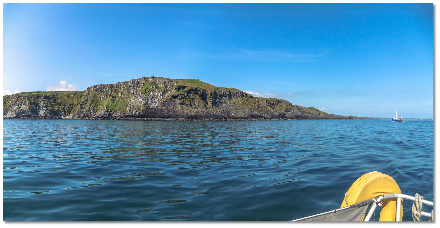
Image: Michael Harpur


Goat’s Head, on the east shore, may be easily distinguished by an old telegraph tower, standing on the cliffs of the headland, at a height of 79 metres. Sheela’s Rock, which dries to 1.5 metres, lies close southeast of Sheela Point.


The bluff 79-metre high Goat’s Head
Image: Burke Corbett


The 27 metres high Adam’s Island lies on the west side of the entrance about 500 metres east of Sheela Point. Between Sheela Point and the island, a distance of about 400 metres, there is a well-covered mid-channel rock that reduces the draft to 3 metres. To the north of the island foul ground extends for up to 200 metres and should be given a wide berth.


Adam and Eve islands as seen from Glandore Quay
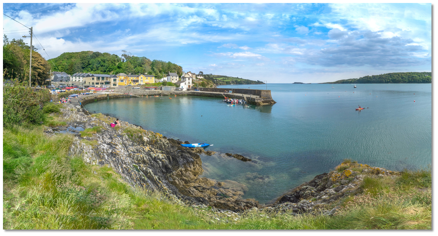
Image: Michael Harpur


The east side is clear of danger, and about 800 metres wide, with around 25 metres of water and as such the preferred passage. The 7 meters high Eve Island, lies about 0.7 of a mile north of Sheela Point and should be passed on its east side as sunken rocks lie some distance off the west shore of the Harbour abreast Eve Island. Then pass to the west of the chain of marked rocks called The Dangers.


Glandore quay and village
Image: Michael Harpur


The village of Glandore stands in the northeast bight of the harbour, where there is a small drying pier that offers a convenient landing point. The active fishing pier of Union Hall is situated on the west side of the harbour and the village of Leap at its north end closed off by a bridge. Vessels can anchor outside the local boat moorings or pick up visitor moorings.


Union Hall's fishing quays
Image: Michael Harpur


Union Hall provides protection during south or south-easterly winds anchored off the pier in 2.5 meters. Yachts may come alongside temporarily for short periods to use the water hose or get provisions.


Rabbit Island and Rabbit Island Sound
Image: Michael Harpur


About a mile to the southwest of Adam’s Island and ¾ of a mile northward of High Island is Rabbit Island that lies midway between the entrances to Glandore Harbour and Castlehaven. It is the largest of a cluster of rocks and islets and is steep-to to the south and east, but the group must not be approached too closely from any other side. There is a sequestered anchorage available in Rabbit Island Sound Click to view haven, nestled between the mainland cliffs extending westward from Sheela Point, to the north, and Rabbit Island to the south.


Squince Harbour as seen from the west
Image: Michael Harpur


Rabbit Island also forms the east shore of the small harbour of Squince Click to view haven, where leisure vessels find good shelter in westerly winds. The small east-facing cove with a beach at its head is very much out of the way but has a narrow backroad leading down to the landing beach.


Belly Rock breaking
Image: Burke Corbett


Vessels approaching Squince Harbour from the west need to be wary of Belly Rock. Awash at low water springs, the 0.4 meters Belly Rock, it lies 270 metres to the south of the rocks that extend from the west end of Rabbit Island.

Belly Rock – unmarked, position: 51° 31.475'N, 009° 07.165'W

This places it very much in the track of vessels taking the Big Sound channel between High Island and the shore, which otherwise presents a clear passage, from 14.5 to 22 metres deep.

Horse Island with its prominent ruined tower
Image: Burke Corbett


Keeping the north shoreline of Low Island in line with the ruined tower on Horse Island, about bearing 253° T, keeps a vessel well south of Belly Rock. Vessels entering Squince Harbour can keep to the west of Belly Rock by keeping to the west of a line of transit from the eastern side of High Island and the western face of Rabbit Island.


Blind Harbour as seen from the west
Image: Michael Harpur


The small sea inlet of Blind Harbour Click to view haven opens to the south approximately a ½ mile east-northeast of the mouth of Castle Haven and 2½ miles east of Glandore. It has 2 metres LAT or slightly more at the centre of its head a little over 1.1 metres in around its neck on either side.


High and Low Islands as seen over Rabbit Island
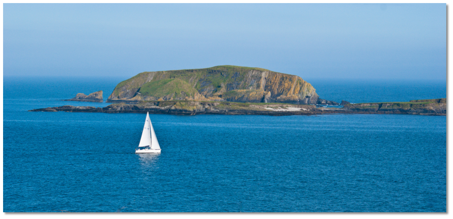
Image: Michael Harpur


The entrance to Blind Harbour is partially covered to the southeast by a ragged cluster of rocks called Low and High Islands a distance of 1 mile off the entrance. They lie ¾ of a mile south-southwest from Rabbit Island and midway between Glandore Harbour and Castle Haven. The 46 metre high High Island. It is the largest of a cluster of rocks and islets and is steep-to to the south and east, but the group must not be approached too closely from any other side.


Passing through Big Sound between High and Low Islands
Photo: Leo Daly


In very settled conditions a temporary anchorage can be taken, on the southern side of Big Sound, between High Island and the mainland to the north of the group, as marked on Admiralty 2092.


Castle Haven
Image: Michael Harpur


Located 8½ miles west of Galley Head, and about three miles to the northeast of the Stag Rocks, is the river inlet of Castle Haven Click to view haven. The entrance resides between Horse Island and Skiddy Island, to the east of it, and is about 800 metres wide and free from danger. A prominent 35 metre high ruined tower stands on the east end of Horse Island and Skiddy Island is a remarkable high flat rock. Horse Island, with the 21 metres high and bold-to Black Rock lying off it.


Castle Haven's Pier
Image: Michael Harpur


Reen Point, to the north of Skiddy Island, is skirted by rocky prongs; just within the point, 100 metres from the shore, there is a rocky head called the Colonel Rock. The entrance between Battery Point and Reen Point is free of dangers and has a least depth of 9.1 metres in the fairway, decreasing to 5.5 metres about a ⅓ of a mile further in.


Yacht approaching the entrance to Castle Haven as seen from within
Image: Liam O'Mahony Photography


A lighthouse is situated on Reen Point providing a sectored light G. shore - 338°, W. -001°, R. - shore.

Castle Haven (Reen Point) - white tower Fl.W.R.G. 10s 9m 5.3M position: 51° 30.980´N, 009° 10.475´W


The anchorage above Cat Island
Image: Leo Daly via CC BY-SA 2.0


On the eastern side of the head is Scullane Bay that is exposed to the southeast, but clear of danger, with gradual soundings to the shore over a clean sandy bottom.


Toe Head can be identified by its old signal tower
Image: Graham Rabbits


The bluff, bold 29 metres high headland of Toe Head, has an old signal tower on its northeastern side. Close inland at Beenteeane Hill, the land rises to the height of 108 metres. The coast in its vicinity is high, barren, and rocky. To the west of the head, foul ground extends to nearly 400 metres from the shore with the Belly Rocks straggler marking its extremity.


The Stags
Image: Burke Corbett


Situated 0.7 miles south of Toe Head the Stag Rocks forms a cluster of rugged, precipitous rocks, 20 metres high. When viewed from the west they appear like pinnacles. They are moderately steep-to and free from outlying danger. The sound between them and Toe Head, Stag Sound, is more than ½ a mile wide with 37 metres of water, and although it can be rough, provides safe passage. The stranded wreck of the Kowloon Bridge lies about 0.2 of a mile southwest of The Stags. This and The Stags are marked by a south cardinal buoy moored 800 metres to the south.
Please note

The tidal currents attain a rate of 2 to 2.5 knots at springs through Stag Sound.


Kowloon Bridge – south cardinal buoy Q(6)+L Fl.15s position: 51° 27.580'N, 009° 13.735'W


Toehead bay
Photo: Michael Foley


The coast between Toe Head and Kedge Island and, about 4½ miles west-southwest, is indented by a number of inlets and small bays. To the east of Toe Head, between Barloge and Toe head, there are two deep indentations, called Tragumna and Toehead bays. They afford little or no shelter or anchorage.


Barloge Creek between Bullock Island and the Carrigathorna headland
Image: Michael Harpur


The remarkable Barloge Creek Click to view haven is situated between precipitous hills, 2½ miles to the east of Kedge Island. It is frequented by a few fishing boats and the occasional passing yacht but it offers no shelter in southerly winds. A modern quay makes for a convenient landing.


Barloge Creek
Image: Michael Harpur


The entrance, which is difficult to find, lies between Carrigathorna, Lalawn Point, on the west side, and the rocks that are situated close south of Bullock Island on the east side.


The entrance to Barloge Creek
Image: Michael Harpur


A narrow 350 metres long channel connects Barloge Creek with the picturesque and deep lake of Lough Hyne. It is a large sheet of water with depths from 18 to 36 metres, with which the level of the external seawater meets at half-tide only. Outside of this, there is a rapid in the narrow connecting channel.


Lough Hyne situated above Barloge Creek
Image: Superbass via CC ASA 4.0


To the east of Baltimore Harbour the coast is high, rocky, barren, and free from hidden dangers. The high flat-topped rocky islet, called Kedge Island lies about two miles east-southeast from the southern entrance to Baltimore Harbour and a ⅓ of a mile south of the coast.


Reenabulliga with Kedge Island and Toe Head in the backdrop
Photo: Tourism Ireland


A chain of pinnacle rocks extend from the islet to the shore, leaving a narrow passage with 7 metres of water close along by Spain Point, that is sometimes used by locals.
Please note

A tidal race occurs off the southwest extremity of the island.


Baltimore Harbour
Image: Michael Harpur


Between Sherkin, Spanish Island and Ringarogy Islands and the mainland is the natural harbour of Baltimore Click to view haven. The village is the main service point for the area and adjacent islands as well as a popular holiday destination in itself. The harbour is mostly used by ferries to Sherkin Island, Cape Clear Island, as well as the eastern side of Roaringwater Bay and Carbery's Hundred Isles. The port also has an active fishing fleet that principally berth alongside the north pier. In addition to this, it has a host of local recreational boats and is a busy yachting centre.

The entrance to Baltimore Harbour
Image: Michael Harpur


The entrance between Beacon Point to the east, marked by a beacon, and Barrack Point on Sherkin Island, marked by a lighthouse.

Baltimore - beacon unlighted position: 51°28.417'N, 009°23.272'W

Barrack Point - white tower Fl.(2)W.R.6s 40m 6/3M position: 51° 28.375´N, 009° 23.670´W


The Baltimore Beacon
Image: Michael Harpur


The entrance is deep but only 80 metres wide, and is not easily made out at any considerable distance. It should also be noted that it is set between a rocky ridge extending from both points. At night is further supported by a sectored light R. 168°-294°, W.-038°, obsc.- 168°.


Yachts in the Baltimore entrance with Barrack Point in the backdrop
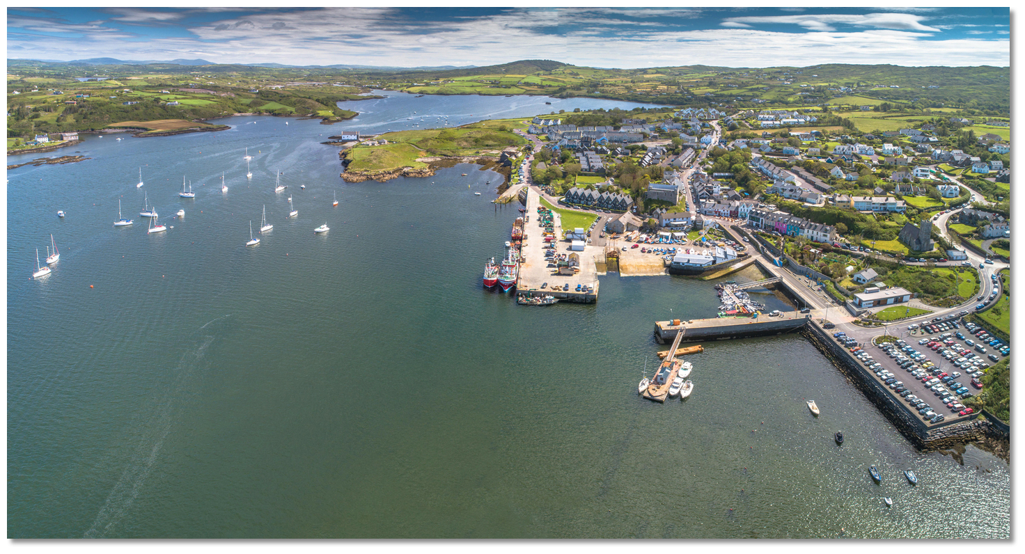
Image: Francesco Crippa via CC BY-SA 2.0


Inside the channel, a Light Buoy marks Loo Rock situated on the eastern side of the entrance. The rock uncovers at low water spring tides and can be seen to the northwest of the beacon, and nearly a quarter of the distance across from the eastern to the western points.

Loo – starboard buoy Fl G 3s position: 51° 28.438'N, 009° 23.458'W

The village and port of Baltimore are situated about ¾ of a mile northeast of the entrance. The area between Sherkin Island and the mainland is relatively shallow but has ample water for leisure craft. It is not without dangers with the principal rocks on the way to the port being: Quarry Rock, Lousy Rock and Wallis Rock that are all well marked.


Baltimore and Church Strand Bay
Image: Michael Harpur


There are other ledges of rocks in different parts of this harbour, but their proximity to the shoreline, or distance from the anchoring grounds, makes a description of them unnecessary but Admiralty chart 3725 will make these clear.


THE RIVER ILEN

The Ilen River enters the sea at Ireland’s southwest corner, to the north of Baltimore Harbour. The river offers several anchorages on its north-eastward path to Skibbereen, the chief town of the area, situated 7 miles above its entrance. Oldcourt is about 4 miles from the river mouth and 1 mile to the northeast of the island of Inishbeg. From Oldcourt, the effective head of navigation for vessels carrying any draught, the river narrows and shallows to a stream in about ¾ of a mile and continues in a north-easterly direction to Skibbereen 2½ miles above.


The seaward approach to the River Ilen
Image: Michael Harpur


Depths of 2 metres LAT or more will be found all the way up to the northeast corner of the Inishbeg 1 mile below Oldcourt. Then there is a shallow patch, with a charted depth of 0.8 metres. The best time to access Oldcourt is three hours before high water. At the half tide, the path of the channel plus the smaller islands and rocks will be more evident.


Vessel approaching the Ilen from Baltimore Harbour via The Sound
Image: Michael Harpur


The River Ilen may be approached via its seaward entrance, from Long Island Bay, or from the north end of Baltimore Harbour. The preferred, most sheltered, and most frequented approach to the River Ilen is through the relatively shallow Baltimore Harbour and out of its northern entrance via The Sound and into the river. Both these river approaches and directions for the run upriver are covered in the Oldcourt Click to view haven description. The Baltimore North Entrance Route location route also provides a list of waypoints that assist pilotage through both these approaches. The river offers several anchorages on its north-eastward path to Skibbereen and several anchoring opportunities off its seaward approach.


White Beach on the east side of East Calf Island
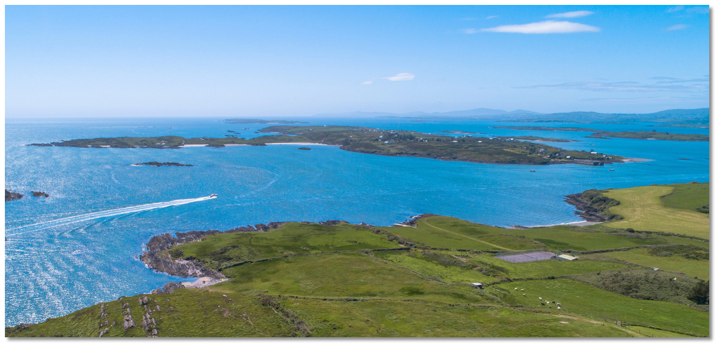
Image: Burke Corbett


Calf Island East Click to view haven is one of three islands at the entrance to Roaringwater Bay, that has an anchorage off the approach path to the river. White Beach on its eastern side has 5 metres LAT inside the outer heads of its flanking reefs and it gradually shelving gradually to 2.5 metres LAT adjacent to the always visible Dooneen islet off the beach on the north side.


Heir Island with boat exiting Ilen River in foreground
Image: Michael Harpur


Heir Island, also known as Hare Island, is the third largest of the archipelago of islands in Roaringwater Bay and the fourth-largest of Carbery's Hundred Isles, after Sherkin Island, Clear Island and Long Island. The 2.5 km long and 1.5 km wide island lies immediately opposite the entrance to the River Ilen with its anchorages immediately off the approach.No more so than the sandy stretch of Trá Bán Click to view haven directly facing the river entrance.


Boats anchored off Trá Bán
Image: Burke Corbett


Less than 400 metres distant is the modern East Pier Click to view haven of Heir Island that connects with Cunnamore Pier on the mainland close north. These provide the main access point to the island with a ferry service operating between the two piers. Another anchorage may be had here in 2.5 metres with 1 metre closer into East Pier.


East Pier Heir Island
Image: Michael Harpur


Rincolisky Harbour Click to view haven is a narrow shallow mainland inlet situated to the east and Cunnamore Point to the west and between it and the Turk Head promontory. It is further protected to the southwest by Hare Island.

Rincolisky Harbour between Cunnamore Point and the Turk Head promontory
Image: Michael Harpur


Rincolisky Harbour has about 1 metre LAT at its entrance which lessens gradually to 0.3 metres LAT over a bottom of soft oozy mud bank, dry at the ebb. Boats that can take to the bottom will find an excellent berth here along the western shore. Close off Cunnamore Pier depths of up to 2.4 metres will be found.

Cunnamore Pier
Image: Michael Harpur


The first River Ilen anchorage is Turk Head Click to view haven in the river mouth, off the southwest extremity of the Turk Head Peninsula and at the north entry point to the river. A fair-weather anchorage with good holding may be taken here, off The Catalogues Islands situated about 400 metres south by southwest of the headland.


Turk Head anchorage behind The Catalogues
Image: Michael Harpur


Shortly within the River Ilen Click to view haven and in its first reach, ½ eastward of Turk Head is Quarantine Island. The island also marks the north entrance to Baltimore Harbour where The Sound and the Ilen River entrance meet, amidst and above Quarantine Island and Sandy Island to the west. The anchorage lies close northwest of the island with 2.4 metres LAT with good holding. Land at Turk Head quay on the north side of the river, locally known as Cusheeen.


Quarantine Island opposite Turk Head Quay
Image: Michael Harpur


About 2 miles upriver from the entrance is the Inane Point Click to view haven anchorage off Ringarogy Island's Inane Quay. Situated in the first broad length of the river, with ample water, it makes for an excellent anchorage with ample water.


Inane Point River Ilen
Image: Michael Harpur


A little over ½ a mile further upriver is the Reena Dhuna Click to view haven anchorage on a bend of the river and off an old 19th-century slip. The slip leads up to a stone boathouse in the grounds of a fine rectory.


Yacht anchored at Reena Dhuna
Image: Burke Corbett


Oldcourt is 1½ miles further upriver and 1 mile to the northeast of the island of Inishbeg. Depths of 2 metres LAT or more will be found all the way up to the northeast corner of the Inishbeg. Then there is the shallow patch, with a charted depth of 0.8 metres, just off the northeast corner of Inishbeg.


Oldcourt Boatyard overlooking the river and historic castle
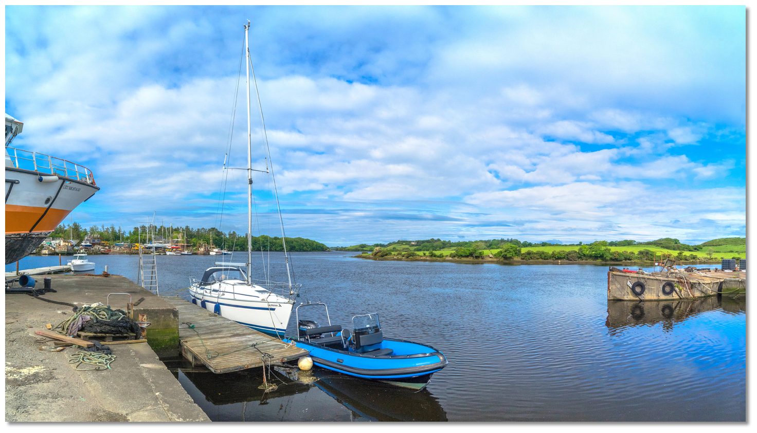
Image: Michael Harpur


Depths of 2.7 metres LAT can be found off of Oldcourt Click to view haven but it shallows to as little over 1 metre LAT about 250 metres further northward. Anchor in the river in the vicinity of the boatyard clear of its operations.


Yacht alongside the boatyard pontoon at Oldcourt Boats
Image: Michael Harpur


The boatyard allows the odd ad-hoc stay alongside its barge and pontoon but if a vessel is left for any period an accommodation must be reached with the boatyard.

BALTIMORE TO LONG ISLAND BAY

Mount Gabriel with its Radar domes
Image: Burke Corbett


This part of the coast is the natural landfall for vessels approaching Ireland from the Atlantic Ocean. The most prominent objects to first present themselves to these ocean approaching vessels are the 682 Metres high Hungry Hill, the 404 metres Mount Gabriel, discernable by a conspicuous radar dome near the summit, the 250 metres high Dursey Island, and the 214 meters high Great Skellig Island.


The view over Long Island Bay and Roaringwater Bay from Mount Gabriel
Image: Gerard Lovett via CC BY 2.0


Closer in, the 229 meters high Mizen Peak will appear in view, and finally the 159 meters high Cape Clear, and Fastnet Rock.


Fastnet Rock as seen from the south with Cape Clear Island in the backdrop
Image: Burke Corbett


Offshore, about nine miles east-southeast of Mizen Head, Fastnet Rock is a compact 23-metre high schist rock that covers an area of 110 metres by 55 at low water. A granite circular tower lighthouse, 28 metres high, painted white plus a helicopter platform stands upon its southwestern side. Alongside it is the base of an old lighthouse that was erected in 1854 to replace the Cape Clear lighthouse.

Fastnet - lighthouse Fl 5's 49m 27M position: 51° 23.358'N, 009° 36.178'W


The bottom to the west, south, and northeast of the Fastnet is shoal and rocky. A ¼ of a mile to the northeast of Fastnet there is a flat rock, with only 3.4 metres of water over it, that often breaks. The space between the Fastnet and the shore is completely free from danger. Nevertheless, in boisterous weather, the sea can violently break here and there as a result of the rough elevations of the ground. When operating in rough conditions in the vicinity of the Fastnet it is best to keep a mile off the rock.
Please note

A Traffic Separation Scheme has been established five miles southeast of Fastnet Rock, with an inshore traffic zone between the westbound lane and Fastnet Rock. This is well marked on Admiralty Charts and leisure craft may avoid this by taking a route closer inshore that leads east from Mizen Head and pass either north or south of Fastnet Rock.


The view westward over the southern entrance to Baltimore Harbour
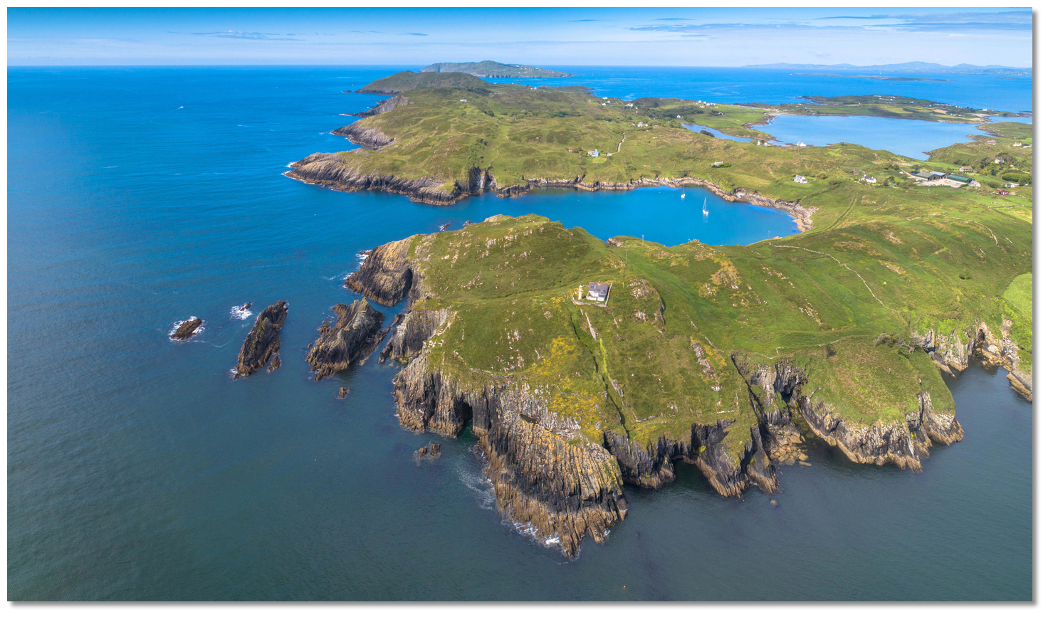
Image: Tom Vaughan External link


In the vicinity Mizen Head and Cape Clear the coast is high, precipitous, and bold, increasing in height to the north of the Cape Clear, where it is fringed by outlying islets and rocks of considerable elevation. These are easily recognised out to a great distance in clear weather.


From Cape Clear and Sherkin Islands to Goat Island, about 5.2 miles to the northwest, is Long Island Bay. This area, that includes Roaringwater Bay tucked into the sheltered northeast corner, is strewn with numerous islets, rocks and shoals. A feature of practically all the islands in this area is waisting. The islands here erode or are being cut across in waists, or are already cut two and sometimes three, by the sea owing to their sandstone geology. These waists provide a host of sheltered anchorages that can be readily called upon by leisure vessels. The principal destinations in the area are Long Island Sound, Castle Island Sound, Roaringwater Bay and Skull Harbour, on the north side of the bay.
Please note

Large scale marine farms are established within the bay. For those approaching Long Island Bay from sea note the rocky bank called Croa-Lea. The bank lies about 3.2 miles south of Little Goat Island and has a least depth of 27 metres. It creates a considerable heave of the sea over it in westerly gales and breaks in heavy gales.


The southern shore of Sherkin Island with Cape Clear in the background
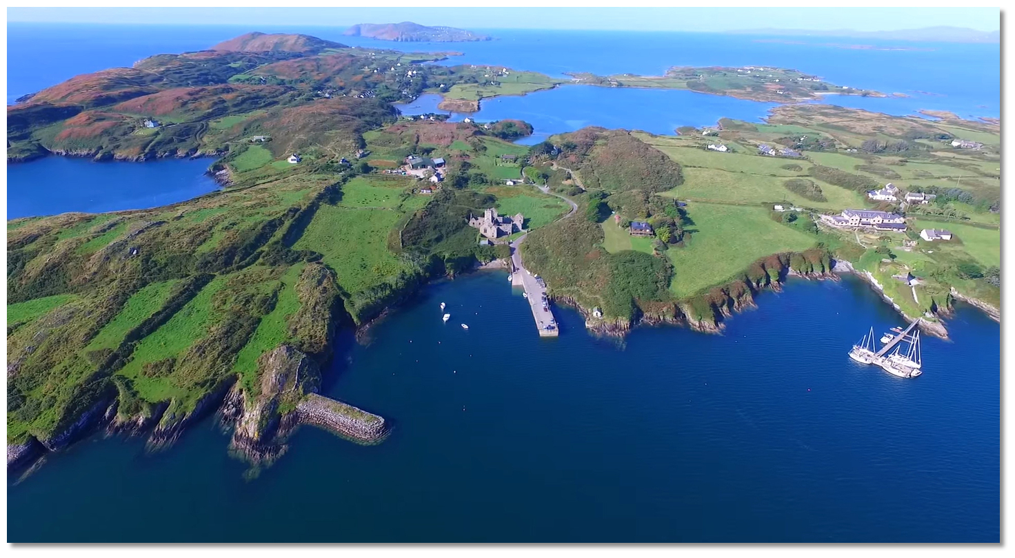
Image: Michael Harpur


Long Island Bay’s southeastern side is formed by the northwest sides of Sherkin and Cape Clear Islands. Likewise, the western side of Baltimore Harbour is made up of Sherkin Island. It is less high than its near neighbour Clear Island and slopes more gradually to the bay. Historically called Inisherkin the island is 3 miles long by 1½ miles wide and hosts a population of just over 100. It is separated from Clear Island by a channel called the Gascanane Sound situated at the southwest end of Sherkin Island - see below.

Sherkin's Pier is situated on the east side of the island, in Baltimore Harbour, just below the ruins of the Abbey. This is the primary embarkation place for the island. Castle Ruins lies off of the Sherkin shore, directly within and opposite the entrance.


Sherkin Island's pier in Baltimore Harbour just below the Abbey
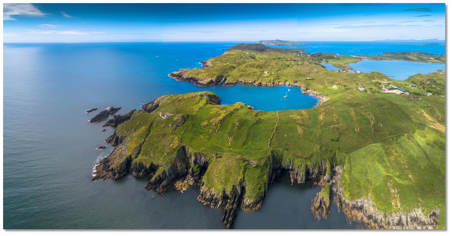
Image: Tom Vaughan External link


The Castle Ruins Click to view haven anchorage here has between 3 - 5 metres and lies off the ivy-clad remains of a medieval fort set upon a rock that appears nowadays more an outbuilding the Islander’s Rest Hotel that stands close above it. There was a seasonal Sherkin Island Marina pontoon that belonged to the hotel. The pontoon was available from mid-April to mid-September (weather permitting) and it catered for up to 10 yachts when rafted in 2.4m LAT. But this has been removed and the hotel closed in 2022.


Horseshoe Harbour on the southeast end of Sherkin
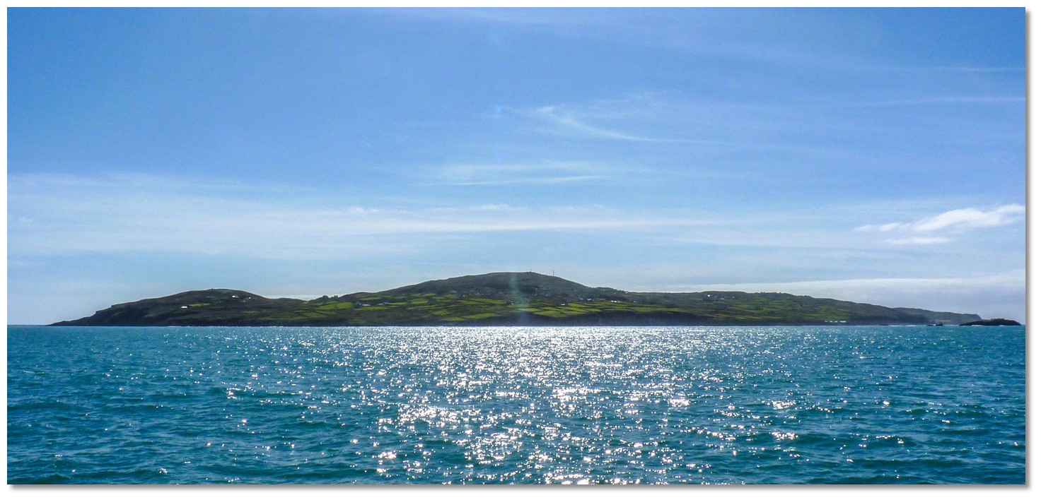
Image: Michael Harpur


An inlet, close south and located on the southeast side of Sherkin Island, called Horseshoe Harbour Click to view haven provides an anchorage but has a very narrow entrance that is further constricted by rocks off the western shore. The very sheltered Kinish Harbour on the northwest side mostly dries and is bestrewn with rocks - beware of Carrogoona Rocks just east of the entrance.


Cape Clear Island as seen from the northeast
Image: Old Wellies via CC BY-SA 4.0


A mile to the southwest, 3 miles long, in an east and west direction, and 1 mile wide, is the imposing Cape Clear Island. The island is high, precipitous, and bold, especially on its southern side, where it rises abruptly from the sea to the height of 159 metres, but slopes more gradually to the north. Two wind motors will be seen on the summit of the island.


The ruins of the old lighthouse located about midway along the south side of the
Island

Image: Superbass via CC ASA 4.0


The ruins of an old lighthouse, that was replaced in 1854 by the Fastnet Rock lighthouse, will be seen about midway along the south side of the Island.


The ruins of the old lighthouse and watch tower on Clear Island
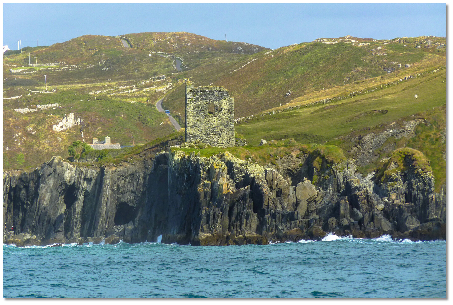
Image: Colin Park via CC BY-SA 2.0


Likewise, the ruins of Doonanore Castle stand on the northwest side, about 0.8 of a mile north northeast of the Bill of Cape Clear. The southwest extremity of Cape Clear Island is called Cape Clear or Pointabullaun, the southernmost a ridge of rock called Blananarragaun.


Doonanore Castle standing on the northwest side of Cape Clear Island
Image: Old Wellies via CC BY-SA 4.0


Both the west and southern shores of Clear Island are steep and bold too, with 20 to 40 metres of water found 200 metres off. The island is clear all-round except its northern side. For about 2 miles from the Cape, the shore continues clear and steep-too, with the exception of Tonelunga Rock that resides 200 metres offshore near the ruins of Doonanore Castle.


The marina in North Harbour (Trawkieran)
Image: © Bill Cremin


To the east of the North (Trawkieran) Harbour Click to view haven, located on the northeastern side of the island, from which a group of islets and rocks extend about ½ a mile offshore, terminating at Bullig Reef. The old telegraph tower east of Baltimore Harbour in range with the white chapel at Sherkin, bearing 082° as best seen on Admiralty 2129, leads to the north of Bullig Reef.


South Harbour (Ineer) Cape Clear Island
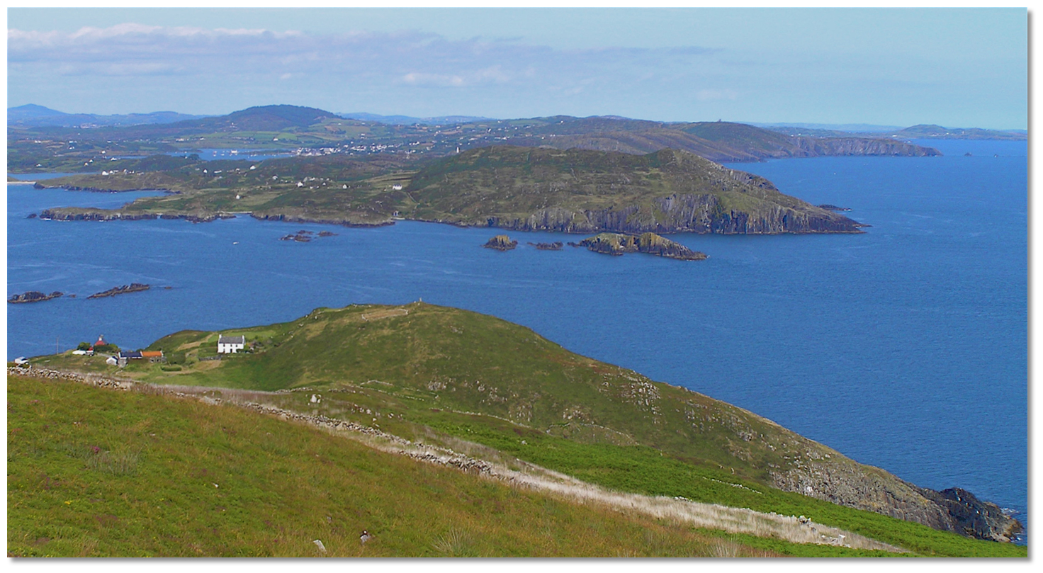
Image: Chris Kealy via CC BY-SA 2.0


Within the extensive and deep cove on the south side of the islands called South Harbour (Ineer) Click to view haven is another anchorage, but it does not afford permanent shelter to a cruising vessel.


Gascanane Sound seen from the summit of Cape Clear Island
Photo: Tourism Ireland


This challenging Gascanane Sound resides between Cooslahan Point, the eastern extremity of Cape Clear Island, and Illaunbrock, an islet off the southwest extremity of Sherkin Island. It is about a mile wide and is divided into two channels by the Carrigmore and Gascanane Rocks. The former Carrigmore Rocks are a group of 6.1 metres high rocks that never cover, and reside about 800 metres northeast of Cooslahan Point. The latter, Gascanane Rock lays nearly 180 metres west of the Carrigmore Group and dries to 1.8 metres but is covered at the half flood. The tides sweep through both channels, especially at springs, with such velocity as to cause dangerous eddies and it should only be approached with a commanding breeze, a reliable back up engine plus good visibility and favourable tides.


Yachts passing in Gascanane Sound the channel between Clear Island and Sherkin
Island

Image: Old Wellies via CC BY-SA 4.0


With all these in hand, it is particularly convenient cut for moving to and from Baltimore to Clear Island’s North Harbour as it saves at least an hour’s sailing. It can also be used when transiting from Long Island Bay, to or from for instance Schull, Crookhaven etc where it will save at least half an hour. The better channel is the 'Eastern Pass' Route location which is deepest, passing east of Carrigmore Rocks and west of Illanubrock Island. This then passes west of Crab Rock that lies about 300 metres north of Illanubrock Island. There is also a 'Western Pass' Route location, west of Gascanane Rock and east of Cape Clear Island that offers a more direct route for North Harbour (Trakieran) on Cape Clear Island and is not subject to a cross tide. It is however much narrower and Gascanane Rock is only visible for the first half of the flood.


Hare Island as seen from Cape Clear Island
Photo: Tourism Ireland


The area between Long Island and Cape Clear Island is full of islets, rocks, and shoals, and is only navigable in fair conditions with excellent charts and preferably with the benefit of local knowledge. The outer islet, named Calf Island West, has deep water close home to its western point, is the westernmost of three small rocky islets named the West, Middle, and East Calf. To the north of these, there is a nest of rocks that have the 10 meters high Carthy’s Island at their western extreme. Between these rocks and Castle Island, there is a clear passage, called Carthy’s Sound, leading into Roaringwater Bay.


Poulgorm Bay overlooked by Kilcoe Castle
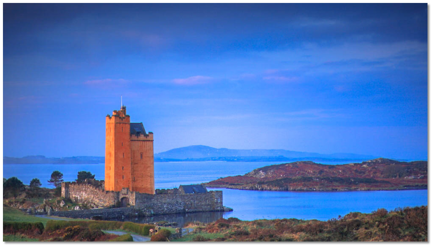
Image: Michael Harpur


At the northeast extreme of Long Island Bay is Roaringwater Bay which is an extensive shallow inlet. Despite the forbidding name, the bay affords quiet and well-sheltered anchorage. This is the result of being completely sheltered from the sea by the rocks and islands to the west of it. The bay is extensively used for aquaculture so it is essential to make any intended approach during daylight hours with the benefit of Admiralty Chart 2129 that marks the corridor through to the two anchorages that lie at its head.


Kilcoe Castle as seen at dusk
Image: Seán Venn via CC BY SA 3.0


The first of these is in Poulgorm Bay which is a secluded anchorage set into a rural landscape overlooked by the magnificent Kilcoe Castle. There is the semblance of a small improvised slip on the western shore inside of Oileanruadhbeag, the smaller of Poulgorm Bay's two islands which leads to a farm track.


Ballydehob Bay
Image: Michael Harpur


Alternatively, proceed into Ballydehob Bay anchorage on the opposite side of the headland and also a secluded anchorage rural landscape. However about 1½ miles up the drying estuary of this bay there is the coastal village of Ballydehob.


Yacht dried out alongside Ballydahob Quay
Image: Andrew Wood via CC BY-SA 2.0


Here the Skeaghanore West Quay, in the northeast corner of the bay, provides a landing opportunity with road access or on the tide there is the possibility of reaching the small drying stone quay just below Ballydehob's weir and signature stone viaduct.

The clearest and most direct channel into Roaringwater Bay is via Carthy’s Sound. This occupies the area between Castle Island and Carthy’s Island. Carthy’s Island lies in the middle of the approach to Roaringwater Bay, about ½ a mile south of Castle Island; it is the outermost of a group of islets and rocks that extend east northeast. Steering about east from the latter position, and then keeping Ilaunnnabinneeny Island closing on Carthy’s Island cliffs until the west end of Horse Island bears north, clears the well covered Moore’s Rock, with 2.7 metres of water, but more importantly the Rowmore Rocks situated ½ a mile to the east – the clearing line is as best seen on Admiralty Chart 2129 and 2184. The same course will lead to the outer anchorage off the east end of Horse Island.


Toorane Rocks showing at low water
Photo: Graham Rabbits
A vessel may also approach Roaringwater Bay from the south of the Calf Islands, passing to the east of or between them; but these channels are full of dangers, and a stranger should avoid it if possible. Between East Calf Island and Hare Island, about a mile to the northeast is obstructed in mid-channel by the drying Anima Rock. The foul ground called the Toorane Rocks, extending about 0.8 miles to the southwest from Hare Island, should also be noted. The channel between Carthy’s Island and the Calf Islands also has a shallow area with only 2.1 metres.
Please note

It may be advisable to navigate this area at low water when the Toorane Rocks show, as these dangers are covered at high water.


Roaringwater Bay is finally entered between Horse Island and West Skeam Island, about 0.6 miles to the south southeast of Horse Island. In the inner part of Roaringwater Bay, the 16 metres high Mannin Island, lies close offshore at the head of the bay. The Carrigviglash Rocks, with two continuously dry heads, 2.1 and 1 metre high, reside at the south end of an extensive mudflat, about ½ a mile south of Mannin Island. An anchorage may be had ½ a mile east of Horse Island, or with better shelter about ½ a mile north further northeast, in sand with 4.9 metres, aligning Knocktower Point and Folinnamuck Point, two projections on the mainland, on a bearing of 013° as best seen on Admiralty Chart 2129.

Between Roaringwater Bay and Schull off the mainland is Horse Island and Castle Island. Horse Island is a small low lying island that is one of five low islands that adjoining the coast here. All are about a ½ mile offshore and are separated from each other by narrow passes. They are set in a line and, from east to west, are Horse Island, Castle Island and on the opposite side of the entrance to Schull Harbour, Long Island, Goat Island and Illaunricmonia Island.

There are four channels of approach to pass in between these island and the mainland:

  • • Between Goat Island and Illaunricmonia Island, called Man-of-War Sound, that joins Lough Buidhe to the north of Goat Island.

  • • Between Goat Island and Long Island called Goat Island Sound.

  • • To the east of Long Island, between it and the Castle Island, called Castle Island Grounds which is the principal approach and marked the entrance into Schull Harbour.

  • • Between Castle and Horse Islands, by passing between the islands avoiding the Derreen Rocks and Castle Island Spit.


It is essential to note that there is no direct passage from Roaringwater Bay into the east end of the Castle Island Channel. The eastern end of Castle Island Channel, between the northeastern end of Horse Island and the mainland, is obstructed by the Horse Ridge that dries to 0.3 metres. However, vessels of a moderate draft may cross this with a sufficient rise to achieve access from Roaringwater Bay.


Rossbrin Castle overlooking the Horse Island Channel from the mainland
Image: Michael Harpur


Horse Island Channel lays between Horse Island and the mainland to the north and there is an anchorage off Horse Island's Click to view haven small pier on its southwest corner facing the channel.


Rosbrin Cove
Image: Michael Harpur


Inshore of Horse Island is Rossbrin Cove Click to view haven situated just over 2 miles east of Schull. It is a funnel-shaped inlet with small quays and a slip at its head. The vast majority of the upper harbour dries to mudflats at low water. Its most significant feature is the ruin of Rossbrin Castle that stands on a rocky bluff overlooking its western shore. At its head is a boatyard.


Castle Island
Image: Tom Vaughan External link


Castle Island Channel is entered from Horse Channel on its eastern side and between the extremity of mainland’s Coosheen Point and Castle Island’s Mweel Ledges on its western side. The sound is about ½ a mile wide and free of dangers.
Please note

Those entering and exiting Schull and Castle Island Sound should not cut tight to the shore as Joan Salter’s Rock lies close southwest of Coosheen Point.


Castle Island's pier
Image: Tom Vaughan External link


Castle Island is a small island approximately 124 acres or 50 hectares, privately owned but uninhabited. It has two anchorages with the first being Castle Island (north shore) Click to view haven in the Castle Island Channel off a substantial pier and slipway beneath the ruins of its castle that offers well-sheltered access to the island in most weather conditions and at all tidal stages.


Castle Island's southern anchorage
Image: Tom Vaughan External link


The latter is in the horseshoe-shaped bight of Castle Island (south shore) Click to view haven on the opposite south side of the island that offers also offers good protection from northerly winds with good depths and holding.


Dereenatra Pier looking out over Castle Island
Image: Michael Harpur


Within Castle Island Channel and opposite the pier on Castle Island is the anchorage of Dereenatra, in a small coastal bight charted as Trawnwaud. It is a remote pier and slipway set into a south-facing cove eastward from Schull. It offers an anchorage with excellent landing. A road passes the head of the cove that leads to Schull situated about 2 miles away. The small quay is popular with swimmers in the season.


Bull Rock beacon with Mount Gabriel and it's radar domes showing in the backdrop
Image: Burke Corbett


On the north shore, directly north of Long Island’s easternmost point, and at the foot of Mount Gabriel is famous Schull Harbour Click to view haven. The harbour provides an excellent anchorage for leisure craft in a scenic setting.


Schull Harbour
Image: Michael Harpur


Entered between Coosheen Point and Skull Point, a ½ mile west by southwest, it has a sheltered harbour that provides ample anchoring opportunities with the option of picking up visitor moorings. It is a very popular location with recreational boaters and is home to a sailing school.

Bull Rock – beacon Fl (2) R 6s position: 51° 30.758’N 009° 32.205’W


Schull Pier with its dingy pontoons
Image: Michael Harpur


The inner entrance to Schull is free from danger on its principal approach route except for one rock called Bull Rock. Situated about midway between the points of the entrance the Bull Rock dries at half-ebb tide and is well marked by a port hand light beacon.


Yacht entering Schull with the Bull Rock beacon and the west end of Castle
Island in the backdrop

Image: Michael Harpur


The outer entrance to Schull is between Long Island and Castle Island with all the dangers on the Castle Island (eastern) side.

Extending from the west end of Castle Island are the Castle Grounds. The grounds reach out ½ a mile to Long Island and within this area are the Mweel Ledges. These consist of several rocks that dry, extending out about ¼ of a mile from the western extremity of Castle Island to terminating at Mweel Point.


Amelia Rock Buoy just visible behind a small boat passing Copper Point
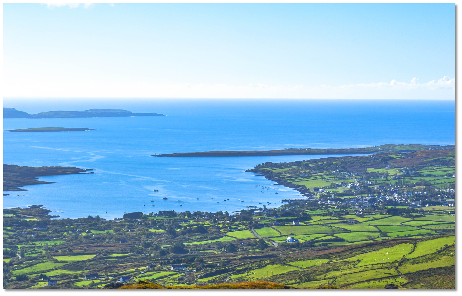
Image: Michael Harpur


The Grounds also extend about 0.3 miles to the south-southwest, much of which has a least depth of 5.5 metres, to terminating at Amelia Rock that has 2.1 metres of water over it. It is marked by a green buoy moored 300 metres west by south of the rock, in 16 metres of water.

Amelia Rock - G Lt buoy Fl. G. 3s position: 51° 29.979’N 009° 31.461’W

Please note

Cosheen Crag and Barnacleeve gap in line 000° T, leads to the west of Amelia Rock as best seen on Admiralty 2184.


Long Island and Copper Point on the western approach to Schull Harbour
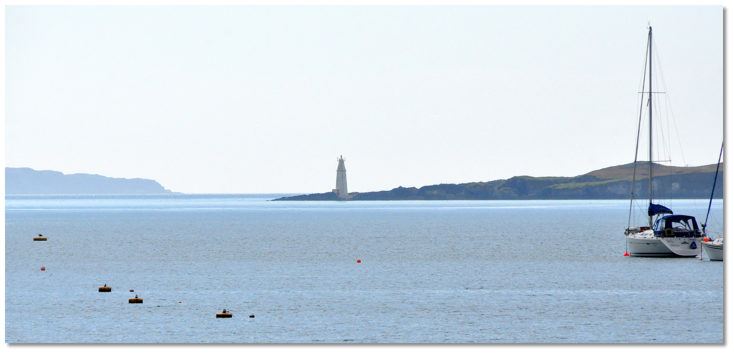
Image: oli xilo via CC BY 2.0


On the western side of the outer approach to Schull Harbour is the two miles long, and about 500 yards wide, Long Island. It rises near the middle to a modest 29 metres from where it declines to the low shelving point at its northeastern end, called Copper Point. A light is shown from a white 14 metre high round tower to mark the entrance into Schull.

Copper Point - Light structure Q(3)10s 16m 8M position 51° 30.250’N 009° 32.063’W


Copper Point light structure as seen from Schull Harbour
Photo: Burke Corbett


The outer shores of Long Island are generally clear to the distance of 90 metres, except near the eastern end, within 0.8 miles of Copper Point, where the, always visible Carrigeenwaun Rocks extend off 200 metres.


Carthy's Island, the Calves and Clear Island as seen from Mount Gabriel
Image: oli xilo via CC BY 2.0


To the south of the approach to Schull are the Calf Islands, between them and Clear Island, there is another passage leading to the Ilen Click to view haven or Skibbereen river. Those wishing to take this passage for both the River Ilen and Baltimore Harbour will find the Baltimore Harbour North Entrance Route location provides a useful set of waypoints. Vessels may also pass to the east of the East Calf, or between it and the Middle Calf.
Please note

All these channels require highly attentive navigation, settled conditions and good visibility for their safe navigation.


Long Island Channel as seen from above Colla Quay on the mainland
Image: Michael Harpur


Continuing westward fro Schull the ½ mile wide Long Island Channel is entered from the east between Copper Point and Skull Point, or from the west between Gun Point and Garillaun Islands, where it leads between Long Island and mainland up to the 11.9 metres high Coney Island. It is about 600 metres in width, with good holding ground plenty of water, and affords good shelter.


Cush Spit buoy with the pier on Long Island in the backdrop
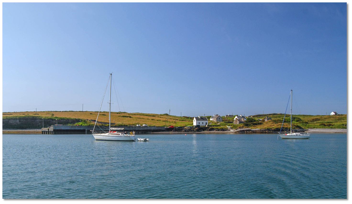
Image: Burke Corbett


Long Island Channel is obstructed by a shoal bank that fringes the north side of Long Island. The principal danger is Cush Spit, a gravel bank about ½ a mile to the west of Copper Point. The spit stretches about 400 metres out from the island, nearly halfway across to the mainland, and has 0.6 metres of water on its north edge, which is steep-to and is marked by a north cardinal buoy. To the east and west of the Cush Spit, the depths decrease but there is plenty of water for the cruising vessel.

Cush Spit - north cardinal Q 4M position 51° 30.304’N 009° 33.017’W


Yachts anchored off Long Island's pier
Image: Burke Corbett


Several anchorages may be obtained in and around the channel. First and foremost of which is off Long Island Click to view haven itself which is the third-largest of Carbery's Hundred Isles at 1.8 km2 (0.7 sq mi), after Sherkin Island and Clear Island, and has a permanent population of no more than 10. The anchorage lies on the north side of the island, between Long Island and the mainland, in Long Island Channel.


Colla Pier set into a bight on the mainland coast
Image: Michael Harpur


Opposite the pier on the mainland is Colla Pier Click to view haven which is a small shallow pier set into a bight on the north side of the Long Island Channel. Colla Pier looks out over Long Island, about 600 metres opposite, to which it provides a regular ferry service to the island small corresponding quay.


Coney Island and Croagh Bay as seen from eastward
Image: Michael Harpur


Close to these anchorages is Coney Island Click to view haven, a small squarish island, about 250 metres broad, situated in Long Island Channel. The island lies on the east side of the mouth of Croagh Bay, rises to only 11.9 metres high and it is shoal northward of the island to the mainland. It is a privately owned island with an anchorage off its northeast corner.


The landing beach on the north-eastern corner of Coney Island
Image: Burke Corbett


West of Coney island is the entrance to Croagh Bay a shallow inlet running up to the Croagh River. It is located on the north and mainland side of Long Island Channel which is located on the north side of Long Island between it and the mainland.


Croagh Bay
Image: Burke Corbett


The bay is entered between Gun Point and Coney Island. Vessels entering the bay should prefer a central-to-western side approach path to stay well clear of the foul area called the Esheens. The Esheens dry to 1 metre LAT and extend about 300 metres to the west from Coney Island.


Long Island, Goat Island and Illaunricmonia as seen from the mainland
Image: Emma Cooney


Goat Island and Goat Island Little form an L-shape at the western end of the run of islands fronting the coast here. Outside them is the small 7-metre high rocky islet of Illaunricmonia, the last island of the chain with foul ground extending to it and the Drommada Rocks a ⅓ of a mile northwest.


Passing the Dromadda Rocks
Image: Graham Rabbits


Goat Island, to the east of Illaunricmonia Island, has rocky shores and rises to the height of 32 metres. It is made distinctive by its cliffs and sea arches, and a remarkable deep chasm, which almost severs its southern portion, called Little Goat Island.

Goat Island Little's stone beacon
Image: Brian Clayton via CC BY 2.0


The smaller Goat Island Little is marked by a white 4.9 metre high stone beacon standing on a hill near its southern extremity. The beacon is the primary mark that helps to distinguish the island and the entrances into Long Island Sound that exist each side of the two islands.

These are Goat Island Sound and Man of War Sound that permit a southwestern approach to the channel. There is also an alternate Barrel Sound approach - see below. These approachs should only be used during daylight hours via the sound that presents best according to conditions.

(i) Man of War Sound is the western channel that lies between Goat Island and Illaunricmonia Island. This joins Lough Buidhe to the north of Goat Island. The beacon on the southern tip of Little Goat Island is to the east of it.

(ii) Goat Island Sound lies between Goat Island and Long Island. This has Goat Island protruding into it from the west and the drying Sound Rock, off Long Island, from the east which is very much in the path of a vessel cutting corners. But vessels taking this course, keeping the Little Goat Island beacon to the west and steering a midway path, will have no further hazards with depths in excess of 20 metres.

(iii) Barrel Sound is a narrow channel, with depths of 9.1 to 24 that has a shallower mid-channel section carrying 4.6 metres LAT over a rock. This leads in and out from the Long Island Channel between Castle Point and Duharrig, thence between the mainland, on the north side, and Drommada then Illaunricmonia Island to join Lough Buidhe to the north of Goat Island. It has a least depth of 22 metres of water in the fairway and is 300 metres wide at its narrowest between Green Isle and the Barrell Rocks.

Westbound vessel heading for Goat Island and the sounds
Image: Burke Corbett


Of these Man of War Sound has fewer dangers in the margins and is 800 metres wide but Goat Island Sound has more regular soundings and smoother waters in any seaway.
Please note

It would be a best practice for newcomers to these sounds to operate under power.


LONG ISLAND BAY TO MIZEN HEAD

Castle Point with Crookhaven in the backdrop
Image: Mike Searle via CC BY SA 2.0


Between Long Island Sound and Crookhaven the coast is deeply indented and skirted by outlying dangers. Spanish Point, about 800 metres north of Sheemon Point, is fringed by foul ground that can extend as far as 135 metres in places offshore.


Castle Point as seen from seaward
Image: Burke Corbett


Approximately 1 mile west-northwest and 3 miles east of Crookhaven is Castle Point. This is made conspicuous by the ruins of an old square Leamcon Castle (sometimes known as Black Castle) standing on a hill, 12 metres high and 300 metres east of Castle Point. Also, the round-topped Tower Hill, rises to 107 metres high, about a mile and a half northeast of Castle Point, where the prominent ruins of Leamcon Signal Tower stands.


Duharrig as seen from the north in silhouette
Image: Burke Corbett


The 5.2-metre high islet of Duharrig lies 0.4 mile southwest of Castle Point. The narrow Barrel Sound channel leads between Castle Point and Duharrig.
Please note

It is advisable to only use this channel in very settled conditions or with the benefit of local knowledge aboard.


There are dangerous clusters of rocks and rocky islets at from 400 to 600 metres distance south of the Castle Point. The most dangerous part of this foul ground, called Bulligmore, has two rocky heads, with 0.9 and 3.6 metres of water respectively. The latter depth is southwest by south, ¾ of a mile from Castle Point, and a similar distance west by north from Illaunricmonia Island.
Please note

A clearing line to pass to the south of Bulligmore is marked on the Admiralty charts; keep Streek Head well open of the southern point of Goat Island Little (257°T).


Bulligmore – unmarked 0.9-metre rock pinnacle position: 51°28.845'N, 009°38.385'W


Toormore Cove
Image: Michael Harpur


To the north northwest of Castle Point, 2½ miles to the northeast of the entrance to Crookhaven is Toormore Bay. The large bay nearly cuts halfway across the Mizen Head promontory, with the remaining isthmus between Dunmanus Harbour, opposite, and Toormore Bay being only 1½ miles across. At its head are the two small inlets of Toormore Cove, tucked in its northeastern corner, and Carrigmore Bay, in the northwest end.


Carrigmore Bay
Image: Michael Harpur


Toormore Bay is entered between Ballyrisode Point and Castle Point, about 1.2 miles east-southeast. Off Ballyrisode Point, the Toormore Bay’s western extremity, foul ground extends to the south for nearly ½ a mile. Amsterdam Reef is awash at low water and on the outer end of this foul ground, at the distance of 800 metres southwest by south from the point.


The Amsterdam Rocks as seen from an approach to Toormore Bay
Image: Burke Corbett


Immediately west, and to the west of Toormore Bay is Ballydivlin Bay that is entered between Sheemon Point and Ballyrisode Point, about 2 miles northeast. Ballydivlin Bay is exposed to south and southeast winds, but in offshore winds offers a sheltered anchorage. The northeast corner of the bay should be avoided as it has many dangers.

Goleen as seen at low water
Image: Michael Harpur


In the northwest corner of Ballydivlin Bay there is the principal village of the area Goleen at the head of a rocky creek named Kireal Coega. The village quay dries at low tide but there is a small well maintained deepwater quay at the entrance to creek that accommodates fishing boats. The inlet provides good shelter in fair weather, except in conditions from the southeast.


Castle Point as seen out through the entrance to Goleen
Image: Michael Harpur


It is more suitable for moderately sized vessels and tight at that. Those that anchor in the creek will need to do so bow and stern but will find excellent windage protection from the inlet high sides. Those that can take to the bottom will find excellent protection at the upper quay.


Crookhaven Harbour
Image: With thanks to Paul Scally ©


Crookhaven Harbour Click to view haven has a long history of providing shelter for sailing vessels. A deep and protected inlet with an entrance 3 miles east by north-eastward of Brow Head and north by north-westward a little more than 6 miles from Fastnet, it was an important shipping port of call between Europe and the United States during the late 19th and early part of the 20th-century. After this, it went on to become an important fishing port. Today the fishing has diminished and in recent years it has become popular with leisure craft.


Crookhaven as seen from Brow Hill
Image: Paul Scally via ASA 3.0


Comprising a long hooked peninsula, Crookhaven encloses an excellent natural harbour that is 2 miles long, a ⅓ of a mile wide and it has a deep eastward facing entrance with unhindered access. It is also well lit with its entrance points of Sheemon Point and Black Horse Rocks being lit and the former has a lighthouse.


Crookhaven's quay which bustled with activity during Victorian times
Image: Michael Harpur


The inlet is deep and provides ample visitor moorings or a very good anchorage with good protection and holding as well as a pontoon for convenient landings. Its small village lies on the south side of the harbour nearly 1 mile within the entrance.


Crookhaven village and pier about a mile within the inlet
Image: Michael Harpur


Entered between Streek Head and Sheemon Point, the eastern extremity of Rock Island located ½ a mile north, this haven is a very convenient and popular anchorage; especially so during easterly winds.


Yacht entering Crookhaven Harbour
Image: With thanks to Paul Scally ©


The north point of the entrance (mainland side) is Rock Island Point, on which stands the lighthouse immediately outside the harbour entrance. The shore here is bold-to and clear of danger. Crookhaven Lighthouse is clearly identifiable 14 meters round cylindrical masonry tower painted white and surrounded by a white wall.

Crookhaven - Lighthouse Fl WR 8s 20m 13/11M position: 51° 28.593’N, 009° 42.273’W


Crookhaven Lighthouse
Photo: Tourism Ireland


The south side is the remarkable Streek Head, that rises abruptly from the sea to a height of 44 metres, has some high detached rocks on its southern side. Part of these dry to 6 metres, Gokane Rock, and the area should not be approached within a 200 metres distance.


Streek Head as seen over the Alderman Rocks
Image: Graham Rabbits


Extending 400 to 600 metres to the east of Streek Head are the Alderman Rocks. Rising from up to 9.1 metres above high water they are foul out beyond the Black Horse Rocks. These rocks extend about 135 metres north from Alderman Rocks and are marked by the Blackhorse Rocks beacon.

Blackhorse Rocks - north cardinal beacon Q FL position: 51°28.437'N, 009°41.683'W


The north cardinal beacon on Blackhorse Rocks
Image: Graham Rabbits


The Alderman Sound, a narrow channel with up to 5.8 metres of water, resides between the mainland and Alderman Rocks. It is constricted by the dangers on both sides and the cut can only be used in good conditions by local boatmen.


Southbound yacht passing Brow Head
Image: Burke Corbett


The 111 metres high and bluff Brow Head slopes down to Galley Cove on its eastern side. Contrary to popular belief, Mizen Head is not the most southerly point on the mainland of Ireland it is, in fact, Brow Head that correctly holds the title. Nevertheless, geography books have long measured the length of Ireland "from Fair Head to Mizen Head" or "from Malin Head to Mizen Head.


Barley Cove
Image: mightymightymatze via CC BY 4.0


A mile to the east of Mizen Head is Barley Cove. It is made conspicuous by tracts of sand at its head plus the ruins of a signal tower on Brow Head, its eastern entrance point. The small bight is only separated from Crookhaven Harbour by a narrow sandy isthmus. Although, on the face of it, the cove may look inviting but it offers no safety in any wind. In about the middle of it there is a large rock that dries about 2.7 metres and is awash at high water, called the Devil’s Rock.


Mizen Head as seen from the mainland
Image: mightymightymatze via CC BY 4.0


The very steep-to Mizen Head resides on the southwest extremity of Cruckaun Island. The island is cut off from the coast by a deep chasm but remains connected to the coast by a narrow neck of land. The chasm is spanned by a bridge that provides access to an old signalling station, a weather station, and a lighthouse.


Bridge spanning the chasm to Cruckaun Island
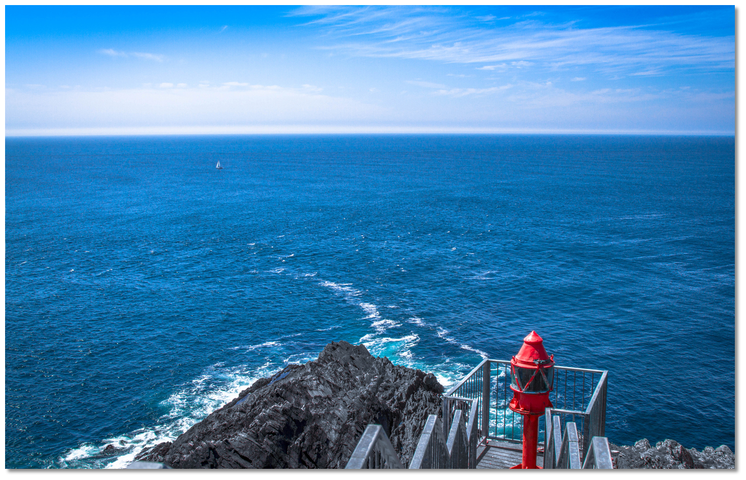
Image: Burke Corbett


The signalling station, once permanently manned, is now a museum.
Please note

Near the head the tide runs at the rate of 4 kn, causing a dangerous race. At a distance from the shore it loses its velocity, and at 5 miles from the head runs only 1.5 knots.


Mizen Head – lighthouse Iso.W 4s 44m 15M position: 51° 26.995´N, 009° 49.225´W


The view from Mizen Head light with rough water over the rock at its foot
Image: mightymightymatze via CC BY 4.0


Mizen Head is clear of danger beyond a distance of 200 metres out from the rocks. ½ a mile southeast of the light structure, and 250 metres offshore, there is the dangerous Carrigower Rock that is awash at high water.


Mizen Head as seen from seaward
Image: Burke Corbett


The headland is made conspicuous by its remarkable 229 metre high Mizen Peak located about a mile to the northeast. This sharp peak is the highest hill in the vicinity and about halfway between Mizen Head and the peak a ruined tower can be seen at an elevation of 128 metres. 12 miles to the northeast of this is the 404 meters Mount Gabriel that will make itself known by conspicuous radar domes near the summit. Mizen Head has a light shown from a light structure on a concrete platform with the lantern visible 313°-133°.

Vessels continuing north may avail of the Mizen Head to Loop Head Route location coastal description.

What is the best sailing time?
May to September is the traditional Irish Sailing season with June July offering the best weather. June and July’s statistical incidence of strong winds are however two days of winds up to force seven. As such, depending on personal sailing preferences, a vessel may expect to be held-up or enjoy robust sailing conditions. Ireland is not subject to persistent fog. Statistically complete days of persistent fog occur less than once in a decade.

Are there any security concerns?
Never been a security issue known to have occurred sailing off the Irish coast.

With thanks to:
eOceanic.com research, Photos with thanks to Burke Corbett, Emma Cooney, Ben Rudiak-Gould, Shane Cronin, Libour Kampas & Graham Rabbitts.


Expand to
new tab or fullscreen


A photograph is worth a thousand words. We are always looking for bright sunny photographs that show this route and its identifiable features at its best. If you have some images that we could use please upload them here. All we need to know is how you would like to be credited for your work and a brief description of the image if it is not readily apparent. If you would like us to add a hyperlink from the image that goes back to your site please include the desired link and we will be delighted to that for you.


Add your review or comment:

John Mcaleer wrote this review on Jun 7th 2023:
Comment re Sherkin island
The pontoon is no longer at Sherkin Island and the Hotel is closed.

Average Rating: Unrated

Michael Harpur wrote this review on Jun 20th 2023:
Thank you John, noted in the text now.

Average Rating: Unrated

Please log in to leave a review of this route.

Please note eOceanic makes no guarantee of the validity of this information, we have not sailed this route and do not have first-hand experience to qualify the data. Although the contributors are vetted by peer review as practised authorities, they are in no way, whatsoever, responsible for the accuracy of their contributions. It is essential that you thoroughly check the accuracy and suitability for your vessel of any waypoints offered in any context plus the precision of your GPS. Any data provided on this page is entirely used at your own risk and you must read our legal page if you view data on this site.