
The anchorage offers good protection in the sheltered Carlingford Lough. However, if the wind comes on strong from the northwest round to the south, it would be more comfortable in the marina on the southern shore. Killowen may be accessed via Warrenpoint Port’s illuminated deep water shipping channel that runs the entire length of the lough. Careful navigation is generally required for this location owing to exceptional currents in the lower lough and entrance.

Keyfacts for Killowen
Facilities


Nature


Considerations


Protected sectors

Approaches

Shelter

Last modified
September 9th 2022 Summary* Restrictions apply
A good location with careful navigation required for access.Facilities
Nature
Considerations
 clyc.info/
Position and approaches

Expand to new tab or fullscreen
Haven position
 54° 4.555' N, 006° 11.390' W
Approximately three hundred metres west of the Carlingford Lough Yacht Club on Killowen point.
What is the initial fix?
The following Carlingford Lough Entrance Initial Fix will set up a final approach:
 54° 0.100' N, 006° 2.052' W


What are the key points of the approach?
Offshore details are available in eastern Ireland’s Coastal Overview for Strangford Lough to Dublin Bay  and directions for the run up the lough are available in the Warrenpoint
  entry.
and directions for the run up the lough are available in the Warrenpoint entry.- From the entrance follow the well-buoyed and lit commercial channel up the length of the inlet.
- Progress up the inlet until the No. 23 buoy and then pass to the west of the Killowen Bank Special Mark Buoy or midway between No. 23 and No. 25 Light buoys before turning north towards the yachts off the club.
Not what you need?
Click the 'Next' and 'Previous' buttons to progress through neighbouring havens in a coastal 'clockwise' or 'anti-clockwise' sequence. Below are the ten nearest havens to Killowen for your convenience.
Ten nearest havens by straight line charted distance and bearing:
- Rostrevor - 0.3 nautical miles NNW
- Carlingford Marina - 1.4 nautical miles S
- Greer’s Quay - 1.6 nautical miles W
- Carlingford Harbour - 2 nautical miles S
- Omeath - 2.3 nautical miles WNW
- Warrenpoint - 2.6 nautical miles WNW
- Greencastle - 3.8 nautical miles SE
- Giles Quay - 5.8 nautical miles SSW
- Kilkeel Harbour - 7 nautical miles E
- Newry - 7.6 nautical miles NW
These havens are ordered by straight line charted distance and bearing, and can be reordered by compass direction or coastal sequence:
- Rostrevor - 0.3 miles NNW
- Carlingford Marina - 1.4 miles S
- Greer’s Quay - 1.6 miles W
- Carlingford Harbour - 2 miles S
- Omeath - 2.3 miles WNW
- Warrenpoint - 2.6 miles WNW
- Greencastle - 3.8 miles SE
- Giles Quay - 5.8 miles SSW
- Kilkeel Harbour - 7 miles E
- Newry - 7.6 miles NW

Chart

What's the story here?
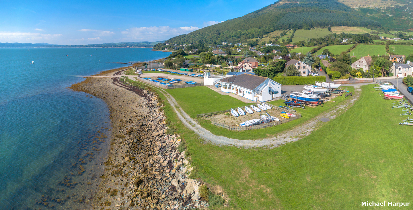
 Carlingford Lough Yacht Club clubhouse
Image: Michael Harpur
Killowen is a small village based at the foot of the forested Slieve Martin, where the Mountains of Mourne terminate at the head and northeastern shore of Carlingford Lough. It is
a picturesque hamlet set on a point that juts out into the Lough. Although Killowen has no services it is the home of the Carlingford Lough Yacht Club that is well set up to receive visiting mariners. It has a welcoming well-appointed clubhouse and spacious grounds that overlook the Lough from the shore.
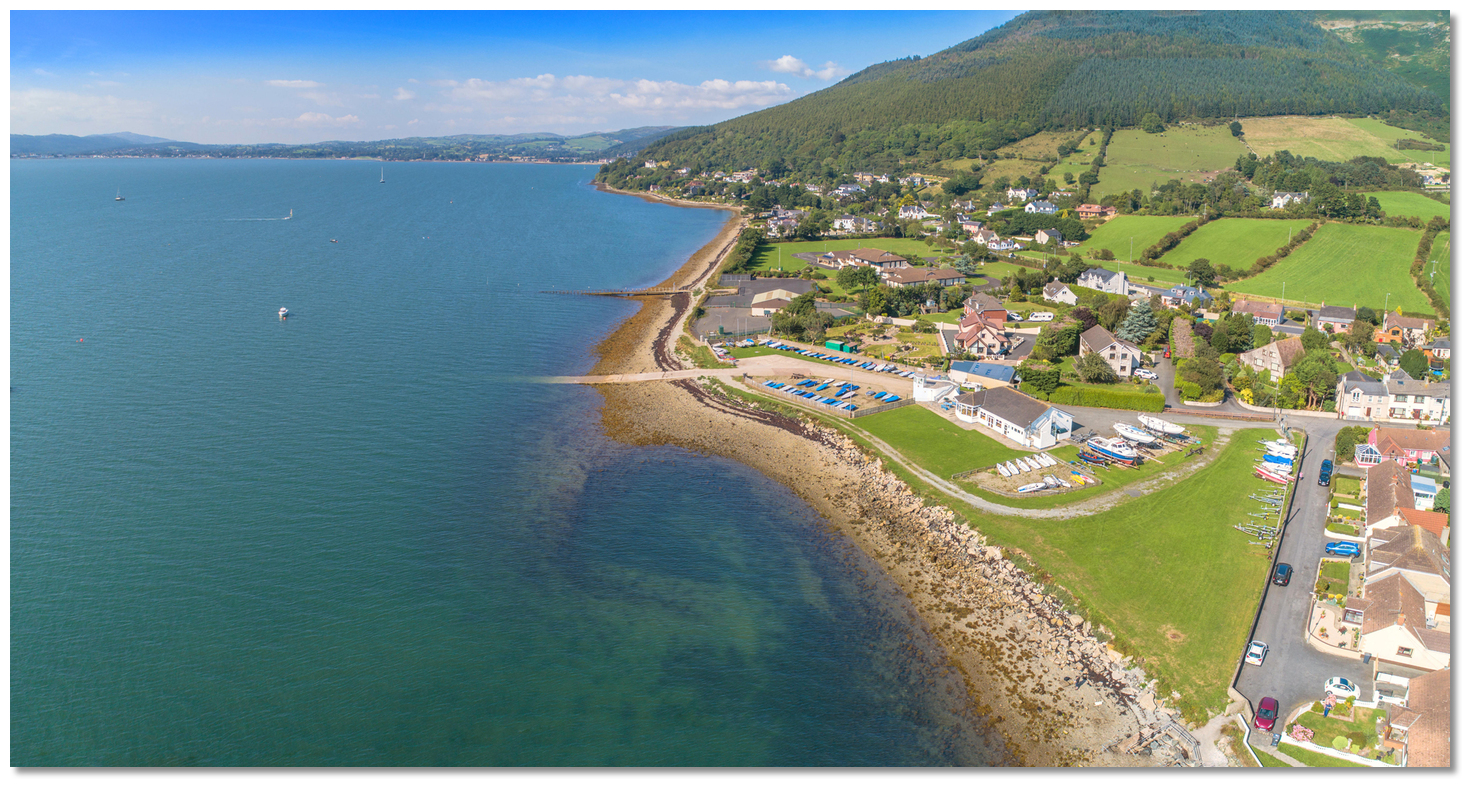 The anchoring and mooring area off of Carlingford Lough Yacht Club
Image: Michael Harpur
Deeper draft visiting vessels can anchor outside of the club moorings approximately 300 metres offshore. Vessels that can take to the ground at low water can practically anchor anywhere in this locality. The yacht club also provide six substantial and well-marked visitor moorings. The hire rate for boats is £10 per day or part thereof, and there is a reduced weekly rate of £50. Contact Carlingford Lough Yacht Club
 by
by  +44 28 4173 8604 or
  info@clyc.info.
How to get in?
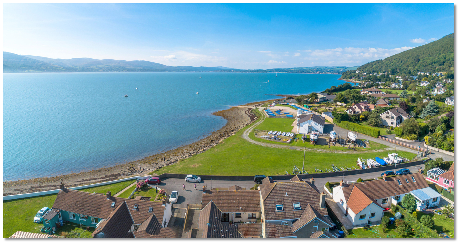
 The run up the Lough to Killowen
Image: Michael Harpur
 Seaward approaches are detailed in eastern Ireland’s coastal overview for Strangford Lough to Dublin Bay . Use the directions provided for Warrenpoint for approaches and the run up the No. 23 starboard-hand marker, Fl(3)G.10s.
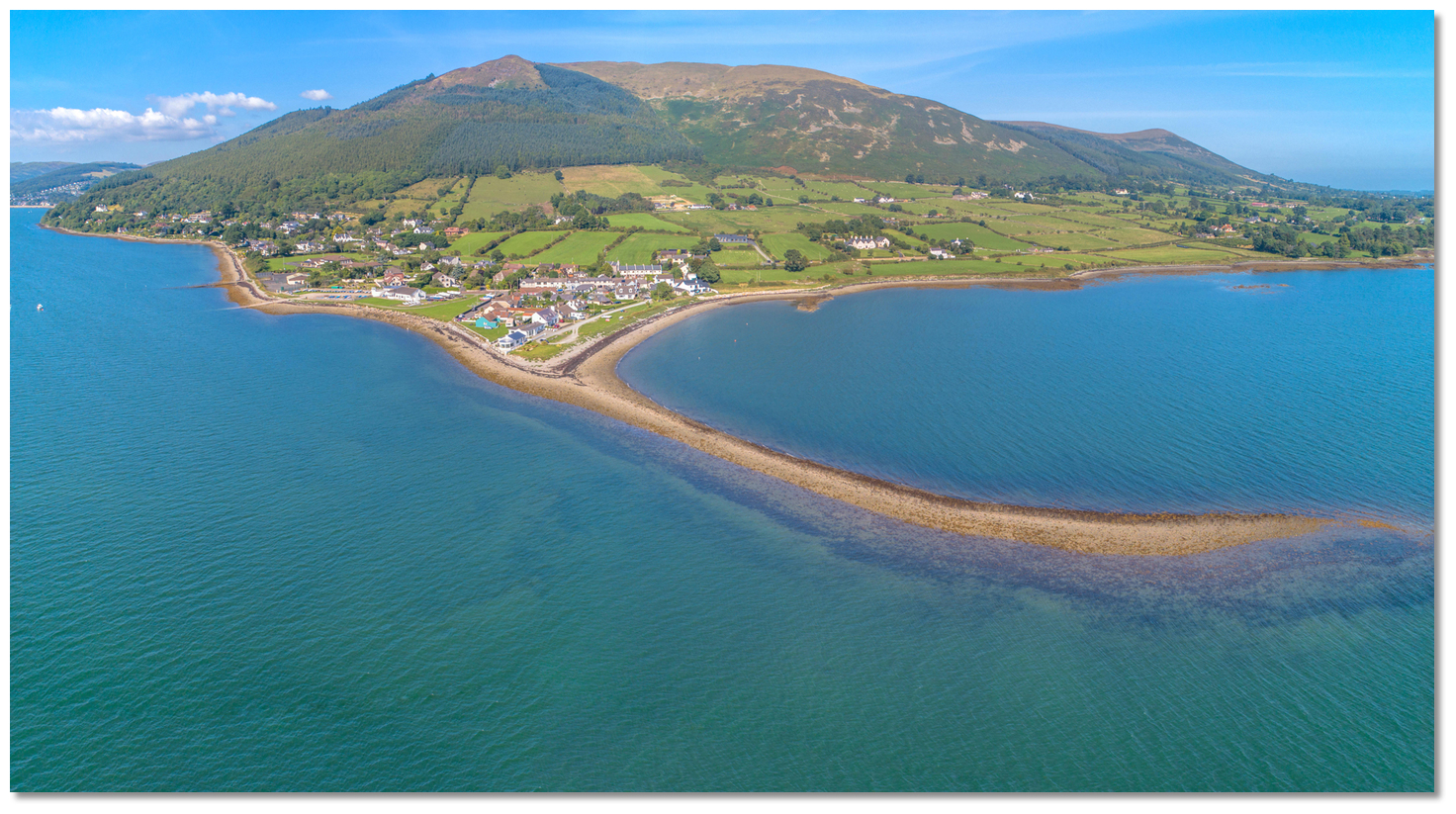 Killowen Point and its drying shoal
Image: Michael Harpur
After passing south of Killowen Point and the No. 23, it will be tempting to turn up for Killowen. However, at low water, there is a shallow area of water that extends west of the Killowen Bank and another bank that extends southward from Killowen Point. The western extension of the Killowen Bank is marked by the yellow Killowen Bank Special Mark Buoy. Clears the Killowen Bank by keeping west of this special mark or, if not present, continuing on to the midpoint between the No. 23 and No. 25 Light buoys before turning north for the anchorage. Thereafter keeping about a ¼ of a mile westward of Killowen Point clears the terrace of shelly gravel that extends from it and dries to more than 4 metres.
Killowen Bank buoy – Fl.Y.5s position: 54° 3.998' N 006° 11.244' W
 Killowen Point is made conspicuous by a line of bungalows
Image: Michael Harpur
Killowen Point is made conspicuous by a line of bungalows stretching out to its extremity. Carlingford Lough Yacht Club clubhouse is situated close north of its extremity. The substantial white building with its spacious grounds and boat park will be prominent. It is fronted by the club slip and another jetty belonging to the Outdoor Education Centre jetty close northward.
 The anchoring position will make itself readily known by the local vessels
Image: Michael Harpur
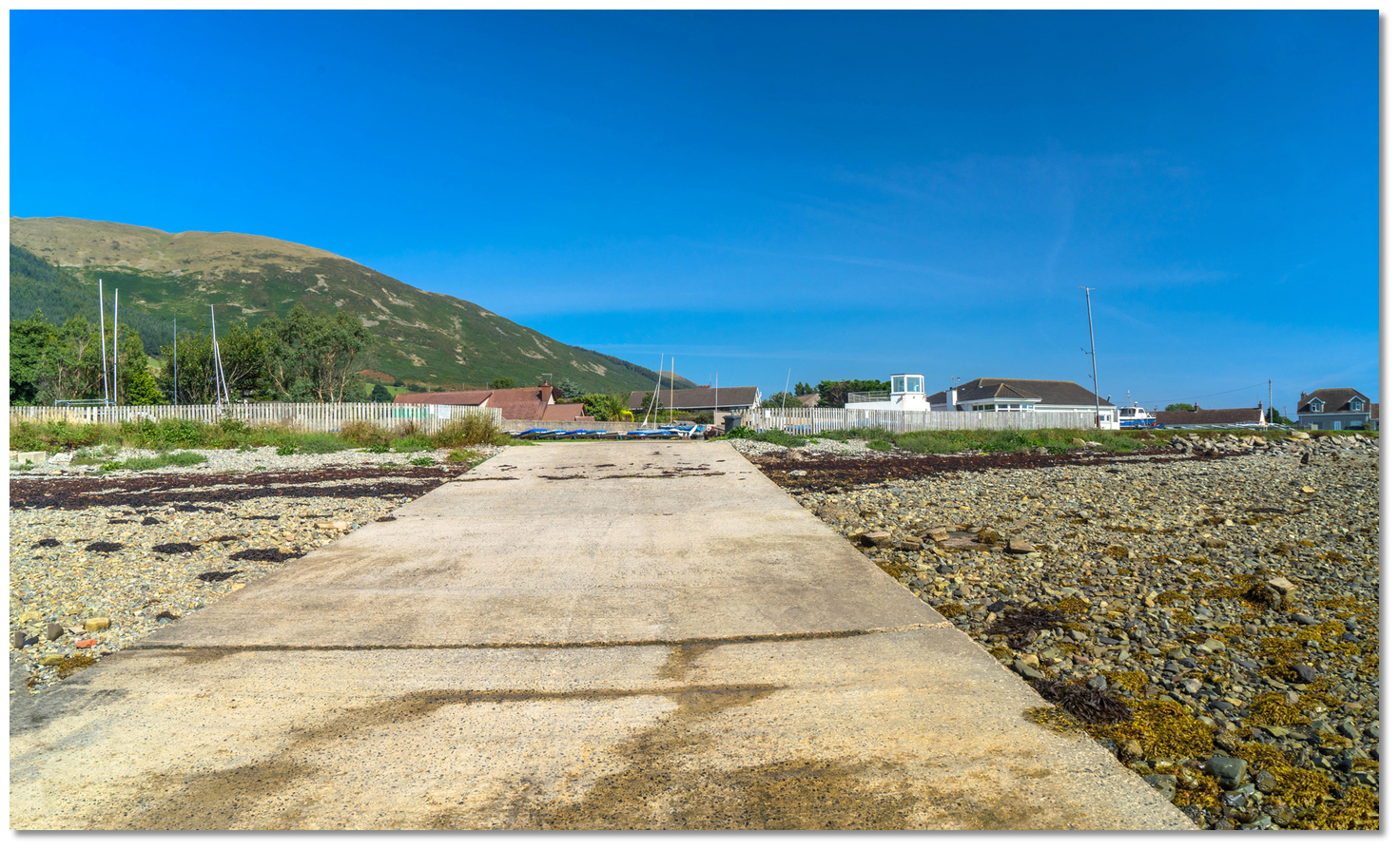
The anchoring position will make itself readily known by the local vessels moored offshore. Come up on the outside of these vessels and anchor approximately 300 metres offshore. Vessels that can take to the ground can practically anchor anywhere in this locality.  Carlingford Lough Yacht Club slipway
Image: Michael Harpur
Land at the slip leading to Carlingford Lough Yacht Club. Those landing at LWS should be prepared to lift the motor and use oars to come in the last length.
 The Outdoor Education Centre jetty with the alternate anchorage beyond
Image: Michael Harpur
If the wind comes on strong from northeast round to southeast you would be more comfortable in the marina on the southern shore. Some better protection can be sought from a northeasterly by tucking in under the mountain noted in the Rostrevor
entry. This is on the perimeter of the 'Carlingford Lough Marine Conservation Zone' a ½ mile northwestward of Killowen Point.Why visit here?
Killowen derives its name from the Irish 'Cill Eoghain', meaning 'Owen's Church'. It is spelled in many different ways: 'Eoghain's church', 'Cill Eoin', or alternatively 'Cill Abhainn'. There are more than twenty places of this name, of which the great majority are 'Cill Eoghain', all of which commemorate about a dozen saints of this name. Killowen’s current 'Church of the Sacred Heart'
Image: P Flannagan via CC BY-SA 3.0
Killowen’s human history goes back much further to megalithic times for this is an ancient part of the country. This is well evidenced by the Kilfeaghan Dolmen located about two km from Killowen. This prehistoric dolmen site shows human inhabitation existed here between 3000 and 4500 years. The portal tomb stands in farmland on the eastern slopes of Knockshee overlooking Greenore and the lower Lough. Its gigantic capstone measures at least 2.5 metres long and is about 1.5 metres thick. Known locally as 'The Big Fella' the capstone is estimated to weigh between 35 and 40 tons and is said to be one of the biggest in Ireland. Beneath this enormous capstone two portal stones have partly sunk into the ground bearing this weight through the centuries. The tomb’s chamber faces north and the cairn is believed to have extended further northward. Excavations at the site earlier this century unearthed various bones and pottery.
 Kilfeaghan Dolmen
Image: Tourism Ireland
Another prehistoric site was discovered by chance on the shore of the loch near Killowen as late as 1976. Unearthed in advance of a road widening scheme the 'Ballinran Court Tomb', sometimes known as the 'Giant's Grave', was situated close to the shore of Carlingford Lough. The tomb had a very long gallery, over 12 metres long, aligned north-south, opening onto an approximately circular forecourt at its north end. No traces survived of the cairn or any kerb or revetment. One of the two portal-stone sockets still contained the fractured stump of the stone which had stood in it. No burial deposits could be found in situ, although some cremated bones, presumably human, and three primary flint flakes were found.
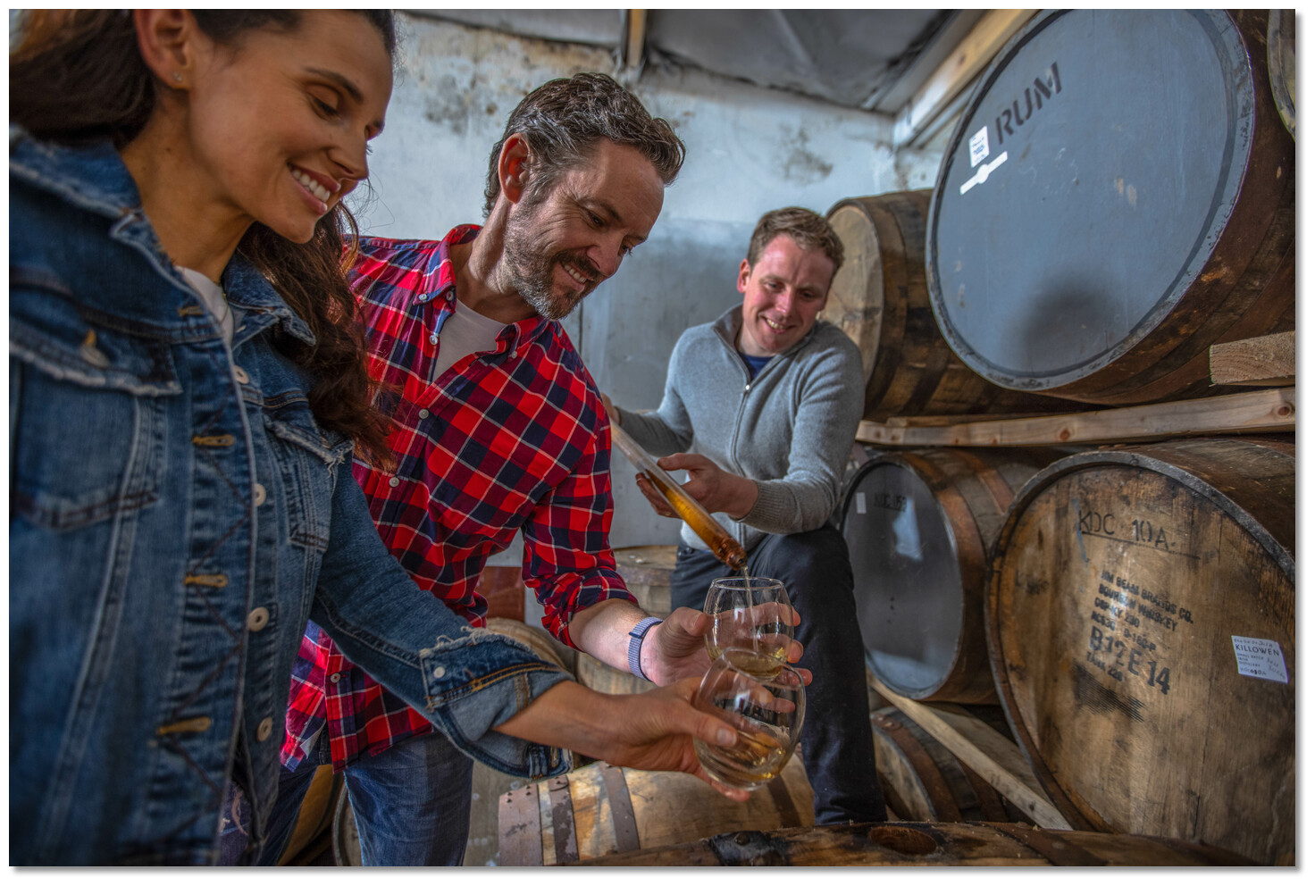 Killowen Distillery tour and tasting
Image: Tourism Ireland
Killowen grew to be a fishing village and was described in an 1846 guide as 'The nursery of the seamen who man the commercial Navy of Newry' which was the primary port of the Lough before Warrenport took this role. A rhyme from the times remains:
And hardy the fishers that call it their own;
A race that nor coward nor traitor have known,
Enjoy the gay homesteads of happy Killowen'
 Carlingford Lough Yacht Club providing a gateway to this area
Image: Michael Harpur
Seated at the foot of the Mournes the townlands of Killowen and Kilfeaghan are renowned today for their natural beauty, history & lore. Perhaps one of the best ways of experiencing this is by a visit to Killowen Distillery which provides samplings of the best in craft spirits straight from the Mourne Mountains. The distillery tour not only provides an introduction to Irish whiskey and poteen making but also to the culture and location of this beautiful part of the Lough.
 Carlingford Lough Yacht Club is the anchorages primary attraction
Image: Michael Harpur
From a boating perspective, the small village provides another excellent anchoring location on the lough. Its primary attraction is its convenient shore access and the excellent facilities provided by Carlingford Lough Yacht Club.
What facilities are available?
Carlingford Lough Yacht Club has a bar and shower facilities that are available when it is open. They are more than helpful and delighted to assist visiting boatmen. Please do return the compliment by providing custom to their bar etc. Minor repairs can be undertaken here or at nearby Rostrevor and Warrenpoint.Two miles away Rostrevor village has a population of 2500, and is popular among holiday-makers so expect to find almost all provisioning necessities there. Nearby Warrenpoint has excellent road links and bus services available to Carlingford/Cooley as well as the major population centres of Ireland. International air services are available from Belfast airport 96 km. Minor repairs can be undertaken.
Useful transport contacts in this area:
Dundalk Train Station + 353 42 933 5521
Dundalk Bus Station + 353 42 9334075
Newry Bus Station + 44 28 30623531
Newry Train Station + 44 28 30269271
Any security concerns?
Never an issue known to have occurred at Killowen and Carlingford Lough Yacht Club.With thanks to:
Charlie Kavanagh ISA/RYA Yachtmaster Instructor/Examiner and Henry McLaughlin Carlingford Lough Yacht Club secretary.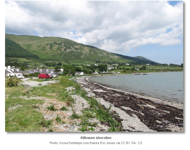


Killowen 360°


Add your review or comment:
Please log in to leave a review of this haven.
Please note eOceanic makes no guarantee of the validity of this information, we have not visited this haven and do not have first-hand experience to qualify the data. Although the contributors are vetted by peer review as practised authorities, they are in no way, whatsoever, responsible for the accuracy of their contributions. It is essential that you thoroughly check the accuracy and suitability for your vessel of any waypoints offered in any context plus the precision of your GPS. Any data provided on this page is entirely used at your own risk and you must read our legal page if you view data on this site. Free to use sea charts courtesy of Navionics.