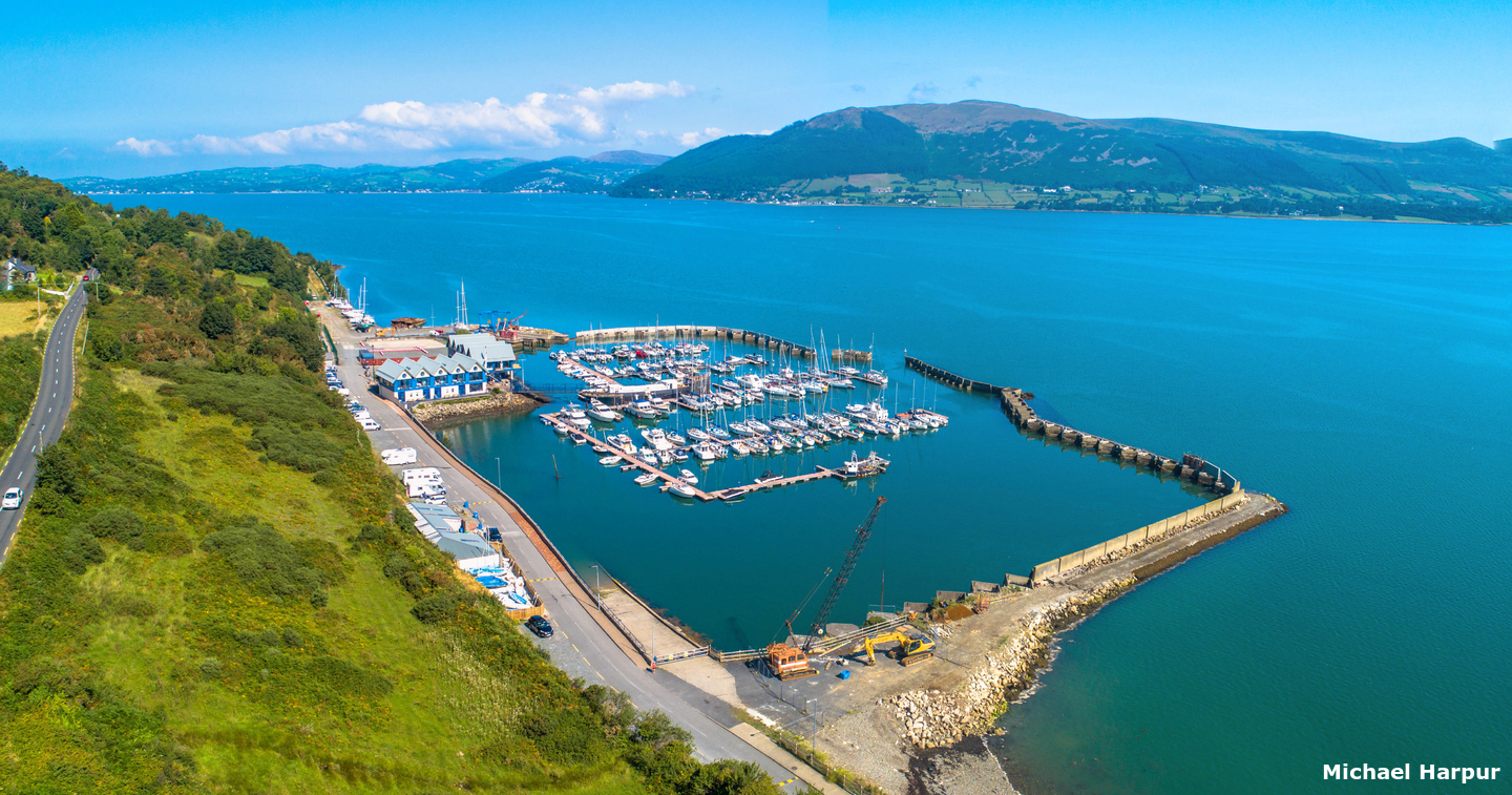
Once inside the marina, a vessel is assured complete protection. The marina is accessed via Warrenpoint Port’s illuminated deep water shipping channel. This runs the entire length of the lough and makes the marina accessible at all states of the tide. Careful navigation is generally required for this location owing to exceptional currents in the lower lough and at the entrance.

Keyfacts for Carlingford Marina


Nature


Considerations


Protected sectors


Summary* Restrictions apply
A completely protected location with careful navigation required for access.


Nature


Considerations


Position and approaches
Haven position
 54° 3.130' N, 006° 11.430' W
At the marina entrance marked with day marks and Port and Starboard lights, QR 4m 1M and QG 4m 1M.
What is the initial fix?
 54° 0.100' N, 006° 2.052' W
 What are the key points of the approach?
 and directions for the run up the lough are available in the Warrenpoint
  entry.
- Follow the well buoyed and lit commercial channel up the lough to the No.18 port hand marker.
- Do not be tempted to cut across directly before the mark as this will bring a vessel upon the Carlingford Bank.
- Round the mark and approach the Carlingford Marina from the north.
Not what you need?
- Carlingford Harbour - 0.6 nautical miles SSE
- Killowen - 1.4 nautical miles N
- Rostrevor - 1.7 nautical miles N
- Greer’s Quay - 2 nautical miles NW
- Omeath - 3.1 nautical miles NW
- Greencastle - 3.2 nautical miles ESE
- Warrenpoint - 3.5 nautical miles NW
- Giles Quay - 4.4 nautical miles SSW
- Kilkeel Harbour - 7 nautical miles E
- Dundalk - 7.5 nautical miles WSW
- Carlingford Harbour - 0.6 miles SSE
- Killowen - 1.4 miles N
- Rostrevor - 1.7 miles N
- Greer’s Quay - 2 miles NW
- Omeath - 3.1 miles NW
- Greencastle - 3.2 miles ESE
- Warrenpoint - 3.5 miles NW
- Giles Quay - 4.4 miles SSW
- Kilkeel Harbour - 7 miles E
- Dundalk - 7.5 miles WSW
Chart
What's the story here?
 Carlingford Marina
Image: Michael Harpur
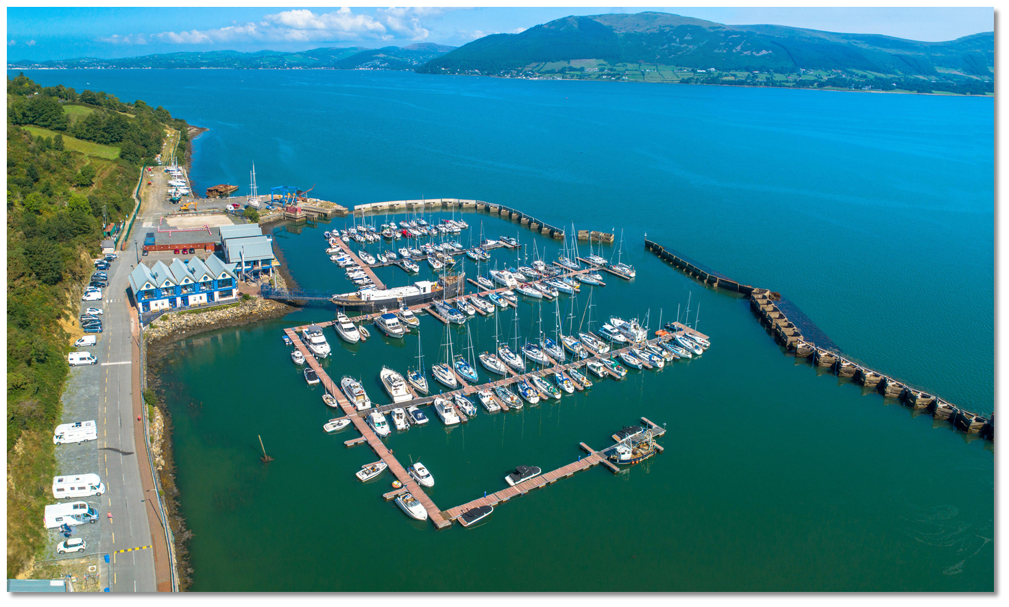
Carlingford Marina is situated on the southwest side of the lough about 4 miles from Haulbowline Light House, marking the entrance, and 2½ miles to the northwest of Greenore Point. It is located in a rural setting ½ a mile northwest of Carlingford, the main town of the Cooley Peninsula. The marina basin is enclosed by stone and concrete breakwaters. These are based on a concrete caisson design with a crown wall above the highest astronomical tide level. Within the centre of the marina is a permanently moored ship 40 metres long. Adjoining the marina basin is a dry boat storage area, which will accommodate up to 65 boats depending upon size.
Carlingford Marina can accommodate boats of up to 25 metres LOA, carrying a maximum draft is 2.2 metres (vessels larger than 15.5 metres LOA only by prior arrangement). The marina has a stated depth of 2.2 metres MLWS but the visitor's pontoon has reportedly as little as 1.5 metres over soft mud, so movements may be restricted at low water Springs. Vessels of 2 metres draft are advised to avoid navigating within the marina basin for 2 hours on either side of low water.
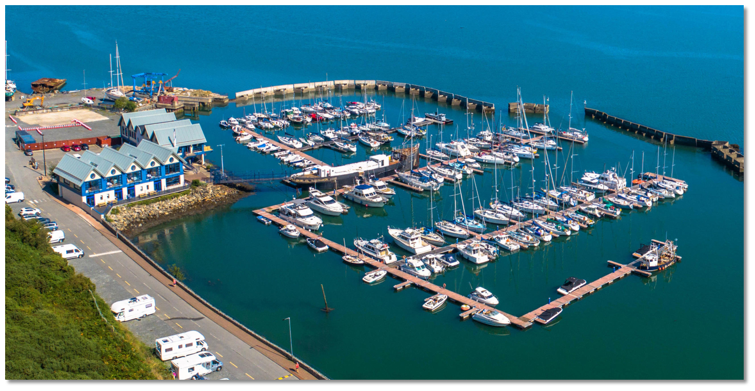 Carlingford Marina's 170 berths
Image: Michael Harpur
The marina has a total of 170 berths with over 20 reserved solely for visiting boats. It is nevertheless advisable to make berthing arrangements in advance with the marina. Carlingford Marina office hours 9 am - 6 pm, 7 days a week,
 16, 37(M1) [Carlingford Marina],
  +353 (0) 42 937 3072,
  info@carlingfordmarina.ie,
  www.carlingfordmarina.
Carlingford Sailing Club has four of their complementary deepwater visitor moorings to the north of the marina. These are available by arrangement with the club,
 Ch. 16 [Carlingford Sailing Club],
  +353 (0) 42 937 3238,
  +353 (0) 87 980 7774,
  info@carlingfordsailingclub.net and have a web site for further information
  www.carlingfordsailingclub.
 How to get in?
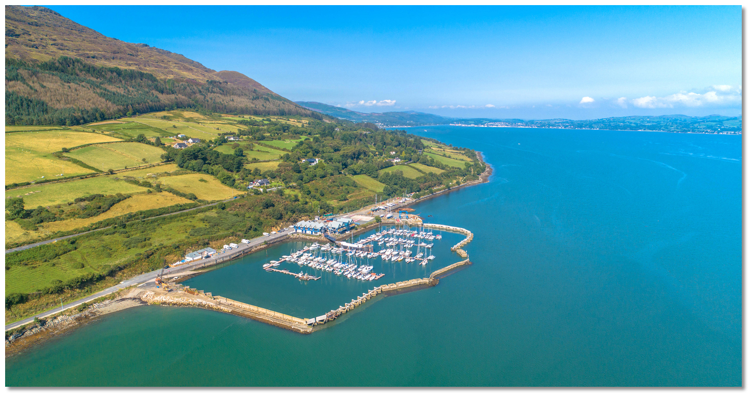 Carlingford Marina with Warrenpoint at the head of the Lough visible in the
backdrop
Image: Michael Harpur
 Seaward approaches are detailed in eastern Ireland’s coastal overview for Strangford Lough to Dublin Bay
  . Use the directions provided for Warrenpoint
  for approaches and the run up the No.18 Port Hand Channel Buoy Fl R (4) 8s.
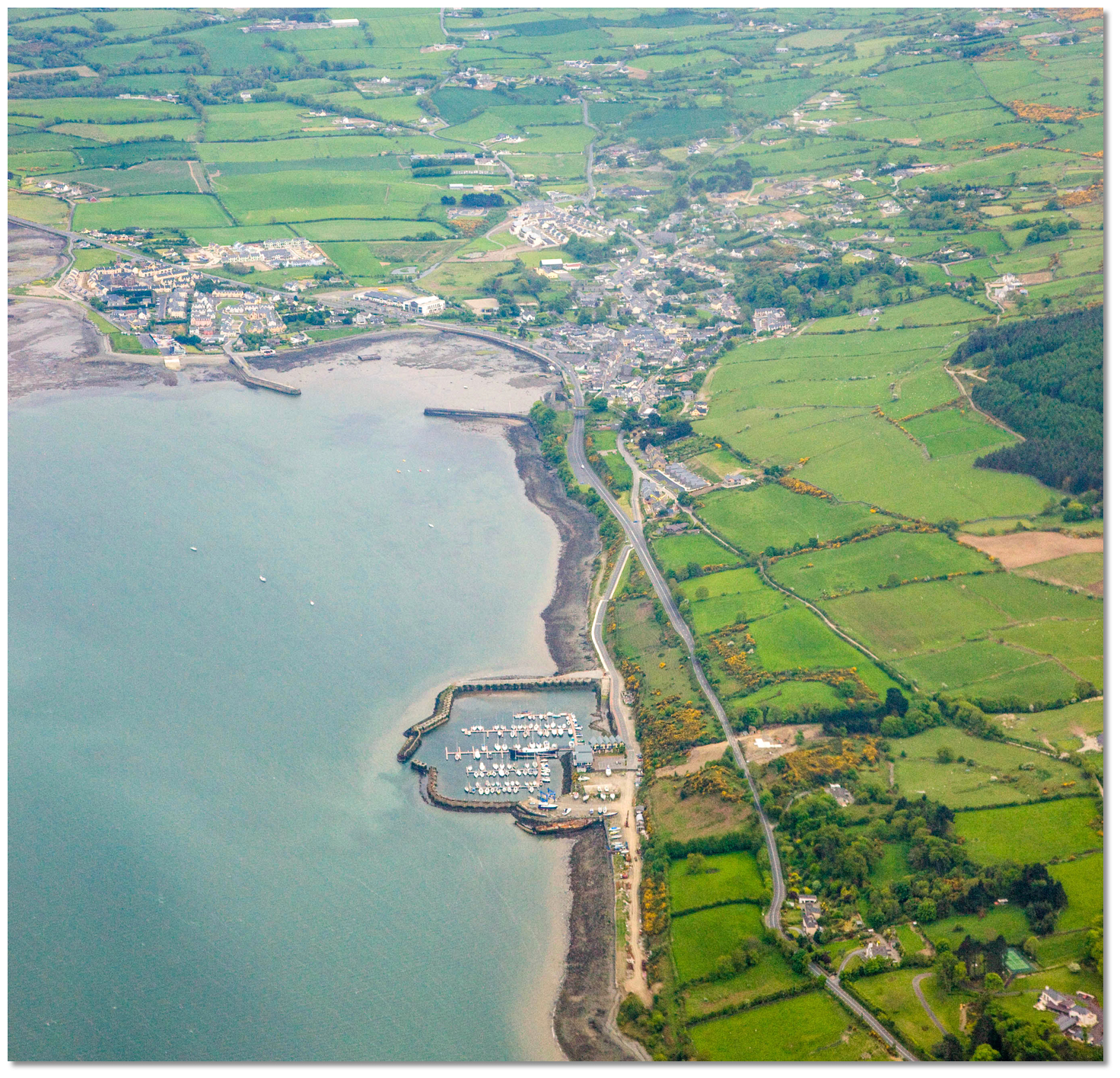 Carlingford Marina and with Carlingford Harbour in the backdrop
Image: Tourism Ireland
This mark visibly carries a vessel past Carlingford Harbour, made conspicuous by the town, piers and castle, and then the Marina itself which is situated 1 mile north by northwest. But it is essential to continue as far as buoy No.18 and approach the marina from the north to avoid the Carlingford Bank.
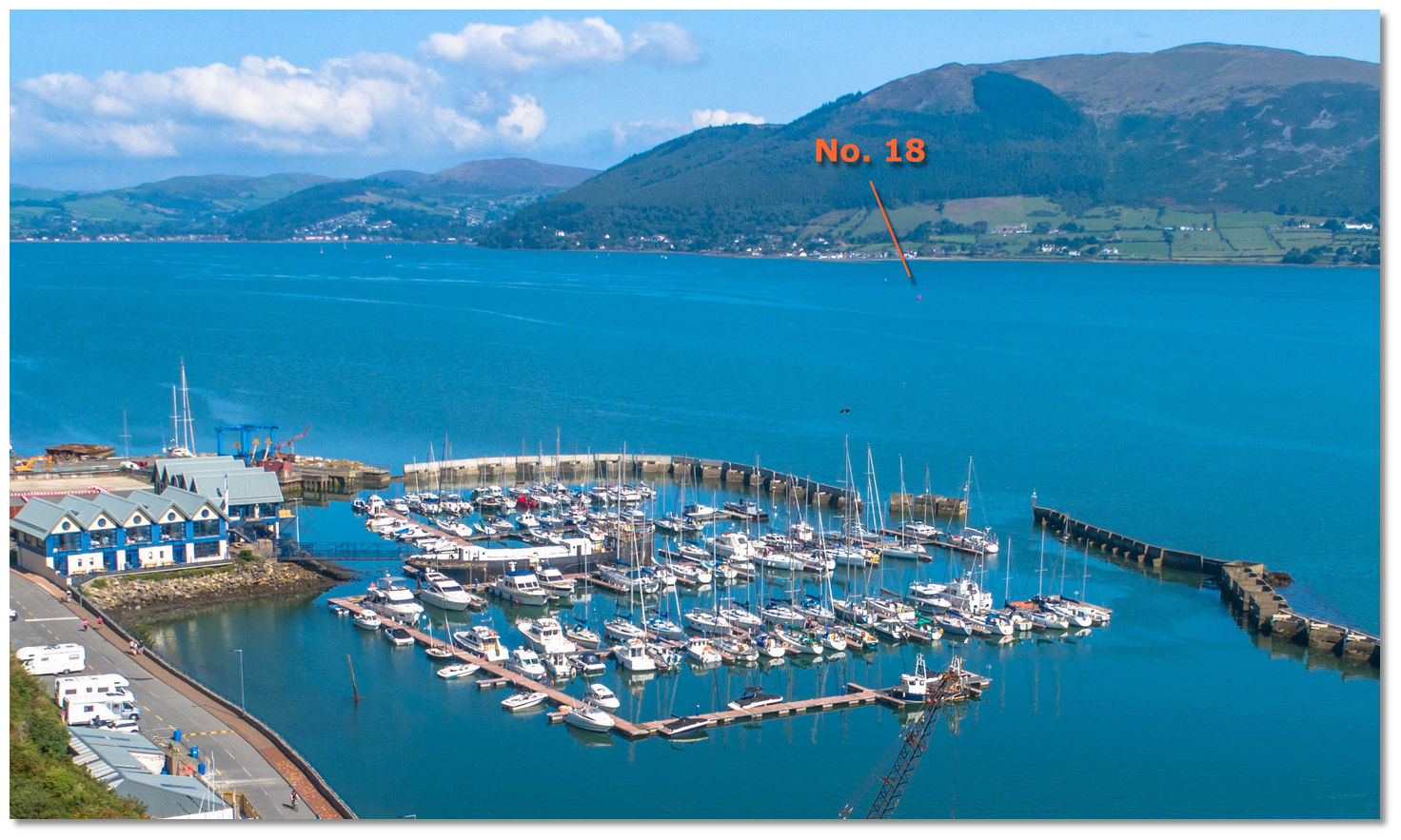 No. 18 Buoy situate a ½ mile northward of the entrance
Image: Michael Harpur
This bank lies in front of the marina, between it and the channel, and terminates before the buoy. The bank's outer edge dries and is steep-to. Between it and the shore, there are extensive shallows reducing from 1.7 to 1.6 in the area to the east of the marina gradually shallowing southward towards Carlingford Harbour.

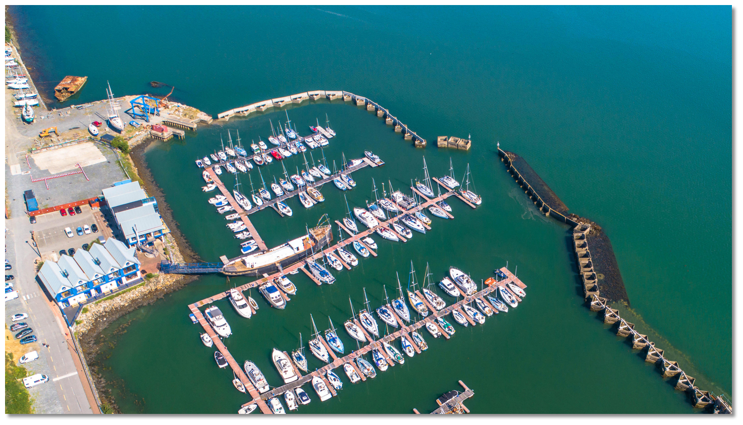 The marina's northward facing entrance is narrow
 Image: Michael Harpur
Once round the northwest end of the Carlingford Bank, taking the No.18 buoy to port, steer a course of about 190°T for the marina. It is about a ½ mile back to the marina entrance that is marked with day marks and Port and Starboard lights, QR 4m 1M and QG 4m 1M. Caution is required with the entrance as it is about 5-7m wide and could prove challenging, especially in rough weather.
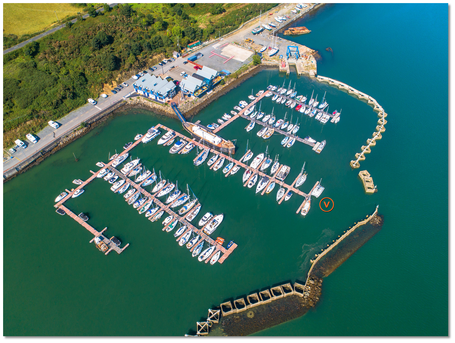 The wait berth is on the hammerhead immediately inside the entrance
Image: Michael Harpur
 The marina basin is enclosed by stone and concrete breakwaters. The northern part of the marina basin accommodates 80 berths and the southern a further 70 pontoon berths. The wait pontoon is the hammerhead immediately inside the entrance. Alternatively, berth as directed by the marina office.
Carlingford Sailing Club's four complementary deepwater visitor moorings are to the north of the marina.
Why visit here?
 Queen Medb
 Image: Public Domain Queen Maev by J. C. Leyendecker
The saga was composed in prose with verse passages in the 7th - 8th century, probably by monks in various versions who were acquainted with such epics as the 'Aeneid'. But this tale is far more ancient than that and was told and retold during the iron age. The 'Bull of Cooley', or 'the driving-off of cows of Cooley', most commonly known as 'The Cattle Raid of Cooley’, is the longest Irish narrative and the central epic of the 'Ulster Cycle' of mythological sagas, if not the most famous tale in Irish mythology.
It portrays an Ireland divided into four kingdoms: Ulaid (Ulster), Connachta(Connaught), Laigin (Leinster), and Mumu (Munster), divisions that persisted into the Middle Ages to become administrative regions of the present day. Within this national context of provincial rivalry is a tale of jealousy, heroism and superhero warrior deeds, largely surrounding the national mythical warrior Cú Chulainn.
 Cú Chulainn & the Bull as depicted by Karl Beutel
Image: Eige Arbeid via ASA 3.0
The Táin involves the story of the Queen Medb of Connacht and her husband Ailill. Medb was measuring up their worldly possessions and found that they were equal in all respects except one; Ailill owned an outstanding white bull that vastly outclassed anything she had. Although she was powerful, she was jealous of her husband Ailill's white bull. Searching for an equal, Medb discovered the Brown Bull of Cooley in Ulster was its equal and she was determined to have it. The bull Donn Cuailnge was the property of Daire, an Ulster chieftain who refused to lend it to her. So Medb gathered an army and mounted an expedition to seize the bull from Daire and his guardians, Ulster’s legendary and formidable 'Red Branch Knights'.
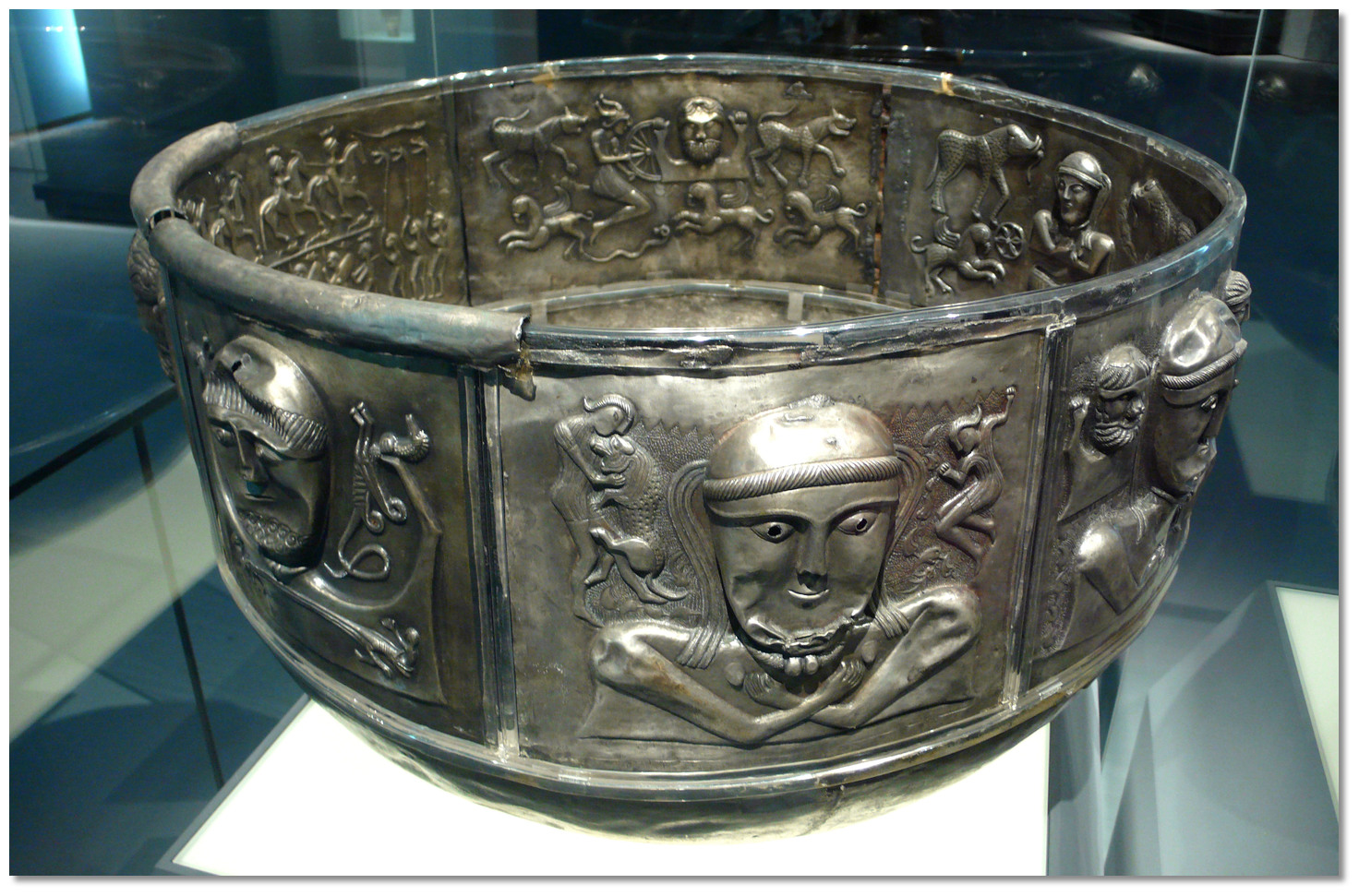 The Gundestrup Cauldron
Image: Rosemania Via CC ASA 2.0
In the event the formidable men of Ulster were afflicted by a debilitating curse, 'The Pangs of Ulster' that caused them to become, as legend has it… "as feeble as a kittens". This left the seventeen-year-old national hero Cú Chulainn, who was free of the spell, to defend Ulster from Medb's army single-handedly. Much of the action in the Táin surrounds the efforts of the hero Cú Chulainn who challenged each Connacht man to fight one-on-one before they could advance, and he slew them all. This standoff culminated in a 'clash-of-the-titans' battle between Cú Chulainn and his foster brother Fer Díad who had joined the Connaught forces. Both haD been trained in combat by the famous she-warrior Scáthach in Scotland and were well matched. Their battle is one of the most famous passages in early Irish literature and after three days of mortal combat, Fer Díad fell.
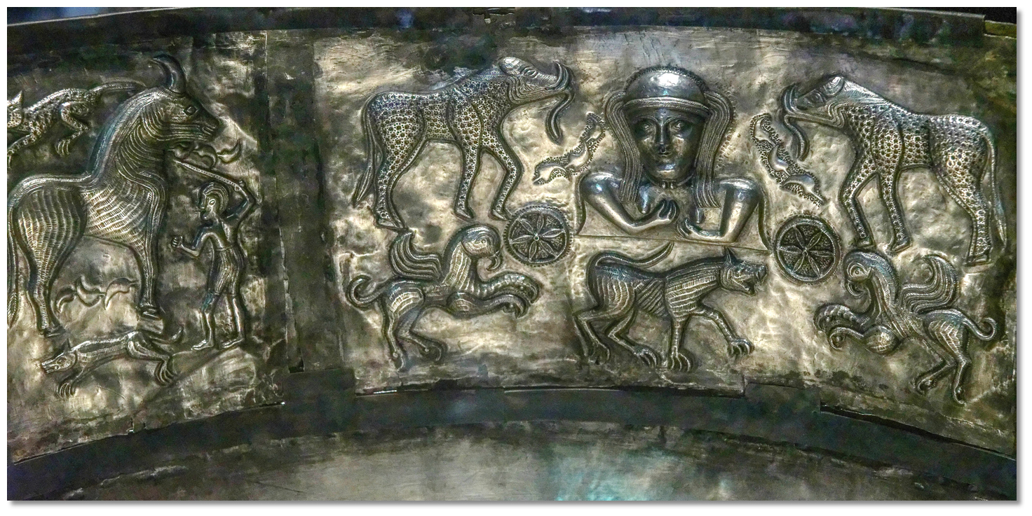 The Gundestrup Cauldron depicting Cú Chulainn triumph in the Cattle Raid of
Cooley
Image: Marie-Lan Nguyen CC ASA 4.0
In the end Medb managed to seize the bull and brought it home to Connaught. But it did not end well for her as the brown bull went wild and fought the white bull until the earth shook. Finally, Donn Cuailnge, the brown bull of Cooley, caught the white bull by the horns and shook it to pieces. Soon after Donn Cuailnge died whilst making its way home to Ulster. Nor did it end well for Cú Chulainn as Queen Maeve took revenge on him by using sorcerers to lure him to his death.
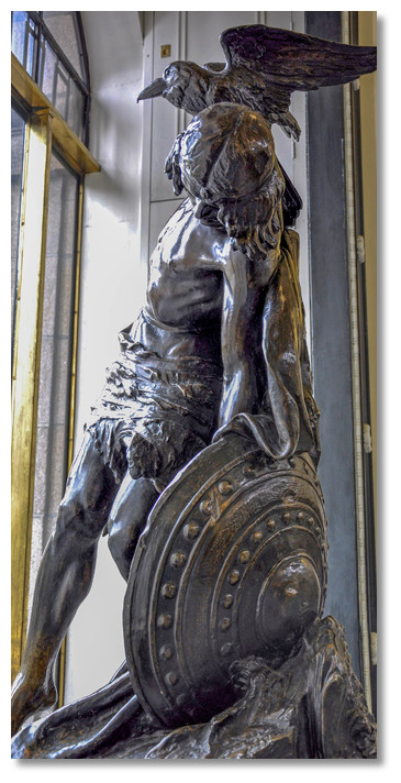 Cú Chulainn statue in the GPO
Image: Jennifer Boyer via CC ASA 2.0
Carlingford Marina provides a secure and tranquil intimate base at the foot slopes of the Cooley Mountains. A day's sail from Dublin, Belfast, The Isle of Man, the West Coast of England and North Wales, the marina is the ideal location to arrive at and explore the most picturesque inlet on the east coast of Ireland and the Cooley peninsula. Unlike many parts of Ireland, the Cooley Peninsula provides good walking country. A hiking route encircles the Cooley Peninsula, offering stunning mountain and sea views, whilst passing sites of mythological importance, and medieval buildings.
From a boating perspective, the lough provides both interesting sailing plus a variety of beautiful locations to anchor in waters that are absent of swell. The marina itself offers a unique blend of natural beauty, spectacular panoramas, and myths and legends that combine with a modern-day culture and great boating facilities. Add the backdrop of the Cooley peninsula, with the Carlingford Mountains, dramatic views across Carlingford Lough and County Down’s 'Mountains of Mourne' from the pontoon, and the marina has all the ingredients in place to make it one of the most picturesque berths in Leinster.
What facilities are available?
Carlingford Marina has fuel, water, electricity, toilets, showers plus garbage disposal. Adjoining the marina basin is a hardcore surfaced dry boat storage area, that can accommodate up to 65 boats. Access to the water is provided either by the 50 tonne capacity boat travel lift, or a 7 metre wide concrete slipway into the marina basin. Winter storage can be arranged, and a boat yard can provide repair facilities and a chandlery. Ashore there is a public telephone, free WiFi, and a first class bar and restaurant with spectacular views of the Mourne and Cooley Mountains. The marina has a Helipad Coordinates 54°03’00.7’’N / 6°11’28.3’’WWithin ten minute's walk is Carlingford town, although hardly bigger than a village it has a surprising array of excellent facilities such as hotels, restaurants, pubs, a post office, a reasonably good supermarket, newsagent, launderette, water, fuel, gas and a host of tourist attractions. A launching slip is available at high tide on the east pier.
Useful transport contacts in this area:
Dundalk Train Station P: + 353 42 933 5521
Dundalk Bus Station P: + 353 42 9334075
Newry Bus Station P: + 44 28 30623531
Newry Train Station P: + 44 28 30269271
Any security concerns?
Carlingford Marina is a secured access location.With thanks to:
Charlie Kavanagh - ISA/RYA Yachtmaster Instructor/Examiner. Photography with thanks to Eric Jones, Norman McMullan, Albert Bridge, Teufelbeutel and Colm Rice.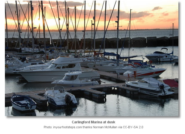
Aerial views of Carlingford and Carlingford Marina
Add your review or comment:
Rodolphe Thimonier wrote this review on Jun 28th 2016:
Probably the best (although not perfect) shelter in Carlingford Lough. However, being only 5-7m wide, the marina entrance is challenging, specially in rough wether. Furthermore, at low water, it is only accessible to shallow drafts and the marina itself is not suitable for deep drafts (whatever the guy of the marina might say, the depth under the visitors pontoon is about 1.5m - according to my rough estimate done when I was standing on my keel). At least the ground is a soft silt. The slack water period between two tides at the Lough entrance is very short, so you either have the current (several knots) with you or against you. With north-wersterly winds, in the Lough you can expect a wind strength twice that forcast, and only 2 shelters in such conditions: Carlingford Lough Marina and Warrenpoint.
Average Rating:


Chris Herbert wrote this review on May 17th 2017:
In the section "What are the key points of the approach?", I recommend including a reference to the lighthouse which stands near the entrance to the lough. As the lighthouse is mid-channel a note such as the following could be considered:
Keep Haulbowline lighthouse to port as you enter the lough and pick up the lateral buoys that line the channel.


Unknown wrote this review on May 17th 2017:
Thank you Chris for your suggestion. As you can see I have taken your advice.
Average Rating: UnratedSailor Fred wrote this review on Oct 21st 2017:
Looking at the Navionics chart above...if you switch the depth display to SonarChart (using the icon on the bottom left of the screen) you will see a depth contour of 0.5M in the fairway between pontoons C & D. Also you can see the mud in the fairway in the "Failte Ireland" aerial picture above. This fairway is not navigable at LWS.
Average Rating: UnratedRon Lub wrote this review on Jun 13th 2019:
Nice little harbour, with our depth 1.70 we touch the ground with low, but it is soft mud
Fee was € 25.00 all in. that's fair.
the port needs some maintenance
Surrounding has nice walks and bicycle roads
Please log in to leave a review of this haven.
Please note eOceanic makes no guarantee of the validity of this information, we have not visited this haven and do not have first-hand experience to qualify the data. Although the contributors are vetted by peer review as practised authorities, they are in no way, whatsoever, responsible for the accuracy of their contributions. It is essential that you thoroughly check the accuracy and suitability for your vessel of any waypoints offered in any context plus the precision of your GPS. Any data provided on this page is entirely used at your own risk and you must read our legal page if you view data on this site. Free to use sea charts courtesy of Navionics.


