
Glenarm is situated on the northeast coast of Ireland about eighteen miles south of Fair Head close northwest of Park Head. The harbour offers a small marina with visitor berths and the possibility of anchoring outside in the bay in favourable conditions.
Tucked into the foot of Glenarm Bay under the sheltering mountains and harbour walls, the marina provides complete shelter and protection. Straightforward access is provided by the absence of immediate offshore dangers or any tidal restriction and the entrance is easy in all but heavy northeast gales. However, daylight is preferred as there are poorly marked marine farms in the surrounding area about a mile offshore.


Keyfacts for Glenarm


Summary* Restrictions apply
A completely protected location with straightforward access.


Nature


Considerations


Position and approaches

Haven position
 54° 58.156' N, 005° 57.068' W
This is the position of the pontoons in Glenarm Marina.
What is the initial fix?
 54° 58.490' N, 005° 57.030' W


What are the key points of the approach?
 .
.- Vessels approaching from the south or southeast can choose to pass either side around the well-marked Hunter Rock and Maidens.
- The bay is clean but take care to avoid the aquaculture to the east of Glenarm.
Not what you need?
- Carnlough - 1.9 nautical miles NW
- Ballygalley Bay - 5.2 nautical miles SE
- Red Bay Pier (Glenariff Pier) - 6.8 nautical miles NNW
- Cushendall - 7.2 nautical miles NNW
- Ferris Bay - 9 nautical miles SE
- Brown’s Bay - 9.3 nautical miles SE
- Larne Harbour - 9.7 nautical miles SE
- Cushendun - 9.9 nautical miles NNW
- Portmuck - 10.6 nautical miles SE
- Ballydowan - 10.6 nautical miles SE
- Carnlough - 1.9 miles NW
- Ballygalley Bay - 5.2 miles SE
- Red Bay Pier (Glenariff Pier) - 6.8 miles NNW
- Cushendall - 7.2 miles NNW
- Ferris Bay - 9 miles SE
- Brown’s Bay - 9.3 miles SE
- Larne Harbour - 9.7 miles SE
- Cushendun - 9.9 miles NNW
- Portmuck - 10.6 miles SE
- Ballydowan - 10.6 miles SE


What's the story here?
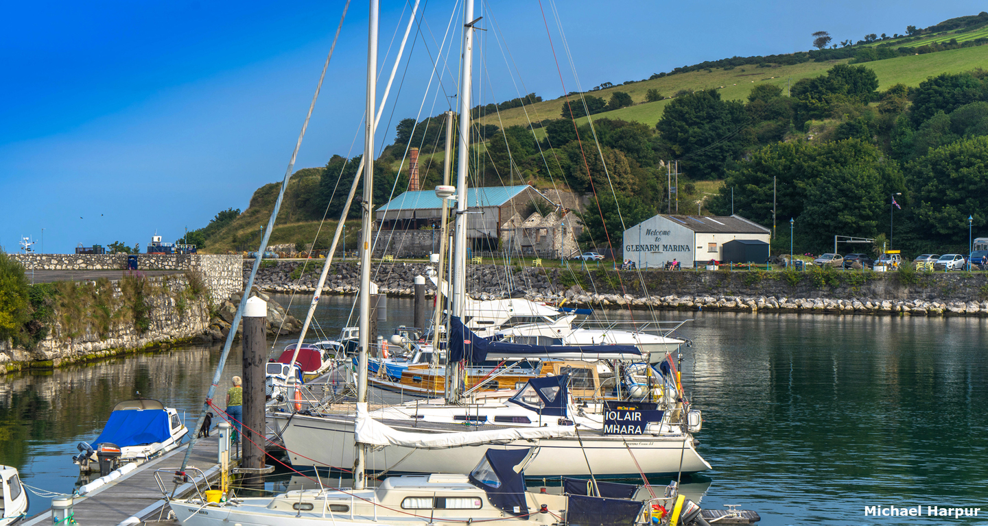
 Glenarm
Image: Michael Harpur
Glenarm Bay is situated immediately northward of Path Head into which the small Altmore River enters the sea. At its head is the charming village of Glenarm with its small historical limestone harbour into which a modern marina is inset. The village sits at the foot of the first of the 'Nine Glens of Antrim' with its surroundings covered in woodland and fronted by a beach curving out eastward to Peaks Point.
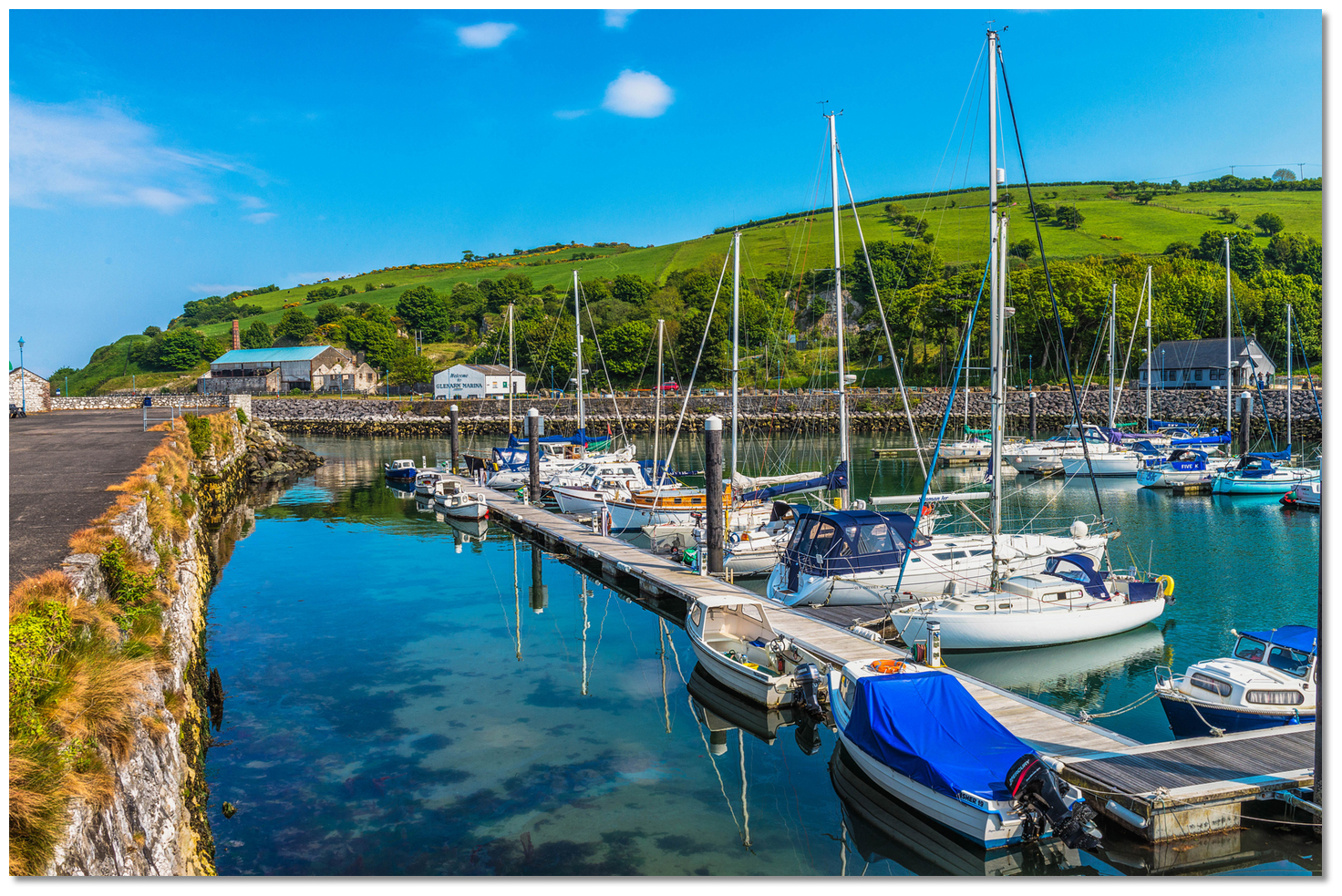
 Glenarm Marina
Image: Michael Harpur
Glenarm Marina provides 50 fully serviced pontoon berths and has depths of 4 metres in the approaches, 3 metres LWS alongside and it can accommodate vessels of up to 14 metres LOA. Having a new 120 metres visitor pontoon added in 2021 it now holds 30 berths for visitors.
 Glenarm Marina
 Image: Michael Harpur
The marina is owned and operated by Larne Borough Council and all visitors must contact Glenarm Marina prior to arrival for berth allocation:
 Ch. 16, 11 & 80 [Glenarm Marina],
  +44 (0)28 2884 1285,
  +44 (0)7703 606763,
  GlenarmMarina@midandeastantrim.gov.uk as detiled on their website
  . No visitor berth bookings can be taken in advance as berths are provided on a 'first-come-first-served' basis. However, the friendly marina staff do all they can to accommodate all visitors at a very reasonable price of [2022] £2.90 per night or £17.40 per 7 nights from arrival.
 Glenarm Marina
 Image: Tourism NI
It is also possible to anchor outside in 2 to 4 metres out of the tide directly north of the harbour. The bay affords good anchorage with westerly and north-westerly winds but is exposed to south-easterly winds.
How to get in?
 Glenarm tucked in behind Park Head
Image: Michael Harpur
 Offshore details for vessels are available in northeast Ireland’s coastal overview for Malin Head to Strangford Lough . Glenarm Bay is entered between Straidkilly Point and Peaks Point, 1½ miles east by southeast. The coast's rugged and precipitous mountain slopes present a remarkably bold outline in this area. Amidst these, the bay's sheltering Park Head, located 17½ miles southeast of Fair Head and an almost vertical headland 137 metres high, makes for an unmistakable seamark for Glenarm Bay.
 Vessels approaching from the north-northeast and east, north of Hangman and Maiden Rocks, have unimpeded access. Here, the Antrim Mountains push out almost vertically to the coast and it is clear of outlying dangers 400 metres beyond the cliffs. Vessels approaching from the southeast need to circumvent the well-marked offshore rock clusters of Hunter Rock, the Maidens, and Highland Rock situated 3 to 5 miles out to sea, east round to northeast, of Ballygalley Head.
 The Maidens Towers
Image: Charles W. Bash vi CC BY SA 4.0
The Maidens are located about 4 miles northeast of Ballygalley Head, a distance of 4½ miles from Larne and consist of two groups of rocks separated by a navigable passage. The rocks are steep-to all around.
The north cluster consists of three small rocks that are arranged in the form of a triangle. The western Russell’s Rock is 1.00 metres above high water, the eastern Highlandman Rock covers one hour before high water, and the southern, or Allen Rock, covers at high water. Rocky ledges extend both to the northward and southeast of the Allen rock whilst the others are steep-to. The northeastmost Highlandman (Highland Rock) is marked by a beacon. They are covered by the red
sector (142°-182°) of the east maiden auxiliary light.
Highlandman (Highland Rock) – unlit 1.5 metres position: 54°57.286'N, 005°43.935'W
 East Maiden with The Saddle and the Sheafing Rock in the backdrop
 Image: David Maxfield via CC BY-SA 3.0
The southern section consists of two clusters of rocks called the East and West Maiden that are separated from each other by a deep and wide sound. East Maiden on which stands a lighthouse, with a white tower and black band, and West Maiden on which is a tall, disused, tower of a disused lighthouse and other prominent buildings.
East Maiden Lighthouse - Fl (3) 20s 29m 24M position: 54° 55.748’N, 005° 43.709’W
 The inactive West Maiden Lighthouse
Image: David Maxfield via CC BY-SA 3.0
West Maiden lighthouse was taken out of service in 1903. Other rocks in the southern group, lying within a ½ mile south of the East maiden lighthouse are; The Bushes, The Griddle, The Saddle and Sheafing Rock. Expect most ships from Larne to head directly to Scotland by passing south of the Maidens. Occasionally vessels, that are awaiting berthing space in Larne, do pass to the north and then inside the Maidens.
 South Hunter
Image: Commissioners of Irish Lights
Between the Maidens and Larne, there is the singular Hunter Rock that has 0.8 metres of water over it. Hunter Rock is a well-marked shoal with North and South Cardinal Light buoys and it is the only danger here. It lies 2½ miles northeast of the entrance or 036° T from Ferris Point, the entrance’s eastern point. Similar to the Maidens, Glenarm may be approached on either side of Hunter Rock.
North Hunter - VQ position: 54° 53.046’N, 005 45.114’W
South Hunter - VQ (6) + LFl 10s position: 54° 52.691’N, 005 45.284’W
Vessels approaching from the south will find an inshore passage from Larne Head, a distance of 9 miles, between the mainland and Hunter and the Maidens, steep-to and clear of off-lying dangers. Good depths will be found close in with 400 metres from the shore clearing all dangers. This is an unusual stretch of water, as across the North Channel the Scottish Islands of North Islay, Mull of Kintyre, Rhyns of Galloway, Paps of Jura and Paddy's Milestone or Ailsa Craig, should also be visible.
 Yacht rounding a misty Park Head
Image: Eskling via CC BY SA 4.0
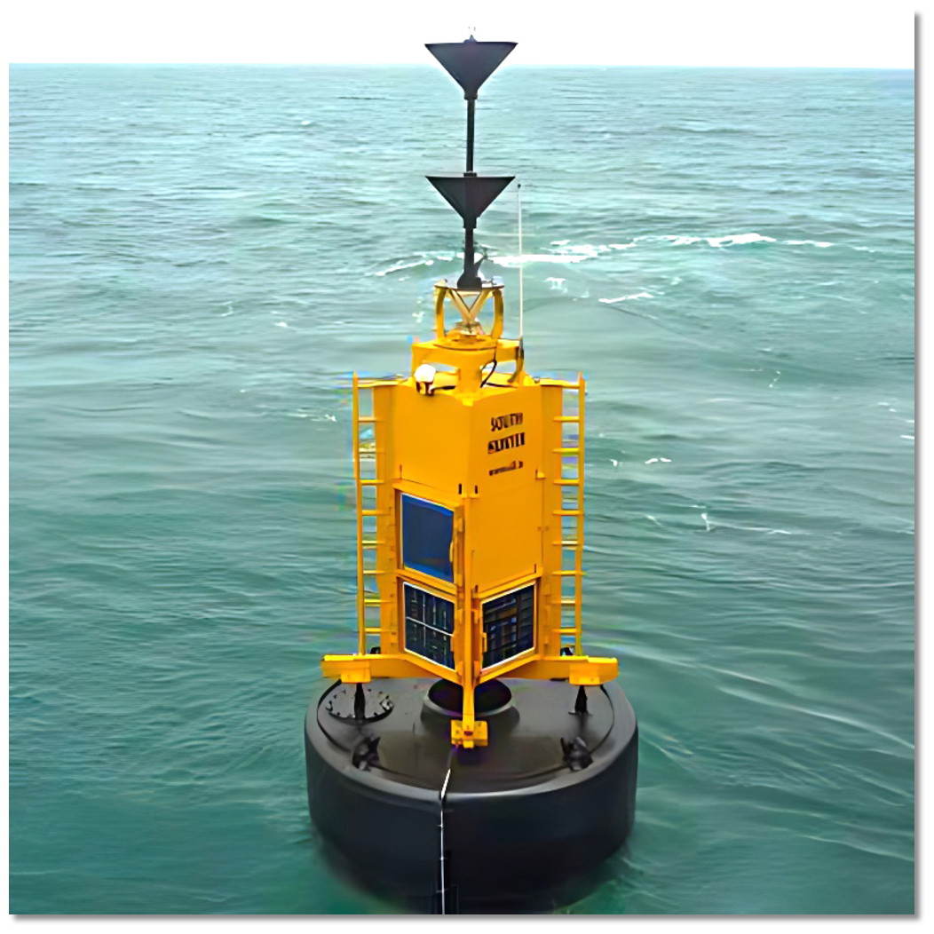
Likewise Park Head will be visible for many miles to seaward in all directions. There is a rocky ledge extending from the foot of the cliff. This is marked by the Peaks Point Buoy.
Peaks Point Buoy – Yellow Fl.(4).Y.12s position: 54° 58.275'N, 005° 55.861' W
 Aquafarm as seen out through the entrance to Glenarm
Image: Michael Harpur
Glenarm Bay then lies just over a ½ mile west of Park Head. Expect a fish farm to be situated about 2 miles to the east of Glenarm Bay. It is marked by lit buoys but they cannot be relied upon.
 Glenarm Harbour
 Image: Michael Harpur
 From the Glenarm Initial Fix come south to enter the harbour between the east and west harbour pier heads. Glenarm Bay is clear of dangers save for the offshore aquaculture that needs to be avoided.
 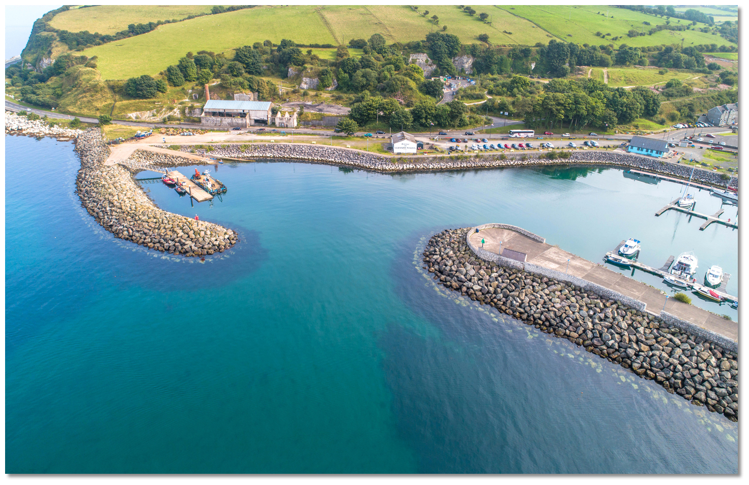 The entrance to Glenarm Harbour
Image: Michael Harpur
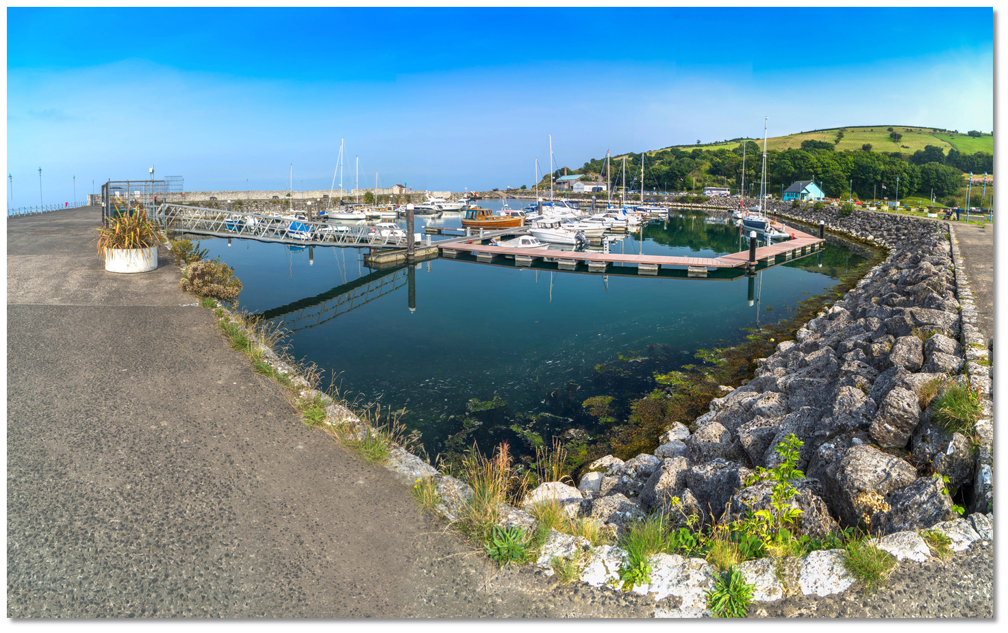
The piers on either side of the entrance are constructed of random boulders so there is little reflected swell. The pier heads are lit port Fl.R.3s 3M and starboard Fl.G.3s3M. Expect 2.7 metres of water in the entrance to the marina set within the old harbour. The well-lit marina is then situated to the southwest of the entrance. Once inside the pier heads, there is a large sheltered area within the harbour with plenty of swinging room to prepare for berthing.
 Pontoon layout Glenarm Marina
Image: Michael Harpur
Glenarm marina consists of two well-spaced finger pontoons usually occupied by berth holders and the new 120 metre linear visitor pontoon on the east side of the basin. Why visit here?
Glenarm derives its name from the Irish 'Gleann Arma' meaning 'valley of the army'. The name is very fitting as over the centuries it has seen its fair share of armies passing through, and the ebb and flow of conflict. In its time, it served as a Norman stronghold, a power base for Irish warlords and a very important Irish port._.jpg) Glenarm Castle and its grounds just off the town (right)
Glenarm Castle and its grounds just off the town (right) Image: Tourism NI
In keeping with this deeply historic coastline, Glenarm’s story goes back to the dawn of recorded Irish history. The first inhabitants around 3,000 BC were Stone Age people, fashioning tools and weapons from the hard flint they quarried nearby. From that point, the natural resources of the area have shaped industry and trade over centuries. In the 5th to 7th centuries A.D., the beginning of the Early Christian period and earliest recorded Irish history, Glenarm was noted as the southeast point of the ancient Celtic Kingdom of 'Dal Riada' Anglicised to 'Dalriada'.
 Glenarm Castle is privately owned but open to the public
Image: Tourism NI
The kingdom straddled both sides of the Irish Sea covering the northeast corner of Antrim, from a line between Glenarm to Bushmills and the west side of Scotland that its people had conquered. The people of 'Dal Riada' were known as 'Gaels' or 'Scotti' and the latter would give their name to the nation that would become Scotland. Today the Dal Riada side of Scotland is remembered in the name Argyle, derived from 'Ard - Geal' 'coast of the Gael'. Dal Riada Chieftains frequently crossed the narrow sea to Scotland, most notably Derry's St Colm Cille who converted the nation to Christianity, and ever since then there have been close links between the two lands. The inland boundary was formed by a watershed ridge of the Antrim hills with the area to south and west belonging to the 'Dal nAraide'. Pronounced 'Dalnary' this was another group of tribes who called the area 'Latharna'.
 Camp Dalfest, originally the Dalriada Festival, in the grounds of Glenarm Castle
Image: Tourism NI
At this time it is believed that King John, granted Glenarm a municipal charter making it one of the oldest towns in the United Kingdom. The charter incorporated Glenarm as a borough, which suggests that the Normans had established a presence in Glenarm in the early 13th Century and it would make Glenarm one of the oldest towns in Ireland. After King John died in 1216, the resentful de Lacy sought to retake the earldom, even though it meant defying the new king of England, Henry III. In 1227, in return for giving two of his sons as a hostage, de Lacy was given the Earldom of Ulster back without the northern coastlands that had been granted to the de Galloways. De Lacy wasted little time in ignoring the terms of his reinstatement and drove the de Galloways out by granting a portion of their land to one of their traditional enemies, John Bisset. Henry III indulged his defiance of this reinstatement due to de Lacy's help in conquering the province of Connacht.
 Tower house on the grounds of Glenarm Castle
Image: Michael Harpur
Bisset had previously lived in Scotland but the family forfeited their lands there and fled for their lives to Ireland after Walter de Bisset was accused of the murder of Patrick, Earl of Atholl, at Haddington, East Lothian in 1242. He promised to go on a pilgrimage to the Holy Land but instead went to Glenarm where he rented a castle from the Bishop of Down and Connor, the castle that had probably been built by the de Galloways. The Bissetts would establish themselves as the Lords of the Glens of Antrim. They quickly became involved in the politics of the Irish province and were among the most Gaelicised of all the so-called Anglo-Norman families in Ireland.
 Glenarm's St Patrick's Church and Glenarm Friary
Image: Michael Harpur
During the medieval period, a settlement had developed around this castle situated at the mouth of the river. But this was a very unstable area especially in the 16th century after the flight of the Irish chiefs. Then the MacDonnell's, the O'Neill's, plus the Maguires and O'Donnells from across the River Bann, and the Crown all competed for power here. The area was a mercurial shifting landscape of political intrigues, quixotic allegiances and open warfare that was, as often as not, strategically manipulated by Queen Elizabeth agents by empowering one clan over another. After a long war with Elizabeth I of England, the area was earmarked for King James for the 'Plantation of Ulster'.
 Glenarm RC Church 'Church Of The Immaculate Conception'
Image: Michael Harpur
Commencing at the start of the 17th century this was an ad hoc plantation of British mainly lowland Scots settlers. Being Protestant, they were thought more likely to be loyal to the English Crown and would most likely tame this hostile and often volatile area. One of the 16-century problems that were targeted to be resolved was the likes of 'Somhairle Buidhe Mac Domhnaill' circa 1505 to 1590. Anglicised to 'Sorley Boy MacDonnell' he was the son of Alexander MacDonnell, lord of Islay and Kintyre and an Antrim Scoto-Irish prince or 'flaith'. 'Sorley Boy' was best known for establishing the MacDonnell clan in Antrim by force of arms and for resisting the English crown’s best efforts to expel them from Ireland. 'Sorley Boy’s' fourth son was Sir Randall MacDonnell who in 1603 made peace with the crown and was on good terms with the court. In return, the king not only granted him Glenarm but also his native Glens of Antrim and the north Antrim Route, during the Plantation.
 The Altmore River at Glenarm with its pedestrian bridge
Image: Michael Harpur
On his return to Glenarm, Sir Randall McDonnell built a new castle on the opposite side of the river from the old one; the site of the present castle. He was created Viscount Dunluce, in the County of Antrim, in 1618, and Earl of Antrim in 1620. This new castle continued to be improved and added to until Sir Randal MacDonnell's death in 1636. The old castle was also repaired during this period as it was leased to kinsmen of the MacDonnells called the Donaldsons. Records show they still held the old castle until the late 18th century when it must have been abandoned and let go to ruin. But during the rebellion of 1641, Alexander MacDonnell, the Earl of Antrim's brother, who resided in Glenarm, fought on the native Irish side. They were crushed in 1642 by an invading Scots parliamentary army, under the command of General Robert Munro, who burnt Glenarm and laid low its castles. A peace settlement restored all the MacDonnell land but they chose not to rebuild their Glenarm castle, but moved to the north coast’s Dunluce Castle and later Ballymegarry.
 Glenarm Harbour dates from the 1860s
Image: Michael Harpur
The 18th century saw the return of Alexander the fifth Earl of Antrim to Glenarm and, with his funding, many major construction works were begun. In 1756 a new castle was built as a Palladian mansion over the remains of the castle destroyed in 1642. Likewise in 1763 Lord Antrim agreed to the construction of St Patrick's Church of Ireland on the site of the domestic quarters of an abandoned Franciscan friary. St Patrick’s Church, or 'Tickmacrevan', was completed in 1769 in an early Gothic style. The name 'Tickmacrevan' means 'the house of MacCrevan'.
 Glenarm in 1888
Image: Public Domain
MacCrevan was a disciple of St Patrick whose remains are buried as venerable relics inside the original church which stood on a site further up the glen 1100 years ago. St Patrick's Church was altered in the 1870s by the then Lady Antrim to reflect her preference for the English Anglo-Catholic revival known as the Oxford movement. Similarly, the castle has been extended ever since particularly by Anne Catherine McDonnell, Countess of Antrim, in the 1820s. She had the dream of a romantic fairytale castle and added the towers, turrets, crenellations, and the dramatic Barbican Gate that is the entrance to Glenarm Castle.
 Glenarm port sometime between 1860 & 1883
Image: Public Domain
Alongside this, Glenarm port developed to be an important port of some standing as far back as the 1400s. The harbour was unique in that some Scottish destinations were visible due to its strategic position. The Harbour at New Row dates from the 15th century. The river moorings continued to the other side of the road bridge to the warehousing behind the merchants' houses in the current Toberwine Street. The present pier dates from the 1860s, when thousands of tonnes of limestone and iron ore were exported every year, feeding the iron foundries of Scotland. By 1908, steamships were loading 700 tons of iron ore each week. Vast quantities of limestone were being exported for use in the smelting furnaces of the Clyde. The ships used were mainly schooners crewed by three men and one boy. Their shallow draft meant they could use the harbours along the Antrim coast. After World War One, flat-bottomed steamships, called 'puffers' carried the limestone away. At times there would be up five puffers in the harbour at one time, ready to load limestone for export, with others anchored off-shore, waiting their turn to enter.
 The old stone walls of the harbour remain visible
Image: Tourism NI
Today the village is now a Conservation Area with many quaint shops and pubs centred around the imposing Barbican Gate at Glenarm Castle and delightful walks. From the top of the main street, Altmore Street, a short walk leads through the gate to Glenarm Forest. It is the first of many outstanding walking opportunities that are the major feature of Glenarm. Entered off Altmore Street, Glenarm Forest Park is an 800-acre nature reserve once part of the demesne of Glenarm Castle that is now in public ownership. In 1750 the fifth Earl had the castle rebuilt as a Palladian mansion. However, it was Anne Catherine MacDonnell, Countess of Antrim, in the 1820s who was responsible for adding the fairy-tale towers, turrets, crenellations and the dramatic Barbican Gate with its fake portcullis slits and boiling oil holes.
 Barbican Gate Glenarm Castle
Image: Kenneth Allen via CC BY 2.0
Another immediately accessible walk is the 'Layde Walk' around the village on the Coast Road. Pass along the main Toberwine Street that leads uphill onto the winding side street 'The Vennel' to the 'Layde Walk'. This was once an artificial waterway, which took water from further up the glen down to the early business installations at the harbour. This old waterway now makes an almost purpose-built mile-long circular walk walkway with rewarding views. It is mostly on a road ascending to a viewpoint that offers spectacular views of the village and its surroundings. At the end of this delightful path, there is the possibility to turn left onto Dickeystown Road where the remains of the old limestone quarry can be seen at the end of this road.
 Glenarm is a pretty village that is part of a conservation area
Image: Tourism NI
Finally, there is the Glenarm Coastal Walk which is a two-mile route south of the village beside the famous County Antrim Coast road. It commences at The Forest Service car Park which is about 150 metres through the 'Town Gate' at the top of Altmore Street in Glenarm village. Picnic tables are also provided along the path and there are several opportunities to descend to the stony beaches via well-worn rough tracks. The towering white limestone cliffs of Minnis North, tower above the route. These were formed from deposits of skeletal remains of fish when the area was submerged in a warm tropical sea about 140 million years ago. The walk features spectacular views to the north which include Glenarm Forest, Carnlough Bay, Gortin Quarry and Garron Point. To the east, the Scottish Islands of North Islay, Mull of Kintyre, Rhyns of Galloway, Paps of Jura and Paddy's Milestone or Ailsa Craig can be seen across the North Channel.
 Fisherman's boathouse Glenarm Harbour
Image: Tourism NI
Glenarm Castle continues to be the private residence ancestral home of the McDonnells, Earls of Antrim, who have been in Glenarm for nearly 600 years. The imposing Barbican Gate entrance is set at the heart of the village. It opens for two days a year, during a very popular festival held in July, where a guided tour may be a possibility for vessels visiting at this time. The harbour retains its fishing tradition in its lobster and crab fishers that work close inshore using small boats. They are visible in the bay as is the Atlantic salmon farming enterprise, with its floating holding pens to be circumvented on approach.
 Glenarm is a key port of call for sailors and yachtsmen along this coast
Image: Tourism NI
From a boating perspective, Glenarm has long been a port of call for sailors and yachtsmen. For boats making north or southbound passages through the North Channel, or indeed crossing from the Western Isles of Scotland, it makes for a very convenient stop-off point. Moreover, it offers a deep, secure Marina with quick access and, being both non-tidal and having the benefits of navigational lights, is available at all times. This also allows mariners to make a perfectly timed exit to take full advantage of a favourable tidal stream which is essential for passage-making along this coast.
 Visiting yacht alongside Glenarm
Image: Michael Harpur
But there is much more than practicalities bringing a yachtsman to Glenarm. It is a very attractive berth set into a historical limestone harbour with the most charming and interesting village immediately ashore. The Glen, in which it lies is beautiful and the southernmost of the magnificent nine Glens of Antrim. It is one of the most beautiful coasts in Ireland, and for those interested in venturing ashore into a walker’s paradise, Glenarm is the gateway for exploring these glens situated throughout the northeast. It is fair to say Glenarm has effectively got it all.
What facilities are available?
All the marina berths are serviced with water, diesel and electricity, wi-fi, mobile pump out station and a shower and toilet block is available in the marina facility. An electricity card costs [2022] £10.00 each with units £0.10 each. Laundry is available in the marina to wash £2.00 per load and dry £2.00 per load. General shopping that includes a very good SPAR mini-supermarket, and a butcher, are located in the village plus there are public toilets beside the car park. There is a good restaurant in the adjacent town of Carnlough, which is a two to three miles walk or a £5 taxi journey, and the town has more shops, pubs and a hotel.Glenarm lies on the A2 Coast Road 11 miles from Larne, and a bus service is available to Coleraine, Larne and Belfast. There is a bus service available to Coleraine, Larne, Belfast.
Any security concerns?
The Marina has secure coded gate access to pontoons.With thanks to:
Terry Crawford, local boatman of many decades, Charlie Kavanagh and John Leahy, ISA/RYA Yachtmaster Instructor/Examiner navigation and sail trainers.Aerial views of Glenarm
About Glenarm
Glenarm derives its name from the Irish 'Gleann Arma' meaning 'valley of the army'. The name is very fitting as over the centuries it has seen its fair share of armies passing through, and the ebb and flow of conflict. In its time, it served as a Norman stronghold, a power base for Irish warlords and a very important Irish port.
Glenarm Castle and its grounds just off the town (right) Image: Tourism NI
In keeping with this deeply historic coastline, Glenarm’s story goes back to the dawn of recorded Irish history. The first inhabitants around 3,000 BC were Stone Age people, fashioning tools and weapons from the hard flint they quarried nearby. From that point, the natural resources of the area have shaped industry and trade over centuries. In the 5th to 7th centuries A.D., the beginning of the Early Christian period and earliest recorded Irish history, Glenarm was noted as the southeast point of the ancient Celtic Kingdom of 'Dal Riada' Anglicised to 'Dalriada'.
Glenarm Castle is privately owned but open to the publicImage: Tourism NI
The kingdom straddled both sides of the Irish Sea covering the northeast corner of Antrim, from a line between Glenarm to Bushmills and the west side of Scotland that its people had conquered. The people of 'Dal Riada' were known as 'Gaels' or 'Scotti' and the latter would give their name to the nation that would become Scotland. Today the Dal Riada side of Scotland is remembered in the name Argyle, derived from 'Ard - Geal' 'coast of the Gael'. Dal Riada Chieftains frequently crossed the narrow sea to Scotland, most notably Derry's St Colm Cille who converted the nation to Christianity, and ever since then there have been close links between the two lands. The inland boundary was formed by a watershed ridge of the Antrim hills with the area to south and west belonging to the 'Dal nAraide'. Pronounced 'Dalnary' this was another group of tribes who called the area 'Latharna'.
Camp Dalfest, originally the Dalriada Festival, in the grounds of Glenarm CastleImage: Tourism NI
At this time it is believed that King John, granted Glenarm a municipal charter making it one of the oldest towns in the United Kingdom. The charter incorporated Glenarm as a borough, which suggests that the Normans had established a presence in Glenarm in the early 13th Century and it would make Glenarm one of the oldest towns in Ireland. After King John died in 1216, the resentful de Lacy sought to retake the earldom, even though it meant defying the new king of England, Henry III. In 1227, in return for giving two of his sons as a hostage, de Lacy was given the Earldom of Ulster back without the northern coastlands that had been granted to the de Galloways. De Lacy wasted little time in ignoring the terms of his reinstatement and drove the de Galloways out by granting a portion of their land to one of their traditional enemies, John Bisset. Henry III indulged his defiance of this reinstatement due to de Lacy's help in conquering the province of Connacht.
Tower house on the grounds of Glenarm CastleImage: Michael Harpur
Bisset had previously lived in Scotland but the family forfeited their lands there and fled for their lives to Ireland after Walter de Bisset was accused of the murder of Patrick, Earl of Atholl, at Haddington, East Lothian in 1242. He promised to go on a pilgrimage to the Holy Land but instead went to Glenarm where he rented a castle from the Bishop of Down and Connor, the castle that had probably been built by the de Galloways. The Bissetts would establish themselves as the Lords of the Glens of Antrim. They quickly became involved in the politics of the Irish province and were among the most Gaelicised of all the so-called Anglo-Norman families in Ireland.
Glenarm's St Patrick's Church and Glenarm FriaryImage: Michael Harpur
During the medieval period, a settlement had developed around this castle situated at the mouth of the river. But this was a very unstable area especially in the 16th century after the flight of the Irish chiefs. Then the MacDonnell's, the O'Neill's, plus the Maguires and O'Donnells from across the River Bann, and the Crown all competed for power here. The area was a mercurial shifting landscape of political intrigues, quixotic allegiances and open warfare that was, as often as not, strategically manipulated by Queen Elizabeth agents by empowering one clan over another. After a long war with Elizabeth I of England, the area was earmarked for King James for the 'Plantation of Ulster'.
Glenarm RC Church 'Church Of The Immaculate Conception'Image: Michael Harpur
Commencing at the start of the 17th century this was an ad hoc plantation of British mainly lowland Scots settlers. Being Protestant, they were thought more likely to be loyal to the English Crown and would most likely tame this hostile and often volatile area. One of the 16-century problems that were targeted to be resolved was the likes of 'Somhairle Buidhe Mac Domhnaill' circa 1505 to 1590. Anglicised to 'Sorley Boy MacDonnell' he was the son of Alexander MacDonnell, lord of Islay and Kintyre and an Antrim Scoto-Irish prince or 'flaith'. 'Sorley Boy' was best known for establishing the MacDonnell clan in Antrim by force of arms and for resisting the English crown’s best efforts to expel them from Ireland. 'Sorley Boy’s' fourth son was Sir Randall MacDonnell who in 1603 made peace with the crown and was on good terms with the court. In return, the king not only granted him Glenarm but also his native Glens of Antrim and the north Antrim Route, during the Plantation.
The Altmore River at Glenarm with its pedestrian bridgeImage: Michael Harpur
On his return to Glenarm, Sir Randall McDonnell built a new castle on the opposite side of the river from the old one; the site of the present castle. He was created Viscount Dunluce, in the County of Antrim, in 1618, and Earl of Antrim in 1620. This new castle continued to be improved and added to until Sir Randal MacDonnell's death in 1636. The old castle was also repaired during this period as it was leased to kinsmen of the MacDonnells called the Donaldsons. Records show they still held the old castle until the late 18th century when it must have been abandoned and let go to ruin. But during the rebellion of 1641, Alexander MacDonnell, the Earl of Antrim's brother, who resided in Glenarm, fought on the native Irish side. They were crushed in 1642 by an invading Scots parliamentary army, under the command of General Robert Munro, who burnt Glenarm and laid low its castles. A peace settlement restored all the MacDonnell land but they chose not to rebuild their Glenarm castle, but moved to the north coast’s Dunluce Castle and later Ballymegarry.
Glenarm Harbour dates from the 1860sImage: Michael Harpur
The 18th century saw the return of Alexander the fifth Earl of Antrim to Glenarm and, with his funding, many major construction works were begun. In 1756 a new castle was built as a Palladian mansion over the remains of the castle destroyed in 1642. Likewise in 1763 Lord Antrim agreed to the construction of St Patrick's Church of Ireland on the site of the domestic quarters of an abandoned Franciscan friary. St Patrick’s Church, or 'Tickmacrevan', was completed in 1769 in an early Gothic style. The name 'Tickmacrevan' means 'the house of MacCrevan'.
Glenarm in 1888Image: Public Domain
MacCrevan was a disciple of St Patrick whose remains are buried as venerable relics inside the original church which stood on a site further up the glen 1100 years ago. St Patrick's Church was altered in the 1870s by the then Lady Antrim to reflect her preference for the English Anglo-Catholic revival known as the Oxford movement. Similarly, the castle has been extended ever since particularly by Anne Catherine McDonnell, Countess of Antrim, in the 1820s. She had the dream of a romantic fairytale castle and added the towers, turrets, crenellations, and the dramatic Barbican Gate that is the entrance to Glenarm Castle.
Glenarm port sometime between 1860 & 1883Image: Public Domain
Alongside this, Glenarm port developed to be an important port of some standing as far back as the 1400s. The harbour was unique in that some Scottish destinations were visible due to its strategic position. The Harbour at New Row dates from the 15th century. The river moorings continued to the other side of the road bridge to the warehousing behind the merchants' houses in the current Toberwine Street. The present pier dates from the 1860s, when thousands of tonnes of limestone and iron ore were exported every year, feeding the iron foundries of Scotland. By 1908, steamships were loading 700 tons of iron ore each week. Vast quantities of limestone were being exported for use in the smelting furnaces of the Clyde. The ships used were mainly schooners crewed by three men and one boy. Their shallow draft meant they could use the harbours along the Antrim coast. After World War One, flat-bottomed steamships, called 'puffers' carried the limestone away. At times there would be up five puffers in the harbour at one time, ready to load limestone for export, with others anchored off-shore, waiting their turn to enter.
The old stone walls of the harbour remain visibleImage: Tourism NI
Today the village is now a Conservation Area with many quaint shops and pubs centred around the imposing Barbican Gate at Glenarm Castle and delightful walks. From the top of the main street, Altmore Street, a short walk leads through the gate to Glenarm Forest. It is the first of many outstanding walking opportunities that are the major feature of Glenarm. Entered off Altmore Street, Glenarm Forest Park is an 800-acre nature reserve once part of the demesne of Glenarm Castle that is now in public ownership. In 1750 the fifth Earl had the castle rebuilt as a Palladian mansion. However, it was Anne Catherine MacDonnell, Countess of Antrim, in the 1820s who was responsible for adding the fairy-tale towers, turrets, crenellations and the dramatic Barbican Gate with its fake portcullis slits and boiling oil holes.
Barbican Gate Glenarm CastleImage: Kenneth Allen via CC BY 2.0
Another immediately accessible walk is the 'Layde Walk' around the village on the Coast Road. Pass along the main Toberwine Street that leads uphill onto the winding side street 'The Vennel' to the 'Layde Walk'. This was once an artificial waterway, which took water from further up the glen down to the early business installations at the harbour. This old waterway now makes an almost purpose-built mile-long circular walk walkway with rewarding views. It is mostly on a road ascending to a viewpoint that offers spectacular views of the village and its surroundings. At the end of this delightful path, there is the possibility to turn left onto Dickeystown Road where the remains of the old limestone quarry can be seen at the end of this road.
Glenarm is a pretty village that is part of a conservation areaImage: Tourism NI
Finally, there is the Glenarm Coastal Walk which is a two-mile route south of the village beside the famous County Antrim Coast road. It commences at The Forest Service car Park which is about 150 metres through the 'Town Gate' at the top of Altmore Street in Glenarm village. Picnic tables are also provided along the path and there are several opportunities to descend to the stony beaches via well-worn rough tracks. The towering white limestone cliffs of Minnis North, tower above the route. These were formed from deposits of skeletal remains of fish when the area was submerged in a warm tropical sea about 140 million years ago. The walk features spectacular views to the north which include Glenarm Forest, Carnlough Bay, Gortin Quarry and Garron Point. To the east, the Scottish Islands of North Islay, Mull of Kintyre, Rhyns of Galloway, Paps of Jura and Paddy's Milestone or Ailsa Craig can be seen across the North Channel.
Fisherman's boathouse Glenarm HarbourImage: Tourism NI
Glenarm Castle continues to be the private residence ancestral home of the McDonnells, Earls of Antrim, who have been in Glenarm for nearly 600 years. The imposing Barbican Gate entrance is set at the heart of the village. It opens for two days a year, during a very popular festival held in July, where a guided tour may be a possibility for vessels visiting at this time. The harbour retains its fishing tradition in its lobster and crab fishers that work close inshore using small boats. They are visible in the bay as is the Atlantic salmon farming enterprise, with its floating holding pens to be circumvented on approach.
Glenarm is a key port of call for sailors and yachtsmen along this coastImage: Tourism NI
From a boating perspective, Glenarm has long been a port of call for sailors and yachtsmen. For boats making north or southbound passages through the North Channel, or indeed crossing from the Western Isles of Scotland, it makes for a very convenient stop-off point. Moreover, it offers a deep, secure Marina with quick access and, being both non-tidal and having the benefits of navigational lights, is available at all times. This also allows mariners to make a perfectly timed exit to take full advantage of a favourable tidal stream which is essential for passage-making along this coast.
Visiting yacht alongside GlenarmImage: Michael Harpur
But there is much more than practicalities bringing a yachtsman to Glenarm. It is a very attractive berth set into a historical limestone harbour with the most charming and interesting village immediately ashore. The Glen, in which it lies is beautiful and the southernmost of the magnificent nine Glens of Antrim. It is one of the most beautiful coasts in Ireland, and for those interested in venturing ashore into a walker’s paradise, Glenarm is the gateway for exploring these glens situated throughout the northeast. It is fair to say Glenarm has effectively got it all.
Other options in this area
Magheramorne Point - 6.8 miles SE
Mill Bay - 6.8 miles SE
Ballydowan - 6.6 miles SE
Larne Harbour - 6 miles SE
Red Bay Pier (Glenariff Pier) - 4.2 miles NNW
Cushendall - 4.5 miles NNW
Cushendun - 6.2 miles NNW
Torr Head - 8.7 miles NNW
Navigational pictures
These additional images feature in the 'How to get in' section of our detailed view for Glenarm.


| Detail view | Off |
| Picture view | On |
Aerial views of Glenarm
Add your review or comment:
Dave Wall wrote this review on Aug 20th 2018:
The pic above 'looking out through Glenarm's Marina entrance' is actually the entrance to Carnlough harbour, to the north of Glenarm.
Average Rating: UnratedMichael Harpur wrote this review on Aug 22nd 2018:
Hi Dave,
Thank you for spotting that. I have now updated the photo with the correct Glenarm image. Many thanks for spotting that issue. Any further issues, please do not hesitate.
Many thanks again, Michael Harpur.
Please log in to leave a review of this haven.
Please note eOceanic makes no guarantee of the validity of this information, we have not visited this haven and do not have first-hand experience to qualify the data. Although the contributors are vetted by peer review as practised authorities, they are in no way, whatsoever, responsible for the accuracy of their contributions. It is essential that you thoroughly check the accuracy and suitability for your vessel of any waypoints offered in any context plus the precision of your GPS. Any data provided on this page is entirely used at your own risk and you must read our legal page if you view data on this site. Free to use sea charts courtesy of Navionics.