
Tucked into the northern end of Carnlough Bay under the sheltering mountains, the harbour provides complete shelter and protection. Access is straightforward owing to the absence of offshore dangers, but it should be avoided in any developed onshore winds of force five or above.

Keyfacts for Carnlough
Facilities


Nature


Considerations


Protected sectors

Approaches

Shelter

Last modified
December 22nd 2022 Summary* Restrictions apply
A completely protected location with straightforward access.Facilities
Nature
Considerations
Position and approaches

Expand to new tab or fullscreen
Haven position
 54° 59.590' N, 005° 59.260' W
This is the position of the North Pier Head where a distinctive white tower stands with two black bands Fl G 3s 4m 5M.
What is the initial fix?
The following Carnlough Harbour Initial Fix will set up a final approach:
 54° 59.437' N, 005° 59.009' W


What are the key points of the approach?
Offshore details are available in northeast Ireland’s Coastal Overview for Malin Head to Strangford Lough  and the Glenarm
  entry for local approaches.
and the Glenarm entry for local approaches.- Avoid the fish farm to the east of Glenarm.
- Approach on a bearing of no more than 305° T of the head of South Pier, to clear Black Rock, and then 310° T on the harbour’s leading marks.
Not what you need?
Click the 'Next' and 'Previous' buttons to progress through neighbouring havens in a coastal 'clockwise' or 'anti-clockwise' sequence. Below are the ten nearest havens to Carnlough for your convenience.
Ten nearest havens by straight line charted distance and bearing:
- Glenarm - 1.9 nautical miles SE
- Red Bay Pier (Glenariff Pier) - 4.9 nautical miles NNW
- Cushendall - 5.4 nautical miles NNW
- Ballygalley Bay - 7.1 nautical miles SE
- Cushendun - 8.2 nautical miles NNW
- Ferris Bay - 11 nautical miles SE
- Brown’s Bay - 11.2 nautical miles SE
- Larne Harbour - 11.6 nautical miles SE
- Torr Head - 12.3 nautical miles NNW
- Portmuck - 12.5 nautical miles SE
These havens are ordered by straight line charted distance and bearing, and can be reordered by compass direction or coastal sequence:
- Glenarm - 1.9 miles SE
- Red Bay Pier (Glenariff Pier) - 4.9 miles NNW
- Cushendall - 5.4 miles NNW
- Ballygalley Bay - 7.1 miles SE
- Cushendun - 8.2 miles NNW
- Ferris Bay - 11 miles SE
- Brown’s Bay - 11.2 miles SE
- Larne Harbour - 11.6 miles SE
- Torr Head - 12.3 miles NNW
- Portmuck - 12.5 miles SE

Chart

What's the story here?
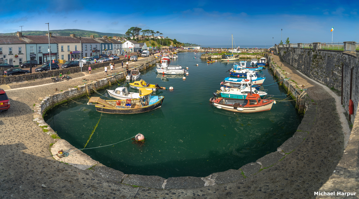
 Carnlough village and harbour
Image: Michael Harpur
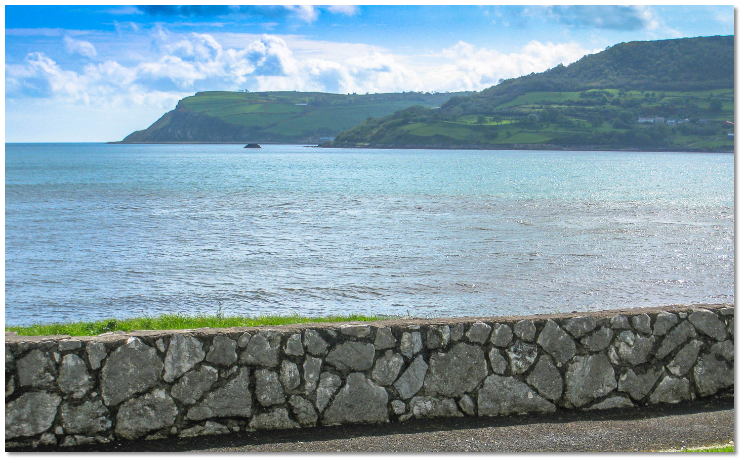
Carnlough Bay lies 3¾ miles south of Garron Point and 1½ miles northwest of Glenarm Bay. The village of Carnlough stands at the north end of the bay fronted by a small boat harbour enclosed by limestone walls and a breakwater. Sitting at the foot of the beautiful Glencloy, the second of the 'Nine Glens of Antrim' it is very pretty with lush green surroundings. The small constrained harbour is used mainly by pleasure boats and small fishing boats. It is only suitable for vessels of no longer than 10 metres with a keen helm that is comfortable manoeuvring in tight locations.
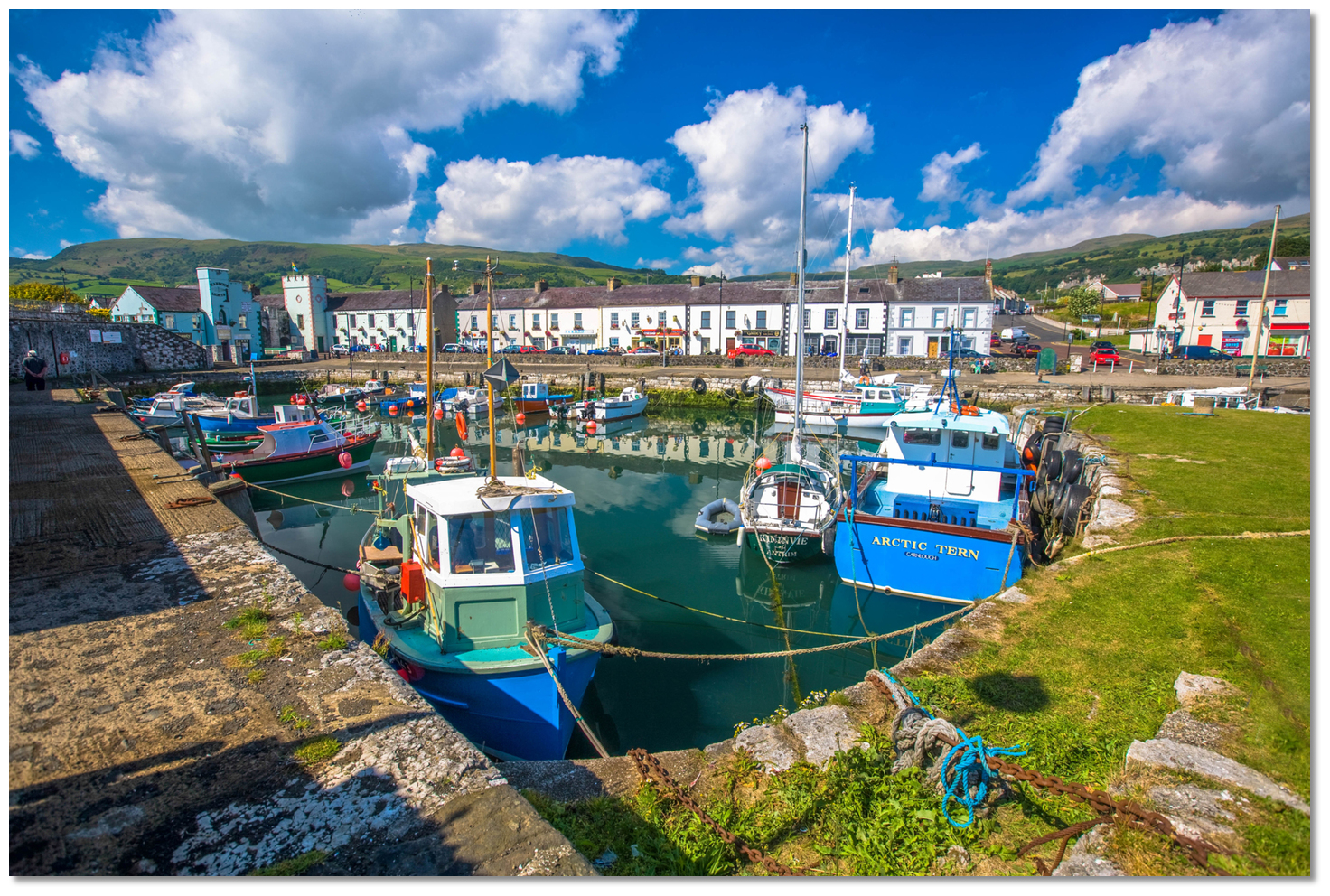 Carnlough Harbour is small and constrained
Image: Tourism NI
The harbour and its approaches tend to silt up and are dredged periodically so depths may vary dramatically. The entrance can have 1.7 metres when the ledge on the port hand wall is covered this depends upon when it was last dredged and from 0.5 to 1 metre LAT is most likely. The harbour was originally excavated to a depth of 2.4 metres at low water but drafts may vary substantially depending on the build-up of kelp and its dredging schedule. It is possible to find 1.5 metres LAT alongside the quay. However, Carnlough Harbour has limited wall space and is liable to be congested with local boats.
 The harbour is divided into an inner and outer harbour area
Image: Michael Harpur
Carnlough is owned and operated by Larne Borough Council and all visitors must contact Glenarm Marina prior to the arrival
 Ch. 16, 11 & 80 [Glenarm Marina],
  +44 (0)28 2884 1285,
  +44 (0)7703 606763,
  GlenarmMarina@midandeastantrim.gov.uk as detiled on their website
  . Although there are berths for visiting
 leisure craft the harbourmaster is un-encouraging pointing towards the excellent arrangments available in Glenarm. Therefore it is recommended that the Harbourmaster be contacted in advance about any intentions to come alongside and take advice on the latest status of silting and harbour depths. It is also advisable that the approach should be planned to be at about half flood tide.
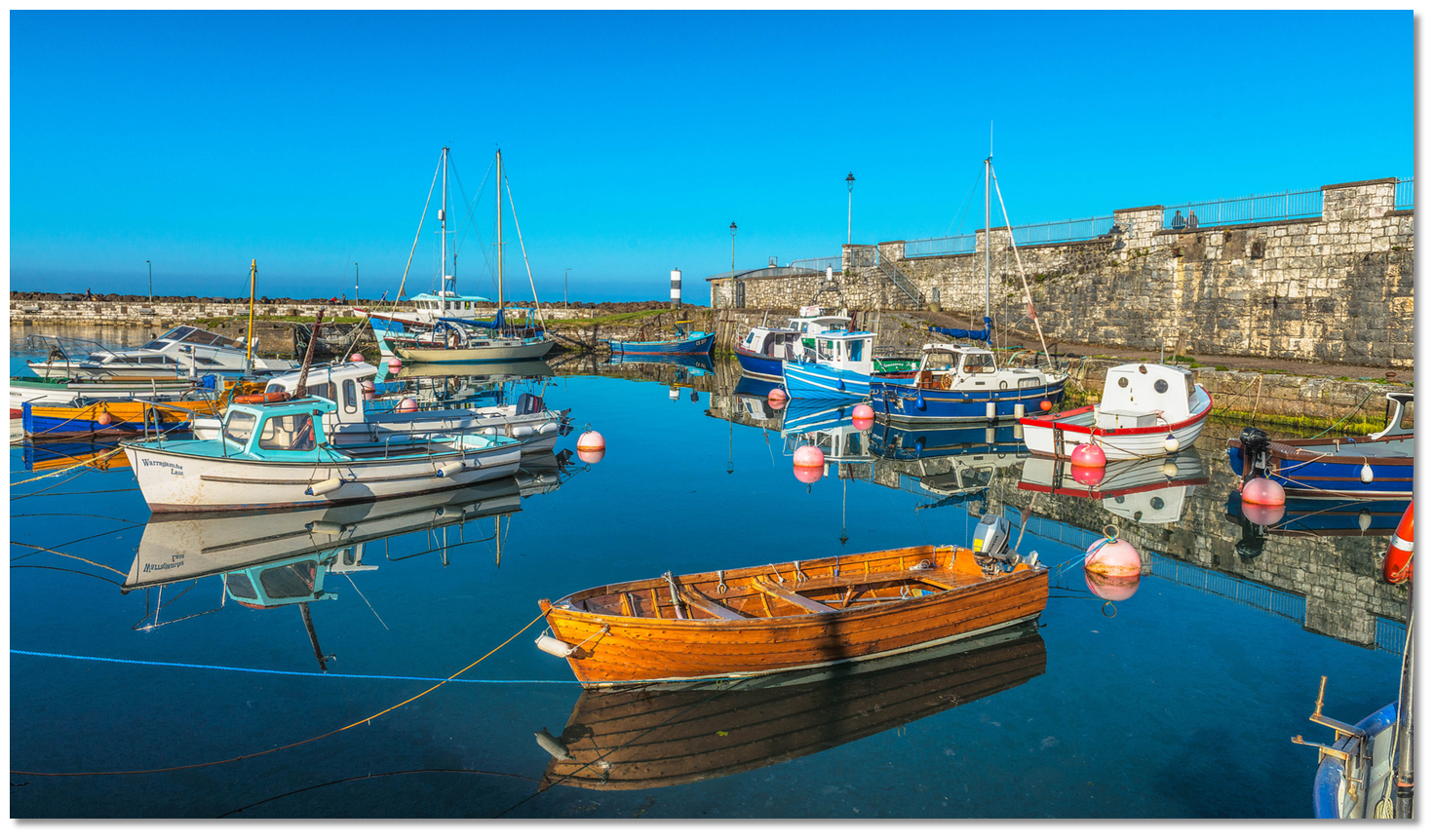 Carnlough's inner stone harbour is highly protected
Image: Tourism NI
In offshore winds, it is also possible to anchor in the bay 200 metres outside the harbour where good holding will be found in sand and gravel. It is reasonably shallow at the head of the bay and provides a good anchorage with westerly and north-westerly winds, but is exposed to easterly winds from north-northeast to south-southeast.
How to get in?
Image: Michael Harpur
 Offshore details for vessels are available in northeast Ireland’s coastal overview for Malin Head to Strangford Lough . Carnlough is about 2 miles to the north of Glenarm, with Carnlough Bay and Glenarm Bay being separated only by the slight projecting curve of Straidkilly Point. As such, the Glenarm entry can be used for local approaches. From seaward the village is backed by hills that rise to heights of over 300 metres about 1 mile inland. Collin Top, the highest peak, is 430 metres high and stands 3.7 miles west of the village.
 The always visible Black Rock situated immediately offshore of Straidkilly Point
Image: VirtuaaliAnu via CC BY 2.0
Vessels passing between Glenarm and Carnlough bays should stand out to avoid the always visible Black Rock situated immediately offshore of Straidkilly Point. A line of bearing of 305° T or less of the head of Carnlough's South Pier will keep a vessel clear of Black Rock. Vessels hugging the shoreline from the north should note the awash Seal Rock stepped out 150 metres from the shore about ⅔ of a mile northward of Carnlough.
 Black Rock as seen out through the entrance to Carnlough Harbour
Image: Michael Harpur
 From the Carnlough Initial Fix steer in on a bearing of 310° T until the harbour entrance becomes visible. The entrance is clearly marked by two six-metre cylindrical towers, white with two black bands, on either side.
  The entrance's two six-metre high white black towers,
 Image: Michael Harpur
Both are lit with the North Pier Head Fl G 3s 4m 5M and the South Pier Head Fl R 3s 6m 5M, with the entrance between them being 18.5 metres wide.
South Pier Head - Fl.R.3s.6m.5M position: 54° 59.601'N, 005° 59.300'W
 Final approached to Carnlough Harbour
Image: Michael Harpur
Closer in, the harbour’s leading marks will become discernible. They describe an in-line bearing of 310° T and consist of two inverted red triangles with white vertical central lines. Most unusually the rear leading mark is lower than the front and painted onto the side of the shop's white store room which can make it difficult to identify. It is nevertheless essential to come in on transit to avoid rocks on either side of the harbour approaches which cover at high water.
 The 310° T alignment marks on the shore inside the entrance
Image: Michael Harpur
Best berths are to be found alongside the 152-meter-long Main Quay. This lies on the harbour's west side, directly ahead upon entry and below the leading marks.  Fishing boat alongside the 152-meter-long Main Quay
Image: Michael Harpur
Alternatively, the northern breakwater in the northeast section of the harbour may be used. However, the only place to come alongside this pier is the outer half. But do not come in any closer than halfway between the slipway and the outer end of this wall.
 Yacht alongside Carnlough's North Pier
Image: Michael Harpur
Smaller boats can turn to port into the well-sheltered inner harbour. This opens the 60-metre-long South Quay located on the southeastern side of the harbour. However, this area is most likely to be taken up by local boats and their moorings.
 Carnlough's the well-sheltered inner harbour
Image: Michael Harpur
Alternatively, in offshore winds, anchor in the bay 200 metres outside the harbour over good holding.
Why visit here?
Carnlough derives its name from the Irish 'Carnlach' from 'carn a' locha'. The Irish word 'cairn', many times anglicised to 'carn', means 'a heap of stones', and as Carnlough, 'the carn of the lough or lake'. It is believed that the name stems from a historical abundance of flint that was available in the valley area. View over Carnlough Bay from the high ground behind
Image: Oisin Patenall via CC BY SA 2.0
It was this abundance of flint that attracted stone-age settlers to the valley as early as 6000 BC. Flint was an essential ingredient for Mesolithic hunters and fishermen to fashion their tools and weapons at that time. Add to this multiple food sources such as the glen’s deer, wild pig, hare, fox, and wolf, and with the seashore's fish and shellfish, it made for the perfect environment for primitive settlers. Numerous sites of archaeological significance refer to the ancient history of the glen and village.
 Carnlough's stone has been its principal draw for inhabitation
Image: Michael Harpur
The area was in turn invaded by the Vikings and the Normans during the age of conquest. But it was not until the 14th century that the area was completely controlled by the MacDonnells of Antrim. Also known as the MacDonnells of the Glens, they were a branch of warlike mercenaries from the Western Isles of Scotland 'Clan MacDonald of Dunnyveg'. They came here in 1395 when John Mór MacDonald, then chief of the Clan MacDonald of Dunnyveg, escaped after a failed Scottish rebellion and was forced to flee. In Antrim, he entered into the service of King Richard II of England, and later King Henry IV.
.jpg) Marchioness of Londonderry (1800-1865)
Marchioness of Londonderry (1800-1865)Image: CC0
The village of Carnlough began life in the early 17th century as a small fishing settlement. The harbour was originally built by a local landowner Phil Gibbons and extended by the Marchioness of Londonderry in the middle 1800s, who owned the quarries to the west of the village. As an owner of large collieries in Durham, England, where she mainly resided, she saw the need for a harbour to cope with Carnlough's developing limestone export trade. Like the harbour, the distinctive railway bridge, the former town hall Londonderry Arms Hotel, the worker's terraced houses were all built from this local white limestone and the wealth created from this industry. After their construction, large quantities of the limestone were exported until 1945 having been transported from the quarries in the hills by a tram road. The harbour continued in service until the late 1950s when silting became a problem. In 2010 it was dredged and renovated for pleasure and small fishing boats.
 The harbour was a commercial harbour up until the late 1950s
Image: Michael Harpur
An unexpected Carnlough architectural claim to fame is the Georgian Londonderry Arms Hotel set in the centre of the village, which was once owned by Sir Winston Churchill. The attractive and stately hotel was built in 1850 and came to Churchill when he was Secretary of State for War. He took ownership as part of the estate he inherited from his great-grandmother, Frances Anne Vane, Marchioness of Londonderry. In more recent years, the harbour may be recognised for its use during the filming of Game of Thrones. Filmed as part of the Free City of Braavos Canal (Season 6), the stone staircase leading down to the sea was where Arya Stark crawled up from the waters after being stabbed by the Waif.
 The inner harbour as seen past the Harbour Lights pub
Image: Tourism NI
Today Carnlough is an attractive and neat 18th-century village located in a stunning part of the country. It is surrounded on three sides by hills that rise to more than 300 metres from the sea and are at the foot of Glencloy, the second of the nine beautiful Glens of Antrim, it is another walker’s paradise. An easily accessible route to explore one of these woodlands is the riverside path with steps that lead uphill to the waterfall at Cranny Falls located just behind the village. Here an off-road path leads under a canopy of hazel, ash and sycamore and the plants lining the route include sanicle, wood avens, woodruff, wild garlic, bluebell and wood anemone.
 The old railway path to Cranny Falls
Image: Philip McErlean via CC BY 4.0
The path traces the bed of the 1854 mineral railway line to the quarry. The 4.8 km line transported limestone down to the Harbour to waiting ships and the term 'Hurry Head' is thought to be after the gravity-inclined plane on which the wagons ran, which gained speed with descent. The limestone was then exported to Scotland to be used in chemical works in Glasgow and it was also used as an early fertiliser.
 The Cranny Falls
Image: thornypup via CC ASA 4.0
Cranny Falls is a Local Nature Reserve where 'Cranny' is Gaelic for 'place of many trees'. However today the spring carpets of bluebells on the surrounding agricultural fields are all that remain of the former woodlands. A viewing platform over the Carnlough River provides a beautiful vista of the falls. The Cranny Falls and Gortin walk commences from the Harbour Lights building to the return path. It is an easy walk on a very gentle incline and well worthwhile. The 0.8km detour to the viewpoint in Gortin Quarry viewpoint is steeper but should not be missed as it offers superb views across Carnlough Bay.
The inner harbour as seen past the Harbour Lights pubImage: Tourism NI
A short distance south of Carnlough, nearby Glenarm has many other walks. Also, Glenariff to the north has the 'Queen Of The Glens' with its forest park and magnificent waterfall. So although a quaint and restful village, there is plenty to explore in and around Carnlough.
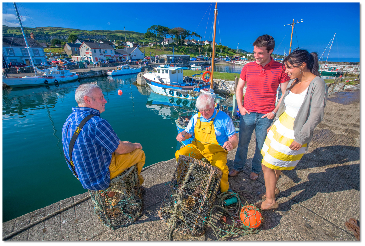 Carnlough Harbour retains its fishing tradition to this day
Image: Tourism NI
From a boating perspective, Carnlough Harbour is small and congested and the domain of smaller leisure craft may be an option depending on the size of the vessel and or recent dredging work. Larger vessels can anchor off outside and if it can be made to work it offers another good base from which a coastal cruiser may explore the beautiful 'Glens of Antrim' for the Antrim coast is scenic gold in this area.
What facilities are available?
Freshwater is available from a standpipe in the inner harbour, fuel is available nearby, and there is a slip for small craft. Amongst the village’s small general shops that serve a local population of 1500, is a post office which usually has a tourist representative in attendance. Refreshments are available in the many hostelries and small cafes in Carnlough village which are all near the quay. WiFi and Public toilets are also available beside the car park at Herbert Street. McKillop’s shop (Main St.) has leaflets describing local attractions, and the folks there are happy to give tips about the Glens.A bus is available to Larne 15 miles (24.2km) to the south along the A2 Coast Road, and taxis can be called upon if required. Hull repairers, engineers and electricians are available in the vicinity.
Any security concerns?
Never an issue known to have occurred in Carnlough.With thanks to:
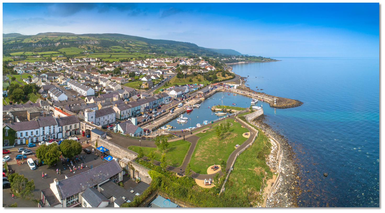
Terry Crawford, local boatman of many decades and Charlie Kavanagh - ISA/RYA Yachtmaster Instructor/Examiner.Carnlough aerial overview


Add your review or comment:
Please log in to leave a review of this haven.
Please note eOceanic makes no guarantee of the validity of this information, we have not visited this haven and do not have first-hand experience to qualify the data. Although the contributors are vetted by peer review as practised authorities, they are in no way, whatsoever, responsible for the accuracy of their contributions. It is essential that you thoroughly check the accuracy and suitability for your vessel of any waypoints offered in any context plus the precision of your GPS. Any data provided on this page is entirely used at your own risk and you must read our legal page if you view data on this site. Free to use sea charts courtesy of Navionics.