Seatons Marina is situated on the north coast of Ireland, three miles upriver from the entrance to the River Bann. It provides pontoon berthing at a fully serviced private marina with fore-and-aft river moorings for short and long-term berth holders. It does not carry visitor berths, however, this may sometimes be arranged by prior contact.
The River Bann provides complete protection and all-round shelter. River access is straightforward between well-lit stone training walls assisted by alignment beacons and leading lights. Once through the entrance, there are no issues progressing up the well-marked river to Coleraine Marina. The entrance, however, is subject to swell, outflow overfalls, and dangerous surf in moderately adverse conditions where careful planning is required. In the worst case, with north and northwest gales, the sea breaks right across it rendering it impassable. Consequently, no attempt should be made by a newcomer in any onshore winds of Force 6 or above.
Keyfacts for Seatons Marina
Last modified
January 31st 2023 Summary
A completely protected location with straightforward access.Facilities


Nature


Considerations


Position and approaches
Expand to new tab or fullscreen
Haven position
 55° 9.213' N, 006° 41.743' W
This is immediately adjacent to the north-western most pontoon of Seatons Marina.
What is the initial fix?
The following River Bann Entrance Initial Fix will set up a final approach:
 55° 10.565' N, 006° 46.493' W
 What are the key points of the approach?
Offshore details are available in northeast Ireland’s Coastal Overview for Malin Head to Strangford Lough  and the River Bann approaches are detailed in the Coleraine
  entry.
 and the River Bann approaches are detailed in the Coleraine
  entry.
Not what you need?
Click the 'Next' and 'Previous' buttons to progress through neighbouring havens in a coastal 'clockwise' or 'anti-clockwise' sequence. Below are the ten nearest havens to Seatons Marina for your convenience.
Ten nearest havens by straight line charted distance and bearing:
- Coleraine - 0.9 nautical miles SE
- The Lower River Bann - 1.9 nautical miles WNW
- Portrush Harbour - 3.5 nautical miles NNE
- Portballintrae - 6.4 nautical miles NE
- White Bay - 9.1 nautical miles WNW
- Portnocker - 9.1 nautical miles WNW
- Cornashamma Bay - 9.4 nautical miles WNW
- Portkill - 9.6 nautical miles WNW
- Magilligan Point - 9.6 nautical miles WNW
- Silver Strand - 9.6 nautical miles WNW
These havens are ordered by straight line charted distance and bearing, and can be reordered by compass direction or coastal sequence:
- Coleraine - 0.9 miles SE
- The Lower River Bann - 1.9 miles WNW
- Portrush Harbour - 3.5 miles NNE
- Portballintrae - 6.4 miles NE
- White Bay - 9.1 miles WNW
- Portnocker - 9.1 miles WNW
- Cornashamma Bay - 9.4 miles WNW
- Portkill - 9.6 miles WNW
- Magilligan Point - 9.6 miles WNW
- Silver Strand - 9.6 miles WNW
What's the story here?
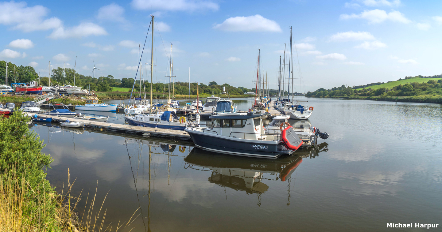
 Seatons Marina
Image: Michael Harpur
Seaton’s Marina lies on the east bank of the River Bann about 2 miles downstream of Coleraine and 3 miles from Barmouth where the River Bann enters the Atlantic. It is a family-run marina that is fully occupied by local vessels. Most of their vessels are hosted on pontoon berths but there is also a number on fore and aft moorings and some vessels are stored ashore.
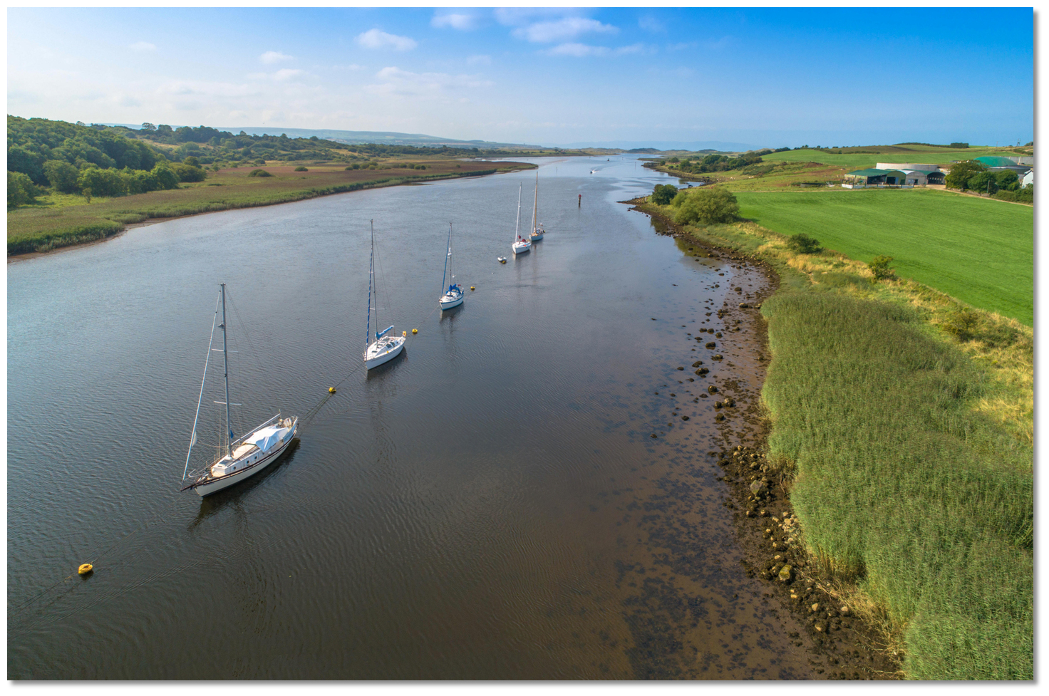
 Fore and aft moorings close north of Seaton's Marina
 Image: Michael Harpur
The 50-berth marina vessels range from about 4.5 metres to 12.5 metres LOA with depths of more than 3 metres LAT in the approaches and outer pontoon. The marina is oversubscribed but may be able to accommodate a visitor in a vacant berth. Enquiries should be made in advance to Jill
 +44 (0)771 888 3099,
  jill@seatonsmarina.co.uk or via their website's contact form
  . The marina office is staffed on Saturdays, but Jill can be contacted at any time on. If the call cannot be taken, just leave a message or a text and she’ll get back to you.
How to get in?
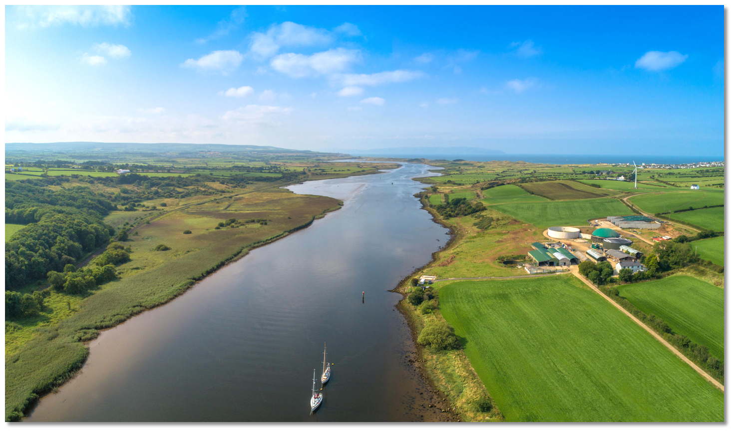
 The run up from the sea to Seaton's Marina
Image: Michael Harpur
 Offshore details are available in northeast Ireland’s coastal overview for Malin Head to Strangford Lough
  . The River Bann is entered at Barmouth which is detailed in the Colerain
  entry. Once inside the river, it is simply a matter of following the well-marked Coleraine river channel that maintains a uniform width of about 200 metres and a depth of 3.4 metres to Seatons Marina.
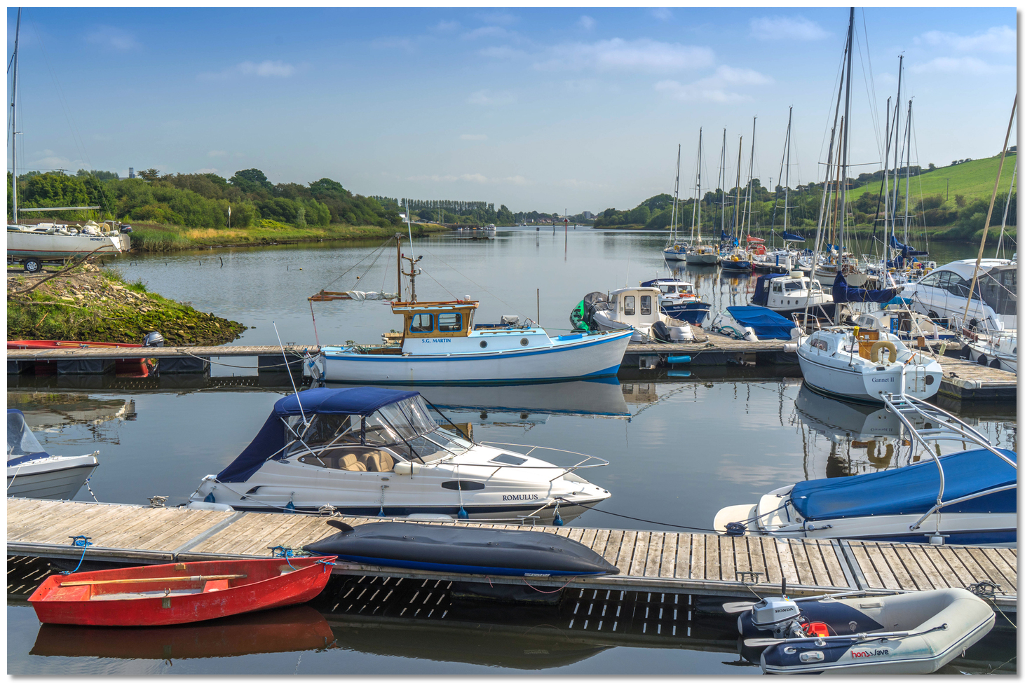
  Berth as directed by the marina office
Image: Michael Harpur
 Seatons is the first marina encountered on the northeast bank about 3 miles from the river's entrance. Berth, if available, according to prior directions.
Why visit here?
Should a berth become available at Seatons Marina it is another opportunity to enjoy the magnificent River Bann with good access to Coleraine. Seatons Marina offers a tranquil River Bann hideaway
Image: Michael Harpur
The River Bann is covered separately in the Lower Bann
 entry, and Colerain is covered in the Coleraine [linl] entry.
 The run southward from Seaton's Marina to Coleraine
Image: Michael Harpur
What facilities are available?
Water, diesel fuel by mobile tanker, and free wireless internet access is available throughout the marina. The pontoons are equipped with water and power, and there are facilities for making tea and coffee, as well as a shower and toilet. There is a slip but it is tidal, so those planning to launch should check the state of the tide. Seatons’ trailer hoist can lift yachts up to 45 feet long or 14 tonnes displacement, and up to 7 feet draft, with the mast up or down. They also provide cradles to specification, if required. Good local engineering and repairers are available in the vicinity.With a population of almost 25,000, shopping in nearby Coleraine is excellent. Likewise, transport connections are good to Belfast 55 miles (88.5 km) to the northwest, and Derry 30 miles (48.3 km) to the east, both of which are linked by major roads and railway connections. Therefore the City of Derry Airport, plus Belfast International Airport, the main regional airport to the south, and George Best Belfast City Airport to the southeast, are all relatively accessible from Coleraine. The Riversdale Quay in Coleraine has a 35-tonne derrick crane available for lifting yachts where some may be lifted with masts rigged. Some space is available here for wintering on the hard in the open or undercover.
Any security concerns?
The marina has twenty four hour security including a web cam.With thanks to:
Terry Crawford, local boatman of many decades.About Seatons Marina
Should a berth become available at Seatons Marina it is another opportunity to enjoy the magnificent River Bann with good access to Coleraine.
 Seatons Marina offers a tranquil River Bann hideaway
Image: Michael Harpur
The River Bann is covered separately in the Lower Bann
 entry, and Colerain is covered in the Coleraine [linl] entry.
 The run southward from Seaton's Marina to Coleraine
Image: Michael Harpur
Other options in this area
Click the 'Next' and 'Previous' buttons to progress through neighbouring havens in a coastal 'clockwise' or 'anti-clockwise' sequence. Alternatively here are the ten nearest havens available in picture view:
Coastal clockwise:
The Lower River Bann - 1.2 miles WNWPortrush Harbour - 2.1 miles NNE
Portballintrae - 4 miles NE
Portbraddan - 6.8 miles ENE
Ballintoy Harbour - 7.8 miles ENE
Coastal anti-clockwise:
Coleraine - 0.5 miles SEMagilligan Point - 6 miles WNW
Foyle Port Marina (Derry City) - 14.3 miles WSW
Culmore Bay - 12.7 miles WSW
Carrickarory Pier - 7.7 miles W
Navigational pictures
These additional images feature in the 'How to get in' section of our detailed view for Seatons Marina.


| Detail view | Off |
| Picture view | On |
Add your review or comment:
Please log in to leave a review of this haven.
Please note eOceanic makes no guarantee of the validity of this information, we have not visited this haven and do not have first-hand experience to qualify the data. Although the contributors are vetted by peer review as practised authorities, they are in no way, whatsoever, responsible for the accuracy of their contributions. It is essential that you thoroughly check the accuracy and suitability for your vessel of any waypoints offered in any context plus the precision of your GPS. Any data provided on this page is entirely used at your own risk and you must read our legal page if you view data on this site. Free to use sea charts courtesy of Navionics.


 seatonsmarina.co.uk/


