

Located off Ireland’s southwest corner, Sherkin Island creates the natural Baltimore Harbour that lies between it and Spanish, Ringarogy Islands as well as the mainland. This berth is off the island's old castle within Baltimore Harbour and it provides an anchorage and a seasonal pontoon.
Set in the lee of the island this location provides complete protection and is especially good in strong westerly component winds. Winds from southeast round to southwest, however, can cause a groundswell that increases in rough weather. The harbour offers safe access at all tides, night or day in all reasonable weather conditions, via its well-marked primary and preferred southern entrance. Baltimore Harbour may also be reached from the northwest by coming in around Hare Island and north of Sherkin Island via The Sound. Although more than workable, this requires careful pilotage between islands and rocks.

Keyfacts for Castle Ruins


Last modified
July 9th 2021 Summary
A completely protected location with safe access.Facilities


Nature


Considerations

Position and approaches

Expand to new tab or fullscreen
Haven position
 51° 28.720' N, 009° 23.930' W
In lee of Sherkin Island off Castle ruins near the pontoon.
What is the initial fix?
The following Baltimore Harbour initial fix will set up a final approach:
 51° 28.120' N, 009° 23.423' W



What are the key points of the approach?
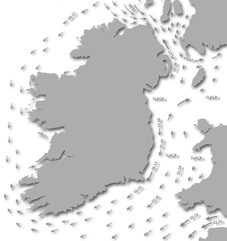
Offshore details are available in southwestern Ireland’s Coastal Overview for Cork Harbour to Mizen Head  .
.
. Not what you need?
Click the 'Next' and 'Previous' buttons to progress through neighbouring havens in a coastal 'clockwise' or 'anti-clockwise' sequence. Below are the ten nearest havens to Castle Ruins for your convenience.
Ten nearest havens by straight line charted distance and bearing:
- Horseshoe Harbour - 0.4 nautical miles S
- Kinish Harbour - 0.6 nautical miles WSW
- Baltimore - 0.9 nautical miles ENE
- Quarantine Island - 1 nautical miles N
- Turk Head - 1.1 nautical miles NNW
- Trá Bán - 1.4 nautical miles NW
- East Pier - 1.5 nautical miles NNW
- Rincolisky Harbour - 1.8 nautical miles NNW
- Inane Creek - 2.1 nautical miles NNE
- Reena Dhuna - 3 nautical miles NNE
These havens are ordered by straight line charted distance and bearing, and can be reordered by compass direction or coastal sequence:
- Horseshoe Harbour - 0.4 miles S
- Kinish Harbour - 0.6 miles WSW
- Baltimore - 0.9 miles ENE
- Quarantine Island - 1 miles N
- Turk Head - 1.1 miles NNW
- Trá Bán - 1.4 miles NW
- East Pier - 1.5 miles NNW
- Rincolisky Harbour - 1.8 miles NNW
- Inane Creek - 2.1 miles NNE
- Reena Dhuna - 3 miles NNE


What's the story here?
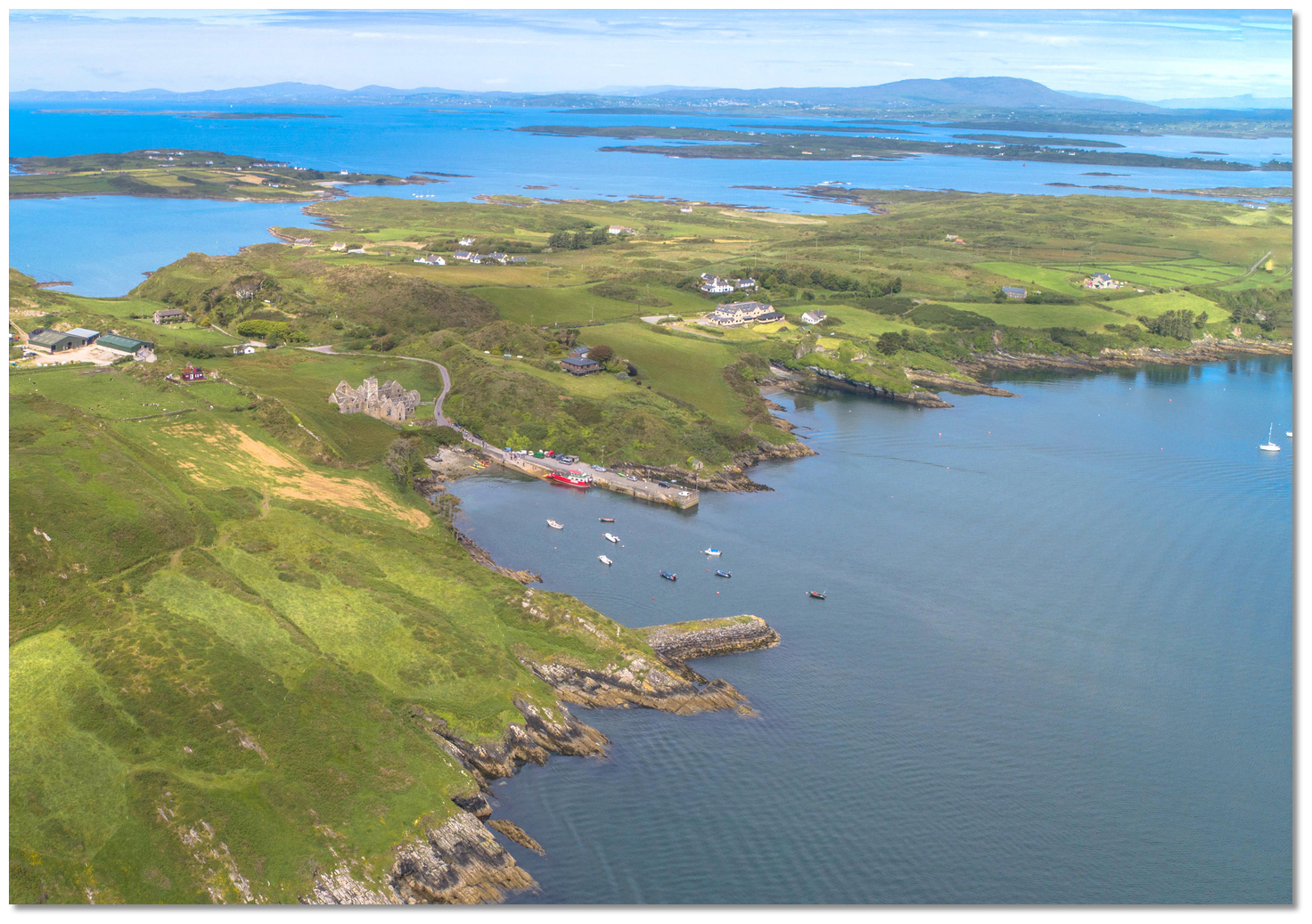 Castle Ruins directly within the entrance to Baltimore Harbour
Image: Michael Harpur
Sherkin Island forms the western boundary of the expansive Baltimore Harbour and is separated from Clear Island by Gascanane Sound, to which it is similar but not so high. 3 miles long and 1 mile wide it is one of the largest islands of Roaringwater Bay and it forms the southeastern boundary of Long Island Bay. Castle Ruins lies off of the Sherkin shore, directly within and opposite the entrance. The anchorage lies off the ivy-clad remains of a medieval fort set upon a rock that appears nowadays more an outbuilding the Islander’s Rest Hotel that stands close above it.
 The pontoon with Baltimore Harbour in the backdrop
Image: Graham Rabbits
An anchorage is available here in from 3 to 5 metres of water, on mud and sand with excellent holding. It provides a very good Baltimore Harbour berth during strong westerly winds. There is also the option to berth alongside on the seasonal Sherkin Island Marina a pontoon that belongs to nearby Islander’s Rest Hotel. The pontoon is available from mid-April to mid-September (weather permitting) and it can cater for up to 10 yachts when rafted in 2.4m LAT. Rates per night vary from €15.00 to €40.00 (depending on size) and enquires can be made to Islander’s Rest Hotel
 +353 (0)28 20116.
 How to get in?
 Sherkin as seen from westward over Baltimore Beacon
Image: Michael Harpur
 Use Ireland’s coastal overview for Cork Harbour to Mizen Head for seaward approaches and the Baltimore
  directions for local approaches to the southern entry. An approach can also be made from Long Island Bay through The Sound, between the islets and rocks at the head of the bay with details available in Baltimore Harbour North Entrance .
 The entrance to Baltimore Harbour as seen from the south
Image: Michael Harpur
The primary entrance to Baltimore Habour is its southern entrance between Beacon Point to the east, marked by a beacon, and Barrack Point on Sherkin Island, marked by a lighthouse. Proceed through the centre of the entrance continuing north to leave the Loo Rock marker, a starboard Light Buoy Fl.G.3s, on the eastern side of the entrance, to starboard. The rock is located in a north-easterly direction from the buoy, nearly one-fourth of the distance across from the eastern to the western points, and uncovers at low water spring tides.
Loo Rock – starboard buoy Fl G 3s position: 51° 28.438'N, 009° 23.458'W
.jpg) Abbey Strand to Castle Ruins (with the pontoon removed)
Abbey Strand to Castle Ruins (with the pontoon removed)Image: Michael Harpur
From the Loo Rock, Starboard marker follow the Sherkin shoreline in depths of 6 metres of water. Within the entrance, the conspicuous ruin of an abbey will be seen on Sherkin Island with a road leading down to the quay to Abbey Strand where the island ferry docks.

 Yacht anchored off of Castle Ruins
Image: Graham Rabbits
Berth alongside on the 'Sherkin Island Marina' pontoon or anchor in 3 to 4 metres of water on mud and sand off of it.  The slipway and small beach at Abbey Strand
Image: Tourism Ireland
Land at Abbey Strand slip or at the pontoon that charges a small dingy fee for vessels that do not have a pontoon berth.
Why visit here?
Sherkin Island has gone by many names. A 1620 map of Baltimore gives it the name 'Inisherkin Island' and Petty’s Survey Map of 1658 refers to 'Inisherkin'. By the 1821 census it was referred to by its modern name 'Sherkin Island also called Innisherkin'. All of the names are derived from the Irish 'Inis Arcáin' meaning 'island of the piglet'. But the piglet referred to here are 'sea-pigs' which were what 'porpoises' were called, a group of fully aquatic marine mammals, similar in appearance to a dolphin.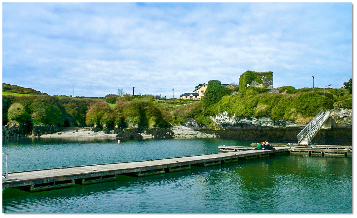 The ivy clad ruins of the O'Driscoll Castle overlooking the pontoon
Image: Tiago Mendes-Costa via CC BY-SA 3.0
One of Carbery’s Hundred Isles, there is evidence of human occupation going back thousands of years as by its standing stones, megalithic tomb and ring fort. In the Middle Ages, The O’Driscoll’s owned Baltimore, Sherkin, Cape Clear, and much of West Cork. It is they that built the ruined Dunalong Castle, from Irish Dún na Long meaning 'Fort of the ships' in the early 1400s. This is the ivy-clad remains on the rock that overlooks the anchorage today and it would remain the seat of the clan. It was Dermot O'Driscol who invited the Franciscans in 1449 to build the friary Mainster Inis Arcain, known locally as the Abbey, that stands in ruin above Abbey strand. But the more nefarious activities of the O'Driscol's would also bring destruction to the island.
In retaliation for a 1537 act of piracy on a Spanish vessel consigned to Waterford port by Fineen O'Driscol and his son, the citizens Waterford fitted out and armed three ships and mustering 400 men to arms. They sailed into Baltimore Harbour and anchored off under the castle. The garrison fled and the Waterford men quickly took over the castle and kept possession of it for five days. During this time, they ravaged the island, destroy all the villages, the Franciscan monastery and eventually the castle itself. Having laid waste to Sherkin they then landed at Baltimore and set fire to the castle and town. Finally, having seized O'Driscol's chief galley and a great number of other small boats, they returned in triumph to Waterford.
 The ruins if the 14th Franciscan Friary over Abbey Pier
Image: Jbuck78 via CC BY 2.0
The castle was subsequently rebuilt and the clan’s last chief, Sir Fineen O'Driscoll, the Rover, was to be the most notorious of the clan. In the first period of his reign, he supported the English rulers by confiscating Spanish ships and was so effective that he was knighted for his efforts in 1587. But when West Cork was to see the climax of the Nine Years' War he changed sides and joined Hugh O'Neill, Hugh Roe O'Donnell and other Irish lords against the English rule of Tudor Queen Elizabeth I. The Irish were supported by an invading Spanish force and Fineen O’Driscoll allowed the Spanish soldiers to garrison his castles. After the devastating defeat of the Irish forces, at the 1601 Battle of Kinsale, the property of the O’Driscolls was confiscated and given to Lord Castlehaven.
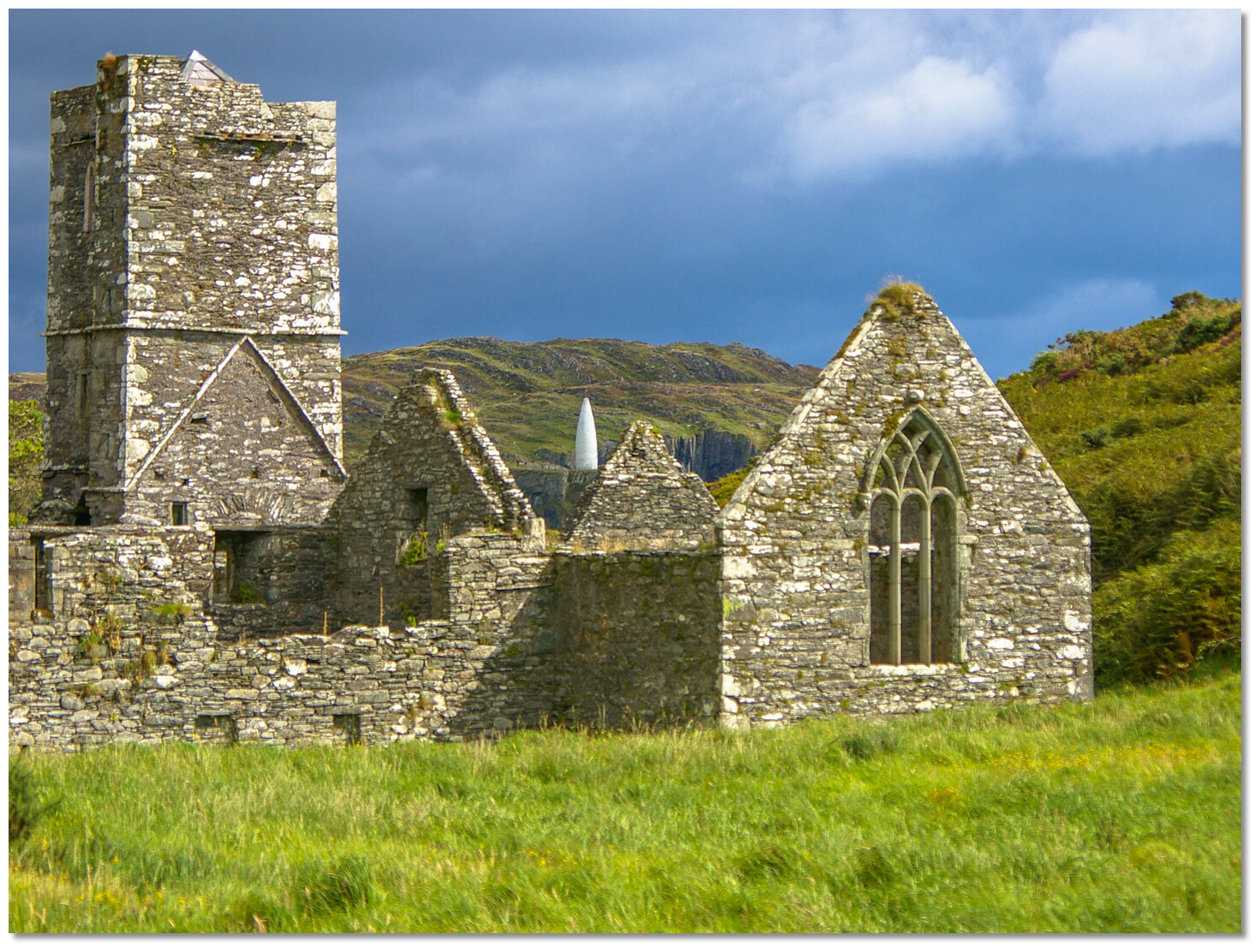 The Baltimore Beacon on the opposite shore as seen over the abbey
Image: Steve Edge via ASA 4.0
Most of the O'Driscolls emigrated to Spain in its aftermath, leaving behind their followers and dependents, who gradually became mixed with the local population. Despite his actions, Sir Fineen managed to secure a pardon from Elizabeth I. He eventually died lonely and destitute in 1629, after retiring to the castle in Lough Hyne. The local islander continued without their old Gaelic lord and the island attained a population of around a thousand in the early 1800s. This population was to precipitously decline and never recover during the middle of the century due to the Great Famine.
 The Baltimore ferry arriving at Abbey Pier
Image: Steve Edge via ASA 4.0
Today the island has a permanent population of about 100 which increases greatly during the summer months as Sherkin is a very popular tourist destination. Many of the local residents are active in the fields of art and culture, island crafts, painting, book writing and of course music. The small community has a primary school, two pubs, a hotel, guest house B&B, a community centre and a R.C. Church and that’s about it. The roads on the island are in such a poor state that most residents prefer to cycle or walk, although there is a rural bus service that meets every ferry.
Those who do brave the roads will find the island has stunning secluded beaches the best of which face Long Island Bay, with swimming areas ideal for children at Silver Strand, Cow Strand or Trabawn, which should not be missed. The best place for barbeques is Silver Strand where there is a choice of soft grass or warm sand to sit on. Those who do picnic should make sure all litter is removed as Sherkin has no disposal facilities and they are proud of their title as being one of Ireland’s cleanest islands. A key sailing event is the Sherkin Regatta that is usually held on the third weekend in July. This is the islands busiest day of the year when it is crowded with sea rowers and much more, including children’s activities, and music and food stalls all contributing their part to this Sherkin fair.
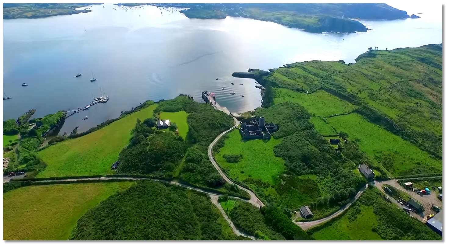 Castle Ruins Sherkin Island
Image: Drone View
From a boating point of view, the anchorage in the lea of Sherkin Island is the place to come when Baltimore Harbour is subject to developed westerlies. Like any other coastal part of Ireland, Sherkin can be affected by heavy coastal gales, but it and the harbour area as a whole is also the perfect 'hurricane hole' to take refuge from foul weather. But don’t make the abode of strong winds as the island is a must-visit location for any yachtsman cruising in this area and best enjoyed during fine weather. It has its own special character, unspoilt charm, tranquil and breath-taking beauty all far removed from the hustle and bustle of life on the mainland. A place where renowned hospitality can be enjoyed, in a relaxed atmosphere, with residents and tourists alike, enjoying informal music sessions in either of the island pubs.
What facilities are available?
The Seahorse Marina provides water and electricity at the pontoon; food and refreshment 50 metres above at The Islander's Rest hotel. Please note the marina does not offer any waste collection. Sherkin Island has two good pubs and a restaurant. General stores are available across the harbour in Baltimore but may be limited. You can however catch a bus to take you to the larger provincial town of Skibbereen (approximately 10km) where a wider range of provisions are available.Ferries sail from Baltimore to Schull further along the coast, to Sherkin Island, and to the more remote Cape Clear Island.
Any security concerns?
Never a security issue known to have occurred off Sherkin Island.With thanks to:
Gareth Thomas, Yacht Jalfrezi.Aerial overviews of Sherkin and the harbour area
About Castle Ruins
Sherkin Island has gone by many names. A 1620 map of Baltimore gives it the name 'Inisherkin Island' and Petty’s Survey Map of 1658 refers to 'Inisherkin'. By the 1821 census it was referred to by its modern name 'Sherkin Island also called Innisherkin'. All of the names are derived from the Irish 'Inis Arcáin' meaning 'island of the piglet'. But the piglet referred to here are 'sea-pigs' which were what 'porpoises' were called, a group of fully aquatic marine mammals, similar in appearance to a dolphin.
The ivy clad ruins of the O'Driscoll Castle overlooking the pontoonImage: Tiago Mendes-Costa via CC BY-SA 3.0
One of Carbery’s Hundred Isles, there is evidence of human occupation going back thousands of years as by its standing stones, megalithic tomb and ring fort. In the Middle Ages, The O’Driscoll’s owned Baltimore, Sherkin, Cape Clear, and much of West Cork. It is they that built the ruined Dunalong Castle, from Irish Dún na Long meaning 'Fort of the ships' in the early 1400s. This is the ivy-clad remains on the rock that overlooks the anchorage today and it would remain the seat of the clan. It was Dermot O'Driscol who invited the Franciscans in 1449 to build the friary Mainster Inis Arcain, known locally as the Abbey, that stands in ruin above Abbey strand. But the more nefarious activities of the O'Driscol's would also bring destruction to the island.
In retaliation for a 1537 act of piracy on a Spanish vessel consigned to Waterford port by Fineen O'Driscol and his son, the citizens Waterford fitted out and armed three ships and mustering 400 men to arms. They sailed into Baltimore Harbour and anchored off under the castle. The garrison fled and the Waterford men quickly took over the castle and kept possession of it for five days. During this time, they ravaged the island, destroy all the villages, the Franciscan monastery and eventually the castle itself. Having laid waste to Sherkin they then landed at Baltimore and set fire to the castle and town. Finally, having seized O'Driscol's chief galley and a great number of other small boats, they returned in triumph to Waterford.
The ruins if the 14th Franciscan Friary over Abbey PierImage: Jbuck78 via CC BY 2.0
The castle was subsequently rebuilt and the clan’s last chief, Sir Fineen O'Driscoll, the Rover, was to be the most notorious of the clan. In the first period of his reign, he supported the English rulers by confiscating Spanish ships and was so effective that he was knighted for his efforts in 1587. But when West Cork was to see the climax of the Nine Years' War he changed sides and joined Hugh O'Neill, Hugh Roe O'Donnell and other Irish lords against the English rule of Tudor Queen Elizabeth I. The Irish were supported by an invading Spanish force and Fineen O’Driscoll allowed the Spanish soldiers to garrison his castles. After the devastating defeat of the Irish forces, at the 1601 Battle of Kinsale, the property of the O’Driscolls was confiscated and given to Lord Castlehaven.
The Baltimore Beacon on the opposite shore as seen over the abbeyImage: Steve Edge via ASA 4.0
Most of the O'Driscolls emigrated to Spain in its aftermath, leaving behind their followers and dependents, who gradually became mixed with the local population. Despite his actions, Sir Fineen managed to secure a pardon from Elizabeth I. He eventually died lonely and destitute in 1629, after retiring to the castle in Lough Hyne. The local islander continued without their old Gaelic lord and the island attained a population of around a thousand in the early 1800s. This population was to precipitously decline and never recover during the middle of the century due to the Great Famine.
The Baltimore ferry arriving at Abbey PierImage: Steve Edge via ASA 4.0
Today the island has a permanent population of about 100 which increases greatly during the summer months as Sherkin is a very popular tourist destination. Many of the local residents are active in the fields of art and culture, island crafts, painting, book writing and of course music. The small community has a primary school, two pubs, a hotel, guest house B&B, a community centre and a R.C. Church and that’s about it. The roads on the island are in such a poor state that most residents prefer to cycle or walk, although there is a rural bus service that meets every ferry.
Those who do brave the roads will find the island has stunning secluded beaches the best of which face Long Island Bay, with swimming areas ideal for children at Silver Strand, Cow Strand or Trabawn, which should not be missed. The best place for barbeques is Silver Strand where there is a choice of soft grass or warm sand to sit on. Those who do picnic should make sure all litter is removed as Sherkin has no disposal facilities and they are proud of their title as being one of Ireland’s cleanest islands. A key sailing event is the Sherkin Regatta that is usually held on the third weekend in July. This is the islands busiest day of the year when it is crowded with sea rowers and much more, including children’s activities, and music and food stalls all contributing their part to this Sherkin fair.
Castle Ruins Sherkin IslandImage: Drone View
From a boating point of view, the anchorage in the lea of Sherkin Island is the place to come when Baltimore Harbour is subject to developed westerlies. Like any other coastal part of Ireland, Sherkin can be affected by heavy coastal gales, but it and the harbour area as a whole is also the perfect 'hurricane hole' to take refuge from foul weather. But don’t make the abode of strong winds as the island is a must-visit location for any yachtsman cruising in this area and best enjoyed during fine weather. It has its own special character, unspoilt charm, tranquil and breath-taking beauty all far removed from the hustle and bustle of life on the mainland. A place where renowned hospitality can be enjoyed, in a relaxed atmosphere, with residents and tourists alike, enjoying informal music sessions in either of the island pubs.
Other options in this area
Click the 'Next' and 'Previous' buttons to progress through neighbouring havens in a coastal 'clockwise' or 'anti-clockwise' sequence. Alternatively here are the ten nearest havens available in picture view:
Coastal clockwise:
Horseshoe Harbour - 0.2 miles SSouth Harbour (Ineer) - 2.9 miles SW
North Harbour (Trawkieran) - 2.8 miles WSW
Kinish Harbour - 0.4 miles WSW
Quarantine Island - 0.6 miles N
Coastal anti-clockwise:
Baltimore - 0.6 miles ENEBarloge Creek (Lough Hyne) - 2.5 miles ENE
Castlehaven (Castletownshend) - 5.6 miles ENE
Blind Harbour - 5.9 miles ENE
Squince Harbour - 6.5 miles ENE
Navigational pictures
These additional images feature in the 'How to get in' section of our detailed view for Castle Ruins.


| Detail view | Off |
| Picture view | On |
Aerial overviews of Sherkin and the harbour area
 A photograph is worth a thousand words. We are always looking for bright sunny photographs that show this haven and its identifiable features at its best. If you have some images that we could use please upload them here. All we need to know is how you would like to be credited for your work and a brief description of the image if it is not readily apparent. If you would like us to add a hyperlink from the image that goes back to your site please include the desired link and we will be delighted to that for you.
Add your review or comment:
Please log in to leave a review of this haven.
Please note eOceanic makes no guarantee of the validity of this information, we have not visited this haven and do not have first-hand experience to qualify the data. Although the contributors are vetted by peer review as practised authorities, they are in no way, whatsoever, responsible for the accuracy of their contributions. It is essential that you thoroughly check the accuracy and suitability for your vessel of any waypoints offered in any context plus the precision of your GPS. Any data provided on this page is entirely used at your own risk and you must read our legal page if you view data on this site. Free to use sea charts courtesy of Navionics.