
Clifden is a coastal town in the Connemara region of western Ireland, located on the Owenglin River where it flows into Clifden Bay. It offers a drying quay close to the town centre to boats that can take-to-the-bottom.
Drying for extended periods and tucked away up an estuary, Clifden Quay offers complete protection from all conditions. Access requires attentive navigation as the quay is approached through a shallow channel with rocks on either side.


Keyfacts for Clifden


Summary* Restrictions apply
A completely protected location with attentive navigation required for access.


Nature


Considerations


Position and approaches

Haven position
 53° 29.123' N, 010° 1.784' W
This is the position of Clifden Quay.
What is the initial fix?
 53° 28.649' N, 010° 11.570' W


What are the key points of the approach?
 .
. - Approach Clifden Bay on the alignment of 080°T of a white beacon on Fishing Point and Clifden Castle.
- Break off the transit as Clifden Bay is approached, between Errislannan Point and Fahy Point, taking a central path.
- Follow the entrance beacons into the river estuary to access the quay at HW ± 2 hours.
- Beware of the training wall.
Not what you need?
- Clifden Boat Club - 0.9 nautical miles W
- Mannin Bay - 3.7 nautical miles WSW
- Fahy Bay - 4.5 nautical miles N
- Cleggan Bay - 5.2 nautical miles NNW
- Ballynakill Harbour - 5.5 nautical miles NNE
- Bunowen Bay - 5.7 nautical miles SSW
- Roundstone Bay - 6.7 nautical miles SE
- Gorteen Bay - 7.2 nautical miles SSE
- Bertraghboy Bay - 8.3 nautical miles ESE
- Little Killary Bay (Salrock) - 9.8 nautical miles NE
- Clifden Boat Club - 0.9 miles W
- Mannin Bay - 3.7 miles WSW
- Fahy Bay - 4.5 miles N
- Cleggan Bay - 5.2 miles NNW
- Ballynakill Harbour - 5.5 miles NNE
- Bunowen Bay - 5.7 miles SSW
- Roundstone Bay - 6.7 miles SE
- Gorteen Bay - 7.2 miles SSE
- Bertraghboy Bay - 8.3 miles ESE
- Little Killary Bay (Salrock) - 9.8 miles NE


How to get in?
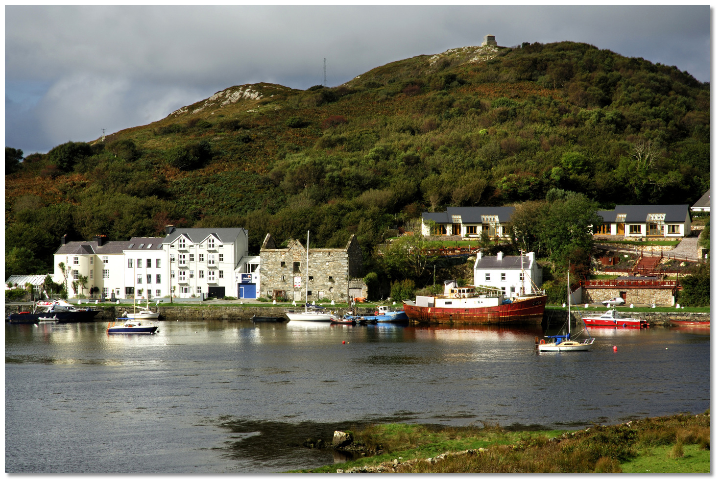
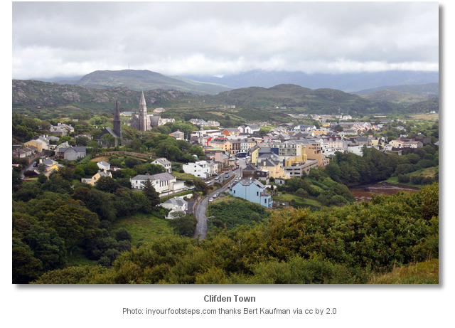
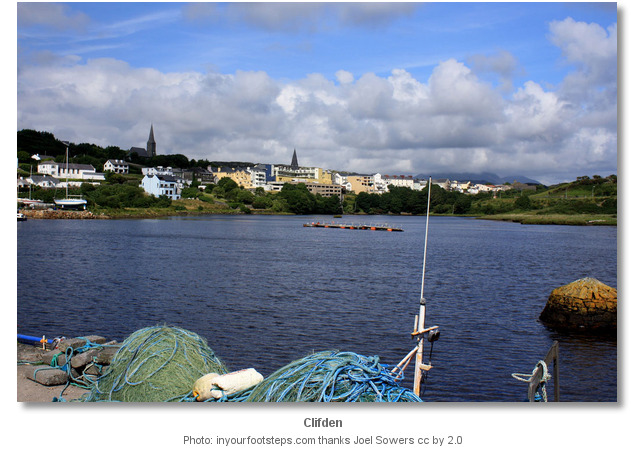
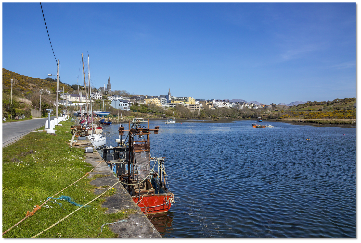
The town of Clifden stands on the north bank of Clifden Bay at the eastern end of a drying inlet where the Owenglin River enters the bay over some picturesque falls. Clifden is the largest town in the region and often referred to as 'the Capital of Connemara'. Clifden Quay is located a 5-minute walk from the town centre making it a highly attractive berth for provisioning or visiting the town.
The quay has a depth of 3 metes alongside at HW but dries to almost -2.00 metres as does its approaches almost a mile from the quay. With MHWS 4.4m MHWN 3.4m, this makes it the domain of moderate draft vessels that can take to the bottom and prepared to access the quay at HW ± 2 hours.
 Offshore details are available in western Ireland’s coastal overview for Slyne Head to Erris Head .
 Image: Graham Rabbits
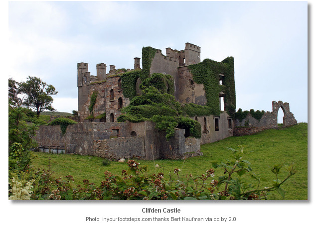
 The initial fix is the initial approach to Clifden Bay on the alignment of 080°T of a white beacon on Fishing Point and Clifden Castle. It leads in between the conspicuous Carrickrana Rocks and Mweem More, then to the south of Coghan's Rocks and north of Doolick Rock, as best seen on Admiralty Chart 2708.
Clifden Castle may be difficult to pick out as it is a ruined grey building not easily distinguished from a distance. Break off the transit as Clifden Bay is approached, between Errislannan Point and Fahy Point, taking a central path. Then steer up the bay toward 'Double Rock' beacon at the entrance to the Owenglin River estuary.
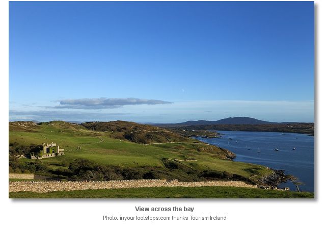
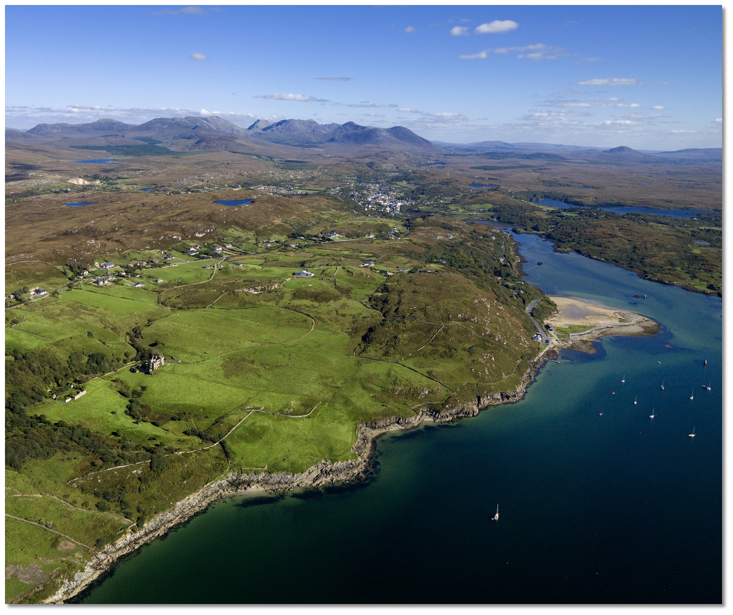 Clifden Castle and the tidal inlet leading up to Clifden
Image: Tourism Ireland
This inlet running up to the quay is narrow, almost a mile long and dries almost throughout its length. The channel passes south of two prominent white and unlit stone beacons, 'Double Rock' and then 'Long Rock' at its entrance. Long Rock which dries to 4 metres close north of its beacon has a general rule of thum that there is at least 1.8 metres in the channel when it covers.
Leave 'Double Rock' beacon close to port, and then arc a little to starboard when steering for the 'Long Rock' Beacon to avoid a shallow area encroaching on a direct path. Then steer for a conspicuous white house on the north shore above an old stone quay.
Image: © Roger Harrison
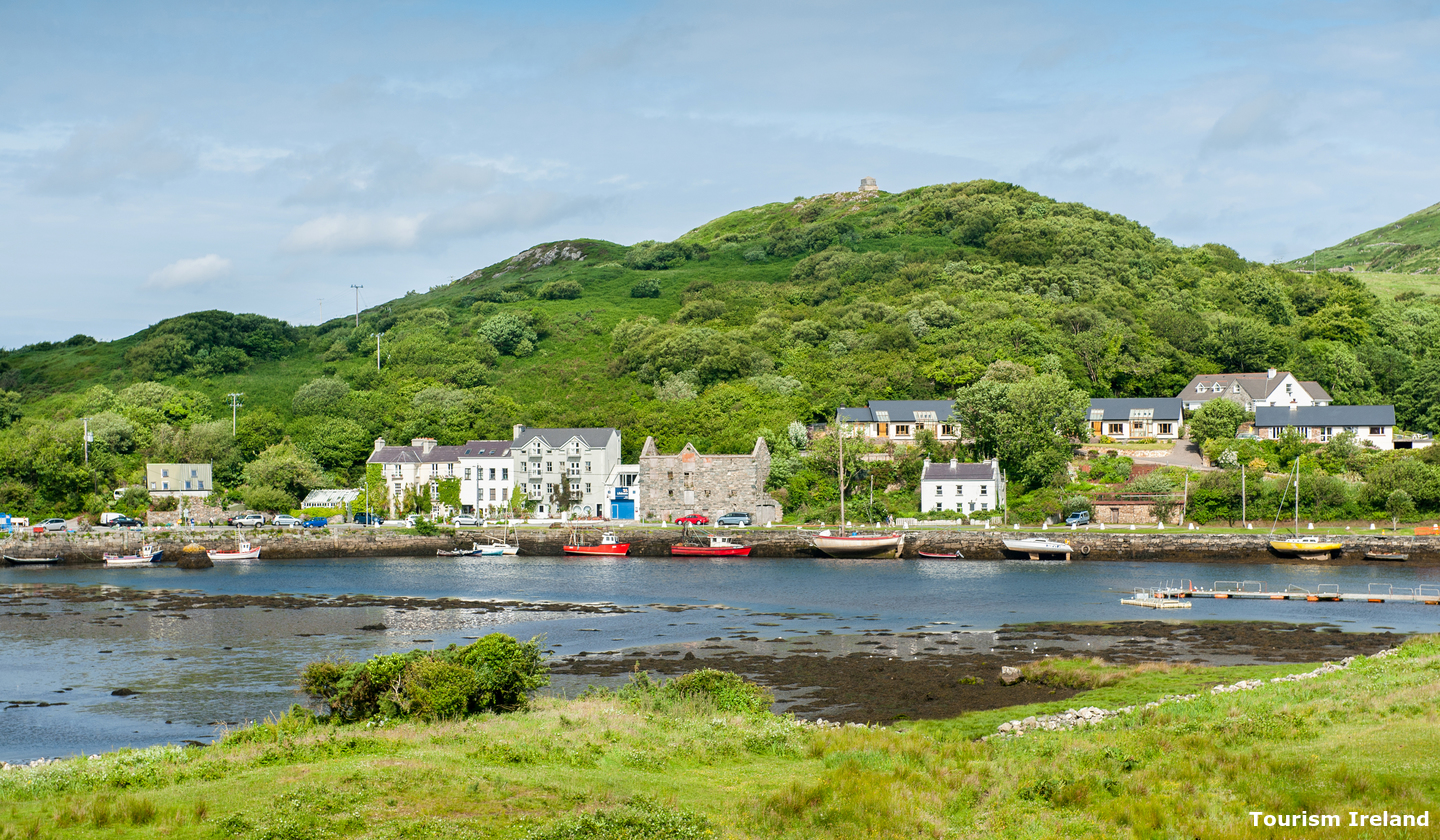
Rounded conical navigation beacons indicate navigable channel at high tide as the town quay is approached. Beware of a ruined training wall extending westward from the southern shore and then, from Black Rock, the channel and flanking training wall to starboard bends northwards towards the quay. Two conical beacons will be seen on the shore and one marking the northern end of the training wall.
 Clifden Quay as seen from the southern shore
Image: Tourism Ireland
The Quay is an 'L' shaped battered quay wall built in the early part of the 19th-century. It runs northeast/southwest and turning to run north-south at its southern end. Walls of roughly dressed limestone blocks, with coping and steps of limestone with painted granite bollards set back from front edge of the quay, and some modern concrete bollards. Pick a place to dry out against the quay, there is usually ample space.Why visit here?
Clifden derives its name from the Irish words An Clochan, meaning 'bee-hive cell'. This is a small free-standing stone dwelling, circular in shape, constructed of stone and corbelled until it closes at the top, usually associated with hermits and monks. It is thought one must have been located on the Owenglen River where it flows into Clifden Bay.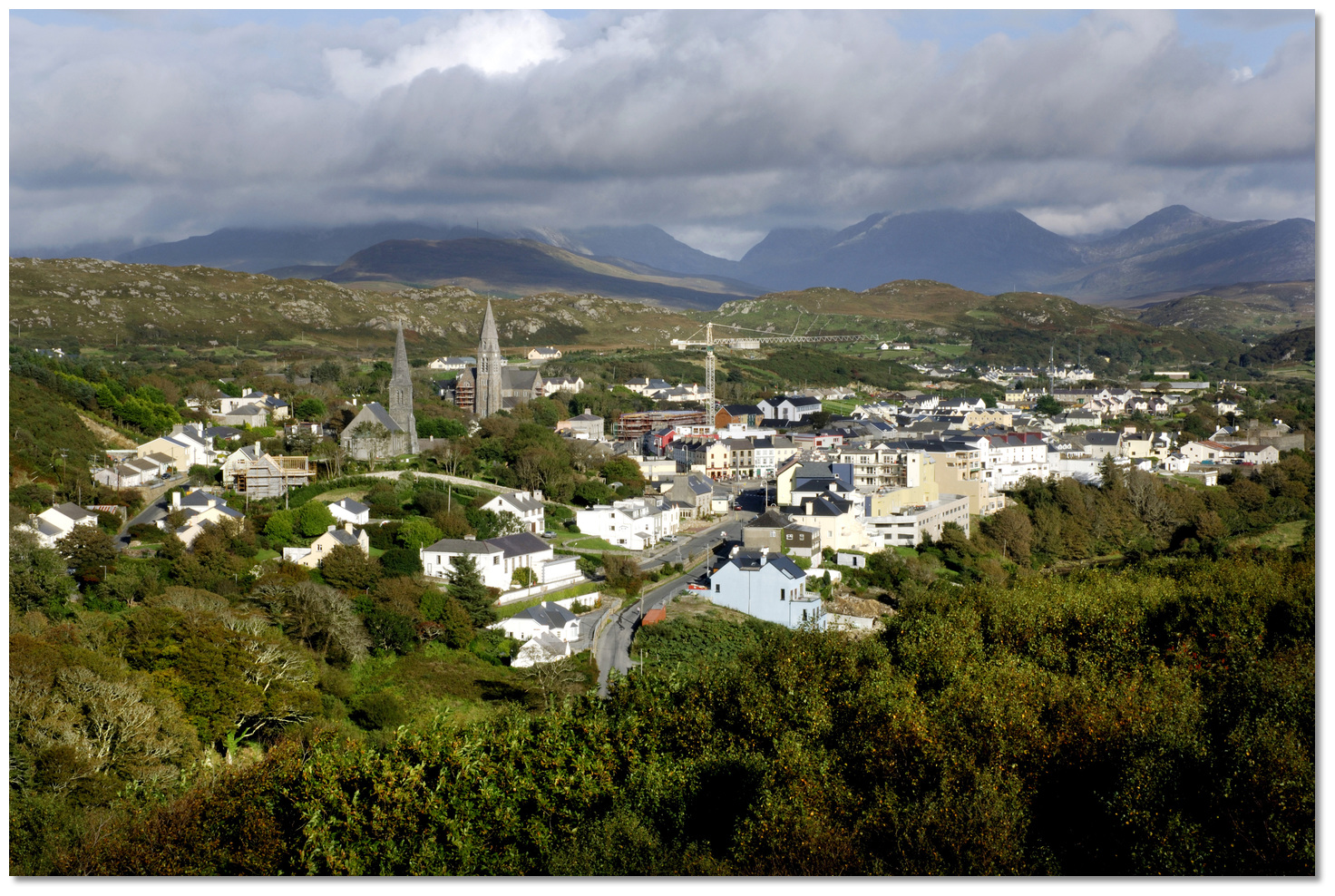 Clifden Town
Image: Tourism Ireland
Clifden is the largest town in the province of western Galway called Connemara and is often referred to as the capital of the province. Connemara is a wild and moody that is regarded as the scenic jewel in Ireland's crown. The area has a strong association with traditional Irish culture and contains a major part of the Connacht Irish-speaking Gaeltacht, which is a key part of the identity of the region and is the largest Gaeltacht in the country. Most of Connemara was once owned by Colonel Richard Martin (15 January 1754 – 6 January 1834), an Irish politician and campaigner against cruelty to animals whose family held some of the biggest estates in all Ireland.
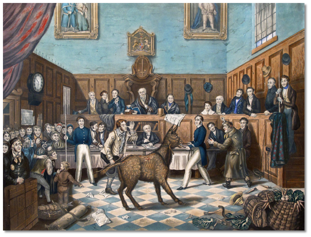 Trial of Bill Burns, showing Richard Martin with a donkey
Image: Public Domain
Martin believed that all animals had feelings and awareness and that abusing them was akin to abusing humans. He finally turned to the law famously succeeding in bringing Bill Burns to justice for animal mistreatment which was the world's first known conviction for animal cruelty, a story that delighted London's newspapers and music halls at the time. He then succeeded in getting the pioneering Cruel Treatment of Cattle Act 1822, nicknamed 'Martin's Act', passed into British law which was the world's first animal rights bill. He was renamed 'Humanity Dick' by King George IV in recognition of his efforts. Two years later he founded the society for the 'Prevention of Cruelty to Animals', which became the RSPCA. He died unrecognised and bankrupted by his efforts, but was much admired in his day in France.
 Early Clifden
Image: Public Domain
The town of Clifden was founded in 1812 by John D'Arcy a local landowner in an attempt to tame the wilderness and provide work. Clifden Castle, which he built circa 1810, was his residence. The quay was designed by Alexander Nimmo and started as a relief work in 1822 on the insistence of J D Arcy, but not completed until 1831. Formerly used for trade, this intact quayside is now used by pleasure craft and fishing boats. John D’Arcy died in 1839. At the time of his death, John’s ambition had been achieved. Clifden was then the headquarters for the coastguard and police force for the district. It had a bridewell and before long there would be a courthouse and workhouse. The town was thriving and the economic benefits to the region were becoming clear as more land in the neighbourhood was brought under cultivation and agricultural production increased to supply the growing market.
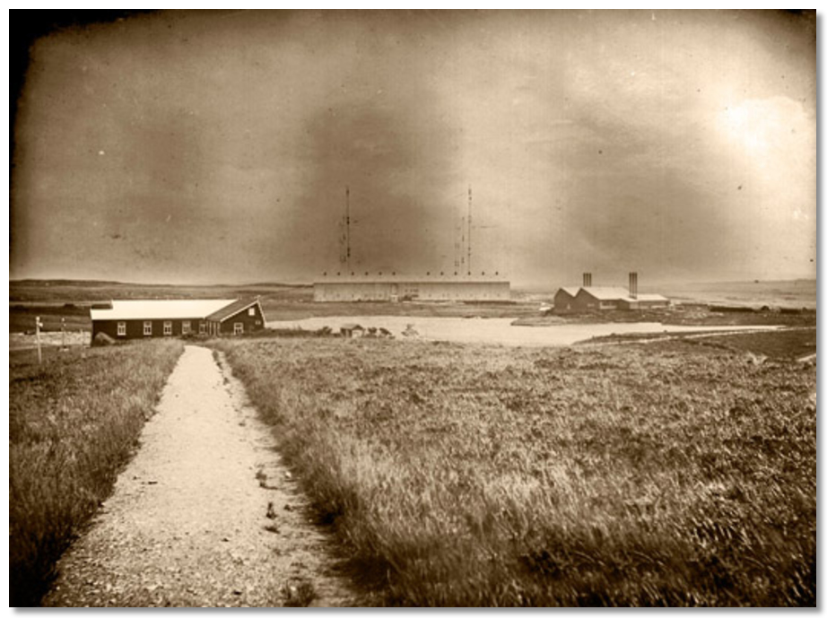 Marconi wireless station buildings circa 1907
 Image: Courtesy of The Marconi Company
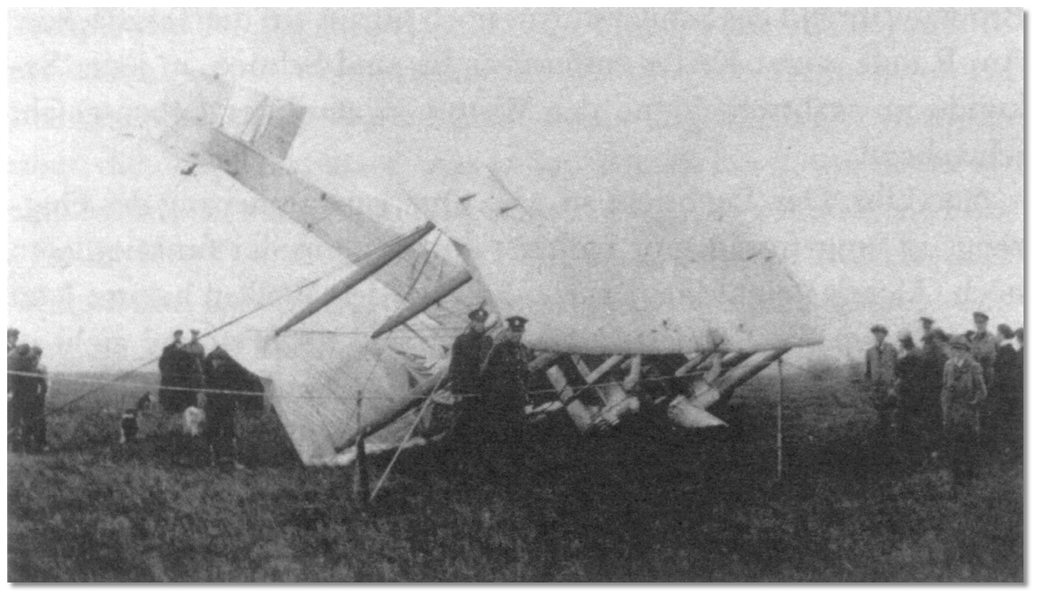 Alcock and Brown's plane after the crash landing
Image: United States Public Domain
Before that, the site played another part in transatlantic history when on the 15th June 1919 Alcock and Brown flew their failing Vickers Vimy aircraft over the Marconi Wireless Station unsuccessfully trying to attract attention. They then headed for Clifden where they circled around the town and were observed by a number of townspeople. Hoping to find a suitable landing site they returned to the Marconi Station and mistook Derrygimla Bog, just south of Clifden, for a smooth green landing strip. Although the nose of the plane sunk into the bog neither Alcock nor Brown suffered serious injury and their place in aviation history of making the first transatlantic flight was secured.
From a boating perspective, the safe and sheltered tidal harbour is a five-minute walk from the town centre the best town to provisioning along this coast. It and has the reputation of being one of Ireland 's most picturesque harbours, and one that sailors should make a point of dropping into on a cruise of the west coast of Ireland. What is particularly attractive about Clifden is the choice of very good berthing opportunities it offers, such as drying out at the quay or anchoring off Clifden Boat Club on the approaches in the bay, or entering Ardbear Bay and anchoring to the south of Yellow Slate Rocks. These and many others in the locality make it a cruising destination.
What facilities are available?
All fresh provisions and stores can be obtained at Clifden and it also has an internet cafe. The town's wide variety of interesting shops and supermarkets make it the best point to stock up in this part of the coast. A jetty in the river below the supermarket, accessible by dinghy near high water, further facilitates this. This together with lots of bars and restaurants within the town all help to make Clifden a really worthwhile destination.Fuel and Lube oil available in drums from Clifden town and tanker deliveries to Clifden quay. Some spares and mechanical repair available locally. Clifden has good bus access to both Westport and Galway for onward rail travel.
With thanks to:
eOceanic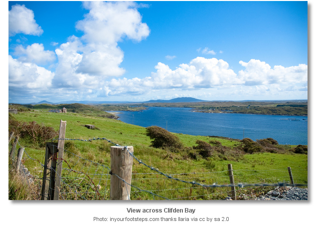
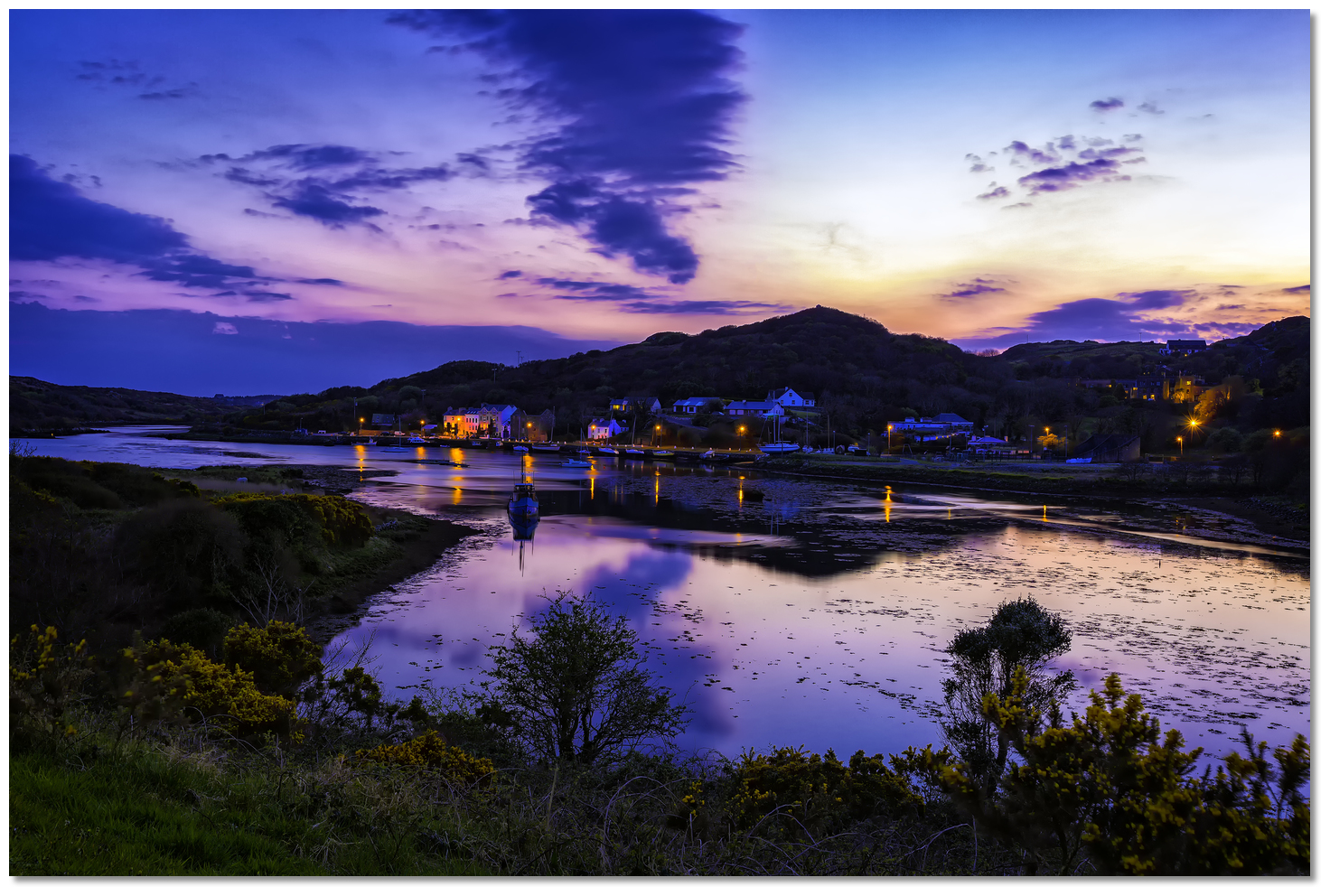
Views across Clifden Bay shows the outstanding beauty of the area
The history of Clifden
Dolphin Beach in Clifden Bay.
About Clifden
Clifden derives its name from the Irish words An Clochan, meaning 'bee-hive cell'. This is a small free-standing stone dwelling, circular in shape, constructed of stone and corbelled until it closes at the top, usually associated with hermits and monks. It is thought one must have been located on the Owenglen River where it flows into Clifden Bay.
Clifden TownImage: Tourism Ireland
Clifden is the largest town in the province of western Galway called Connemara and is often referred to as the capital of the province. Connemara is a wild and moody that is regarded as the scenic jewel in Ireland's crown. The area has a strong association with traditional Irish culture and contains a major part of the Connacht Irish-speaking Gaeltacht, which is a key part of the identity of the region and is the largest Gaeltacht in the country. Most of Connemara was once owned by Colonel Richard Martin (15 January 1754 – 6 January 1834), an Irish politician and campaigner against cruelty to animals whose family held some of the biggest estates in all Ireland.
Trial of Bill Burns, showing Richard Martin with a donkeyImage: Public Domain
Martin believed that all animals had feelings and awareness and that abusing them was akin to abusing humans. He finally turned to the law famously succeeding in bringing Bill Burns to justice for animal mistreatment which was the world's first known conviction for animal cruelty, a story that delighted London's newspapers and music halls at the time. He then succeeded in getting the pioneering Cruel Treatment of Cattle Act 1822, nicknamed 'Martin's Act', passed into British law which was the world's first animal rights bill. He was renamed 'Humanity Dick' by King George IV in recognition of his efforts. Two years later he founded the society for the 'Prevention of Cruelty to Animals', which became the RSPCA. He died unrecognised and bankrupted by his efforts, but was much admired in his day in France.
Early ClifdenImage: Public Domain
The town of Clifden was founded in 1812 by John D'Arcy a local landowner in an attempt to tame the wilderness and provide work. Clifden Castle, which he built circa 1810, was his residence. The quay was designed by Alexander Nimmo and started as a relief work in 1822 on the insistence of J D Arcy, but not completed until 1831. Formerly used for trade, this intact quayside is now used by pleasure craft and fishing boats. John D’Arcy died in 1839. At the time of his death, John’s ambition had been achieved. Clifden was then the headquarters for the coastguard and police force for the district. It had a bridewell and before long there would be a courthouse and workhouse. The town was thriving and the economic benefits to the region were becoming clear as more land in the neighbourhood was brought under cultivation and agricultural production increased to supply the growing market.
Marconi wireless station buildings circa 1907 Image: Courtesy of The Marconi Company
Alcock and Brown's plane after the crash landingImage: United States Public Domain
Before that, the site played another part in transatlantic history when on the 15th June 1919 Alcock and Brown flew their failing Vickers Vimy aircraft over the Marconi Wireless Station unsuccessfully trying to attract attention. They then headed for Clifden where they circled around the town and were observed by a number of townspeople. Hoping to find a suitable landing site they returned to the Marconi Station and mistook Derrygimla Bog, just south of Clifden, for a smooth green landing strip. Although the nose of the plane sunk into the bog neither Alcock nor Brown suffered serious injury and their place in aviation history of making the first transatlantic flight was secured.
From a boating perspective, the safe and sheltered tidal harbour is a five-minute walk from the town centre the best town to provisioning along this coast. It and has the reputation of being one of Ireland 's most picturesque harbours, and one that sailors should make a point of dropping into on a cruise of the west coast of Ireland. What is particularly attractive about Clifden is the choice of very good berthing opportunities it offers, such as drying out at the quay or anchoring off Clifden Boat Club on the approaches in the bay, or entering Ardbear Bay and anchoring to the south of Yellow Slate Rocks. These and many others in the locality make it a cruising destination.
Other options in this area
Cleggan Bay - 3.2 miles NNW
Bofin Harbour - 6.2 miles NW
Fahy Bay - 2.8 miles N
Ballynakill Harbour - 3.4 miles NNE
Bunowen Bay - 3.5 miles SSW
Gorteen Bay - 4.5 miles SSE
Roundstone Bay - 4.1 miles SE
Bertraghboy Bay - 5.2 miles ESE
Navigational pictures
These additional images feature in the 'How to get in' section of our detailed view for Clifden.


| Detail view | Off |
| Picture view | On |
Views across Clifden Bay shows the outstanding beauty of the area
The history of Clifden
Dolphin Beach in Clifden Bay.
Add your review or comment:
Paul Harrison wrote this review on Sep 14th 2015:
Mooring off Clifden Bay SC @6.50 a night in 2015. Very friendly club, bar food available. toilets and shower in club.
Average Rating: UnratedGuy Adams wrote this review on Jun 28th 2016:
Clifden Boat Club serves great food, very helpful staff
Average Rating: UnratedPlease log in to leave a review of this haven.
Please note eOceanic makes no guarantee of the validity of this information, we have not visited this haven and do not have first-hand experience to qualify the data. Although the contributors are vetted by peer review as practised authorities, they are in no way, whatsoever, responsible for the accuracy of their contributions. It is essential that you thoroughly check the accuracy and suitability for your vessel of any waypoints offered in any context plus the precision of your GPS. Any data provided on this page is entirely used at your own risk and you must read our legal page if you view data on this site. Free to use sea charts courtesy of Navionics.