


Mulroy Bay is an inlet off the North Atlantic Ocean on the north coast of Ireland about 10 miles north of Letterkenny. It is a large inlet in a peaceful and tranquil setting which offers several anchorages with possible berthing at the quay at Milford.
The inlet provides complete shelter protection in all reasonable weather conditions. Access through the long and narrow marked channel requires careful navigation.

Keyfacts for Mulroy Bay


Last modified
July 23rd 2021 Summary
A completely protected location with careful navigation required for access.Facilities


Nature


Considerations

Position and approaches

Expand to new tab or fullscreen
Haven position
 55° 12.121' N, 007° 48.692' W
this is the position at Fanny's Bay anchorage
What is the initial fix?
The following Mulroy Bay initial fix will set up a final approach:
 55° 15.432' N, 007° 46.335' W

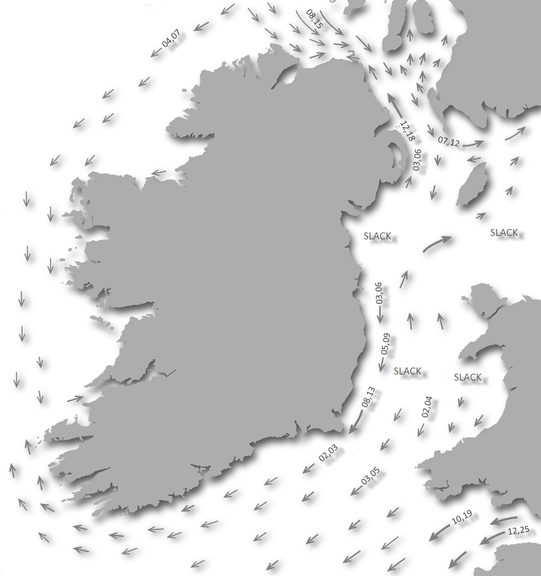


Not what you need?
Click the 'Next' and 'Previous' buttons to progress through neighbouring havens in a coastal 'clockwise' or 'anti-clockwise' sequence. Below are the ten nearest havens to Mulroy Bay for your convenience.
Ten nearest havens by straight line charted distance and bearing:
- Sheep Haven - 1.3 nautical miles SW
- Portsalon - 6.6 nautical miles E
- Pincher Bay - 7.4 nautical miles NE
- Tramore Bay - 7.6 nautical miles W
- Scraggy Bay - 8.4 nautical miles ESE
- Crummie's Bay - 9 nautical miles E
- Dunree Bay - 9.3 nautical miles E
- Lenan Bay - 10.1 nautical miles ENE
- Macamish Bay - 10.6 nautical miles ESE
- Ramelton - 11.4 nautical miles SSE
These havens are ordered by straight line charted distance and bearing, and can be reordered by compass direction or coastal sequence:
- Sheep Haven - 1.3 miles SW
- Portsalon - 6.6 miles E
- Pincher Bay - 7.4 miles NE
- Tramore Bay - 7.6 miles W
- Scraggy Bay - 8.4 miles ESE
- Crummie's Bay - 9 miles E
- Dunree Bay - 9.3 miles E
- Lenan Bay - 10.1 miles ENE
- Macamish Bay - 10.6 miles ESE
- Ramelton - 11.4 miles SSE


What's the story here?
This north facing inlet is situated between Lough Swilly to the east and Sheephaven Bay to the west, with its entrance between Melmore Head and Ballyhoorisky Point, about 10 miles to the north of Letterkenny.How to get in?

 The 'Erris Head to Malin Head' coastal description provides approach information to the suggested initial fix. Vessels approaching from the south should select the northeast bound
  sequenced description; vessels approaching from the north should select the southwest bound sequence; western approaches may use either description.
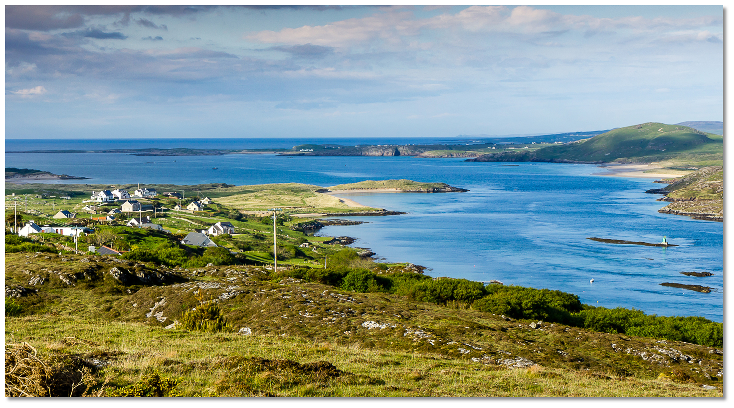 The entrance to Mulroy Bay
Image: © Ciaran Kelly
The outer bay is quite open and leads to a narrow tortuous winding channel about 8 miles long in a north-south direction. This channel varies in width and depth with three significant narrows throughout its length, which eventually opens into Broadwater, an open shallow sea lough that has many small islands and islets, and which is again connected by a further narrow channel to Northwater (Kinny Lough).
At its commencement, the second narrows is spanned by a new bridge opened in 2009 linking Rawros Point and Paddys Point which offers 19 metres of clearance. Caution should also be taken to avoid four special water monitoring buoys which may be moored in the vicinity of Island Roy at the end of the first narrows and before the new Mulroy Bay bridge.
Of the many anchorages throughout the length of this bay the best one is in Fanny's Bay about 3 miles inside the bar with 2 metres depth and which affords complete shelter out of the stream at all times. Other notable anchorages are to the north of Dundooan Rocks off the west shore, south of Ballyhoorisky Island off the east shore, in Glinsk Bay at the end of the first narrows off the east shore, and for those who journey to the head of the bay there is alongside berthing at the quay at Milford in 3 to 4 metres depth.Why visit here?
Mulroy Bay, is an anglicisation of the Irish name Cuan Mhaoil Ruaidh. The bay was first recorded in 1608 by the shortened version of Maol Rua simply meaning meaning 'red current' with the full Irish title Cuan na Mhaoil Ruaidh meaning 'Bay of the Red Current' or 'Bay of the Red Stream'.The bay penetrates many miles inland through three sets of narrows leading to an almost inland lake environment that has tranquil and scenic surroundings. Beyond the third narrows is Broadwater which has beautiful scenery with tree-clad shorelines and rocky shoals, many of which are marked by ancient stone cairns. Mulroy Bay has been described as having some of the most awe-inspiring and jaw-dropping scenery in all of Ireland.
There is little in the way of facilities for the length of the bay, but at the excellent anchorage in Fanny's Bay, there is a slipway for a landing, to enable a walk to be made to the village of Downings one mile across the peninsula dividing Mulroy Bay from Sheephaven Bay, where there is a post office and shop.
The village of Milford, in Irish Baile na Galloglach, situated at the head of the bay is a small market town which from the 19C has been the centre of local and national trade in North Donegal owing to its trade links and good communication network, and although latterly this has declined it remains an important centre of trade for the peninsulas of Fanad and Rosquill. It has the usual facilities for a town with a population of over 1500, including supermarkets and a variety of shops, a health centre and pharmacy, post office, service station for fuel, hotels, bars and restaurants, and many craft and local heritage outlets, and freshwater is available by the quay.
Located north of Letterkenny the town of Milford was founded in the 18th-Century by the Clement family. The Irish Baile na Galloglach literally means 'town of the galloglach'. The 'Galloglaigh' were an elite class of mercenary warriors who came from Gaelic Norse clans in Scotland between the mid 13th and late 16th-Century. A battle between the Irish, helped by the 'Galloglaigh', and the English took place on a hill in the townland, and this is where the name comes from.
What facilities are available?
One mile over the peninsula from Fanny's Bay anchorage is Downings village which has a post office and shop, and at Rosapenna 0.75 miles away there is an excellent hotel. About eight miles from the Fanny's Bay anchorage the town of Milford has most other facilities including Supermarkets, Butchers, Hotel, Bars & Restaurants, Post Office, Doctors and a Pharmacy.With thanks to:
eOceanic site research. Photography with thanks to © Artur.

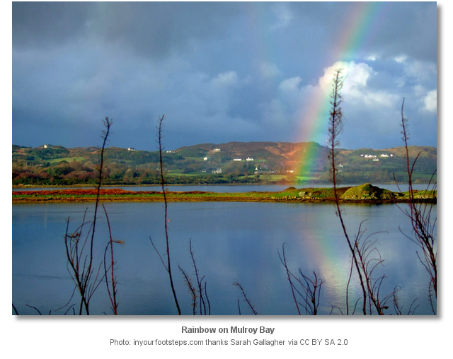

Sailing from Lough Swilly to Mulroy Bay
About Mulroy Bay
Mulroy Bay, is an anglicisation of the Irish name Cuan Mhaoil Ruaidh. The bay was first recorded in 1608 by the shortened version of Maol Rua simply meaning meaning 'red current' with the full Irish title Cuan na Mhaoil Ruaidh meaning 'Bay of the Red Current' or 'Bay of the Red Stream'.
The bay penetrates many miles inland through three sets of narrows leading to an almost inland lake environment that has tranquil and scenic surroundings. Beyond the third narrows is Broadwater which has beautiful scenery with tree-clad shorelines and rocky shoals, many of which are marked by ancient stone cairns. Mulroy Bay has been described as having some of the most awe-inspiring and jaw-dropping scenery in all of Ireland.
There is little in the way of facilities for the length of the bay, but at the excellent anchorage in Fanny's Bay, there is a slipway for a landing, to enable a walk to be made to the village of Downings one mile across the peninsula dividing Mulroy Bay from Sheephaven Bay, where there is a post office and shop.
The village of Milford, in Irish Baile na Galloglach, situated at the head of the bay is a small market town which from the 19C has been the centre of local and national trade in North Donegal owing to its trade links and good communication network, and although latterly this has declined it remains an important centre of trade for the peninsulas of Fanad and Rosquill. It has the usual facilities for a town with a population of over 1500, including supermarkets and a variety of shops, a health centre and pharmacy, post office, service station for fuel, hotels, bars and restaurants, and many craft and local heritage outlets, and freshwater is available by the quay.
Located north of Letterkenny the town of Milford was founded in the 18th-Century by the Clement family. The Irish Baile na Galloglach literally means 'town of the galloglach'. The 'Galloglaigh' were an elite class of mercenary warriors who came from Gaelic Norse clans in Scotland between the mid 13th and late 16th-Century. A battle between the Irish, helped by the 'Galloglaigh', and the English took place on a hill in the townland, and this is where the name comes from.
Other options in this area
Click the 'Next' and 'Previous' buttons to progress through neighbouring havens in a coastal 'clockwise' or 'anti-clockwise' sequence. Alternatively here are the ten nearest havens available in picture view:
Coastal clockwise:
Pincher Bay - 4.6 miles NEPortsalon - 4.1 miles E
Scraggy Bay - 5.2 miles ESE
Macamish Bay - 6.6 miles ESE
Rathmullan - 7.2 miles ESE
Coastal anti-clockwise:
Sheep Haven - 0.8 miles SWTramore Bay - 4.7 miles W
Tory Island - 9.1 miles WNW
Toberglassan Bay - 7.7 miles W
Inishsirrer Island - 11.4 miles WSW
Navigational pictures
These additional images feature in the 'How to get in' section of our detailed view for Mulroy Bay.


| Detail view | Off |
| Picture view | On |
Sailing from Lough Swilly to Mulroy Bay
 A photograph is worth a thousand words. We are always looking for bright sunny photographs that show this haven and its identifiable features at its best. If you have some images that we could use please upload them here. All we need to know is how you would like to be credited for your work and a brief description of the image if it is not readily apparent. If you would like us to add a hyperlink from the image that goes back to your site please include the desired link and we will be delighted to that for you.
Add your review or comment:
Please log in to leave a review of this haven.
Please note eOceanic makes no guarantee of the validity of this information, we have not visited this haven and do not have first-hand experience to qualify the data. Although the contributors are vetted by peer review as practised authorities, they are in no way, whatsoever, responsible for the accuracy of their contributions. It is essential that you thoroughly check the accuracy and suitability for your vessel of any waypoints offered in any context plus the precision of your GPS. Any data provided on this page is entirely used at your own risk and you must read our legal page if you view data on this site. Free to use sea charts courtesy of Navionics.