
Dunbeacon Harbour is situated on the southwest coast of Ireland and at the head of Dunmanus Bay. It provides an anchorage in a serene location with access to a new quay and a nearby village.
Although windswept and exposed to the full length of Dunmanus Bay a vessel can find good protection within the harbour in and around its small island. Access is straightforward at any stage of the tide. However, there are no marks and outlying obstructions that require some easy navigation during the day would make a nighttime entry inadvisable. The harbour has a well-established marine farm that is easily avoided.


Keyfacts for Dunbeacon Harbour


Last modified
December 3rd 2021 Summary* Restrictions apply
A good location with straightforward access.Facilities


Nature


Considerations


Position and approaches

Expand to new tab or fullscreen
Haven position
 51° 36.804' N, 009° 32.997' W
South of the old pier, near the village of Durrus, in about 2 metres making best advantage of the shelter provided by Mannion's Island.
What is the initial fix?
The following Dunbeacon Harbour initial fix will set up a final approach:
 51° 36.116' N, 009° 35.452' W


What are the key points of the approach?
Offshore details are available in southwestern Ireland’s Coastal Overview for Mizen Head to Loop Head  .
.
.- A central course between Three Castle Head and Sheep’s Head, to midway between Carbery Island and the north shore presents no hazards.
- After Carbery Island the leading line of the 232° T alignment, astern of (front mark) the northwest of Carbery Island, with the (rear mark) northwest shores of Bird Island, 4½ miles behind, leads up the bay.
- Pass in between Mannion's Island and the mussel farms southward.
Not what you need?
Click the 'Next' and 'Previous' buttons to progress through neighbouring havens in a coastal 'clockwise' or 'anti-clockwise' sequence. Below are the ten nearest havens to Dunbeacon Harbour for your convenience.
Ten nearest havens by straight line charted distance and bearing:
- Dunbeacon Cove - 1.9 nautical miles SW
- Kitchen Cove - 3.2 nautical miles WSW
- Bantry Harbour - 5.2 nautical miles NE
- Schull Harbour (Skull) - 5.3 nautical miles S
- Kilcrohane Pier - 5.9 nautical miles WSW
- Dereenatra - 5.9 nautical miles SSE
- Dunmanus Harbour - 6 nautical miles SW
- Ballydehob Bay - 6.1 nautical miles SE
- Rossbrin Cove - 6.1 nautical miles SSE
- Poulgorm Bay - 6.3 nautical miles SE
These havens are ordered by straight line charted distance and bearing, and can be reordered by compass direction or coastal sequence:
- Dunbeacon Cove - 1.9 miles SW
- Kitchen Cove - 3.2 miles WSW
- Bantry Harbour - 5.2 miles NE
- Schull Harbour (Skull) - 5.3 miles S
- Kilcrohane Pier - 5.9 miles WSW
- Dereenatra - 5.9 miles SSE
- Dunmanus Harbour - 6 miles SW
- Ballydehob Bay - 6.1 miles SE
- Rossbrin Cove - 6.1 miles SSE
- Poulgorm Bay - 6.3 miles SE


What's the story here?
Image: Michael Harpur
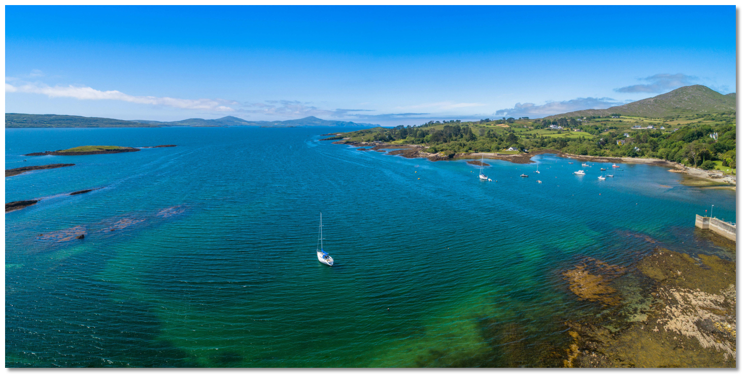
Dunbeacon Harbour lies at the head of Dunmanus Bay about 14 miles from the ocean. It is a large almost landlock body of water that is protected by a small island and enclosing points. The outer harbour is mostly shallow with a large easily avoided mussel farm in its southern part but there is ample water and anchoring opportunities for leisure craft. Further up its narrows is the small Durris Pier used by small fishing boats and the village of Durrus about 2km away from the pier that can be reached by road.
Image: Burke Corbett
Vessels can find perfect security against all winds and sea anchored in Dunbeacon Harbour with ample water excellent holding.
Image: Michael Harpur
How to get in?
Image: Michael Harpur
 Use Ireland’s coastal overview for Mizen Head to Loop Head for seaward approaches. Dunmanus Bay is a long narrow Atlantic Ocean bay inlet situated between Mizen Head, to the south, and Bantry Bay to the north. It is entered 4 miles north of Mizen Head between Three Castle Head and Sheep’s Head, a distance of about 3½ miles apart. The bay extends easterly for a distance of 12 miles inland up to the small village of Durrus at the head of the bay, within Dunbeacon Harbour.
  Sheep's Head may be distinguished by its light structure
Image: Burke Corbett
The entrance is well marked by Sheep's Head with its light tower. Three Castle Head is also distinctive as it has a notable ruined castle set into a concave of the headland.
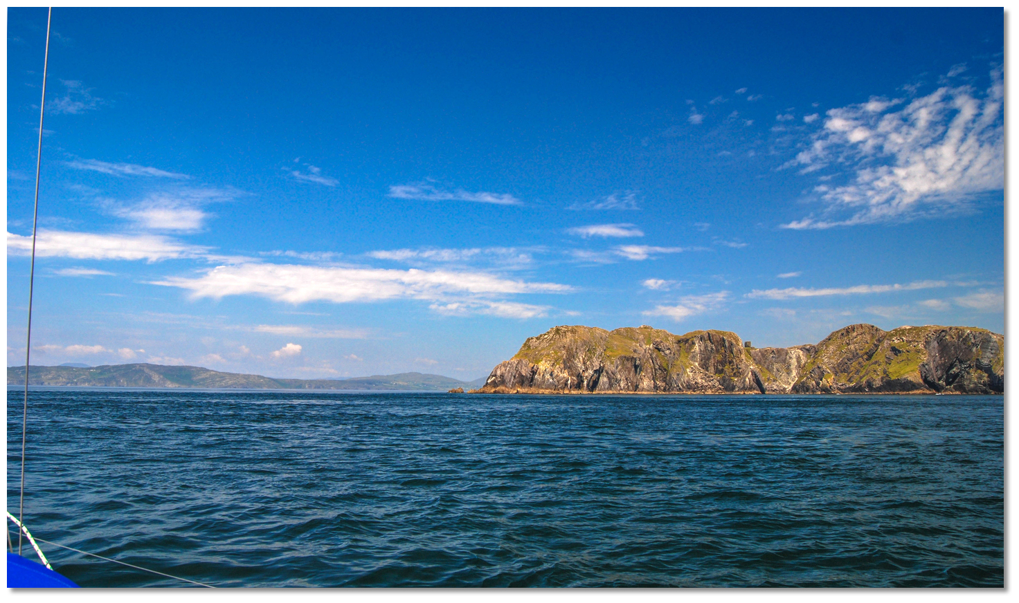 Dunmanus Bay opening around Three Castle Head
Image: Burke Corbett
Keeping 300 metres off each headland clears all headland dangers. In rough conditions, Sheep's Head’s Bullig, with 6 metres over it 400 metres west of the head, and Three Castle Head's South Bullig, with 4.5 metres over it 800 metres southwest of its head, should be avoided. These shoals both break in bad weather.
 Castle ruin on Three Castle Head
Image: Burke Corbett
The shores of the bay as far up as Carbery Island, situated 8 miles inside the entrance, will be seen to be largely composed of rugged inaccessible cliffs. They are steep-to and clear of danger, but subject to a heavy seaway particularly so along the south shore.
 Bird Island and Three Castle Head as seen approaching Dunmanus Bay
Image: Burke Corbett
On the south shore, 3 miles northeast of Three Castle Head is the 51 metres high Bird Island. Situated close off Dunmanus Bay’s south-eastern shoreline the very green and pointed island is a conspicuous feature that plays host to colonies of puffins and shearwaters.
 Dunmanus Harbour
Image: Michael Harpur
The rocky creek on the south shore that is Dunmanus Harbour
 is located 1 mile to the south of Carbery Island. It hosts leisure craft but can be subject to a heavy ground swell, more so in the winter, which makes it challenging in strong south-westerlies.
  Carbery Furze and Cold islands outside the entrance to the harbour
Image: Michael Harpur
Carbery Island is the westernmost of three small islets lying near the middle of Dunmanus Bay. 15 metres high and green it has outlying rocks that extend 200 metres from its low rugged western end. Beyond these lie a dangerous reef called Carbery Breaker, with from 4.1 to 9.9 metres of cover, situated nearly 600 metres west-southwest from the island. There is a good clear ¾ of a mile wide passage to the inner part of the bay between Carbery Island and the north shore.
 Astern view towards Bird Island when passing out between Cold Island and
Murphy's Rocks
Image: Burke Corbett
With good charts or a plotter, in settled weather, a passage to the east of Carbery Islands can provide for some interesting pilotage. This is a particularly useful cut when passing from Dunmanus Harbour to Dunbeacon Harbour. Keep midway between Carbery and Furze Islands giving the west point of Furze Island a berth of at least 200 metres. Then steer in mid-channel between Furze Island and Cold Island, located 600 metres to the north, and then steer north to exit through the ¼ mile-wide gap between Cold Island and Murphy Rocks that are situated off the main. A modern self-sufficient home has been constructed behind Carbery's Brandy Point where a floating pontoon and small beach will be seen. These islets abound with seals.
After passing Carbery Island the track continues up the middle of the bay which is free of hazards. A leading line is available that is best seen on Admiralty 2552, on the alignment 232° T, astern of (front mark) the northwest cliffy point of Carbery Island, with the (rear mark) on northwest shores of Three Castle Head, 7½ miles behind, and Bird Island, 4½ miles behind. This leads up the bay passing south of the low and rocky Pointabulloge, on the north shore and to the northwest of Drishane Point situated about 2 miles further up the inlet from Carbery Island. The Dunbeacon Harbour initial fix is set on the endpoint of this alignment so steering onto this and maintaining 052° T will keep a vessel on track.
The outer headland of Dunmanus Bay has few habitations. Continuing from this point up the long inlet the rocky headland cliffs gradually transform, particularly so the more sheltered southern shores that are not as rugged as those to the north. Here increasingly beautiful pastoral meadows will be seen with scattered sheep and cattle and the occasional solitary white cottage.
Image: Michael Harpur
From Carbery Island to Drishane Point, two miles to the east, the south shore is foul out to a ¼ of a mile. To the east of this, it is steep-to and clear of danger as far as Dunbeacon Cove
identifiable by the spartan ruins of Dunbeacon Castle stood on a promontory to the east side of the cove. Ruins of an ancient fort, or rath the Gaelic for a fort, will also be seen above on a low cliffy fronted shore. From there it again becomes foul from 600 metres north by northeast beyond the tower. _cove.jpg) Ballynatra (Trá Ruaim) Cove
Ballynatra (Trá Ruaim) CoveImage: Michael Harpur
On the north shore, in favourable weather conditions, there is the little fair-weather stay-aboard anchorage at Ballynatra (Trá Ruaim) Cove
. _cove.jpg) Yacht anchored in Ballynatra (Trá Ruaim) Cove
Yacht anchored in Ballynatra (Trá Ruaim) CoveImage: Gareth Thomas
Situated 3½ miles from Sheeps Head and 1 mile to the west of Dooneen Point, it is a small and lonely cove with a substantial drying pier, recently restored, in its northwest corner. A landing party can come ashore here but it would not be a place to leave a boat unattended.
 The prominent Dooneen Point
Image: Michael Harpur
A mile above Ballynatra (Trá Ruaim) Cove is Dooneen Point which is the first point that attracts attention when running up the bay. This is a low rocky projection 5 miles to the east of Sheep’s Head, and it is clear of danger. It is a remote area with a substantial refurbished concrete Dooneen Pier
, set into the rocky outcrops and ridges that extend eastward from the promontory just inside the small craggy island of Illanunglass. Dooneen Pier and the small island of Illanunglass
Image: Michael Harpur
Although it presents a sheltered appearance it is not an ideal anchorage on the east side of this point. Unfortunately, the area off of the Dooneen Pier is steep-to and deep, anchoring in 5-10 metres. A trip line is advised as the area has subsurface mariculture frames and ropes.
 The view up Dunmanus Bay from Dooneen Point
Image: Michael Harpur
Moored vessels also run the risk of 'falling off' in the event of the anchor breaking free so an anchor watch should be maintained. However, a landing can easily be had here.
 Kilcrohane Point 6½ miles from the entrance with Dooneen Point 1½ miles behind
Image: Michael Harpur
Kilcrohane Point is situated 6½ miles from the entrance to Dunmanus Bay and 1½ miles east by northeast of Dooneen Point. Kilcrohane Pier
is situated close northeast of Kilcrohane Point set into a bight in the northern shore. It is a small rocky southeast-facing cove. At its head is a small shingle beach and a drying pier with a pair of slips. Close west the small Kilcrohan River flows into the bay.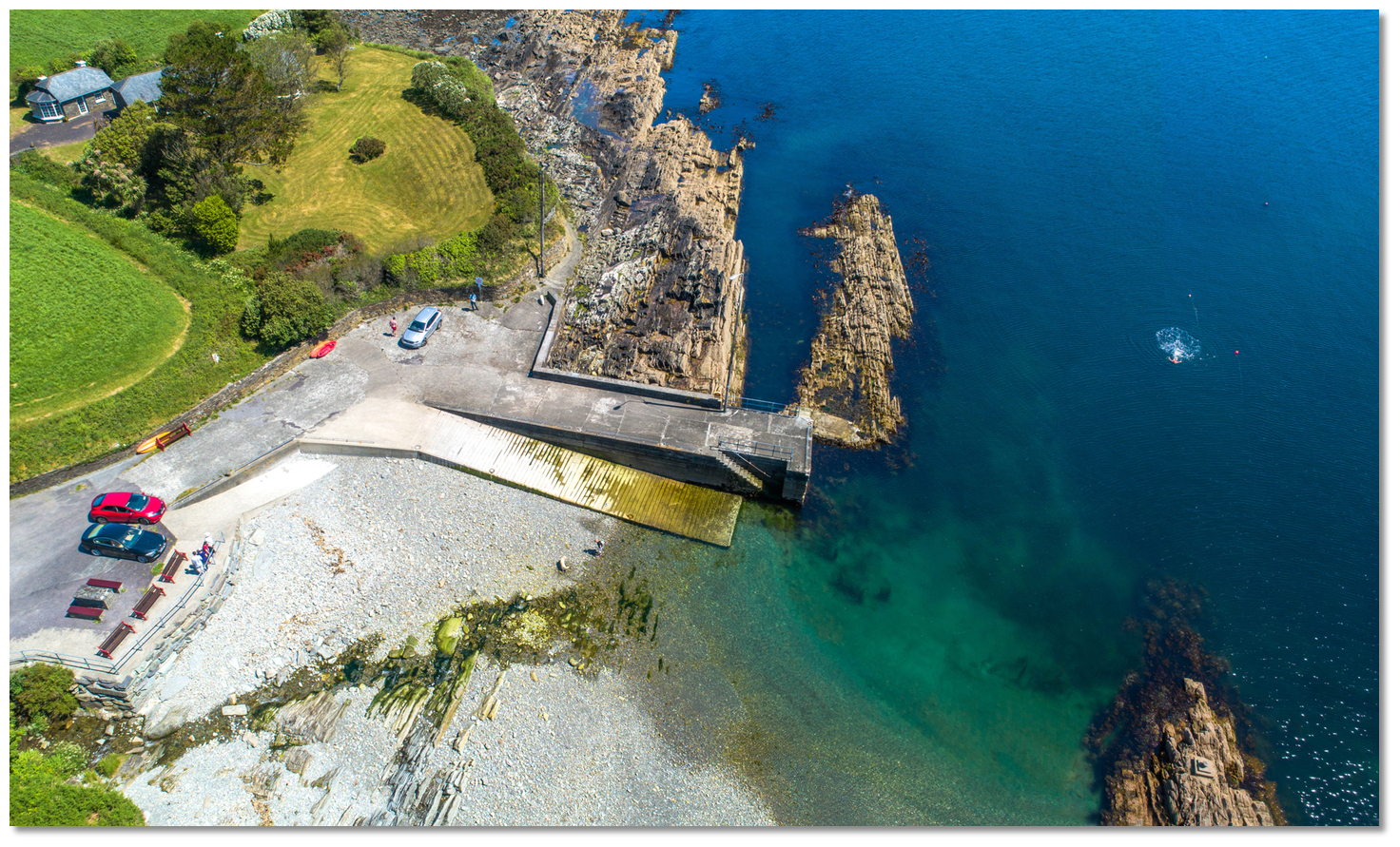 Kilcrohane Pier
Image: Michael Harpur
Kilcrohane Pier is a place for those cruising Dunmanus Bay in settled weather with a mind to discovering interesting day anchorages and short walks. For this is a steep-to exposed anchorage and one that ideally makes a lunch stop or a place to have a swim.
 Pointabulloge, the second headland left, as seen from Kilcrohane
Image: Michael Harpur
Pointabulloge, from Gaelic ’Point-na-bullig’, the most outstanding point to the east of Dooneen Point, is low and rocky, with foul ground extending nearly 200 metres to the west of it. Lord Bandon's Tower, in the bight on the west side of the point, is conspicuous when sailing up the bay.
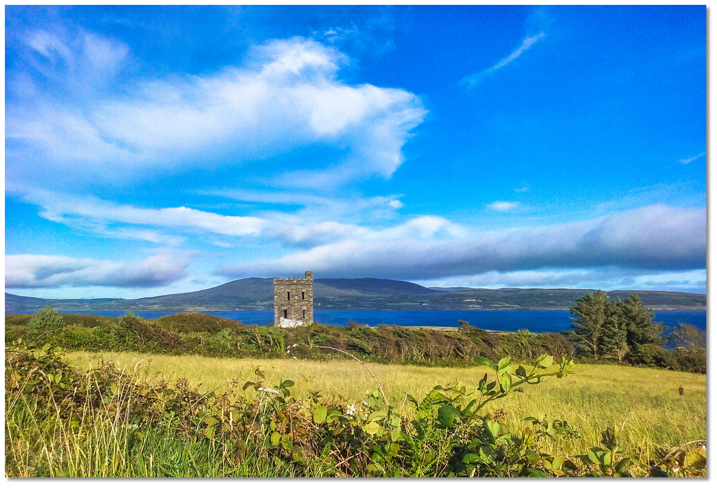 Lord Bandon's Tower
Image: Tourism Ireland
From this point to the east the north shore continues moderately bold-to as far as Reen Point, which lies nearly opposite to Dunbeacon Castle on the south shore.
 The entrance to Kitchen Cove with Carbery and Furze in the distance
Image: Michael Harpur
The small rocky inlet of Kitchen Cove
is situated nearly midway between Pointabulloge and Reen Point and is the second-best berth, after Dubeacon Harbour, that Dunamnus Bay has to offer. The small low Owen's Island sits almost centrally outside of it and the east side of the cove is foul with reefs. At its head is the sheltered and recently renovated Ahakista Pier that dries. The cove may be easily recognised from seaward by some trees near its head, a chapel on the rising ground a ½ mile to the northeast, and also its pier and pub, the mansion house in the northwest corner.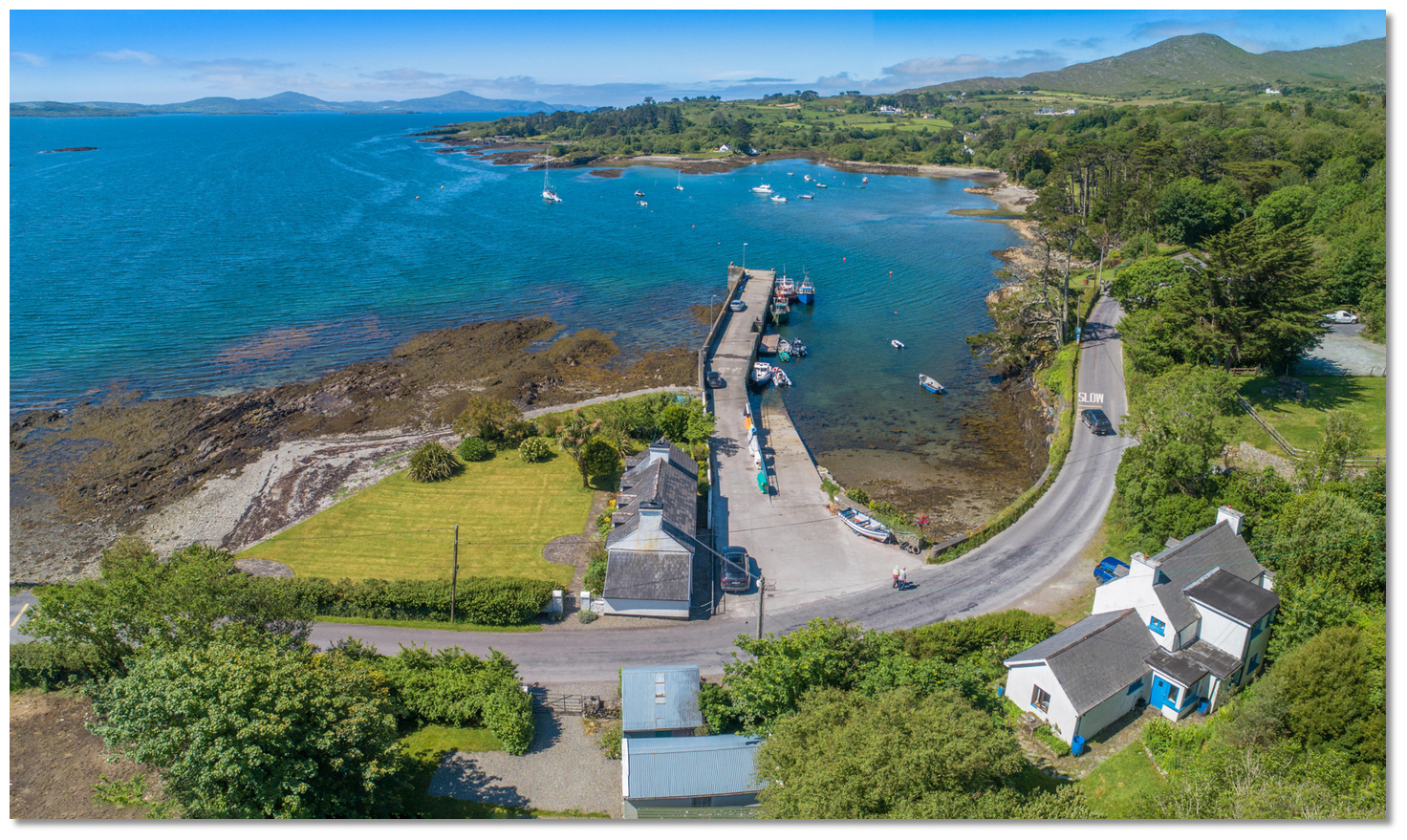 Ahakista Pier at the head of the inlet
Image: Michael Harpur
The coastal village of Ahakista is just set back and close northward from the pier. The harbour has two seasonal visitor moorings and Ahakista Pier has a dingy dock and slipway that makes for convenient landings. The pier is used by local fishing boats but it may be possible to dry along the inner side of the pier. It can take a moderate-sized boat alongside at the end on a neap tide if it is free.
 The always visible Twopoint Island
Image: Burke Corbett
To the east of a line joining Reen Point and Dunbeacon Cove both shores of the bay become foul, and the navigation towards Dunbeacon Harbour have some well-covered rocks near the mid-channel. The shoals covering the south shore, with 4.1 and 7.2 metres over them, terminate to the northwest in the Doona Rock, an extensive patch with 4.1 metres of water LAT over it. However, 400 metres to the northwestward of it, on the eastern projection of the shoals that extend from Reen Point, is an unnamed rock on the chart but colloquially known as the Six-feet Rock with 1.7 metres of cover.
 Rossmore Point and Mannion's Island and the foul ground between
Image: Michael Harpur
 The Dunbeacon Harbour initial fix is situated in the midpoint of these two rocks, where the channel to Dunbeacon Harbour turns east by northeast towards to pass midway between Rossmore Point and Dunbeacon Point. The track from the initial fix to the entrance is 400 metres wide with 19 to 15 metres of water and has no obstructions in the least depth of 10 metres. Admiralty Chart 2552 notes a transit of Ardogeena House, a white house among some trees 2½ miles distant in the back of the harbour, kept midway between Mannion Island and Dunbeacon Point, on a bearing of 78° T will lead into the harbour.
Image: Burke Corbett
But do not veer off to the shores as to the north of the path is Carrigtuil Rock that is situated off the north shore a ¼ of a mile northwest from Rossmore Point and 300 metres from the shoreline. This is awash at low water and dries to 0.2 metres. To the south, there is the 0.6 metres high and always visible Twopoint Island with drying reefs extending to the southwest and northeast of it.
Set at the head of Dunmanus Bay, 13.5 miles east of the entrance to the bay, is Dunbeacon Harbour. The entrance is ¼ of a mile wide, with a depth of 10 metres, and will have been distinctly seen from the fairway from the initial fix. From the centre of the entrance, pass into the harbour keeping in more than 5 metres.
Image: Michael Harpur
Mannion's Island is foul out to its southwest for 100 metres. To the southeast of Mannion’s Island, is an extensive fish farm that occupies the centre and south end of the harbour. This was clearly marked by yellow pillar buoys at each corner, four in total, making its coverage area readily apparent. The fairway passes between Mannion’s Island and the north end of the rafts.
 The mussel rafts in the south side of the bay as seen on approach
Image: Burke Corbett
When south of Mannion's Island turn northeastward to pass between the island and the fish farms northwestern marker buoy. Continue to the south of the island and the northern line of the farm.
 The quay, further up the inlet, opening as Mannion's Island is rounded
Image: Burke Corbett
The recommended anchorages are east of Mannion’s Island and southwest of the fragmentary remains of Rossmore Castle that overlooks Dunmanus Bay and the harbour. Anchor in about 3 metres with excellent mud holding. Alternatively, progress to the northeast from here as far as draft permits to obtain the best shelter. Image: Michael Harpur
The northeast corner of the farm, about 600 metres northeast of Mannion's Island, should be avoided as Carrigbroanty Rock is situated there which dries to 0.5 metres. North of Carrigbroanty, the water quickly shallows to less than 2 metres in general and access to the pier is restricted by a least depth of approximately 0.5 meters between Carrigbroanty Rock and the pier.
 The remains of the ruined pier in the north end of the outer harbour
Image: Michael Harpur
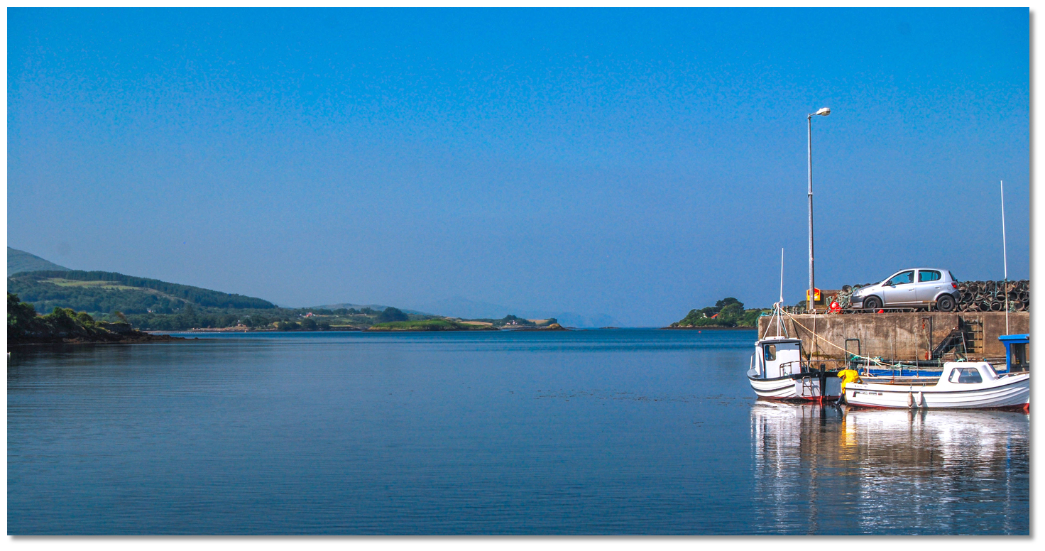
About 2 metres can be found on the outside berth of the new quay that is well supplied with good ladders and mooring points. The pier is used by Dunbeacon’s fishing fleet so it is best to check with the local boatmen if a berth can be accommodated and the depths that may be expected.
 The fishing quay above at Sea Lodge
Image: Michael Harpur
It would only be considered for a high water shopping trip and the best landing via a tender is on the slip at the pier’s eastern end.
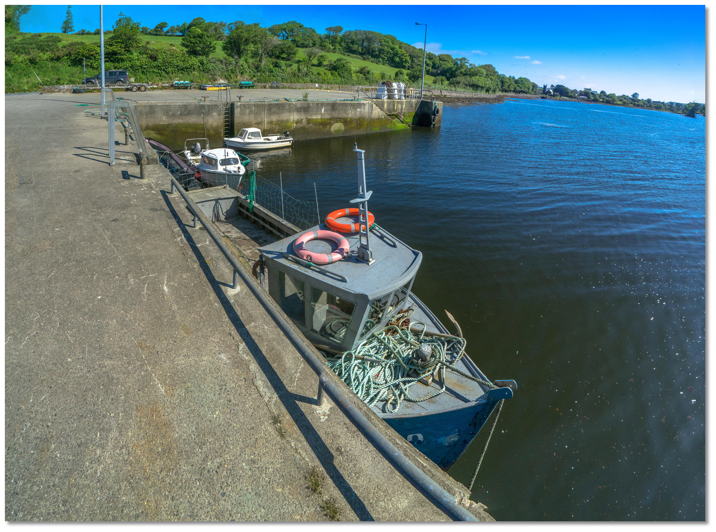 A berth may be possible at the east end of the pier
Image: Michael Harpur
The pier on the north side of the bay is derelict but usable for landings. It has a bench overlooking the anchorage. There are also plenty of gravel landing beaches to come ashore nearby.
Why visit here?
Dunbeacon, derived from the Irish 'Dún Béacáin' meaning 'fort of Béacáin'. Situated at the head of the inlet that is located between the peninsulas of Sheep's Head and Mizen Head, it is an area steeped in history.Monuments at Coolcoulagha and at Dunmanus date back to the Neolithic period, 3500–1500 BC, indicating that a significant pre-Celtic population resided here. Centuries later, around 500 BC, the Celts started arriving and began the slow process of overlaying their language and culture on the local population. The 'Annals of Innisfallen' state that St Ciarán, of Cape Clear, came back to his native place from Rome in 402 A.D. to introduce Christianity to the southwest. The new religion became firmly established and intermingled with old practices.
 Coolnalong Castle on Rossmore Point
Image: Mike Searle via CC BY SA 2.0
In the 6th and 7th centuries the family, now known, as the O'Mahonys from the 'Eoghanach' in North Munster arrived in the area. By the 8th-century they were well settled in the Sheep’s Head peninsula or 'Muintir Bháire' as is its ancient name - meaning 'the people of 'Bháire''. The McCarthys and O'Donovans arrived in the 12th-century also from The 'Eoghanach'. They secured lands belonging to the O'Mahonys but remained on good terms with them. By 1190 the Normans, known as the 'grey foreigners', had reached as far west as Durrus but were repulsed by the 'Desmumu' as the people of south Munster were then known.
 Coolnalong Castle ruin
Image: Mike Searle via CC BY SA 2.0
From this time onwards the herring fishery became very well established in the southwest. As noted in the Dunmanus Harbour
entry, a tribute was paid by the English and Iberian fleets to the O'Mahony, O'Driscoll and McCarthy families. This conferred on them the right to fish and set up salting bases ashore. The associated prosperity gave rise to a significant building of 15th-century religious and tower houses that are a reoccurring theme of this area. 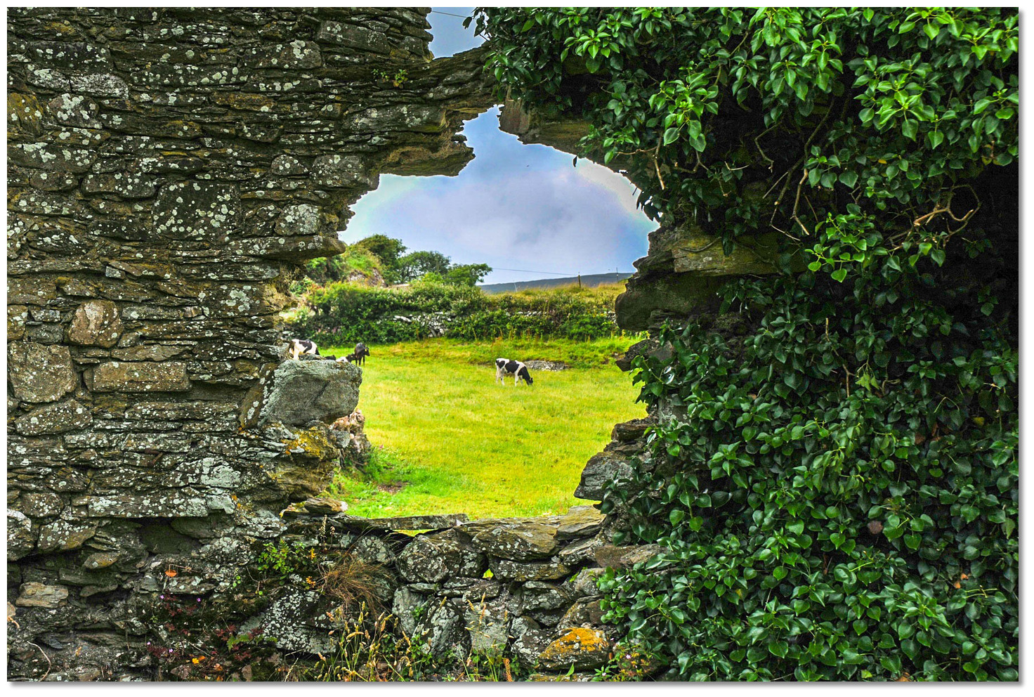 View through the window of the ruin of Coolnalong Castle
Image: Joachim S. Müller via CC BY-SA 2.0
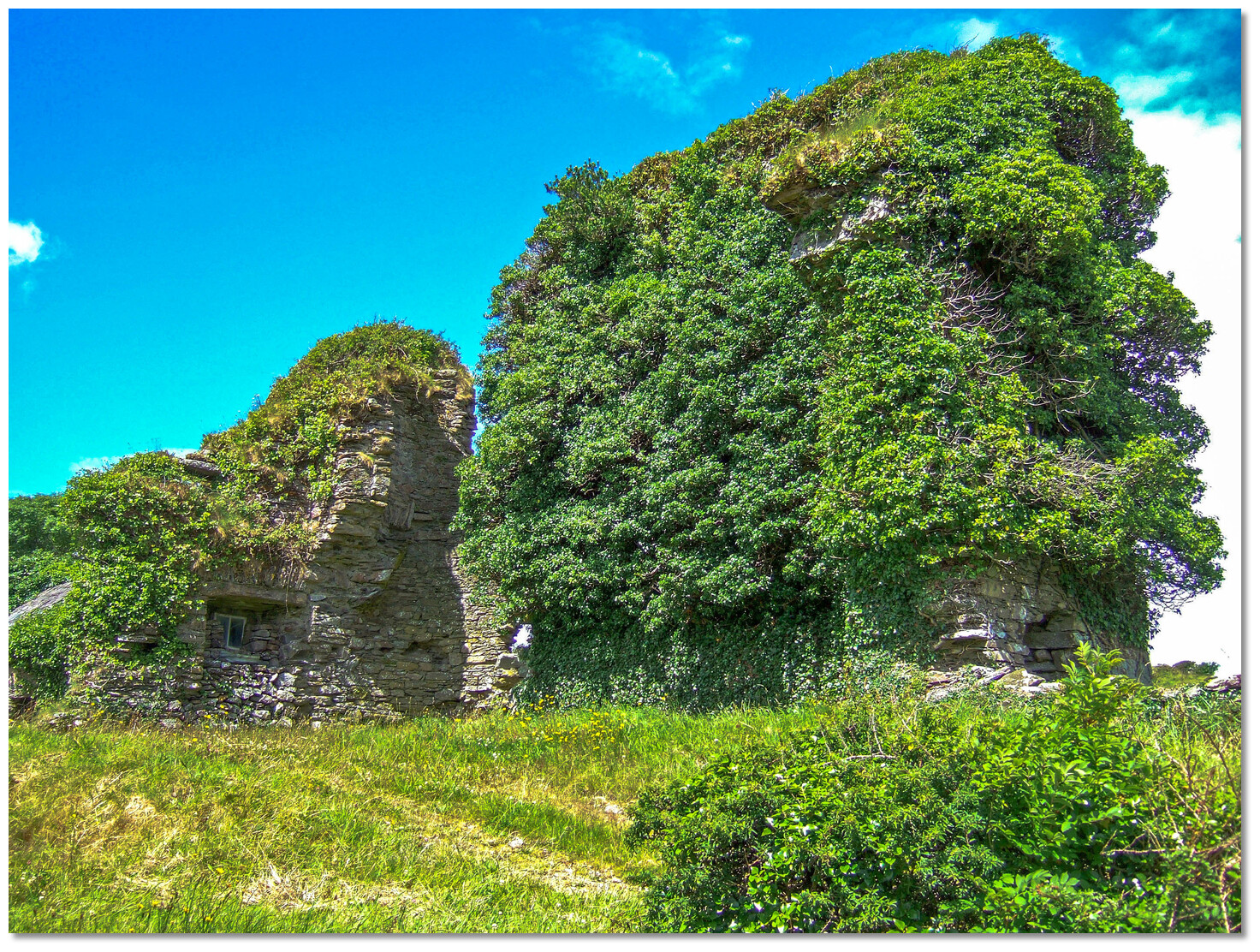
The fragmentary remains of one of these tower houses can still be seen just above the anchorage on Rossmore Point - derived from the Irish ros mór, 'big headland'. Now incorrectly known as Rossmore Castle, it has recently been correctly identified as Coolnalong Castle, from 'Cul na long, 'hill back of the ship'. This tower house had unhindered views over the lagoon-like outer harbour and the calm waters of Dunmanus Bay and would in its day have served as guardian over all it surveyed. The stronghold is believed to have originated as a possession of the O'Mahonys and to have later been occupied by the Muclagh sept, a sub sept of the McCarthy Reaghs, whose lands consisted of Caheragh, Kilcocomoge, Durrus, Colomane, Dromore and Letterlickey.
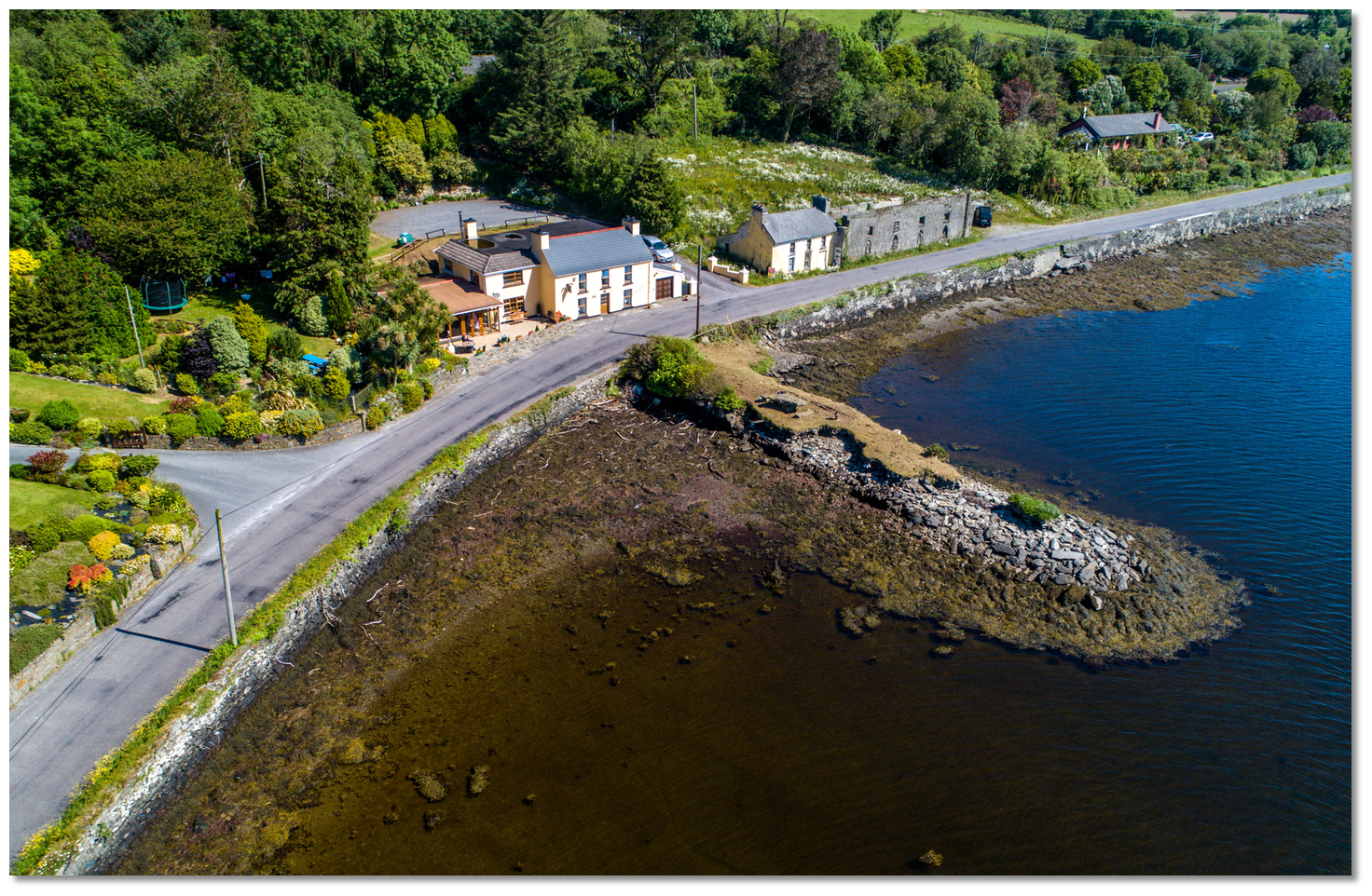
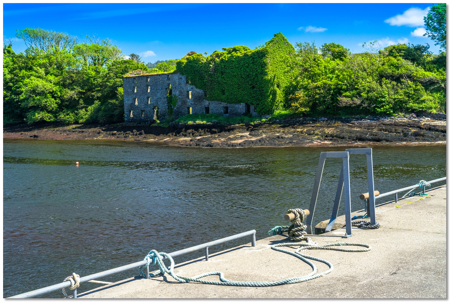 The Granary opposite Durris Pier dates back to the 1770s
Image: Michael Harpur
After the 'Flight Of the Earls', William Hull, the Vice President of Munster, and part-time pirate (see Croagh Bay
), established pilchard palaces at Dunmanus and Dunbeacon and had fleets of seine boats working the bay. One of the fish palaces is believed to have existed on Mannions Island. A survey of the area in 1810, by Townsend, noted its pilchard fishing was still in existence at that time and stated that the peasants of this area used milk and fish to put a 'taste' on potato which was the staple food of the time. Image: Michael Harpur
The ruin opposite Durris Pier dates to the 1770s when it was first built as a granary. The complex continued to be in use up to the beginning of the 19th-century as the crop was extensively cultivated in the area due to high demand, largley due to the Napoleonic Wars. It was in its time served by a small jetty navigable by small boats. After the Battle of Waterloo in 1815 it finally closed. It is believed to have been used as an auxiliary workhouse for girls during the famine. Records show that in 1850 a number of young girls, were sent to an auxiliary workhouse at 'Four-mile-water' (Durrus) and it is very likely, though not certain, that the granary was used for this purpose at the time.
 Lobster pots on Durris Pier today
Image: Michael Harpur
After the famine, and up to the turn of the 20th century, a mackerel fishing industry thrived in the bay. Boats and nets for fishing were made locally as well as lobster pots. This continued to be a local mainstay either by people directly involved in fishing, usually 'small' farmers who fished part-time or in supporting activities of making and mending nets, salting and transportation of the catch.
 Mussel farms abreast of the anchorage in the south side of the bay
Image: Burke Corbett
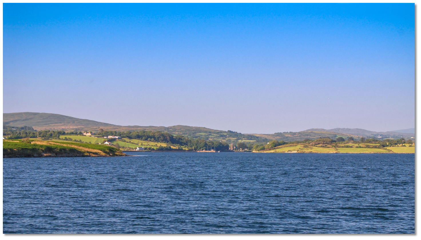
Today the still waters of Dunbeacon Harbour continues its mariculture legacy in its central mussel farm. The area is very remote and secluded but a brisk mile’s walk from the pier leads to the charming village of Durrus that lies at the head of the harbour. Durrus, in Irish Dúras, was formerly also known as 'Four Mile Water' after the nearby river, has almost all you would ever want and several more things you never realised you needed.
 Dunamanus Bay as seen from below Durris Pier
Image: Burke Corbett
Dunbeacon Harbour is a safe location to leave a boat and access the 'The Sheep’s Head Way' walking route. The route extends eastwards out along the narrow and high peninsula that provides glorious views over Dunmanus Bay and the Atlantic Ocean. The walkway offers linear walks and loop walks of varying distance and difficulty and maps and details can be found in Durrus.
 The ruin of the pier overlooking the harbour from the north shore
Image: Michael Harpur
Those looking for a shorter outing could venture out to the stone circle on the slopes of Mount Corrin. This Neolithic monument overlooks the harbour from its southern shore. It is situated at an elevated position high above Dunmanus Bay within a small dell where it can be just glimpsed through a fold in the hills to the west. The stone circle seems to have consisted of 11 original stones, six of which are still standing, albeit some at odd angles, and the remainder toppled. At its centre is a slab-like stone. Overall, it is an impressive monument that is well worth the walk as it does to continue upward to the top of Mount Corrin. The summit provides fabulous vistas that, on a clear day, reach out over Durrus, Dunmanus Bay and Sheep's Head, with glimpses of Bantry Bay across to the Beara and Kerry to the west and north, and Roaringwater Bay to the south. Mount Gabriel, the islands of Roaringwater, with Kilcoe Castle and the Fastnet Rock also been visible to the south.
Harbour
Image: Burke Corbett
From a boating point of view, this well-protected harbour offers plenty of safe anchoring, and there is ample to interest those who are prepared to stride out and embrace this wonderful windswept and ancient coastline.
What facilities are available?
At Durrus village there is a post office, grocery store, a hardware store, pubs, restaurants, cafes plus fuel by jerry cans and gas refills. The quay and slip is approximately 1.6 km or 1 mile to the west of the village. Further facilities can be found at Bantry, just six miles (9.7 km) from Durrus.With thanks to:
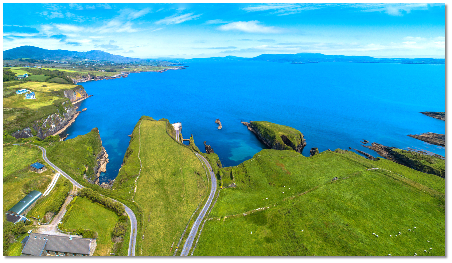
Burke Corbett, Gusserane, New Ross, Co. Wexford.Aerial Overview of Dunmanus Bay
About Dunbeacon Harbour
Dunbeacon, derived from the Irish 'Dún Béacáin' meaning 'fort of Béacáin'. Situated at the head of the inlet that is located between the peninsulas of Sheep's Head and Mizen Head, it is an area steeped in history.
Monuments at Coolcoulagha and at Dunmanus date back to the Neolithic period, 3500–1500 BC, indicating that a significant pre-Celtic population resided here. Centuries later, around 500 BC, the Celts started arriving and began the slow process of overlaying their language and culture on the local population. The 'Annals of Innisfallen' state that St Ciarán, of Cape Clear, came back to his native place from Rome in 402 A.D. to introduce Christianity to the southwest. The new religion became firmly established and intermingled with old practices.
Coolnalong Castle on Rossmore PointImage: Mike Searle via CC BY SA 2.0
In the 6th and 7th centuries the family, now known, as the O'Mahonys from the 'Eoghanach' in North Munster arrived in the area. By the 8th-century they were well settled in the Sheep’s Head peninsula or 'Muintir Bháire' as is its ancient name - meaning 'the people of 'Bháire''. The McCarthys and O'Donovans arrived in the 12th-century also from The 'Eoghanach'. They secured lands belonging to the O'Mahonys but remained on good terms with them. By 1190 the Normans, known as the 'grey foreigners', had reached as far west as Durrus but were repulsed by the 'Desmumu' as the people of south Munster were then known.
Coolnalong Castle ruinImage: Mike Searle via CC BY SA 2.0
From this time onwards the herring fishery became very well established in the southwest. As noted in the Dunmanus Harbour
entry, a tribute was paid by the English and Iberian fleets to the O'Mahony, O'Driscoll and McCarthy families. This conferred on them the right to fish and set up salting bases ashore. The associated prosperity gave rise to a significant building of 15th-century religious and tower houses that are a reoccurring theme of this area. View through the window of the ruin of Coolnalong CastleImage: Joachim S. Müller via CC BY-SA 2.0
The fragmentary remains of one of these tower houses can still be seen just above the anchorage on Rossmore Point - derived from the Irish ros mór, 'big headland'. Now incorrectly known as Rossmore Castle, it has recently been correctly identified as Coolnalong Castle, from 'Cul na long, 'hill back of the ship'. This tower house had unhindered views over the lagoon-like outer harbour and the calm waters of Dunmanus Bay and would in its day have served as guardian over all it surveyed. The stronghold is believed to have originated as a possession of the O'Mahonys and to have later been occupied by the Muclagh sept, a sub sept of the McCarthy Reaghs, whose lands consisted of Caheragh, Kilcocomoge, Durrus, Colomane, Dromore and Letterlickey.
The Granary opposite Durris Pier dates back to the 1770sImage: Michael Harpur
After the 'Flight Of the Earls', William Hull, the Vice President of Munster, and part-time pirate (see Croagh Bay
), established pilchard palaces at Dunmanus and Dunbeacon and had fleets of seine boats working the bay. One of the fish palaces is believed to have existed on Mannions Island. A survey of the area in 1810, by Townsend, noted its pilchard fishing was still in existence at that time and stated that the peasants of this area used milk and fish to put a 'taste' on potato which was the staple food of the time. Image: Michael Harpur
The ruin opposite Durris Pier dates to the 1770s when it was first built as a granary. The complex continued to be in use up to the beginning of the 19th-century as the crop was extensively cultivated in the area due to high demand, largley due to the Napoleonic Wars. It was in its time served by a small jetty navigable by small boats. After the Battle of Waterloo in 1815 it finally closed. It is believed to have been used as an auxiliary workhouse for girls during the famine. Records show that in 1850 a number of young girls, were sent to an auxiliary workhouse at 'Four-mile-water' (Durrus) and it is very likely, though not certain, that the granary was used for this purpose at the time.
Lobster pots on Durris Pier todayImage: Michael Harpur
After the famine, and up to the turn of the 20th century, a mackerel fishing industry thrived in the bay. Boats and nets for fishing were made locally as well as lobster pots. This continued to be a local mainstay either by people directly involved in fishing, usually 'small' farmers who fished part-time or in supporting activities of making and mending nets, salting and transportation of the catch.
Mussel farms abreast of the anchorage in the south side of the bayImage: Burke Corbett
Today the still waters of Dunbeacon Harbour continues its mariculture legacy in its central mussel farm. The area is very remote and secluded but a brisk mile’s walk from the pier leads to the charming village of Durrus that lies at the head of the harbour. Durrus, in Irish Dúras, was formerly also known as 'Four Mile Water' after the nearby river, has almost all you would ever want and several more things you never realised you needed.
Dunamanus Bay as seen from below Durris PierImage: Burke Corbett
Dunbeacon Harbour is a safe location to leave a boat and access the 'The Sheep’s Head Way' walking route. The route extends eastwards out along the narrow and high peninsula that provides glorious views over Dunmanus Bay and the Atlantic Ocean. The walkway offers linear walks and loop walks of varying distance and difficulty and maps and details can be found in Durrus.
The ruin of the pier overlooking the harbour from the north shoreImage: Michael Harpur
Those looking for a shorter outing could venture out to the stone circle on the slopes of Mount Corrin. This Neolithic monument overlooks the harbour from its southern shore. It is situated at an elevated position high above Dunmanus Bay within a small dell where it can be just glimpsed through a fold in the hills to the west. The stone circle seems to have consisted of 11 original stones, six of which are still standing, albeit some at odd angles, and the remainder toppled. At its centre is a slab-like stone. Overall, it is an impressive monument that is well worth the walk as it does to continue upward to the top of Mount Corrin. The summit provides fabulous vistas that, on a clear day, reach out over Durrus, Dunmanus Bay and Sheep's Head, with glimpses of Bantry Bay across to the Beara and Kerry to the west and north, and Roaringwater Bay to the south. Mount Gabriel, the islands of Roaringwater, with Kilcoe Castle and the Fastnet Rock also been visible to the south.
Harbour
Image: Burke Corbett
From a boating point of view, this well-protected harbour offers plenty of safe anchoring, and there is ample to interest those who are prepared to stride out and embrace this wonderful windswept and ancient coastline.
Other options in this area
Click the 'Next' and 'Previous' buttons to progress through neighbouring havens in a coastal 'clockwise' or 'anti-clockwise' sequence. Alternatively here are the ten nearest havens available in picture view:
Coastal clockwise:
Kitchen Cove - 2 miles WSWKilcrohane Pier - 3.6 miles WSW
Dooneen Pier - 4.5 miles WSW
Ballynatra (Trá Ruaim) Cove - 5.2 miles WSW
Bantry Harbour - 3.2 miles NE
Coastal anti-clockwise:
Dunbeacon Cove - 1.2 miles SWDunmanus Harbour - 3.7 miles SW
Crookhaven - 6.7 miles SW
Goleen - 5.7 miles SW
Carrigmore Bay - 4.5 miles SSW
Navigational pictures
These additional images feature in the 'How to get in' section of our detailed view for Dunbeacon Harbour.


| Detail view | Off |
| Picture view | On |
Aerial Overview of Dunmanus Bay
Add your review or comment:
Please log in to leave a review of this haven.
Please note eOceanic makes no guarantee of the validity of this information, we have not visited this haven and do not have first-hand experience to qualify the data. Although the contributors are vetted by peer review as practised authorities, they are in no way, whatsoever, responsible for the accuracy of their contributions. It is essential that you thoroughly check the accuracy and suitability for your vessel of any waypoints offered in any context plus the precision of your GPS. Any data provided on this page is entirely used at your own risk and you must read our legal page if you view data on this site. Free to use sea charts courtesy of Navionics.