

Landlocked and several miles inland, the anchorage offers complete protection from all conditions. A vessel could be left unattended here all year, but when staying aboard it can get a little uncomfortable in a strong northwesterly. In these circumstances, better protection can be had by moving a short distance and re-anchoring off the north mainland shore. Safe access is assured in all reasonable conditions by Cork Harbour, one of the most easily approached, well-marked and safest natural harbours in the world.


Keyfacts for Northeast of Great Island
Nature


Considerations


Protected sectors


Summary
A completely protected location with safe access.Nature
Considerations
 +353 21 4273125
 info@portofcork.ie
 Ch.12, 14, 16
Position and approaches

Haven position
 51° 52.777' N, 008° 12.170' W
This is the position that provides the best protection from prevailing winds.
What is the initial fix?
 51° 46.580' N, 008° 15.460' W


What are the key points of the approach?
 . Details for vessels approaching from the southwest are available in southwestern Ireland’s Coastal Overview for Cork Harbour to Mizen Head . The run-up to the East Channel is best described in the East Ferry Marina
  entry, with Aghada about two miles from the Westgate terminal.
Not what you need?
- East Ferry Marina - 0.9 nautical miles SSW
- Aghada - 2 nautical miles S
- Cuskinny - 2.8 nautical miles WSW
- Cobh - 4 nautical miles WSW
- Spike Island - 4.1 nautical miles SW
- White Bay - 4.9 nautical miles SSW
- Glenbrook - 4.9 nautical miles WSW
- Cork Harbour Marina - 5.2 nautical miles WSW
- Crosshaven - 5.7 nautical miles SW
- Drake’s Pool - 6.6 nautical miles SW
- East Ferry Marina - 0.9 miles SSW
- Aghada - 2 miles S
- Cuskinny - 2.8 miles WSW
- Cobh - 4 miles WSW
- Spike Island - 4.1 miles SW
- White Bay - 4.9 miles SSW
- Glenbrook - 4.9 miles WSW
- Cork Harbour Marina - 5.2 miles WSW
- Crosshaven - 5.7 miles SW
- Drake’s Pool - 6.6 miles SW

Chart

What's the story here?
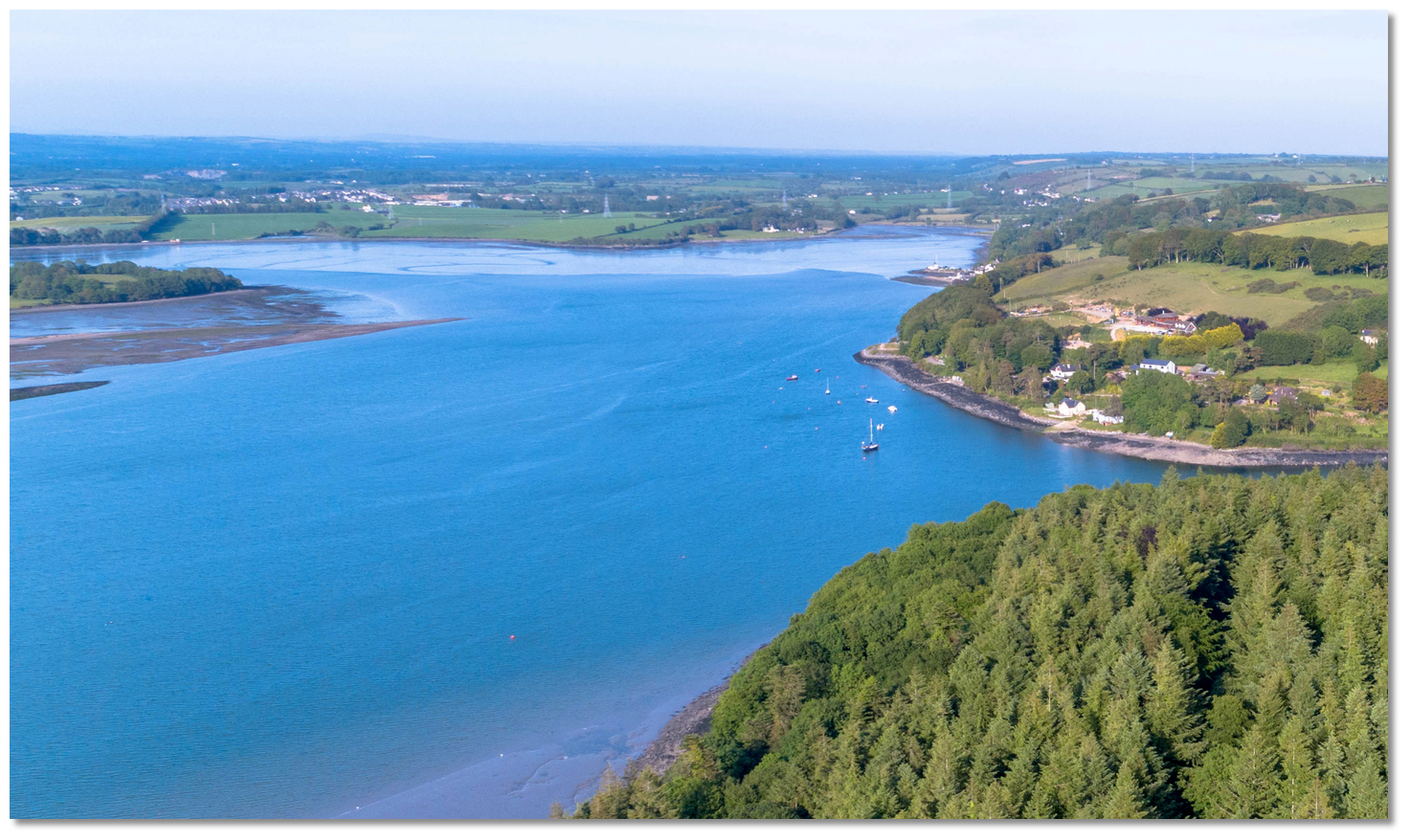 Northeast Great Island anchorage
Image: Michael Harpur
Great Island lies in Cork Harbour, just outside Cork City at the mouth of the River Lee. The island divides the harbour into Lower and Upper Harbours and is home to the town of Cobh. The anchorage is in a rural setting between Great Island and the mainland to the north, which is accessed via the East Passage.
An anchorage can be obtained virtually anywhere in the deepwater area outside the north end of the East Passage. Depths of 3 to 8 metres will be found here close to the shore, with excellent mud holding. The typical location is clear of the moorings that lie off Rathcoursey West on the eastern mainland side. Boats that can take to the bottom will also be able to come in and dry on the shoreline.
How to get in?
 East Passage between Great Island and the mainland
Image: Michael Harpur
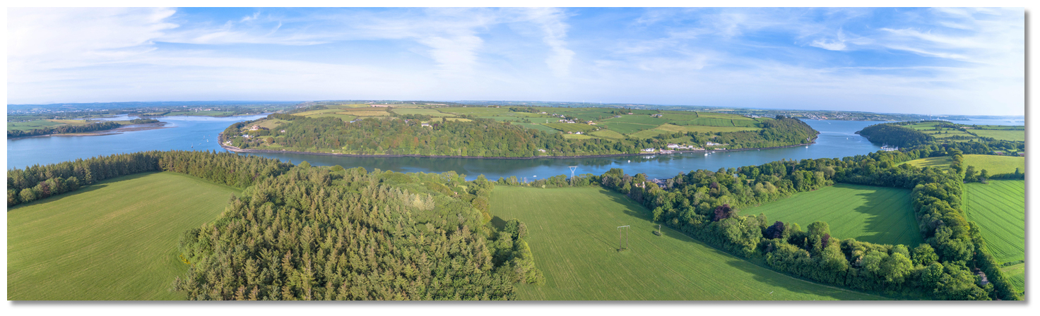
 Use Ireland’s coastal overviews Rosslare Harbour to Cork Harbour or Cork Harbour to Mizen Head as appropriate for seaward approaches. Directions for entry and run-up through Cork Harbour are provided in the Cork City Marina and East Ferry Marina entries. The anchorage is reached by continuing a mile beyond the marina to the head of the East Passage, which lies between Great Island and the mainland.
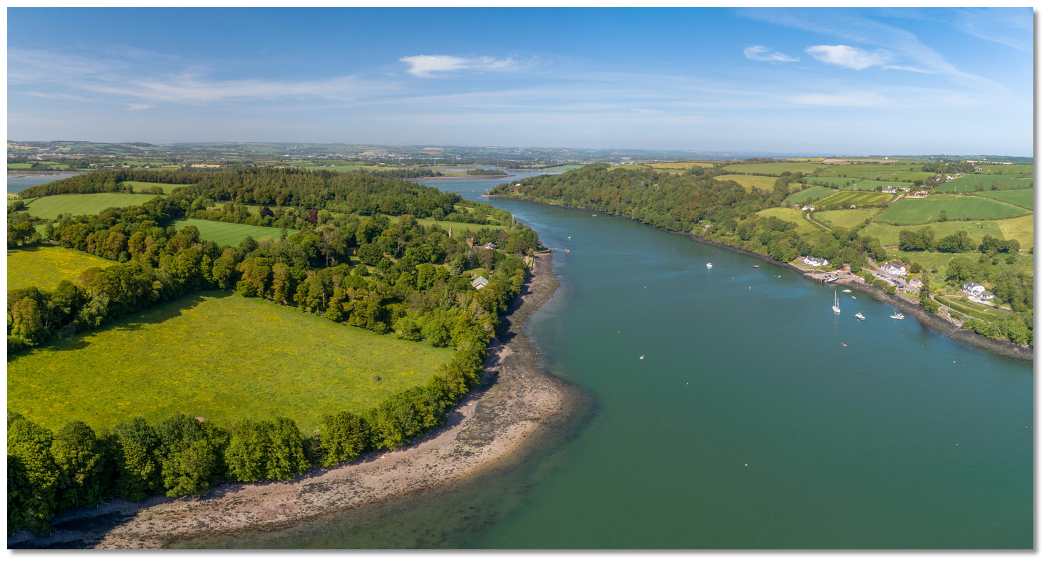 East Passage to the north of East Ferry Marina
Image: Michael Harpur
From East Ferry Marina the East Channel continues north with pleasant wooded shorelines, each fringed by many moorings.
 East Passage as seen from Great Island
Image: Michael Harpur
The old quay and wooden pier on the eastern side of East Passage can be used by leisure vessels. It was used by the discontinued ferry service but can take a yacht alongside; check for depths with locals. It also makes an alternative landing place.
 The old ferry pier on the eastern side of East Passage
Image: Michael Harpur
A jetty fronting the stately Belgrove House on the west side will be seen about ½ mile beyond the marina. Two towers – Trafalgar Tower alongside the house and Waterloo Tower set behind on the side of Bagwell Hill, both marked on the Admiralty 1773 – will also be seen.
 Private Jetty fronting Belgrove House
Image: Michael Harpur
Immediately beyond Belgrove House a power cable spans the East Passage. This is very high, and with a safe overhead clearance of 24 metres HAT, it presents no issue to most leisure craft. A further ½ mile takes a vessel out the north end of the East Passage.
 Power cable spanning East Passage beyond Belgrove House
Image: Michael Harpur
The suggested anchoring area, frequently used by local boats, is just off the northeast corner of Great Island as it provides deepwater protection from the prevailing winds. However, an anchorage can be obtained virtually anywhere in the deepwater area outside the north end of the East Passage.  The anchoring area to the north of the East Passage
Image: Michael Harpur
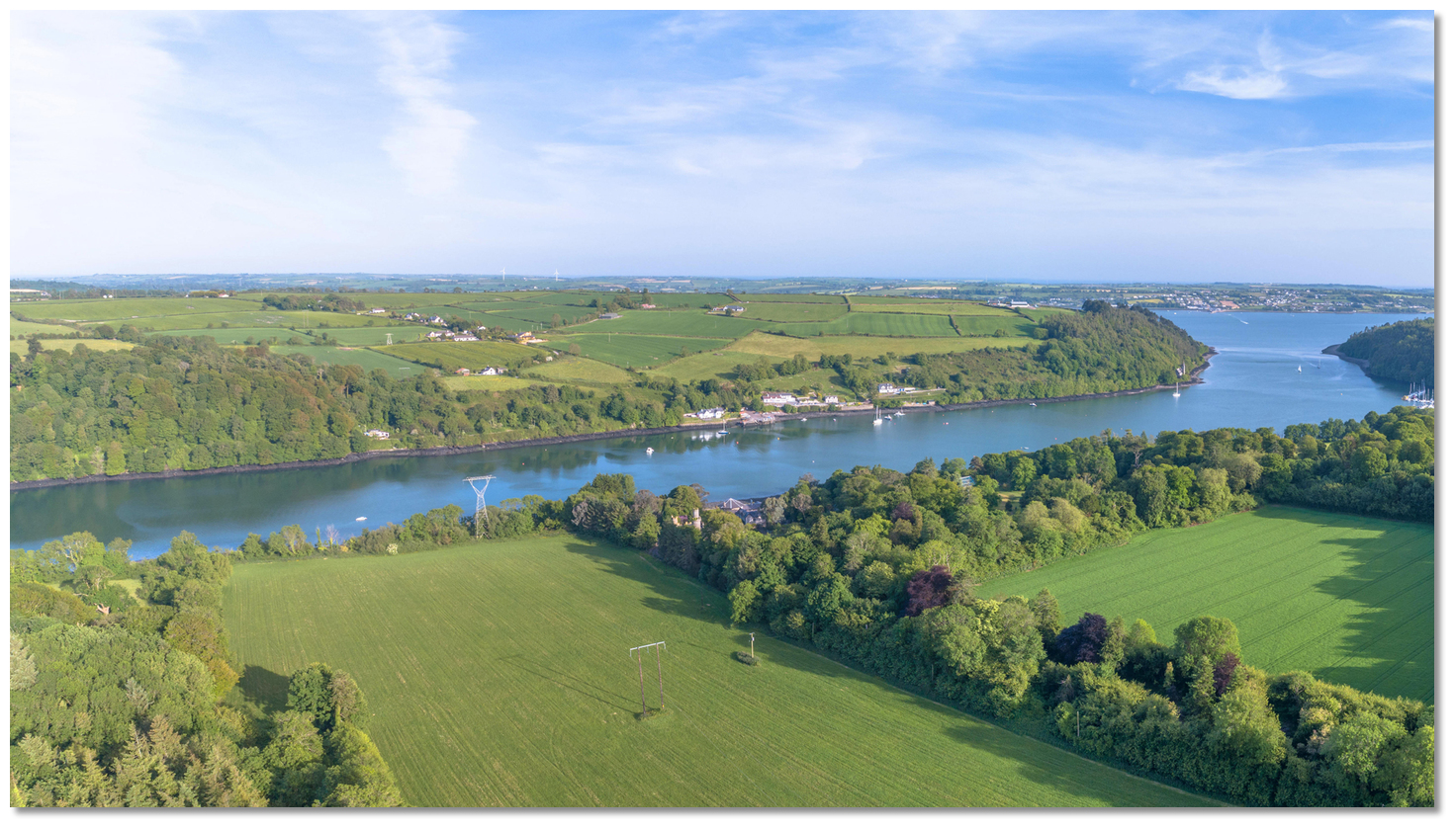
In northerly conditions, the holding will be found to be very good to the southwest of Ahenesk House on the mainland shore. However, as can be seen on Admiralty chart 1773, move east or west from this deepwater area and what appears to be a large expanse of water at high tide quickly turns into shallows or drying areas on a low tide. Vessels that can take to the bottom will have a wide range of options along the shoreline here.
 The expanse of water north of Great Island extending westwards towards
 Rossmore Point and beyond
Image: Michael Harpur
Local knowledge, as commented below, suggest that you should go no further west than the mooring buoys of local boats and the longitude of 008° 12.400’ W. The area beyond is foul, with uncharted and unmarked old aquaculture gear that is revealed only at low water.
 Yacht on the hard, south of Rossmore Point
Image: Michael Harpur
This tendency to dry to mud is the single issue with this anchoring location. All immediate landing areas dry, with Rathcoursey drying to 2.4 metres LAT. East Ferry Pier (½ mile back down the East Passage, on the east side of the channel) or East Ferry Marina (a further a ½ mile on the west side) are available at all stages of the tide. With the tides in the East Passage, these options will require a tender equipped with a stalwart outboard.
Why visit here?
The name Great Island is a shortening of the Irish Oileán Móran Barraigh, meaning 'Great Island of the Barrys'. Prior to this, the island was called Oilean Ard na Neimheadh or Ard-Neimheadh, meaning the 'High [as in status] Island of Neimheadh'. This was in deference to the legendary leader Neimheadh, who invaded Ireland in ancient times, and it is one of the first places mentioned in Irish history whose locality can be fixed with precision.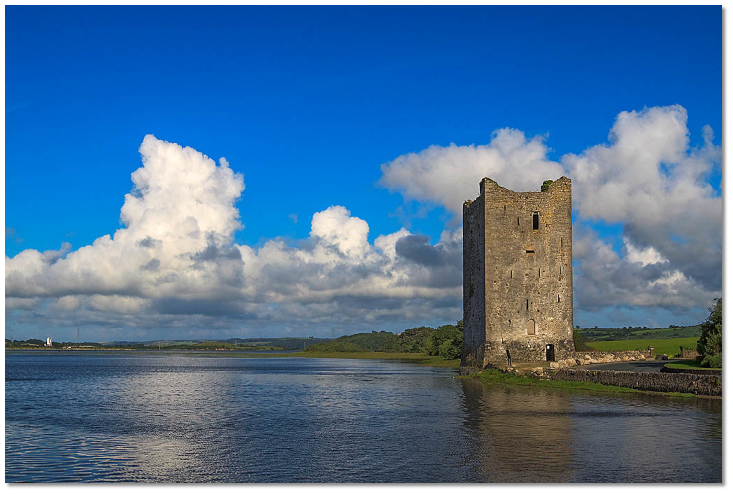 Hodnett Castle defending the approaches to Great Island
Image: Mike Searle via CC BY SA 2.0
In 1329 it was taken by the Anglo-Norman Hodnett family and became the property of Lord Philip Hodnett, who resided at Clonmel. The Hodnetts built several structures, including Belvelly Castle, to defend the island and its approaches. But the Barry (de Barra) and Roche families besieged Lord Hodnett in Clonmel and had all his adherents put to death. The island and its defences were then taken by the Barry family, who retained power in the area for several centuries and gave it the name Oileán Móran Barraigh.
 Belgrove House, with Trafalgar and Waterloo Towers,
 as seen from the East Passage
Image: John M via CC BY-NC 2.0
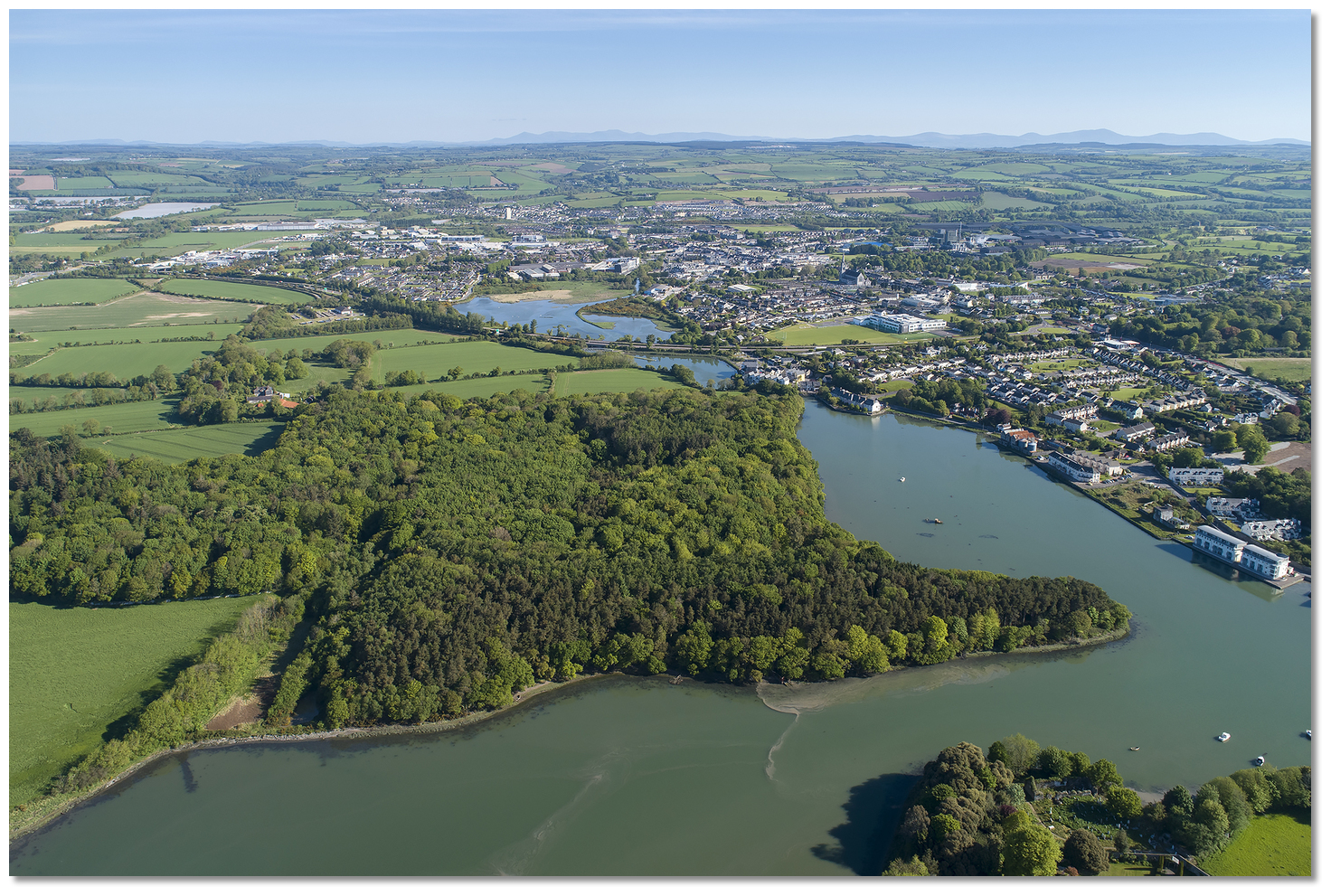 Ballynacorra, right, with Midleton above
Image: John Finn
At the time, Ballynacorra (in Irish Baile na Cora, meaning 'town of the weir') served as the port for the town of Midleton, situated less than 2 km to the north of the quays. The small port closed in 1962 as it was deemed too expensive to dredge the growing levels of river silt at the entrance, and the channel is now extremely shallow. Today this presents an interesting opportunity for vessels anchored in this haven, as a visit to Midleton is not only useful for shopping but provides for a very interesting day out.
 Whiskey maturing in wooden barrels
Image: Image by AJACS from Pixabay
Irish whiskey was one of the earliest distilled drinks in Europe, arising around the 12th century. It is believed that Irish monks brought the technique of distilling perfumes back to Ireland from their travels to the Mediterranean countries around AD 1000. This process was then modified to obtain a drinkable spirit. The Irish monks gave the drink the name 'whiskey' in the early Middle Ages, which is an anglicisation of the Irish phrase Uisce beatha. This means 'the water of life' and is a direct translation of the Latin aqua vitae. The oldest known written record of whiskey comes from Irish in the 1405 Annals of Clonmacnoise, where it was recorded that the head of a clan died after “taking a surfeit of aqua vitae” at Christmas. The mispronunciation of the word Uisce returned to influence the modern Irish word for whiskey, fuisce.
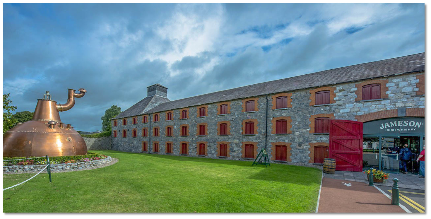
 The Midleton Distillery is home to the world-famous Jameson Irish whiskey
Image: CC0
Anyone who is 'fond of a drop' will find a visit to Midleton more than enlightening. Cork Distilleries, formed in 1825, merged into Irish Distillers in 1967 and, owned by French spirits group Pernod Ricard as of 2011, has its distilleries here. It produces Paddy Whiskey (taking its name from Patrick J Flaherty, a salesman for Cork Distilleries in the 1920s), as well as the world-famous Jameson whiskey. Alongside these, they distil other branded vodka and gin products at the new Midleton distillery complex, opened in 1975.
 Copper dome pot still, the largest ever built, once operated at the Midleton distillery
Image: CC0
The Old Midleton Distillery hosts frequent 'Jameson Experience' tours throughout the day, which show how whiskey was made in the past. The old stone building has many examples of 19th-century industrial architecture, including an impressive fully functional waterwheel. The site also boasts the world’s largest pot still, a copper dome with a capacity of 140,000 litres. An appeal is normally made for a 'whiskey taster' at the outset of the tours, so those who are interested should be ready to step forward. If you are not selected, a complimentary glass of Jameson's Irish whiskey is always made available at the end of the tour.
 Jameson's 19th-century industrial buildings
Image: CC0
In addition to these attractions, Midleton has excellent shopping and a very popular farmers' market on Saturdays at the old site of Midleton Mart, now called Market Green. So, a mixture of pleasure and purpose can be had here.
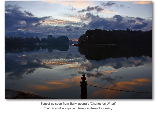
A tender or shallow draught vessel, or indeed vessels that can take to the hard, may stay over to visit this interesting town by riding a flood tide up the 2½ miles of river from this haven. This is very easily achieved as the southern end of the River Owenacurra (in Irish Abhainn na Cora, meaning 'River of the Weirs') is marked with occasional white buoys and the final lengths between the central path between pronounced winding banks. On final approach, the warehouses on the east bank at the old port of Ballynacorra will be seen, now converted into modern housing called the Charleston Wharf. A vessel can come alongside a slip just past these, close to the quays. A short walk beyond this is Midleton. If tide times are inconvenient, Midleton is likewise only a 7km bicycle ride from the East Ferry pier.
 The anchorage as seen from the north shore
Image: Michael Day via CC BY 2.0
From a boating perspective, this is a wonderful sequestered and landlocked anchorage where one can comfortably ride out a bad weather spell and have access to plenty to explore in Cobh, or indeed Midleton.
What facilities are available?
There are no facilities in this secluded rural setting. However 2½ miles upriver on a rising tide, or 7km by road from the East Ferry pier, you will find excellent shopping in the important town of Midleton. Catering for a rural population of 26,500, it has a choice of supermarkets and a host of other shops. There is a popular farmers' market on Market Green on Saturdays. For everything else there are bus connections to Cork or other berthing destinations, such as Crosshaven, where a concentration of boat services and facilities may be had.Any security concerns?
Never an issue known to have occurred to a vessel anchored off the northeast corner of Great Island.With thanks to:
Eddie English, Yachtmaster Instructor/Examiner Dinghy & Powerboat Trainer at sailcork.com.


Add your review or comment:
Rodolphe Thimonier wrote this review on Jun 16th 2016:
Nice anchorage with good holding in mud/silt and subject to tidal currents. Yet I dont recommend going farther west than the mooring buoys of local boats and the longitude of 8 12.4W as there is old uncharted and unmarked aquaculture gear that is only revealed at low water.
Average Rating:

Michael Harpur wrote this review on May 4th 2018:
Noted, thank you!
Average Rating: UnratedPlease log in to leave a review of this haven.
Please note eOceanic makes no guarantee of the validity of this information, we have not visited this haven and do not have first-hand experience to qualify the data. Although the contributors are vetted by peer review as practised authorities, they are in no way, whatsoever, responsible for the accuracy of their contributions. It is essential that you thoroughly check the accuracy and suitability for your vessel of any waypoints offered in any context plus the precision of your GPS. Any data provided on this page is entirely used at your own risk and you must read our legal page if you view data on this site. Free to use sea charts courtesy of Navionics.