

This is a good anchorage from anything south round to southwest. Depending upon the vessel’s draught, a berth alongside the fishing pier may offer protection from all quadrants except northwesterlies, which create a chop inside. In these circumstances it is best to head across the bay to Dungarvan. Access is straightforward at any state of the tide night or day, but the bay should be avoided entirely during easterlies.

Keyfacts for Helvick
Facilities


Nature


Considerations

Protected sectors

Approaches

Shelter
Last modified
November 12th 2020 Summary* Restrictions apply
A good location with straightforward access.Facilities
Nature
Considerations
Position and approaches

Expand to new tab or fullscreen
Haven position
 52° 3.314' N, 007° 32.763' W
At the head of Helvick Harbour’s pier, where the west-facing entrance will be found.
What is the initial fix?
The following Helvick initial fix will set up a final approach:
 52° 3.530' N, 007° 31.860' W


What are the key points of the approach?
Offshore details are available in southeastern Ireland’s coastal overview for Rosslare Harbour to Cork Harbour  .
.
.- Clear approaches are available to the initial fix and then to the harbour south of the Helvick cardinal from the eastward quadrants.
- Helvick Head is steep to and clean beyond its visible extension rocks, and it may be rounded at a sensible distance by vessels approaching from the south and southwest.
- Dungarvan Bay is choked with sand, and vessels approaching from Dungarvan Harbour must exit the harbour channel, steer for the yellow outflow buoy and then the Helvick Buoy to make an approach.
Not what you need?
Click the 'Next' and 'Previous' buttons to progress through neighbouring havens in a coastal 'clockwise' or 'anti-clockwise' sequence. Below are the ten nearest havens to Helvick for your convenience.
Ten nearest havens by straight line charted distance and bearing:
- Ballynacourty (The Pool) - 2 nautical miles NNW
- Dungarvan Town Quay - 3.4 nautical miles NW
- Stradbally Cove - 4.9 nautical miles NE
- Ardmore Bay - 8.9 nautical miles SW
- Boatstrand Harbour - 10.3 nautical miles ENE
- Youghal - 12.6 nautical miles WSW
- Knockadoon Slip - 15.6 nautical miles SW
- Port of Waterford - 20.3 nautical miles NE
- Little Island - 21.2 nautical miles ENE
- Dunmore East - 21.3 nautical miles ENE
These havens are ordered by straight line charted distance and bearing, and can be reordered by compass direction or coastal sequence:
- Ballynacourty (The Pool) - 2 miles NNW
- Dungarvan Town Quay - 3.4 miles NW
- Stradbally Cove - 4.9 miles NE
- Ardmore Bay - 8.9 miles SW
- Boatstrand Harbour - 10.3 miles ENE
- Youghal - 12.6 miles WSW
- Knockadoon Slip - 15.6 miles SW
- Port of Waterford - 20.3 miles NE
- Little Island - 21.2 miles ENE
- Dunmore East - 21.3 miles ENE

Chart

What's the story here?
 Helvick Harbour
 Image: Michael Harpur
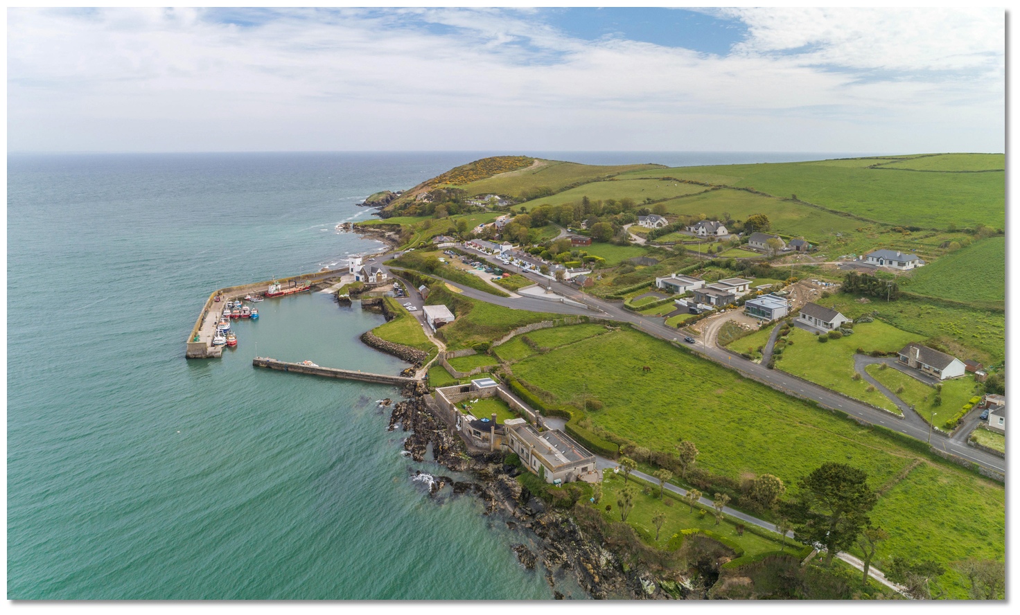
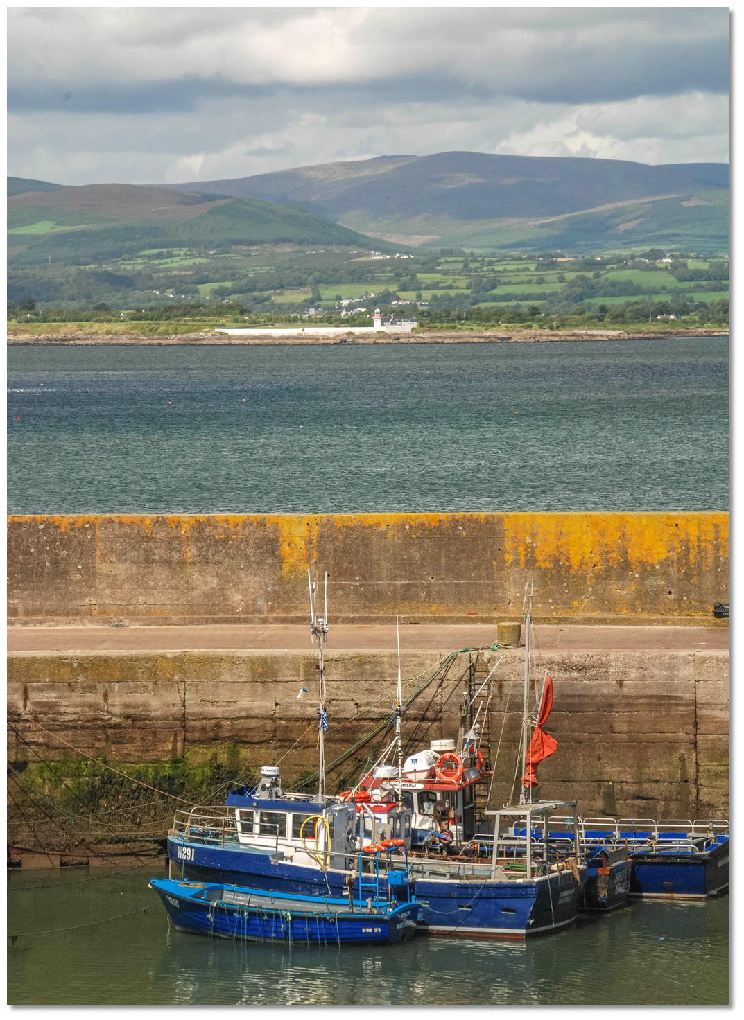
Helvick Pier is a small fishing harbour in the south part of Dungarvan Bay and on the north side of Helvick Head. The harbour is located ⅓ mile west of the extremity of the headland and consists of a curved L-shaped breakwater with a west-facing entrance. The west pier extends 90 metres to the entrance and the east breakwater 83 metres to seaward, continuing westward along the shore about 90 metres. An RNLI station is situated in the southeast corner of the harbour, with a small hamlet above and around it.
 Helvick Harbour as seen from within
Image: Michael Harpur
Yellow seasonal visitor moorings are set out close northwest of the harbour. Anchor adjacent to these in 2-3 metres with very good holding. This is a busy, working trawler harbour, but leisure vessels may berth alongside the inner side of the breakwater if unoccupied.
 Helvick Harbour's fishing boats alongside the wall
Image: John Morris via CC BY-SA 2.0
Shelter inside is excellent except in northwesterlies. Depths in the entrance are about 1.5 metres LAT, but the harbour is prone to silting and it is best to make enquires before coming alongside.
How to get in?
 Helvick Harbour situated to the north of Helvick Head
Image: Michael Harpur
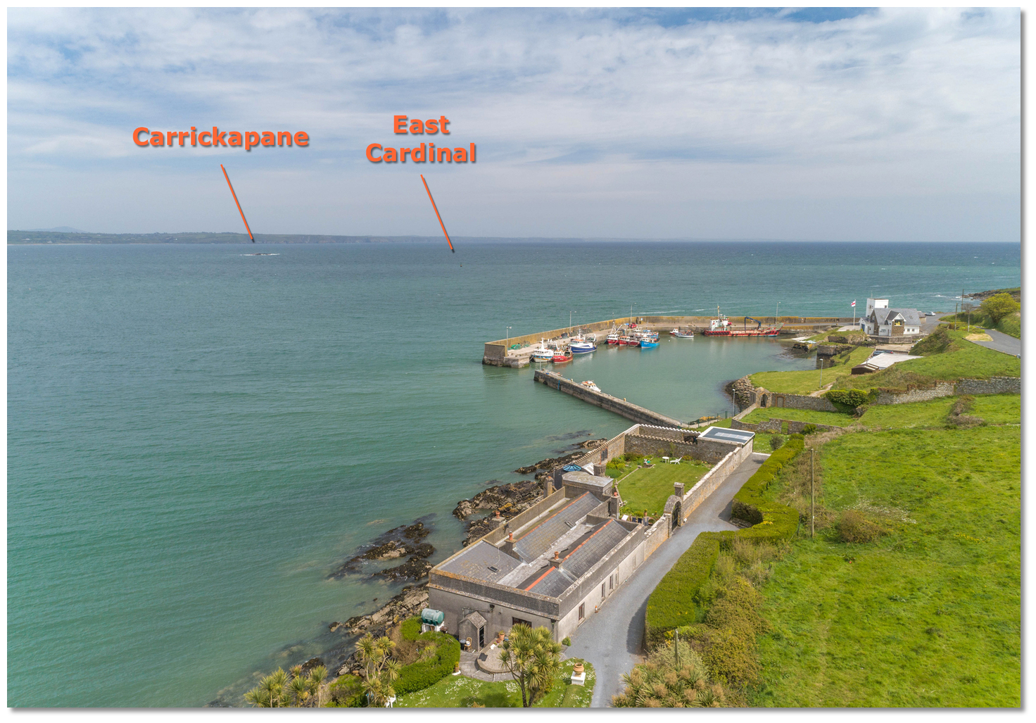
 Seaward approaches are available from southeastern Ireland’s coastal overview for Rosslare Harbour to Cork Harbour . Dungarvan Bay is entered between the high, bold promontory of Helvick Head on the south and Ballynacourty Point and its outlying rocks to the north, made conspicuous by the white tower of Ballynacourty Point Lighthouse. Vessels approaching from the east or northeast, noting the position of Carrickapane, will find no impediments to a direct approach to the initial fix.
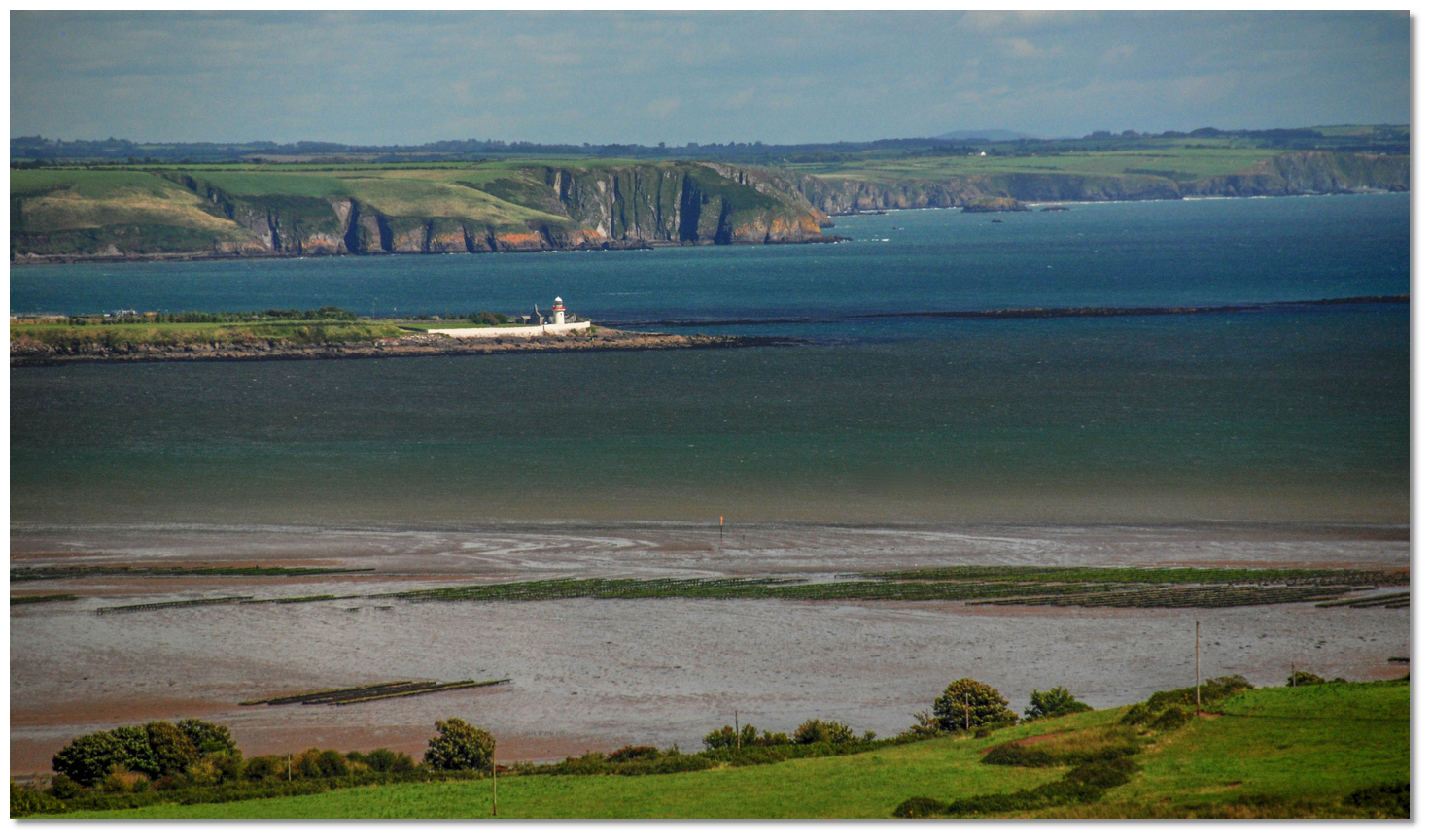 Ballynacourty Point Lighthouse standing opposite Helvick Head
Image: Michael Harpur
Ballynacourty Point Lighthouse - Fl (2) WRG 10s position: 52° 04.688’ N, 007° 33.182’ W
Viewed at high water, the bay presents a large expanse, of which the greater part uncovers to reveal the Whitehouse and Spit Banks, and the remainder is shallow. Carrickapane Rock sits central to the entrance of Dungarvan Bay, and being clearly visible at 2 metres high, it is better described as an islet, known locally as Black Rock.
 The prominent bluff of Helvick Head as seen from the northeast
Image: Michael Harpur
Helvick Head, situated on the southern side, is a 66-metre-high, steep-to bluff, close off which is an islet (14.9 metres high) and two conical rocks (6.4 metres high), which are steep-to. The old coastguard buildings on the northside of the head form a conspicuous row of cottages, with a structure resembling a tower at the eastern extremity.
 Vessels approaching from the southwest will find Helvick Head clean and steep-to on its east and north sides, with no dangers beyond the visible rocks that extend out from its head. Keep at least 400 metres off the head, or 200 metres off its outlying rocks, ideally rounding the headland along the 15-metre contour.
  The key marks southward at the exit to the Dungarvan Channel
Image: Burke Corbett
 Vessels approaching from Dungarvan must exit via the buoyed channel and from the Wyse Buoy, or when south of Ballynacourty Point lighthouse, steer for the Yellow Outflow Buoy.
  Carrickapane with the shadow of the covered Gainers showing as seen from the southwest
Image: Michael Harpur
The principal dangers to avoid when approaching from the north are Carrickapane; Helvick Rock, ½ mile south by southeast, which has 1.4 metres of water; and the Gainers, situated about ⅓ mile west-northwest of Helvick Rock. The Gainers is a rocky shoal that uncovers at low water.
 The outflow buoy and the Helvick buoy already in alignment
 on an approach from the channel
Image: Burke Corbett
Helvick – East cardinal Q (3) 10s, position: 52° 03.611’ N, 007° 32.251’ W
These are easily avoided by passing to the east of the Helvick east cardinal buoy, moored 400 metres to the east of the Helvick Rock: simply steer from the Yellow Outflow to Helvick’s east cardinal mark, located about a mile away, and directly track the line between them. This clears a sunken rocky ledge with 1.1-1.7 metres of cover, which extends 200 metres westward from Carrickapane. An alternate approach to avoid these outliers is to not let the eastern bearing on Ballynacourty Point lighthouse drift below 325° T. When the cardinal is rounded to seaward, it is safe to proceed directly to the harbour.
 Carrickapane and the Helvick buoy as seen from the south
Image: Michael Harpur
It is possible to cut corners here. There is pass with a least depth of 2.9 metres LAT east of the Gainers and west of the covered Helvick Rock. A spur from the Gainers that also has 1.4 metres over it needs to be circumvented. This is entirely feasible but requires some more careful pilotage and a sharper eye to the sounder. Tracking up/down a line N/S of the root of the eastern breakwater charts this possibility, but the above outer route is by far the easier and safer option for those not familiar with the area
 From this initial fix, come in directly to the harbour on a bearing of 250° T, standing off the inner headland at least 200 metres to keep clear of close-lying obstructions. This passes to the south of the Helvick Buoy, as well as the Helvick Rock and The Gainers, which it marks. Continue past Helvick Harbour, keeping well off the northern breakwater to avoid the shallows that extend out from it.
  Harbour area
Image: Michael Harpur
The anchorage is approximately 200 metres north or northwest of the harbour entrance in 2 to 3 metres, with very good sand and shale holding. Alternatively, pick up one of the eight Yellow seasonal visitors' moorings northwest of the harbour. Land on the slip within the harbour. Yachts may also berth alongside the inner side of the breakwater if unoccupied by fishing vessels. Shelter inside is excellent except in northwesterlies. Vessels coming into the harbour will find the entrance faces westward, with depths in the entrance itself of about 1.5 metres LAT. There is a small 0.5-metre patch off the north pier, so keep at least 30 metres off the wall before rounding and entering.
The deepest water is on the southern east-to-west breakwater at the entrance. This section of the pier is busy due to a limited availibility of deepwater quayside berths. Some dredging has been carried out to give 2 metres along the length of the pier, but it is always subject to silting and you cannot rely upon it at any given time.

 Ballynagaul Pier
Image: © Liam Cahill
Another possibility for boats than can take to the bottom is the badly silted Ballynagaul pier, about a mile west of Helvick Harbour. Baile na nGall was the original harbour until Helvick was constructed circa 1900.
Why visit here?
Helvick derives its name from Old Norse heilvik – heil meaning ‘safe’ or ‘healthy’, and vík meaning ‘bay’ or ‘inlet’, such as in Smerwick, which means ‘safe bay/inlet’. Its origins are all too clearly derived from the Old Norse of the Viking sailors who patrolled these coasts in the Middle Ages, with the very similar Hellvik a coastal village in Norway. In all, there are around 15 or 16 examples of Norse place names in Ireland. Of these, however, Helvick is the only one adopted into the Irish language, as Heilbhic (also present in Cé Heilbhic, English name Helvick New Pier or Helvic Quay (cé or céibh = quay/pier)). Helvick Harbour was built circa 1900
Image: Michael Harpur
It is a small, picturesque and tranquil harbour, overlooked by a row of charming fishermen’s cottages. The harbour dates back to 1900, when it was built by the principal landowner in the district, Lord Stuart de Decies. Prior to that, the badly silted Ballynagaul Quay was the principal fishing harbour of the area. The townland name is found often in Ireland, variously spelt Ballynagall, Ballynagaul or Ballygall, all meaning ‘town of the Englishmen’. This is slightly ironic as the area now sits centrally in the Irish-speaking Gaeltacht na nDéise part of County Waterford, which includes Helvick. Since the area was designated a Gaeltacht, all signposts are now as Gaelige. Today Ballynagaul (Irish name Baile na nGall) and the principal Gaeltacht town of Ring (in Irish An Rinn) are located in this townland.
 The pierhead of Ballynagaul just visible inside of Helvick
Image: Michael Harpur
The Irish name An Rinn is thought to be derived from the long sandy dune spit guarding the inner bay, known locally as 'The Cunnigar', or in Irish An Coinigéar. This Gaeltacht district is the smallest coastal area and second most easterly Irish-speaking area in Ireland, and its development has been bolstered by the Irish Language College in the village of Ring, Colaiste Na Rinne, which was founded in 1909. The language plays an important role here, with the community conducting all their business in Gaelic. It makes a unique visitor experience, as the love of Irish music, song and dance, together with the language is very special. Reputedly, famous Carrick-on-Suir Irish folk singing family The Clancy Brothers first made their musical name in the Ring district.
 The Gaeltacht celebrates Irish cultural richness in terms of language, music and
the arts
Image: Tourism Ireland
The imposing promontory of Helvick Head is a place of great beauty and has been designated an Area of Special Protection. Rising 70 metres (230 ft) above a harbour, the impressive headland has fine views. Its mainly sandstone cliffs form the easternmost point of the Old Red Sandstone ridge that starts at Cork City. The cliffs make an ideal nesting area for various seabirds. Those who enjoy a good hike will find the 7km Helvick Head Walking Trail the best way to experience the headland. The trail takes the hiker along heathland, close to the shoreline, and then onwards up to the summit, which offers fabulous views over Dungarvan Bay, with a backdrop of surrounding mountains. The official beginning and ending points of this trail, somewhat ideally for many, are to be found by Mooney’s Pub on the R674 road.
 Ballynacourty Point Lighthouse standing opposite Helvick Harbour
Image: Michael Harpur
For those who enjoy a more challenging activity, Helvick Head is also a noted rock climbing location
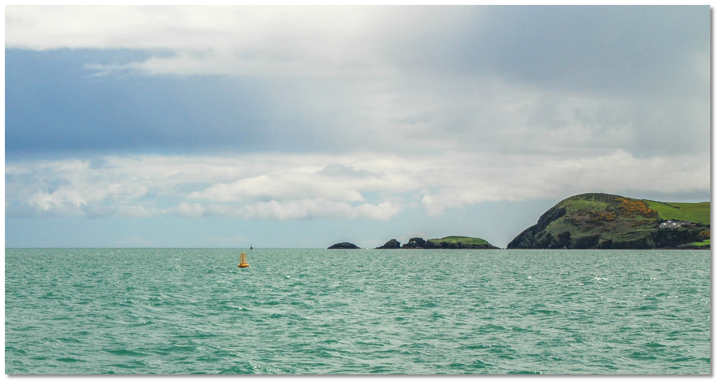
 . The Gainers, locally known as Goat Islands, are also good for those inclined towards climbing. The group of fragmented rocks can really be considered an extension of Helvick Head itself, and they may be reached by landing in or about the gap separating them from the mainland, or upon sheltered rocks. The largest, grass-topped inner island is reachable on foot at LW springs. Climbers will find the outer rocks pleasing to explore for their gaps, passages and small cliffs.
 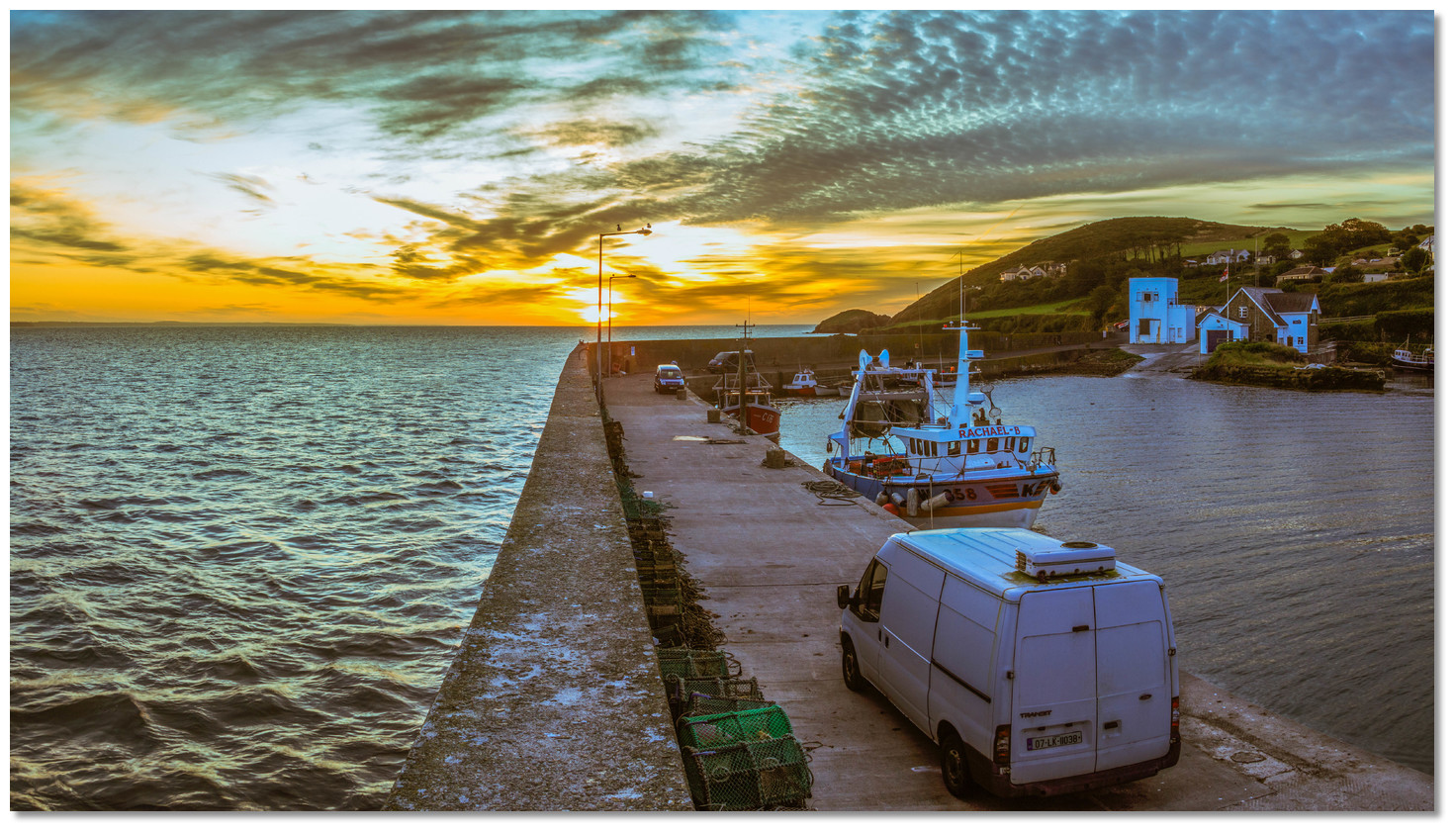 Sunrise at Helvick Harbour
Image: Alexander Redfern via CC ASA 4.0
From a boating perspective, this is an excellent and quickly accessible location on this coast to avoid some foul weather or wait out a tide. There are no obstructions coming from the east or from the sea so it is very easy to drop in and out and quickly be on your way. It is a useful tide-wait location for Dungarvan, or indeed a good, quiet alternative to that bustling harbour. Although the harbour may be crowded when the fishing boats is in, equally it is quiet when the fleet is at sea. It also makes an ideal passage destination for a UK boat heading west from the Bristol Channel and looking for a daylight arrival point as far west as possible.
What facilities are available?
Helvick is a small remote location with few facilities except for the infrastructure of the quay and its slipway. Fresh water is available on a domestic tap, there are toilets close to the pier and a local pub overlooks the anchoring area. Ballynagaul, about a mile to the west and also available by dinghy, has a few more offerings, including a restaurant and a grocery. Dungarvan, on the north side of the bay, offers better provisioning potential.Any security concerns?
You would be unlikely to experience any issues on anchor or moorings at this location.With thanks to:
Burke Corbett, Gusserane, New Ross, Co. Wexford & Austin Flynn Commodore of Dungarvan Yacht Club.

Aerial view of Helvick


Add your review or comment:
Please log in to leave a review of this haven.
Please note eOceanic makes no guarantee of the validity of this information, we have not visited this haven and do not have first-hand experience to qualify the data. Although the contributors are vetted by peer review as practised authorities, they are in no way, whatsoever, responsible for the accuracy of their contributions. It is essential that you thoroughly check the accuracy and suitability for your vessel of any waypoints offered in any context plus the precision of your GPS. Any data provided on this page is entirely used at your own risk and you must read our legal page if you view data on this site. Free to use sea charts courtesy of Navionics.