Sandy Cove is situated immediately west of the entrance to Kinsale Harbour on the southwest coast of Ireland. It offers a scenic anchorage in a remote and secluded location.
Tucked into an inlet, behind a small island, Sandy Cove provides a good anchorage that is highly protected and virtually free of roll in most conditions. It is uncomfortable in easterly component winds when adjacent Kinsale or Oyster Haven may be easily availed of. Daylight access to the haven is straightforward and at any stage of the tide as it has no outlying dangers.

Keyfacts for Sandy Cove
Summary
A good location with straightforward access.


Nature


Considerations

Position and approaches
Haven position
 51° 40.680' N, 008° 31.130' W
This position is in the middle of the bay on the 2.7 metre contour.
What is the initial fix?
 51° 40.642' N, 008° 30.722' W
 What are the key points of the approach?
 and seaward approaches are covered in the Kinsale Harbour
  haven entry.
Not what you need?
- Castlepark Marina - 1.2 nautical miles N
- Kinsale Harbour - 1.4 nautical miles N
- Oyster Haven - 2.7 nautical miles ENE
- Holeopen Bay East - 3.7 nautical miles S
- Holeopen Bay West - 3.9 nautical miles SSW
- Coolmain Bay - 6.2 nautical miles WSW
- Blindstrand Bay - 7.3 nautical miles WSW
- Broadstrand Bay - 7.4 nautical miles WSW
- Courtmacsherry - 7.6 nautical miles WSW
- Seven Heads Bay - 8.6 nautical miles SW
- Castlepark Marina - 1.2 miles N
- Kinsale Harbour - 1.4 miles N
- Oyster Haven - 2.7 miles ENE
- Holeopen Bay East - 3.7 miles S
- Holeopen Bay West - 3.9 miles SSW
- Coolmain Bay - 6.2 miles WSW
- Blindstrand Bay - 7.3 miles WSW
- Broadstrand Bay - 7.4 miles WSW
- Courtmacsherry - 7.6 miles WSW
- Seven Heads Bay - 8.6 miles SW
What's the story here?
 Sandy Cove and Sandy Cove Island as seen from the west
Image: Michael Harpur
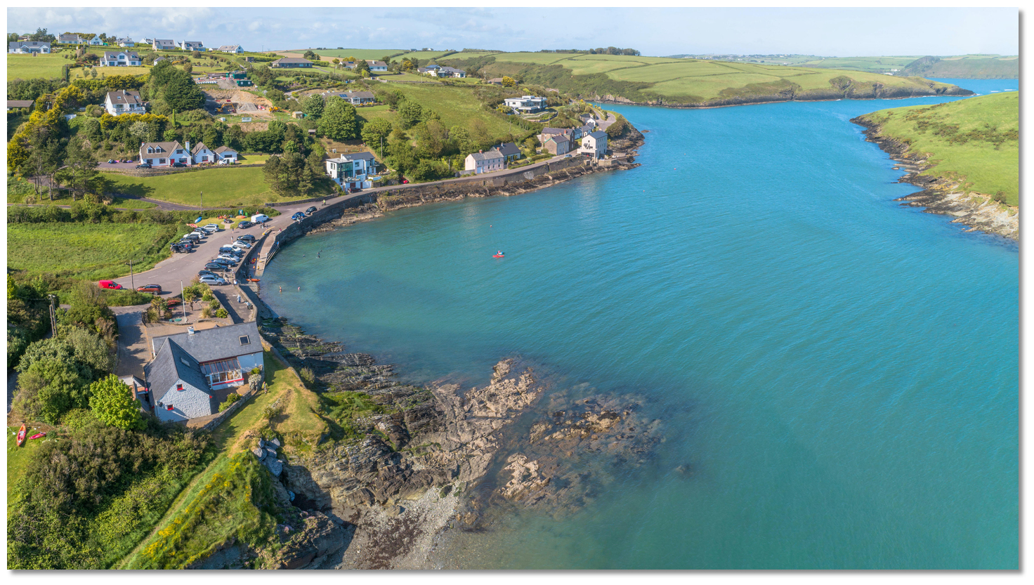
Sandy Cove is a small inlet at the mouth of Sandy Cove Creek that is protected by the small Sandy Cove Island that rises to 28 metres. The island is situated a ¼ of a mile southwestward of Shronecan Point that forms the western entrance to Kinsale Harbour. The small hamlet of Sandycove, with a population about 100, lies on the north shore overlooking the island from a distance of about 200 metres.
 The slip at Sandycove
Image: Michael Harpur
An anchorage can be had to the north of the island in Sandy Cove Sound that has depths in excess of 2.7 metres. The best protection is further northwest but depths shallow quickly to below 1.5 metres so some soundings will be required.
 Families enjoying Sandy Cove
Image: Michael Harpur
For vessels that can take to the bottom, there is also the potential of using the Sandy Cove Creek, also known as the Ardkilly Creek, that extends northward into the mainland.
 Sandy Cove Creek, or Ardkilly Creek, as seen from the north
Image: Tom via CC BY 2.0
How to get in?
 The entrance is to the east of the island
Image: Michael Harpur
 Use southwestern Ireland’s coastal overview for Cork Harbour to Mizen Head
  for seaward approaches, and the Kinsale Harbour
  haven for the entrance area. Sandy Cove is situated immediately west of the Kinsale Harbour entrance, between Shronecan Point and Sandy Cove Island, which from seaward, appears to be an unremarkable hump.
  The entrance as seen from the mainland
Image: Michael Harpur
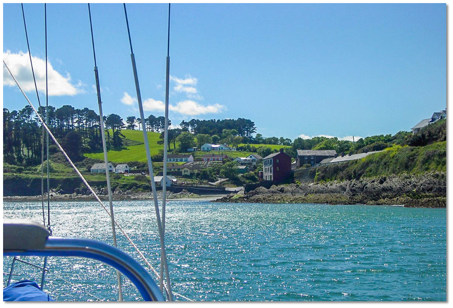
Vessels should approach as if entering the centre of the mouth of Kinsale Harbour then turning to enter from the east passing in northward of Sandy Cove Island island when it opens from Shronecan Point.

 The Sandy Cove initial fix supports the entrance between Sandy Cove Island and the mainland’s Shronecan Point. From the initial fix continue directly up the inlet taking a central course. The neck is about 400 metres long and leads into Sandy Cove Sound situated off the northmost point of the island.
  Sandy Cove
Image: Michael Harpur
Keep a sharp eye out for swimming activity as the area is a centre for sea swimming. Yellow cone buoys divide the entrance to create a wide lane for swimmers on the island side.
 The small hamlet of Sandycove with its slip as seen from the anchorage
Image: Graham Rabbits
 Anchor according to the draft and conditions in sand with very good holding. Land at the slip below the small hamlet of Sandycove on the north shore.
  Sandy Cove Creek or Ardkilly Creek opening to the north
Image: Graham Rabbits
Vessels that can take to the bottom, can explore Sandy Cove Creek / Ardkilly Creek, which extends northward into the mainland.
 Sandy Cove Creek as seen from the western shore
Image: Michael Harpur
Why visit here?
Sandy Cove is a beautiful little bay at the mouth of Ardkilly Creek that shelters behind its namesake island, Sandy Cove Island. It is situated on the west shores of the Castlepark Peninsula, which itself forms the western side of the entrance to Kinsale Harbour. Sandy Cove and Sandy Cove Island as seen from the western headland
Image: Michael Harpur
The small rock ringed and grass-topped island is uninhabited except for a heard of feral goats. These have grazed upon the island’s lush green grasses for generations indicating that a reliable source of freshwater is available on the island. Over the centuries a number of ships have foundered on the rocks off the island, including the 147-ton brig Eliza that went aground on the island in 1826.
 Local boat mooring northwest of the island
Image: Tom via CC BY 2.0
By contrast, the facing mainland shore has many large holiday homes and a tiny Sandy Cove hamlet with a permanent population of around 100. It is from here each September that the 'Sandy Cove Island Challenge' takes place. This is an annual open-water swimming race that has been held here since 1994 and attracts over three hundred swimmers. The swim departs from the slipway of the small hamlet, goes around Sandy Cove Island and back again to the slipway. The total distance is approximately 1,600 metres and the race has no handicapping applied and is open to all competent sea swimmers.
 The placid hamlet of Sandycove
Image: Graham Rabbits
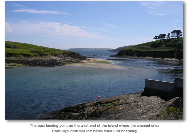
It is also possible to land on Sandy Cove Island. The best landing point is on some sand or shingle situated at the west end of the island facing the mainland shore and opposite the slip. Please note that Herring Gulls breed here and care should be taken by landing yachtsmen to avoid disturbing nesting birds.
 The island is a centre for swimming
Image: Julien Carnot CC BY-SA 2.0
From a boating perspective, the sound between the island and shore makes for a delightful and out-of-the-way anchorage with all-round views over the lush green countryside. Yet it is only a five-minute drive from the town of Kinsale, which can be accessed by crossing the bridge situated on the opposite side of the Castlepark Peninsula.
 Sandycove sunrise
Image: Peter Harding via CC BY 2.0
The protective island creates a perfect place for a vessel to swing peacefully on its chain for a few days and is a particularly good location for boats that have a young family aboard. The kids will find plenty to explore in the protected little inlet and it is also a good place to let young children loose with a 'dingy’; by anchoring in the neck of the bay the vessel will stand between them and the sea whilst being able to monitor them at all times from the cockpit.
What facilities are available?
Apart for the slip there are no facilities in the secluded Sandy Cove.Any security concerns?
It would be unlikely that you would experience any issues at anchor in Sandy Cove.With thanks to:
Burke Corbett, Gusserane, New Ross, Co. Wexford. Photos with thanks to Julien Carnot, Andy Beacroft, YanoG, Graham Rabbits and Mario Luna.
Aerial views of Sandycove (i)
Aerial views of Sandycove (ii)
About Sandy Cove
Sandy Cove is a beautiful little bay at the mouth of Ardkilly Creek that shelters behind its namesake island, Sandy Cove Island. It is situated on the west shores of the Castlepark Peninsula, which itself forms the western side of the entrance to Kinsale Harbour.
 Sandy Cove and Sandy Cove Island as seen from the western headland
Image: Michael Harpur
The small rock ringed and grass-topped island is uninhabited except for a heard of feral goats. These have grazed upon the island’s lush green grasses for generations indicating that a reliable source of freshwater is available on the island. Over the centuries a number of ships have foundered on the rocks off the island, including the 147-ton brig Eliza that went aground on the island in 1826.
 Local boat mooring northwest of the island
Image: Tom via CC BY 2.0
By contrast, the facing mainland shore has many large holiday homes and a tiny Sandy Cove hamlet with a permanent population of around 100. It is from here each September that the 'Sandy Cove Island Challenge' takes place. This is an annual open-water swimming race that has been held here since 1994 and attracts over three hundred swimmers. The swim departs from the slipway of the small hamlet, goes around Sandy Cove Island and back again to the slipway. The total distance is approximately 1,600 metres and the race has no handicapping applied and is open to all competent sea swimmers.
 The placid hamlet of Sandycove
Image: Graham Rabbits
It is also possible to land on Sandy Cove Island. The best landing point is on some sand or shingle situated at the west end of the island facing the mainland shore and opposite the slip. Please note that Herring Gulls breed here and care should be taken by landing yachtsmen to avoid disturbing nesting birds.
 The island is a centre for swimming
Image: Julien Carnot CC BY-SA 2.0
From a boating perspective, the sound between the island and shore makes for a delightful and out-of-the-way anchorage with all-round views over the lush green countryside. Yet it is only a five-minute drive from the town of Kinsale, which can be accessed by crossing the bridge situated on the opposite side of the Castlepark Peninsula.
 Sandycove sunrise
Image: Peter Harding via CC BY 2.0
The protective island creates a perfect place for a vessel to swing peacefully on its chain for a few days and is a particularly good location for boats that have a young family aboard. The kids will find plenty to explore in the protected little inlet and it is also a good place to let young children loose with a 'dingy’; by anchoring in the neck of the bay the vessel will stand between them and the sea whilst being able to monitor them at all times from the cockpit.
Other options in this area
Holeopen Bay West - 2.4 miles SSW
Coolmain Bay - 3.8 miles WSW
Courtmacsherry - 4.7 miles WSW
Broadstrand Bay - 4.6 miles WSW
Kinsale Harbour - 0.9 miles N
Oyster Haven - 1.7 miles ENE
Robert's Cove - 5.4 miles ENE
Ringabella Bay - 6 miles NE
Navigational pictures
These additional images feature in the 'How to get in' section of our detailed view for Sandy Cove.


| Detail view | Off |
| Picture view | On |
Aerial views of Sandycove (i)
Aerial views of Sandycove (ii)
Add your review or comment:
Melven Macilwraith wrote this review on Oct 25th 2019:
While the chart makes it clear not to attempt the southerly entrance, the description does not, I once saw a french yacht left high and dry on the rocks after such an attempt. At low tide the depth inside the island is below 1.5m, anchor by depth sounder in other words. It must be 30 years since there was a shop in sandy cove. The swimming activity mentioned has increased recently and the entrance is divided by yellow cone buoys to create a wide lane for swimmers on the island side. While I would generally recommend Sandycove for shelter it should be left well alone in an easterly.
Average Rating: UnratedMichael Harpur wrote this review on Apr 7th 2020:
Hi Melvin,
Many many thanks for this insight. I have sharpened up the detail so no mistake can be made about that southern entrance. Your feedback is most welcome.
Please log in to leave a review of this haven.
Please note eOceanic makes no guarantee of the validity of this information, we have not visited this haven and do not have first-hand experience to qualify the data. Although the contributors are vetted by peer review as practised authorities, they are in no way, whatsoever, responsible for the accuracy of their contributions. It is essential that you thoroughly check the accuracy and suitability for your vessel of any waypoints offered in any context plus the precision of your GPS. Any data provided on this page is entirely used at your own risk and you must read our legal page if you view data on this site. Free to use sea charts courtesy of Navionics.


