

Set well within the river that is protected by outer islands, Turk’s Head anchorage provides good protection from all wind directions. It may, however, become uncomfortable in prolonged heavy south-westerly conditions where there are many better berthing locations to choose from. Careful navigation is however required for all of the havens within the River Ilen. The river can be entered directly from Long Island Bay or from the north end of Baltimore Harbour, and in either case, there is little in the way of supporting marks and it can involve significant pilotage. Narrow, shallow at times and with ample rocks to circumvent be prepared for some keen eyeball navigation supported by excellent visibility.

Keyfacts for Turk Head
Facilities

Nature


Considerations
Protected sectors

Approaches

Shelter

Last modified
September 15th 2021 Summary
A good location with careful navigation required for access.Facilities
Nature
Considerations
Position and approaches

Expand to new tab or fullscreen
Haven position
 51° 29.637' N, 009° 24.763' W
In the anchoring area to the south of the river fairway.
What is the initial fix?
The following Baltimore north entrance initial fix will set up a final approach:
 51° 28.080' N, 009° 27.450' W



What are the key points of the approach?
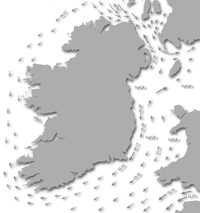
Offshore details are available in southwestern Ireland’s Coastal Overview for Cork Harbour to Mizen Head  . River Ilen directions to the anchorage are covered in the Oldcourt
  description situated upriver from Quarantine Island. A useful waypoint to target is at the head of 'The Sound'.
. River Ilen directions to the anchorage are covered in the Oldcourt description situated upriver from Quarantine Island. A useful waypoint to target is at the head of 'The Sound'. Not what you need?
Click the 'Next' and 'Previous' buttons to progress through neighbouring havens in a coastal 'clockwise' or 'anti-clockwise' sequence. Below are the ten nearest havens to Turk Head for your convenience.
Ten nearest havens by straight line charted distance and bearing:
- Quarantine Island - 0.4 nautical miles ENE
- East Pier - 0.4 nautical miles NW
- Trá Bán - 0.5 nautical miles WNW
- Rincolisky Harbour - 0.7 nautical miles NW
- Castle Ruins - 1.1 nautical miles SSE
- Kinish Harbour - 1.1 nautical miles S
- Horseshoe Harbour - 1.4 nautical miles SSE
- Baltimore - 1.6 nautical miles ESE
- Inane Creek - 1.7 nautical miles NE
- Reena Dhuna - 2.5 nautical miles NE
These havens are ordered by straight line charted distance and bearing, and can be reordered by compass direction or coastal sequence:
- Quarantine Island - 0.4 miles ENE
- East Pier - 0.4 miles NW
- Trá Bán - 0.5 miles WNW
- Rincolisky Harbour - 0.7 miles NW
- Castle Ruins - 1.1 miles SSE
- Kinish Harbour - 1.1 miles S
- Horseshoe Harbour - 1.4 miles SSE
- Baltimore - 1.6 miles ESE
- Inane Creek - 1.7 miles NE
- Reena Dhuna - 2.5 miles NE

Chart

What's the story here?
Turk Head is the southwest extremity of the Turk Head Penninsula and the north entrance point of the River Ilen. An anchorage may be taken here, off The Catalogues Islands situated about 400 metres south by southwest of the headland.This is a fair-weather anchorage with good holding.
How to get in?
 Turk Head and The Catalogues as seen from the northwest
Image: Michael Harpur
 Offshore details are available in southwestern Ireland’s Coastal Overview for Cork Harbour to Mizen Head . The anchorage lies in the mouth of the River Ilen which is approached between the south end of Hare Island and the northwest side of Sherkin Island or accessed via The Sound from Baltimore Harbour. Seaward approaches and run up the River Ilen are covered in the Oldcourt description.
 _when_rounding_in.jpg) Stand off The Catalogues (right) when rounding in
Stand off The Catalogues (right) when rounding inImage: Burke Corbett
The Baltimore North Entrance
route provides a list of waypoints that assist pilotage through the entrance to River Ilen and likewise the path from the north end of Baltimore Harbour. 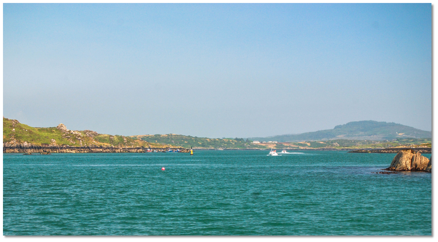 The Mealbeg south cardinal buoy with boats exiting via the channel
Image: Burke Corbett
It is essential for vessels approaching from seaward to stand well off The Catalogues Islands when rounding in as dangerous rocks extend northwestward from them. Likewise, be aware of Mealbeg situated close off Turk Head. This is a double-headed rock with its outer head awash at low water. It is marked by the Mealbeg south cardinal buoy.
 The location of the anchoring area
Image: Michael Harpur
Anchor according to draft on the southern edge of the deepwater channel to the south of Turk’s Head just within the crescent formed by The Catalogues group. Land at Turk Head pier situated on north the mainland side of the river to the northeast of Sandy Island.
Why visit here?
Turks Head most likely got its name from the 1631 Algerian pirate raid upon the village of Baltimore as it is believed the pirates moored here at the estuary of the Ilen.From here, in the dead of night, they were led up the creek between Ringarogy and Spanish Island, by the eponymous John Hackett, to arrive unseen into the harbour opposite the village of Baltimore. They then sacked the village kidnapped most of the inhabitants and brought them off to the slave markets of Algiers.
The tiny channel, about 100 metres in length became known as Hackett’s Channel. Similarly, the phrase 'Carbery's Hundred Isles', that it overlooks, stems directly back to the Thomas Davis' 1844 narrative poem of raid 'The Sack of Baltimore'. The title was taken directly from the poems first scene-setting line 'The summer sun is falling soft on Carbery's hundred isles'. This is very much an instance of poetic license since there are no more than 50 islands in the archipelago.
The Catalogues name by contrast is derived from the Irish Na Ceirtleoga meaning little balls of yarn, or rags, that most likely reflects the group's diminutive stature. There are five small islets in the group that are remarkably rich in varied floras. All The Catalogues have a covering of healthy grassland, heather and gorse. There are many goats throughout the islands, but they cannot keep the growth in check.
 Sandy, The Catalogues and Sherkin with Clear Island in the backdrop
Image: Michael Harpur
Situated immediately to the east, but not included in The Catalogues island group, is the larger five-hectare Sandy Island, in Irish known as Oileán na Gaineamaha. Despite its name, the island has no sand but it is well worth landing on for a visit. On the island's east side are the remains of a rudimentary slipway will be found, and this leads up to an old 1960s style holiday home set in the middle of the island. There are wonderful walks around Turk Head that are accessible by landing at Turk Head pier known as a Cusheen.
From a boating point of view, akin to Quarantine Island, this is an out of the way anchorage in a natural setting. Yet, with a good outboard, Baltimore Harbour with its excellent restaurants and pubs is less than 15 minutes away by boat via The Sound. All the islands in Roaring Water Bay are very accessible and it makes an excellent tide wait location for those ascending the River Ilen.
What facilities are available?
There are no facilities here. A short distance upriver Oldcourt boatyard offers a complete service of boat building and workshop facilities.Any security concerns?
Never an issue known to have occurred to a boat anchored off Turk’s Head.With thanks to:
Diarmuid Minihane, Baltimore Harbour Master. Photographs: Burke Corbett, Graham Rabbitts and A McCarron.

 A photograph is worth a thousand words. We are always looking for bright sunny photographs that show this haven and its identifiable features at its best. If you have some images that we could use please upload them here. All we need to know is how you would like to be credited for your work and a brief description of the image if it is not readily apparent. If you would like us to add a hyperlink from the image that goes back to your site please include the desired link and we will be delighted to that for you.
Add your review or comment:
Please log in to leave a review of this haven.
Please note eOceanic makes no guarantee of the validity of this information, we have not visited this haven and do not have first-hand experience to qualify the data. Although the contributors are vetted by peer review as practised authorities, they are in no way, whatsoever, responsible for the accuracy of their contributions. It is essential that you thoroughly check the accuracy and suitability for your vessel of any waypoints offered in any context plus the precision of your GPS. Any data provided on this page is entirely used at your own risk and you must read our legal page if you view data on this site. Free to use sea charts courtesy of Navionics.