

Set within an almost enclosed inlet, the greater part of which dries, Kinish Harbour offers very good protection from all but very strong north-easterly winds. It offers a deep water anchorage but boats that can take-to-the-bottom will find complete protection. Access however requires highly involved eyeball navigation, excellent visibility, and settled clear waters.


Keyfacts for Kinish Harbour
Facilities
None listedNature


Considerations


Protected sectors

Approaches

Shelter

Last modified
September 14th 2021 Summary* Restrictions apply
A good location with highly involved navigation required for access.Facilities
None listedNature
Considerations
Position and approaches

Expand to new tab or fullscreen
Haven position
 51° 28.586' N, 009° 24.905' W
Just inside the neck of the entrance where 4.6 metres can be found.
What is the initial fix?
The following Kinish Harbour initial fix will set up a final approach:
 51° 29.200' N, 009° 25.420' W


What are the key points of the approach?
Offshore details are available in southwestern Ireland’s Coastal Overview for Cork Harbour to Mizen Head  .
.
Before any approach, seek local advice or reconnoitre the approaches with a tender.
. Before any approach, seek local advice or reconnoitre the approaches with a tender.
Not what you need?
Click the 'Next' and 'Previous' buttons to progress through neighbouring havens in a coastal 'clockwise' or 'anti-clockwise' sequence. Below are the ten nearest havens to Kinish Harbour for your convenience.
Ten nearest havens by straight line charted distance and bearing:
- Castle Ruins - 0.6 nautical miles ENE
- Horseshoe Harbour - 0.6 nautical miles ESE
- Turk Head - 1.1 nautical miles N
- Trá Bán - 1.2 nautical miles NNW
- Quarantine Island - 1.3 nautical miles NNE
- East Pier - 1.4 nautical miles N
- Baltimore - 1.6 nautical miles ENE
- Rincolisky Harbour - 1.7 nautical miles NNW
- Inane Creek - 2.5 nautical miles NE
- Calf Island East - 2.6 nautical miles W
These havens are ordered by straight line charted distance and bearing, and can be reordered by compass direction or coastal sequence:
- Castle Ruins - 0.6 miles ENE
- Horseshoe Harbour - 0.6 miles ESE
- Turk Head - 1.1 miles N
- Trá Bán - 1.2 miles NNW
- Quarantine Island - 1.3 miles NNE
- East Pier - 1.4 miles N
- Baltimore - 1.6 miles ENE
- Rincolisky Harbour - 1.7 miles NNW
- Inane Creek - 2.5 miles NE
- Calf Island East - 2.6 miles W

Chart

What's the story here?
 Kinish Harbour (rear) is a landlocked inlet at the centre of Sherkin Island
 Image: Michael Harpur
Kinish Harbour, more commonly known as An Cúinne, is a sheltered muddy tidal inlet in the centre of Sherkin Island the greater part of which dries and is bestrewn with rocks. At high tide, the Kinish Harbour is full of water but at low tide, it mostly dries to an extensive mudflat with only a narrow channel of water flowing at the mouth of the harbour. It has a small quay on its southwestern side.
The landlocked harbour provides good protection, complete protection for those that can take to the bottom on its shores. Deep waters, in excess of 4 metres will be found at Kinish Narrows in the harbour entrance which is constantly scoured by the rise and fall of the tide.
How to get in?
 Sherkin and Kinish Harbour as seen from the northwest
Image: © Trebography
 Use Ireland’s coastal overview for Cork Harbour to Mizen Head for seaward approaches. Kinish is entered from Roaring Water Bay through a narrow passage on the northwest side of Sherkin Island about ¾ of a mile east by northeast of Drowlaun Point. Use the Oldcourt
  local approach directions to the northwest side of Sherkin. Local knowledge will provide the best advice and it is essential to seek it before making an approach. Failing this reconnoitre the approaches with a tender.
 From the initial fix steer 150°T towards the harbour entrance for about 500 metres. Use eyeball navigation to approach the entrance. After 500 metres the final approach is laden with rocky shoals that necessitate clear settled water and eyeball navigation that is too complex to describe. Beware of Carrogoona Rocks just east of the entrance. The best water is to be had in Kinish Narrows just inside the narrow passage at the entrance. This narrow strait has a sand and pebbles bottom and a steep slope of boulders and bedrock on each side. Get the anchor well in as currents, attaining as much as 2kn reportedly, will be experienced here.
 Land by tender on the muddy shores of the island or at the quay at high water.
Why visit here?
It is unknown how Kinish Harbour, more commonly known as the An Cúinne, got its name. An Cúinne, means 'the corner' which would perfectly describe a berth in the almost landlocked harbour. Likewise, Kinish, is most likely an anglicisation of Cill Inish, 'church of the island'. This would perfectly fit as the inlet is overlooked by the site of the original and present St Mona’s Church.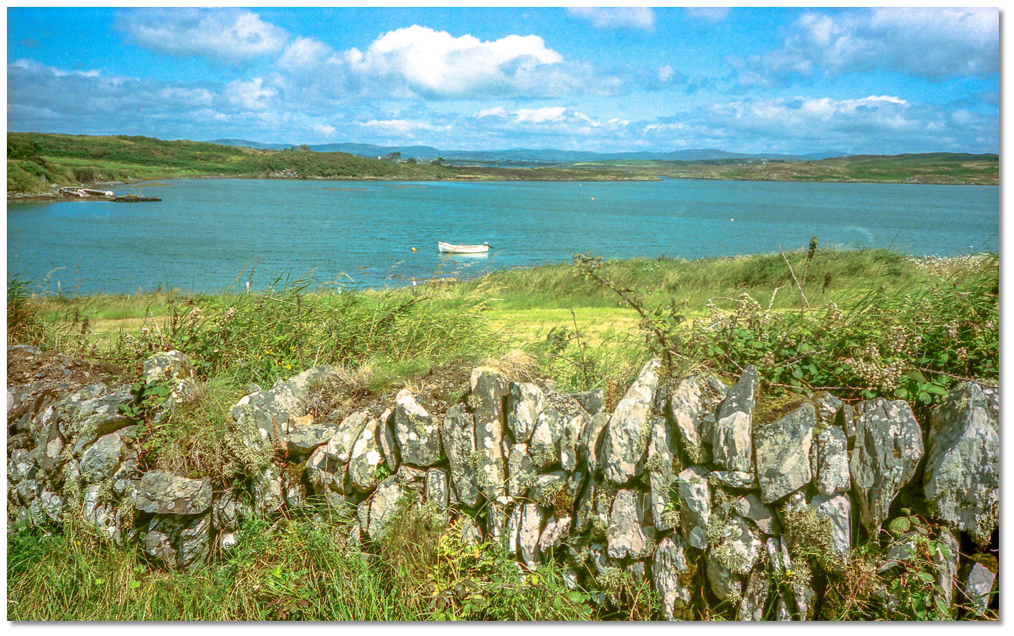 Sherkin dry stone walls with Kinish Harbour in the backdrop
 Image: Mark Murray via CC BY-SA 2.0
All earliest known references to churches and Christianity on Sherkin are attributed to St Mona who, according to tradition, is the patron saint of the island. Little, however, is known of St Mona and what is at best ambiguous. In the (2012) Dictionary of Irish Saints, Ó Riain, referring to Mughain (Mona), saving [she may] be the patron of Kilmoon on Sherkin Island in the Cork Parish of Tullagh, whom the genealogists attached to the same branch of the Corca Laoighdhe (Corkalee) as Liadhain, mother of Ciarán of Seirkeiran and Cape Clear Island'. This would make her more than a century older than St Ciaran which gives rise to the question of how Mughain (Mona), was Christianised so many years earlier? St Ciaran, born on Cape Clear in 352 AD, according to tradition and the Annals of Innisfallen, was the first person to preach Christianity in Ireland.
 Kinish slitting the island's roads from the landing stage at Abbey Strand
Image: Michael Harpur
Whatever the case, all records point to it being St Mona establishing the earliest Christian Church on Sherkin Island overlooking the inlet. The current St Mona’s Church Sherkin Island was built in 1830 to replace the older ruinous building located close by. Interestingly, Sherkin's Mass Rock, which was used in penal times, also overlooks Kinish Harbour. It lies in a secluded spot, in the townland of Farranacoush, to the west surrounded by higher land to the east, north and south. The site is obscure as these places had to be in case of discovery by the authorities. Lookouts would have probably been posted in the high surrounding ground when service was observed.
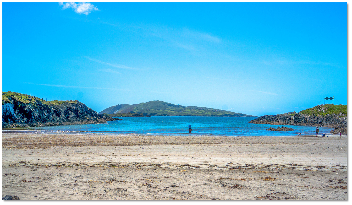 Cow Strand
Image: © Aaron Smart
During these times Kinish served as a safe anchorage to small fishing smacks. As many as thirty at a time would take refuge here during a prevalence of bad weather. The island's National School was opened on the shores of Kinish Harbour in 1891. This was originally opened as a school for boys, as the girls had their own separate primary schoolhouse, which has since been transformed into a holiday home. Secondary education for the children of Sherkin would always remain across the Bay to Baltimore.
But Kinish Harbour's busy times were in bygone years. It is now a quiet place that has more the appearance of a solitary salt-water lake. A single boat or two may be observed reclining idly on the beach and little else. At high tide, Kinish Harbour is full of water but at low tide, it is an extensive mudflat, with only a narrow channel of water remaining at the entrance. The broad inlet in the heart of the island forks the central roads that lead from the ferry landing stage at Abbey Strand. One road to the east leading to a drying pier at the north-eastern corner of the island; the other to the west out to the islands best beaches of 'The Cow' and 'Silver Strands', with their fine sands and safe bathing. Both beaches are accessible from the west side of Kinish Harbour.
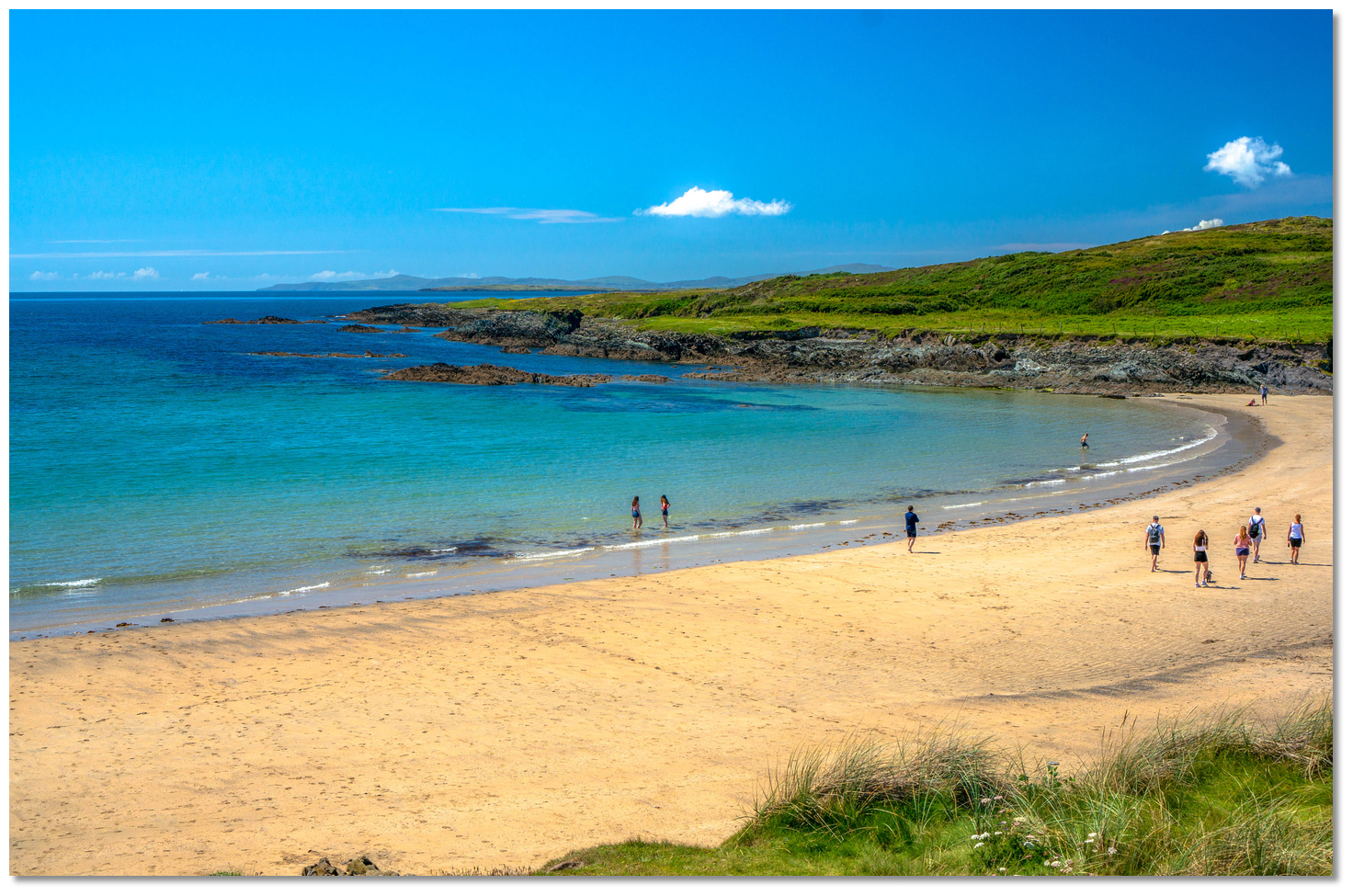 Silver Strand
Image: © Aaron Smart
The south side of Kinish Harbour has saltmarsh communities and is the only substantial strand of woodland on the island. It is the drab mudflats here that are the main interest for birds and those who like to watch them. The harbour's denizens are Redshank, Oystercatchers, Greenshank's, Little Egrets, Grey Herons, Curlew and even the odd Hooded Crows swoop into feast here when the tide goes out. Then, at low water, the exposed mud is full of clams, razor-shells, shrimps, crabs and worms upon which they feast. This makes it an ideal location for birdwatchers with a bilge keel vessel that can take to the mud.
From a boating perspective, this secluded landlocked harbour still presents a safe retreat from the storms of the Atlantic. And although mostly drying Kinish Narrows will always provide deep water. But a vessel would have to get in safely before any advancing system.
What facilities are available?
There are no facilities in Kinish Harbour.Any security concerns?
Never an issue known to have occurred to a boat in Kinish HarbourWith thanks to:
Diarmuid Minihane, Baltimore Harbour Master.An aerial view of Kinish


Add your review or comment:
Please log in to leave a review of this haven.
Please note eOceanic makes no guarantee of the validity of this information, we have not visited this haven and do not have first-hand experience to qualify the data. Although the contributors are vetted by peer review as practised authorities, they are in no way, whatsoever, responsible for the accuracy of their contributions. It is essential that you thoroughly check the accuracy and suitability for your vessel of any waypoints offered in any context plus the precision of your GPS. Any data provided on this page is entirely used at your own risk and you must read our legal page if you view data on this site. Free to use sea charts courtesy of Navionics.