

It provides reasonable shelter from the prevailing south-westerly wind, and the nearby High and Low islands to the south of the entrance dampen the swell entering the anchorage. Access is straightforward but a dangerous isolated rock needs careful circumvented with most approaches.

Keyfacts for Squince Harbour
Facilities


Nature


Considerations
Protected sectors

Approaches

Shelter
Last modified
May 10th 2021 Summary
A tolerable location with attentive navigation required for access.Facilities
Nature
Considerations
Position and approaches

Expand to new tab or fullscreen
Haven position
 51° 31.865' N, 009° 7.845' W
The anchorage is midway up the haven as it turns west towards the beach
What is the initial fix?
The following Squince Harbour Initial Fix will set up a final approach:
 51° 31.250' N, 009° 7.460' W


What are the key points of the approach?
Offshore details are available in southwestern Ireland’s Coastal Overview for Cork Harbour to Mizen Head  and the Glandore Harbour
 entry provides approach directions for this general area.
and the Glandore Harbour entry provides approach directions for this general area. - With the exception of shoal draft vessels at high water all approaches must be from the south.
- Vessels approaching from Castletownshend have clear water through the Big Sound channel.
- Vessels approaching from all other directions have to circumvent the dangerous Belly Rock.
Not what you need?
Click the 'Next' and 'Previous' buttons to progress through neighbouring havens in a coastal 'clockwise' or 'anti-clockwise' sequence. Below are the ten nearest havens to Squince Harbour for your convenience.
Ten nearest havens by straight line charted distance and bearing:
- Rabbit Island Sound - 0.3 nautical miles ENE
- Blind Harbour - 1 nautical miles WSW
- Castlehaven (Castletownshend) - 1.5 nautical miles W
- Glandore - 1.8 nautical miles N
- Tralong Bay - 2.9 nautical miles ENE
- Mill Cove - 3.6 nautical miles ENE
- Rosscarbery Inlet - 4.8 nautical miles ENE
- Barloge Creek (Lough Hyne) - 6.5 nautical miles WSW
- Oldcourt - 7.1 nautical miles W
- Dirk Bay - 7.1 nautical miles E
These havens are ordered by straight line charted distance and bearing, and can be reordered by compass direction or coastal sequence:
- Rabbit Island Sound - 0.3 miles ENE
- Blind Harbour - 1 miles WSW
- Castlehaven (Castletownshend) - 1.5 miles W
- Glandore - 1.8 miles N
- Tralong Bay - 2.9 miles ENE
- Mill Cove - 3.6 miles ENE
- Rosscarbery Inlet - 4.8 miles ENE
- Barloge Creek (Lough Hyne) - 6.5 miles WSW
- Oldcourt - 7.1 miles W
- Dirk Bay - 7.1 miles E

Chart

What's the story here?
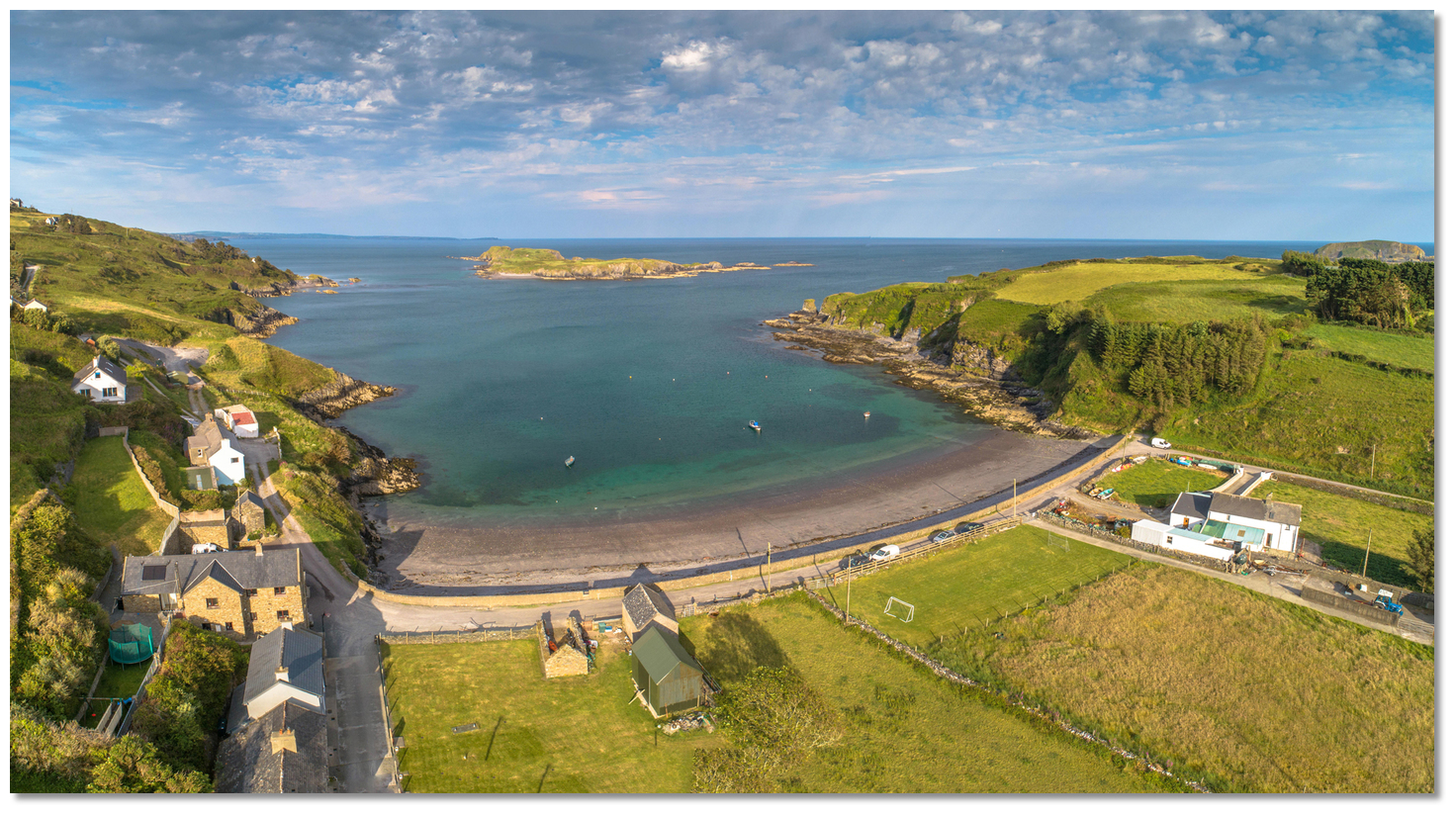 Squince Harbour as seen from the west
Image: Michael Harpur
Squince Harbour is situated 1½ miles southwest of the entrance to Glandore Harbour and ¾ of a mile north-northeast from High Island, between the mainland and Rabbit Island. It is a small east-facing cove with a beach at its head.
Leisure vessels will find good shelter in westerly winds with good depths and sand holding.
How to get in?
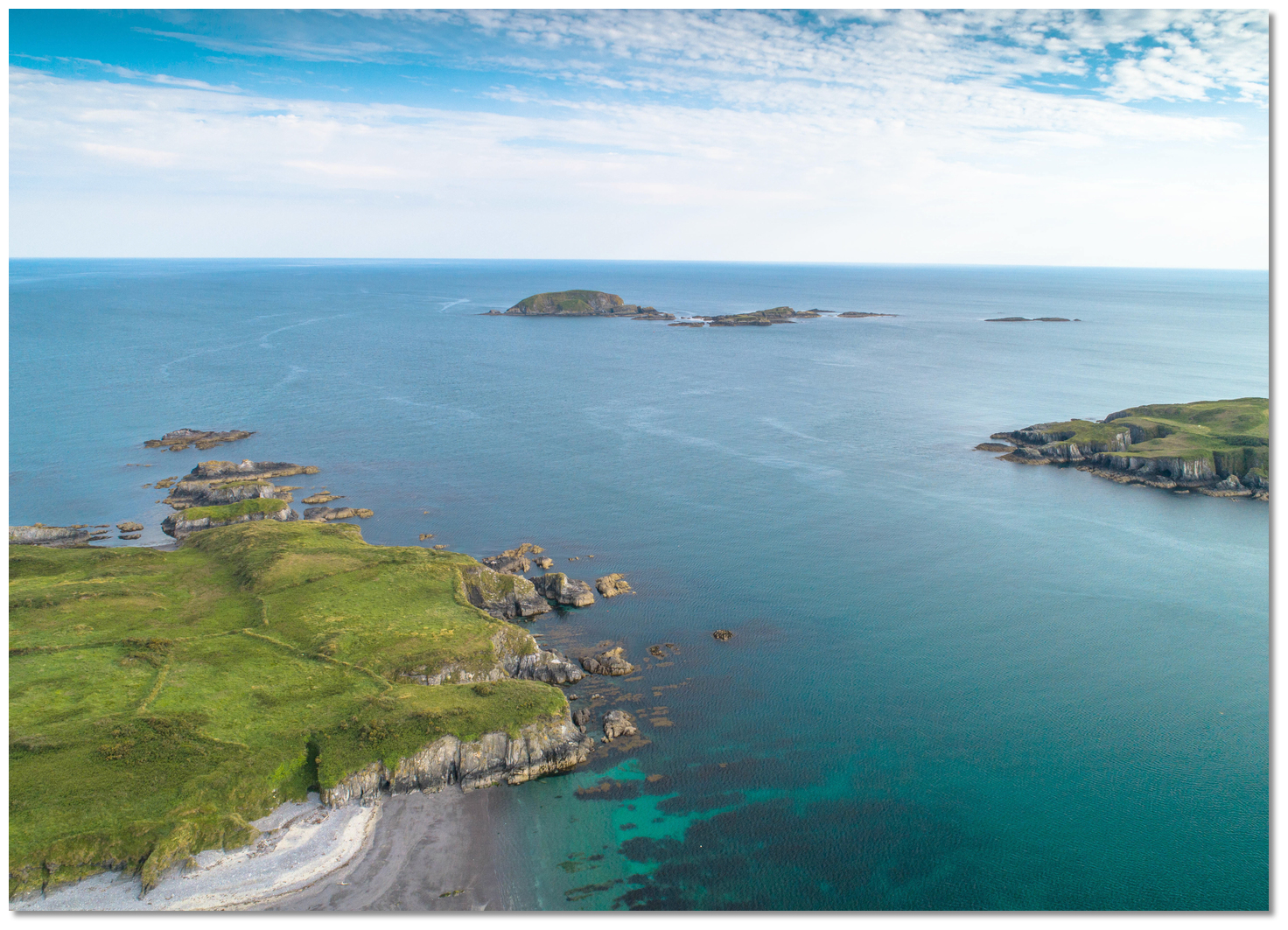
.jpg) Rabbit Island (left), High and Low Islands and Squince Harbour (right)
Rabbit Island (left), High and Low Islands and Squince Harbour (right)Image: Michael Harpur
 Use Ireland’s coastal overview for Cork Harbour to Mizen Head for seaward approaches. Glandore Bay lies between Sheela Point and Galley Head, a distance of about 5¾ miles, and the Glandore Harbour entry provides approach directions for this general area. The Harbour should be approached from the south, between the mainland and the west end of Rabbit Island, as there is shallow between the mainland, to the north, and the west end of Rabbit Island.
Vessels approaching from the west, Castletownshend or Blind Harbour, will have clear water all the way and can approach by maintaining a central path through the Big Sound channel between High and Low islands and the mainland shore. Vessels approaching from all other directions have to circumvent the primary danger in the area, Belly Rock.
 Belly Rock breaking
Image: Burke Corbett
Belly Rock is awash at low water springs and dries to 0.4 meters as it's difficult to see until a vessel is on it. It lies 300 metres to the south of the rocks that extend from the west end of Rabbit Island and 600 metres from the west end of the island.
Belly Rock – unmarked, position: 51° 31.475'N, 009° 07.165'W
 The conspicuous ruined tower on Horse Island
Image: Burke Corbett
Vessels approaching from the east can stay well south of Belly Rock by keeping the north shoreline of Low Island in line with the ruined tower on Horse Island, about bearing 253°T. Alternatively, approach the east of High Island for simplicity.
Image: Michael Harpur
Keeping to the west of a line of transit from the eastern side of High Island and the western face of Rabbit Island clears Belly Rock on the approach to the entrance. The safest route in is to commence an approach midway between High Island and the southern outliers of Rabbit Island. High Island is readily identified with its elevation of 46 metres. Rabbit Island lies midway between the entrances to Glandore Harbour and Castlehaven. It is the largest of a cluster of rocks and islets and is steep-to to the south and east, but the group must not be approached too closely from any other side.
 The entrance as seen from just beyond the inital fix
Image: Burke Corbett
 The initial fix is sent in the middle of this track and the entrance of the haven will be visible a ½ mile away on the north shore from this point. Tracking in on this line, or west of this, keeps Belly Rock 400 metres or more eastward.
 When Rabbit Island's southern outlier, South Rock, is abeam Belly Rock has been passed. Steer for the centre of the entrance, with the mainland on the west side and Rabbit Island forming its eastern shore, to give the reefs extending southward of Rabbit Island a sensible clearance.
 The entrance between Rabbit Island and the mainland
Image: Michael Harpur
Continue through the entrance between the mainland's small islet Lamb Island and Rabbit Island which is 400 metres side. Give Rabbit Island a sensible distance as it it is foul along its western shore.
 Squince Harbour as seen from the east
Image: Michael Harpur
Steer for the Head of the bay and the anchoring area that can be found up in the northwest corner.
 Squince Harbour as seen from the anchoage
Image: Burke Corbett
Anchor according to conditions and draft requirements. It is a quiet anchorage that could accommodate larger yachts. Land on the beach by tender.  Land on the beach by tender
Image: Michael Harpur
Why visit here?
Squince Harbour derives its name from an ancient Irish name for a 'horse'. There are several Irish words for a horse with the most common being 'each'[agh] and capall. Each is very often found in the beginning of place names, contrary to the usual Irish order, as is the case with the name Squince. It acquired the name for being a favourite horse pasture. In the Victorian 'History of Cork' 'The Squince' was noted for its capability to 'produce a wonderful sort of herbage that recovers and fattens diseased horses to admiration'.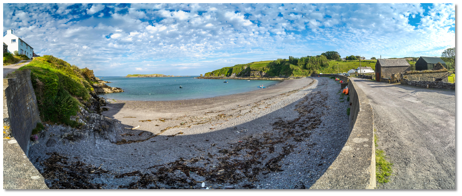 Squince has been a harbour since ancient times
Image: Michael Harpur
Squince Harbour was a trading base anciently and the Iomhair, 'Ivor', sept of the Donnell Clan lived partly from ancestral 'customs, royalties, dues and privileges' from Squince, Blind Harbour and Castlehaven. They controlled these ports from a tower house can be seen in the profile of a hill above Union Hall. The shapeless ruin still stands at the brink of a sharp slope to the south and is built out over the edge of it. The panoramic view it provided extends from Galley Head to Toe Head so they could easily keep a watchful eye over Castlehaven and their two small bays that indented the coastline to the east of it. Long after the Flight of the Earls, in the 19th-Century, the bay was seen to be such a good point to land goods that a Coastguard Station was built here to stop smuggling activity.
 The old Coastguard cottages are in the northwest corner of the bay
Image: Michael Harpur
Today, the small southeast facing inlet of Squince Harbour offers visitors one of the finest beaches in the Union Hall area. It is small, spanning about 400 metres in length, and consists mainly of fine gravel as opposed to powder sands that West Cork is famous for. So it is less about 'bucket and spade' and more about a 'shrimp net and crab line' experience. For older children, however, it offers excellent dinghy sailing and kayaking in a safe confined area with much to explore.
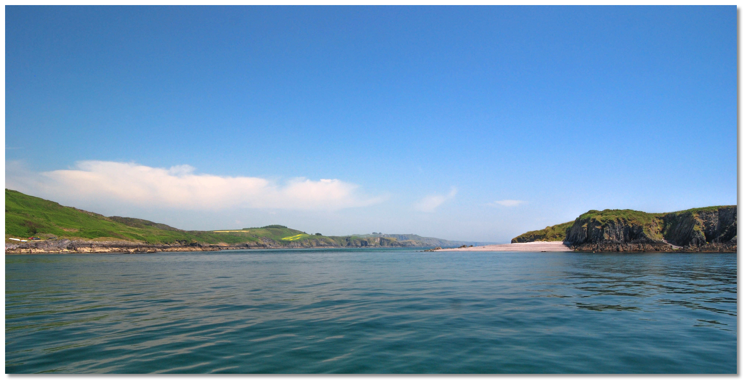
 Squince Harbour's incredible vista westward
Image: Michael Harpur
But its shortcomings are readily made up for by the scenery here. On a sunny day has to be amongst the most breathtaking in the area as it has it all. Crystal clear waters, that are translucent turquoise over the sands, enfolding cliffs with views out over Rabbit Island and the distant Galley Head peninsula that are seriously stunning. Moreover, there is always a beach here regardless of the tide and when the tide is out it opens up access to some wonderful rock climbing and rock pools.
 Rabbit Island
Image: Michael Harpur
Rabbit Island is well worth a dinghy ride as it is a good place to have a potter around either on foot or afloat. The best landing place is halfway along the north coast on a sheltered pebble beach beneath a ruined house. The island was formerly inhabited and is privately owned today, so visitors rely on the good graces of the owners who prefer to retain their exclusive use of its south-facing beach. This aside, they allow well-behaved visitors to use the rest of the island.
 The small beach on Rabbit Island as seen from a tender
Image: Burke Corbett
Climbers should note that there is a pair of detached giant stacks on the east side of the island. It is possible to get through the channels to these stacks except at low water. The stack nearest to Rabbit Island is climbable on its eastern side with care, but the larger and taller stack farthest from Rabbit is too dangerous to climb.
 Pretty Squince Harbour at sunset
Image: Michael Harpur
From a boating perspective, this is a lovely quiet anchorage where one could spend time on the beach with the family. It also makes for an excellent passage makers lunch stop or rest point. If at the end of the day the decision was to stay put, a reasonable night's sleep is more than possible.
What facilities are available?
There are no facilities at this location.Any security concerns?
Never an issue known to have occurred to a vessel in Squince Harbour.With thanks to:
Burke Corbett, Gusserane, New Ross, Co. Wexford.

Add your review or comment:
Please log in to leave a review of this haven.
Please note eOceanic makes no guarantee of the validity of this information, we have not visited this haven and do not have first-hand experience to qualify the data. Although the contributors are vetted by peer review as practised authorities, they are in no way, whatsoever, responsible for the accuracy of their contributions. It is essential that you thoroughly check the accuracy and suitability for your vessel of any waypoints offered in any context plus the precision of your GPS. Any data provided on this page is entirely used at your own risk and you must read our legal page if you view data on this site. Free to use sea charts courtesy of Navionics.