
The bay provides an exposed anchorage that can be used in a northerly component or offshore winds and is entirely open to the south. Access is straightforward as there are no off-lying dangers on the approach to the bay.

Keyfacts for Rosscarbery Inlet
Facilities
None listedNature


Considerations
Protected sectors

Approaches

Shelter

Last modified
April 22nd 2021 Summary
A tolerable location with straightforward access.Facilities
None listedNature
Considerations
Position and approaches

Expand to new tab or fullscreen
Haven position
 51° 33.735' N, 009° 0.682' W
This is in the Rosscarbery Bay close east of Creggane pier
What is the initial fix?
The following Rosscarbery Bay initial fix will set up a final approach:
 51° 33.461' N, 009° 0.411' W


What are the key points of the approach?
Offshore details are available in southwestern Ireland’s Coastal Overview for Cork Harbour to Mizen Head  .
.
.- Approaches from west and south are clear. From the east, the line of bearing of 320°T of the pointed spire of Rosscarbery Cathedral just open of Creggan Point leads across the bay to the southwest of Cloghna Rock.
- Keep off the headlands
Not what you need?
Click the 'Next' and 'Previous' buttons to progress through neighbouring havens in a coastal 'clockwise' or 'anti-clockwise' sequence. Below are the ten nearest havens to Rosscarbery Inlet for your convenience.
Ten nearest havens by straight line charted distance and bearing:
- Mill Cove - 1.2 nautical miles WSW
- Tralong Bay - 1.9 nautical miles WSW
- Dirk Bay - 2.9 nautical miles ESE
- Glandore - 4.3 nautical miles W
- Dunnycove Bay - 4.5 nautical miles E
- Rabbit Island Sound - 4.5 nautical miles WSW
- Squince Harbour - 4.8 nautical miles WSW
- Blind Harbour - 5.8 nautical miles WSW
- Castlehaven (Castletownshend) - 6.3 nautical miles WSW
- Clonakilty Harbour (Ring) - 6.6 nautical miles ENE
These havens are ordered by straight line charted distance and bearing, and can be reordered by compass direction or coastal sequence:
- Mill Cove - 1.2 miles WSW
- Tralong Bay - 1.9 miles WSW
- Dirk Bay - 2.9 miles ESE
- Glandore - 4.3 miles W
- Dunnycove Bay - 4.5 miles E
- Rabbit Island Sound - 4.5 miles WSW
- Squince Harbour - 4.8 miles WSW
- Blind Harbour - 5.8 miles WSW
- Castlehaven (Castletownshend) - 6.3 miles WSW
- Clonakilty Harbour (Ring) - 6.6 miles ENE

Chart

What's the story here?
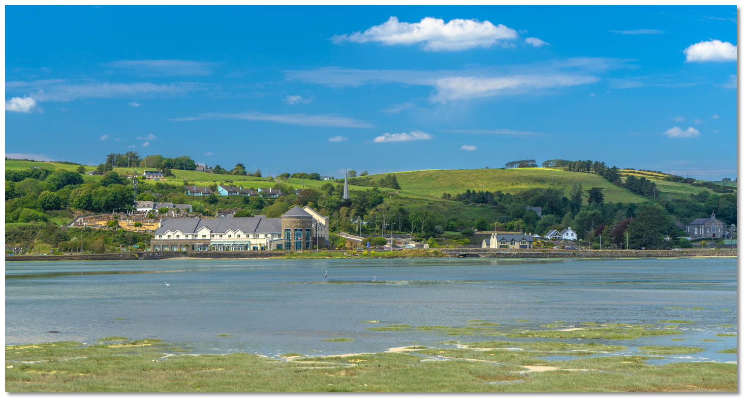 Rosscarbery Town a mile up the drying inlet
 Image: Michael Harpur
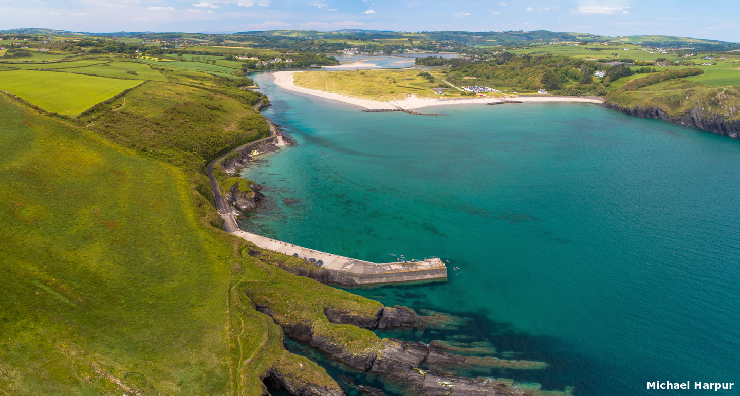
Rosscarbery is a very small town with a population of about 500 set 1 mile up the shallow and drying Rosscarbery Inlet. The inlet opens onto Rosscarbery Bay and dries out to its entrance points between Downeen Point and Creggane Point close eastward. Close north of Downeen Point and on the western shore is a small Creggane pier.
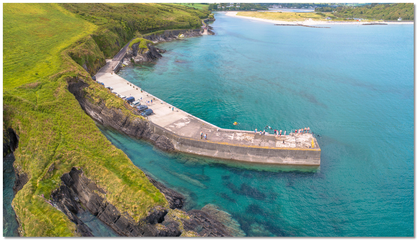 Creggane pier close north of Downeen Point
Image: Michael Harpur
The inlet is all dry at low water as far out as Downeen Point but could be useful for vessels that can take to the bottom either off anchored off or alongside the small pier.
How to get in?
 The Rosscarbery Inlet
Image: Michael Harpur
 Use Ireland’s coastal overview for Cork Harbour to Mizen Head for seaward approaches. Rosscarbery Bay lies west of Galley Head, in the east side of Glandore Bay and the Glandore
  entry provides approach directions for this general area.
 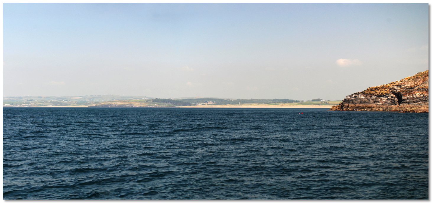 Rosscarbery Bay's beaches either side of Cloghna Head opening around Galley Head
Image: Burke Corbett
From seaward, Rosscarbery Bay can be determined by two sandy beaches, separated by the central rugged cliffs of Cloghna Head. The southernmost of these, called Long Strand, forms a remarkable feature of the coast; from its southern end, there commences a bold rocky shore that leads to Galley Head.
Approaches to the inlet from the west and south are clear of outlying dangers but an eastern approach needs to avoid Cloghna Rock, the outmost danger of Rosscarbery Bay. Situated 1½ miles out from the shore in front of Long Strand it is a pinnacle rock that is steep to all-round and has 0.9 metres LAT of water over it.
 Rosscarbery Inlet and the spire just open of Creggan Point
 Image: Burke Corbett
There is a transit that clears Cloghna Rock as well as Doolic Rock off of Galley Head in good conditions. This is a line of bearing of 320°T of the pointed spire of Rosscarbery Cathedral just open of Creggan Point situated 1 mile to the southeast of the cathedral. It leads between the Doolic Rock and Galley Head in from 16 to 20 metres of water and then safely across the bay to the inlet southwest of Cloghna Rock.
 Cormack's Rock and Iron Rock flanking the northeast side of the approach
Image: Michael Harpur
 From the initial fix head in on a bearing of about 340°T to pass the eastern side of Downeen Point. Downeen Point has foul ground extending 150 metres south of the point, but keeping 100 metres east of the head clears all dangers on approach. Do not drift too far east as the Iron Rock, always visible and drying to 3.7 metres, is located 800 metres east of Downeen Point’s eastern face. Likewise, Creggane Point has the offlying Cormack's Rock.
At high water, the entrance is 100 metres wide, and once east of Downeen Point the drying Creggane Pier will be seen on the north side of the point.
 Creggane Pier
Image: Michael Harpur
Rosscarbery Inlet is all dry at low water so anyone staying must take to the bottom. Anchor in sand and mud to the east of Creggane Pier or lie alongside. Do not proceed north of a line between Creggane Pier and the facing Creggane Point, on the north shore, as the inlet entirely dries out to the northwest of this line. Shallow draft vessels may also temporarily berth alongside the small pier at high water or anchor further out and use it to land by tender.
Why visit here?
Rosscarbery, or Roscarbery, anciently Ross Alithra, derives its name from Irish Ros Ó gCairbre, meaning 'Cairbre's wood'. Situated on the shallow protected estuary that opens onto Rosscarbery Bay this is an area that is steeped in history.A megalithic tomb on a ledge of a hillside, 2.4 km east of Rosscarbery, dates back 4000 years to the Stone Age. It is thought to be one of only two portal tombs in the southern half of Ireland and shows that the area has been occupied from very early times. Drombeg, one of the finest examples of a Bronze age stone circle, is located 4.5 km southwest of the town. It consists of 17 standing stones, the highest, forming the entrance to the circle, the others tapering down in height to the altar-like axial stone opposite that has two cup marks. During the winter solstice, the sun’s rays fall on this stone.
 The Drombeg Bronze age stone circle
Image: Tourism Ireland
Adjacent to the circle is an ancient cooking pit or Fulacht Fiadh. Evidence suggests that Drombeg was more than a temporary seasonal hunting encampment and was used more as a ritual site where many people would gather. There are also many other Neolithic and Bronze Age remains including a number of Ring Forts and Holy Wells that speak of the Iron Age transition from the Old to the New (Christian) Gods.
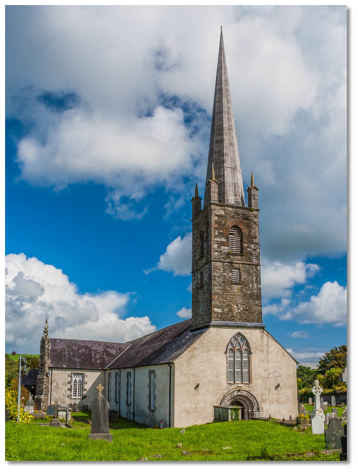 St Fachtna's Cathedral Rosscarbery
 Image: Andreas F. Borchert via CC BY-SA 2.0
A town gradually rose around the monastery, which was believed to be walled, and subsequently became the seat of a diocese. But in the wars of the McCarties, O'Driscols, and other Irish septs, the walls were thrown down, and a great part of the town was destroyed and it fell into decline. Prior to the arrival of the Normans the region belonged to the ancient Corcu Loígde, of whom the O'Learys were one of the leading septs. Uí Laoghaire Ruis Ó gCairbre controlled the immediate area.
After the Norman Conquest all the lands, except such as belonged to the bishop, were granted to Fitz-Stephen, by whom they were afterwards assigned to Adam de Roches. The Anglo-Norman adventurers rebuilt and walled the town. They subsequently secured a charter of incorporation from King John, by which many privileges were secured to 'Ross Lehir'. It remained the seat of the Bishop of Ross throughout the late medieval period although it was in the Gaelic Irish confine. But the peacetime relationship between the Anglo-Normans the citizens of Rosscarbery and the surrounding chieftains remained delicate for centuries.
 Downeen Castle
Image: Mike Searle via CC BY SA 2.0
This uneasy coexistence led to large scale castle construction across the West Cork entire region. Over 150 castles were built in the area during the following centuries, both by the Normans and by local clan chieftains. Almost every headland had a castle erected upon it. By the second half of the 16th-century, the amount of timber tower houses brought about a shortage of substantial trees. It is thought that the resultant deforestation led to the silting up of Rosscarbery and other important local harbours such as Clonakilty and Timoleague.
 The remains of Downeen Castle's Tower
Image: Mike Searle via CC BY SA 2.0
A great example of this medieval arms race is the minor stronghold of Downeen that overlooks Castle Bay on the opposite side of Downeen Point. The fort and headlands name is derived from Duinin meaning 'little fort'. Standing on a steep rock it has been cut off from the mainland since the 16th-Century. The 1801 'Pacata Hibernia' mentioned a timber drawbridge 'resembling the seat of Dunluce in Ulster' which presumably met some sort of gate structure several metres north of the present edge of the island. Virtually nothing else is known of the history of this stronghold except that it is now alleged to have been held by the O'Cowhig Clan.
 Rosscarbery's 'The Warren' Beach
Image: Michael Harpur
Today the skyline of Rosscarbery today is appropriately dominated by the historic St Fachtna’s Cathedral that speaks to its genesis. Likewise, the general layout of the town's charming square goes back to its original Norman designs. It features plenty of traditional shop and pub fronts with ample other nicely decorated buildings all focused on the tourist trade. And this si a large haul during the summer when crowds flock to nearby beaches such as Owenahincha and The Warren. The pretty town is a short walk along the pleasant estuary of less than a couple of KM. The spectacularly sited ruin of Downeed Castle is also an easy walk today around the headland.
 The road alongside the inlet leading to Rosscarbery
Image: Michael Harpur
From a boating point of view, Rosscarbery Bay is another place to visit on the way to or from Glandore Harbour. Although it could never be described as a great anchorage and the domain of vessels that can take to the bottom, Rosscarbery Bay has the advantage over the neighbouring inlets of Mill Cove and Tralong Bay of having no rocks to obstruct its approach.
What facilities are available?
The location has no facilities for provisions, but Rosscarbery is only a short walk and has facilities to support its permanent population of about 1000 people.Any security concerns?
Never an issue known to have occured to a vessel anchored off Rosscarbery.With thanks to:
Michael Harpur, eOceanic.com.Rosscarbery Inlet
The following video provides a view of Rosscarbery Bay, inlet and village from the eastern shoreline


Add your review or comment:
Please log in to leave a review of this haven.
Please note eOceanic makes no guarantee of the validity of this information, we have not visited this haven and do not have first-hand experience to qualify the data. Although the contributors are vetted by peer review as practised authorities, they are in no way, whatsoever, responsible for the accuracy of their contributions. It is essential that you thoroughly check the accuracy and suitability for your vessel of any waypoints offered in any context plus the precision of your GPS. Any data provided on this page is entirely used at your own risk and you must read our legal page if you view data on this site. Free to use sea charts courtesy of Navionics.