

Set within the enclosed channel the anchorage offers good protection from all but very strong westerly or north-easterly winds. Approaches to the general area are straightforward at any stage of the tide and the approach to the channel's eastern entrance is lit.

Keyfacts for Colla Harbour
Facilities


Nature


Considerations
Protected sectors

Approaches

Shelter

Last modified
November 8th 2021 Summary
A good location with safe access.Facilities
Nature
Considerations
Position and approaches

Expand to new tab or fullscreen
Haven position
 51° 30.381' N, 009° 33.640' W
This is the position of Colla pier head set into a bight on the mainland shoreline.
What is the initial fix?
The following Schull initial fix will set up a final approach:
 51° 29.947' N, 009° 31.682' W



What are the key points of the approach?
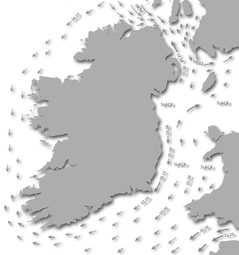
Offshore details are available in southwestern Ireland’s Coastal Overview for Cork Harbour to Mizen Head  seaward approaches to the Long Island Channel available in the Schull Harbour
  and Long Island entries.
seaward approaches to the Long Island Channel available in the Schull Harbour and Long Island entries.Not what you need?
Click the 'Next' and 'Previous' buttons to progress through neighbouring havens in a coastal 'clockwise' or 'anti-clockwise' sequence. Below are the ten nearest havens to Colla Harbour for your convenience.
Ten nearest havens by straight line charted distance and bearing:
- Long Island - 0.4 nautical miles SSE
- Coney Island - 0.4 nautical miles SW
- Croagh Bay - 0.9 nautical miles WSW
- Schull Harbour (Skull) - 1.3 nautical miles NNE
- Castle Island (South Side) - 2.3 nautical miles E
- Castle Island (North Side) - 2.3 nautical miles E
- Dereenatra - 2.5 nautical miles ENE
- Calf Island East - 3.2 nautical miles ESE
- Toormore Cove - 3.3 nautical miles W
- Horse Island - 3.3 nautical miles ENE
These havens are ordered by straight line charted distance and bearing, and can be reordered by compass direction or coastal sequence:
- Long Island - 0.4 miles SSE
- Coney Island - 0.4 miles SW
- Croagh Bay - 0.9 miles WSW
- Schull Harbour (Skull) - 1.3 miles NNE
- Castle Island (South Side) - 2.3 miles E
- Castle Island (North Side) - 2.3 miles E
- Dereenatra - 2.5 miles ENE
- Calf Island East - 3.2 miles ESE
- Toormore Cove - 3.3 miles W
- Horse Island - 3.3 miles ENE

Chart

What's the story here?
 Colla Pier set into a bight on the mainland coast
Image: Michael Harpur
Colla Pier is a small shallow pier set into a mainland bight on the north side of the Long Island Channel. Colla Pier looks out over Long Island, about 600 metres opposite, to which it provides a regular ferry service to the island small corresponding quay. Several holiday homes overlook the small bight and pier but apart from this, it is a quiet rural location.
 The mainland bight above the pier
Image: Michael Harpur
The anchorage immediately offshore in Long Island Channel affords good shelter over good holding ground with plenty of space and water.
How to get in?
 The view from Colla to Copper Point that marks the entrance to Schull
Image: Michael Harpur
 Offshore details are available in southwestern Ireland’s Coastal Overview of Cork Harbour to Mizen Head for seaward approaches. Vessels approaching from the south may use the Schull Harbour general approach directions and initial fix. This is the principal approach, the safest and is lit.
  Approaching Colla from the Long Island Channel
Image: Burke Corbett
These directions should be used in conjunction with the Long Island
entry as it is situated directly opposite Long Island pier on the mainland side of Long Island Channel. This entry also provides additional directions for vessels intending to enter Long Island Channel's western end from the southwest via Goat Island Sound or Man of War Sound.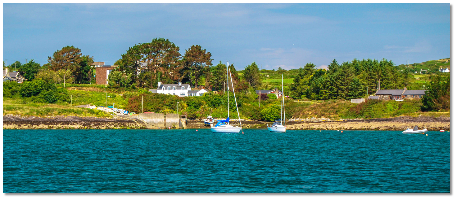 Colla Pier as seen from the anchoring area
Image: Burke Corbett
Anchor according to draft off the bight where the small pier is situated. Beware of an underwater cable when anchoring. Land alongside the pier. Why visit here?
Colla takes its name from the Irish 'Cé an Chalaidh' 'harbour of the ferry'. This is derived from its connection to Long Island to which Colla has provided a ferry service since ancient times. The pier on Long Island opposite Colla
Image: Emma Cooney
This service continues to this day as Long Island remains one of the few of Carbery's Hundred Isles and the smallest that is still inhabited, though just with a permanent population of about 10 people. The main area of habitation is situated just above the pier opposite Colla in the island's houses that date back to the early 1900s. These buildings have been entirely restored and have running water with mains electricity that is supplied from the mainland through a submarine power cable. They are catered for by a regular ferry service passes back and forth, operating five days a week during the summer months and three days a week during the winter months, from Colla.
 The pretty Colla Pier
Image: Michael Harpur
Colla offers a quiet setting with beautiful scenery overlooking Colla's coastal backdrop, to the north, and Long Island to the south. For a family boat, the small coastal bight is an ideal location to let kids loose to explore. It has a small beach, albeit stony, and the occasional pub and small local produce outlet in the hinterlands are within walking distance. Schull is a 30 minute (3.0 km) walk from the pier via Colla Road or 5 minutes by taxi.
 Tranquil Colla
Image: Emma Cooney
From a boating perspective, the berth off Colla pier provides another truly lovely Long Island Channel anchorage. Yet, and unlike the adjacent Long Island anchorage, it has quick and easy access to Schull by road. This makes it a very good alternative to Schull Harbour.
 Dusk at Colla
Image: Emma Cooney
From here a vessel can benefit from both road and boat access to the active holiday town but also escape all its disturbance in the night. But this said, if southerly wind protection is required the anchorage off Long Island pier will be the best.
What facilities are available?
There is nothing here at this location except for the small quay and slipway and the Long Island Ferry service. Contact Maurice Coughlan: +353 86 172 1254 for booking/prices. A water taxi service is available at other times.Any security concerns?
Never an issue known to have occurred to vessel anchored off Colla Harbour.With thanks to:
Burke Corbett, Gusserane, New Ross, Co. Wexford.Colla Pier Aerial Views


 A photograph is worth a thousand words. We are always looking for bright sunny photographs that show this haven and its identifiable features at its best. If you have some images that we could use please upload them here. All we need to know is how you would like to be credited for your work and a brief description of the image if it is not readily apparent. If you would like us to add a hyperlink from the image that goes back to your site please include the desired link and we will be delighted to that for you.
Add your review or comment:
Please log in to leave a review of this haven.
Please note eOceanic makes no guarantee of the validity of this information, we have not visited this haven and do not have first-hand experience to qualify the data. Although the contributors are vetted by peer review as practised authorities, they are in no way, whatsoever, responsible for the accuracy of their contributions. It is essential that you thoroughly check the accuracy and suitability for your vessel of any waypoints offered in any context plus the precision of your GPS. Any data provided on this page is entirely used at your own risk and you must read our legal page if you view data on this site. Free to use sea charts courtesy of Navionics.