_county_dublin_ireland_RDP_20140908_8482_2.jpg)
Situated a little more than two miles from the breakwater heads, the marina provides complete protection from all conditions as does Dublin City Moorings further upriver. With a 600-metre wide entrance between two lighthouses Dublin Port offers safe access in all reasonable conditions, night and day, at any state of the tide. This is not to say there are no hazards and the dangers lie further east for a seaward approach to Dublin Bay itself. In heavy-weather seas break over the Burford and Kish Banks when it is advisable to stay well clear of them. In addition to this, a Traffic Separation Scheme has been established in Dublin Bay that leisure craft should avoid.

Keyfacts for Dublin Port


Nature


Considerations


Protected sectors


Summary
A completely protected location with safe access.


Nature


Considerations


Position and approaches
Haven position
 53° 20.647' N, 006° 13.074' W
This is the western end of Poolbeg Marina's outer pontoon.
What is the initial fix?
 53° 20.318' N, 006° 5.546' W
 What are the key points of the approach?
 and, from the south, in eastern Ireland’s Coastal Overview for Dublin Bay to Rosslare Harbour
  .
.- Dublin Bay is free from hazards save for some moderatly deep banks the principal one to avoide being the Burford Bank.
- Leisure craft must stay out of the TSS keeping at least a ½ mile from the Dublin Bay Buoy and remain close outside fairways and give large vessels the freedom to manoeuvre at all times.
- In the Liffey approach close but outside the north side of the fairway under power.
- Cross the channel at 90° to the south side when abeam the Poolbeg Power Station's chimneys.
- • Monitor VTS Dublin on VHF 12 at all times.
Not what you need?
- Dún Laoghaire Harbour - 3.9 nautical miles SE
- Howth - 6.2 nautical miles ENE
- Balscadden Bay - 6.2 nautical miles ENE
- Sorrento Point - 6.3 nautical miles SE
- Dalkey Island - 6.4 nautical miles SE
- Carrigeen Bay - 6.4 nautical miles NE
- Malahide - 7 nautical miles NNE
- Bray Harbour - 9.1 nautical miles SSE
- Rogerstown Inlet - 10.6 nautical miles NNE
- Talbot’s Bay - 10.8 nautical miles NE
- Dún Laoghaire Harbour - 3.9 miles SE
- Howth - 6.2 miles ENE
- Balscadden Bay - 6.2 miles ENE
- Sorrento Point - 6.3 miles SE
- Dalkey Island - 6.4 miles SE
- Carrigeen Bay - 6.4 miles NE
- Malahide - 7 miles NNE
- Bray Harbour - 9.1 miles SSE
- Rogerstown Inlet - 10.6 miles NNE
- Talbot’s Bay - 10.8 miles NE
Chart
What's the story here?
.jpg) Poolbeg Marina on the south side of the river (right)
Poolbeg Marina on the south side of the river (right)Image: Public Domain
Dublin lies at the head of Dublin Bay and is both the capital and the largest city in the Irish Republic. The River Liffey flows through the middle of the city and is navigable by ocean-going vessels up to about 3½ miles west of the entrance. Within this area are the quays, basins and installations of the Port of Dublin that is the principal commercial and industrial port for the Republic of Ireland. It is equipped with all modern cargo handling facilities as well as being a terminus for vehicle and passenger ferries to and from the United Kingdom.
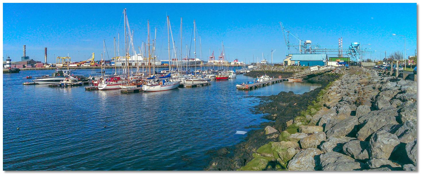 Poolbeg Yacht & Boat Club
Image: Michael Harpur
The capital offers two berthing opportunities. The first is the 100-berth privately operated Poolbeg Yacht Club & Marina situated on the south side of the river 2⅓ miles from the entrance. It has unimpeded access to the sea and can accomodate vessels of up to 20 metres LOA carry a drafts of up to 2.4 metres.
Poolbeg Yacht & Boat Club,
 Ch. 37 12 16 [Poolbeg Marina],
  +353 (0)1 668 9983,
  info@poolbegmarina.ie, and they also may be contacted via their website www.poolbegmarina.ie
  , where they publish their rate card
  . The Bar or Office are usually open from 1000-2000.
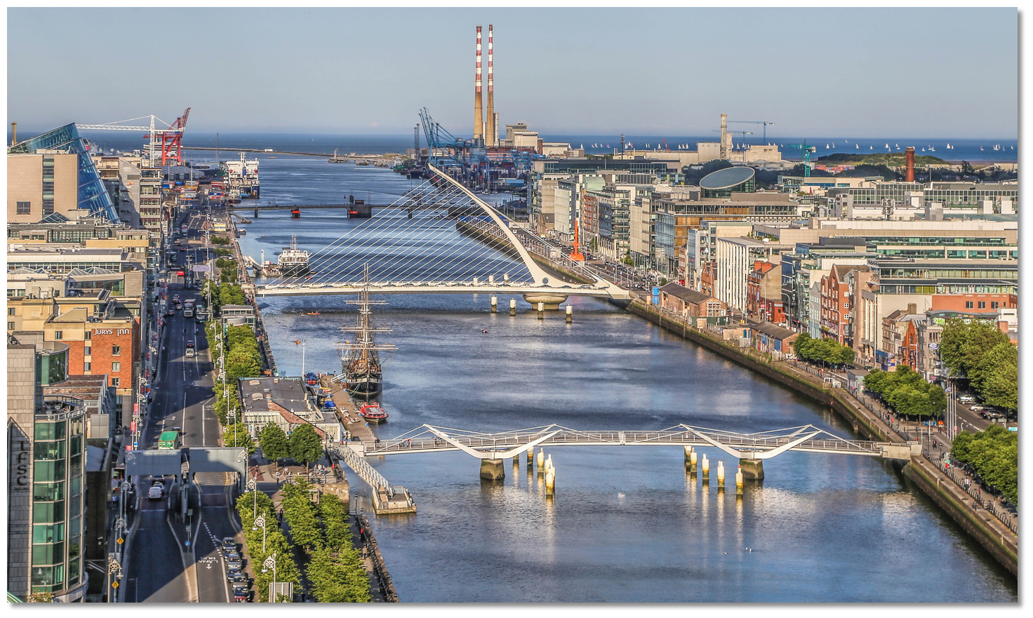 Dublin City Moorings above the East Link and Samuel Beckett bridges
Image: Tourism Ireland
The other alternative is the more central Dublin City Moorings that are located 1 mile further upriver to the west of the East Link and Samuel Beckett bridges. These must be pre-booked and are available to visitors on a short term basis.
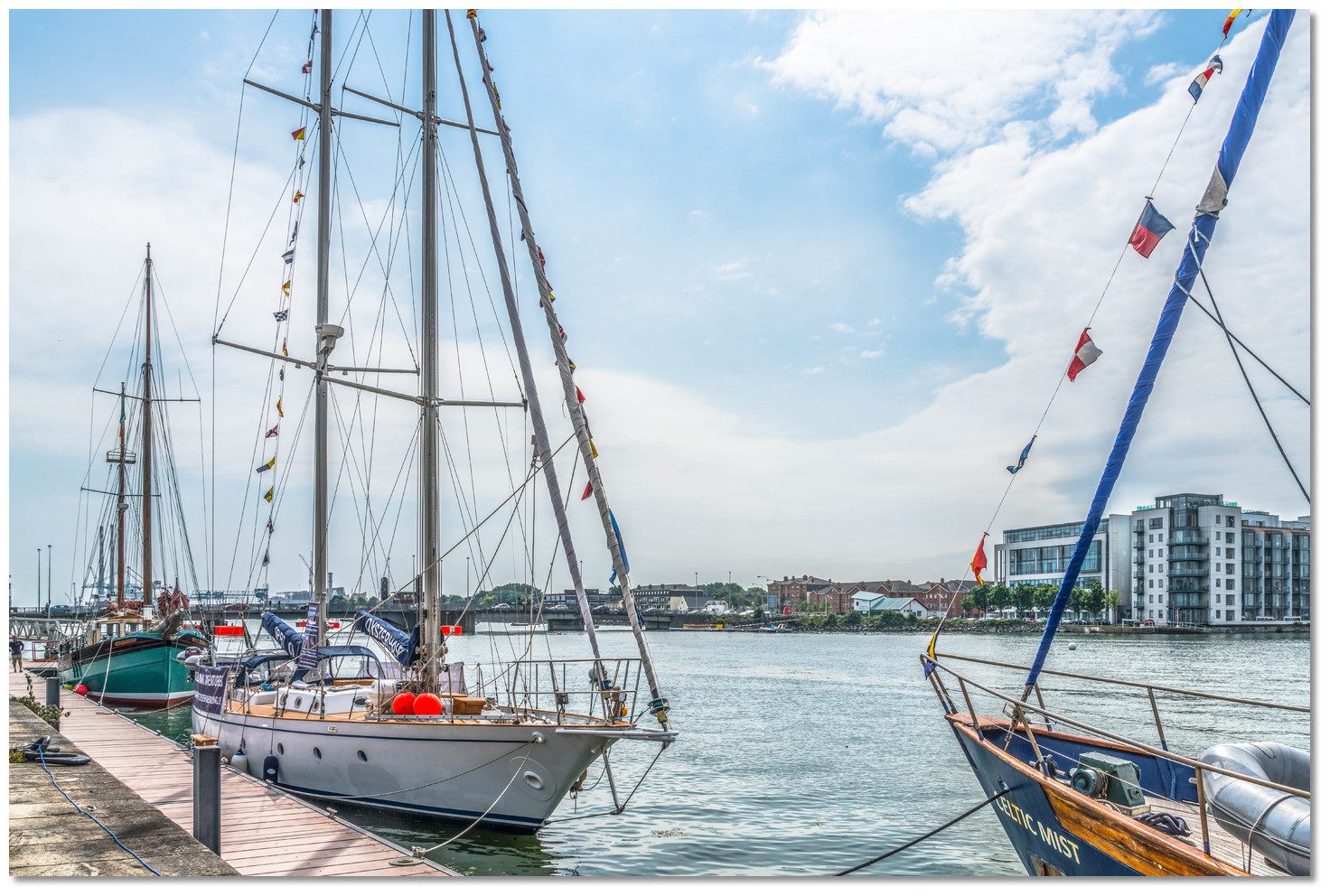 Yacht alongside Dublin City Moorings
Image: William Murphy via CC BY SA 2.0
The East Link has a width of 31.5 metres and vertical clearance of 2.2 metres (HWS) 1.85 (HAT), 6.3 metres (LAT) when closed so a sailing yacht would require a bridge lift to pass upstream. The Samuel Beckett bridge is slightly lower with a 1.6 (HAT). Therefore sailing vessels will require two synchronized bridge lifts for access and a berth will only be granted following confirmation of bridge lifts from the Harbourmaster's Office.
 Military ship passing through the East Link Bridge
Image: Irish Defence Forces via CC BY 2.0
The bridge operator can be contacted on [VHF] Ch. 12 and 13 [East Link] or via Dublin Port
 +353 (0)1 8876000. The bridges are only opened for leisure craft between 00:00 hrs to 06:30 hrs, at 11:00 hrs and between 20:00 hrs to 24:00 hrs.
How to get in?
 Port of Dublin and Dublin Bay
Image: Giuseppe Milo
 Offshore details are available for vessels approaching from the north in eastern Ireland’s Coastal Overview for Strangford Lough to Dublin Bay
  and, from the south, in eastern Ireland’s Coastal Overview for Dublin Bay to Rosslare Harbour
  . Dublin Bay is unmistakable from seaward, situated between Dalkey Island on the south and the ‘Hill of Howth’ on the north. It is about 5.8 miles wide and 6 miles River Liffey flows into the head of the bay. This is guided by long walls with pierhead lights. Dublin Port and city line both banks of the river close within the entrance. Kish, Bennet, and Burford Banks in the approach and Rosbeg Bank in the entrance are the only dangers other than those near the shores. All are moderately deep but can be subject to breakers.
 Poolbeg Power Station's chimneys make an unmistakable sea mark
Image: Dan Heap via CC BY 2.0
Once in the Bay, the path of approach to Dublin Port is very easily located as a result of the twin Poolbeg power station chimneys situated on the south bank of the river about 1½ miles above the harbour entrance. The two conspicuous 210 metres high chimneys stand close together and have red with white painted bands. Beneath them is the large complex of an electricity generating station. At night red aeronautical lights show from the top of the chimneys at a height of 85 metres along with fixed red lights at intermediate heights.
The lighthouses on the ends of the outer piers of the training walls will be seen eastward Poolbeg chimneys. Poolbeg (red) on the end of the Great South Wall and North Bull (green) on the head of the Bull Wall that covers at high water.

The Harbour Master provides Dublin Bay Guidance Notes for Leisure Craft web page
 .
. Port of Dublin
Image: Tearbringer via CC BY-SA 4.0
Their instructions for leisure craft is to:
- • Stay out of the TSS and at least a ½ mile from the Dublin Bay Buoy, (see coastal description
) and remain close outside of the buoyed fairway channel. This is the main shipping channel that commences at the 'Safe Water Mark' in the centre of Dublin Bay and terminating at the entrance to the Liffey. Leisure vessels are required to give large vessels the freedom to manoeuvre at all times (Colregs Rule 9). If it is necessary to cross the TSS or Fairway, check that it is entirely free of commercial shipping and cross at a right angle. Ships, especially ferries, move fast in the approaches so keep a sharp watch.
- • Once inside the Liffey, leisure vessels to approach to the north side of the channel starboard marks, as required by normal COLREGS for buoyed channels, for the passage up the Liffey. Only cross the channel to the south side when safe to do so abreast of the two Poolbeg Generation Station chimneys and at 90°.
- • During the passage up the Liffey, it is requested that vessels should maintain a listening watch for traffic information from [Dublin Port V.T.S] on VHF Ch. 12, the port working frequency, taking care to assure the volume is high enough to be heard above the engine noise. A hand-held or binnacle-mounted remote VHF is essential.
- • As VHF Ch.12 is Dublin Port’s primary working channel, used to manage port traffic, they ask users to avoid unnecessary communication on the channel and indicate that vessels should only contact them in the event of observing difficulties. In the event of being contacted, a vessel should immediately obey any instructions given by Dublin Port VTS.
In practice, however, they prefer all newcomers or non-regular visitors, that are less familiar with the port, to call in to [Dublin VTS] and state their position and intentions on Ch.12 prior to entering the Liffey. Their worst situation is a visiting vessel coming up the Liffey unsure of the exact procedures and out of contact. Port control is just as interested in leisure boat safety as that of commercial shipping.
 Powerboat exiting to the south of the Liffey Fairway buoys
Image: William Murphy via CC BY SA 2.0
There is, however, a local procedure for vessels approaching Pollbeg Marina that avoids crossing the Liffey at the Poolbeg Power Station. It is used by all local boats and may also be used by visitors who understand the approach and make their intentions clear. Proceed to the Poolbeg Lighthouse and then remain just south of the channels red port hand lateral marks all the way up to the Poolbeg Sailing Club. Do not stray too far south from the line of red buoys since it shoals very fast. As a visitor, you must indicate to VTS on CH 12 that you know the procedure. The protocol is as follows and should be carried out when approaching the Poolbeg Light.
['Yacht [name] to Dublin VTS. Approaching Poolbeg Lighthouse clear of the channel. Will proceed on the south side of the Liffey, south of the port hand marks and clear of the channel to Poolbeg Yacht Club'.]
Dublin VTS will most likely respond an approval as follows:
[“Dublin VTS, yacht [name] proceeding from Poolbeg Sailing Club, south of the buoyed channel to Poolbeg Light”]
A Dublin VTS notification should also be adhered to when leaving Dublin Port.
_north_side_of_the_entrance_and_poolbeg_(red)_on_the_south_side.jpg) The North Bull (green) north side of the entrance, and Poolbeg (red) on the
The North Bull (green) north side of the entrance, and Poolbeg (red) on thesouth side
Image: William Murphy via CC BY SA 2.0
 The entrance channel commences from the area of the initial fix, adjacent to the normal starboard approach from the No. 1 Fairway Light starboard buoy. The buoys lead across Dublin Bay for a distance of 2 miles to the harbour entrance between the North Bull [green], on the north side of the entrance, that corresponds with Poolbeg [red tower], on the south side. Both lighthouses will have been readily apparent in the bay area for many miles before the initial fix.
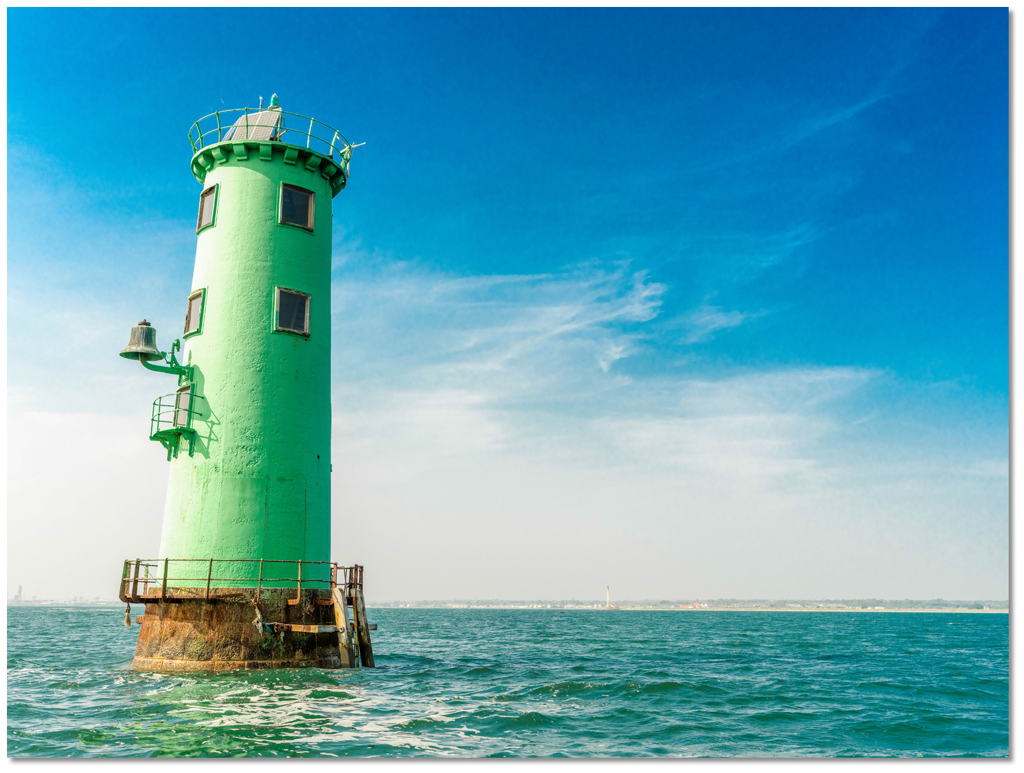 North Bull light tower with the Bull Wall covered
Image: Siobhan Pepper via CC BY-SA 2.0
The North Bull Light is 15 metres high and stands at the head of the north breakwater. 'The Bull Wall' leading to the North Bull lighthouse, notably credited to Captain Bligh during his Dublin tenure, covers at high water.
North Bull - Fl. (3) G10s 15m 15M position: 53° 20.690’N, 006° 08.920’W
 Poolbeg at the head of the Great South Wall
 Image: William Murphy via CC BY SA 2.0
The 20 metres high Poolbeg Light stands at the head of the south breakwater or 'The Great South Wall'. This wall never covers and is very popular line fishermen and walkers.
Poolbeg - Oc. (2) R 20s20m15M position: 53° 20.520’N, 006° 09.020’W
The entrance to the Liffey can be a bit lumpy in a wind over tide situation but this should not be much of an issue for the average cruising yacht. Between the heads, the channel is about 215 metres wide and dredged to a depth of 7.8 metres. The dredged channel is 140 metres wide at its narrowest point as far as Poolbeg Yacht & Boat Club & Marina and is well marked by numbered light buoys on each side.
Once inside the Liffey yachts must operate under power. From the entrance to the Poolbeg Generating Station inbound leisure craft should keep just outside of the line of the buoys marking the commercial channel, if close outside as it gets shallow very quickly.
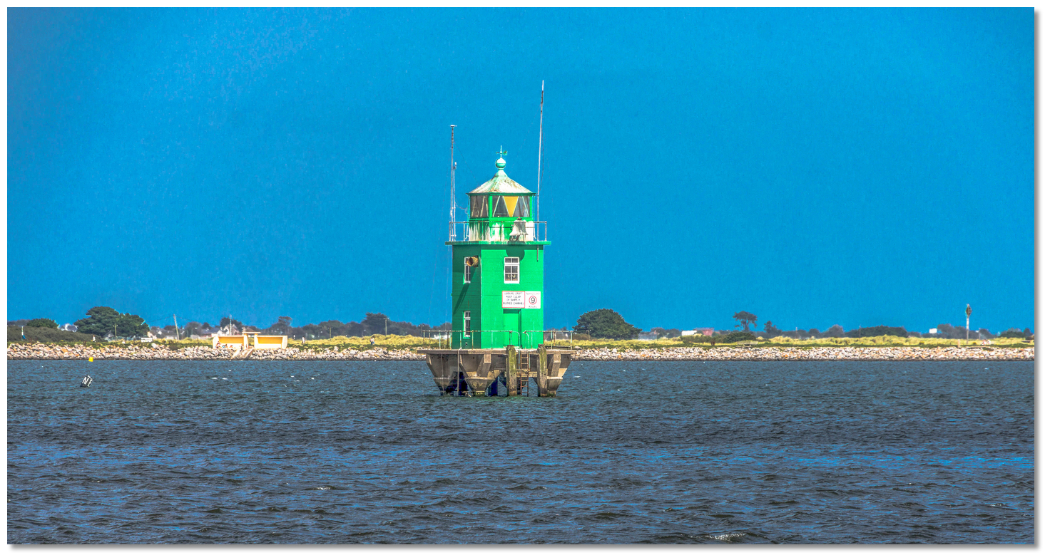 The North Bank Light locally known as 'The Tea Caddy'.
Image: William Murphy via CC BY SA 2.0
From the entrance, a further 11-metre high tower will be seen situated 0.9 miles west, about halfway to the first of the quays. This is the North Bank Light mounted on concrete pillars and coloured green and it marks the north side of the channel.
It is locally known as 'The Tea Caddy'.
North Bank – Tower Oc.G.8s.16M position: 53° 20.684'N, 006° 10.537'W
Those passing close outside the north side of the channel should pass south of North Bank tower. Then at Poolbeg Generating Station leisure craft should cross at right angles, when it is safe to do so, to the south side of the channel, and continue upriver as far in as is practicable to the south side.
Keep clear of all shipping and maintain a sharp lookout at all times, particularly so astern, as the Port of Dublin is a very busy commercial port and ships can quietly come upon a vessel during the run upriver. These vessels normally berth on the north side of the river but many swing to occupy most of the river during their berthing procedure.
 Poolbeg Yacht & Boat Club pontoons
Image: Michael Harpur
 Poolbeg Yacht & Boat Club & Marina is on the south side of the river, immediately upstream of the Container Terminal and opposite the entrance to the Alexandra Basin with its black and white lighthouse.
Berth as arranged or, if no prior arrangements have been made and no one is responding, come alongside the outer long pontoon. Avoid approaching any inner finger pontoons without specific instruction as there are some shallow patches.
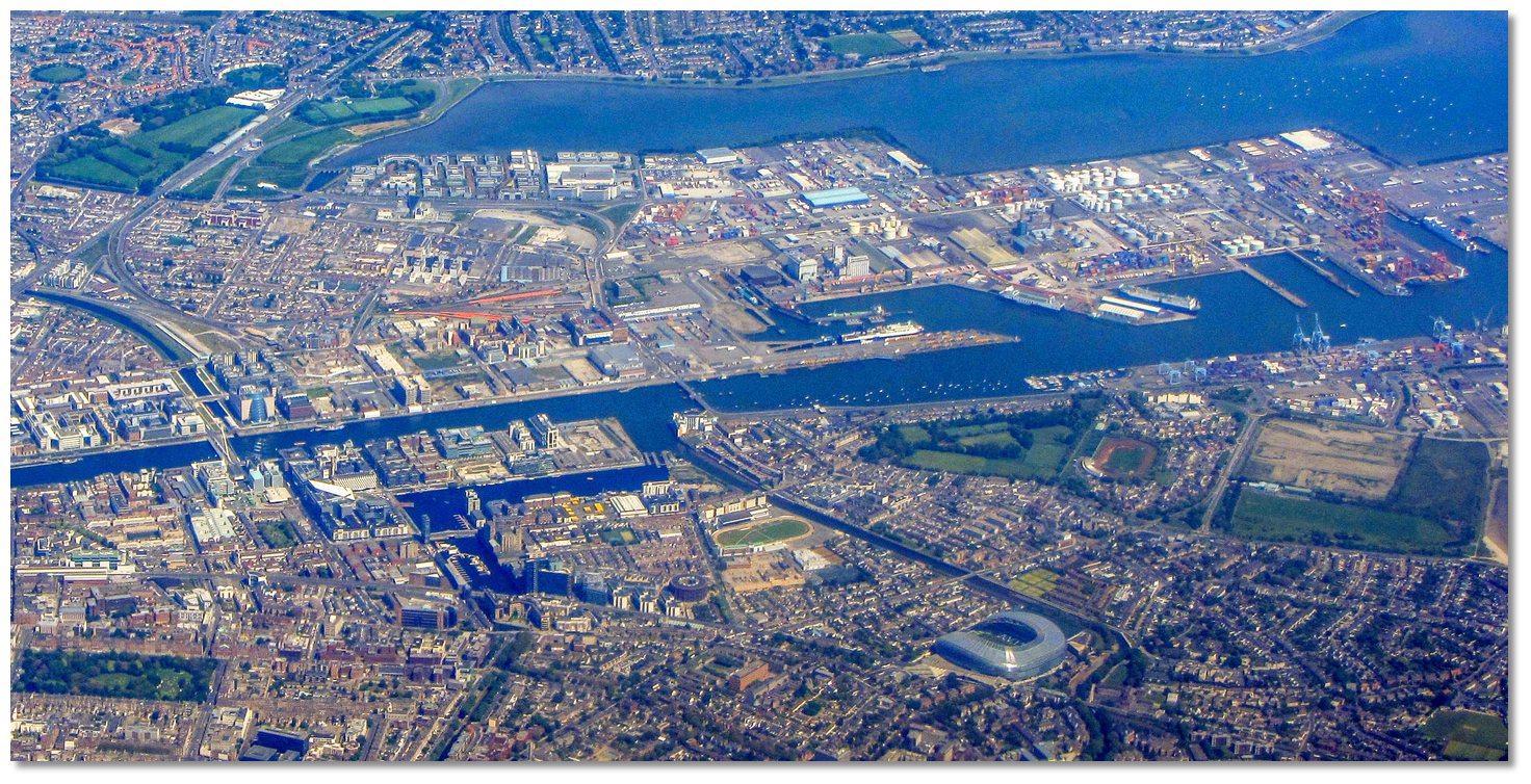 Dublin City Moorings one bridge lift above Poolbeg Yacht & Boat Club
Image: Tearbringer via CC BY-SA 4.0
Access to the Dublin City Moorings requires two synchronized bridge lifts; the East Link and Samuel Beckett bridges, for a sailing yacht to pass upstream. A minimum of 2 hours notice is required and the bridges are only opened for leisure craft between 00:00 hrs to 06:30 hrs, at 11:00 hrs and between 20:00 hrs to 24:00 hrs. However, they do open at other hours for commercial vessels and it may be possible to follow one through - see advisory
 .
.  Tall Ship exiting through the East Link Bridge
Image: William Murphy via CC BY SA 2.0
The bridge operator can be contacted on [VHF] Ch. 12 and 13 [East Link] or via Dublin Port
 +353 (0)1 8876000. Give some thought to the arrangements for the following day too and schedule a lift to get out at the same time so as to avoid being trapped on upriver.
The piers on either side of the 31-metre lifting span are painted bright orange so you can clearly see where you pass before the bridge lifts.
The Port Traffic signals used for the lifting span are as follows:
- 3 Vertical Red Lights to mean vessels shall not proceed.
- 3 Vertical Green Lights to mean vessels may proceed. (One way traffic only).
- 3 vertical Red Lights FLASHING to mean Emergency – all vessels stop or divert.
 Yacht off Dublin City Moorings
Image: William Murphy via CC BY SA 2.0
Dublin City Moorings will be found on the north bank of the river Liffey adjacent to the International Financial Services Centre.
Why visit here?
Dublin derives its name Dubhlinn, or Duibhlinn, that are made up of the elements dubh, meaning 'black' and linn meaning 'pool' or 'black-pool'. The name stemmed from dark bog waters that once drained into the original river anchorage making it a 'black pool'. The modern Irish name for the city is Baile Átha Cliath, meaning 'town of the hurdled ford' referring to a fording point over the River Liffey that existed near the present Father Matthew Bridge. Depiction of the a Viking fleet landing at Dublin
Image: Public Domain painting by James Ward 1851-1924
At this time Baile Átha Cliath was an early Christian monastery, but human habitation of the area dates back to prehistoric times. This is well evidenced by having four of Ireland’s five ancient great roads converging very close to the location of Baile Átha Cliath. Possibly the earliest reference to a settlement in Dublin appeared in Ptolemy’s, the Greco-Roman astronomer and cartographer, AD 140 Geōgraphikē hyphēgēsis, ‘Guide to Geography’. In it he called the settlement Eblana Civitas. Yet, despite these indications of more than 2,000 years of habitation, the first settlement for which there is historical proof was not to be Celtic but Norse. For these raiders, a well-protected sea opening, at the head of the large bay that leads in through the mountains to the fruitful Irish central plains, could not have been more ideal.
 Depiction of the Battle of Clontarf
Image: Public Domain painting by Hugh Frazer 1826
In about 830 AD they built a settlement in an area now known as Wood Quay. This was on the River Poddle which was a tributary of the Liffey, and they used the small dubhlinn lake to moor their boats. During this period the Poddle connected the lake with the Liffey but it was covered over during the early 18th-century when the city was extensively developed. They built a settlement and fort on the ridge above the river’s south bank where Dublin Castle was to rise 400 years later. From here the raiders ruled for almost three centuries during which time they establishing one of Europe’s largest slave markets.
 River Liffey today
Image: Tourism Ireland
Throughout this time they fended off Irish counter attacks until they were defeated on the north shore of the bay by the Irish High King Brian Boru in the 1014 Battle Of Clontarf. They nevertheless reoccupied the town and re-established themselves albeit with the Norse kings reduced to being earls under the new Irish overlords.
 Dublin Castle today
Image: Taranis via CC BY-SA 2.0
Although founded as a Viking settlement Dublin would go on to become Ireland's principal city after the Normans took control. Strongbow, the 2nd Earl of Pembroke and leader of the invasion, captured the city in 1170. Alarmed for fear that Strongbow and his generals would claim Ireland for their own and establish a breakaway kingdom, Henry II, King of England, quickly landed in Ireland with a large army to affirm his sovereignty. In Dublin, they set about removing the Norse strongholds and in 1204, on the orders of King John of England, raised a typical Norman château-fort, Dublin Castle, to consolidate their power. Founded for the defence of the city, the administration of justice, and the protection of the King's treasure, the castle was largely complete by 1230. It became the centre of Norman power in Ireland and was key to Dublin’s development, establishing it as the centre of government.
 Dublin central street Merrion Square
Image: Tourism Ireland
Around the castle and national seat of government, a walled town began to establish itself. In the following half-century, it saw off an attempt to capture it by the Scottish King Robert I in 1317, suppressed three uprisings, and in the decade following 1348, endured the Black Death, a lethal plague which had ravaged Europe. Throughout this time the town prospered as a centre for trade. Yet, under constant threat from the surrounding native clans, it remained a relatively small walled medieval town as late as the middle of the 17th-century. By then Dublin was part of a narrow strip of English settlement along the eastern seaboard known as 'The Pale'. It was then the only part of Ireland that remained subject to the English king. Most of the island was by then only paying token recognition to the overlordship of the crown.
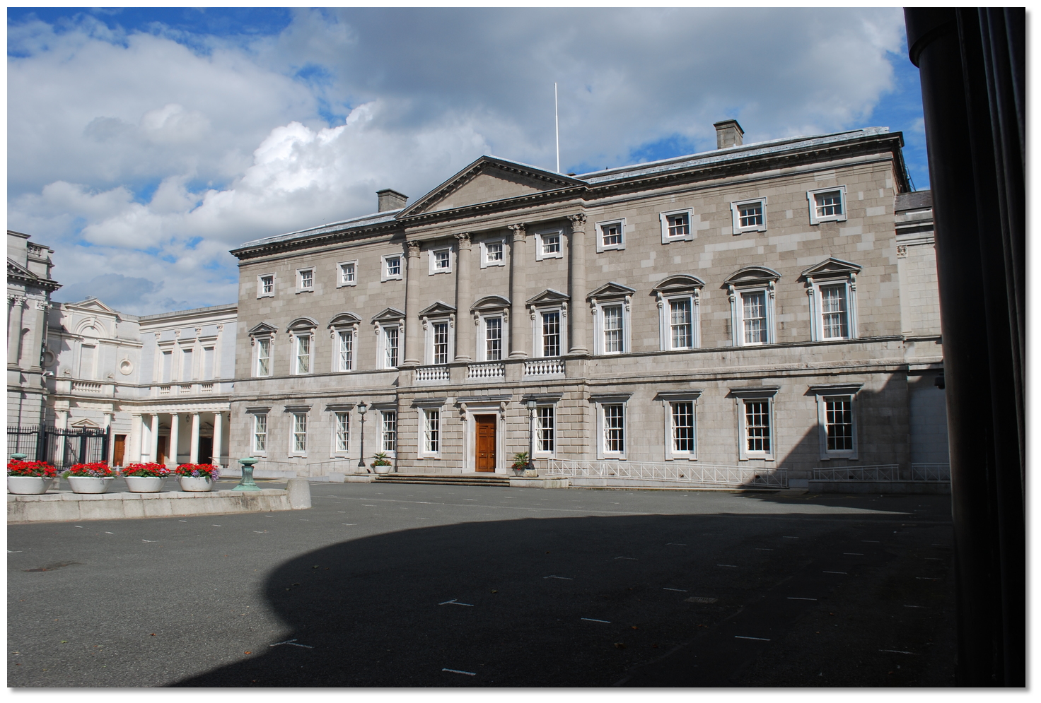 Leinster House now the seat of the Oireachtas, the parliament of Ireland
Image: Jean Housen via CC BY-SA 3.0
The 16th-century Tudor conquest of Ireland spelt the beginning of a new era for Dublin. Dublin and the surviving Pale at the time were used as the crown's main military base and the city enjoyed a renewed prominence as the centre of administrative rule in Ireland. Determined to make Dublin a Protestant city, Queen Elizabeth I established Trinity College in 1592 as a solely Protestant university and ordered the Catholic St. Patrick's and Christ Church cathedrals be converted to Protestant churches. By the time of the Reformation, Dublin had become largely Protestant.
 Trinity College Dublin
Image: Tourism Ireland
During the English Civil Wars, the city defenders surrendered the city to Oliver Cromwell’s English parliamentary army when they landed in 1649. In 1689 James II held his last Parliament in Dublin, and after winning the ‘Battle of the Boyne’, William III entered the city as the new King in 1690. But the Dublin he entered was not faring well. The plague in 1649–51 wiped out almost half of the city's inhabitants leaving a population of only about 9,000 and the town was largely in a state of collapse. Even its central castle had been described by Cromwell as being, “the worst in Christendom.”
 River Liffey Bridge
Image: Tourism Ireland
From this low point, the city underwent a remarkable resurgence before the Act of Union in 1800. It briefly became the second-largest city in the British Empire and the fifth-largest city in Europe. The growth was propelled by an influx of thousands of refugee French Protestant (Huguenots) weavers. They came here after the 1685 revocation of the Edict of Nantes that had curtailed their rights. In their wake came Flemish weavers, then English, and soon the cloth trades were flourishing. Following a decisive military defeat of the native Irish, a new English Protestant establishment became Dublin’s ruling elite. Known as ‘The Ascendancy’ they were made up of soldiers, officials, settlers, and artisans who arrived in substantial numbers from England, displacing the previously dominant Catholic patrician families.
 The old parliament building is now a bank
Image: Tourism Ireland
The wealthy aristocratic elite employed a network of fine craftsmen, luxury goods sellers, and aesthetic, cultural, and intellectual endeavours. With them, Dublin grew rapidly as a commercial, administrative, and industrial centre. The economic prosperity led to wholesale development with one of the most vibrant sectors being the construction industry.
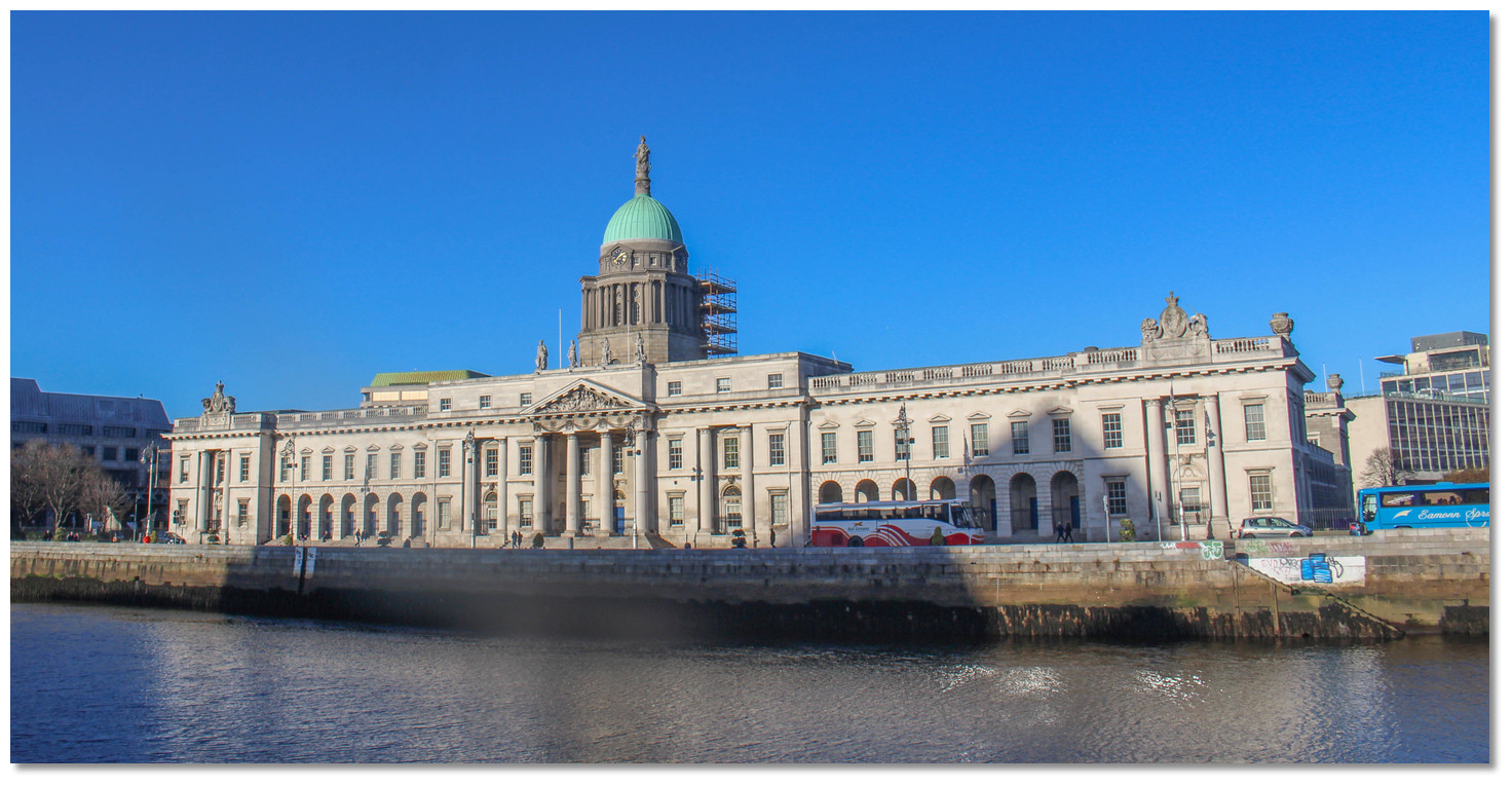 The Customs House overlooking the river
Image: Tourism Ireland
Dublin, as we know it today, was built in the 18th-century. The city they built extended beyond the old medieval walls establishing new suburbs to the north and east with connecting bridges along the river. They built broad streets and garden squares with a sense of space, order and beauty. The trademark Georgian red brick houses ranged in squares and long terraces were built with well-proportioned windows. In between they included plenty of parks, and the most notable amongst them Phoenix Park, is to this day Europe’s largest enclosed urban park.
 Farmleigh in Phoenix Park
Image: Tourism Ireland
This was Dublin’s culturally richest period and it was widely regarded as a colourful, fashionable city of elegance and wit. But this was all the reserve of ‘The Ascendancy’; it was something very different for Roman Catholics who constituted the majority of the city’s population. They endured ‘The Ascendancies’ Penal Laws. These were a series of harsh discriminatory measures against Catholics and Presbyterians. They included laws of disenfranchisement, restrictions on property ownership, educational obstructions and other constraints to thwart Catholics entering the professions. As a result, the majority population was impoverished and degraded.
_in_about_1900.jpg) Sackville Street (O'Connell Street) in about 1900
Sackville Street (O'Connell Street) in about 1900Image: Public Domain
But the city's seminal years were about to come to an abrupt end in 1801. Then the 'Act of Union' created the 'United Kingdom of Great Britain and Ireland' and merged the British and Irish legislatures into a single Parliament of the United Kingdom. With Dublin’s ‘Parliament of Ireland’ abolished Irish representatives were thereafter sent to the British Parliament to serve. With no governmental duties to compel a local presence, the leading figures of the Ascendancy moved from their Dublin mansions to London. Wealthy aristocrats followed and the city fell into a decline from which it did not recover for 150 years.
.jpg) Rebels Holding the General Post Office (GPO)
Rebels Holding the General Post Office (GPO)Image: Public Domain
The Industrial Revolution then started to transform England, but this passed Dublin by. Ireland had no significant sources of coal, the fuel of the time, and unlike Belfast, a centre of ship manufacturing which was the other main driver of industrial development, Dublin had no heavy industries. The city, however, remained the centre of administration and a national transport hub.
 1916 rebel barricade
Image: Public Domain
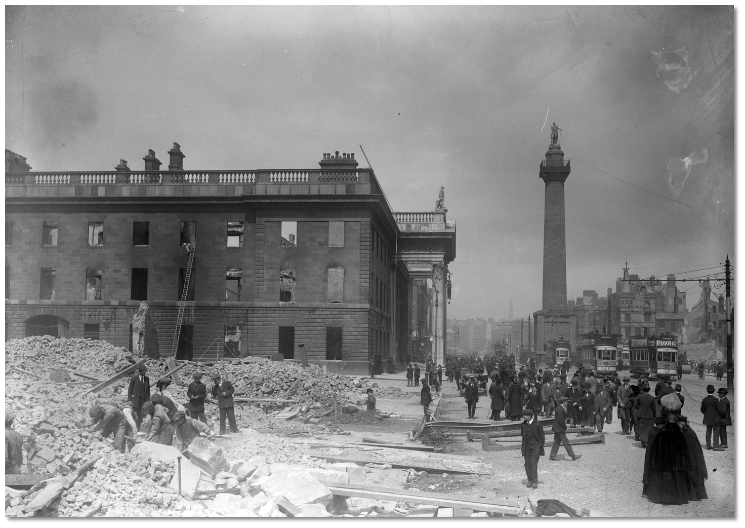 The shell of the GPO on Sackville Street afterwards the rising
Image: Public Domain
Infant and child mortality rates were uncommonly high, with tuberculosis constituting a particular scourge. Sanitation and hygiene were practically non-existent. As a consequence of the abysmal conditions, a series of strikes known as the Dublin Lockouts commenced in 1913 that would paralyse the city. These were largely led by the trade union leader 'Big Jim' James Larkin who fought for the rights of unskilled workers to unionise, coining the phrase "A fair day's work for a fair day's pay". This unrest and unease would culminate eventually in an armed insurrection in 1916.
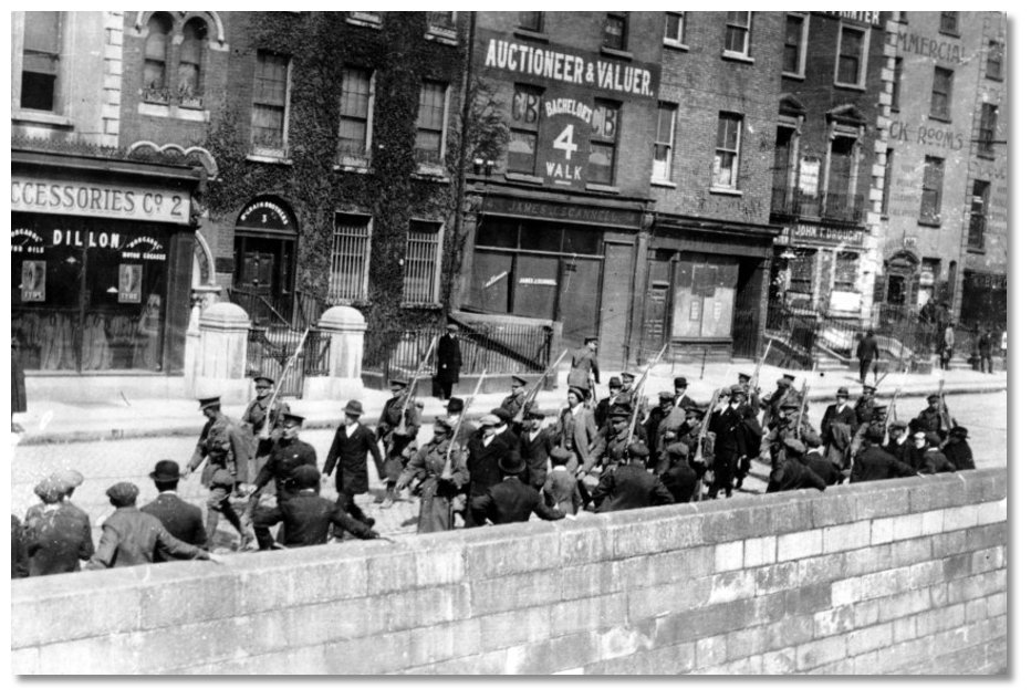 Rebel prisoners being marched to gaol
Image: Public Domain
They seized key Dublin locations with the GPO in Sackville Street been at the centre point of their efforts. It was from here that they proclaimed the Irish Republic independent of the United Kingdom. With vastly superior numbers and artillery, support by gunboats that ascended the Liffey, the British army quickly suppressed the rising within six days. Defeated, the surviving rebels were marched through the streets of Dublin to gaol.
 The remains of the Dublin Bread Company
Image: Public Domain
These were soon followed by trawls of arrests throughout the country of those remotely thought to be implicated. These arrests brought further waves of men to be incarcerated in prison ships in Dublin Bay. A total of 3,430 men and 79 women were arrested, including 425 people for looting.
 Ruins of the Metropole Hotel on Sackville Street, next to the GPO
Image: National Library of Ireland on The Commons
To the eyes of the denizens of the city, they were a band of troublemakers who caused wholesale destruction of the capita. They had entirely halted the commerce and industry that gave the populace the most meagre of livings. This included food supplies that put a quarter of the city’s population on public relief. They saw the rebels as hot-headed vandals and their efforts pointless as the 1912 Home Rule Bill had already set on track a slow path to devolution, albeit temporarily delayed as a result of the war. So when the Volunteers were marched through the streets they were hissed at, pelted with refuse, and denounced as "murderers" and "starvers of the people" to the jeers and abuse of the largely lower-class populace.
 The wall at Kilmainham Gaol where the rebels were executed
Image: Sitomon via CC BY-SA 2.0
But the United Kingdom, heavily engaged in World War I and seeing the revolt as a stab in the back, was heavy-hardheadedly changing sentiment. The mass imprisonment and establishment of martial law in Dublin was starting to take its toll. But the critical mistake they made was to execute the leaders of the rebellion within 10 days, a group comprising largely, socialists, poets and dreamers. The resultant shock of the aftermath roused the nationalist fervour that the rebellion itself had failed to ignite. Revolutions across Europe further emboldened a new swell of Irish revolutionaries.
 Crowds awaiting for the release of the rebel prisoners in Westland Row 1917
Image: National Library of Ireland on The Commons
The following Irish War of Independence and the subsequent Irish Civil War resulted in a significant amount of bloodshed and physical destruction in central Dublin. But through this process, Dublin re-established itself again as the capital of the Irish Republic from 1919 - 1922, and following the 1922 partition of Ireland the capital of the Irish Free State through to 1949, since then the capital of the Republic of Ireland. The Government of the Irish Free State rebuilt the city centre and located the new parliament, the Oireachtas, in Leinster House. Sackville Street (originally named after Lionel Sackville, 1st Duke of Dorset) was renamed in honour of Daniel O'Connell in 1924, a nationalist leader of the early 19th-century, whose statue stands at the lower end of the street, facing O'Connell Bridge.
 Statue in honour of James (or Jim) Larkin in O'Connel Street
Image: Tourism Ireland
Though Dublin has undergone modernization, in some areas, such as the narrow and winding streets of the Temple Bar district west of Trinity College, a strong sense of history and of a centuries-old capital pervades. The city has a faded grandeur that lends it a comfortable 'worn-in' feeling. Being the birthplace of Jonathan Swift, Oliver Goldsmith, Oscar Wilde, George Bernard Shaw, James Joyce, Sean O'Casey and Samuel Beckett, it is steeped in culture. This rich and turbulent mixture of history and culture has shaped the city as much as its citizens.
 Dublin is a friendly city to visit
Image: Tourism Ireland
Dubliners are world-renowned for friendliness and being always up for the 'craic', pronounced 'crack'. Far from being anything illicit 'craic' is aptly derived from the old English 'crack' meaning a 'pop' or 'small explosion', as in a firework, purely for a frisson of mirth or fun. In a discussion, it will be a found to be a mixture of banter, humour, astuteness, an acerbic and deflating insight that has attracted writers, intellectuals, and visitors to this warm and welcoming city for centuries.
 The Spire of Dublin, alternatively the Monument of Light, in O'Connell Street
Image: Tourism Ireland
From a purely boating perspective, this is a capital city well worth a visit. Poolbeg offers little when compared to Dún Laoghaire or Howth that have excellent transport links into the centre. Both, incidentally, are designated as ports of entry that may be used for clearing in purposed by vessels arriving entering territorial waters of the Republic of Ireland from outside of the EU & UK territories. But Poolbeg and most specifically Dublin City Moorings uniquely provide for the opportunity to berth at the heart of one of the most vibrant capital cities of Europe. Visitors here should visit the Dublin Tourist Centre, formerly St. Andrews Church, 1 Suffolk Street, Dublin 2 or explore the visit Dublin site in advance to plan how to get the most out of a visit to the capital.
What facilities are available?
Dublin is the capital city of Ireland and as such has everything you would need right at hand.In boating terms diesel fuel is available alongside at Poolbeg Yacht and Boat Club, bottled gas is available in Dublin City, and groceries can be brought to the marina by taxi. Water and electricity are available on the marina pontoons, shower and toilet facilities are located by the Clubhouse bar. Poolbeg is located in an off the beat industrial docklands area of the city. Ringsend and Irishtown are however within walking range where there are small shops, cafes and bars, but the centre of Dublin is about a 2 km walk. As it is an industrial area you are better off to order a taxi in advance.
Busaras, the Central Bus Station, is in Beresford Place just behind the Customs House Building. This offers services to Dublin airport every 20 minutes, which is approximately 15 KM north of the river, and also national bus services. Irish Ferries to Holyhead are available from Dublin Port and Dun Laoghaire (via Dart). The Blue Aircoach bus leaves the Maldron Hotel (Cardiff Lane) nearby for the airport every 20/30 minutes.
Dublin is served by an extensive network of nearly 200 bus routes which serve all areas of the city and suburbs. A "Real Time Passenger Information" system was introduced at 'Dublin Bus' bus stops in 2012. Electronically displayed signs relay information about the time of the next bus arrival based on its' GPS determined position.
Heuston and Connolly stations are the two main railway stations in Dublin. Operated by Iarnród Éireann, the Dublin Suburban Rail network consists of five railway lines serving the Greater Dublin Area and commuter towns such as Drogheda and Dundalk in County Louth. One of these lines is the electrified Dublin Area Rapid Transit (DART) line, which runs primarily along the coast of Dublin, from Malahide and Howth southwards as far as Greystones in County Wicklow. The Luas is a light rail system, run by Veolia Transport with a network that consists of two lines; the Red Line links the Docklands and city centre with the south-western suburbs, while the Green Line connects the city centre with suburbs to the south of the city.
Dublinbikes is a self-service bicycle rental scheme that consists of 550 French-made unisex bicycles stationed at 44 terminals throughout the city centre. A 3 Day Ticket costs €2 with the first 30 minutes of use free, but after that, a service charge depending on the extra length of use applies.
Any security concerns?
Both berthing facilities are secure with swipe card activated locked gates and CCTV surveillance.With thanks to:
Francis Butler local sailor._county_dublin_ireland_William Murphy (7).jpg)
_county_dublin_ireland_IMAG0375.jpg)
_county_dublin_ireland_IMAG0349.jpg)
_county_dublin_ireland_IMAG0360.jpg)
_county_dublin_ireland_IMAG0385.jpg)
_county_dublin_ireland_IMAG0352.jpg)
_county_dublin_ireland_IMAG0354.jpg)
_county_dublin_ireland_William Murphy (6).jpg)
_county_dublin_ireland_Joseph Bassett (1).JPG)
_county_dublin_ireland_Daniel Dudek_Corrigan via CC BY 2.0.jpg)
_county_dublin_ireland_The Liffey central Dublin Giuseppe Milo or pixael.com via CC BY SA 2.0.jpg)
_county_dublin_ireland_Tall Ship on the Liffey William Murphy via CC BY SA 2.0.jpg)
A good introduction to Dublin
Sights and Sounds of Dublin
Add your review or comment:
Dale Smith wrote this review on Sep 8th 2013:
According to an email received from info@dublindocklands.com on 3rd September 2013, the dock at Dublin City Moorings is no longer in operation.
Average Rating: UnratedPlease log in to leave a review of this haven.
Please note eOceanic makes no guarantee of the validity of this information, we have not visited this haven and do not have first-hand experience to qualify the data. Although the contributors are vetted by peer review as practised authorities, they are in no way, whatsoever, responsible for the accuracy of their contributions. It is essential that you thoroughly check the accuracy and suitability for your vessel of any waypoints offered in any context plus the precision of your GPS. Any data provided on this page is entirely used at your own risk and you must read our legal page if you view data on this site. Free to use sea charts courtesy of Navionics.


