
Set within the estuaries’ channels it offers good protection in most conditions. However, it is exposed to a large body of water to the north and with strong winds from northwest round to northeast it becomes uncomfortable. Chichester Harbour's channels are well marked making access straightforward in most conditions, day or night and at most stages of the tide.

Keyfacts for East Head
Facilities


Nature


Considerations


Protected sectors

Approaches

Shelter
Last modified
July 17th 2018 Summary
A good location with straightforward access.Facilities
Nature
Considerations
HM  +44 1243 512301
  Ch.14 [Chichester Harbour Patrol]
+44 1243 512301 Ch.14 [Chichester Harbour Patrol] Position and approaches

Expand to new tab or fullscreen
Haven position
 50° 47.444' N, 000° 54.745' W
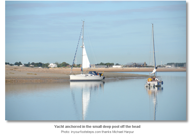
This is in the anchoring area close south of a line between East Head Spit and the Snowhill starboard buoys.


What are the key points of the approach?
Offshore details are available in the westbound  or eastbound sequenced 'Selsey Bill to Start Point' coastal description. Use the Itchenor
  entry for the approaches to Chichester Harbour and directions for Chichester Channel.
or eastbound sequenced 'Selsey Bill to Start Point' coastal description. Use the Itchenor entry for the approaches to Chichester Harbour and directions for Chichester Channel.Not what you need?
Click the 'Next' and 'Previous' buttons to progress through neighbouring havens in a coastal 'clockwise' or 'anti-clockwise' sequence. Below are the ten nearest havens to East Head for your convenience.
Ten nearest havens by straight line charted distance and bearing:
- Pilsey Island - 0.7 nautical miles NNE
- Sparkes Marina - 1.2 nautical miles WSW
- Chalkdock Point - 1.8 nautical miles NE
- Itchenor - 2 nautical miles ENE
- Hayling Yacht Company - 2.3 nautical miles WNW
- Thornham Marina - 2.8 nautical miles N
- Bosham - 3 nautical miles NE
- Birdham Pool Marina - 3.2 nautical miles ENE
- Emsworth Yacht Harbour - 3.2 nautical miles NNW
- Northney Marina - 3.3 nautical miles NW
These havens are ordered by straight line charted distance and bearing, and can be reordered by compass direction or coastal sequence:
- Pilsey Island - 0.7 miles NNE
- Sparkes Marina - 1.2 miles WSW
- Chalkdock Point - 1.8 miles NE
- Itchenor - 2 miles ENE
- Hayling Yacht Company - 2.3 miles WNW
- Thornham Marina - 2.8 miles N
- Bosham - 3 miles NE
- Birdham Pool Marina - 3.2 miles ENE
- Emsworth Yacht Harbour - 3.2 miles NNW
- Northney Marina - 3.3 miles NW

Chart

How to get in?
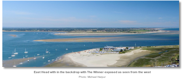
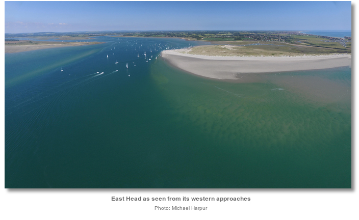
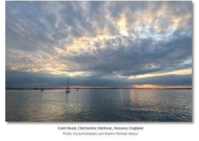
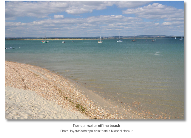
East Head sits on the south side of Chichester Harbour. Located a mile up the Chichester Channel, that stretches north-westward up through the harbour, it is conveniently close to the entrance and easily accessed. It is, however, East Head's natural beauty that makes it the most popular of Chichester Harbour’s three recognised anchorages.
The other anchorages of Pilsey Island
, accessible by branching off in the Thorney Channel, and Chalkdock Point , on the approaches to Itchenor, are also accessed from Chichester Channel that is detailed, along with approaches to the harbour, in the Itchenor entry.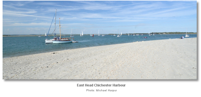
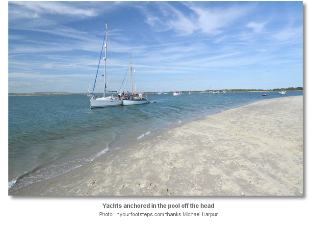
Chichester Harbour's sheltered and drying channels are almost entirely occupied by private moorings. Vessels should not anchor in or near established mooring grounds for fear of fouling existing ground tackle. Vessels anchored in Chichester Harbour should not be left unattended for long periods and must display a black ball along with an anchor light at night. Swimming off the boat is dangerous here because of the strong tides within the channel.
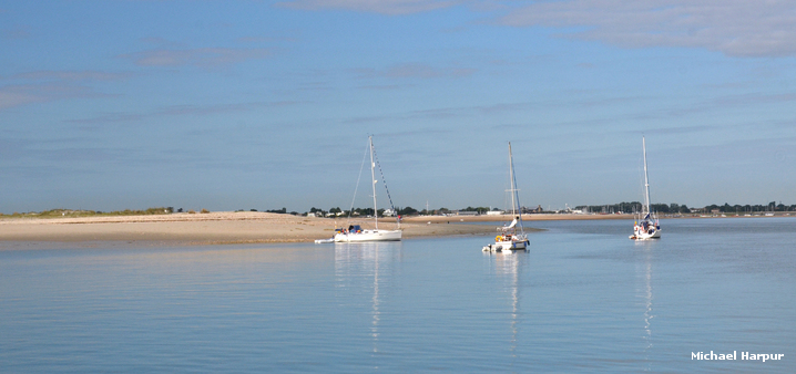
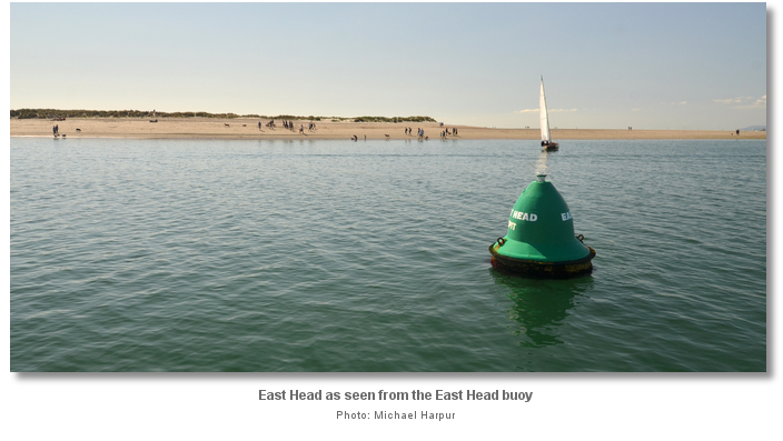
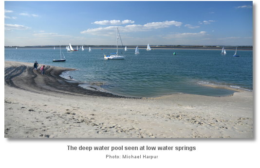
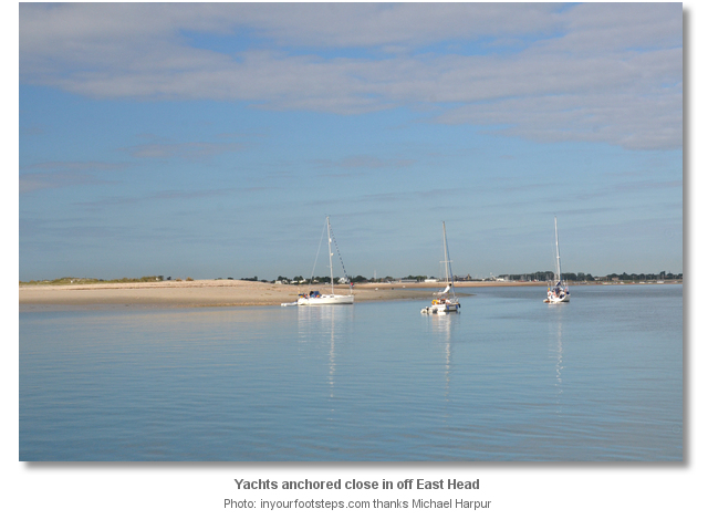
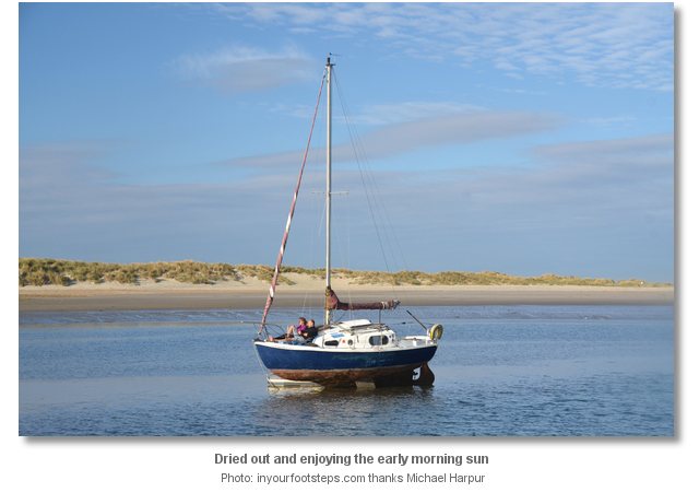
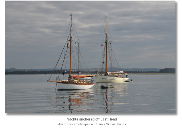
 Drop off the Chichester Channel between East Head Spit buoy and the Snowhill buoy and anchor anywhere close south of a line between the buoys. Depths of 6.4 to 3.2 metres will be found in this area with excellent sand holding.
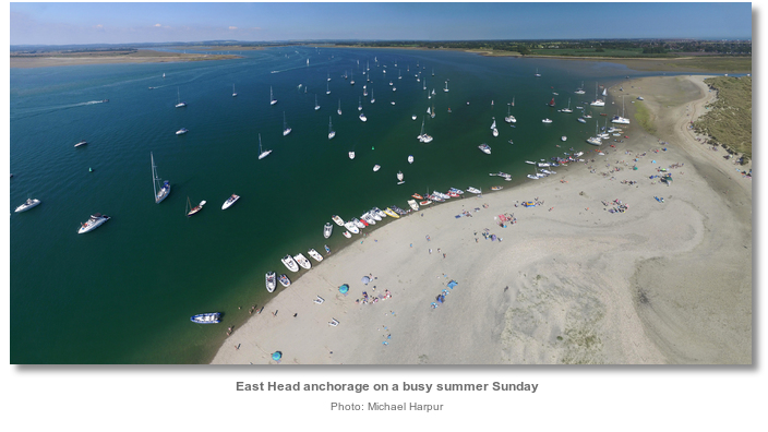
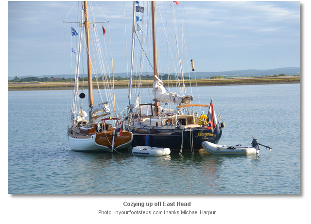
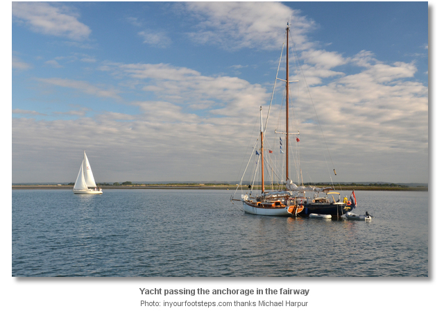
 The anchorage, although quiet during the weekdays, can be very busy during summer weekends. During busy times it is important not to anchor in such a fashion as to encroach upon the main channel.
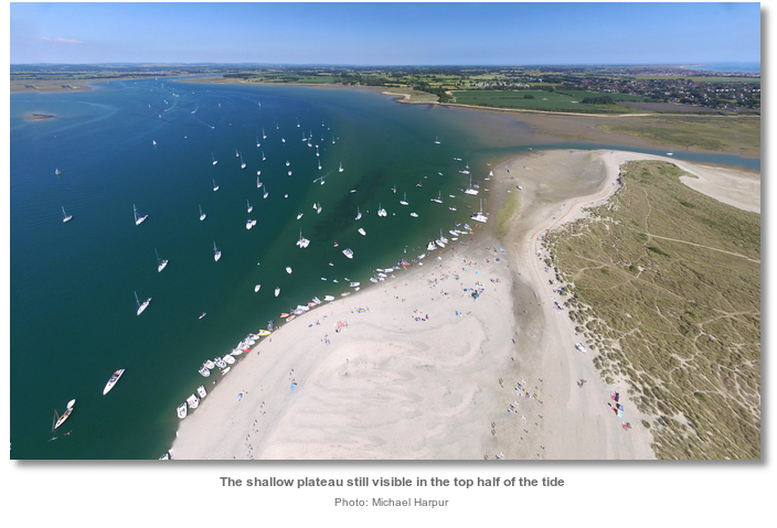
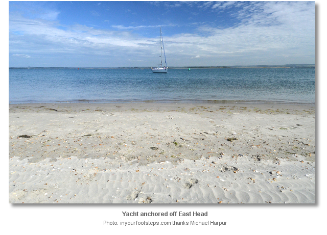
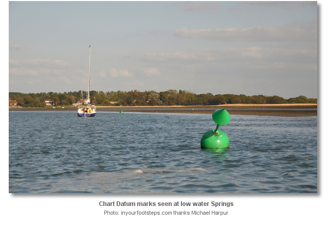
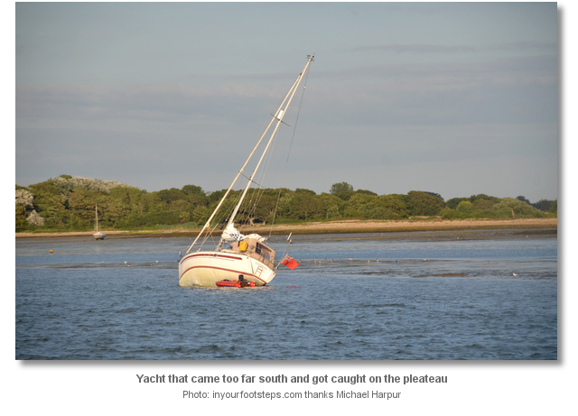
Likewise, it is important not come too far south and anchor at high water. A shallow plateau extends east by northeast from the head following the line of the channel.
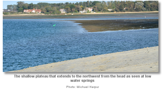
The flat has tended to catch out many an unwary visitor each year. In all cases the vessels crews only have to endure the long ‘wait of shame’ but it is more than embarrassing as fuel can spill through breather pipes when aground and there is always the risk of an adverse turn of events. To avoid this the harbour master has marked the Chart Datum contour of this flat with two small unlighted starboard buoys. These are located to the south of the main channel’s East Head Spit and Snowhill marks on the northern side of the shallow area. Only vessels that can take to the hard and are intending to dry out should anchor to the south of these Chart Datum marks.
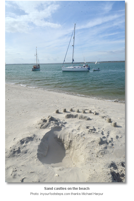
Land on the beach by tender.
Why visit here?
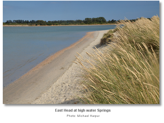
The head was formed by a process known as longshore drift. In this process, sands are washed, or up-drift, along the coastline gradually accumulating in shoreline shallows. Then, at low tides, the top sands are dried and blown inland. These inland deposits progressively amass ashore to form dunes. Over time these are stabilised by plants that grow within the sands. This is how East Head was formed and although East Head has changed very little in the past half century it is both a dynamic and fragile environment.
Although it has now largely stabilised in its current form it is a very fragile environment and increasingly so. The head was breached immediately north of its narrowest section, that links the spit to the mainland, called the Hinge by a severe storm in 1963. It was overtopped in 1987 after which the drowning of its stabilising plant life caused rapid thinning. The sea broke through again in 2004 almost entirely washing away the area around the Hinge.
To combat this East Head has had extensive use of artificial structures to stimulate dune growth. In 2005 a 'rock berm' was put on the inside of the Hinge area to secure the spit’s connection to the mainland and avoid the formation of a new channel. To support this, huge quantities of sand were also transported from the northern tip to this area, and again in 2009. The manually created dunes have been extensively planted with Marram Grass. Despite this assistance, the neck of the spit remains vulnerable. A combination of a spring tide with a severe storm could wash it all away.
Today East Head is a Site of Special Scientific Interest, SSSI, and a designated Ramsar wetland site of international importance. It is now managed by the National Trust who strive to find the right balance between managing its internationally recognised environmental designations and promoting the quiet enjoyment of this very delicate and important public property.
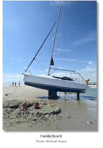
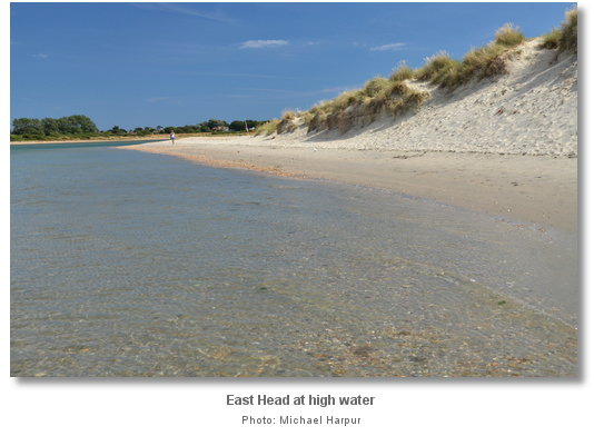
Coming ashore is a must here as there is plenty to explore. The sand dune spit is about a kilometre long and, at the widest point is half a kilometre deep. It covers about 10 hectares in total area and yet has very distinct habitats. The beach on the western side is made up mostly of fine sand with shingle at its northern end. Behind this are its sand dunes covered in marram grass, interspersed with pretty tough-leaved sea holly and sea bindweed. Both these flowering plants are at their vibrant, colourful best in summer.
East of the dunes and north of the fragile Hinge is the 30-hectare salt-marsh that is one of rarest habitats in the south. Here the hummocky Spartina cordgrass becomes the particularly distinctive feature of the seascape. These distinct environments provide a haven for all kinds of wildlife. Many different types of gulls and terns will be seen here with the occasional Kestrel or Skylark hovering overhead. Offshore a grey seal will occasionally pop its head up and be mistaken for a marker buoy.
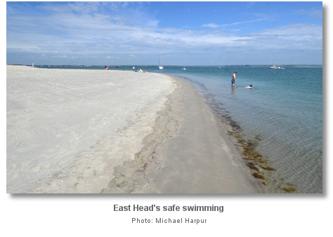
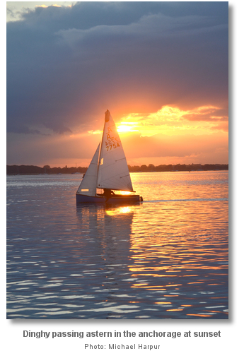
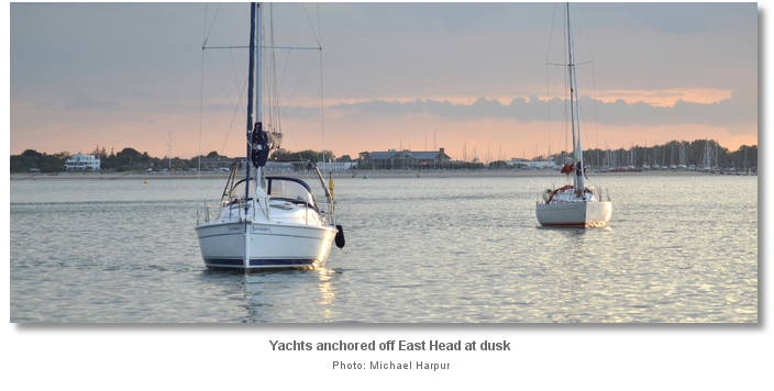
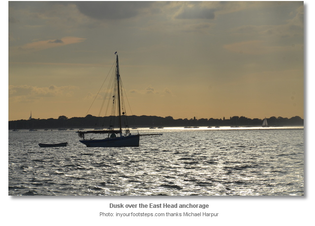
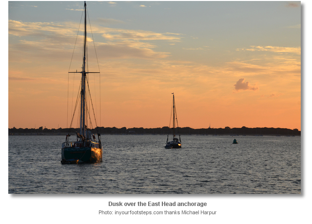
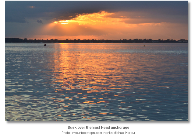
Chichester Harbour Area, as a whole, is an area of Outstanding Natural Beauty and East Head has to be the jewel in its natural crown. The light white sands of the shore and the shallow waters make this an enchanting anchorage. At times on a sunny day, it is not unlike being transported to the Caribbean, and on a still evening when there is any colour to reflect from the sky, it is like a painting by Monet.
What facilities are available?
There are no facilities at East Head. Occasionally during summer weekends an ice cream boat lands on the beach, but they only take cash so come prepared.Any security concerns?
Never an issue known to have occurred to a vessel anchored off East Head.With thanks to:
Phil Walker Deputy Harbour Master Chichester Harbour. Photography by Michael Harpur.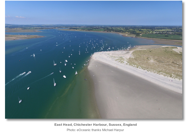


Add your review or comment:
Please log in to leave a review of this haven.
Please note eOceanic makes no guarantee of the validity of this information, we have not visited this haven and do not have first-hand experience to qualify the data. Although the contributors are vetted by peer review as practised authorities, they are in no way, whatsoever, responsible for the accuracy of their contributions. It is essential that you thoroughly check the accuracy and suitability for your vessel of any waypoints offered in any context plus the precision of your GPS. Any data provided on this page is entirely used at your own risk and you must read our legal page if you view data on this site. Free to use sea charts courtesy of Navionics.