
Set within a nearly landlocked harbour Bembridge is well protected from all weather conditions. Although tidal and set behind a meandering channel, with a sufficient rise of tide a daylight entry is made straightforward by its closely spaced and numbered channel marks. The approach channel becomes challenging in north to the northeast winds of Beaufort force 4 and above, and in such conditions it is best avoided by a newcomer.

Keyfacts for Bembridge Harbour
Facilities


Nature


Considerations


Protected sectors
Approaches


Shelter


Last modified
October 15th 2018 Summary* Restrictions apply
A completely protected location with straightforward access.Facilities


Nature


Considerations


Position and approaches
Expand to new tab or fullscreen
Haven position
 50° 41.666' N, 001° 6.026' W
This is the eastern end of the marina pontoon within the harbour.
What is the initial fix?
The following Bembridge Initial Fix will set up a final approach:
 50° 42.468' N, 001° 5.016' W
 What are the key points of the approach?
The entry and the run-up thorough The Solent and Southampton Water are covered in
The Solent and Isle of Wight coastal description.
The Solent and Isle of Wight
 coastal description.
 - The primary hazard for vessels approaching from the north is the expansive and drying Ryde Sand that mariners should approach with caution.
- Vessels approaching from the south should note the position of Bembridge Ledge and its outlying patches of the Dickey Dawe Rocks and the very dangerous Cole Rock offshore of Bembridge Lifeboat Station.
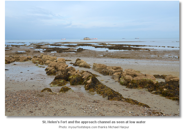
- Find the Bembridge Approach Light-beacon situated about 400 metres northward of the conspicuous St. Helen's Fort.
- Carefully check the tide gauge on the Light-beacon to confirm there is sufficient clearance to proceed into the harbour.
- Enter the meandering channel, located about 400 metres westward, and strictly follow the marks as they ascend inwards.
- Dry out inside the entrance or proceed to Duver Marina to stay afloat.
Not what you need?
Click the 'Next' and 'Previous' buttons to progress through neighbouring havens in a coastal 'clockwise' or 'anti-clockwise' sequence. Below are the ten nearest havens to Bembridge Harbour for your convenience.
Ten nearest havens by straight line charted distance and bearing:
- St Helens Duver - 0.9 nautical miles NE
- Priory Bay - 1.1 nautical miles NNE
- Whitecliff Bay - 1.5 nautical miles SSE
- Seaview - 1.8 nautical miles N
- Ryde Harbour - 3.1 nautical miles NW
- Sandown Bay - 3.5 nautical miles SW
- Ryde Roads - 4.2 nautical miles NW
- Wootton Creek (Fishbourne) - 4.9 nautical miles WNW
- Stokes Bay - 5.6 nautical miles NNW
- Haslar Marina - 5.9 nautical miles N
These havens are ordered by straight line charted distance and bearing, and can be reordered by compass direction or coastal sequence:
- St Helens Duver - 0.9 miles NE
- Priory Bay - 1.1 miles NNE
- Whitecliff Bay - 1.5 miles SSE
- Seaview - 1.8 miles N
- Ryde Harbour - 3.1 miles NW
- Sandown Bay - 3.5 miles SW
- Ryde Roads - 4.2 miles NW
- Wootton Creek (Fishbourne) - 4.9 miles WNW
- Stokes Bay - 5.6 miles NNW
- Haslar Marina - 5.9 miles N
Chart
How to get in?

Bembridge Harbour lies close northward of the easternmost point of the Isle of Wight and immediately west of Bembridge Point. It is a tidal harbour bordered by the twin villages of Bembridge and St. Helens that lie opposite each other across the harbour. The larger of the two villages is Bembridge, reputed to be largest village in England, which is home to many of the Island's wealthiest residents. Its chief attraction is the pretty harbour and its surrounding scenery.

A tide gauge that indicates the depth of water in the shallowest part of the channel is mounted on the Bembridge Approach Light-beacon that marks the outer Harbour limit. The beacon, a yellow pile with an X topmark Fl.Y.2s 1M, is situated about 250 metres northward of St. Helens Fort and marks the point of approach into the harbour. A live electronic feed from the tide gauge, exhibiting the current depth of water over the on the bar, is streamed to the top of page on the Bembeidge Harbour website so that it may be also appraised from distance over the web. The site also provides local tide height and time predictions for the week ahead. The site also a provides a channel pictorial guide showing a walk through of all the channel marker buoys in turn.

In fair conditions newcomers may enter with confidence as Bembridge has a well-maintained set of closely spaced and numbered marks. With a rising tide and a sensible clearance, which may be accurately confirmed on the tide gauge, it presents little concern to those who carefully follow the buoy’ ascending increments and maintain a modicum of seamanlike attention. Newcomers however should avoid the harbour in winds of over Force 4 or above between northeast and east. These conditions create confused seas in the channel, add wave troughs that require added clearance, and this turns the Duver shoreline that the channel runs very close to into a dangerous lee shore.
The harbour authority is in charge of all the moorings within the harbour, and they can be contacted on VHF Ch. 80 call sign [Bembridge Harbour] or P: +44 1983 872828. Harbour Office: 0900-1700 Monday to Friday and it is closed at weekends and Bank Holidays. Berthing Staff operate 7 days per week 0800-1800 during summer; Winter 7 days per week 1000-1600. The harbour as a whole can accommodate approximately 100 visiting yachts and takes advance bookings usually 24 hours in advance.
In all cases staff will make best endeavors to find a berth, rafting vessels when necessary in most cases. During busy weekends in the season the harbour often gets overwhelmed so it pays to arrive earlier on the tide during these times to increase the likelihood of securing a berth. It is however advisable that larger vessels should make contact in advance and especially so during peak periods. Then stay on VHF channel 80 to listen for any special instructions from the Harbour Staff.
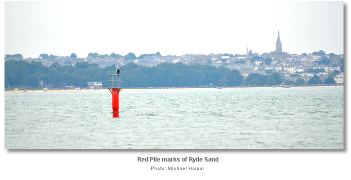
 The primary hazard for vessels approaching from the northwest is Ryde Sand. Keep its Red Piles at least 200 metres to starboard approaching No Man's Land Fort.
 No Man's Land Fort can be passed via the ¼ mile wide Small Boat Channel on the fort’s western or island side. It has a least charted depth of 2 metres between the fort and the red beacon that exhibits a light at night, Fl.R.12s. After passing No Man's Land Fort steer for St. Helen's Fort, just over two miles southward, leaving the various spherical seasonal buoys to starboard to clear the rocks and shoals off the shore between Nettlestone and Nodes Point.

 The key hazards for vessels rounding Foreland, the low eastern extremity of the Isle of Wight, is the Bembridge Ledge, Cole Rock and the Dickey Dawe Rocks.
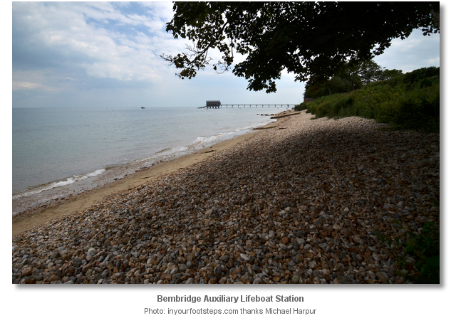
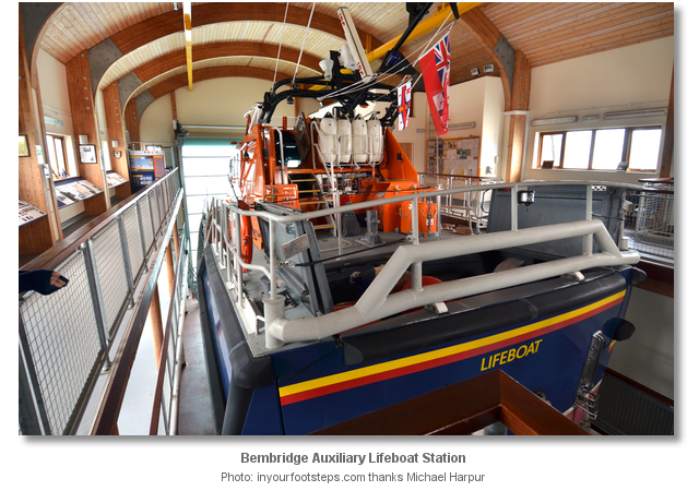
 The eastern point of the Isle of Wight is fringed by one unbroken rocky Bembridge Ledge. A wide variety of boats commonly run aground here, especially in the often stormy weather conditions which affect the area during winter months. This ledge uncovers at low water and extends out nearly one third of a mile from the shore. These rocks are high and steep-to at their outer edge, and over many parts there are not more than 1 to 1.5 metres at high-water springs. Outside their edge the depth increases to about 3 metres very quickly. The outer rim of the shore reef is made plain by the Bembridge Auxiliary Lifeboat Station’s slipway which extends into the sea to the east of the village.

But this is not the only danger as the northern part of Bembridge Ledge has three unexpected outlying patches that leisure vessels should approach with great caution. These are called the Dickey Dawe Rocks, the very dangerous Cole Rock and a shallow area to the northwest of this. These are situated about 350 metres out from the ledge lifeboat station and lie parallel to the shore in a northwest to southeast line a little over a ½ mile in length. The south-eastern Dickey Dawe Rocks is an uneven area of rock that has 1.8 metres over its shallowest part. The much more dangerous Cole Rock, situated 400 metres due east from the Bembridge Auxiliary Lifeboat Station, shows itself at spring tides when it dries to several heads over more than 200 metres. About 400 metres northwest of Cole Rock there is a further shallow patch with 0.9 metres of water.
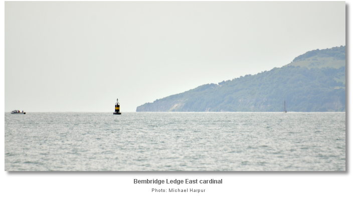
All these dangers can be avoided by keeping outside the Bembridge Ledge East cardinal a third of a mile eastward and the yellow seasonal buoys offshore of Bembridge. On final approaches keep St. Helen's Fort at least 200 metres to port when shaping up on the tide gauge.
 Vessels approaching from the northeast have no local hazards to contend with. Keep a transit open between the northern face of St. Helen's Fort and the white seamark south of Node's Point on the Duver shore. When the Bembridge Approach Light-beacon becomes visible make a course directly for it.
 Bembridge initial fix is the position of the Bembridge Approach Light-beacon. It is located 400 metres northward of the conspicuous St. Helen's Fort which although the smallest of the 1860 Palmerston forts, makes itself readily known for many miles to seaward.
Once at the Bembridge Approach Light-beacon carefully check the tide gauge, indicating the current least depth of water over the bar in metres, to confirm there is sufficient clearance to proceed. Visiting yachts should call the Berthing Master on Channel 80, callsign [Bembridge Harbour], for instructions at the tide gauge, and then again from Channel marker buoy No 12. Give a description of your vessel, name, type (sailing or motor), LOA, draft, and any specific requirements such as single handed, crew with mobility problems etc and the berthing masters will do their best to provide a berth.
Then steer a course of approximately 240°T to the commencement of the outer buoyed channel located about 400 metres westward. The meandering and acutely bending channel can appear confusing on first impression. Only the two entrance buoys to the channel, No. 1 and 2, are lit. After this the buoys are marked with reflective numbers and tape, even numbers are to port, odd to starboard, ascending inwards. It is essential to stay within the marks and carefully follow the buoys on their correct sides in their ascending numbering scheme. Try to remain focused as the course involves some surprisingly quick bends but apart from that it is very straightforward. The recommended maximum speed in the entrance channel and harbour is 6 knots but first time visitors should take it very steady.


Once through the first No. 1 and 2 buoys, steer straight in for buoys 2A and 3 where the channel’s shallowest point is approached. On arrival at buoys No. 4 and 5 turn to starboard for the next pair of buoys 6 and 7 where it then turns to port. Upon passing buoys No. 6a and 7a the channel will run parallel to the Duver shore, overlooked by the Baywatch Café, and the Harbour Entrance will start to become visible in the distance.
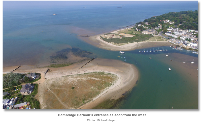
On big spring tides the current can be extremely strong from buoys No. 8 and 9 right through into the harbour entrance where at buoy No. 11A, passed to starboard, the strongest currents will be experienced.

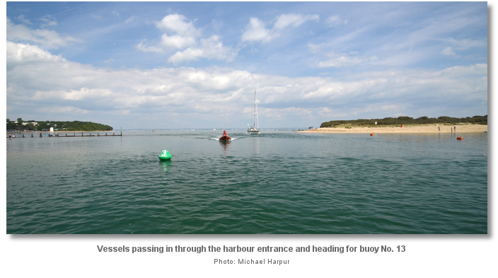
 Vessels that can take-to-the-hard may anchor fore-and-aft at Bembridge Point on the Bembridge side of the beach.
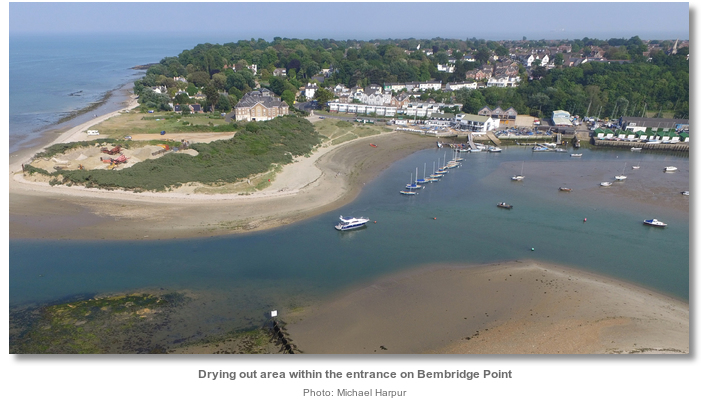
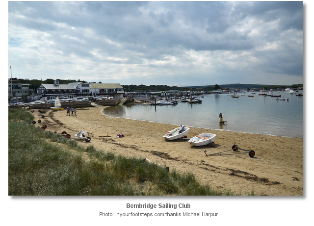
This is immediately inside the harbour entrance on the port hand side. Vessels are allowed to run up and to dry out here on the sandy beach close to Bembridge Sailing Club.

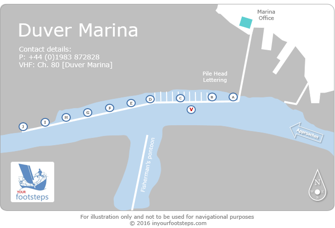
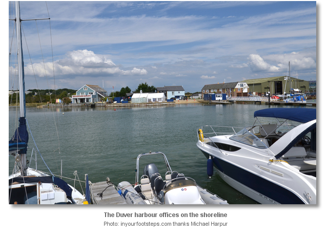
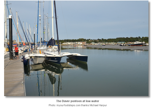
Fin keel vessels that need to stay afloat should continue up to the visitors' pontoon at ‘The Duver’ which is the harbour’s main location for receiving visiting boats. Take a sharp turn westward at starboard hand buoy No. 13 inside the harbour and pass north of the port hand buoy 10A. Duver marina is about 200 metres up from the entrance. The last buoy before the visitor’s pontoon is port hand Buoy No. 12A located opposite the fuel pontoon at Atrill's Yard on the shore to starboard, and the Duver pontoon is on the north, or starboard side, of the harbour.
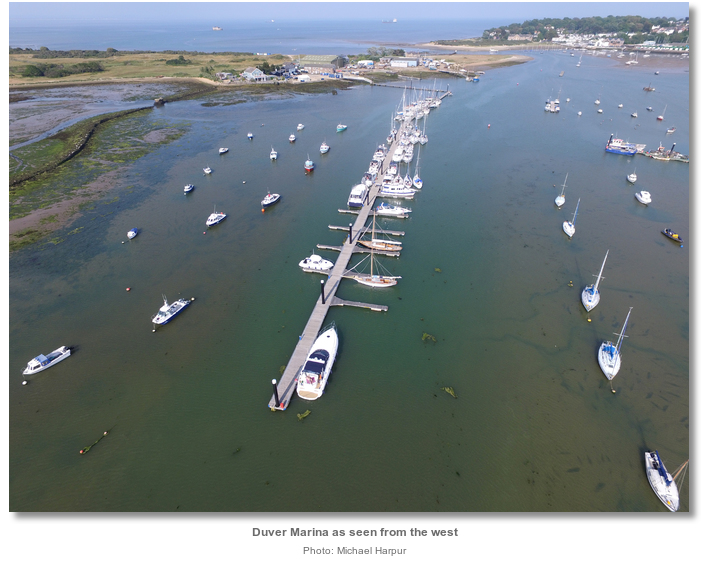
Duver Marina is a clearly marked single length of pontoon connected to the seaward shore of the harbour at the Duver yard. It is sectioned according to its pile posts that have lettered heads 'A' to 'J' ascending inwards. The marina staff normally assign berths according to the lettered pile posts that are clearly visible. The pontoon is dredged on both sides to a depth of approximately 2 metres LWS.

Rafting out is common on busy summer weekends and the berthing staff are on hand to give instructions, take lines and help where needed. Although 2 metres of water can be expected, it is possible to touch mud at the bottom of the tide albeit so soft that it is hard to notice.
Deeper into the harbour is Bembridge Marina that is fully occupied by local boats and has no visitor’s berths available and similarly the Fisherman's Wharf opposite. However the harbour staff have been known to squeeze vessels into these locations on some occasions.

Why visit here?
Bembridge Harbour was originally part of Brading Haven which ranked as an important Island port from Roman times, and at that time the sea extended down as far as Yaverland and Sandown. The whole peninsula was almost itself an island. This is how Bembridge acquired its name that was first recorded as Bynnebrygg in 1316 when a causeway was built from Yarbridge to Yaverland around 1300. The 'Eastern Island; was called Bin Bridge derived from Old English words binnan plus brycg or ‘within bridge’ meaning ‘place lying inside, or this side of the bridge'.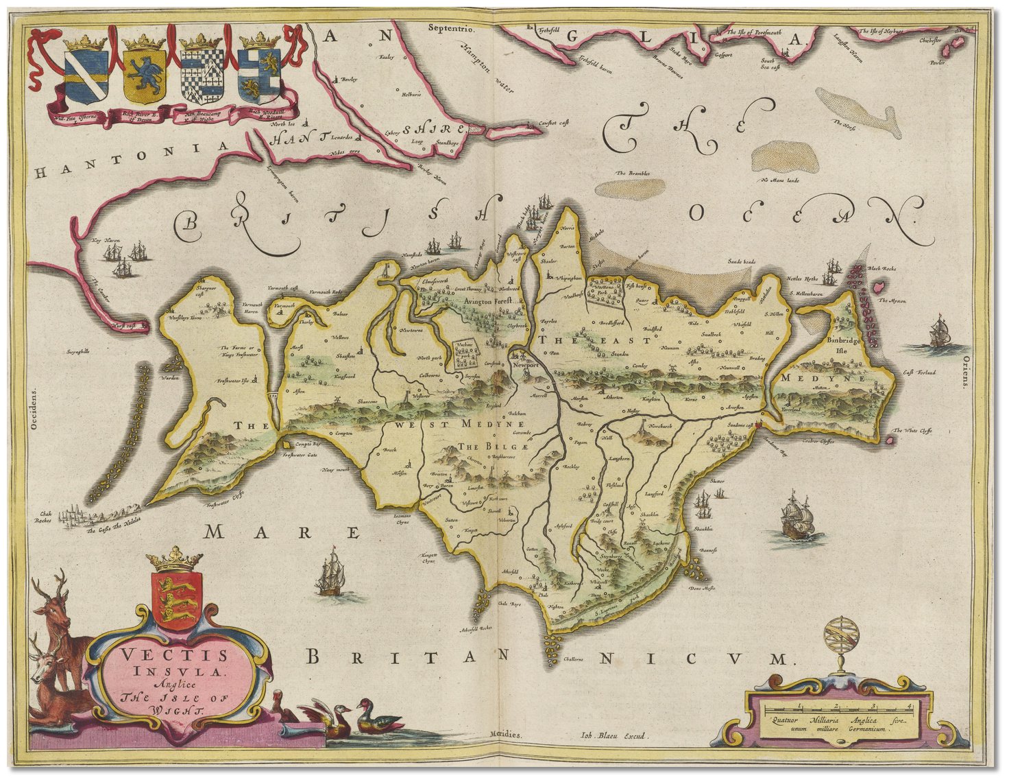 Joan Blaeu map of 1665 shown as Binbridge Iſle, nearly separated from the rest
of Wight
Image: Public Domain
The original entrance of Brading Haven was by St Helens Old Church with the spit, known as the Duver (pronounced 'duvver'), that extended out from the Bembridge side. By the early 1600’s this had shifted to its current layout, with the entrance on the Bembridge end of the Duver.
The history of Bembridge can be traced from the Paleolithic period through to the Iron Age with various finds of stone tools. In AD 432 Roman Galleys entered Brading Haven establishing a settlement at Brading and small finds of coins and tiles from this period have been found in Bembridge. In 661 AD, Wulfere, son of Penda of Mercia, landed here on the Isle of Wight, taking it from the Kingdom of Wessex and ceding it to the King of Sussex. In 704 AD Bishop Wilfred landed at St Helens and brought Christianity to the area. The Domesday survey records four separate hamlets on Bembridge Isle, with taxable returns relating to just 40 male adults. There were no seemingly urban areas on the Island at the time of the Domesday survey although the nearby settlements of Yaverland and Brading figure much more prominently than any at Bembridge.
 St Helens Old Church, now a seamark, and Duver beach
 Image: Michael Harpur
Bembridge remained very much the same until the Victorian era because it remained so difficult to access. The only route to it was via marshes in Yaverland which flooded in winter. Even at the start of the 19th Century access to Bembridge was difficult owing to the strong currents across the mouth of the harbour. It was only safely accessible in fair weather and at low tide via a ‘horse boat’. This kept it a rural area of small dispersed hamlets of wooden huts and farmhouses which may have had links and physical access to Yaverland, Brading and St Helens but for the most part it was home to a self-sufficient agricultural/fishing community.
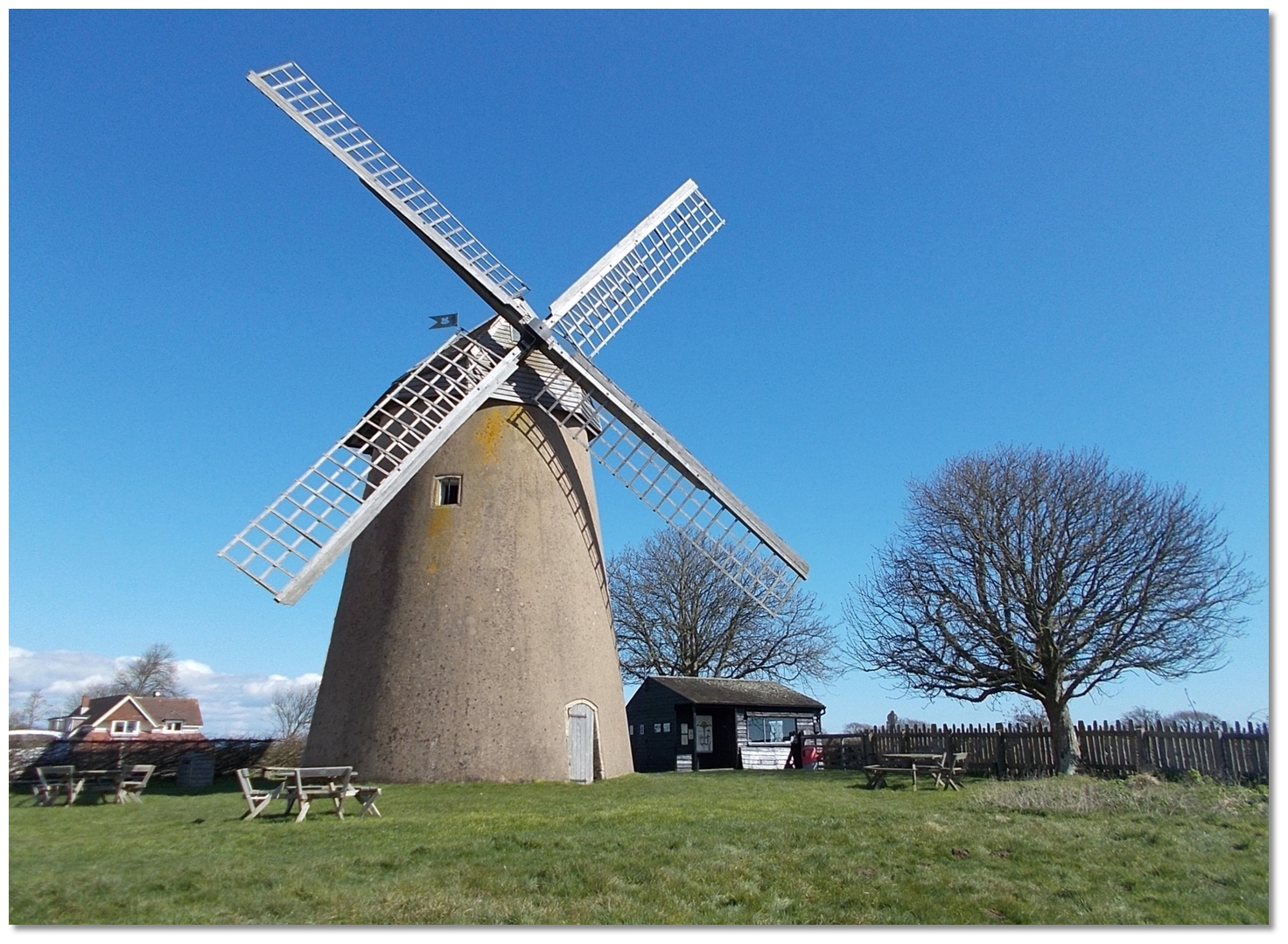 Bembridge Windmill
Image: Mypix via CC ASA 4.0
In 1545, Bembridge was taken by the French, when French naval and military forces attempted to secure Portsmouth and its harbour. They set it alight to provoke the English fleet in Portsmouth to come out and engage. The English fleet, who could clearly see the flames, refused to leave the safety of Portsmouth and Spithead, except that is, for the Mary Rose, which promptly sank. The famous diarist John Oglander gives an account of the invasion. "Afterwards they [the French] landed again in Bindbridge, where Seigneur de Tais commanded-in-chief. They marched up as high as the top of Binbridge Down before they were by us set on. We, lying in ambush on the other side, fell on them both with foot and some horse that we had mustered up among the carts, killed many, took prisoners, and drove the rest down as far as their ships, killing them all the way; but then the Admiral, having notice of it, commanded all ashore to their succour, and our King also sent word to us that we should retreat in order, seeking to draw all their strength ashore far from their ships, hoping for a favourable opportunity to bring our fleet in the interim to surprise theirs. Whereupon we retreated and skirmished with them as far as Yarbridge, and gave them leave to burn all Bindbridge and Yaverland, but the wind being still calm and not serving for our fleet we beat them back again to their ships."
 The French fleet attacks Bembridge
Image: Public Domain
In 1822 the coastguards were first stationed in Bembridge and in 1827 the first parish church was built. With the construction of the church, later rebuilt in 1846, a true village began to form. By then the Victorian resort era had commenced and, in a similar fashion to the growth of East Cowes and Seaview, Bembridge grew from a tiny fishing village to become a fashionable seasonal retreat for the affluent classes. In 1853, a small steamer, the Dart, was making two trips a day to Bembridge from Portsmouth and also called into Ryde and Seaview. In 1867 a lifeboat station was established to help those using the busy Solent sea lanes and the fort on Bembridge Down was constructed between 1862 and 1867 as part of the defence of the Portsmouth and Solent area.
 Visiting Bembridge Lifeboat Station today
Image: Henry Burrows via CC BY-SA 2.0
The Bembridge Railway, Tramway and Pier Act was passed by Parliament in 1864 authorising the reclamation works and the construction of a short 250-foot timber pier. After several successive attempts that date back to the Middle Ages, Brading Haven was finally dammed in 1880 and the embankment road built, over 800 acres of land were reclaimed, and the pier was in active service. The visitors benefited from the accessibility provided by road, steamer and later rail, which opened in May 1882 to provide the principal link to the village until 1952.
These transport links were instrumental in the development of the village, but unlike many other British seaside resorts, including Sandown and Ryde, it did not fuel extraordinary levels of growth. In a Directory of 1878, Bembridge is described as having ‘several good inns and many handsome villas and lodging-houses, many of them built since 1830’. Most notable of these are The Spithead Hotel, completed in 1880, and Old Bembridge Hotel, on Kings Road.
Initially, the best route for travellers to Bembridge was by seagoing vessels and so the stout timber pier played an important part in the initial growth for the village. Unfortunately, the Haven continued to silt up and this reduced the effectiveness of the pier at low tide meaning the steamers frequently had to row their passengers ashore and land them on the beach. Soon this would all change with the coming of the railway in 1882.
 Saint Helens North Quay and South Quay today
Image: Michael Harpur
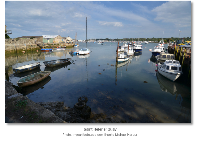
From then on, travellers were able to come into Ryde and then into Bembridge by rail and this dramatically increased the number of visitors and raised its profile. St. Helens Quay, the location of Bembridge Marina as opposed to Duver Marina where most visitors stay, then became the main railway terminus with railway sidings, a crane, warehouses, a gas works and an engine shed. It was the main port with North and South Quays. The railway made a considerable difference to the lives of people in St. Helens and Bembridge. By 1899, a guide for travellers to the Island describes Bembridge as a select, rather than popular, resort by virtue of the quality of its facilities including the landmark Royal Spithead Hotel and the Isle of Wight Golf Club and the Bembridge Sailing Club which was formed in 1886. All of these received Royal patronage in 1883.
Bembridge was at its peak at the turn of the century, and the 20th century led to a decline in the tourist industry particularly during the war years, and further when the railway closed in 1953. By then housing developments sprung up creating a burgeoning local population. The 1950s and 1960s saw the building of many new houses and the village expanded to its present boundary. Today the historical heart of the village is located close to the church in the north of the village, consisting of a number of shops, pubs and restaurants, along with the Village Hall and site of the former Parish Council hall. The Bembridge Windmill is now under the care of the National Trust and has been restored for visitors.
 Boats alongside Duver Marina
Image: Michael Harpur
From a sailing point of view access to Bembridge has to be planned to coincide with high water but after that, the buoyage up the doglegged channel is excellent and well maintained. Once inside and alongside its pontoon there is a natural beauty, whether it’s the downland, the harbour and marshes, the many pleasant and varied coastal and rural walks, or simply the convenient Duver beach a short stroll away for a family. Across the water Bembridge town is a joy, the coast at foreland and The National Trust windmill and the RNLI station are well worth a visit.
What facilities are available?
Pontoons provide power and water. Domestic requirements such as showers and toilets, and including WiFi, the first half hour free of charge, can be had in the marina. Bins for domestic rubbish are available at all pontoons. All waste goes to a customised picking station on the Island to be sorted for recycling. A coin operated launderette is available on the ground floor of the Old Marina Office at Bembridge Marina.Diesel fuel can be obtained from H Attril & Sons pontoon or Ken Stratton's Boatyard located to the north of Bembridge Marina. Petrol by jerry can is available from the Hodge & Childs Peugeot garage in Bembridge. All are only open during workweek days.
The Galley Locker in the Berthing Office stocks a range of essentials such as milk, tea, coffee etc, ice, weekend newspapers, and a selection of Isle of Wight produce. It is open seven days a week from 0830. A small on site cafe serves breakfast, lunches and special street food dishes in the evening at the weekends. The harbour welcomes rallies offering discounts although these are not applicable in July and August and over Bank Holidays. Two marquees, overlooking the Duver pontoon and Harbour, with commercial BBQs are available for groups of visiting yachtsmen to hire (gas is provided as are tables with bench seating) which can be pre-booked.
Two clubs, Bembridge Sailing Club and Brading Haven Yacht Club that have their own private jetties for tenders, have their home in the harbour area. Both run active sailing, racing and training programmes throughout the summer and welcome visiting yachtsmen. A number of local businesses also offer water-based activities and tuition, from paddle boarding, dinghy sailing and kayaking, to powerboat training and charter boat fishing.
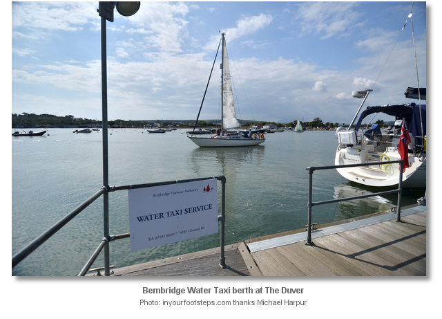
A harbour water taxi operates 3 hours +/- HW during the day June through September, by prior arrangement after 1900. It can be contacted on VHF Channel 80 or +44 7582 806017. The taxis are based at The Duver pontoon and stops are at the beach next to the Tollgate Cafe and Bembridge Sailing Club, the Fisherman's pontoon, and Bembridge Marina next to Grading Haven Yacht Club. They also service the trot moorings and central Harbour pontoons. In all cases fares apply.
Bembridge village, situated a ½ hours’ walk around the harbour, has a good range of shops including medium sized supermarkets, delicatessens, a bakery, butchers, chip shop, Chinese takeaway as well as a high street bank. The bank does not have a cashpoint but one can be found in the village supermarket. The much closer village of St. Helens, about 10 minute’s walk from the marina, has a post office, cashpoint, and a smaller local shop. Both villages offer a choice of pubs, that serve food, and restaurants.
An hourly summer bus service runs between Bembridge and the harbour, Ryde, Sandown and
Newport. Newport is the central hub for the island’s bus service from where connections to all other parts of the island can be found.
Any security concerns?
Never an issue known to have occurred to a vessel in Bembridge Harbour.With thanks to:
Michael Harpur S/Y Whistler. Photography with thanks to Michael Harpur, Chris and Paul Brown.





Aerial view of the Duver in Bembridge
Aerial view of St. Helens Fort, Duver, Bembridge and the channell at low water
Aerial view of Foreland, Bembridge and Duver
Add your review or comment:
Please log in to leave a review of this haven.
Please note eOceanic makes no guarantee of the validity of this information, we have not visited this haven and do not have first-hand experience to qualify the data. Although the contributors are vetted by peer review as practised authorities, they are in no way, whatsoever, responsible for the accuracy of their contributions. It is essential that you thoroughly check the accuracy and suitability for your vessel of any waypoints offered in any context plus the precision of your GPS. Any data provided on this page is entirely used at your own risk and you must read our legal page if you view data on this site. Free to use sea charts courtesy of Navionics.


 +44 1983 872828
 office@bembridgeharbour.co.uk
 Ch.80 [Bembridge Harbour]


