

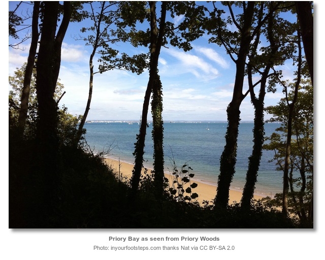
Priory Bay is situated off the south coast of England on the Isle of Wight about midway between the island’s north-eastern and eastern most points. It is an open sandy bay backed by woodlands that offers an offshore anchorage in a natural setting.
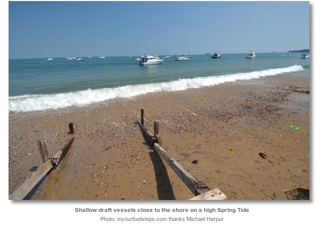
The bay provides a tolerable anchorage as its shallow gradual slope pushes vessels of any draft up to half a mile offshore. As such deeper draft vessels could only overnight in settled or moderate westerly component winds of less that force 3. By contrast vessels that can come inshore and dry out on the hard sand beach will however find it very good. Approaches are straightforward as there no hazards to an eastern approach and a large fort, close to its southern end, makes a very good identifying mark from seaward.

Keyfacts for Priory Bay


Last modified
August 24th 2018 Summary
A tolerable location with straightforward access.Facilities


Nature


Considerations


Position and approaches

Expand to new tab or fullscreen
Haven position
 50° 42.660' N, 001° 5.400' W
This is on the 2 metre contour ½ out from the shore in about the middle of the bay.
What is the initial fix?
The following Priory Bay initial fix will set up a final approach:
 50° 42.885' N, 001° 4.780' W


What are the key points of the approach?
The entry and the run-up thorough The Solent and Southampton Water are covered in
The Solent and Isle of Wight coastal description. Approaches are covered in the adjacent Bembridge Harbour
  entry. Vessels converging on the entrance will find nothing in the way of local hazards by staying in reasonable soundings and following the marks.
The Solent and Isle of Wight
coastal description. Approaches are covered in the adjacent Bembridge Harbour entry. Vessels converging on the entrance will find nothing in the way of local hazards by staying in reasonable soundings and following the marks.- Work in from the east and anchor according to draft.
Not what you need?
Click the 'Next' and 'Previous' buttons to progress through neighbouring havens in a coastal 'clockwise' or 'anti-clockwise' sequence. Below are the ten nearest havens to Priory Bay for your convenience.
Ten nearest havens by straight line charted distance and bearing:
- St Helens Duver - 0.3 nautical miles SSE
- Seaview - 0.9 nautical miles NNW
- Bembridge Harbour - 1.1 nautical miles SSW
- Whitecliff Bay - 2.5 nautical miles S
- Ryde Harbour - 2.8 nautical miles WNW
- Ryde Roads - 4 nautical miles WNW
- Sandown Bay - 4.5 nautical miles SSW
- Stokes Bay - 4.9 nautical miles NNW
- Wootton Creek (Fishbourne) - 4.9 nautical miles WNW
- Haslar Marina - 5 nautical miles N
These havens are ordered by straight line charted distance and bearing, and can be reordered by compass direction or coastal sequence:
- St Helens Duver - 0.3 miles SSE
- Seaview - 0.9 miles NNW
- Bembridge Harbour - 1.1 miles SSW
- Whitecliff Bay - 2.5 miles S
- Ryde Harbour - 2.8 miles WNW
- Ryde Roads - 4 miles WNW
- Sandown Bay - 4.5 miles SSW
- Stokes Bay - 4.9 miles NNW
- Wootton Creek (Fishbourne) - 4.9 miles WNW
- Haslar Marina - 5 miles N


How to get in?
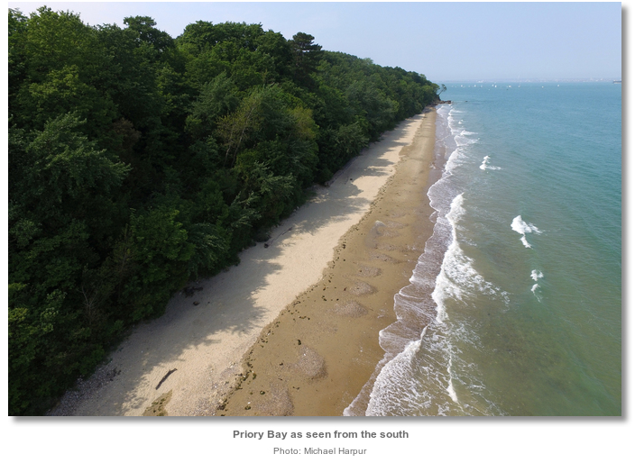
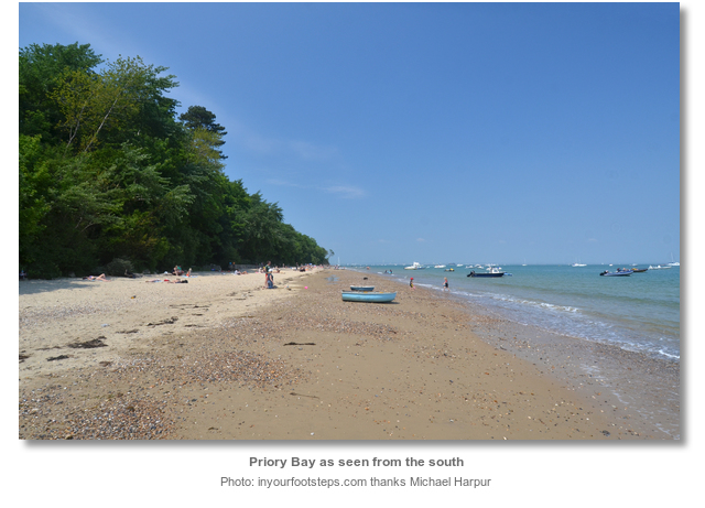
Priory Bay is a small east facing bay on the northeast coast of the Isle of Wight. It lies ¾ of a mile southward of the village of Seaview, on Nettlestone Point, between Horestone Point and Nodes Point situated 600 metres to the south. The pretty bay is backed by a coastal slope, rising to around 40 metres, covered by 2.94 hectares of Priory Woods owned by the National Trust. Beneath the woods the private Priory Bay has a straight sandy coastline that curves slightly eastward as it terminates at Nodes Point.
The bay gradually shelves to the shore and dries a ⅓ of a mile from the foot of trees. The 2 metre contour is located a ½ mile out from the shore. This pushes vessels of any draft well out from the shore making it only comfortable in settled offshore conditions of Force 3 or less. By contrast vessels that can take to the hard will find it an excellent location. The beach is a broad stretch of predominantly flat hard sand that is excellent to dry out on. Local small boat visitors make use of a long thin shallow pool of water that is sometimes retained close to the beach at low tide by a sand bank called ‘Gull Bank’.

 Use details provided for the adjacent Bembridge Harbour for approaches. Keep watch for the odd lobster pot that may be encountered around this area.
 The initial fix is the position of the Yellow Seasonal Race Buoy, Fl. Y 4s, close west of the Saint Helen's Patch and about a mile out from the shore. Work in westward and anchor off according to draft.
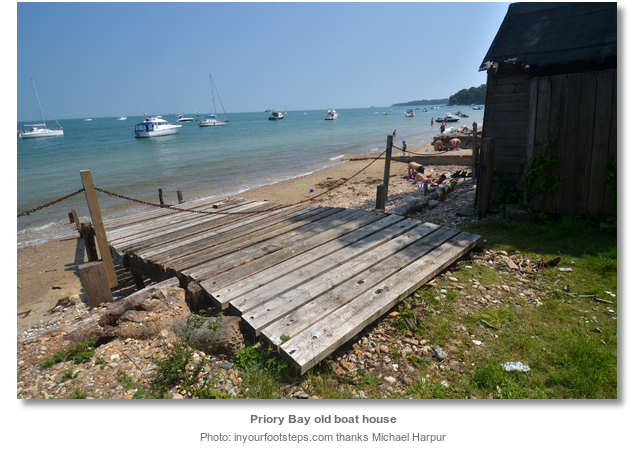
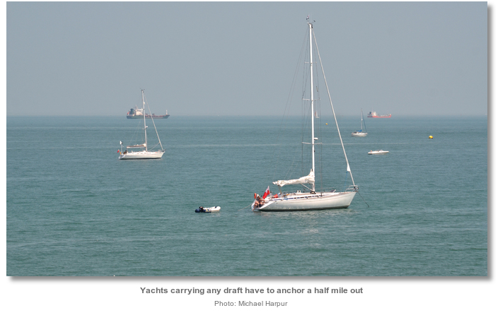 Anchor according to draft anywhere off Priory Bay or dry out closer in. Holding is good in hard compacted sand once time is taken to plough the anchor in. Expect an occasional long frequent wash from large ships coming and going from Southampton and Portsmouth. Land on the beach by tender.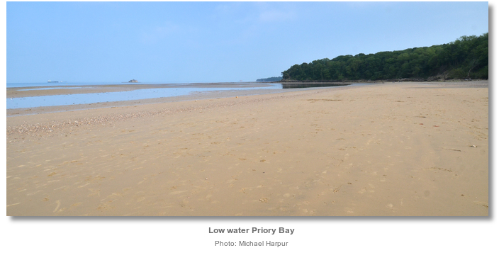
Why visit here?
Priory Bay takes its name from the ancient Priory of St. Helen's that was founded after the Norman Conquest by French Benedictine monks. The priory was dedicated to St. Helena, mother of the Roman Emperor Constantine, from which the village of St. Helen’s, overlooking Bembridge Harbour close south, subsequently took its name. It is believed the priory once stood in a field behind the current location of the Priory Bay Hotel though nothing remains of it today. It is possible that the priory was connected to St. Helens Old Church, now the seamark to the south overlooking the approaches to Bembridge Harbour, although no archaeological remains have yet been discovered to support this. The oldest parts of the current Priory Bay Hotel date back to the late medieval period.
Though Priory Bay today is a secluded unspoiled woodland, its history of inhabitation runs very deep; possibly even deeper than that of humanity itself. The cliff and Priory Wood strata is made of Pleistocene gravels overlying Eocene Bembridge Marls that are of special scientific interest. The Pleistocene geological epoch spanned the world's most recent period of repeated glaciations. During this time glaciers covered much of Britain but did not come as far south as the Isle of Wight. This period however had intervening milder periods that caused major changes in sea levels. During cold phases sea levels fell and mainland Britain, the Isle of Wight and the Continent were at times attached. During milder phases the sea rose and the Island was separated from the mainland. These events are captured in the gravels of the cliffs of Priory Bay. Moreover there is a very interesting technical overlap with the end of the Pleistocene age and that of archelogies Palaeolithic age, and they are very much bridged in the woods and cliffs of Priory Bay.
In 1886 early Palaeolithic, or old Stone Age, hand tools happened to be discovered on the beach of Priory Bay. On closer examination the source of the tools was eventually traced back to gravels eroded from the cliff-top. When these cliff gravels were explored numerous further flint hand axes, flakes and artefacts derived from them were found. Although similar material has been found elsewhere in the area, the Priory Bay finds were by far the most prolific Palaeolithic site on the island. The bay’s intriguing findings were dated to the Hoxnian Stage of the Pleistocene Period, between 424,000 through to 374,000 years ago, making this the Isle of Wight’s oldest known archaeological site. While our ancestors have been around for about six million years, the modern form of humans only evolved about 200,000 years ago. As such these stone tools clearly predate our period which would indicates their users were Neanderthals. Investigations continue as the erosion of the bays gravel exposes new finds to this day.

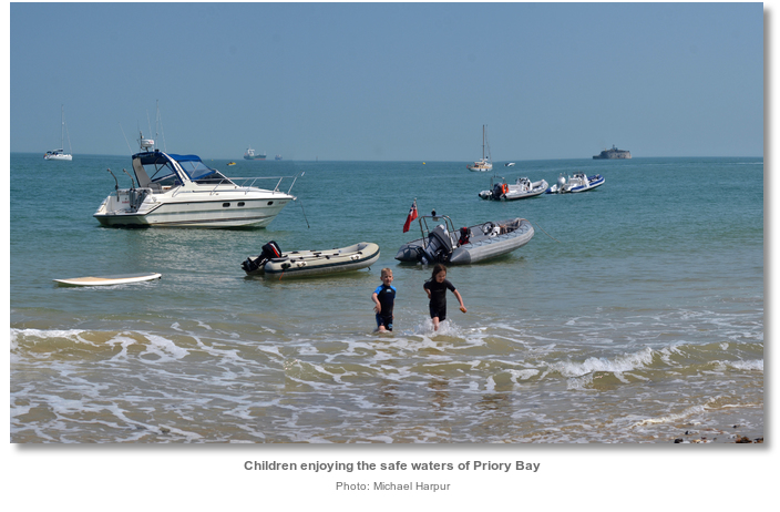
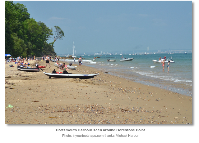
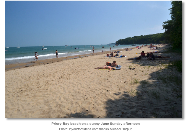
Today the beautiful beach is privately held by the Priory Bay Hotel, but in reality it is anything but a private beach on a sunny summer’s weekend. Perfectly sheltered from the UK’s prevailing south-westerly breeze and less than a thirty minutes cruise from Portsmouth Harbour it is a magnet for family boaters along with scramblers who come in over Horestone Point from Seagrove Bay. On such days it is a peaceful hive of families enjoying the wonderful secluded wood-fringed paradise. Yet during the week it is sandy, unspoilt and peaceful.

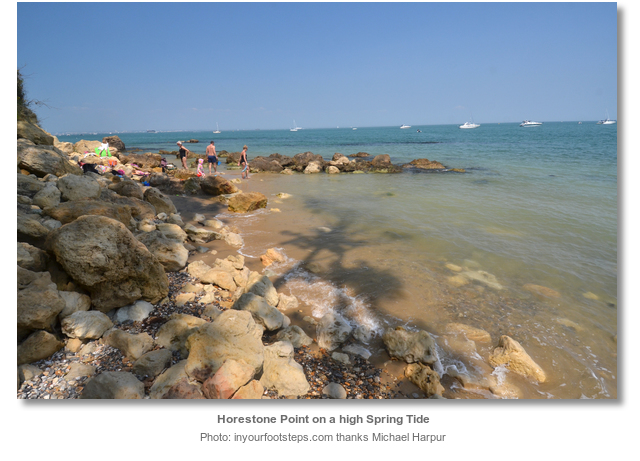
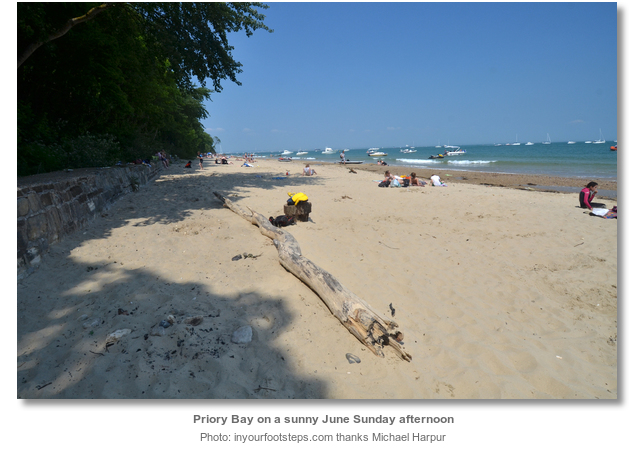
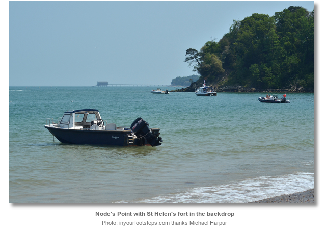
From a boating point of view, unless a vessel can take to the hard, Priory Bay is far from a perfect anchorage. What it has is one of the Isle of Wight’s most delightful beaches. In this context it has it all; a sheltered beach making a dinghy landing of buckets, spades, and barbecues etc. very easy, and lovely soft white sands under its treeline that provide perfect afternoon shade, relatively shallow waters that make it ideal for swimming or children’s splashing about and a wonderful selection of rock pools for children to explore around Horestone Point. Those who just want to sit back and relax will have great views from the Spinnaker tower in Portsmouth round and and offshore to ‘No Man’s Land’, 'Horse Sand' and 'St Helens' forts and then onward south to Bembridge Lifeboat station. This is as good as it gets in England when it comes to a family beach anchorage.
What facilities are available?
There are no facilities in Priory Bay apart from the hotel above the beach.Any security concerns?
Never an issue known to have occurred to a vessel anchored off Priory Bay.With thanks to:
Martyn Squibb, Bosum Wotton Creek Sailing Club. Photography with thanks to, Nat, Michael Harpur and Daniel Hall.




The early parts of this Rib Video show Priory Bay
About Priory Bay
Priory Bay takes its name from the ancient Priory of St. Helen's that was founded after the Norman Conquest by French Benedictine monks. The priory was dedicated to St. Helena, mother of the Roman Emperor Constantine, from which the village of St. Helen’s, overlooking Bembridge Harbour close south, subsequently took its name. It is believed the priory once stood in a field behind the current location of the Priory Bay Hotel though nothing remains of it today. It is possible that the priory was connected to St. Helens Old Church, now the seamark to the south overlooking the approaches to Bembridge Harbour, although no archaeological remains have yet been discovered to support this. The oldest parts of the current Priory Bay Hotel date back to the late medieval period.
Though Priory Bay today is a secluded unspoiled woodland, its history of inhabitation runs very deep; possibly even deeper than that of humanity itself. The cliff and Priory Wood strata is made of Pleistocene gravels overlying Eocene Bembridge Marls that are of special scientific interest. The Pleistocene geological epoch spanned the world's most recent period of repeated glaciations. During this time glaciers covered much of Britain but did not come as far south as the Isle of Wight. This period however had intervening milder periods that caused major changes in sea levels. During cold phases sea levels fell and mainland Britain, the Isle of Wight and the Continent were at times attached. During milder phases the sea rose and the Island was separated from the mainland. These events are captured in the gravels of the cliffs of Priory Bay. Moreover there is a very interesting technical overlap with the end of the Pleistocene age and that of archelogies Palaeolithic age, and they are very much bridged in the woods and cliffs of Priory Bay.
In 1886 early Palaeolithic, or old Stone Age, hand tools happened to be discovered on the beach of Priory Bay. On closer examination the source of the tools was eventually traced back to gravels eroded from the cliff-top. When these cliff gravels were explored numerous further flint hand axes, flakes and artefacts derived from them were found. Although similar material has been found elsewhere in the area, the Priory Bay finds were by far the most prolific Palaeolithic site on the island. The bay’s intriguing findings were dated to the Hoxnian Stage of the Pleistocene Period, between 424,000 through to 374,000 years ago, making this the Isle of Wight’s oldest known archaeological site. While our ancestors have been around for about six million years, the modern form of humans only evolved about 200,000 years ago. As such these stone tools clearly predate our period which would indicates their users were Neanderthals. Investigations continue as the erosion of the bays gravel exposes new finds to this day.
Today the beautiful beach is privately held by the Priory Bay Hotel, but in reality it is anything but a private beach on a sunny summer’s weekend. Perfectly sheltered from the UK’s prevailing south-westerly breeze and less than a thirty minutes cruise from Portsmouth Harbour it is a magnet for family boaters along with scramblers who come in over Horestone Point from Seagrove Bay. On such days it is a peaceful hive of families enjoying the wonderful secluded wood-fringed paradise. Yet during the week it is sandy, unspoilt and peaceful.
From a boating point of view, unless a vessel can take to the hard, Priory Bay is far from a perfect anchorage. What it has is one of the Isle of Wight’s most delightful beaches. In this context it has it all; a sheltered beach making a dinghy landing of buckets, spades, and barbecues etc. very easy, and lovely soft white sands under its treeline that provide perfect afternoon shade, relatively shallow waters that make it ideal for swimming or children’s splashing about and a wonderful selection of rock pools for children to explore around Horestone Point. Those who just want to sit back and relax will have great views from the Spinnaker tower in Portsmouth round and and offshore to ‘No Man’s Land’, 'Horse Sand' and 'St Helens' forts and then onward south to Bembridge Lifeboat station. This is as good as it gets in England when it comes to a family beach anchorage.
Other options in this area
Click the 'Next' and 'Previous' buttons to progress through neighbouring havens in a coastal 'clockwise' or 'anti-clockwise' sequence. Alternatively here are the ten nearest havens available in picture view:
Coastal clockwise:
St Helens Duver - 0.2 miles SSEBembridge Harbour - 0.7 miles SSW
Whitecliff Bay - 1.5 miles S
Sandown Bay - 2.8 miles SSW
Ventnor - 5.2 miles SSW
Coastal anti-clockwise:
Seaview - 0.6 miles NNWRyde Harbour - 1.7 miles WNW
Ryde Roads - 2.5 miles WNW
Wootton Creek (Fishbourne) - 3.1 miles WNW
Osborne Bay - 4.2 miles WNW
Navigational pictures
These additional images feature in the 'How to get in' section of our detailed view for Priory Bay.


| Detail view | Off |
| Picture view | On |
The early parts of this Rib Video show Priory Bay
 A photograph is worth a thousand words. We are always looking for bright sunny photographs that show this haven and its identifiable features at its best. If you have some images that we could use please upload them here. All we need to know is how you would like to be credited for your work and a brief description of the image if it is not readily apparent. If you would like us to add a hyperlink from the image that goes back to your site please include the desired link and we will be delighted to that for you.
Add your review or comment:
Please log in to leave a review of this haven.
Please note eOceanic makes no guarantee of the validity of this information, we have not visited this haven and do not have first-hand experience to qualify the data. Although the contributors are vetted by peer review as practised authorities, they are in no way, whatsoever, responsible for the accuracy of their contributions. It is essential that you thoroughly check the accuracy and suitability for your vessel of any waypoints offered in any context plus the precision of your GPS. Any data provided on this page is entirely used at your own risk and you must read our legal page if you view data on this site. Free to use sea charts courtesy of Navionics.