

Located deep within England’s most extensive natural harbour, it offers good protection in almost all conditions. In developed situations, it can be somewhat exposed to the open harbour, and the surrounding hills can funnel gusts up the tributaries. This can be particularly uncomfortable in wind-over-tide conditions. Access is straightforward in almost all reasonable conditions, day or night, and for the majority of boats at all stages of the tide.


Keyfacts for Goathorn Point
Nature


Considerations


Protected sectors


Summary* Restrictions apply
A good location with straightforward access.
Best time to enter or exit
Full guidance, including waypoints, tidal flows, and harbour pilotage, can be found in Navigating Poole Harbour .
Nature
Considerations
Position and approaches


Haven position
 50° 40.749' N, 001° 59.060' W
This is in South Deep about 500 metres northwest of Goathorn Point.
What is the initial fix?
 50° 38.944' N, 001° 55.484' W




What are the key points of the approach?
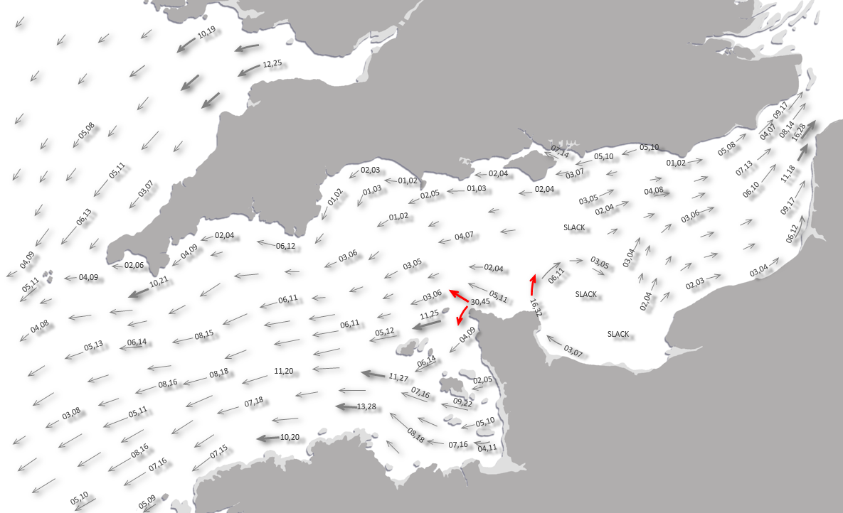
. For directions to Poole Harbour, including approach routes and tidal timers, see Navigating Poole Harbour .- Check that there is sufficient water in the approaches.
- Branch off the main channel after the No.14 Port buoy located in the entrance off the southeast corner of Brownsea Island and follow the ample marks.
Not what you need?
- Brownsea Island - 0.9 nautical miles N
- Port of Poole Marina - 1.7 nautical miles N
- Shipstal Point - 1.7 nautical miles WNW
- Poole Yacht Club - 1.8 nautical miles NNW
- Salterns Marina - 1.9 nautical miles NE
- Poole Quay Boat Haven - 1.9 nautical miles N
- Poole Town Quay - 2 nautical miles N
- Parkstone Yacht Club - 2.1 nautical miles NNE
- Lake Yard Marina - 2.4 nautical miles NW
- Cobb's Quay - 2.6 nautical miles NNW
- Brownsea Island - 0.9 miles N
- Port of Poole Marina - 1.7 miles N
- Shipstal Point - 1.7 miles WNW
- Poole Yacht Club - 1.8 miles NNW
- Salterns Marina - 1.9 miles NE
- Poole Quay Boat Haven - 1.9 miles N
- Poole Town Quay - 2 miles N
- Parkstone Yacht Club - 2.1 miles NNE
- Lake Yard Marina - 2.4 miles NW
- Cobb's Quay - 2.6 miles NNW

What's the story here?
 Yachts anchored off Goathorn Point
Image: Michael Harpur
Goathorn Point is a densely wooded finger of land, bordered by the marshy inlets along Poole Harbour's southern shore and by smaller islands to the west. Surrounded by woodland and farmland, it sits in a secluded natural setting near the harbour entrance. It offers anchorage outside the channel fairway, in depths of 2 metres or more, and is generally considered one of Poole Harbour's best all-weather anchorages.
 Yacht anchored in South Deep above Goathorn Point
Image: Michael Harpur
Approaches via Poole Bay and Harbour provide a minimum draft of 6 metres CD. After branching off the main harbour entrance channel, there is a short stretch with a minimum depth of 1.2 CD before reaching the deeper waters of South Deep. Check the tide to confirm there is sufficient draft in the initial approaches. If you draw more than 1.5 metres, you must check the tide tables carefully to ensure you have enough water throughout your stay. That said, vessels with a draft of up to 1.7 metres can generally enter and leave at low water. Anchoring just outside the marked channel is the standard practice at Goathorn Point. Some boaters report finding depths of over 2 metres at mean low water near Goathorn Pier, but this varies.
This is a popular spot during the season. For the best spots, arrive early, as the area can get busy with 20-30 boats on a nice evening. Although anchoring itself is free, Poole Harbour Commissioners require harbour users to pay harbour dues where applicable, and patrol boats may check vessels within the harbour. The daily harbour dues for recreational vessels [2026] in Poole Harbour set by the Poole Harbour Commissioners (PHC) are £1.07 per metre of overall vessel length per day (including VAT).
Sail Dorset with the Instincts of a Local Pro


Navigation apps only get you from A to B, leaving you guessing about the "where," the "why," and the "how." eOceanic isn't another "nav app." It's the Intelligence Uplift that enhances the tools you already use, powering up both your capabilities and understanding.
Once activated on your device, it doesn't just display data, it brings it to life with real-time situational awareness, giving you a "digital sixth sense" for the Dorset coastline.
Go beyond navigation to truly know the coast and everything it offers.
- Sail Stress-Free: Make boat handling easier with a helpful assistant and avoid "hidden" hazards with an extra set of eyes on watch for dangers along the coast.
- Discover More: Most sailors only experience a small fraction of a coastline's rewards. We unlock the "hidden gems" and local resources that create unforgettable experiences for you, your family, and your friends.
- Engage Ashore: We don't stop at the waterline; we bring you in to fully experience the best of the world waiting for you ashore.
The power of knowing. Autonomy, agency, agility and the joy of roaming free.
How to get in?
 Green and Furzey Islands and Goathorn Point as seen from Cleavel Point on the
southern shore
Image: Michael Harpur
The approaches to the entrance, with its tidal flow, are detailed in Navigating Poole Harbour
. Yachts anchored in the South Deep Channel around Goathorn Point
Image: Michael Harpur
Anchor according to the draft and conditions, anywhere from the entrance to South Deep up to Cleavel Point and beyond. Stay clear of the fairway, moorings and clearly marked oyster beds. Anchoring is prohibited in the vicinity of an underwater cable, well charted and marked by shore beacons, laid between Furzey and Green Islands and the mainland. Likewise, avoid fouling the ground chain of the four private moorings east of the pier.  Special Marker on the shore for underwater cables
Image: Michael Harpur
Harbour cruise boats and the oil workers' ferries supporting the oil rig on Furzey Island frequently use this channel, so do not anchor in a way that might obstruct the fairway. The channel edge is marked by red and green lateral marks, but another channel within it, marked by red and green buoys, denotes the area to keep clear for the continuous flow of harbour traffic. At Goathorn, the channel is marked only with steel posts/buoys, but the south side is deeper and offers more room to moor.
Once clear of these and you find a spot, the creek bottom is all soft mud, so if you do touch it, it will do little harm. The harbour's deep, cloying black mud offers excellent holding.
Goathorn is somewhat sheltered by the harbour islands, but it can be uncomfortable when a contrary wind and tide set the boat dancing. You can avoid this by moving out to the channel's edges and away from the full run of the tide. But keep an eye on the sounder, as much of Poole Harbour shelves rapidly once you're outside the main channel. Its most exposed wind direction is northeast round to east, where, at high tide, a 1½-mile fetch can be created. The best anchorages are in the reach between Cleavel and Goathorn points, particularly at its southern end.

Landing is not permitted at Goathorn Point, but you can land at high water on the beautiful, rustic shore overlooking Newtown Bay, south of Cleavel Point. Newtown Bay's central marsh divides its channels east and west. The western channel runs close to the southern shore, so you can land by dinghy. This is only possible at high water, as everything is mud at low water.
 eOceanic’s App Objects:
 eOceanic Objects specify the characteristics and precise locations of key seamarks and contact items in the water that are central to navigation within an area. While underway, the eOceanic App actively monitors these markers relative to your vessel's position, providing enhanced positioning and proactive hazard alerts at customisable ranges to meet your sailing needs.

Why visit here?
The origins of the name ‘Goathorne Point’ are uncertain, and it is most likely that it describes the ‘peninsula where goats are kept’. Newtown Bay, the marshy inlets between Goathorn and Cleavel points, acquired its name from the ambitions of King Edward I who, in 1286, ordered a new town called Nova Villa ‘Newton’ to be built here.
Edward’s intention was to create a new port for the export of stone. He granted his planned Nova Villa a charter in 1287 that enabled it to have two weekly markets and an annual fair. But neighbouring Ower Quay was already well-established by this time and it quickly became obvious that such an ambitious development was not viable. Some development however took place as the historic maps of Poole Harbour, including one as late as the 1597, mark a Newton settlement.
The 1st Edition of the Ordnance Survey map of 1811 shows only buildings around the present Newton Cottage and does not name the area Newton. This would indicate that the settlement had by this point declined to such an extent that it was no longer noteworthy. No traces of any historic buildings associated with the planned town have ever been discovered. The current Newton Farmhouse, or Newton Cottage, dates to the late 17th or early 18th century, since which it has been extensively modernised. The most distinctive manmade feature of the area today is Goathorn Pier, with its jetty, that was used by barges to ship Purbeck Ball Clay to Poole Harbour.

The clays of Purbeck have been used for thousands of years and it is said that it can be found in a third of all fine pottery ever produced in England. It is valued for its whiteness and its special properties, when fired, which made it ideal for tableware, bathroom ceramics and in situations where it is required to cope with high temperatures. Purbeck clay was first mined in the 17th Century when it was used for the manufacture of clay pipes used for tobacco smoking. It was soon shipped to London where it began to be used in the manufacture of tableware. When, in the 18th Century Josiah Wedgwood adopted the high quality clay, he gave birth to an extensive industry in this quiet rural backwater.
The clay had been taken by pack horse to wharves on the River Frome but this was far too slow for the large scale commercial extraction required by the Staffordshire potteries. The bottleneck was first removed by the introduction the ‘Middlebere Tramway’ in 1806. It ran from the principal workings pits at Norden, near Corfe Castle, to a wharf on Middlebere Creek in the southwest corner of Poole Harbour from where it was transhipped to Poole Town Quay. The horse drawn plateway was one of the first railways to be established in southern England and the first in Dorset. This was then followed by the ‘Furzebrook Railway’ in 1840 leading from the clay pits near Furzebrook and West Creech to a at Ridge Wharf.
In 1854 a pier was then built at Goathorn Point with a rail line that lead to the clay pits at Newton. The ‘Newton Tramway’ waggons were initially horse drawn. In 1870 a small steam locomotive called Corfe was introduced that was locally nicknamed as Tiny because of its diminutive size. In 1907 the ‘Newton Tramway’ was then extended to Norden by the ‘Norden & Goathorn Railway’ where it became known as the ‘Fayles Tramway’. The ‘Middlebere Tramway’ was then linked to this and, after 101 years of continual use, the original ‘Middlebere Tramway’ to the Middlebere Wharf was discontinued.
In its day the Goathorn line hauled tons of clay for transhipment to Poole but it also had a passenger service, a school service, and carried workmen. But after almost a century of service the line was little used and finally abandoned in 1937. The line that crossed Newton Heath was taken up in 1940 leaving no working line north of Norden. The pier at Goathorn was closed in the Second War when the peninsula was used as part of a bombing range and military practice area. After the Second World War transport shifted increasingly to more flexible lorries which led to the decline of tramways and the mainline railway across the whole range of clay workings. The remaining ground lines were finally abandoned in 1970. While the old quays endure only the routes of the railways survive to this day.

Today Goathorn Point provides boatmen with a peaceful anchorage in quiet waters. Shut in by the dense coniferous plantations along the Goathorn Peninsula, and the thickly forested Brownsea, Green and Furzey Islands, along with the southern shores low-lying meadows, rising up to heathland and coniferous plantations, it is today an extraordinarily beautiful location. It is a place to escape the northern shore’s bustling ferry port and the conurbation of Poole. A place to gently swing at anchor surrounded by wildlife, looking out over the southern shore’s numerous points, bays, channels and marshy inlets that give the harbour its lake-like appearance.
What facilities are available?
There are no facilities at this remote and sequestered anchorage.Poole Harbour Commissioners (PHC / Harbour Master): For general harbour inquiries, harbour dues, and Vessel Traffic Services.
 +44 (0)1202 440 200 |
 pooleharbourcommissioners@phc.co.uk | Poole Harbour Commissioners |
 Ch. 14 [Poole Harbour Control / VTS]
Address: 20 New Quay Road, Hamworthy, Poole, Dorset, BH15 4AF.
Harbour Control Officer: For any emergency within the harbour.
+44 (0)1202 440 230 | harbourcontrol@phc.co.uk | Ch. 14 (or 16) [Poole Harbour Control]| Poole Bridge: | +44 (0)1202 674 115 | Customs & Excise: | +44 (0)1202 685 157 |
| Police: | +44 (0)1202 552 099 (Ext. 3276) | Doctor: | +44 (0)1202 679 234 |
| Dentist: | +44 (0)1202 672 138 | Hospital: | +44 (0)1202 665 511 |
| Chemist: | +44 (0)1202 678 001 | Dolphin Taxi: | +44 (0)1202 777 879 |
| Tourist Information: | +44 (0)1202 253 253 | ||
With thanks to:
John Binder CMM Poole Quay Boat Haven & Port of Poole Marina manager. Photography with thanks to Graham Rabbitts, Tom Montgomery and Michael Harpur.


Goathorn Point, early morning with a spring tide
Image: © Tom Montgomery


 A photograph is worth a thousand words. We are always looking for bright sunny photographs that show this haven and its identifiable features at its best. If you have some images that we could use please upload them here. All we need to know is how you would like to be credited for your work and a brief description of the image if it is not readily apparent. If you would like us to add a hyperlink from the image that goes back to your site please include the desired link and we will be delighted to that for you.
Add your review or comment:
Please log in to leave a review of this haven.
Please note eOceanic makes no guarantee of the validity of this information, we have not visited this haven and do not have first-hand experience to qualify the data. Although the contributors are vetted by peer review as practised authorities, they are in no way, whatsoever, responsible for the accuracy of their contributions. It is essential that you thoroughly check the accuracy and suitability for your vessel of any waypoints offered in any context plus the precision of your GPS. Any data provided on this page is entirely used at your own risk and you must read our legal page if you view data on this site.