_dorset_england_DJI_0016_stitch.jpg)
West Bay, also known as Bridport, is a small harbour at the head of Lyme Bay on the south coast. It provides seasonal pontoons for visiting boats with a moderate draft in its outer harbour.
This is a good berth in all but strong southerly and particularly south-easterly winds which, when approaching force 4 or more, send in an uncomfortable surge or swell that makes the outer harbour untenable. A berth further inside the harbour may be possible during these conditions depending on availability. Although subject to draft constraints, access is straightforward in suitable weather conditions, night or day.

Keyfacts for West Bay (Bridport)
Summary
A good location with straightforward access.


Nature


Considerations


 +44 1308 423222
  +44 7870 240636
  harbourmanagement@westdorset-weymouth.gov.uk
  dorsetforyou.gov.uk/westbayharbour
  Ch.16/11 [Bridport Radio]
 Position and approaches
Haven position
 50° 42.585' N, 002° 45.849' W
This is the head of the visitor pontoon in the outer harbour.
What is the initial fix?
 50° 42.335' N, 002° 45.700' W
 What are the key points of the approach?
 or eastbound
  sequenced 'Selsey Bill to Start Point' coastal description.
 - Avoid in all strong southerly and particularly south-easterly and easterly winds.
- Contact the Harbour Master whilst approaching in open water and take berthing advice.
- Approach from the south by south-east in the white sector of harbour’s F.WRG, 331°-341° sectored light.
Not what you need?
- Lyme Regis - 6.6 nautical miles W
- Axmouth - 11.2 nautical miles W
- Beer - 12.4 nautical miles W
- Weymouth Marina - 13.1 nautical miles ESE
- Weymouth Harbour - 13.4 nautical miles ESE
- Small Mouth - 13.8 nautical miles ESE
- Portland Marina - 14.3 nautical miles SE
- Church Ope Cove - 16.5 nautical miles SE
- Ringstead Bay - 16.8 nautical miles ESE
- Durdle Door - 19.3 nautical miles ESE
- Lyme Regis - 6.6 miles W
- Axmouth - 11.2 miles W
- Beer - 12.4 miles W
- Weymouth Marina - 13.1 miles ESE
- Weymouth Harbour - 13.4 miles ESE
- Small Mouth - 13.8 miles ESE
- Portland Marina - 14.3 miles SE
- Church Ope Cove - 16.5 miles SE
- Ringstead Bay - 16.8 miles ESE
- Durdle Door - 19.3 miles ESE
How to get in?
_.jpg) West Bay harbour area (Bridport)
West Bay harbour area (Bridport) Image: Michael Harpur
West Bay, also known as Bridport Harbour, is a small fishing and pleasure craft harbour that lies at the mouth of the River Brit, three miles east by south-east of Golden Cap, 6.5 miles east by south of Lyme Regis and 16 miles north by north-west of Portland Bill. The harbour consists of an outer harbour and inner harbour basin.
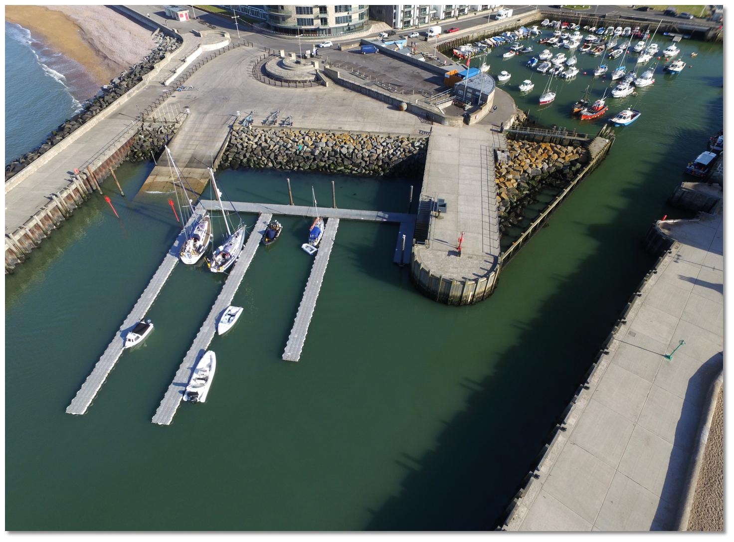 West Bay's seasonal pontoon
Image: Michael Harpur
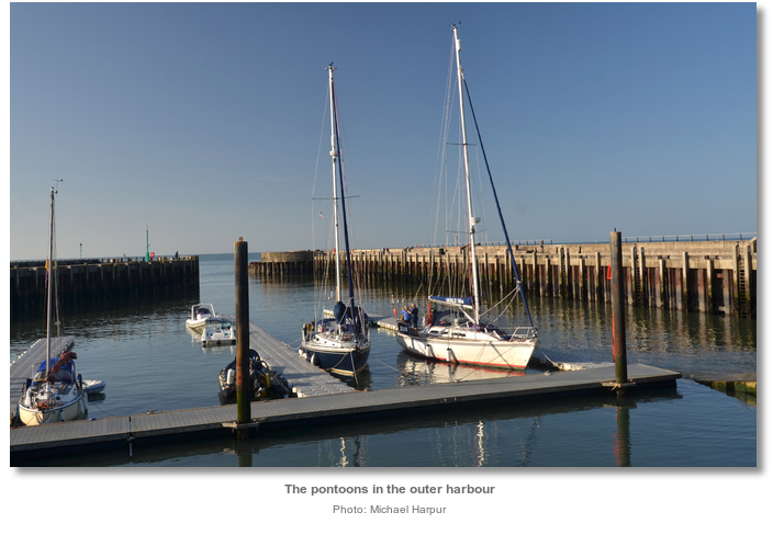
The outer harbour, enclosed between two piers, is dredged each spring to provide a depth of around 0.75 metres CD. Especially designated visitor pontoons, with space to accommodate about 10 vessels, are laid each season through the middle of the outer harbour.
Proceeding northwards leads into the inner harbour that is entered over a sill which dries to 0.1 metres CD. Beyond the cill the inner harbour expands into a secure inner basin, 160 metres long and 42 metres wide, the vast majority of which dries up to as much as 0.7 metres save for a deep pool at its centre. This deep section, below the sluice gates to the River Brit, is scoured out to depths of 2.7 to 2.0 metres CD and provides a depth of up to 2 metres alongside the East Pier where visiting fishing boats and commercial vessels berth.
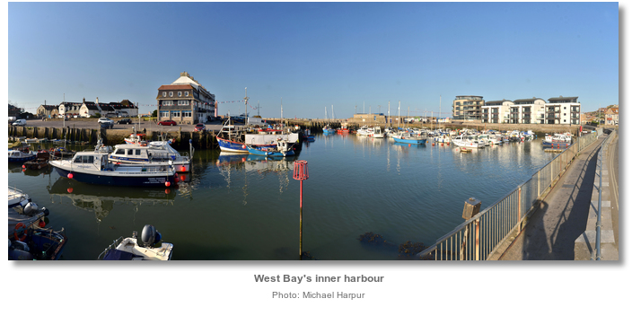
The inner harbour has 115 drying moorings the majority of which are let for private use. The Harbour Master may be able to find space for a couple of yachts along the wall, or perhaps a vacant mooring in the inner harbour pool, so a deeper draft vessel might be accommodated. Likewise, any swell the harbour is experiencing is much reduced within the inner harbour area should a berth become available.

Vessels intending on berthing at West Bay should contact West Bay Harbourmaster whilst approaching in open water. The harbour is generally manned from 8 am to 6 pm, seven days a week during the summer season. West Bay Harbourmaster can be contacted by P: +44 1308 423222, M: +44 7870 240636. They may be contacted by VHF by call sign [Bridport Radio], listening on VHF Ch. 16 and using Ch. 11 as their working channel.
 A useful landmark for West Bay and Lyme Regis harbours is the conical Golden Cap that lies between them. The cliffs rise to a height of 187 metres at Golden Cap which is located slightly over 3 miles westward of West Bay. The prominent hill, that takes its name from its flat head and yellow cliffs at its summit is conspicuous for miles and never more so when the sun falls upon its head.
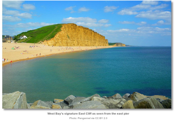
West Bay Harbour will then make itself known from seaward by its 45 meters high ochre-coloured East Cliff. The striking cliff is located about 200 metres east by south-east of the pier heads.
Approaches to the harbour are largely free from danger. There are a few rocky shoals in the immediate vicinity that are best avoided if there in any seaway. The shallowest of these are situated west and south-west of West Bay and are called High Ground and Pollock.
High Ground lies about ½ a mile offshore, 2 miles westward of West Bay. It is ½ a mile long with only 3 metres CD near its south-eastern end. The smaller, and nearly circular, Pollock shoal lies ¾ of a mile west by south of West Bay with 3.7 metres over its shallowest part. These shoals lie about ¾ of a mile apart, with 11 metres of water between them.
A sewer outfall pipeline extends about 0.8 miles south by south-west from close east of the harbour’s entrance. It is marked by a lit yellow buoy, FI.Y.5s, at the seaward end and situated on the contour that is immediately outside and close eastward of both shoals.
_harbour_as_seen_from_the_east.jpg)
 This is set on the 5 metre CD contour about 200 metres out from the entrance. It is in the white sector of harbour’s F.WRG (331°-341°) approach light positioned at the root of the new West Pier. The pierhead’s with their Red and Green beacons standing on the outer edges of the rock armour, Iso.R.2s5m4M and Iso.G.2s5m4M by night, will be clearly visible from here.
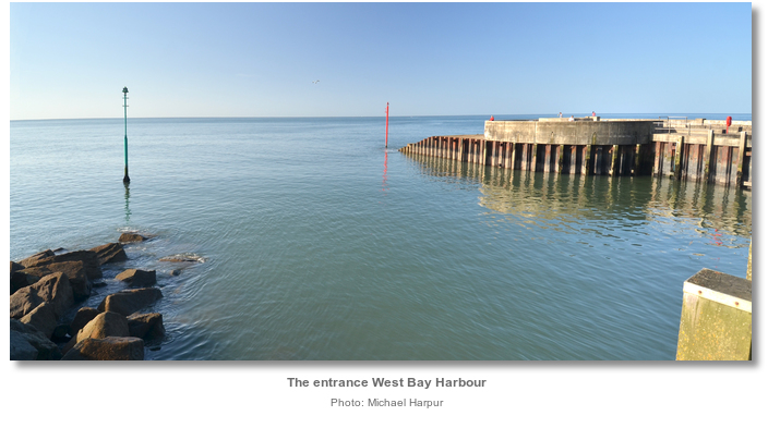
Keep an eye to the sounder on the final approaches in case a sandbar has built up before the entrance. Pass between the piers, and the pontoons will be seen immediately in front of the slipway to port.
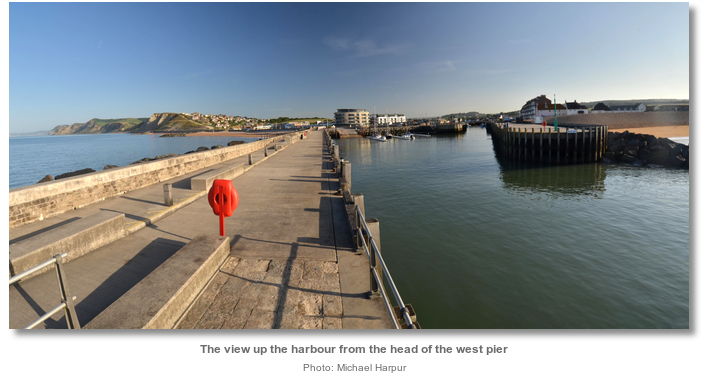
The inner harbour is entered by continuing along the east pier passing a light, FI.R.8s5m4M, on the head of an inner pier head, on the opposite west side. The cill, with a tide gauge on the side, is located at the foot of the inner pier head.
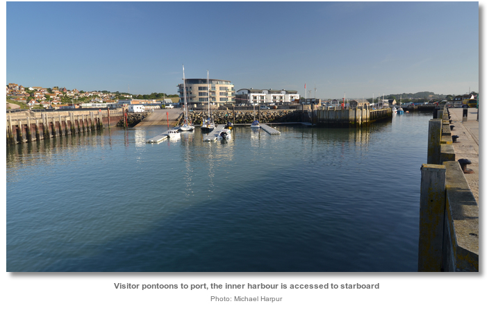
 Berth as directed by the harbour master.
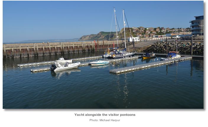
In settled or offshore winds it is permissible to anchor off East Beach, using as much of the sheltering arms of the harbour walls as possible. Vessels should not anchor in a fashion that impedes the movement of boats in and out of the harbour. Any vessel intending to stay overnight should move well away from the entrance and carry a riding light.
Why visit here?
West Bay was originally called Bridport Harbour since it was the trading port of the market town located just over a mile upriver near the confluence of the small River Brit and its tributary the Asker. The harbour was renamed as ‘West Bay’ after the railway arrived in a Victorian bid to remarket the town as a seaside resort. The harbour trades by both names to this day.Bridport derives its name from its ancient owner named Bredy. In Saxon times, ‘port’ meant a place of trade, not necessarily a seaport, and so the name described a ‘harbour or market town belonging to a man called Bredy’. Somewhere along the way, the Saxon word ‘port’ conjoined to create the Bridport and it was recorded as being that by Doomsday in 1086. The River Brit then took its name from the market town.
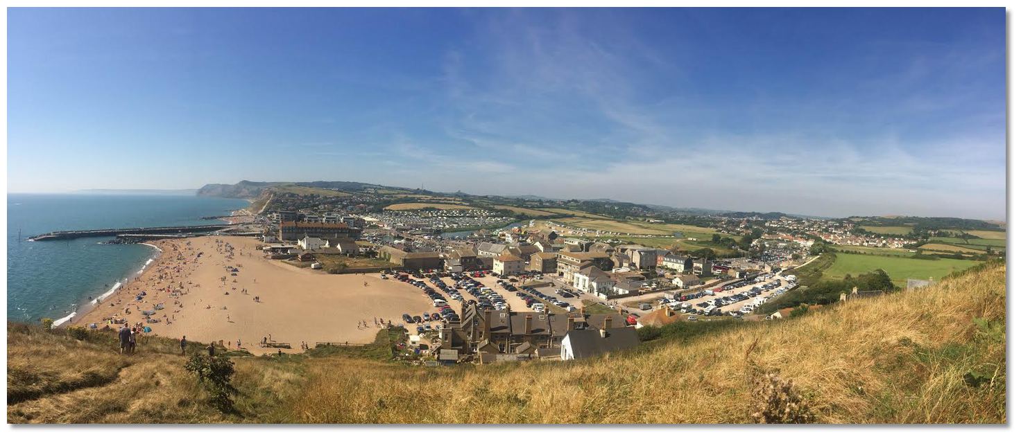 West Bay and Bridport as viewed from East Cliff
Photo: Rcsprinter123 via CC BY 3.0
Bridport's origins are Saxon when, during the early Middle Ages, it ranked alongside Dorchester, Shaftesbury and Wareham as one of the four most important Saxon settlements in Dorset. King Alfred, created the ‘Burgh of Brydian’ in the 9th century making it a fortified town and a mint. The market town was evidently of some importance during the reign of Edward the Confessor from 1042-1066, as after the Norman Conquest Doomsday recorded Bridport as having 120 houses, indicating a population of around 500 people, and it was rated for all the king's services and paid a geld of five hides. The end of the Saxon era would soon set the town back as by 1086 it was recorded that the number of houses had decreased to 100, and of these 20 were in such a wretched condition that they could not pay geld.
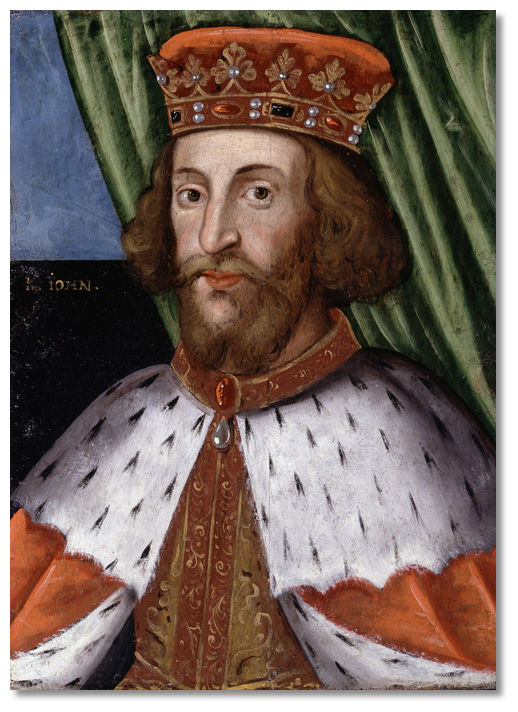 King John
Photo: Public Domain
The following century was to see the cataclysm of the Black Death lay waste to the county of Dorset. A 14th-century account by Geoffrey Baker noted that the disease ‘almost stripped the seaports of Dorset of their inhabitants’. Those who survived the recurring outbreaks of the disease were then subjected to attacks by raiding French and Spanish forces.
During all this time the harbour was upriver and close to the town with the river mouth providing its exit to the sea. But this was always subject to silting and when, in 1388 the town began to recover, a local merchant called John Huderesfeld, started building a quay at the river mouth to overcome this problem. This became known as Bridport Harbour and it was the embryo for what would become West Bay. After its completion in 1395 trade flourished again and the harbour prospered for fifty years before winter storms severely damaged its structure and set the town back again.
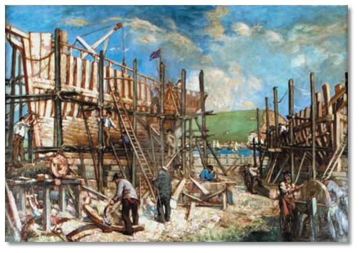 Depiction of boat building in Bridport Harbour in the late 19th Century
Photo: Public Domain
The 18th century opened up global trading and the need for Bridport’s rope grew expotentially. West Bay’s small 15th Century harbour was ill-equipped to deal with the increasing size of ships required. Being the only suitable site for the construction of an industrial harbour along this exposed stretch of coastline another new harbour was commenced in 1740. This was located close west of the 1444 harbour and is the site of the present harbour. It was roughly the same size and shape as that of today, with an L-shaped basin and two canal-like piers protecting the entrance from the sea. Extensive warehousing facilities were set up west of the new harbour. By the 1760s a shipyard opened on the sloping site to the west of the harbour. It expanded to become one of the most successful shipyards in Dorset in the early 19th century, building a variety of vessels including frigates, cutters, schooners, brigantines, barques and fishing smacks.
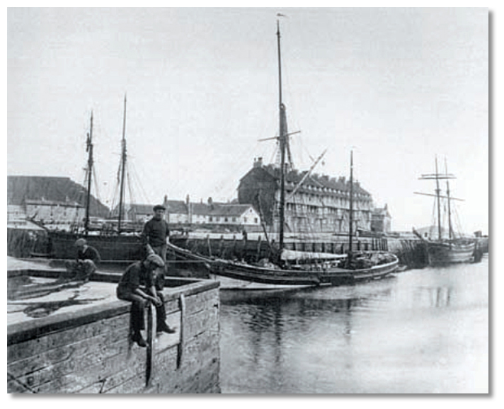 Bridport Harbour in 1890
Photo: Public Domain
Many of the town’s beautifully lavish houses, particularly on the main street including the town hall, built in 1785-6 with its clock tower and cupola added about twenty years later, date back to this period. Bridport’s particularly wide main street is due to it being used to dry the ropes after they had been spun in long gardens behind the houses. During the Napoleonic Wars, the Navy aided the development of the industry in Bridport as rope making was seen as a critical industry. Many large ships were built at the harbour for the war. The town had even spawned its own dark colloquialism ‘Bridport dagger’ that was a widely use phrase from the period referring to the hangman’s ropes that were made here.
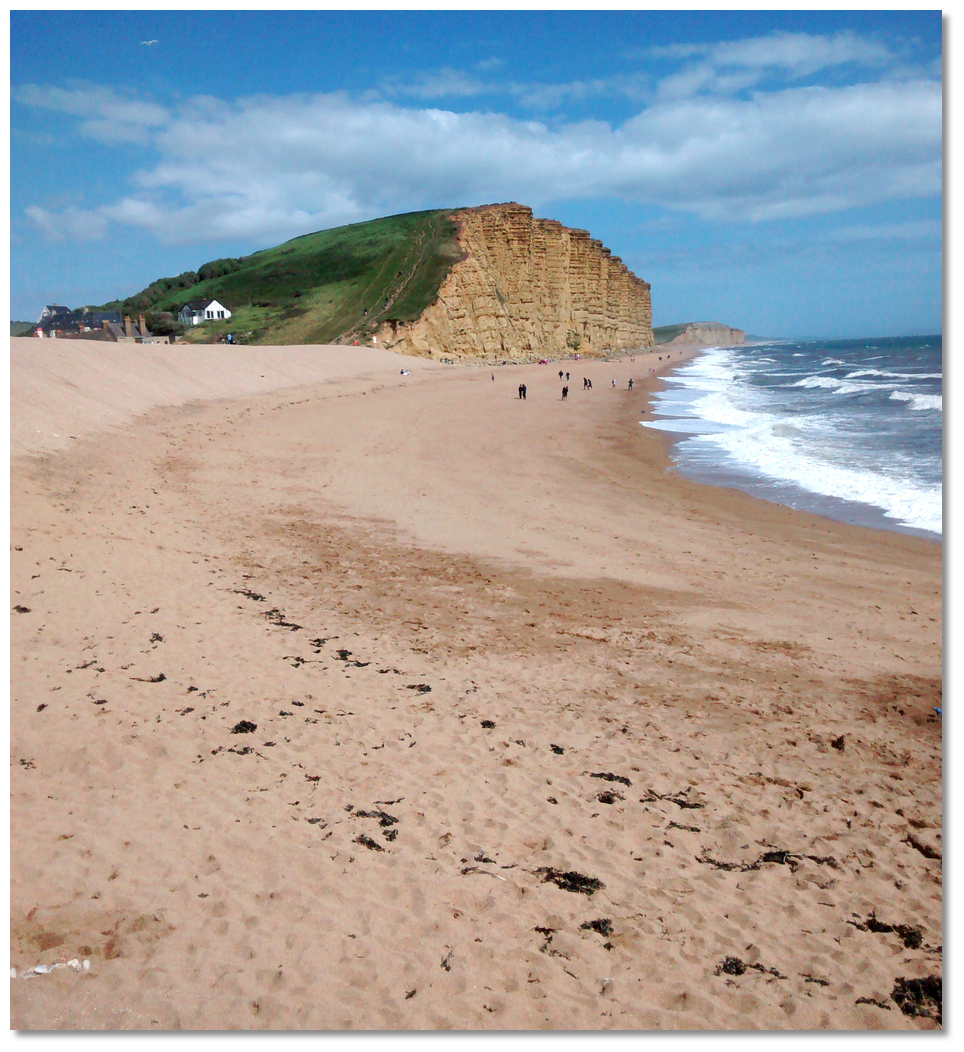 West Bay's signature East Cliff and beach
Photo: Andrew Bone via CC BY 2.0
The traditional manufacture of ropes, twine and netting still carries on at Bridport though they were superseded in modern times by artificial fibres such as nylon. The nets that were used during England’s 1966 world cup victory and those used by many football clubs, as well as at Wimbledon still come from Bridport today.
Over the years, West Bay’s sea defences have been strengthened in order to cope with the enormous pressures of coastal erosion and storms. Between 2002 and 2005, the harbours 1740 narrow canal-like entrance was extensively redeveloped. As part of a new coastal defence scheme, the harbour's west pier was replaced, the east pier rebuilt and a new wide slipway placed into the outer harbour. The new west pier was named the Jurassic Pier.
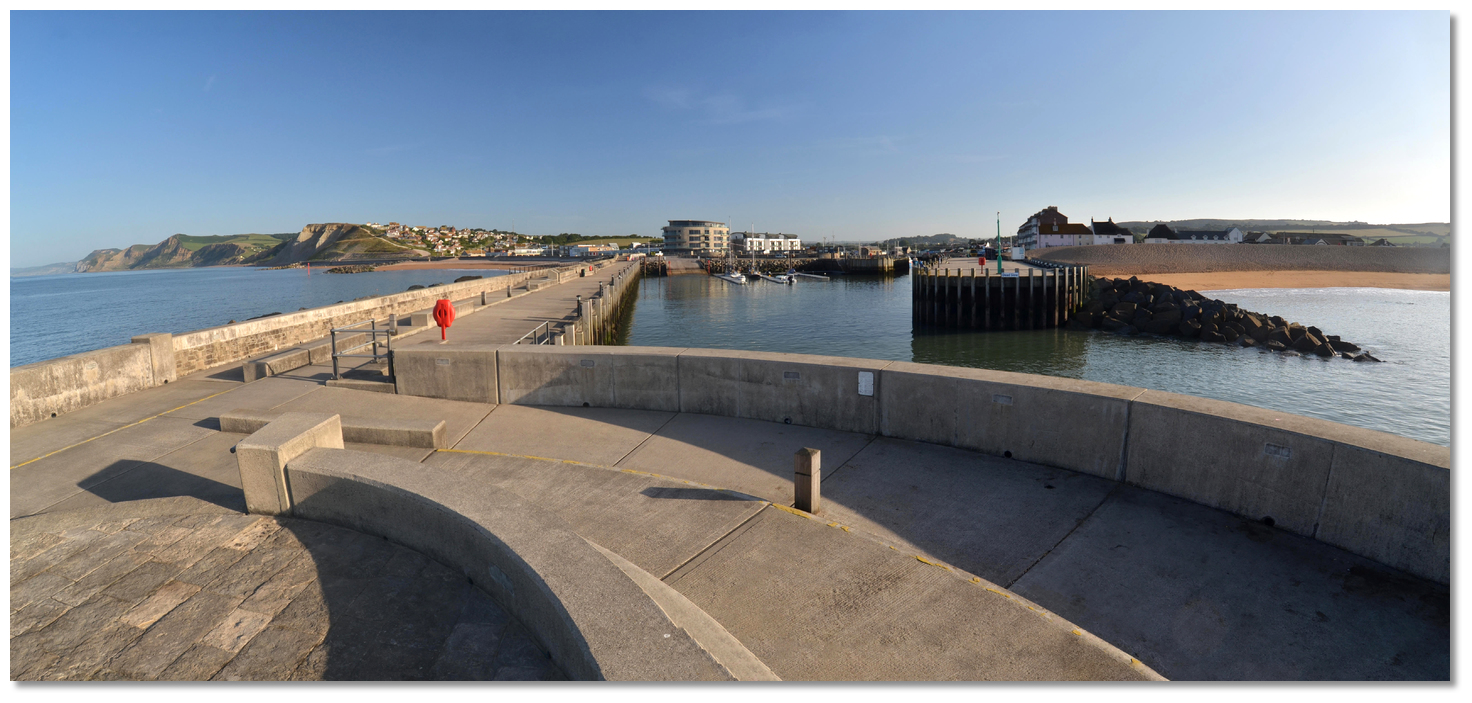 West Bay as seen from the head of the new Jurassic Pier
Photo: Michael Harpur
Bridport and West Bay today retain a high proportion of their historic buildings, including the old West Bay station that remains to this day as a seaside tearoom. West Bay is a centre for fishing, tourism geology, and Bridport remains a picturesque lively market town. They are both a joy to visit and the harbour serves, as it always has, as a berth on an otherwise exposed length of the coast. The harbour is ideal in settled conditions or offshore winds for a coastal cruiser of modest draught.
What facilities are available?
The pontoons do not have water or shore power. Water can be obtained from taps on the piers. Toilets and showers for visiting vessels, accessed by a key code, are located at the south-western corner of the inner harbour, behind the Harbour Master's office on the Mound.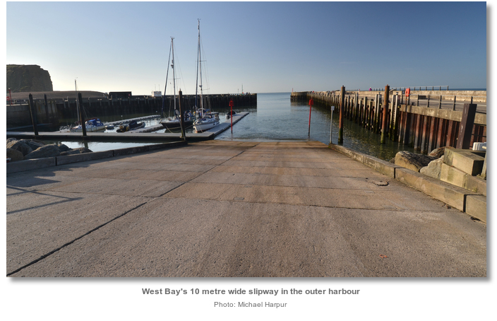
There is a 10-metre wide slipway in the outer harbour by the pontoons. This can launch craft of up to 12 m in length, at any state of the tide, into 0.75 metres of water. A pontoon for landing passengers and for loading and unloading boats launched on the slipway has been provided. All those intending on using the slipway should go to the Harbour Master's Office to pay launching fees before attempting to launch your vessel.

Minor local repair facilities may be found in the area. There is a choice of restaurants, pubs and cafes in and around West Bay and Bridport town centre, and a Morrisons supermarket can be found between the two.
Bus services follow the coast, Exeter, Seaton, Beer, Bridport, Lyme Regis etc. There is also an Axminster, Lyme Regis, Bridport, Dorchester, Weymouth services, with mainline trains running from Axminster, Dorchester and Weymouth. A small regular local bus service runs from West Bay to Bridport.
With thanks to:
Michael Harpur S/Y Whistler. Photography, Rcsprinter123, Pengannel, Andrew Bone, Aimee Walton Michael Harpur and Sheila Thomson._dorset_england_NIC_8281.JPG)
_harbour.jpg)
_dorset_england_NIC_8250.JPG)
_dorset_england_Sheila Thomson.jpg)
_dorset_england_NIC_8275.JPG)
_dorset_england_NIC_8348.JPG)
_dorset_england_NIC_8305.JPG)
_dorset_england_NIC_8374.JPG)
_dorset_england_NIC_8377.JPG)
_dorset_england_NIC_8308.JPG)
_dorset_england_NIC_8367.JPG)
_dorset_england_NIC_8370.JPG)
_dorset_england_NIC_8372.JPG)
_dorset_england_Boats_in_West_Bay_harbour_at_sunset___geograph.org.uk_Aimee Walton.jpg)
Aerial views of West Bay
Aerial views of West Bay in January
About West Bay (Bridport)
West Bay was originally called Bridport Harbour since it was the trading port of the market town located just over a mile upriver near the confluence of the small River Brit and its tributary the Asker. The harbour was renamed as ‘West Bay’ after the railway arrived in a Victorian bid to remarket the town as a seaside resort. The harbour trades by both names to this day.
Bridport derives its name from its ancient owner named Bredy. In Saxon times, ‘port’ meant a place of trade, not necessarily a seaport, and so the name described a ‘harbour or market town belonging to a man called Bredy’. Somewhere along the way, the Saxon word ‘port’ conjoined to create the Bridport and it was recorded as being that by Doomsday in 1086. The River Brit then took its name from the market town.
 West Bay and Bridport as viewed from East Cliff
Photo: Rcsprinter123 via CC BY 3.0
Bridport's origins are Saxon when, during the early Middle Ages, it ranked alongside Dorchester, Shaftesbury and Wareham as one of the four most important Saxon settlements in Dorset. King Alfred, created the ‘Burgh of Brydian’ in the 9th century making it a fortified town and a mint. The market town was evidently of some importance during the reign of Edward the Confessor from 1042-1066, as after the Norman Conquest Doomsday recorded Bridport as having 120 houses, indicating a population of around 500 people, and it was rated for all the king's services and paid a geld of five hides. The end of the Saxon era would soon set the town back as by 1086 it was recorded that the number of houses had decreased to 100, and of these 20 were in such a wretched condition that they could not pay geld.
 King John
Photo: Public Domain
The following century was to see the cataclysm of the Black Death lay waste to the county of Dorset. A 14th-century account by Geoffrey Baker noted that the disease ‘almost stripped the seaports of Dorset of their inhabitants’. Those who survived the recurring outbreaks of the disease were then subjected to attacks by raiding French and Spanish forces.
During all this time the harbour was upriver and close to the town with the river mouth providing its exit to the sea. But this was always subject to silting and when, in 1388 the town began to recover, a local merchant called John Huderesfeld, started building a quay at the river mouth to overcome this problem. This became known as Bridport Harbour and it was the embryo for what would become West Bay. After its completion in 1395 trade flourished again and the harbour prospered for fifty years before winter storms severely damaged its structure and set the town back again.
 Depiction of boat building in Bridport Harbour in the late 19th Century
Photo: Public Domain
The 18th century opened up global trading and the need for Bridport’s rope grew expotentially. West Bay’s small 15th Century harbour was ill-equipped to deal with the increasing size of ships required. Being the only suitable site for the construction of an industrial harbour along this exposed stretch of coastline another new harbour was commenced in 1740. This was located close west of the 1444 harbour and is the site of the present harbour. It was roughly the same size and shape as that of today, with an L-shaped basin and two canal-like piers protecting the entrance from the sea. Extensive warehousing facilities were set up west of the new harbour. By the 1760s a shipyard opened on the sloping site to the west of the harbour. It expanded to become one of the most successful shipyards in Dorset in the early 19th century, building a variety of vessels including frigates, cutters, schooners, brigantines, barques and fishing smacks.
 Bridport Harbour in 1890
Photo: Public Domain
Many of the town’s beautifully lavish houses, particularly on the main street including the town hall, built in 1785-6 with its clock tower and cupola added about twenty years later, date back to this period. Bridport’s particularly wide main street is due to it being used to dry the ropes after they had been spun in long gardens behind the houses. During the Napoleonic Wars, the Navy aided the development of the industry in Bridport as rope making was seen as a critical industry. Many large ships were built at the harbour for the war. The town had even spawned its own dark colloquialism ‘Bridport dagger’ that was a widely use phrase from the period referring to the hangman’s ropes that were made here.
 West Bay's signature East Cliff and beach
Photo: Andrew Bone via CC BY 2.0
The traditional manufacture of ropes, twine and netting still carries on at Bridport though they were superseded in modern times by artificial fibres such as nylon. The nets that were used during England’s 1966 world cup victory and those used by many football clubs, as well as at Wimbledon still come from Bridport today.
Over the years, West Bay’s sea defences have been strengthened in order to cope with the enormous pressures of coastal erosion and storms. Between 2002 and 2005, the harbours 1740 narrow canal-like entrance was extensively redeveloped. As part of a new coastal defence scheme, the harbour's west pier was replaced, the east pier rebuilt and a new wide slipway placed into the outer harbour. The new west pier was named the Jurassic Pier.
 West Bay as seen from the head of the new Jurassic Pier
Photo: Michael Harpur
Bridport and West Bay today retain a high proportion of their historic buildings, including the old West Bay station that remains to this day as a seaside tearoom. West Bay is a centre for fishing, tourism geology, and Bridport remains a picturesque lively market town. They are both a joy to visit and the harbour serves, as it always has, as a berth on an otherwise exposed length of the coast. The harbour is ideal in settled conditions or offshore winds for a coastal cruiser of modest draught.
Other options in this area
Axmouth - 7 miles W
Beer - 7.7 miles W
Exmouth - 16 miles WSW
The Bight - 16.2 miles WSW
Portland Marina - 8.9 miles SE
Small Mouth - 8.5 miles ESE
Weymouth Marina - 8.1 miles ESE
Weymouth Harbour - 8.3 miles ESE
Navigational pictures
These additional images feature in the 'How to get in' section of our detailed view for West Bay (Bridport).
_.jpg)


_harbour_as_seen_from_the_east.jpg)


| Detail view | Off |
| Picture view | On |
Aerial views of West Bay
Aerial views of West Bay in January
Add your review or comment:
Stefan Bartkowiak wrote this review on Jul 10th 2021:
Adjacent waters in Lyme Bay heavily seeded with lobster pots.
The approach into West Bay has a very confused, cross-sea in most conditions for about 50m outside the entrance.
On entering the harbour, the heavy resident fishing vessels are unsympathetic to visiting yachts.
The berths inn the outer harbour are of the plastic 'Mexican wave' variety which continually move an all except the calmest of conditions.
The harbourmaster and staff are very helpful and friendly but not always available.
The shower facilities are a single shower at the rear of the harbourmaster's office. Keys available when harbourmaster's office is manned.
Useful as a haven west of Portland Bill. Not ideal as a base for several nights ashore.
Please log in to leave a review of this haven.
Please note eOceanic makes no guarantee of the validity of this information, we have not visited this haven and do not have first-hand experience to qualify the data. Although the contributors are vetted by peer review as practised authorities, they are in no way, whatsoever, responsible for the accuracy of their contributions. It is essential that you thoroughly check the accuracy and suitability for your vessel of any waypoints offered in any context plus the precision of your GPS. Any data provided on this page is entirely used at your own risk and you must read our legal page if you view data on this site. Free to use sea charts courtesy of Navionics.


