
There is reasonable shelter from the prevailing southwesterly wind, and the nearby High and Low islands, to the south of the entrance, dampen the swell entering the anchorage. Access is straightforward from the eastward at any stage of the tide but in daylight only.


Keyfacts for Rabbit Island Sound
Facilities
None listedNature


Considerations

Protected sectors

Approaches

Shelter
Last modified
July 19th 2023 Summary
A good location with straightforward access.Facilities
None listedNature
Considerations
Position and approaches

Expand to new tab or fullscreen
Haven position
 51° 31.955' N, 009° 7.361' W
North of the highest part of Rabbit Island
What is the initial fix?
The following South of Adam's Island will set up a final approach:
 51° 32.176' N, 009° 6.002' W


What are the key points of the approach?
Offshore details are available in southwestern Ireland’s Coastal Overview for Cork Harbour to Mizen Head  . The Glandore
  entry provides local approach directions as Rabbit Island Sound lies just off its entrance.
. The Glandore entry provides local approach directions as Rabbit Island Sound lies just off its entrance.Not what you need?
Click the 'Next' and 'Previous' buttons to progress through neighbouring havens in a coastal 'clockwise' or 'anti-clockwise' sequence. Below are the ten nearest havens to Rabbit Island Sound for your convenience.
Ten nearest havens by straight line charted distance and bearing:
- Squince Harbour - 0.3 nautical miles WSW
- Blind Harbour - 1.3 nautical miles WSW
- Glandore - 1.7 nautical miles N
- Castlehaven (Castletownshend) - 1.8 nautical miles WSW
- Tralong Bay - 2.6 nautical miles ENE
- Mill Cove - 3.3 nautical miles ENE
- Rosscarbery Inlet - 4.5 nautical miles ENE
- Barloge Creek (Lough Hyne) - 6.8 nautical miles WSW
- Dirk Bay - 6.8 nautical miles E
- Oldcourt - 7.4 nautical miles W
These havens are ordered by straight line charted distance and bearing, and can be reordered by compass direction or coastal sequence:
- Squince Harbour - 0.3 miles WSW
- Blind Harbour - 1.3 miles WSW
- Glandore - 1.7 miles N
- Castlehaven (Castletownshend) - 1.8 miles WSW
- Tralong Bay - 2.6 miles ENE
- Mill Cove - 3.3 miles ENE
- Rosscarbery Inlet - 4.5 miles ENE
- Barloge Creek (Lough Hyne) - 6.8 miles WSW
- Dirk Bay - 6.8 miles E
- Oldcourt - 7.4 miles W

Chart

What's the story here?
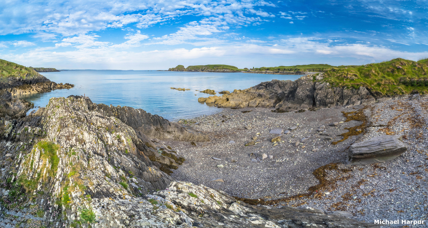
 Rabbit Island anchorage
Image: Michael Harpur
Rabbit Island lies ¾ of a mile northward of High island, forms the east shore of the small cove of Squince. The sound is nestled between the mainland cliffs extending westward from Sheela Point, to the north, and Rabbit Island to the south. It is very much out of the way but has a narrow backroad leading down to the shore near the landing beach.
Nestled in behind the island the rural bay offers good protection from southerly and northerly winds and reasonable protection from westerly winds. The shelter is also good from southerly, northerly and westerly swell.
How to get in?
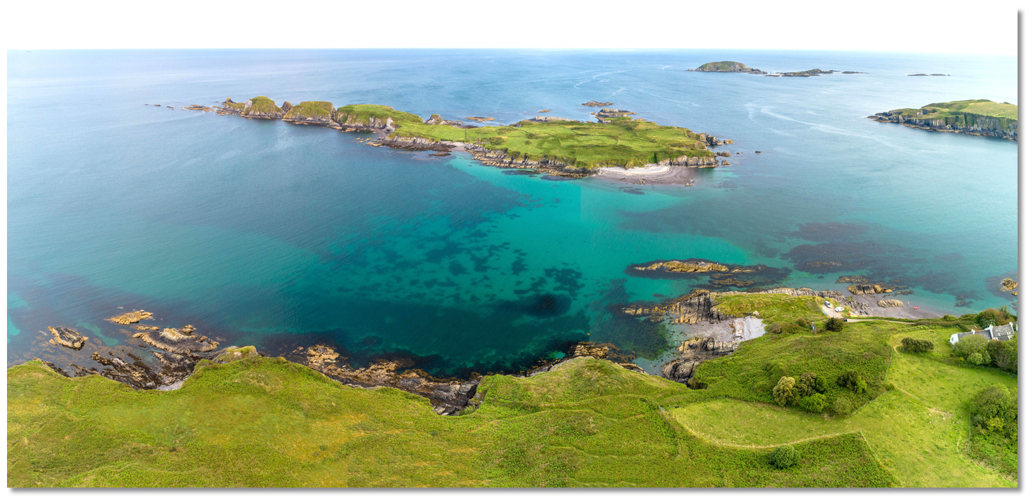
 Rabbit Island lies immediately west of the entrance to Glandore
Image: Michael Harpur
 Use Ireland’s coastal overview for Cork Harbour to Mizen Head for seaward approaches. The Glandore entry provides local approach directions as Rabbit Island Sound lies just off its entrance.
The bay has straightforward access from the east/northeast, without any mark but without hidden hazard although night access might not be advisable. Vessels approaching from the west need to be wary of Belly Rock. Awash at low water springs, the 0.4 meters Belly Rock, lies 270 metres to the south of the rocks that extend from the west end of Rabbit Island.
Belly Rock – unmarked, position: 51° 31.475'N, 009° 07.165'W
This places it very much in the track of vessels taking the Big Sound channel between High Island and the shore, which otherwise presents a clear passage, from 14.5 to 22 metres deep.
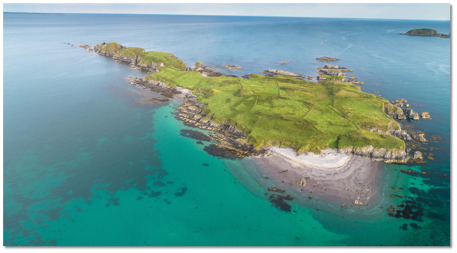
 Rabbit Island Sound
Image: Michael Harpur
Anchor according to draft. The small Sound offers good holding in what is thought to be sand/gravel. Be careful not to go too deep into the anchorage as a north-south sandbar connects the northwest part of Rabbit Island with the mainland.  The shallows separating Rabbit Island Sound and Squince Harbour as seen from the
latter
Image: Burke Corbett
Watch the depth sounder and those intending to cross in and out of Squince Harbour should only do so if they have a very shallow draft or a high tide.
Why visit here?
It is uncertain how Rabbit Island got its name. One of five Rabbit Islands nationally, with the others in Bantry Bay, Cork Harbour, Galway Bay and Lough Corrib, it must surely relate to the natural protected environment that it provided for rabbits to thrive. Rabbit Island Sound as seen from the shore
Image: Michael Harpur
Its Irish name Oileán Bhríde, is however not a direct translation but rather 'Brigid's Island'. This refers to St Brigid the patron saint of the local district of Myross. It is said that in the 5th-Century St Brigid visited the Uí Laogh tribe on the island, and it was after this that the island took on the name Oileán Bhríde. The island's well named after her it was believed to thereafter have curative properties. The local country people had a pilgrimage each year to congregate around it on the eve of the patron saint's day to offer up devotions. However, in Victorian times, a boat capsized whilst returning late one evening from the devotions. Sadly one of the pilgrims was drowned. After that, the well became neglected, fell in upon itself, and another well on the mainland, in a little sequestered nook near Squince Coastguard station, became the chosen point of devotion.
 Rabbit Island's old stone walls of long since departed inhabitants still visible
Image: Michael Harpur
Uninhabited now, the island was continually inhabited up until a fire in 1931 destroyed the house on the island the remains of which can be seen on the northern shore. The island almost played a part in the Civil War in 1920. This was after the burning of Cork, and a site was required to land weapons for Cork to take up the struggle. Arms had been sourced from Italy and a ship, the cargo vessel Stella Maris, was ready to sail with the first run of weapons. It was just a matter of getting a captain to sail her to Ireland and the arrangement of a land point the weapons.
 The ruins of the old dwelling house above the landing beach
Image: Michael Harpur
The sequestered Rabbit Island sound had the advantage of being screened from the sea by Rabbit Island and sufficient depth of water in the channel for the coaster. At the time it was inhabited then by an O’Driscoll family who were friendly to the cause and Curly Driscoll agreed to use his intimate knowledge to pilot the ship into Rabbit Island Sound and anchor close to the shore. As there was no pier four rowing boats were arranged to land the arms on the beach and the West Cork IRA made roughly 100 dumps ready to spread the cache. So the arrangements for the landing were all in place by February 1921.
 The Sound almost was the point where 6,000 guns were landed
Image: Michael Harpur
Mick Leahy left for Genoa in June but arriving in Rome was made aware that the plans had gone awry. The Italians had sold the information to the British and with the British navy aware the boat would never get through. As such the landing had to be called off and a second plan was made to land arms from Germany the following year. But by that time, eight months later, when the IRA were at their weakest point, both sides had sat down to the negotiating table. Could the planned 6,000 rifles and ammo, have tipped the balance of the negotiations, we will never know.
 Rabbit Island East, essentially a separate pair of giant stacks
Image: Michael Harpur
Today the attractive island is well worth a visit and taking the time to enjoy a lengthy stroll around. The island was formerly inhabited and is privately owned today, so visitors rely on the good graces of the owners who prefer to retain their exclusive use of its south-facing beach. This aside, they allow well-behaved visitors to use the rest of the island.
 The landing beach at the waist of Rabbit Island
Image: Michael Harpur
The best landing place is halfway along the north coast, on a sheltered pebble beach under the ruins of the house. The island has an abundance of birdlife burrows, and Linnet with chough and peregrine falcon being two of its more colourful occupants. The island has wild horses and otters have been seen on its western side and at the Stack of Beans at the east end.
What facilities are available?
There are no facilities in this remote bay.With thanks to:
Frédéric & SophieAerial views of Rabbit Island


Add your review or comment:
Please log in to leave a review of this haven.
Please note eOceanic makes no guarantee of the validity of this information, we have not visited this haven and do not have first-hand experience to qualify the data. Although the contributors are vetted by peer review as practised authorities, they are in no way, whatsoever, responsible for the accuracy of their contributions. It is essential that you thoroughly check the accuracy and suitability for your vessel of any waypoints offered in any context plus the precision of your GPS. Any data provided on this page is entirely used at your own risk and you must read our legal page if you view data on this site. Free to use sea charts courtesy of Navionics.