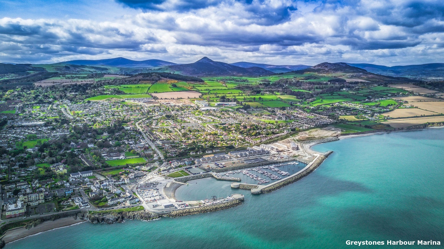
Berths in the marina offer complete protection. The harbour has straightforward access as there are no immediate off-lying dangers and it may be safely approached day or night and at any stage of the tide. The only difficulty is in the following seaway of a robust northeasterly where it would be best avoided by newcomers.
Keyfacts for Greystones


Nature


Considerations

Protected sectors


Summary
A completely protected location with straightforward access.


Nature


Considerations

 +353 86 271 8161
  info@greystonesharbourmarina.ie
  greystonesharbourmarina.ie/
  Ch.Ch 37, M
 Position and approaches
Haven position
 53° 9.114' N, 006° 3.851' W
This is in the middle of the entrance to Greystones Harbour.
What is the initial fix?
 53° 9.223' N, 006° 3.770' W
 What are the key points of the approach?
 .
.Not what you need?
- Bray Harbour - 3.7 nautical miles NNW
- Sorrento Point - 7.1 nautical miles N
- Dalkey Island - 7.3 nautical miles N
- Dún Laoghaire Harbour - 9.3 nautical miles NNW
- Wicklow Harbour - 10.2 nautical miles S
- Dublin Port - 12.8 nautical miles NNW
- Balscadden Bay - 14.1 nautical miles N
- Howth - 14.5 nautical miles N
- Carrigeen Bay - 15.2 nautical miles N
- Malahide - 18.4 nautical miles N
- Bray Harbour - 3.7 miles NNW
- Sorrento Point - 7.1 miles N
- Dalkey Island - 7.3 miles N
- Dún Laoghaire Harbour - 9.3 miles NNW
- Wicklow Harbour - 10.2 miles S
- Dublin Port - 12.8 miles NNW
- Balscadden Bay - 14.1 miles N
- Howth - 14.5 miles N
- Carrigeen Bay - 15.2 miles N
- Malahide - 18.4 miles N
Chart
What's the story here?
 Greystones Harbour Marina
Image: Greystones Harbour Marina
Greystones is a small coastal town located two miles south of Bray Head and about midway between Dun Laoghaire and Wicklow. The town is fronted by a harbour which contains a modern marina. Originally a small fishing hamlet, it became a popular holiday destination during Victorian times and has remained a seaside resort.
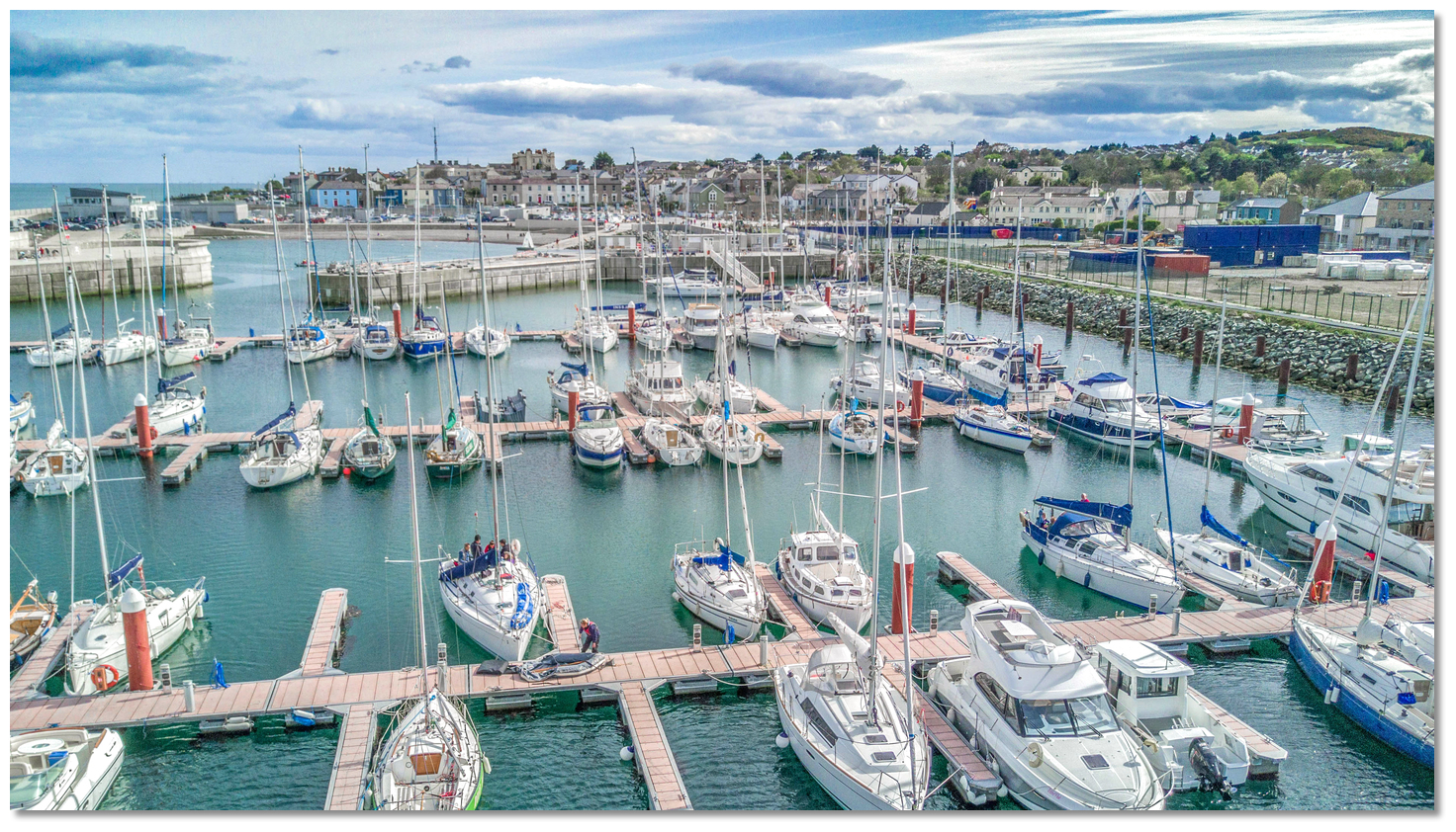
Greystones Harbour Marina has 100 berths, growing to 230 berths, that caters for vessels from 6 to 30 metres LOA, and it can cater for drafts of up to 5 metres. Visitors intending on berthing in the marina should make berthing arrangements in advance of arrival and the marina may be contacted by
 +353 (0)1 287 3131,
  +353 (0)86 2718161,
  info@greystonesharbourmarina.ie or
  Ch 37, M. The marina's site hosts their current
  visitor rate sheet on their web site. In settled or offshore conditions it is possible to anchor in the bay to the north of the harbour.
How to get in?
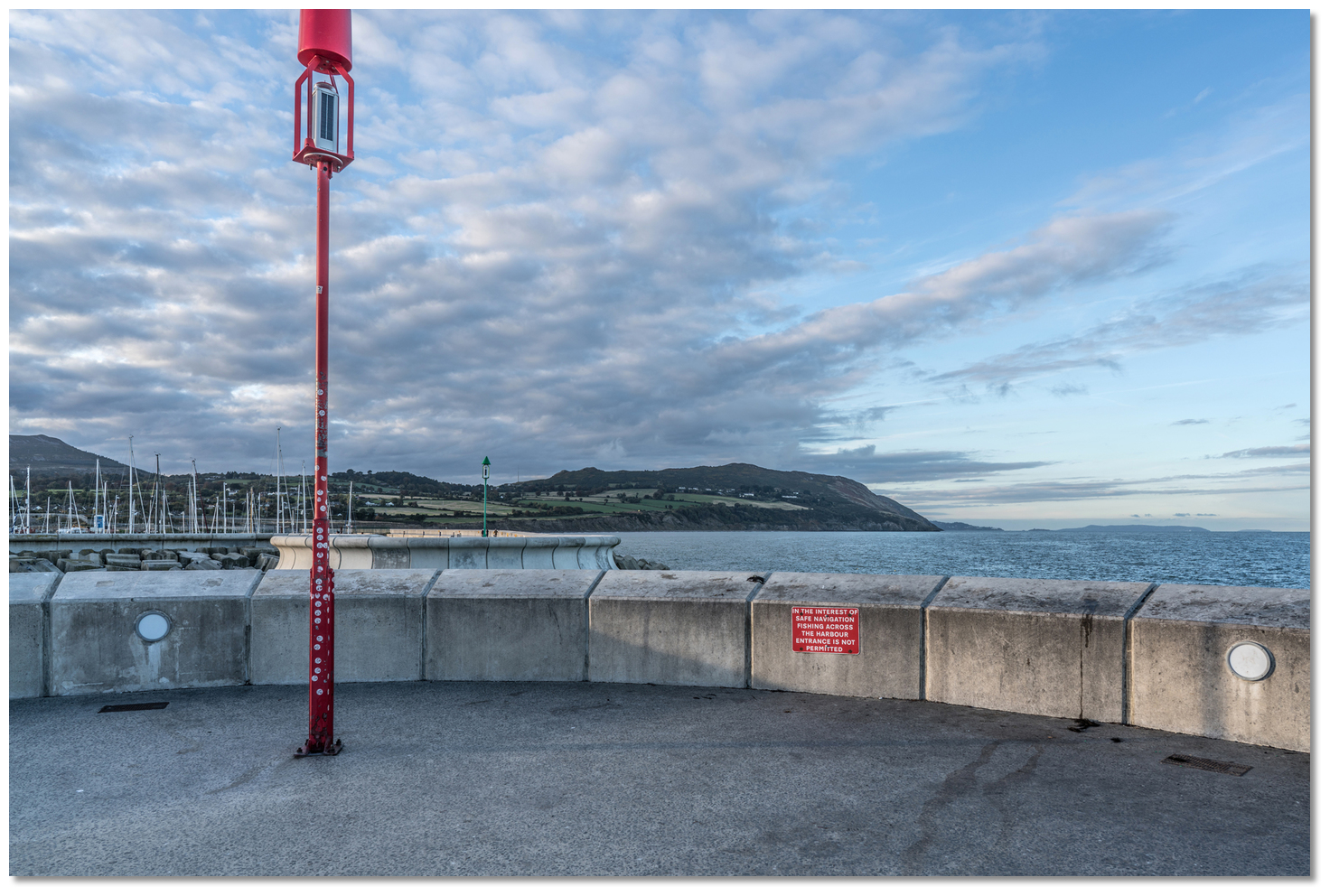 Bray Head as seen from the entrance to Greystones Harbour
Image: William Murphy (Infomatique)
 Use southeast Ireland's coastal overview Dublin Bay to Rosslare Harbour
  for seaward approaches. Approaches to the harbour are broadly clear however it is worth making note of the Moulditch Bank with 3.8 metres of water LAT over it that is located just over 1 mile to the southeast of Greystones. It is an irregular patch of coarse gravel and large stones, extending nearly 1¼ miles from the shore and is marked by a port hand marker buoy situated a ⅓ of a mile east of the bank.
Moulditch - Red Buoy Fl R 10s position: 53° 08.430'N, 006° 01.230’W
Although deep it is well worth avoiding as the tide rushing over the Moulditch causes overfalls which extend beyond the limits of the bank.
Inside the Moulditch Bank the Greystones outfall marker buoy will be seen, about a mile to the southeast of Greystones Harbour.
Greystones O/F – Yellow Fl Y 5s position: 53° 08.441'N, 006° 02.532’W
It is also worth noting that Greystones can be a subject to funnelling winds from nearby mountain ranges.
 The entrance to Greystones Harbour as seen from within
 Image: William Murphy (Infomatique)
 From the initial fix, situated immediately outside about 200 metres north by northeast of the entrance, the two large round piers of the harbour’s northeast-facing entrance will be readily apparent. Proceed towards the entrance steering south-by-southwesterly in the deepest waters of the approach. At night, the northwest side of the entrance Fl.G5s, the southeast side of the entrance Fl.R5s but expect the pierhead lights to be difficult to pick out from the shore lights.
Pass between moles of the outer harbour and into the outer basin where 5 metres of water will be found. Prepare to swing hard to the north (starboard) around the northern pierhead to enter the marina.
 Turn northward to enter Greystones Harbour Marina
Image: William Murphy (Infomatique)
 Three pontoon hammerheads will be seen to port, the first being 'A' Pontoon, then 'B' and 'C' Pontoon. Berth as directed by the marina office.
 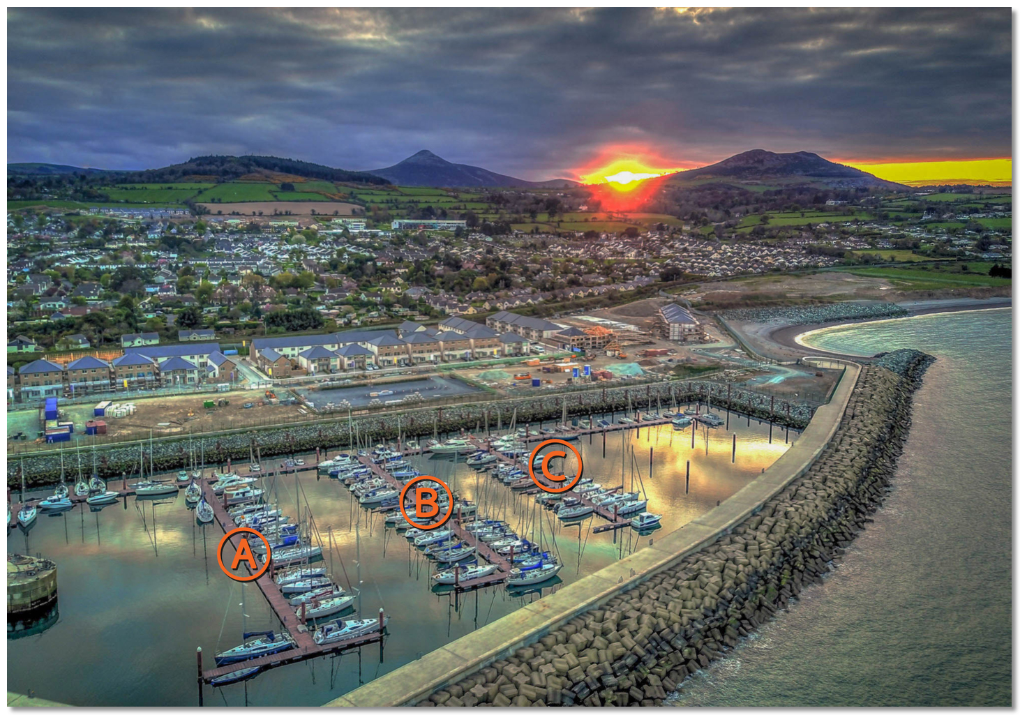 Greystones Harbour Marina Pontoon Plan
Image: Greystones Harbour Marina
In settled conditions, an exposed anchorage is available off the North Beach to the north of the harbour. It only offers protection from the west round to the southwest with a convenient landing available in the harbour or on the gravel beach. In these conditions, it is possible to anchor anywhere between Greystones and Bray Head.
 The bay to the north of Greystones Harbour
Image: Michael Harpur
The combination of funnelling winds from nearby mountain ranges and strong tides make this a location where it would be advisable not to leave a boat unattended for any length of time.
Why visit here?
Greystones, in Irish Na Clocha Liatha a direct translation Na Clocha the stones liatha derived from léith meaning grey, takes its name from the one-kilometre stretch of grey Cambrian rocks on its seafront. Apart from this short rocky stretch fronting the town the beach is unbroken all the way from Bray Head to Wicklow Harbour. Greystones' trademark grey rocks on South Beach
Image: William Murphy (Infomatique)
Marked on the old maps as 'The Grey Stones' the northern end of rocks would have afforded shelter to small open fishing boats operating off this length of the beach. In these early times, there was no town, not even a village and the fishermen would have lived in dwellings scattered around the hinterlands.
 The railway passing around Bray Head
Image: Miguel Mendez via CC BY 2.0
Fifty years later, between 1885 and 1897, the local people campaigned for the construction of a harbour to aid the fishing industry and the landing of imports such as coal. A jetty was built at the north end of The Grey Stones to encourage the fishing industry. Local shipwrights then grew to service the fleet and grew a reputation for building lucky boats. Despite these efforts, the tide of time quickly set in against the fleet of fishing schooners that plied their trade from the small harbour.
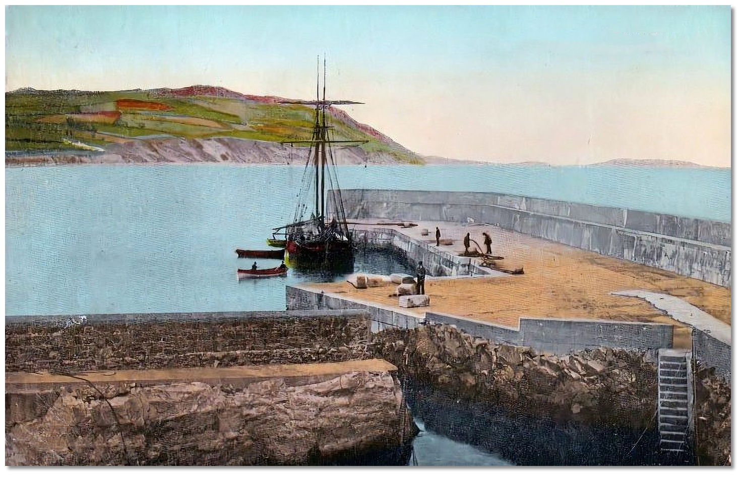 1911 postcard of Greystones Harbour
Image: Public Domain
By the beginning of the 20th-century, they had found themselves unable to compete with the steam trawlers landing their catches much nearer to the Dublin markets. The finishing stroke was to come in October 1911 when a sudden and unexpected storm blew into the harbour. It wrecked the bulk of the harbour's fleet of schooners effectively wiping out the villages fishing industry in one stroke. Fortunately, Greystones fortunes had by this time already taken on an entirely different direction.
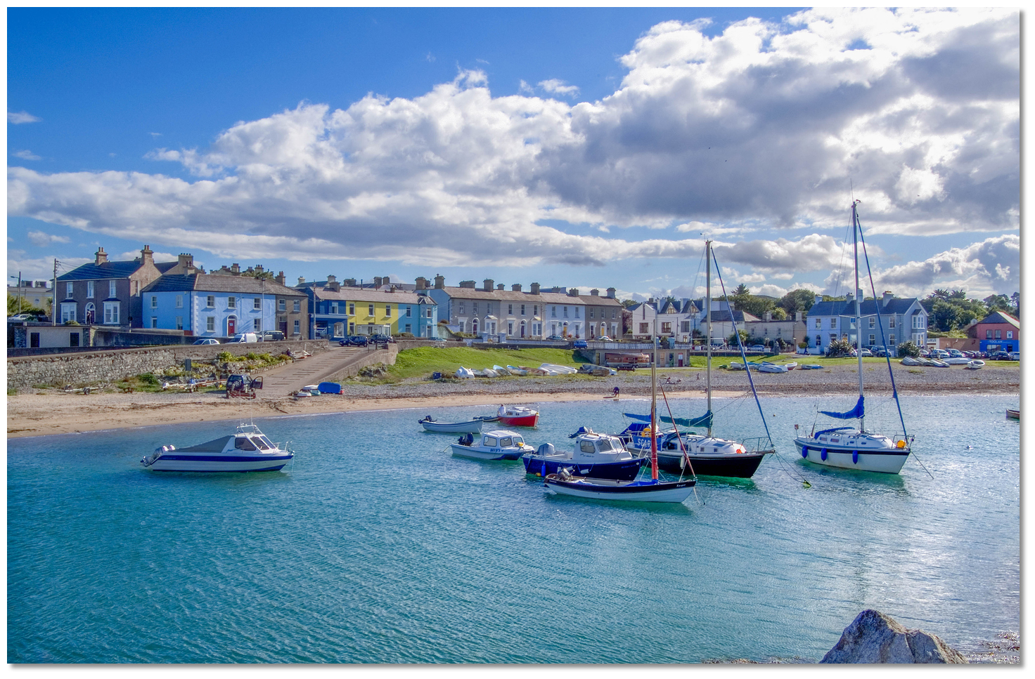 The harbour area prior to the current development
Image: Tourism Ireland
In 1835 the Dublin and Kingstown railway line opened and it was subsequently extended to Dalkey and then to Bray. Here the engineers came up against the rather difficult obstacle of Bray Head. None other than the celebrated Victorian engineer Isambard Kingdom Brunell was called upon to resolve the problem. This he did by recommending the constructing a single line with several tunnels to continue the line around the head and southward through Greystones to Wicklow. The arrival of the railroad to Greystones in 1855 put the small village on the map. Overnight Greystones had become a lovely day-trip from Dublin, particularly on a sunny day, and it quickly became a Victorian holiday destination. During the first decade of the 20th-century, most of the houses in Greystones were built to cater for summer let holiday trade. In the latter half of the 20th-century, cars and petrol became widely available, and Greystones then began to gradually expand, filling in the space between itself and outlying areas.
 Greystones Harbour Marina provides a safe base from which to explore
Image: William Murphy (Infomatique)
Today Greystones has a permanent population of about 15,000 and continues its role of a vibrant seaside town. Watched over by the Sugarloaf Mountain, and set between the curving expanse of its south beach, the ultra-modern waterfront and the smaller north beach, it is not hard to see why it is so attractive. It's a quieter resort than its near neighbour Bray and, while growing rapidly with the expansion of the capital's commuter belt, it retains much of its old-world Victorian charm. This can be seen in its gently sloping main street and leafy avenues lined with elegant houses as well as the pretty churches. The old fishing harbour has been completely redeveloped and, although ultra-modern, it does not detract from the town but rather adds to it. The town offers a large variety of upmarket shops, supermarkets for food and provisions, boutiques, cafes, bars and a number of restaurants catering for all tastes.
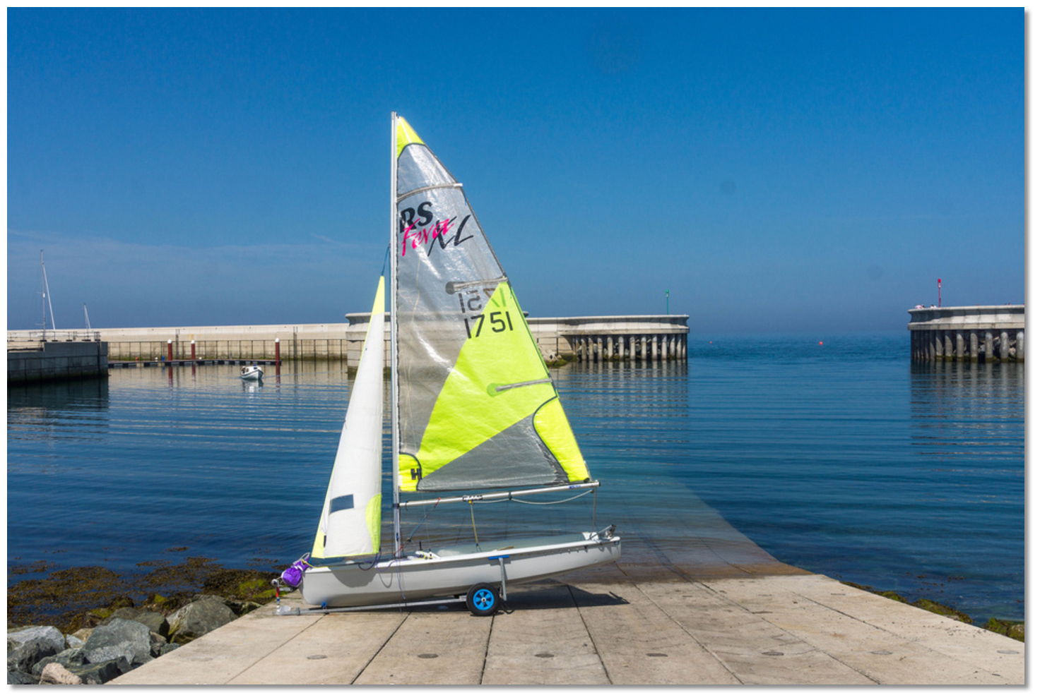 Greystones is a major centre for boating recreation
Image: William Murphy (Infomatique)
The adjacent spectacular Wicklow countryside, known as the 'Garden of Ireland' provides just as much a visitor attraction as the town and its beaches, but it is not necessary to go far to experience the loveliness of this location. The moderate 'Cliff Walk' or 'Cliff Trail', is an 8km (5-mile) path that follows the railway line around Bray Head to Bray, is a must for any visitor. The relatively flat and easy two-to-three-hour walk provides spectacular views as it snakes its way along some gorgeous cliffs. Likewise, a walk southwards along the shore of the broad sandy kilometre long Blue Flag South Beach is just as much of a pleasure.
 Sunset over the Wicklow Mountains
Image: Greystones Harbour Marina
From a boating perspective, Greystones is an ideal location to pick up or drop off crew with its excellent transport connections to Dublin. It also makes for a good provisioning point. Being on Dublin’s doorstep, with a totally secure berth and excellent transport, it is also an excellent destination to explore Dublin and return to a quiet rural location at the end of the day.
What facilities are available?
The marina has water, shore power and its boatyard has a 30 ton hoist and hard standing storage. Supplies of all sorts may be obtained in the small town of Greystones – shops, filling station, banks, ATMs, chemists, doctor etc. Similarly, as it is a major tourist town, there is a focus on recreation - pubs, restaurants, evening entertainment, etc.Situated just 27 km south of Dublin Greystones has excellent transport connections. Greystones railway station is the southern terminus of the DART railway line, a service which connects thirty stations along Dublin's east coast. Iarnród Éireann diesel Commuter and InterCity trains also serve Greystones, linking the town with Wicklow, Arklow, Gorey, Wexford, and Rosslare Europort to the south, and Dublin's Connolly Station to the north. In terms of buses Greystones is served by the 84, 184, and 84X Dublin Bus routes.
By road Greystones is accessible from the N11 Dublin-Wexford road; a new interchange constructed near Charlesland connects with the town via a dual carriageway.
Any security concerns?
Never an issue known to have occurred in Greystones.With thanks to:
Charlie Kavanagh - ISA/RYA Yachtmaster Instructor/Examiner.Aerial views of the completed development at Greystones
Add your review or comment:
Michael Byrne wrote this review on Jun 13th 2019:
Nobody expects boating to be for free, but the marina fees here a possibly the highest in the country.
Average Rating:


Shane McDonald wrote this review on Aug 14th 2022:
Safe location. If arriving after hours, make prior arrangement. Despite 24 hours advertised marina not staffed outside office hours, they don't tell you this when booking a berth. You can arrive and find everything closed with no way to access anything and no 24 hour phone or number. Probably most expensive visitor fees Beth in Ireland but without facilities to match.
Average Rating:


Please log in to leave a review of this haven.
Please note eOceanic makes no guarantee of the validity of this information, we have not visited this haven and do not have first-hand experience to qualify the data. Although the contributors are vetted by peer review as practised authorities, they are in no way, whatsoever, responsible for the accuracy of their contributions. It is essential that you thoroughly check the accuracy and suitability for your vessel of any waypoints offered in any context plus the precision of your GPS. Any data provided on this page is entirely used at your own risk and you must read our legal page if you view data on this site. Free to use sea charts courtesy of Navionics.


