
The River Fal enters the sea on England's southwest coast about fourteen miles northeast of Lizard Point. It has one of the English Channel’s major ports near its entrance and several miles of sheltered deep waters stretching inland. Within its length is a separate marina, detached river pontoons, pick up moorings and a host of sheltered inlets and creeks where it is possible to anchor afloat or dry out.
The river provides a host of land-locked berthing opportunities where complete protection from all conditions can be found. The entrance and its channels are well marked and deep so it may be safely accessed in all reasonable conditions, at any stage of the tide, night or day.

Keyfacts for The River Fal


Last modified
March 28th 2019 Summary
A completely protected location with safe access.Facilities


Nature


Considerations

HM  +44 1872 224231 HM +44 1872 272130
  harbouroffice@carrick.gov.uk
  portoftruro.co.uk
  Ch.12 [Carrick Tree]
+44 1872 224231 HM +44 1872 272130 harbouroffice@carrick.gov.uk portoftruro.co.uk Ch.12 [Carrick Tree] Position and approaches

Expand to new tab or fullscreen
Haven position
 50° 15.717' N, 005° 2.856' W
This is the position of the visitor pontoon in front of the harbour masters office Truro.
What is the initial fix?
The following Falmouth Harbour Initial Fix will set up a final approach:
 50° 7.967' N, 005° 1.336' W


What are the key points of the approach?
Offshore details are available in southwestern England’s coastal overview from Start Point to Lizard Point  . The entrance to the River Fal is covered in the Falmouth Harbour
  entry.
. The entrance to the River Fal is covered in the Falmouth Harbour entry.- The River Fal is best addressed after half flood.
- It is marked all the way to Truro and navigation is simply a matter of following the marks on to the next.
- The limit of low water navigation is just below the confluence with the Truro and Tresillian River at Malpas Point, 2 miles below Truro.
- The last couple of miles to the city of Truro becomes addressable at HW -2.5 hours.
Not what you need?
Click the 'Next' and 'Previous' buttons to progress through neighbouring havens in a coastal 'clockwise' or 'anti-clockwise' sequence. Below are the ten nearest havens to The River Fal for your convenience.
Ten nearest havens by straight line charted distance and bearing:
- Portscatho - 5.6 nautical miles SSE
- Saint Mawes - 6.4 nautical miles SSE
- Falmouth - 6.5 nautical miles S
- Gorran Haven - 10.1 nautical miles E
- Portmellon - 10.2 nautical miles E
- Mevagissey - 10.2 nautical miles E
- Helford River - 10.4 nautical miles SSW
- Gillan Creek - 10.7 nautical miles S
- Charlestown - 11.9 nautical miles ENE
- Par - 14.2 nautical miles ENE
These havens are ordered by straight line charted distance and bearing, and can be reordered by compass direction or coastal sequence:
- Portscatho - 5.6 miles SSE
- Saint Mawes - 6.4 miles SSE
- Falmouth - 6.5 miles S
- Gorran Haven - 10.1 miles E
- Portmellon - 10.2 miles E
- Mevagissey - 10.2 miles E
- Helford River - 10.4 miles SSW
- Gillan Creek - 10.7 miles S
- Charlestown - 11.9 miles ENE
- Par - 14.2 miles ENE


What's the story here?
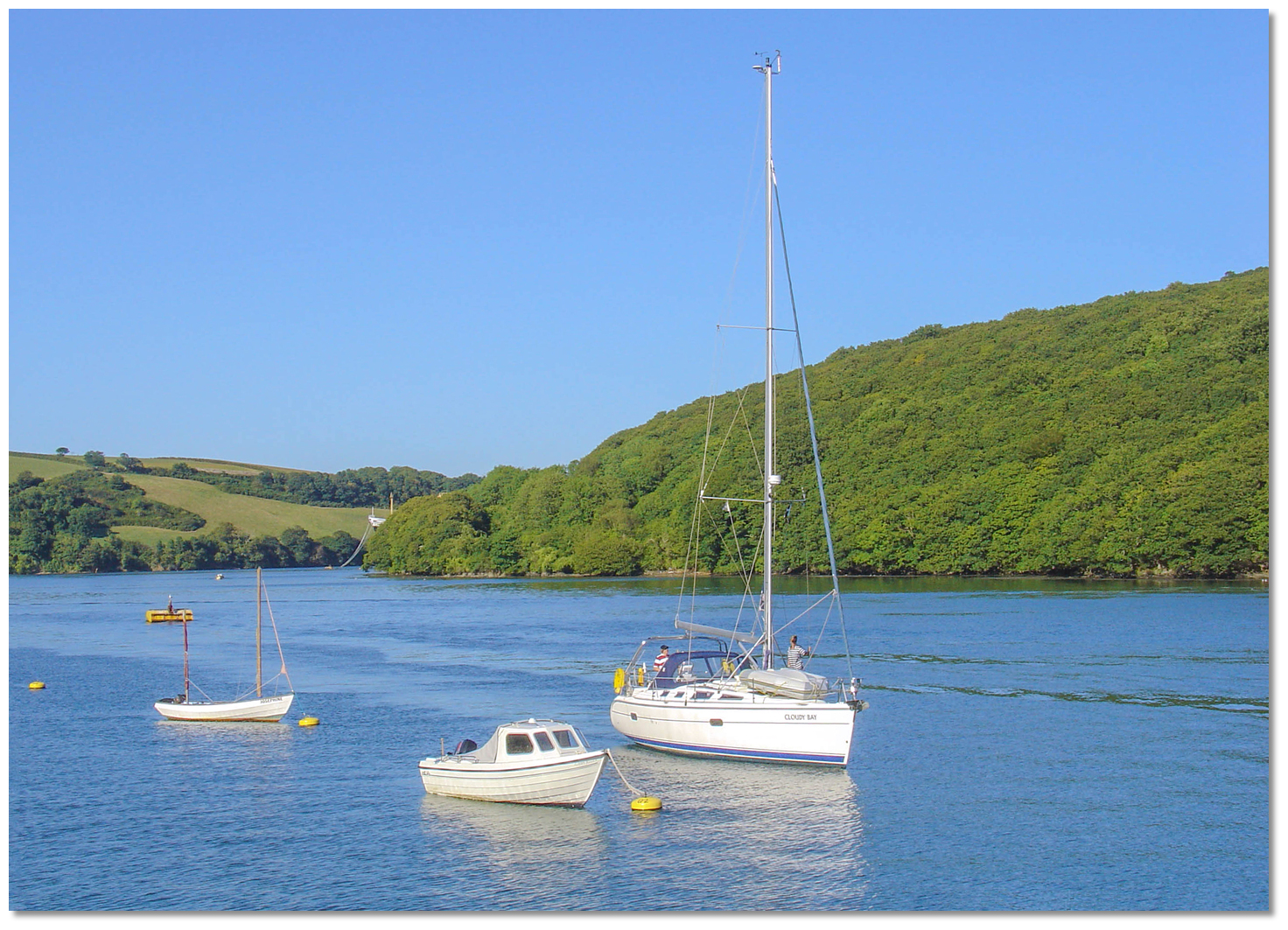
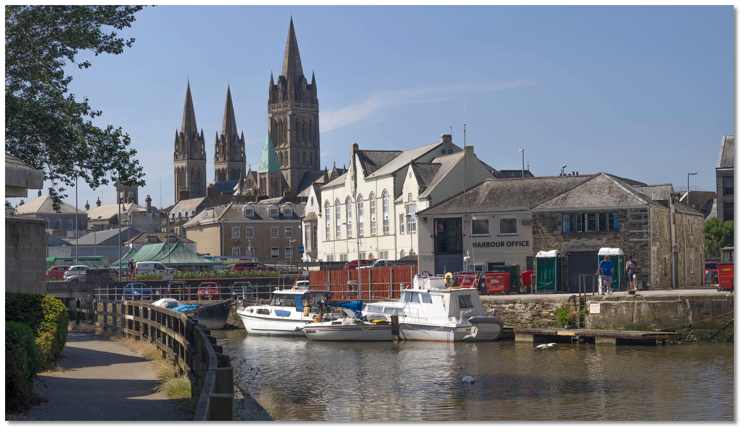 Port of Truro Visitor Pontoon and Harbour Office
Image: Michael Harpur
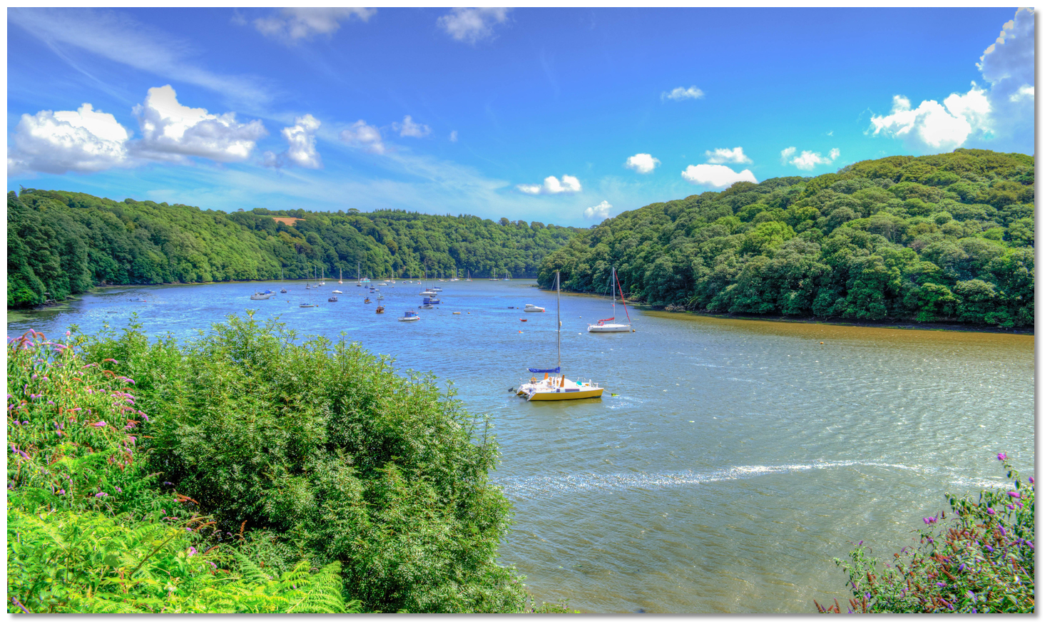
The River Fal rises at Pentevale on Goss Moor and flows through Cornwall to reach the English Channel at Falmouth. It is navigable to the town and port of Truro located about 7 miles above its most famous anchorage at Carrick Roads, which is situated just inside the entrance. The Fal estuary is a classic ria or drowned river valley which, unlike many rivers, means that the passage to the conjunction with the Truro River is deep all the way. It starts to shallow a mile up the River Truro, with the limit of low water navigation being reached just below the confluence of the Truro and Tresillian Rivers at Malpas Point. Thereafter the channel requires the top third of the tide to proceed the final 2 miles to Truro.
Vessels with draughts of less than 2 metres can reach Truro on the tide and during Springs it can be visited by vessels of less than 3 metres. In that length, the Fal provides excellent shelter and beautiful anchorages, with the addition of several drying creeks for those that can take to the mud.
The authority for the River Fal north of Falmouth, together with Penryn Harbour, is the Port of Truro. They provide four detached visitor pontoons along the river's upper reaches at Turnaware Bar, Ruan Creek, Woodbury and Malpas, as well as berthing facilities alongside the quays in Truro. The midriver pontoons do not provide walk ashore access, electricity or water and boats may have to raft up during high season. Water, however, is available at the central King Harry Ferry pontoon which can only be used for a short stay. There are also a number of designated visitor’s moorings located at Smugglers Cottage and just below Malpas. It is also permissible to anchor in the river but it does attract harbour dues.
Port of Truro may be contacted by
Ch.12 [Carrick Tree], +44 1872 224231/272130 weekdays between 08.30 - 17.30. Alternatively harbouroffice@carrick.gov.uk, www.portoftruro.co.uk.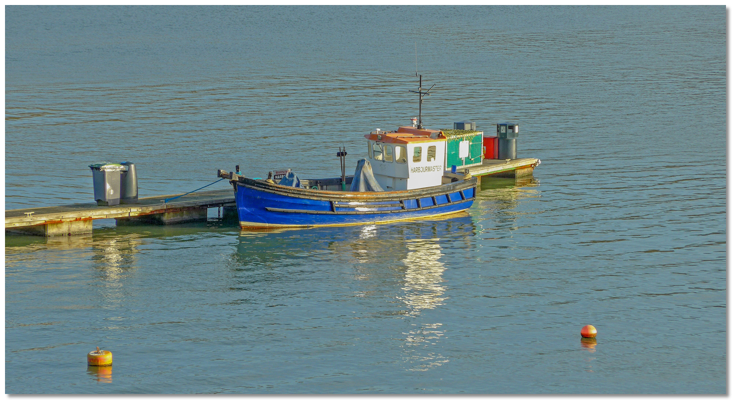 Harbourmaster boat at Malpas
Image: Tim Green
Harbour office staff will be seen out and about on the river during the summer months ensuring byelaws are adhered to and collecting visitor mooring and anchoring fees. The staff on the river launch,
Ch. 12 [Carrick One], will be delighted to offer information and assistance to customers. 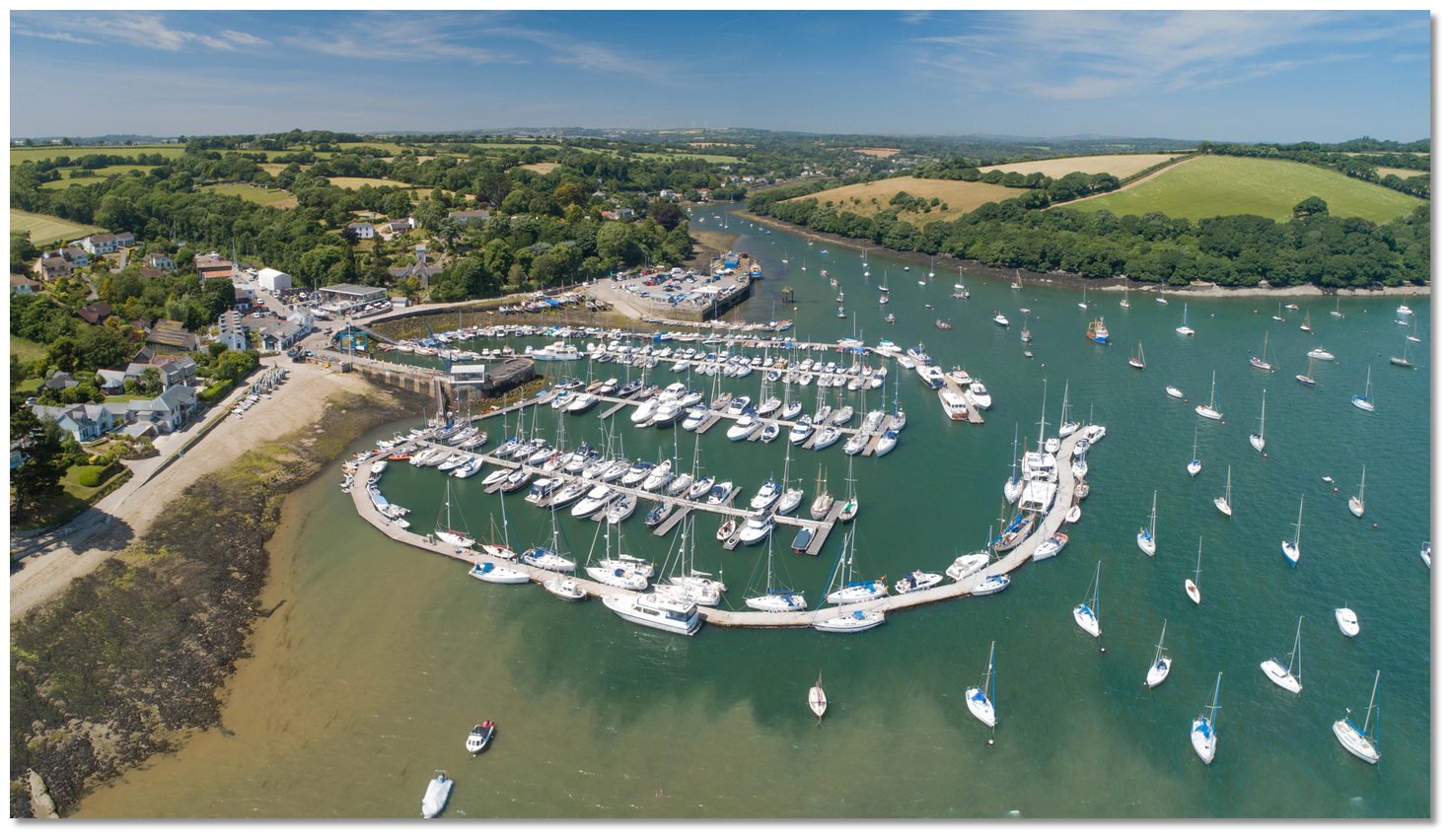 Mylor Yacht Harbour
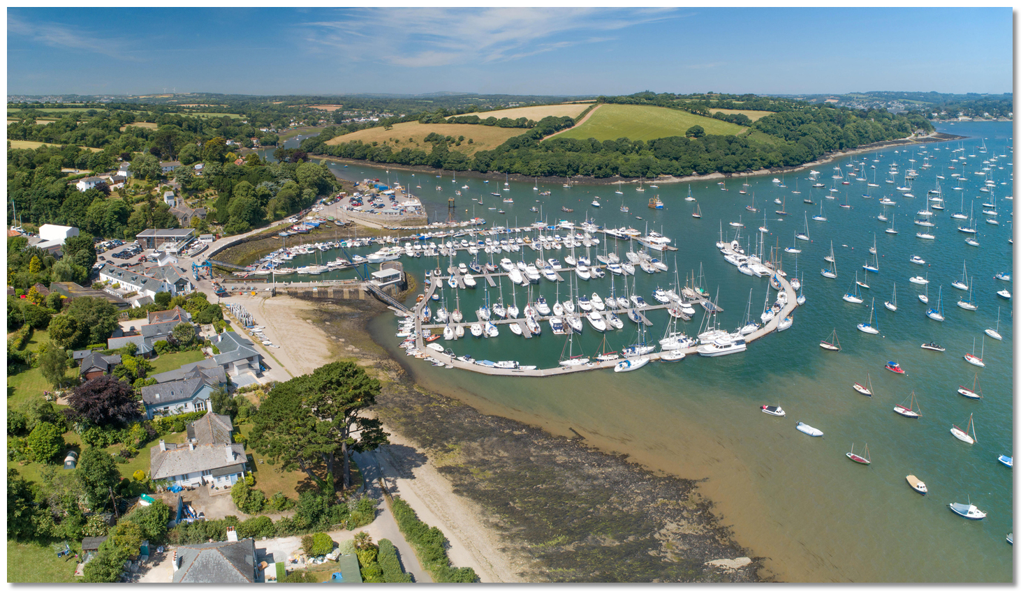
Image: Michael Harpur
Mylor Yacht Harbour is situated on the western shore of the Falmouth Estuary northwest of Carrick Roads and opposite Saint Just. It is a well-appointed marina with 40 pontoon visitor berths and 15 visitors' moorings capable of taking boats of up to 15 metres LOA. The marina and approach fairway are dredged to 2 metres below LAT. The visitor’s pontoon is the clearly signposted 'E' pontoon that surrounds the eastern side of the marina.
 Mylor Yacht Harbour Pontoon Plan
Image: Michael Harpur
It is a popular location which makes it advisable to call ahead to make arrangments in advance
Ch: 37/80, +44 1326 372 121, enquiries@mylor.com or via a contact form on their sitewww.mylor.com. Office opening times: 8:30am – 5pm, 7 days a week but opening times may vary during public holidays.Vessels over 4 metres are charged [2019] Marina £3.70/m, Mooring £2.15/m per day. The same applies per week with a 10% discount, or per month with 15% off. Electricity is included in the short stay afloat prices. Short stays of up to 3 hours for vessels up to 7.6 metres (25ft) are £5, and above £7.
Tenders of less than 4 metres LOA can berth in the marina for a daily rate of £7.70 or on the beach £3.45.
 The river offers many anchoring opportunities
Image: Edward Webb via CC BY-SA 2.0
There are anchorages off Saint Just Creek, Restronguet, Channal Creek, Tolcarne Creek, Lamouth Creek, Ruan Creek, Church Creek and pretty much anywhere in the upper reaches above or below the Maggoty Bank buoy. Harbour dues will be collected but they are moderate.
How to get in?
 Black Rock and St Anthony Lighthouse as seen from Pendennis Castle
Image: Tim Green
 Use southwestern England’s coastal overview from Start Point to Lizard Point for seaward approaches. The entrance to the River Fal is covered in the Falmouth Harbour entry.
 The entrance to the Fal is passable in all reasonable conditions and the river is best addressed after half flood. It has deep waters in the channel all the way to Malpas in the Truro River and navigation is simply a matter of following the lit marker buoys on to the next. Shallow banks flank the channel in Carrick Roads but these are unlikely to present an issue for most leisure craft after half tide and to the largest part it is all soft mud. Only the creeks dry in the upper harbour.
Passing St Anthony Lighthouse and Black Rock at the entrance leads into Carrick Roads, the estuary of the River Fal. The historic anchorage of Carrick Roads reaches depths of up to 34 meters, is nowhere less than a mile wide, and constitutes the third largest natural harbour in the world.
 Carrick Roads and Penarrow Point as seen from the eastern shore
Image: Michael Harpur
Pass St Mawes to starboard and Falmouth and the Docks to port. Continue northward up Carrick Roads following the channel markers to stay in deep water. The deepwater main channel trends towards the low promontory of Penarrow Point. It has a prominent 3-metre high granite pillar close south of the point that corresponds with another on Messack Point, on the opposite shore, to show the historic dividing line between the authorities Port of Truro and Falmouth Harbours. It is best to follow the channel here as the St Mawes Bank, or Flat, borders the eastern side of the roadstead extending nearly a mile northward of St. Mawes Castle. It stretches halfway over Carrick Roads and has a least depth of 1.2 metes at its centre. The northwestern extremity, named the Vilt, is steep-to, and marked by a starboard buoy Vilt, Fl.G.4s.
 Yachts anchored of Saint Just Creek with Mylor opposite
Image: Michael Harpur
 About a ⅓ of a mile from Penarrow Point the channel bends east and then turns north to St Just Pool. The entrance to Saint Just Creek opens to the north of Saint Just Pool and the first popular river anchorage is off the entrance to the creek in 3 metres close inside Messack Point. Sound-in directly from the main channel and anchor south of the local moorings. Situated under the northern promontory, it provides good protection from the north round to the east and is usually serviceable in anything except strong west or southwesterly conditions. The easterly protection is very useful as it can be uncomfortable alongside the pontoon in Mylor Yacht Harbour in strong easterlies.
  Saint Just Creek at low water
Image: Michael Harpur
Further in, Saint Just Creek dries 300 metres within the entrance and is full of local small craft moorings managed by Pascos Boatyard. The creek has a useful jetty for anchored boats to land by tender. It also provides an idyllic drying location for a boat that can take to the bottom when the tide is away. Being south of the line denoted by the granite pillars, the port authority for this area are the Falmouth Harbour Commissioners who will collect their harbour dues which tend to be significantly more than those upriver.
 Mylor Yacht Harbour Marina at the entrance to Mylor Creek
Image: Michael Harpur
 Those intending on visiting Mylor Yacht Harbour should not be tempted to cut in around Penarrow Point. A ledge that dries to 2.7 metres extends 150 metres from the point and it is shallow, with as little as 0.5 metres in places, between the north shore and the marina's entrance channel. It is best to pass close to the 'North Bank', Fl.R.4s, port buoy off Penarrow Point and then steer for the two lateral approach buoys, red Fl.R.5s and green Fl.G.6s, that mark the beginning of the marina's approach channel. This has 2 metres LAT all the way in through the outlying moorings on both sides. The heavy concrete pontoon forming the eastern breakwater arm of the Marina is where the visitor berths are located.
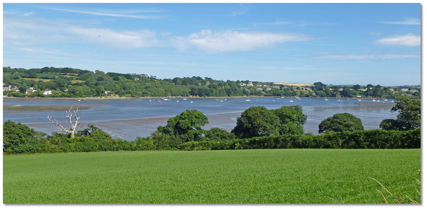 Restronguet Creek
Image: Tim Green
Likewise, when exiting Mylor, it is important to exit via the dredged channel and then steer east to regain the main channel to head upriver. It is all too tempting to exit and steer directly for Restronguet Creek less than a mile northward. But this would be a mistake for a vessel carrying any draft if the tide is near LW. Beyond the outer moorings at Mylor there is an extensive shallow bank that extends across to the channel with depths as little as 0.3 metres.
 Restronguet Point with the creek to the left
Image: Michael Harpur
The next popular anchorage is just outside the tidal ria tributary of Restronguet Creek which joins the west side of Carrick Roads. Vessels carrying any draft need to consider the tide height as the least charted depth on the approaches to the entrance of the creek is 1 metre. There is a deep pool in the entrance but it is full of local boat moorings so that the only space to be found is just outside of these or, if you are lucky, a vacant mooring.  The Pandora Inn's extensive pontoon at low water
Image: Michael Harpur
With a couple of hours of flood shoal draft vessels should be able to get up to the Pandora Inn's extensive mooring pontoon. It dries to 0.9 metres but vessels that can take to the bottom can dry out alongside. Vessels anchoring off can land on the pontoon by tender,
+44 1326 372678, info@pandorainn.com, www.pandorainn.com. Dinner at the Pandora Inn is considered a must for all River Fal visitors
Image: Michael Harpur
The wonderful inn with its mooring pontoon, and shower and launderette facilities, is the primary reason boaters visit the creek. Dinner at the historically interesting Pandora Inn is generally considered a must for all visitors to the River Fal. Above it, Restronguet Creek dries entirely and is full of local moorings that should not be used. At the head of the creek, about 1½ miles onwards, the small village of Devoran may be reached by dinghy on the tide. It was a busy port in the 1880s, exporting copper and tin, but is now a quiet village with a post office and general store.
In all cases Restronguet is best addressed from the main channel breaking off to the west about 200 metres south of the 'Carick' starboard buoy, Fl(2)G.10s. Pass south of the Carick Rock, that drys to 0.8 metres and is marked by unlit north and south cardinal posts. As with Mylor, come out the same way when there is sufficient steering for the channel close north or south of the Carick Rock.
The change in the river is dramatic at Turnaware Point about a mile northeastward. The wide expanse of Carrick Roads narrows into an extensively wooded channel. The wind dies, the hills close in and the oaks steal down to the water's edge, as the most attractive part of the river begins.
 The first mooring pontoon with Turnaware Point in the backdrop
Image: Ian S via CC BY-SA 2.0
It is essential to pass the 'Turnaware Bar' buoy, Fl.G.5s, on its correct side keeping close to the western shore as the drying shoal, between it and the point called Turnaware Bar, extends northwest from the Point. The narrows and the river bend combine to increase the velocity of the currents here, so during ebb and flood tides, the helm should be prepared to encounter 2-3 knots at springs and rips. It also marks the start of the 8-knot speed limit of the River Fal.
 Tressilick House as seen from the river
Image: Robert Pittman via CC BY-SA 2.0
The deep water channel turns eastward for a ¼ of a mile after Turnaware Point and is flanked by the popular anchorages at Channels Creek, on the north side, and Tolcarne Creek on the south. After this, stay in mid-stream and follow it as it turns north again. The short stay pontoon just below King Harry Ferry
Image: Michael Harpur
 This then passes 'Turnaware Bar', the first of Port of Truro's 40 metres long visitor mooring pontoons on the west side. The walk-ashore pontoon further upriver, just below King Harry Ferry on the western shore, is used by tripper boats and can only be used for a short stay. Keep clear of the mussel farm just south of the pontoon on the approaches.
Freshwater is available here and it is a convenient set down location for the crew to visit the National Trust Tressilick Gardens which, in season, is well worth it. Dinghies may be left on the inside of the pontoon. When the tripper boats have finished for the day the harbourmaster may give permission for an overnight stay but do not berth here without permission.
 Layed up vessels north of the King Harry Ferry
Image: Robert Ashby via CC BY-SA 2.0
The King Harry chain ferry has priority at all times and above it a number of very large cargo ships may be encountered on fore-and-aft moorings. These large merchant ships, of up to 190 metres LOA & 15,000 tonnes, use the river's protected deepwater as a lay-up location until commercially viable work becomes available. They look entirely out of place sleeping on their moorings amongst the pristine woodlands.
 Lamouth Creek as seen from Trelissick Gardens
Image: Tim Green
A ½ a mile above the short stay pontoon the river bends eastward opposite the entrance to the drying Lamouth and Cowlands creeks. At the junction of the two inlets is the drying 18th-century Roundwood Quay. Today a National Trust property, but in its day locally smelted copper and tin was shipped by vessels of up to 300 tons from these quays. Roundwood Quay
Image: Callum MacLeod via CC BY-SA 2.0
Behind the quay is an Iron Age promontory fort that now hides within the woodland. Yachts carrying deeper drafts can sound-in and anchor outside of the entrance clear of the local moorings. It is advisable to use a trip line in this area owing to the large ship mooring chains.
 Cowlands Creek
Image: Tim Green
Both the pretty creeks inside provide some excellent opportunity for dinghy exploration, and perhaps a beautiful berth for the creek crawling bilge-keeler. The foreshores of the peaceful hamlets of Coombe, about halfway up and on the north shore, and Cowlands make for highly attractive destinations for a bilge keeler to dry out.
 Local boat mooring off the entrance to Lamouth and Cowlands creeks
Image: Tim Green
On the inside of the bend opposite and on the south bank is the Smugglers Cottage Restaurant and Tea Bar which hosts a visitors pontoon for either short stay or overnight. Sadly, the Smugglers is now in private hands and no longer serves food and beers. There are still mooring buoys in the area, immediately upstream to the east of the jetty. There is a traditional anchorage just east of them. If it is busy the mud is very soft sediment so deeper-draught boats can sink in at low water. The pontoon is used by tripper boats but it is possible to land by dinghy around the back of the pontoon. Smugglers Cottage
Image: Tim Green
The river turns north once more ¼ of a mile to the northwest of the jetty changing into the Truro River. The River Fal branches to the northeast rather insignificantly to become the long shallow Ruan Creek that is dry within a ⅓ of a mile.
Shoal-draught yachts can lie in the mud of the creek in a pocket of undisturbed wilderness. There is a voluntary restriction on anchoring beyond the first bend of the creek, which is a Site of Special Scientific Interest. On the tide, tenders can explore to the small village of Ruan Lanihorne at its head. Keep a sharp eye out for three very large abandoned mooring blocks close to the north shore on the approaches. They begin to uncover after half tide and are marked with a yellow pole. Ruan Creak Harbour Authority visitors' pontoon
Image: Tim Green
As the river continues north the second 'Ruan Creek' Harbour Authority visitors pontoon will be seen off the eastern shore. After passing the pontoon, favour the east side until Maggoty Bank buoy, Fl.G.5s, is identified. This marks the extent of the shallow Maggoty Bank encroaching from the east side. Leave this close to starboard and then drift back into the centre of the river once more. It is possible to anchor anywhere above the Maggoty Bank, or indeed below, clear of the fairway.  'Woodbury' Harbour Authority visitors pontoon
Image: Tim Green
As the river turns the corner to the northeast around Woodbury Point the 'Woodbury' Harbour Authority visitors pontoon provides a good indication of the channel. After rounding Woodbury Point Maggoty Bank, the depths start to fall away. A ⅓ of a mile short of Malpas is Mopus Reach that has a LAT of 0.9 before a deep pool is arrived at fronting the town.
 Mopus Reach as seen from Malpas
Image: Michael Harpur
The Malpas visitors' swinging moorings are marked V1, V2, V3, etc which are rated to take up to 12 metres LOA. The Malpas Marina walk ashore pontoon is located opposite Malpas Point on the mouth of the Tresillian River which conjoins with the Truro River from the northeast. The pontoon has 1 metre at LWS and is only suitable for boats less than 9 metres. You may be charged by the boatyard for landing by dinghy. The Tresillian River dries 200 metres above the pontoon. The marina has been bought by Cornwall County Council so there may be some changes.  Tresillian Rive with the Malpas Marina pontoon left
Image: Tim Green
Malpas is the limit of low water navigation which means for those who do not want to dry, this is the last place that a yacht of an average draft can lay afloat at all states of the tide. The walk to Truro is an enjoyable two miles from here or a dingy ride on the tide for a stock up.
The Truro River continues past Malpas to the city which can be reached from HW -2.5 hours. The river first tends southwest, then bends around Victoria Point to make an 'S' curve to Lighterage Quay with its course marked by lighted buoys all the way. The river narrows to about 100 metres off the quay with the best water close to the quay wall.
The 12 metres wide flood gate is generally open but it can be shut if an exceptionally high tide is expected, higher than a 5.6 metres Falmouth datum, with an accompanying tidal surge or heavy river flood water. There is a waiting pontoon just downstream if the gate is closed or if you arrive too early on the tide to make Town Quay. The helm should prepare for some acceleration in the flood gates pinch-point if the tide is in full flow.
 The channel above the flood barrier as seen at low water
Image: Tim Green
The channel to Truro is a little over a ½ mile above the flood gates. It first swings to starboard and then to port back towards the long quay on the western bank as it proceeds northwards. It is marked all the way by unlit red and green posts.
 Town Quay adjacent to the Harbour Office
Image: Michael Harpur
At its head Port of Truro had many quays within the city centre, but most have silted up. Three short channels will be seen with harbourmaster's office and berths in the western arm which is the first option to port.
The small Port of Truro berths dry out to soft mud beyond HW+/-2 hours. It is best to report to the overlooking harbour office before drying out.Why visit here?
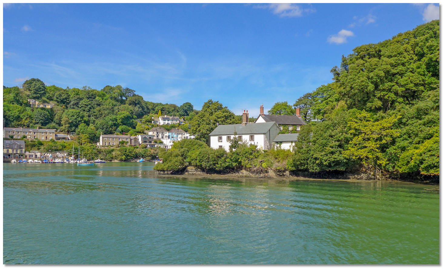
Although the first records of the River Fal come to us from AD 969 and 1049, the origin and meaning of the name Fal is unknown to this day. Likewise, the whole estuary tends to be referred to as the Fal, but the Fal only comprises a deep water tidal channel, Carrick Roads, and the complete waterway is made up of a series of major creeks or tributaries.These include the Percuil river, with the small port and holiday destination of St Mawes, the Fal and Ruan rivers draining into the estuary from the east, and the Tresillian River. The Truro River with the county capital city of Truro joins from the north, and Restronguet Creek ria and Penryn River and the town of Falmouth draining from the west. The major tributaries typically comprise extensive drying creeks but the central 'ria', the drowned river valley or flooded estuarine valley, is deep providing low tide access for the vast majority of its length.
 St Just Church
Image: Tim Green
Immediately inside the entrance is the magnificent Carrick Roads whose name comes from the Cornish Dowr Carrek, meaning ‘rock anchorage’. It is the world's third largest natural harbour and the first or last port for transatlantic shipping. During the 19th-century when Falmouth, Penryn and Truro flourished on the tin trade it was one of the busiest ports outside of London. Although only Falmouth is still functioning as a major port, Carrick Roads is still important as the first and last port of call for large ships approaching or leaving England. It has been a magnet for yachtsmen being the natural jump-off and return point for transatlantic sailors. Robin Knox Johnston completed the first west/east solo nonstop circumnavigation from here in the Sunday Times Golden Globe Race. Ellen MacArthur also returned here from her record-breaking solo circumnavigation.
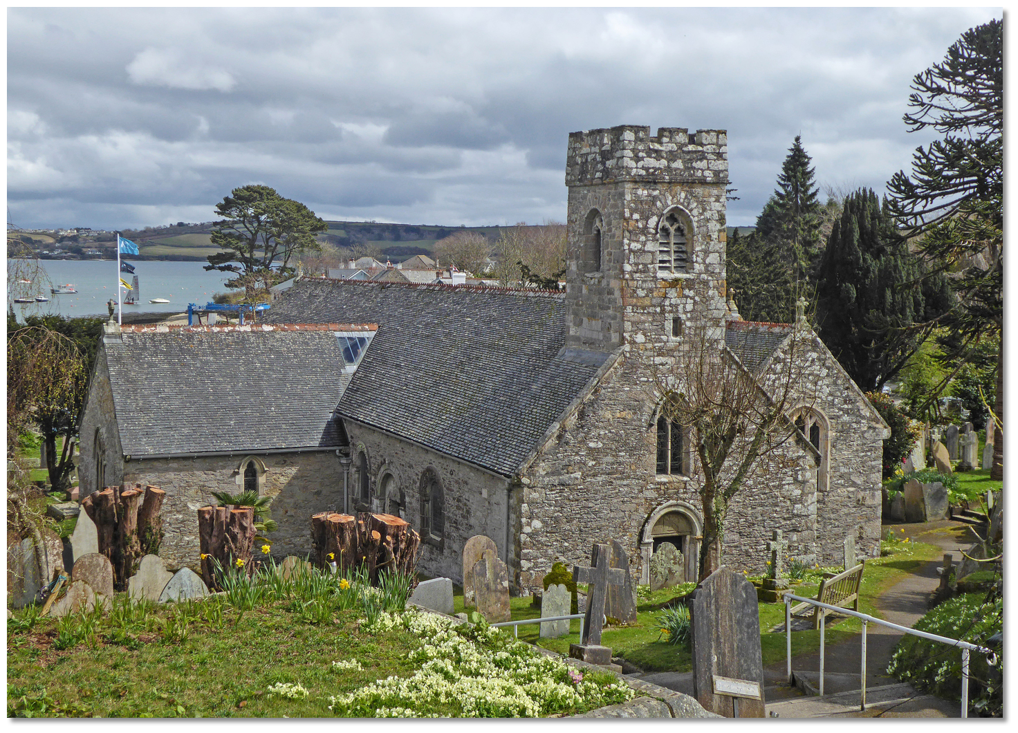
St Just Creek joins the roadstead in the northwest corner. Overlooked by the pretty Church of St. Just it is said to be one of Cornwall’s most photographed churches. Legend has it that Christ came here as a boy with tin merchant Joseph of Arimathia. Having such a legend attached it is unsurprising that the travelling Irish monks came here to build a Celtic chapel in the 5th-century. The current church replaced this in 1261 with its tower being added in the 15th-century. The creek was used by Nelson, and in the 18th-century there were even plans to build a naval dockyard here, but Devonport was selected in the end. So the creek, with its church and granite gravestones tumbling right down to the water's edge, remains today a perfect pocket of tranquility.
 Mylor's historic church
Image: Tim Green
Mylor Churchtown, opposite, was more active in maritime history and warships were built here. The beautiful old Norman Church at the water’s edge is sited where it is believed St. Meliosus was slain and buried in 411 AD. The churchyard is full of Yew trees, the oldest of which is said to be 900 years old, and it possesses the largest Cornish cross in existence. The massive cross was discovered buried head downwards serving as a buttress to support the church wall and it measured over 5 metres high, with almost 3 metres in the ground. The quays seen today were established by the Admiralty in the 19th-century to load stores during the Napoleonic and Crimean Wars. It went on to be used by the Free French during WWII as a base for cross-Channel raids. The Americans also used it for fitting out landing craft in preparation for D-Day.
 The Pandora Inn
Image: Michael Harpur
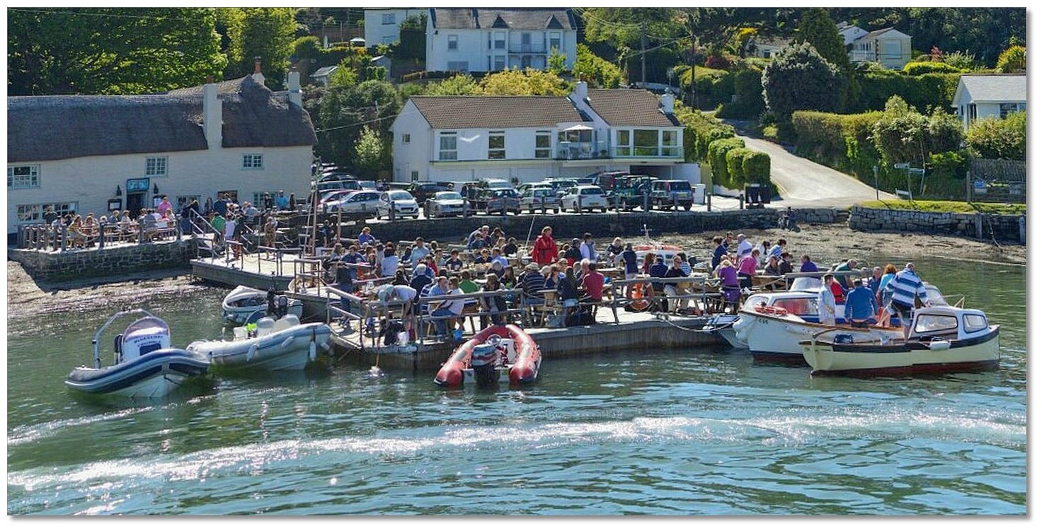
From a visitor perspective, Restronguet Creek's most popular attraction is 'The Pan'. The building is steeped in history with parts of it dating back to the 13th-century farmhouse. The inn was re-named in memory of HMS Pandora, the naval ship sent to Tahiti to capture the mutineers of Captain Bligh’s Bounty. Unfortunately, the Pandora struck the outer part of the Great Barrier Reef in 1791 and sank claiming the lives of 31 crew and 4 of the mutineer prisoners. 16 more were to die after surviving the wreck, many having fallen ill during their sojourn in Jakarta - then Batavia.
 The inn takes its name from the ship sent to capture the Bounty mutineers
Image: Michael Harpur
The captain, Captain Edwards, and his officers were court-martialled on his return to Cornwall where they were entirely exonerated for the loss of the ship. Edwards is reputed to have bought this Inn after the trial to retire and tell his story time and time again. The position of the Pandora was discovered in 1977 and it is today one of the best-preserved shipwrecks in Australian waters. the pretty inn was gutted by a fire in 2011 and was rebuilt with sensitive improvements that the Grade II listed building deserved. Setting aside its excellent landing and shore facilities, that are highly attractive to boaters, its excellent food is more than enough to make it a must for all Fal River visitors.
 The Pandora Inn is a firm favourite with visiting boatmen
Image: Robert Pittman via CC BY-SA 2.0
Continuing upriver Turnaware Point was where many Americans left England for D-Day. In the leadup to the invasion, this forested part of the river was used as an assembly point for part of the American fleet of D-Day landing craft. The landing craft used the overhanging trees along the river edge and in the numerous creeks to hide from aerial observation.
 Smuggler's Cottage where Eisenhower stayed and inspecting the D-Day landing
fleet
Image: Callum MacLeod via CC-BY-SA 2.0
Specialised beach-landing units awaited the invasion camped in various locations from Boscawen Park down to Turnaware Bar and The Roseland. Remains of some of the D-Day 'hard' flexible concrete matting can be seen on the Turnaware today. Smuggler's Cottage upriver was the place where General Eisenhower stayed whilst inspecting the fleet of landing craft prior to the landings.
 Mothballed vessels in the Fal
Image: Tim Green
After the war was won scores of Royal Navy battleships, carriers, and cruisers came to the river to await sale for scrap. The river’s deep water and protection from the elements has meant this use has continued to this day. During times of reduced global trade, ships are mothballed here sometimes with a skeleton crew for ship maintenance.
 Roundwood Quay as seen at low water
Image: Dennis White via CC ASA 4.0
About halfway along the riverine route connecting Truro and Falmouth, is Roundwood Quay. During the 18th-century heyday of Cornwall's tin and copper trade 300-ton ships docked here. But its history runs much deeper as the first use of the location was for an Iron Age fort, dating from 350 BC, and it then became the site of a Roman encampment. Later it was a shipyard and finally, it became the loading point for copper and tin from the mining district of Redruth. The quay's granite walls, quoins and capping stones remain entirely intact from its shipping days. The remains of the old fort grace the woods on the raised ground stepped back from the quay.
 Malpas Point as seen from the river
Image: Tim Green
Malpas, Norman French for treacherous crossing, acquired its name from having an ancient ford. It was a busy place in times past with ships built in Victorian times from Messrs Scoble's boatyard, and timber was also discharged here. Cargo for Truro was unloaded from ship to barge and then transported to the city on the tide. Victoria Point was named after Queen Victoria moored the Royal Yacht here in 1880. Prince Albert landed and went on into Truro to lay the foundation stone of the fledgeling cathedral.
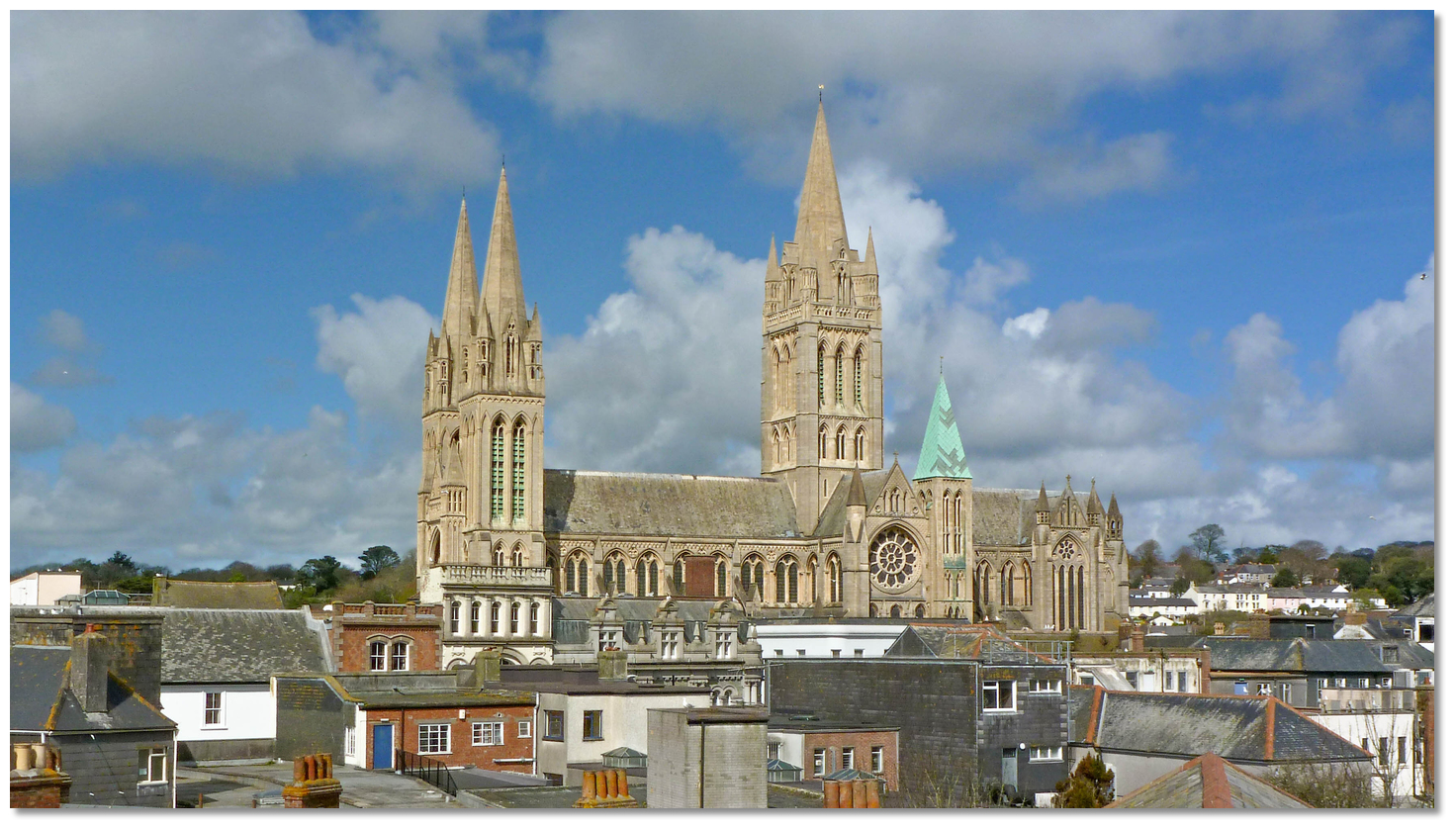 Truro Cathedral towers over the city
Image: Tim Green
The cathedral was completed in 1910 and it was the first cathedral built in England since St Paul's, and the last built in England. The three mighty neo-Gothic spires of the cathedral dominate the city of Truro to this day. Truro itself developed as a protected inland port town on a wedge of land separating the Allen and Kenwyn rivers. Its primary trade was the shipment of tin to Europe and copper to Wales. 17th-century silting of the river sent it into decline but prosperity returned when the tin-mining boom of the 1800s was bolstered by the arrival of the railway in 1859. Granted city status in 1877, it took on the role of Cornwall's commercial and administrative centre and it remains today the county's only city.
 Truro's impressive architecture
Image: Michael Harpur
Sailors visiting this region tend to focus on Falmouth, and the River Fal is less well known. This is a major oversight as in all the miles that extend from the river entrance to Truro there is nothing that isn't lovely. The entire area is designated an Area of Outstanding Natural Beauty and all of it is just cries out for exploration which is best done by boat. It is full of hidden nooks and secluded crannies, with plenty of opportunities to pause come ashore on enticing shingle beaches. Most of which is surrounded by ancient woodlands backed by quiet pastoral land and the occasional picture perfect little farm or village. Best of all, you share the verdant tranquility with the finest of company; shoaling fish, kingfishers, curlews and godwits. The river is an absolute gem that is a world away from the buzz of Cornwall's tourist traps.
 The Drummer on Truro's Lemon Quay
Image: Michael Harpur
From a boating point of view, the river has it all; deep waters, a choice of excellent locations to moor in complete security, excellent provisioning, pubs galore, fine country walks, locations of interest or the green loneliness of very special hidden places. This beautiful Cornish river has so much to offer.
What facilities are available?
Water, power and chandlery on the Truro Quay berth, garbage disposal, shower, toilets, chemical toilet disposal, excellent restaurants and cinemas all near to hand. Truro has a Tesco a few steps away from the Harbourmaster's visitor berths on the quay wall, and the city's shopping is a short walk away.Truro Trains and coaches provide connections to everywhere in the country. A local two-carriage train shuttles up and down the west bank of the estuary every 30 minutes between Truro and Falmouth Docks, stopping at Penryn and Falmouth Town (The Dell) on the way.
The four midriver pontoons along the river do not have electricity or water but do offer garbage facilities. Water can be had at a pontoon near King Harry Ferry which can only be used for a short stay.
Restronguet Pandora Inn provides showers, fresh water and a launderette.
Mylor marina has showers, toilets and a laundry facility also gas and water a comprehensive chandlery, slipway and drying out facilities. Diesel and petrol are available from the southern side of the outer pontoon. It has a 35-ton boat lift and hard standing with a full-service boatyard, and comprehensive service facilities for everything a boat owner could need for all-round boat maintenance or repair. The yard has a host of specialist services; engineers, electricians, shipwrights, GRP laminators and finishers. A Post Office will be found nearby and Mylor Yacht Club, on the quay,
welcomes visitors to their the clubhouse and bar. Anything that cannot be catered for will be solved in Falmouth.
Services in the Fal/Falmouth Area
Batteries:
Cornwall batteries P: +44 1872 270P: +44 11
Trago mills P: +44 1326 315738
Builders & repairers
Falmouth boat co. P: +44 1326 374309
Pendennis shipyard P: +44 1326 211344
Chandlers
Bosuns locker P: +44 1326 312212
Mylor chandlery P: +44 1326 375482
Macsalvors @ the boathouse P: +44 1326 377131
Divers
Falmouth divers P: +44 1326 374736
Seawide services P: +44 1326 317517
Sub marine services P: +44 1326 211517
Electricians
Falmouth boat co. P: +44 1326 374309
Marine electrical services P: +44 1326 378497
Marine trak engineering P: +44 1326 376588
Electricians (technical)
Selex communications P: +44 1326 378031
Sim rad P: +44 1326 374411
Riggers
A2 rigging P: +44 1326 312209
Falmouth boat co. P: +44 1326 374309
Mylor rigging P: +44 1326 375482
Stay tensioner services P: +44 1326 373310
The boathouse P: +44 1326 374177
Engineers
Cellar marine (yanmar) P: +44 1326 280214
Challenger marine (volvo penta) P: +44 1326 377222
Coastal diesel & transmission P: +44 1326 313332
Seastart (inboard / outboard) M: +44974 250533
Falmouth boat co P: +44 1326 374309
Kevin Hearn M: +44 767 303286
Marine Trak Engineering (vetus agents) P: +44 1326 376588
Nick Eddy M: +44968 214226
Powerfal (turbo chargers) P: +44 1326 377160
Robin Curnow (outboards) P: +44 1326 373438
Simon Caddy P: +44 1326 372682
General supplies
FWB (screws, bolts etc.) P: +44 1872 243500
Bubbles (laundry services) P: +44 1326 311291
Marineco (clothing) P: +44 1752 816005
Seaware (all boat fittings) P: +44 1326 377998
Trago Mills (various) P: +44 1326 315738
Sailmakers
Penrose Sailmakers P: +44 1326 312705
Sailtech P: +44 1326 376550
SKB Sails P: +44 1326 372107
With thanks to:
eOceanicAbout The River Fal
Although the first records of the River Fal come to us from AD 969 and 1049, the origin and meaning of the name Fal is unknown to this day. Likewise, the whole estuary tends to be referred to as the Fal, but the Fal only comprises a deep water tidal channel, Carrick Roads, and the complete waterway is made up of a series of major creeks or tributaries.
These include the Percuil river, with the small port and holiday destination of St Mawes, the Fal and Ruan rivers draining into the estuary from the east, and the Tresillian River. The Truro River with the county capital city of Truro joins from the north, and Restronguet Creek ria and Penryn River and the town of Falmouth draining from the west. The major tributaries typically comprise extensive drying creeks but the central 'ria', the drowned river valley or flooded estuarine valley, is deep providing low tide access for the vast majority of its length.
St Just ChurchImage: Tim Green
Immediately inside the entrance is the magnificent Carrick Roads whose name comes from the Cornish Dowr Carrek, meaning ‘rock anchorage’. It is the world's third largest natural harbour and the first or last port for transatlantic shipping. During the 19th-century when Falmouth, Penryn and Truro flourished on the tin trade it was one of the busiest ports outside of London. Although only Falmouth is still functioning as a major port, Carrick Roads is still important as the first and last port of call for large ships approaching or leaving England. It has been a magnet for yachtsmen being the natural jump-off and return point for transatlantic sailors. Robin Knox Johnston completed the first west/east solo nonstop circumnavigation from here in the Sunday Times Golden Globe Race. Ellen MacArthur also returned here from her record-breaking solo circumnavigation.
St Just Creek joins the roadstead in the northwest corner. Overlooked by the pretty Church of St. Just it is said to be one of Cornwall’s most photographed churches. Legend has it that Christ came here as a boy with tin merchant Joseph of Arimathia. Having such a legend attached it is unsurprising that the travelling Irish monks came here to build a Celtic chapel in the 5th-century. The current church replaced this in 1261 with its tower being added in the 15th-century. The creek was used by Nelson, and in the 18th-century there were even plans to build a naval dockyard here, but Devonport was selected in the end. So the creek, with its church and granite gravestones tumbling right down to the water's edge, remains today a perfect pocket of tranquility.
Mylor's historic churchImage: Tim Green
Mylor Churchtown, opposite, was more active in maritime history and warships were built here. The beautiful old Norman Church at the water’s edge is sited where it is believed St. Meliosus was slain and buried in 411 AD. The churchyard is full of Yew trees, the oldest of which is said to be 900 years old, and it possesses the largest Cornish cross in existence. The massive cross was discovered buried head downwards serving as a buttress to support the church wall and it measured over 5 metres high, with almost 3 metres in the ground. The quays seen today were established by the Admiralty in the 19th-century to load stores during the Napoleonic and Crimean Wars. It went on to be used by the Free French during WWII as a base for cross-Channel raids. The Americans also used it for fitting out landing craft in preparation for D-Day.
The Pandora InnImage: Michael Harpur
From a visitor perspective, Restronguet Creek's most popular attraction is 'The Pan'. The building is steeped in history with parts of it dating back to the 13th-century farmhouse. The inn was re-named in memory of HMS Pandora, the naval ship sent to Tahiti to capture the mutineers of Captain Bligh’s Bounty. Unfortunately, the Pandora struck the outer part of the Great Barrier Reef in 1791 and sank claiming the lives of 31 crew and 4 of the mutineer prisoners. 16 more were to die after surviving the wreck, many having fallen ill during their sojourn in Jakarta - then Batavia.
The inn takes its name from the ship sent to capture the Bounty mutineersImage: Michael Harpur
The captain, Captain Edwards, and his officers were court-martialled on his return to Cornwall where they were entirely exonerated for the loss of the ship. Edwards is reputed to have bought this Inn after the trial to retire and tell his story time and time again. The position of the Pandora was discovered in 1977 and it is today one of the best-preserved shipwrecks in Australian waters. the pretty inn was gutted by a fire in 2011 and was rebuilt with sensitive improvements that the Grade II listed building deserved. Setting aside its excellent landing and shore facilities, that are highly attractive to boaters, its excellent food is more than enough to make it a must for all Fal River visitors.
The Pandora Inn is a firm favourite with visiting boatmenImage: Robert Pittman via CC BY-SA 2.0
Continuing upriver Turnaware Point was where many Americans left England for D-Day. In the leadup to the invasion, this forested part of the river was used as an assembly point for part of the American fleet of D-Day landing craft. The landing craft used the overhanging trees along the river edge and in the numerous creeks to hide from aerial observation.
Smuggler's Cottage where Eisenhower stayed and inspecting the D-Day landingfleet
Image: Callum MacLeod via CC-BY-SA 2.0
Specialised beach-landing units awaited the invasion camped in various locations from Boscawen Park down to Turnaware Bar and The Roseland. Remains of some of the D-Day 'hard' flexible concrete matting can be seen on the Turnaware today. Smuggler's Cottage upriver was the place where General Eisenhower stayed whilst inspecting the fleet of landing craft prior to the landings.
Mothballed vessels in the FalImage: Tim Green
After the war was won scores of Royal Navy battleships, carriers, and cruisers came to the river to await sale for scrap. The river’s deep water and protection from the elements has meant this use has continued to this day. During times of reduced global trade, ships are mothballed here sometimes with a skeleton crew for ship maintenance.
Roundwood Quay as seen at low waterImage: Dennis White via CC ASA 4.0
About halfway along the riverine route connecting Truro and Falmouth, is Roundwood Quay. During the 18th-century heyday of Cornwall's tin and copper trade 300-ton ships docked here. But its history runs much deeper as the first use of the location was for an Iron Age fort, dating from 350 BC, and it then became the site of a Roman encampment. Later it was a shipyard and finally, it became the loading point for copper and tin from the mining district of Redruth. The quay's granite walls, quoins and capping stones remain entirely intact from its shipping days. The remains of the old fort grace the woods on the raised ground stepped back from the quay.
Malpas Point as seen from the riverImage: Tim Green
Malpas, Norman French for treacherous crossing, acquired its name from having an ancient ford. It was a busy place in times past with ships built in Victorian times from Messrs Scoble's boatyard, and timber was also discharged here. Cargo for Truro was unloaded from ship to barge and then transported to the city on the tide. Victoria Point was named after Queen Victoria moored the Royal Yacht here in 1880. Prince Albert landed and went on into Truro to lay the foundation stone of the fledgeling cathedral.
Truro Cathedral towers over the cityImage: Tim Green
The cathedral was completed in 1910 and it was the first cathedral built in England since St Paul's, and the last built in England. The three mighty neo-Gothic spires of the cathedral dominate the city of Truro to this day. Truro itself developed as a protected inland port town on a wedge of land separating the Allen and Kenwyn rivers. Its primary trade was the shipment of tin to Europe and copper to Wales. 17th-century silting of the river sent it into decline but prosperity returned when the tin-mining boom of the 1800s was bolstered by the arrival of the railway in 1859. Granted city status in 1877, it took on the role of Cornwall's commercial and administrative centre and it remains today the county's only city.
Truro's impressive architectureImage: Michael Harpur
Sailors visiting this region tend to focus on Falmouth, and the River Fal is less well known. This is a major oversight as in all the miles that extend from the river entrance to Truro there is nothing that isn't lovely. The entire area is designated an Area of Outstanding Natural Beauty and all of it is just cries out for exploration which is best done by boat. It is full of hidden nooks and secluded crannies, with plenty of opportunities to pause come ashore on enticing shingle beaches. Most of which is surrounded by ancient woodlands backed by quiet pastoral land and the occasional picture perfect little farm or village. Best of all, you share the verdant tranquility with the finest of company; shoaling fish, kingfishers, curlews and godwits. The river is an absolute gem that is a world away from the buzz of Cornwall's tourist traps.
The Drummer on Truro's Lemon QuayImage: Michael Harpur
From a boating point of view, the river has it all; deep waters, a choice of excellent locations to moor in complete security, excellent provisioning, pubs galore, fine country walks, locations of interest or the green loneliness of very special hidden places. This beautiful Cornish river has so much to offer.
Other options in this area
Click the 'Next' and 'Previous' buttons to progress through neighbouring havens in a coastal 'clockwise' or 'anti-clockwise' sequence. Alternatively here are the ten nearest havens available in picture view:
Coastal clockwise:
Falmouth - 4.1 miles SHelford River - 6.4 miles SSW
Gillan Creek - 6.6 miles S
Coverack - 9 miles S
Cadgwith - 10.7 miles SSW
Coastal anti-clockwise:
Saint Mawes - 3.9 miles SSEPortscatho - 3.5 miles SSE
Gorran Haven - 6.3 miles E
Portmellon - 6.3 miles E
Mevagissey - 6.3 miles E
Navigational pictures
These additional images feature in the 'How to get in' section of our detailed view for The River Fal.


| Detail view | Off |
| Picture view | On |
Add your review or comment:
Please log in to leave a review of this haven.
Please note eOceanic makes no guarantee of the validity of this information, we have not visited this haven and do not have first-hand experience to qualify the data. Although the contributors are vetted by peer review as practised authorities, they are in no way, whatsoever, responsible for the accuracy of their contributions. It is essential that you thoroughly check the accuracy and suitability for your vessel of any waypoints offered in any context plus the precision of your GPS. Any data provided on this page is entirely used at your own risk and you must read our legal page if you view data on this site. Free to use sea charts courtesy of Navionics.