
Coverack is a small harbour on England's south-west coast, 6 miles north-east of Lizard Point. It offers an anchorage in moderate offshore winds or, should space be found, the option of drying out on flat sand behind its small pier.
The cove provides tolerable shelter in moderate westerly conditions. Positioned at the south-west end of a clean bight, the approach is straightforward during daylight but the surrounding area is notoriously rocky.
Keyfacts for Coverack
Last modified
July 19th 2019 Summary* Restrictions apply
A tolerable location with straightforward access.Facilities


Nature


Considerations

Position and approaches
Expand to new tab or fullscreen
Haven position
 50° 1.379' N, 005° 5.658' W
This is the head of Coverack Pier.
What is the initial fix?
The following Coverack Initial Fix will set up a final approach:
 50° 1.474' N, 005° 5.015' W
 What are the key points of the approach?
Offshore details are available in south-west England’s coastal overview from Start Point to Lizard Point  .
.
 .
.- Vessels approaching from the north must stay well clear of The Manacles rock group extending a mile to seaward between Manacle Point and Lowland Point.
- Vessels approaching from the south must stay clear of the coast. This is not a place to cut in. Keep well clear of all the points and take a central bay approach to the anchoring position.
Not what you need?
Click the 'Next' and 'Previous' buttons to progress through neighbouring havens in a coastal 'clockwise' or 'anti-clockwise' sequence. Below are the ten nearest havens to Coverack for your convenience.
Ten nearest havens by straight line charted distance and bearing:
- Gillan Creek - 3.8 nautical miles N
- Cadgwith - 3.9 nautical miles SW
- Helford River - 4.6 nautical miles NNW
- Kynance Cove - 6 nautical miles WSW
- Mullion Cove & Porth Mellin - 6.4 nautical miles W
- Falmouth - 7.9 nautical miles N
- Saint Mawes - 8.7 nautical miles NNE
- Porthleven Harbour - 9.3 nautical miles WNW
- Portscatho - 10.7 nautical miles NNE
- The River Fal - 14.5 nautical miles N
These havens are ordered by straight line charted distance and bearing, and can be reordered by compass direction or coastal sequence:
- Gillan Creek - 3.8 miles N
- Cadgwith - 3.9 miles SW
- Helford River - 4.6 miles NNW
- Kynance Cove - 6 miles WSW
- Mullion Cove & Porth Mellin - 6.4 miles W
- Falmouth - 7.9 miles N
- Saint Mawes - 8.7 miles NNE
- Porthleven Harbour - 9.3 miles WNW
- Portscatho - 10.7 miles NNE
- The River Fal - 14.5 miles N
What's the story here?
 Coverack Pier with its collection of small boats
Image: Michael Harpur
Coverack is a coastal village and fishing quay on the east side of the Lizard peninsula. The village is built on both sides of Dolor Point, a spur of rock that juts out into the sea 1¼ miles south-westward of Lowland Point. A pier extends north-westward from this point, providing shelter to small boats that take the ground at low water. It is used by local potting and line-handling fishing boats able to take the ground at low water.
An anchorage is available 100 metres to east-north-east off the end of the pier in depths of 2 to 5 metres. It provides a serviceable berth in settled or moderate westerly conditions with the absence of groundswell. Any likelihood of a shift of wind to the south, or worse east, and it quickly becomes uncomfortable, if not dangerous, so be prepared to move.
 Coverack standing on Dolor Point
Image: Michael Harpur
The pier provides protection from winds from south-west to north-east and is usually full of local boats. Should space be found, it has depths of up to 4 metres at high water springs, 2.5 metres at neaps, and it dries at low water. It exhibits no navigation lights.
How to get in?
 Coverack Pier with Chynhalls Point in the backdrop
Image: Michael Harpur
 Use south-west England’s coastal overview from Start Point to Lizard Point
  for seaward approaches.
There are no offshore dangers on approaches from the east or south-east. Vessels approaching from the north need to stand clear of the dangerous Manacle Rock group, more often called The Manacles. Located between Lowland Point and Manacle Point, this foul ground extends a mile eastward from the shore and, except for the metre-high Carn-du, the whole rock group covers at high-water springs. The rocks are marked by the lit Manacles east cardinal mark, Q(3)10s, moored ⅓ mile eastward.
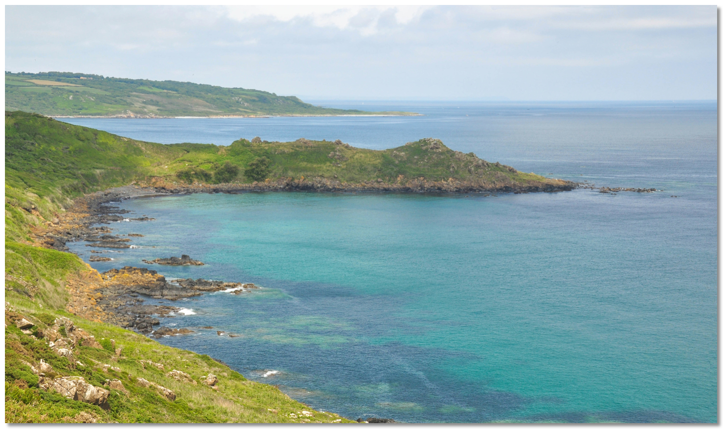 Chynhalls and Lowland points as seen from the south-west
Image: Nilfanion via CC ASA 4.0
Coverack Cove lies between Lowland Point and Chynhalls Point, 1½ miles south-westward. This is not a place to cut in and both of these points should be given a wide berth. Lowland Point is fringed by drying rocky ledges and outlying rocks that extend out ¼ mile. Between Lowland Point and the pier is a patch of rocks named the Pedy-myin, which only covers at the highest tides. It extends up to 200 metres in a southerly direction from the shore and dries to 1.8 metres.
Chynhalls Point may be identified by a hotel situated on the heights above the shore, which is particularly conspicuous from the east. To the eastward of the point, about 300 metres from the shore, lie the Guthens Rocks, which dry to 5 metres and cover only at high water.
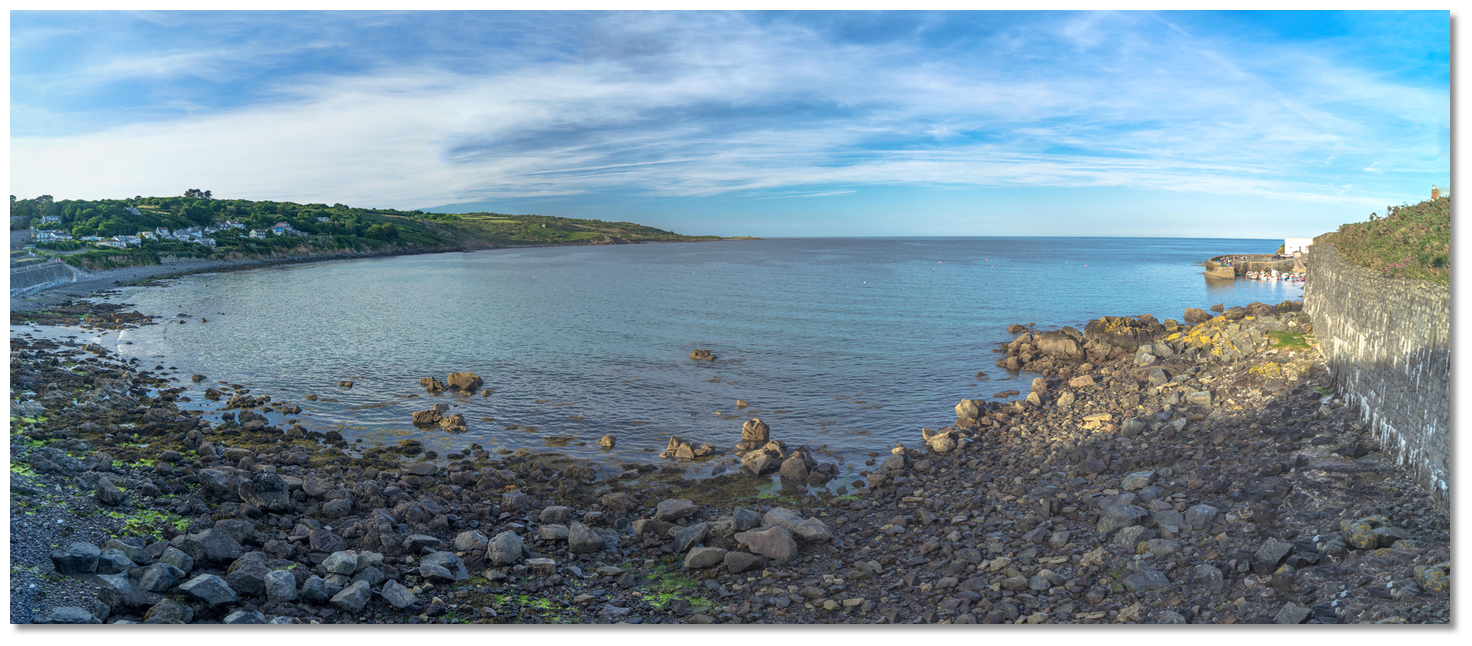 Coverack Cove
Image: Michael Harpur
 From the initial fix, sound into Coverack Cove to the north of Dolor Point. Keep well clear of Dolor Point as it has isolated rocks and a reef that extends south by south-eastward.
  The pier is usually fully occupied with local boats
Image: Michael Harpur
 Anchor according to draught and conditions clear of a number of private buoys outside the harbour. Holding is good in sand. Land at the pier, where there are ladders to ascend; at the slipway at the root of the pier; or on the beach.
 If coming in behind the pier, keep close to the wall because rocks extend well out behind the pier from the west.
Why visit here?
Coverack, first listed as Covrack in 1588, takes its name from Cornish Porth-kovrek, meaning cove of the stream, with kovrek derived from the old word goveryk, meaning streamlet.History of human habitation runs deep here and the village's wild Poldowrian Garden, on the clifftop, is one of the oldest dwelling sites in Cornwall. Situated just off the South West Coast Path, the beautiful garden has the remains of a Bronze Age roundhouse. The multi-aged site has been radiocarbon dated from the late Mesolithic period to the Iron Age, circa 5500 BC to 200 BC. The modern-day Coverack began life in medieval times as a small fishing community, making use of the large, crescent-shaped cove to launch boats and take protection from the prevailing south-westerly gales.
 Coverack Quay was built in 1723
Image: Michael Harpur
The quay was built in 1723 from the local serpentine rock, a dark green metamorphic rock that is sometimes mottled or spotted like a serpent's skin, hence the name. The quay supported the then-thriving pilchard industry and in its 19th-century heyday this was a busy place. The Coverack pilchard huers would scan the sea from Black Head looking for sardine-like hordes that ran thick and silvery in the offing. The boats were always ready in the bay and when the hue and cry went up, they would look to the huers, whose signals guided them to the shoal. The nets were then hauled back to the cove, where the extended families would reap the harvest.
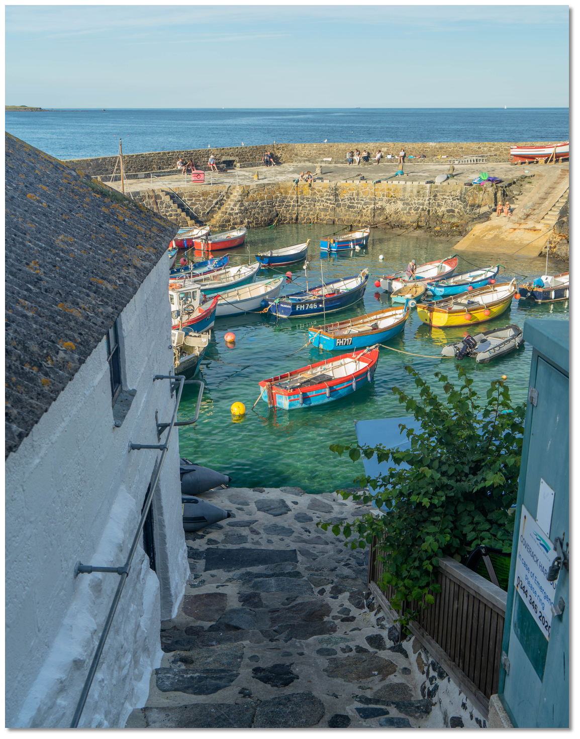 The pretty, historic harbour is now Grade II listed
Image: Michael Harpur
These same clear views of the sea, along with the remote setting, made it a very private location, where revenue cutters were easily spotted approaching. These qualities made Coverack an infamous haunt for smugglers between the 17th and 19th centuries. During this time it was noted that smuggling was formerly carried on in this, and some of the adjoining parishes, with astonishing activity and perseverance, and perhaps a braver set of men than those who were thus engaged, England never produced.
 Norwegian sailing ship the Hansy, run up near the Lizard
Image: Michael Harpur
Wrecking has entered into the coastal folklore of Cornwall, usually in a negative way. A traditional legendary trope is that wreckers deliberately led ships onto the coast, using tricks such as exhibiting false lights and so forth, so that they ran ashore for easy plundering. While this has been depicted in many stories and legends, no material evidence has ever been presented to suggest that it happened. Of course, local coastal people did not hesitate to ransack a foundering ship. The wreckage that reached a beach would always be recycled and the spoils of the sea could deliver an annual harvest. Their pickaxes and hatchets could quickly dismember any ships that came in and any and all goods aboard were quickly carried away. So wreckers can be fairly stereotyped as predatory scavengers, but luring ships to their doom, or murder, is likely a stretch too far.
 SS Mohegan
Image: Public Domain
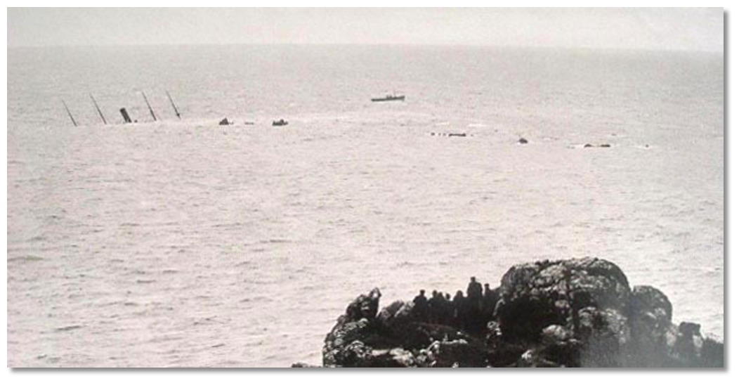 SS Mohegan on The Manacles
Image: Public Domain
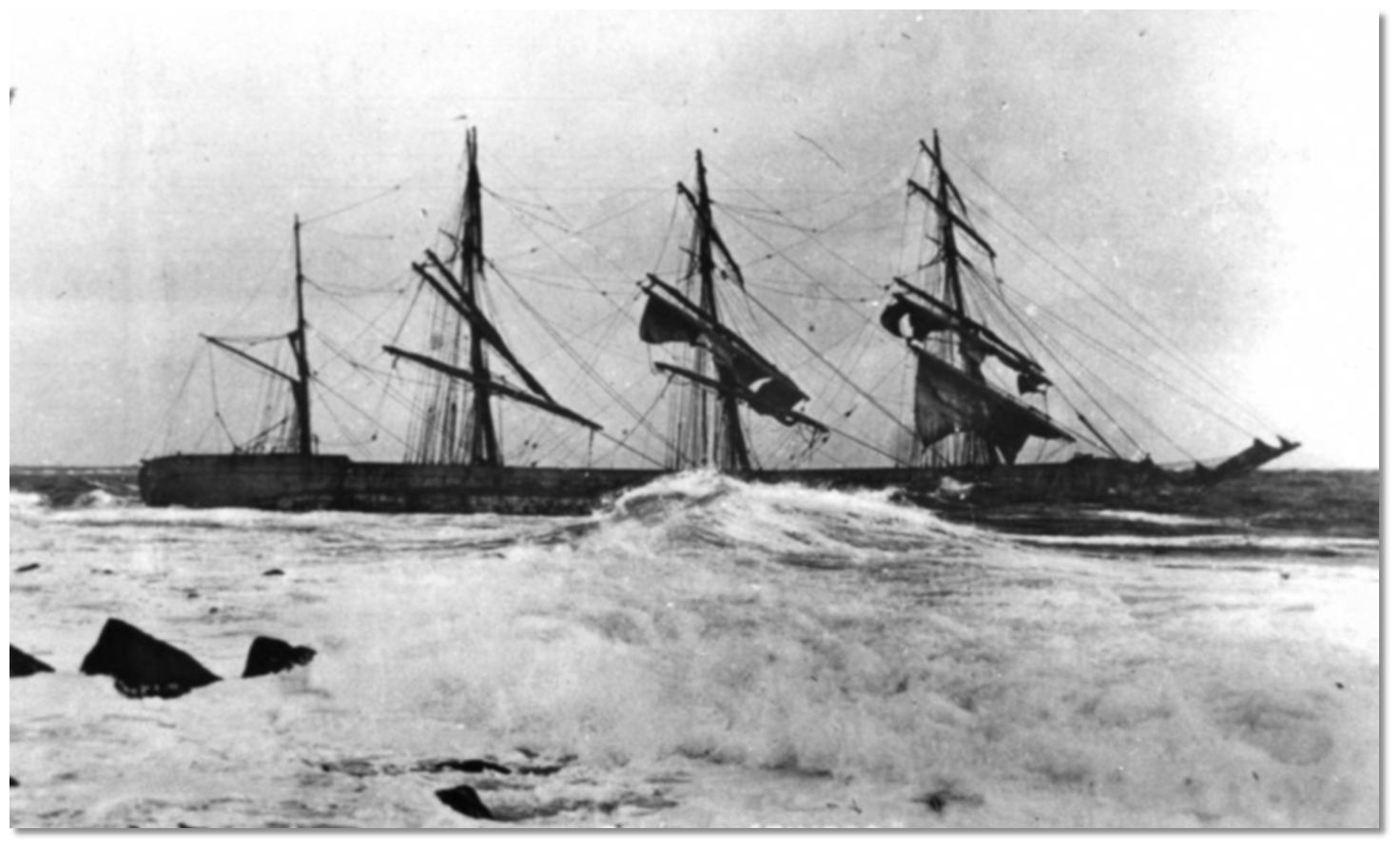 Barque Pindos wrecked at Coverack
Image: Public Domain
The tragic list goes on. Even the unlikely named Paris Hotel overlooking the harbour took its name from American liner City of Paris, which ran aground just off Coverack in 1899. Fortunately, her 700 passengers were brought safely ashore by local boats before she was eventually refloated. Suffice to say wrecking must have been a traditional mainstay for the otherwise economically marginalised communities of this coast.
 A wreck below Coverack's Dolor Point in 1914
Image: Public Domain
What was not widely talked about, however, was the coastal communities' ability to combine wrecking with lifesaving practices. This aspect of was discussed as early as 1792 in a letter from a Joseph Banfield that detailed the 'plundering' of Dutch frigate Brielle close to Coverack. Banfield describes the men from Coverack setting to sea upon sighting the distressed vessel '...and with great alacrity and activity, tho there was a great sea & they ran some risk of the boats and their lives, very humanely brought all the ships company together with the Soldiers safe to land, excepting only some few who were unfortunately drowned'. He then goes on to castigate the press accounts of stirring sensationalism, in his words `symbolic violence', stating that their view of the Coverack community 'plundering the people of their cloaths as they came on shore I believe is totally destitute of the truth'.
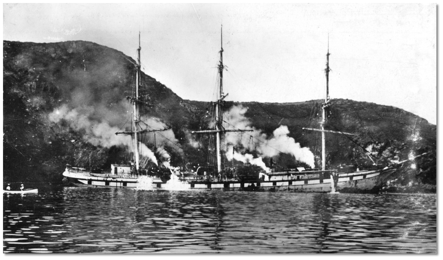 Socoa, wrecked and on fire off Cadgwith, 1901
Image: Public Domain
Most of the men involved with lifesaving were pilots and fishermen, while whole communities often became involved once the wreck and the victims came ashore. The 'plundering' occurred the following day after the wreck started to break up and wash onshore, only then provoking Banfield's ire. He continues in his account, ‘tis true they have humanity enough to save men's lives at the hazard of their own: when that is done, they look upon all the rest as their own property'.
 The Paris Hotel overlooking the harbour takes its name from a grounding close offshore
Image: Michael Harpur
Following the outcry after the wrecking of the SS Mohegan, Coverack received a lifeboat house. The Coverack lifeboat crew went on to rescue many from this coast until its closure in October 1978, following the allocation of a faster boat to Falmouth Lifeboat Station. In 1961, the RNLI chose Kilcobben Cove, 5 miles south-west, as the location for The Lizard Lifeboat Station because it was sufficiently protected to allow safe launches in all conditions.
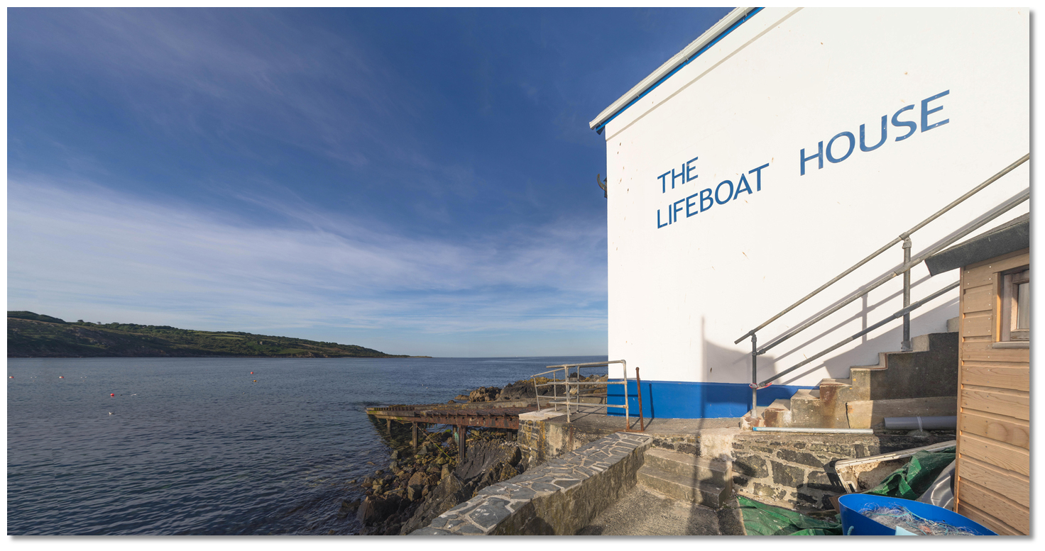 Coverack's lifeboat house is now a seafood restaurant
Image: Michael Harpur
Today the village presents a much more placid picture, while retaining much of its original charm and atmosphere. The thatched and whitewashed granite fisherman's cottages overlooking the bay are now mostly second or holiday homes. The harbour, however, remains an active fishing port and is home to seven full-time open boats of less than 7 metres that fish with pots and nets from spring through to autumn. These are occasionally joined by three part-timers that work similar gear plus mackerel handlines. Crab, mullet and monkfish are now landed at the harbour instead of the original pilchards. Fishing activity is minimal during the winter, when gear is brought ashore to avoid damage.
 Coverack remains an active fishing port
Image: Michael Harpur
The harbour is still the focal point of the village. The Old Lifeboat House has become a fine restaurant, while the old salt store overlooking the harbour is now a gift shop, both speaking to Coverack's new summer cachet. The beach is ideal for swimming and windsurfing, and the village is home to the Coverack Windsurfing Centre. Being the site of so many shipwrecks it has also become a favourite diving destination.
 Coverack Pier today is a much more placid environment
Image: Michael Harpur
From a boating point of view, in moderate westerlies Coverack is about the best anchorage available along this stretch of coast. Cadgwith, Church Cove and House Bay near the Lizard are possible, but more suited to short stops or day anchorages. In moderate westerly winds this is a wonderful berth that could not contrast more with its near neighbour the Helford River.
What facilities are available?
Water is available from the harbourmaster toilets close by. Basic provisions, a post office and fuel by jerry can be found two miles uphill, at the nearest garage. Being more of a tourist destination today, there is a small selection of cafés, pubs and hotels that serve good food.The most useful bus for getting around the Lizard is the T2, which runs from Helston to Goonhilly, Coverack and St Keverne, 15 times daily from Monday to Saturday (twice on Sundays). The T3, twice daily Monday to Saturday, travels from Helston around to Mawgan, Helford, Manaccan, Porthallow, St Keverne, Roskilly’s Farm and Coverack.
With thanks to:
eOceanic
Coverack Pier, Cornwall
Image: eOceanic thanks Michael Harpur
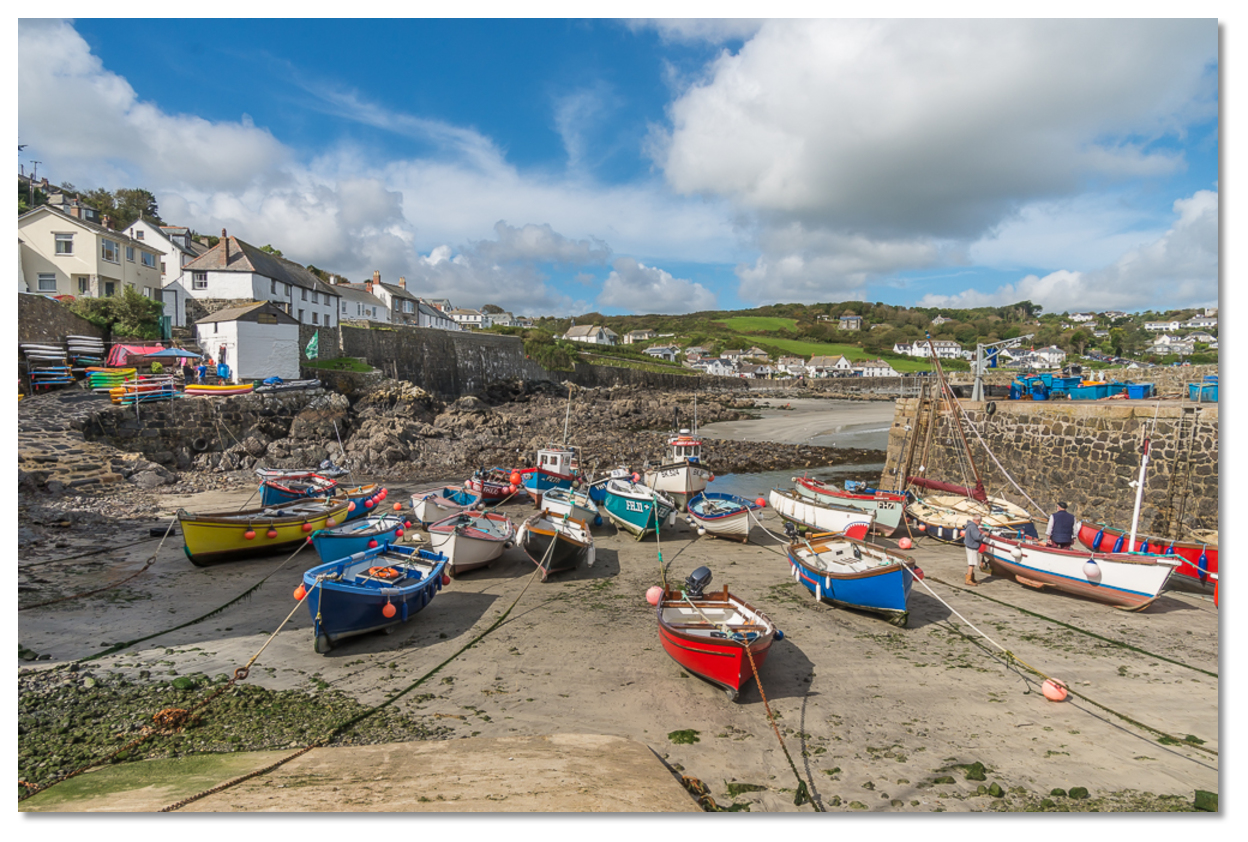
Boats behind Coverack Pier at low water
Image: eOceanic thanks Ian Capper via CC BY-SA 2.0

Local boats at low water
Image: eOceanic thanks Ian Capper via CC BY-SA 2.0

Coverack's fishing boats today
Image: eOceanic thanks Ian Capper via CC BY-SA 2.0
Aerial overview
About Coverack
Coverack, first listed as Covrack in 1588, takes its name from Cornish Porth-kovrek, meaning cove of the stream, with kovrek derived from the old word goveryk, meaning streamlet.
History of human habitation runs deep here and the village's wild Poldowrian Garden, on the clifftop, is one of the oldest dwelling sites in Cornwall. Situated just off the South West Coast Path, the beautiful garden has the remains of a Bronze Age roundhouse. The multi-aged site has been radiocarbon dated from the late Mesolithic period to the Iron Age, circa 5500 BC to 200 BC. The modern-day Coverack began life in medieval times as a small fishing community, making use of the large, crescent-shaped cove to launch boats and take protection from the prevailing south-westerly gales.
 Coverack Quay was built in 1723
Image: Michael Harpur
The quay was built in 1723 from the local serpentine rock, a dark green metamorphic rock that is sometimes mottled or spotted like a serpent's skin, hence the name. The quay supported the then-thriving pilchard industry and in its 19th-century heyday this was a busy place. The Coverack pilchard huers would scan the sea from Black Head looking for sardine-like hordes that ran thick and silvery in the offing. The boats were always ready in the bay and when the hue and cry went up, they would look to the huers, whose signals guided them to the shoal. The nets were then hauled back to the cove, where the extended families would reap the harvest.
 The pretty, historic harbour is now Grade II listed
Image: Michael Harpur
These same clear views of the sea, along with the remote setting, made it a very private location, where revenue cutters were easily spotted approaching. These qualities made Coverack an infamous haunt for smugglers between the 17th and 19th centuries. During this time it was noted that smuggling was formerly carried on in this, and some of the adjoining parishes, with astonishing activity and perseverance, and perhaps a braver set of men than those who were thus engaged, England never produced.
 Norwegian sailing ship the Hansy, run up near the Lizard
Image: Michael Harpur
Wrecking has entered into the coastal folklore of Cornwall, usually in a negative way. A traditional legendary trope is that wreckers deliberately led ships onto the coast, using tricks such as exhibiting false lights and so forth, so that they ran ashore for easy plundering. While this has been depicted in many stories and legends, no material evidence has ever been presented to suggest that it happened. Of course, local coastal people did not hesitate to ransack a foundering ship. The wreckage that reached a beach would always be recycled and the spoils of the sea could deliver an annual harvest. Their pickaxes and hatchets could quickly dismember any ships that came in and any and all goods aboard were quickly carried away. So wreckers can be fairly stereotyped as predatory scavengers, but luring ships to their doom, or murder, is likely a stretch too far.
 SS Mohegan
Image: Public Domain
 SS Mohegan on The Manacles
Image: Public Domain
 Barque Pindos wrecked at Coverack
Image: Public Domain
The tragic list goes on. Even the unlikely named Paris Hotel overlooking the harbour took its name from American liner City of Paris, which ran aground just off Coverack in 1899. Fortunately, her 700 passengers were brought safely ashore by local boats before she was eventually refloated. Suffice to say wrecking must have been a traditional mainstay for the otherwise economically marginalised communities of this coast.
 A wreck below Coverack's Dolor Point in 1914
Image: Public Domain
What was not widely talked about, however, was the coastal communities' ability to combine wrecking with lifesaving practices. This aspect of was discussed as early as 1792 in a letter from a Joseph Banfield that detailed the 'plundering' of Dutch frigate Brielle close to Coverack. Banfield describes the men from Coverack setting to sea upon sighting the distressed vessel '...and with great alacrity and activity, tho there was a great sea & they ran some risk of the boats and their lives, very humanely brought all the ships company together with the Soldiers safe to land, excepting only some few who were unfortunately drowned'. He then goes on to castigate the press accounts of stirring sensationalism, in his words `symbolic violence', stating that their view of the Coverack community 'plundering the people of their cloaths as they came on shore I believe is totally destitute of the truth'.
 Socoa, wrecked and on fire off Cadgwith, 1901
Image: Public Domain
Most of the men involved with lifesaving were pilots and fishermen, while whole communities often became involved once the wreck and the victims came ashore. The 'plundering' occurred the following day after the wreck started to break up and wash onshore, only then provoking Banfield's ire. He continues in his account, ‘tis true they have humanity enough to save men's lives at the hazard of their own: when that is done, they look upon all the rest as their own property'.
 The Paris Hotel overlooking the harbour takes its name from a grounding close offshore
Image: Michael Harpur
Following the outcry after the wrecking of the SS Mohegan, Coverack received a lifeboat house. The Coverack lifeboat crew went on to rescue many from this coast until its closure in October 1978, following the allocation of a faster boat to Falmouth Lifeboat Station. In 1961, the RNLI chose Kilcobben Cove, 5 miles south-west, as the location for The Lizard Lifeboat Station because it was sufficiently protected to allow safe launches in all conditions.
 Coverack's lifeboat house is now a seafood restaurant
Image: Michael Harpur
Today the village presents a much more placid picture, while retaining much of its original charm and atmosphere. The thatched and whitewashed granite fisherman's cottages overlooking the bay are now mostly second or holiday homes. The harbour, however, remains an active fishing port and is home to seven full-time open boats of less than 7 metres that fish with pots and nets from spring through to autumn. These are occasionally joined by three part-timers that work similar gear plus mackerel handlines. Crab, mullet and monkfish are now landed at the harbour instead of the original pilchards. Fishing activity is minimal during the winter, when gear is brought ashore to avoid damage.
 Coverack remains an active fishing port
Image: Michael Harpur
The harbour is still the focal point of the village. The Old Lifeboat House has become a fine restaurant, while the old salt store overlooking the harbour is now a gift shop, both speaking to Coverack's new summer cachet. The beach is ideal for swimming and windsurfing, and the village is home to the Coverack Windsurfing Centre. Being the site of so many shipwrecks it has also become a favourite diving destination.
 Coverack Pier today is a much more placid environment
Image: Michael Harpur
From a boating point of view, in moderate westerlies Coverack is about the best anchorage available along this stretch of coast. Cadgwith, Church Cove and House Bay near the Lizard are possible, but more suited to short stops or day anchorages. In moderate westerly winds this is a wonderful berth that could not contrast more with its near neighbour the Helford River.
Other options in this area
Click the 'Next' and 'Previous' buttons to progress through neighbouring havens in a coastal 'clockwise' or 'anti-clockwise' sequence. Alternatively here are the ten nearest havens available in picture view:
Coastal clockwise:
Cadgwith - 2.4 miles SWKynance Cove - 3.7 miles WSW
Mullion Cove & Porth Mellin - 4 miles W
Porthleven Harbour - 5.8 miles WNW
Saint Michael's Mount - 9.9 miles WNW
Coastal anti-clockwise:
Gillan Creek - 2.4 miles NHelford River - 2.9 miles NNW
Falmouth - 4.9 miles N
The River Fal - 9 miles N
Saint Mawes - 5.4 miles NNE
Navigational pictures
These additional images feature in the 'How to get in' section of our detailed view for Coverack.


| Detail view | Off |
| Picture view | On |
Aerial overview
Add your review or comment:
Please log in to leave a review of this haven.
Please note eOceanic makes no guarantee of the validity of this information, we have not visited this haven and do not have first-hand experience to qualify the data. Although the contributors are vetted by peer review as practised authorities, they are in no way, whatsoever, responsible for the accuracy of their contributions. It is essential that you thoroughly check the accuracy and suitability for your vessel of any waypoints offered in any context plus the precision of your GPS. Any data provided on this page is entirely used at your own risk and you must read our legal page if you view data on this site. Free to use sea charts courtesy of Navionics.


 +44 1326 280679


