

The cove provides a good anchorage in easterly or south-easterly conditions, but the island offers only partial protection from prevailing winds. Approaches north of the island are clear, but attentive daylight navigation is required as the cove is fringed with rocks.

Keyfacts for Mullion Cove & Porth Mellin
Facilities


Nature


Considerations

Protected sectors

Approaches

Shelter
Last modified
August 18th 2019 Summary* Restrictions apply
A good location with straightforward access.Facilities
Nature
Considerations
Position and approaches

Expand to new tab or fullscreen
Haven position
 50° 0.848' N, 005° 15.621' W
This is in a depth of about 3 metres about 150 metres outside the entrance to Porth Mellin.
What is the initial fix?
The following Mullion Cove Initial Fix will set up a final approach:
 50° 1.000' N, 005° 16.249' W


What are the key points of the approach?
Offshore details are available in south-west England’s coastal overview from Lizard Point to Land's End  .
.
.- Approach from the north-north-west to the north of Mullion Island.
- Anchor in sand to the south-west of the entrance of its small drying harbour.
Not what you need?
Click the 'Next' and 'Previous' buttons to progress through neighbouring havens in a coastal 'clockwise' or 'anti-clockwise' sequence. Below are the ten nearest havens to Mullion Cove & Porth Mellin for your convenience.
Ten nearest havens by straight line charted distance and bearing:
- Kynance Cove - 2.8 nautical miles SSE
- Cadgwith - 3.6 nautical miles ESE
- Porthleven Harbour - 4.7 nautical miles NNW
- Coverack - 6.4 nautical miles E
- Helford River - 7.1 nautical miles NE
- Gillan Creek - 7.8 nautical miles NE
- Saint Michael's Mount - 10.5 nautical miles NW
- Falmouth - 11.3 nautical miles NE
- Mousehole - 11.5 nautical miles WNW
- Penzance Harbour - 12 nautical miles WNW
These havens are ordered by straight line charted distance and bearing, and can be reordered by compass direction or coastal sequence:
- Kynance Cove - 2.8 miles SSE
- Cadgwith - 3.6 miles ESE
- Porthleven Harbour - 4.7 miles NNW
- Coverack - 6.4 miles E
- Helford River - 7.1 miles NE
- Gillan Creek - 7.8 miles NE
- Saint Michael's Mount - 10.5 miles NW
- Falmouth - 11.3 miles NE
- Mousehole - 11.5 miles WNW
- Penzance Harbour - 12 miles WNW

Chart

What's the story here?
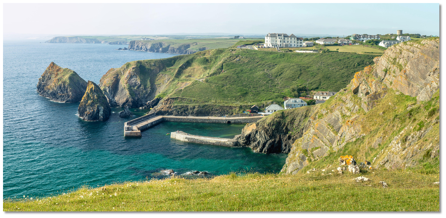
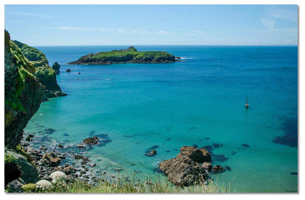
 The view out over the cove from Porth Mellin
 Image: Nilfanion via CC ASA 4.0
Mullion Cove lies between The Lizard and Porthleven in the shelter of Mullion Island. It comprises an open cove with the small basin of Porth Mellin among steep-to cliffs at its head, about ⅓ mile north-east of the island. Formed by two piers, the tiny harbour dries to about 2.4 metres and is open to south-westerly winds and swell. The harbour is managed by the National Trust and is home to two potting boats that fish for lobsters and brown crabs between May and October, one setting 375 pots, the other between 150 and 250 pots. Around the thick walls of the harbour are a scattering of cottages and a couple of businesses that cater to the tourist trade.
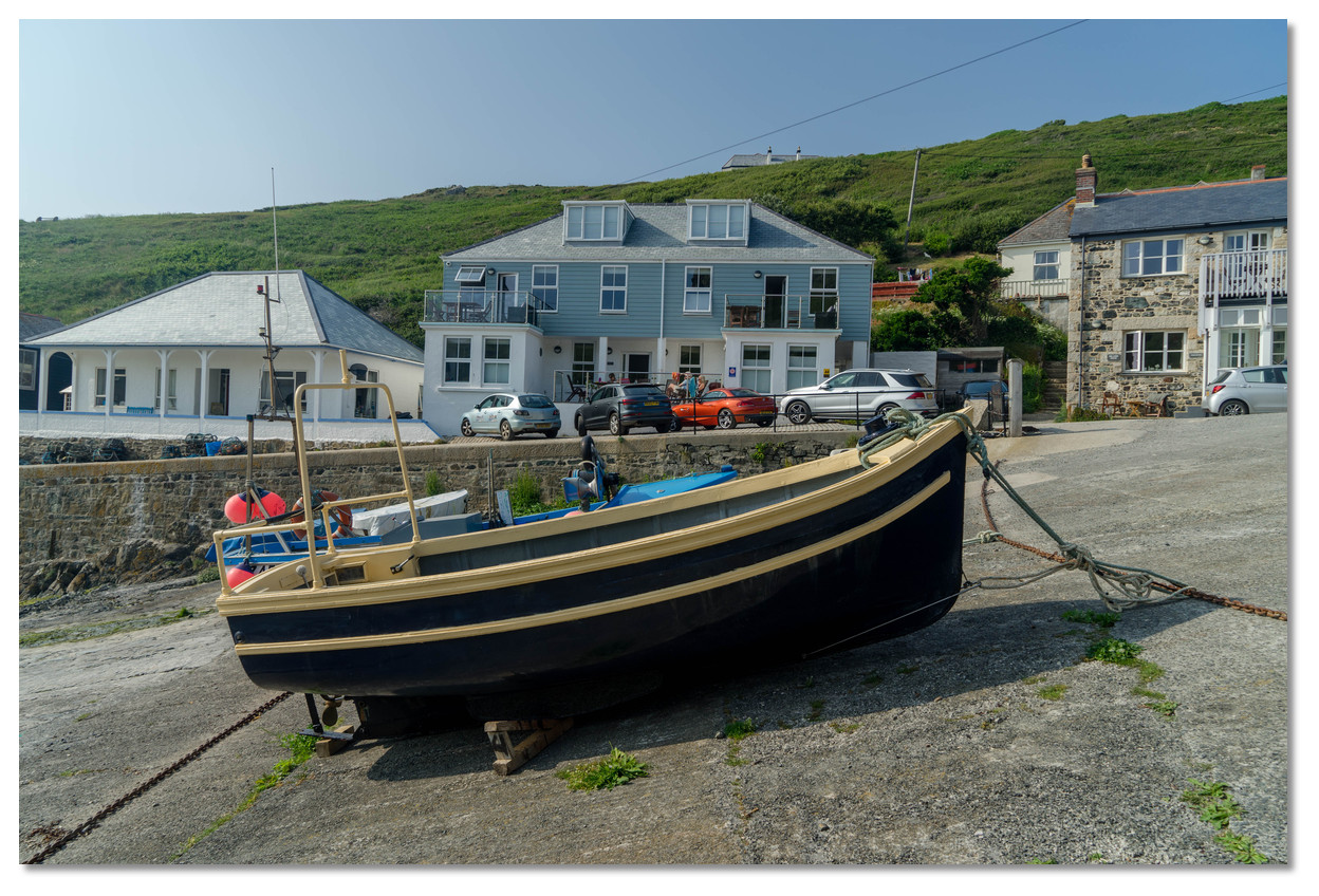
 Porth Mellin
Image: Michael Harpur
The harbour may be used for short periods for setting down crew or loading purposes by arrangement with the harbourmaster,
 +44 1326 240222. It cannot be used for an overnight stay. This would not be wise as it is open to the south-west and the main function of the tiny basin is not to create a safe mooring area, but to protect the landing beach so that its small fishing boats may be run in and hauled clear of the sea.
 A delightful anchorage is possible to the south-west of the entrance, where the bottom is clear beyond the 5 metre contour. It provides very good protection in strong easterly or south-easterly conditions and, of course, in settled conditions with the absence of swell. Mullion Island provides some protection from the south-west, but be prepared to weigh anchor if the wind shifts to the westward as it is dangerous here in any onshore winds. Likewise, the arrival of even a fairly modest Atlantic swell, nothing exceptional for west Cornwall, will quickly make it untenable.
How to get in?
 The Mullion Cove Hotel overlooking the cove makes for a conspicuous mark
Image: Michael Harpur
 Use south-west England’s coastal overview from Lizard Point to Land's End for seaward approaches. Mullion Island, situated about ½ mile north of Predannack Head and ¼ mile offshore, lies close south-west of Mullion Cove and makes for a prominent seamark. It rises 29 metres above high water and is precipitous on its western side. Immediately outside of it is the small yet conspicuous Tregwyn Rock. A hotel will be seen standing prominently on the northern mainland cliffs of the cove above its small harbour.
 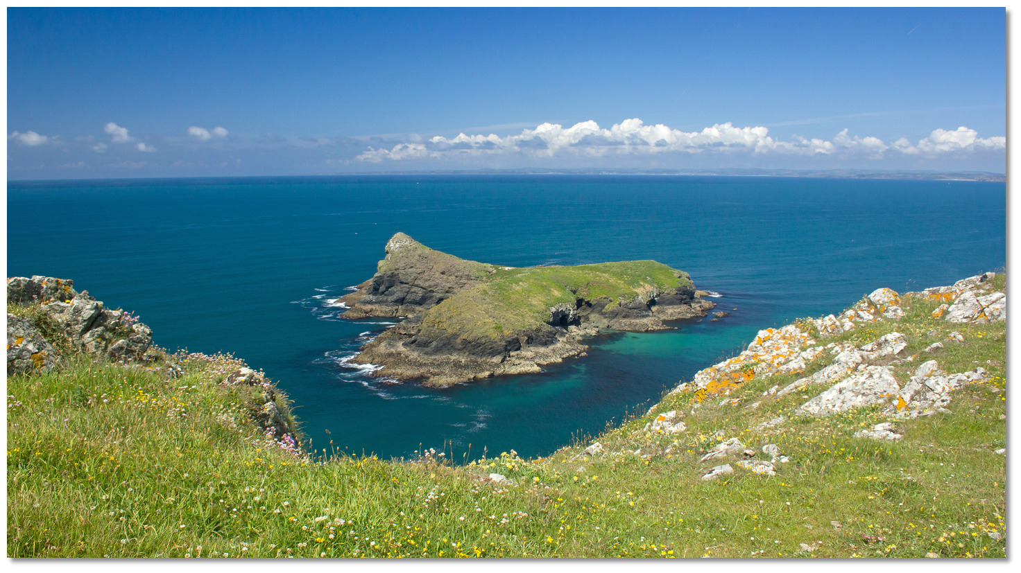 Mullion Island
Image: Nic via CC NC 2.0
There is southern pass with a depth of at least 2.7 metres between Mullion Island and the 43-metre-high Gull Rock off the mainland. Local boats may be seen taking this route, but it is fringed with rocky ledges on both sides, making it inadvisable without the benefit of local knowledge.
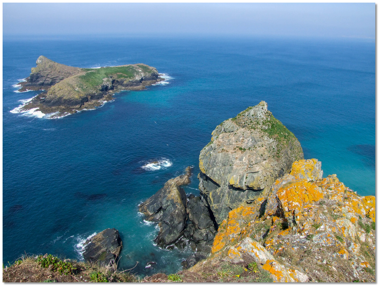 It is possible to pass between Gull Rock and Mullion Island, but not advisable for newcomers
Image: Philip Goddard
 The initial fix sets up a south-easterly approach to the north of the island. Mullion Island and Mullion Cove Hotel, on the cliffs above, will be seen on this approach. It is safe to steer a midway between the walls of Porth Mellin harbour below and the island until the 5 metre contour is reached. Be careful not to drift down onto the northern end of Mullion Island as it is foul out to nearly 100 metres. As a general rule, keep 200 metres from all the cliffs around the cove to avoid any off-lying rocks.
 Mullion Cove as seen from the north-east
Image: Nilfanion via CC ASA 4.0
Anchor according to draft and conditions in good holding over clean sand. It can be weedy and rocky the farther out a boat anchors. The usual berth it close south-west of the entrance to the small harbour in about 4 to 5 metres. 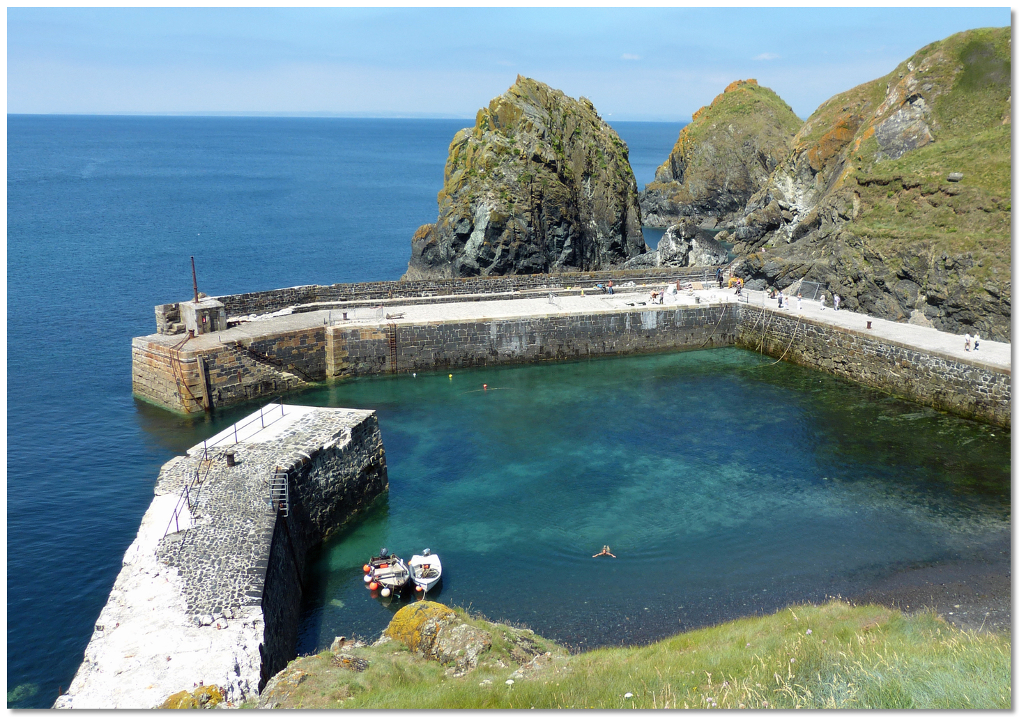 The harbour area is enclosed as it is intended to provide a safe landing area
Image: Andrew
Land by tender inside the drying harbour. Vessels coming into the harbour should note the position of rocks that flank the approaches to the entrance.
Why visit here?
Mullion Cove takes its name from the village of Mullion, located a mile inland, which is the largest village on The Lizard. The name was first recorded in 1262 with the parish Church of Sanctus Melanus, from St Melaine, the patron saint of the church. St Mellanus Church, Mullion
Image: Public Domain
Occupancy of the cove dates back to at least to the 1600s, when a small community of fishing families with links to Newlyn made a living here. Like many other Cornish coastal villages during the 18th century, it became a pilchard fishery controlled by seining companies based around Penzance and Newlyn. The set-up costs were beyond the means of the majority of poor fishermen, so the seining companies provided the equipment and paid the workers a relatively small wage plus 25% of the catch. The Mullion catches were cured at Newlyn and exported to Mediterranean countries. The companies posted a huer, a lookout for shoals, on Mullion Island to watch for the dark and silvery patches of the approaching fish.
 The Grade II protected old net store building predates the harbour
Image: Eugene Birchall via CC BY-SA 2.0
In 1793, local fishermen looking to develop fishing in the cove successfully sought permission from Lord Robartes at Lanhydrock to increase the number of boats used. Rocks were removed, widening the entrance to the cove to accommodate the extra boats, while additional winching facilities were set in place. By the early 1800s, cereal grain was being ground into flour and middlings at three grist mills, including 'Criggan Mill, Mullion Mill Farm'. By the time of the first recorded census in 1841, the cove had several working fish cellars, net lofts and two thatched cottages.
A description from about this time noted: "Mullion Cove contains a Mill worked by a stream running down through the valley, some fish cellars and a few humble cottages, on which last, owing to the height of the rising ground behind them, the sun, in the winter months, never shines. In one of these lives an old man who has been blind for many years who... is glad indeed when the month of March is come, for he finds his solitary walk up and down the road in front of his cottage more cheerful when he feels the blessed sunshine falling on his sightless eyes."
 The harbour walls were not built until the end of the 19th century
Image: Michael Harpur
Smuggling was a common side activity among the fishermen during the 18th and 19th centuries. Lizard boatmen had ties with the Bretons and Mullion Cove, and the surrounding cliffs witnessed many boats slowly and quietly make their way in at night, loaded with tubs of French Brandy and other illicit goods. The fishermen saw this rough trade and the avoidance of excise duty as a way of pocketing a few extra shilling to see them through the years when the pilchards failed to come, not to mention just reward for foiling the excise men and customs. In an attempt to curtail the activity, two cottages were built in 1848 for local coastguard officers and their families, which today form Cove Cottage. The excisemen did have a limited effect, but by then the bottom was falling out of smuggling with Prime Minister Robert Peel’s phasing out of import tariffs.
 The view from the entrance
Image: Eugene Birchall via CC BY-SA 2.0
Another natural sideline for this coastal community was wrecking, for which there were plenty of opportunities. When easterly or north-easterly winds blew down the channel, ships were forced to anchor and take shelter in what was then called Mullion Roads, the area of coast between Mullion Island and Pedngwynian. During the 18th and 19th centuries, 200 to 300 sailing ships could anchor here for up to three weeks at a time. On other occasions many became trapped or embayed in Mounts Bay by south-westerly or westerly winds and eventually forced onto the cliffs when they could not tack out to sea. In the six years up to 1873 alone, there were nine wrecks under Mullion cliffs, with the loss of 69 lives. Unsurprisingly, in an 18th-century letter, the Rev GC Smith described the local people of the area as 'sadly infested with wreckers'. It was not only the men of the area involved in the practice. Mr Smith was particularly concerned about the women and children who were seen working to break up vessels, noting 'the hardships they endure especially to save all they can, are almost incredible'.
Image: Bill Boaden via CC BY-SA 2.0
Despite its relative protection from the elements, the fleets were far from immune to the weather in the cove. Being entirely open to the west, when bad weather or storms approached, the seine boats survived by being winched out to a position above high water. However, when a freak storm suddenly raged across Mount's Bay in 1839, the entire pilchard fishing fleet was caught off guard and destroyed. Tragedies would occur time and time again in the following decades, eventually prompting the Royal National Lifeboat Institution to station a lifeboat at Mullion Cove in 1867 to address the death toll.
 The cove in a westerly blow
Image: Lizard Fine Art via CC BY SA 2.0
The exposure to precarious weather and the sudden absence of the pilchard shoals led to a decline, forcing the sale of a number of boats, nets and gear in 1877. However, catches varied and some good years remained. It was not until 1890 that the two stone piers were commissioned to ensure a safer passage ashore for the the fleet and to recompense the fishermen for a number of bad pilchard seasons. Constructed from granite and serpentine rock with a concrete core, the west pier was constructed between 1890 and 1892, and the south pier between 1895 and 1897. The harbour walls were maintained each year by a local stonemason.
 Recent storm damage on the south wall
Image: Andrew
In 1928 Montague Meyer bought the harbour, island and fish cellars from Viscount Clifden. By 1944, after neglect and further storm damage, extensive maintenance and repair were required. The harbour and surrounding 12 acres were acquired by the National Trust the following year, principally by way of a gift from Mr A Meyer. The Trust maintains ownership of the harbour area and Mullion Island to this day. Considerable damage to the walls has been incurred in recent years, most notably during the winter storms of 2013-2014, necessitating very costly repairs, which have recently been undertaken. The Trust aims to patch up the breakwaters for as long as is possible but concedes they are likely to be damaged beyond repair over the next couple of decades.
 Local boats on the steep slipway today
Image: Michael Harpur
Today the Victorian Harbour is Grade II listed, along with the net loft and Winch House at the top of the slipway, which pre-date the harbour walls and the wooden fish cellar on the northern breakwater. All still stand proud after facing a century and a quarter of Atlantic storms, which have regularly beaten against their walls and sometimes caused structural damage. The lifeboat house was demolished, but its barometer remains on display in the village. As mentioned, the harbour still supports two potting boats, but it is for recreation and quiet enjoyment that most people visit Mullion Cove and Porth Mellin today. They are an attraction on this coast not to be missed for their sheer beauty and scenery.
 Small yacht anchoring in the cove
Image: KalivonGall via ASA 3.0
Beach lovers tend to head to the neighbouring softer sand and swimmable surf beaches of Polurrian Cove and Poldhu Cove a mile to the north. Both are accessible by the South West Coast Path, which offers awe-inspiring scenery along this length of the coast. A short walk along the path is the Mullion Cliffs National Nature Reserve, where rare plants such as land quillwort and fringed rupture-wort can be found. Mullion Island is a bird sanctuary with breeding colonies of kittiwakes, cormorants and guillemots. Landing is not permitted.
From a boating perspective, this is never a good anchorage in prevailing conditions. During settled weather in any easterly quadrant conditions, however, an overnight anchorage here is an absolute joy.
What facilities are available?
There is a slip on the east side of the harbour with a few buildings in its surrounds, including the Porthmellin Tea Rooms café and a kayak business. Drinks with great views are available at the Victorian Mullion Cove Hotel above the cove, but its award-winning food can be pricey.Supplies can be had a mile's walk to the east at Mullion, which is the largest village on The Lizard peninsula. Alongside local supermarkets are a post office, pharmacy, restaurants, inns, hotels and a heritage centre.
With thanks to:
eOceanic
Mullion Cove & Porth Mellin, Cornwall, England
Image: eOceanic thanks Michael Harpur
Yacht anchored in Mullion Cove
Image: eOceanic thanks KalivonGall via ASA 3.0
.jpg)
Fishing boat Porth Mellin
Image: eOceanic thanks Nilfanion via CC ASA 4.0
Hauled out boats on the slip
Image: eOceanic thanks Michael Harpur
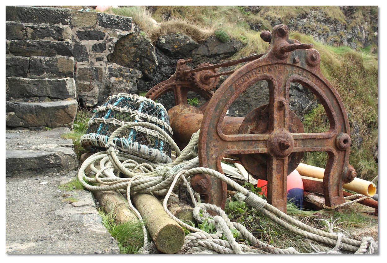
The old winch Porth Mellin
Image: eOceanic thanks Public Domain

The more modern capstain
Image: eOceanic thanks Michael Harpur
Mullion Cover aerial overview


Add your review or comment:
Please log in to leave a review of this haven.
Please note eOceanic makes no guarantee of the validity of this information, we have not visited this haven and do not have first-hand experience to qualify the data. Although the contributors are vetted by peer review as practised authorities, they are in no way, whatsoever, responsible for the accuracy of their contributions. It is essential that you thoroughly check the accuracy and suitability for your vessel of any waypoints offered in any context plus the precision of your GPS. Any data provided on this page is entirely used at your own risk and you must read our legal page if you view data on this site. Free to use sea charts courtesy of Navionics.