
The harbour offers complete shelter from all conditions. Being a busy commercial port with a deep and well-marked commercial channel, the Port of Waterford provides safe access in all conditions on any tide, day or night. Port of Waterford is a long upriver trek and the very strong harbour currents need to be factored into your visit; conversely, a favourable passage current can make the journey very quick.

Keyfacts for Port of Waterford


Nature


Considerations


Protected sectors


Summary
A completely protected location with safe access.


Nature


Considerations


Position and approaches
Haven position
 52° 15.727' N, 007° 6.508' W
This is below the bridge where the visitor berth pontoon is located. It is upriver and immediately west of the Millennium Plaza on the quay.
What is the initial fix?
 52° 6.900' N, 006° 59.250' W
 What are the key points of the approach?
 .
. Not what you need?
- Little Island - 1.8 nautical miles ESE
- Cheekpoint - 4.2 nautical miles E
- Seedes Bank - 4.5 nautical miles E
- Buttermilk Point - 4.6 nautical miles E
- Passage East - 5.2 nautical miles ESE
- Ballyhack - 5.2 nautical miles E
- Arthurstown - 5.8 nautical miles ESE
- Duncannon - 6.7 nautical miles ESE
- Creadan Head - 7.5 nautical miles SE
- Dunmore East - 8 nautical miles SSE
- Little Island - 1.8 miles ESE
- Cheekpoint - 4.2 miles E
- Seedes Bank - 4.5 miles E
- Buttermilk Point - 4.6 miles E
- Passage East - 5.2 miles ESE
- Ballyhack - 5.2 miles E
- Arthurstown - 5.8 miles ESE
- Duncannon - 6.7 miles ESE
- Creadan Head - 7.5 miles SE
- Dunmore East - 8 miles SSE
Chart
What's the story here?
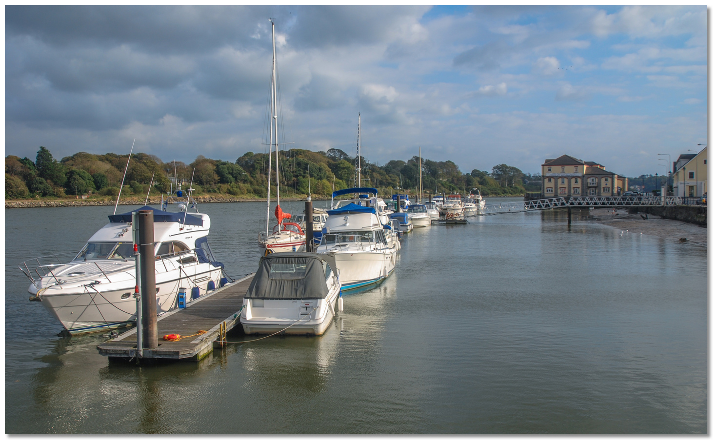 Port of Waterford pontoon
Image: Michael Harpur
The Port of Waterford lies on the south bank of the River Suir, 5 miles above its confluence with the River Barrow, and 16 miles from the sea at the entrance to Waterford Harbour. Waterford is an ancient city, founded by the Danes in the 9th century. It is the oldest and fifth most populous city within the Republic of Ireland, and the eighth-most populous on the island of Ireland. It remains a thriving commercial port, trading town and provincial government area.
 The extensive cruising area from Waterford City to New Ross to Hook Head
Image: Image courtesy of the Earth Science and Remote Sensing Unit, NASA Johnson
Space Center
Waterford City & County Council operates Waterford City Marina
 at Merchant's Quay on the south bank of Waterford City, abeam Christ Church Cathedral spire.
For further details on the pontoon closure contact Darren Doyle
 info@portofwaterford.com
  +353 (0)51 899800.
 Outside of this, the quays have all-tide access with depths alongside varying from 5.2 to 7.5 metres but beware of the strong tidal streams.
Visitors should contact berthing manager Dick Fanning by phone
 +353 (0) 87 238 4944 prior to any intended visit. Berths are usually available, but it is worth calling ahead to make certain as it is a long upriver trek that has to be synchronised with a favourable tide.
  Waterford County Council Pontoons
Image: Andrew Bennett via CC ASA 4.0
The passage to the marina and associated run up the estuary is a primary consideration here, depending upon where the vessel is in the harbour. By the river, the distance to Waterford from Hook (Head) Lighthouse is 16 miles, from Passage East 7 miles, and from Cheekpoint 5 miles. The key consideration is the strong estuarial ebb tide. On Springs these can attain a speed of 3 knots close-in, decreasing to 1.5kt about 5 miles out and are at their maximum at about 90 minutes on either side of LW Cobh. With the benefit of a fair tide, the distance to the marina will be quickly covered, but when the tide is adverse, it is better to anchor off in any of the many listed anchorages along the way. When approaching from seaward it is worth remembering that when these strong Waterford estuary ebb tides collide with rough sea conditions, the ugly ‘Tower Race’ occurs at the entrance.
How to get in?
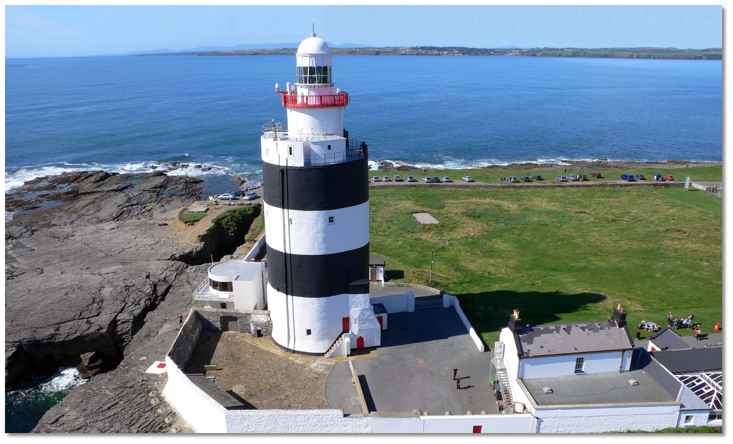 Hook Head marking the eastern approaches to Waterford Estuary
Image: Tourism Ireland
 Use southeastern Ireland’s coastal overview for Rosslare Harbour to Cork Harbour
  for seaward approaches. Waterford Harbour’s entrance lies between Swine Point and Hook Point, bearing from each other southeast by east and northwest by west. It is just under 4 miles wide, deep, clear of dangers and unmistakable when close in. On the eastern side of the entrance is Hook Point – a long, narrow, low-lying peninsula that terminates in a shelving point, where the prominent Hook Lighthouse stands.
  Hook Point
Image: Michael Harpur
The significant old convent of Loftus Hall stands about 1.7 miles north by northeast of the lighthouse.
Hook Lighthouse – Fl 3s 46m 24M position: 52° 07.300’ N, 006° 55.700’ W
 Loftus Hall stands prominent on the eastern shore
Image: Michael Harpur
The western shore of the entrance is high and bold. A mile and a half within Swine Point, situated at the south end of Dunmore Bay, is Dunmore East Harbour
 with its East Pier Lighthouse. This is a 16-metre-high white lantern set on a grey granite tower, which stands at the head of the main part of East Pier’s harbour wall.
 Dunmore East, East Pier Lighthouse – Fl WR 8s position: 52° 08.935' N, 006° 59.337' W
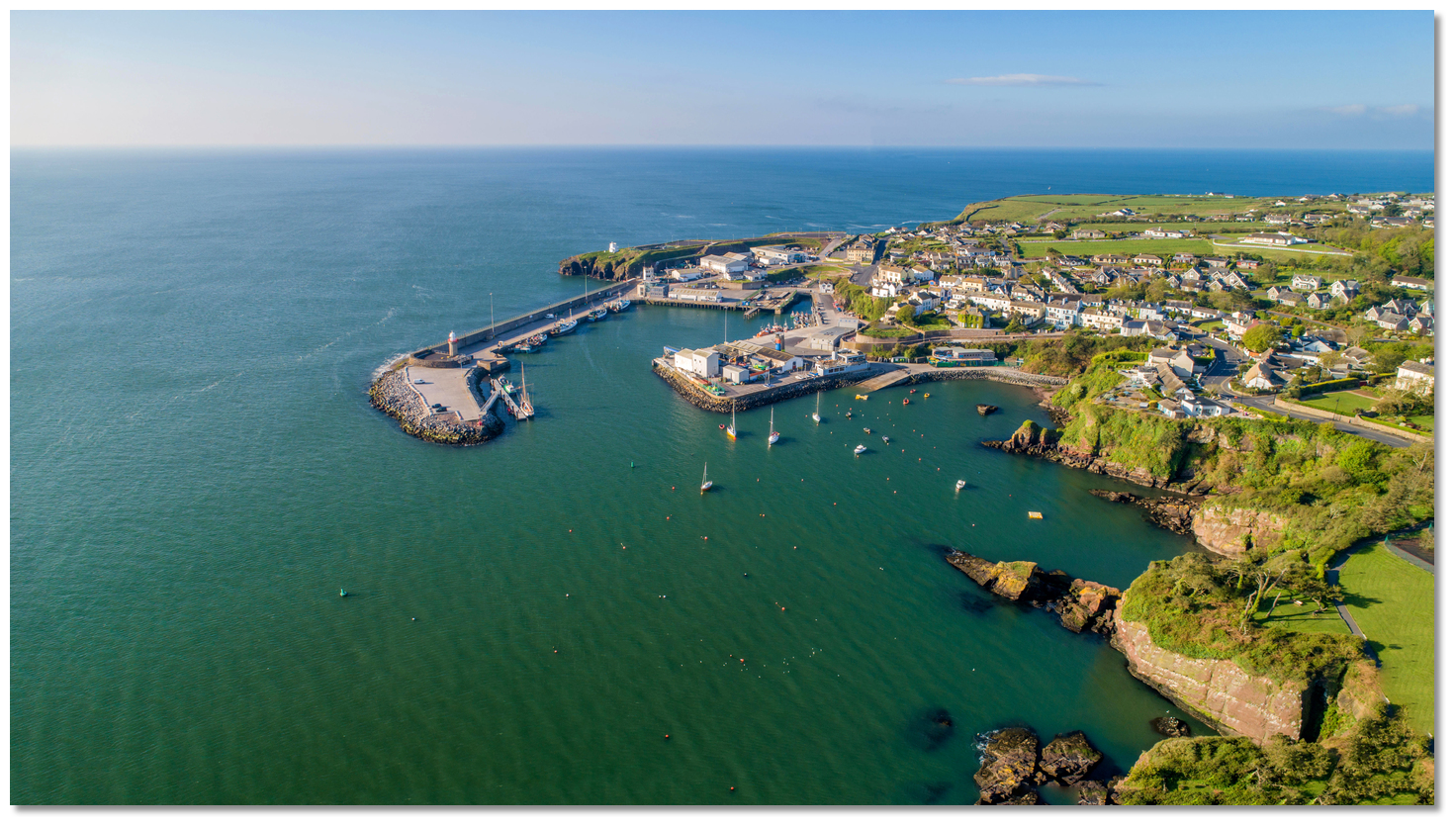 Dunmore East
Image: Michael Harpur
Dunmore East Harbour will be clearly identifiable for some distance. A white lookout tower, close south of Dunmore East Harbour, is also conspicuous. A sectored light located in Duncannon, within the estuary, leads up the fairway; ample channel markers make estuary navigation very straightforward.
 Lumsdin’s Bay
Image: Michael Harpur
The principal danger in the approach is the Tower Race, which occurs at the entrance when strong Waterford estuary ebb tides collide with rough sea conditions. If a tidal race is forming, it will be clearly visible at deck level. A very short chop will be seen over dark green water to seaward, and light green or pale blue water within; this colouration will be particularly visible in sheltered waters. When the tide is on the ebb, the chop is much shorter; in the flood, the wavelength is longer and much easier. In extreme conditions, such as a southeasterly or southwesterly Force 8 colliding with the Waterford ebb, it can be particularly bad. At such times overfalls and hazardous seas stand as far as two miles from the Hook Lighthouse and it is best avoided. Once past the race, however, and inside the harbour area, the seaway quickly calms and Waterford Harbour offers plenty of depth for the leisure sailor.
 From the initial fix, set in the middle of the entrance, head northeast for the ‘Waterford’ port marker buoy. The buoy lies midway between Dunmore East and the conspicuous square Loftus Hall on the Hook Peninsula near Lumsdin's Bay
  . It should be rounded to port or passed on its eastern side.
‘Waterford’ port buoy – Fl(3) R 10s position: 52° 08.938’N 006° 57.000’W
 Duncannon with its prominent light tower
Image: Michael Harpur
The 002° T leading beacon or lights based on Duncannon will be visible from the vicinity of the ‘Waterford’ port marker buoy. The front and lower leading light of the estuary shows from a white tower situated at the southwest corner of Duncannon Fort (Oc WR 4s). The rear tower and light is set into a wooded hill north of Duncannon Harbour (Oc 6s).
Duncannon light (front) – Oc WR 4s, rear – Oc 6s; position: 52° 13.232’ N, 006° 56.245’ W
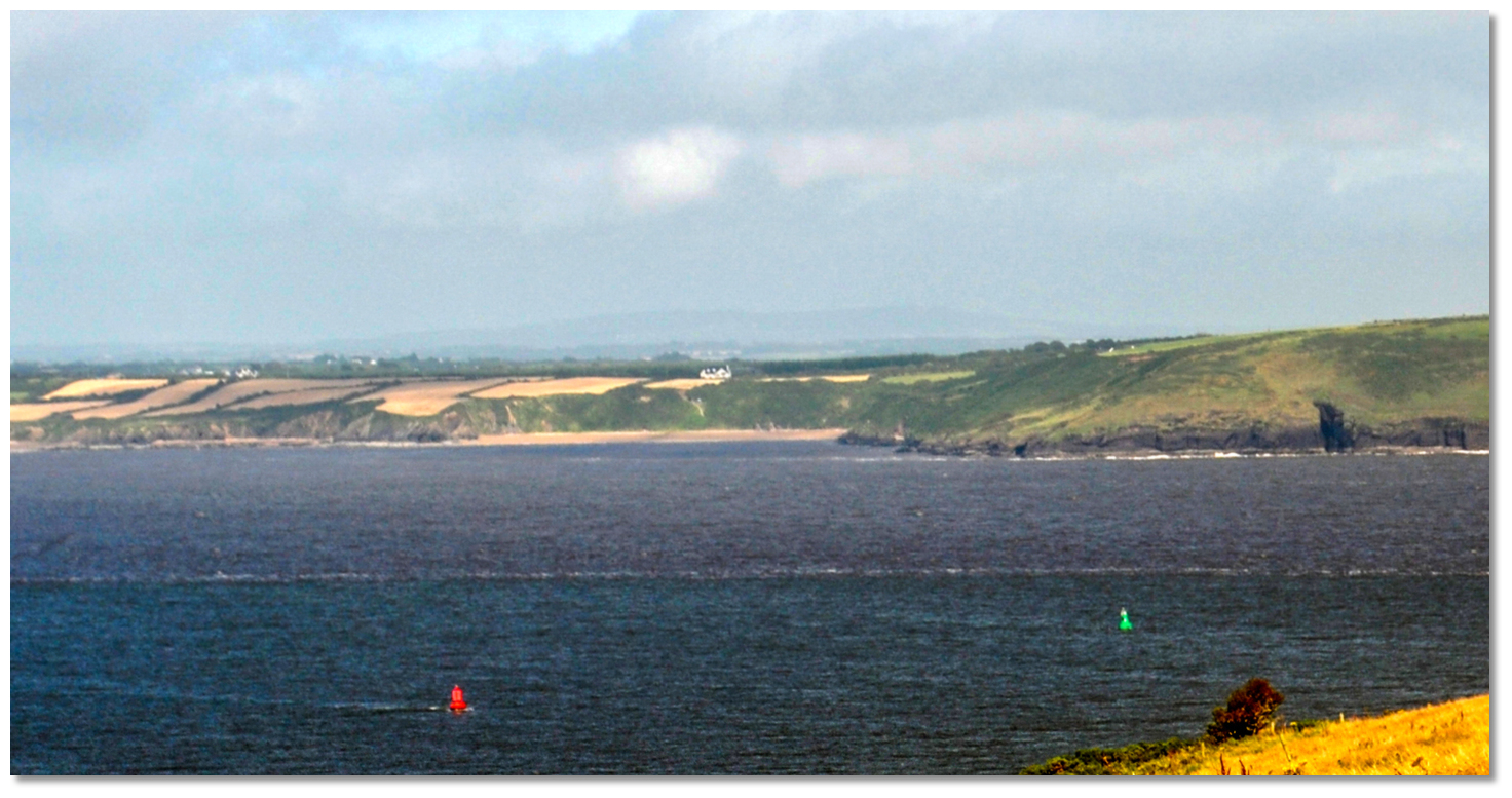 The first pair of lateral marks as seen from Creadan Head
Image: Michael Harpur
From the ‘Waterford’ Buoy, the first buoys of the entrance channel, No.1 and No.2, will be just visible to the northeast off Creadan Head
 . This is a long, high finger of a headland extending from the western shore, and the most easterly point of County Waterford.
 Creadan Head, with Hook Head in the background
Image: Michael Harpur
The headland points at Templetown Bay
 on the opposite, eastern Wexford shoreline, at the head of which are the ruins of a 13th-century church.
 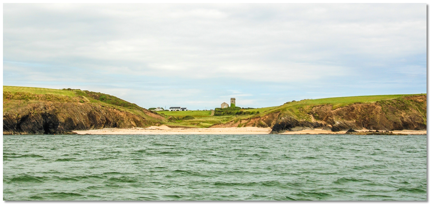 The ruins of the 13th-century church overlooking Templetown beach
Image: Burke Corbett
The western headland of Creadan Head encroaches upon the channel and concentrates the estuary tides. On springs it can reach up to 3 knots off Creadan Head, but this decreases out to mid-channel.
 Dollar Bay to Duncannon
Image: Michael Harpur
The fairway buoys in the lower estuary are largely for the benefit of commercial shipping, and leisure craft will find plenty of water surrounding these marks. However, after Dollar Bay
 , on the eastern shore, has been passed (and the Starboard No.3 Buoy [known as Duncannon Bar Buoy] and particularly Starboard No.5 buoy [known as the Spit Buoy], marking the drying Duncannon Spit), shallow areas begin to encroach on the channel. Although there is nothing especially challenging in the margins for a leisure craft, it would be best to closely adhere to the marks from this point onward. In fine weather, a vessel may bring up anywhere in the entrance of the harbour to wait for a tide or daylight.
 Duncannon with its fort on a promontory that juts out into the harbour
Image: Michael Harpur
Approaching Duncannon
 the estuary fairway deepens. After passing the Starboard No.5, or Spit Buoy, depths that would have previously exceeded 5 metres begin to step down to attain 9 to 19 metres mid-channel. This is where a vessel should veer off to port from Duncannon’s leading beacon or lights, and pass the port to starboard.
 Duncannon is unmistakable, with its commanding fort at the entrance to the harbour and sweep of beach off to the east. A deepwater channel runs close to the fort; vessels should keep about 200 metres off the fort, but do not stray much further west, in order to avoid the shallow tail of Drumroe Bank. This shallow area extends nearly ¼ mile to the southwest of the Drumroe Bank North Buoy, with extending shallow waters from the western shore.
 Arthurstown Pier and Kings Bay
Image: Michael Harpur
The eastern shore above Duncannon has good depths and is the favoured side for this length. The western shore, called Passage Strand, dries almost halfway across the estuary here. The northern extremity of this is marked by the Passage Spit port hand octahedral lighthouse. This is locally known as the Spider and is situated opposite Arthurstown Pier
 .
.  Passage Spit and the estuary narrowing between Passage East and Ballyhack
Image: Michael Harpur
Vessels should stay east of this marker in at least 5 metres of water as it entirely dries out to the mark from the western shore. Be careful not to cut to the west of this mark: it is a common mistake as the channel turns gradually to port after the mark, suggesting the inner path, and the light structure breaks the convention of port hand marks.
 Passage Spit
Image: Michael Harpur
Turning to port after the Passage Spit presents the facing villages of Passage East
 and Ballyhack
  , with regular ferry crossings between them.
  Passage East and Ballyhack
Image: Michael Harpur
Here, about 7 miles above Hook Point, the irregular shores of the entrance begin to approach each other, narrowing the channel so that it takes on the personality of a river as opposed to its previous estuarial character.
 The ferry passing from Ballyhack to Passage East
Image: Burke Corbett
Particular attention needs to be paid when passing the ferry in the fast-flowing waters of the River Suir. In summer months it crosses every 10-15 minutes, making as many as 120 crossings each day, and can reach speeds of up to 4 knots at certain phases of the tide. The ferry operates within very tight margins and should not be impeded, nor should a vessel anchor anywhere within its vicinity.
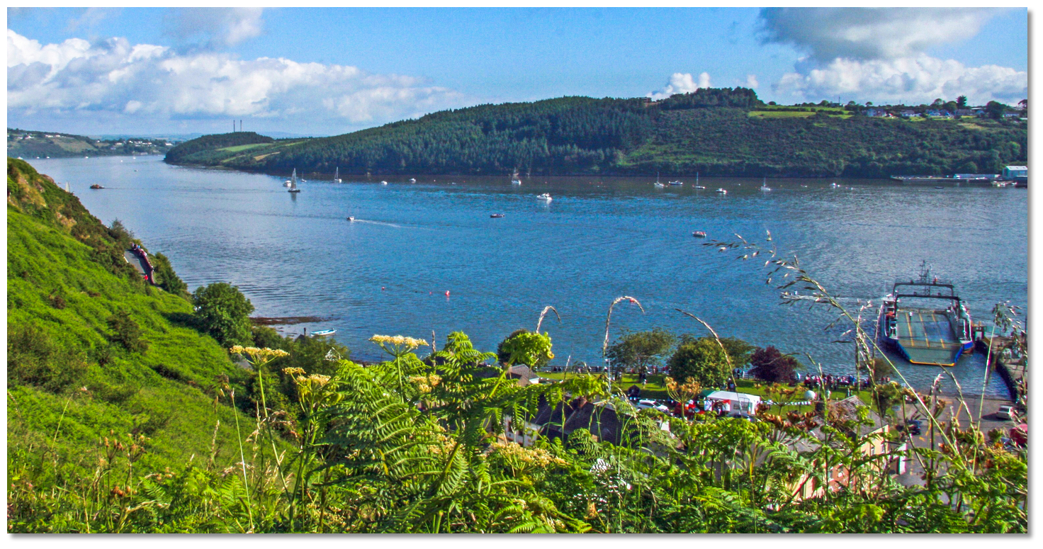 Seedes Bank above Ballyhack, as seen from Passage East
Image: Paul O'Farrell via CC BY-SA 2.0
Above Passage East and Ballyhack, the western (Waterford) shore is precipitous, rocky and bold-to, and excellent depths will be found 100-200 metres from the rocks. The best water now may be found along this western shore. The eastern Wexford and Ballyhack shore is skirted by a sandy flat, which runs off into the Seedes Bank immediately above Ballyhack. The only danger here is a shallow ridge (with as little as 0.8 metres) that extends out 450 metres from the eastern bank, about midway between Ballyhack and Buttermilk Point. Adhering to the channel as far as the ‘Seedes Bank South’ starboard mark clears this danger.
 Buttermilk Point
Image: Michael Harpur
The Seedes Bank
 (just off the east shore) or Buttermilk Point
  (around the high, forested eastern upriver headland) are the usual anchorages for vessels seeking a convenient berth or tide-wait to head up to the city of Waterford.
 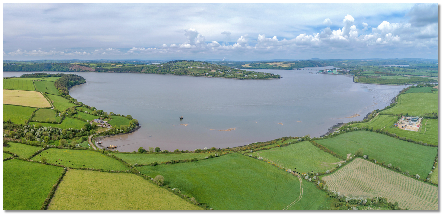 St Catherine’s Bay and Shelburne Bay between Buttermilk and Kilmokea Points
Image: Michael Harpur
Around Buttermilk Point the eastern shore is covered by mud flats. To the east, the inland ruin of Dunbrody Abbey and the wreck of the French trawler Petit Sarah present conspicuous objects. Great Island Power Station will be seen to the north.

 Cheek Point and Kilmokea Point
Image: Michael Harpur
Approaching Cheekpoint
 , the confluence of the Rivers Suir and Barrow, Great Island Power Station and the Barrow Bridge (a railway swing bridge that opens a couple of times a day to provide shipping access to New Ross
  ) appear to the north.
  Cheek Point pier and its approaches
Image: Michael Harpur
As Great Island Power Station is approached, a very hard turn to port is required to follow the River Suir’s deepwater fairway up to Little Island and on to Waterford port and city, situated 5 miles west of the River Barrow junction.

 The railway swing bridge and Great Island Power Station as seen from Cheek Point
Image: Michael Harpur
The drying Cheekpoint Bar stretches from the south shore for 300 metres northwards across the entrance of the River Suir. Drumdowney Point, on the north shore, is encircled by a mud flat that dries off some distance to the south.
Cheekpoint Bar had been encroaching upon large vessels travelling to the Port of Waterford and so four groins were constructed to divert it. At the head of these groins are yellow buoys. These four yellow marks in effect replace the traditional port marks on the south side of the river off Cheekpoint, which may be confusing. These four buoys should be kept to port.

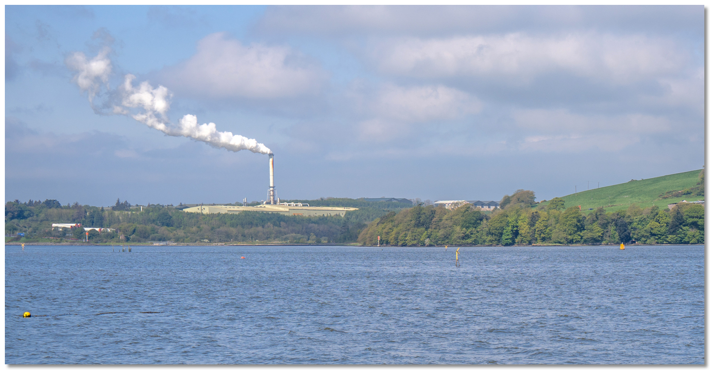 Cheekpoint Bar special marks, with Snowhill and Glass House alignment marks in
the background
Image: Michael Harpur
There is, however, plenty of water for a leisure vessel and the commercial channel has a maintained depth of 6 metres. If uncertain use the commercial channel alignment marks 255° T of Snowhill Point Leading Lights. These are a white 6.5-metre-high mast on Snowhill Point (Fl WR 2.5s 5m 3M), with a rear light 800 metres west-southwest on an 11-metre-high white framework tower at Glass House flour mill (Q 12m 5M).
Snowhill Point (front) – Fl WR 2.5s 5m 3M, position: 52° 16.393’ N, 007° 00.010’1 W.
 The run from Kilmokea to Little Island
Image: Michael Harpur
On approaching Snowhill Point veer off the transit to port, where the deeper water will be found by keeping north of mid-channel until abreast of Glass House flour mill, where the rear mark is positioned, and the port and starboard buoys resume. Here the river winds round in a southwesterly direction for over 2 miles through Glasshouse reach to Little Island.
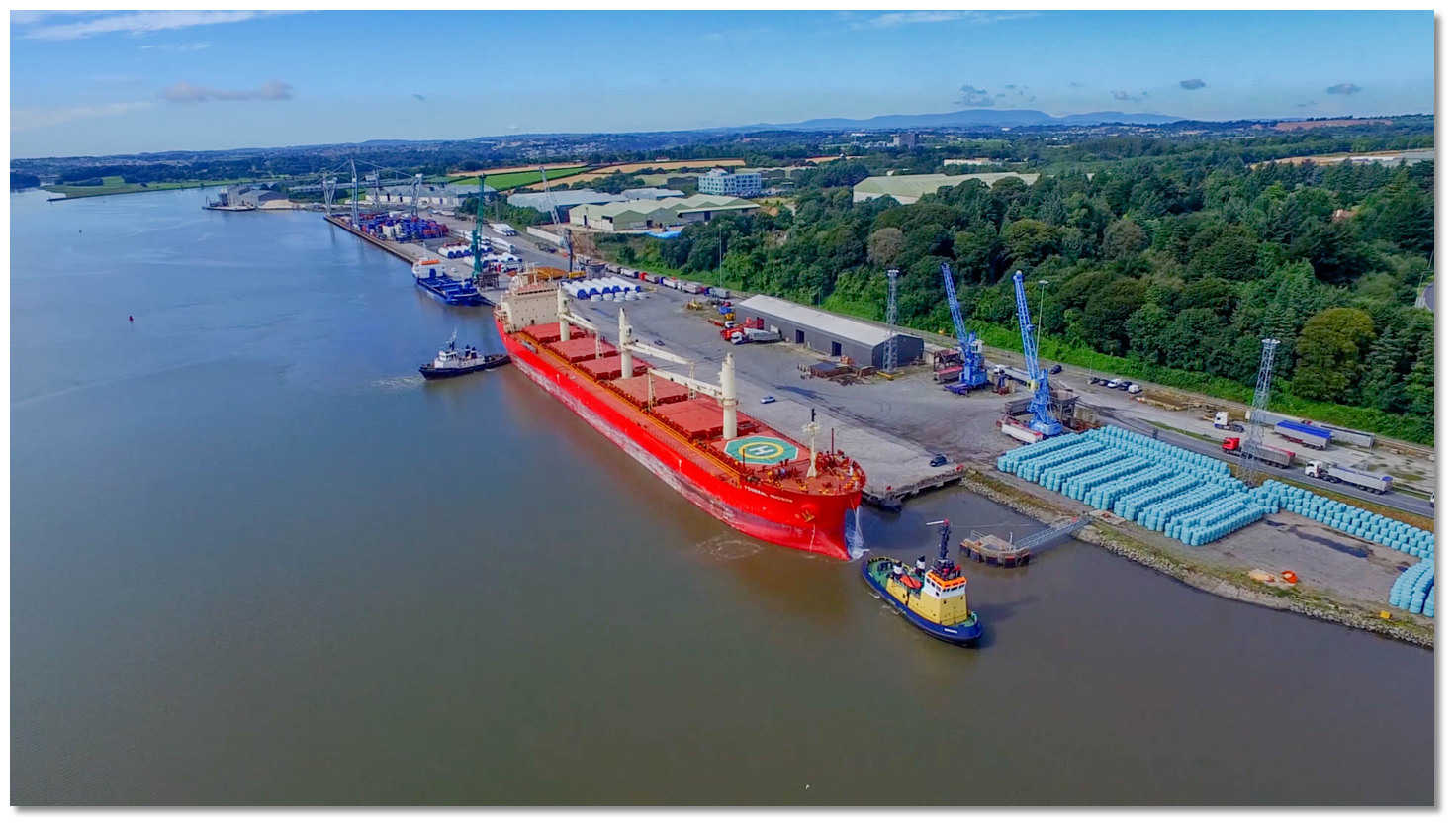 Waterford’s Belview Bulk Terminal
Image: Port of Waterford
The northern shore, or Kilkenny side, hosts Waterford’s Belview container terminal, which was completed in 1997. Located 3½ miles downstream from the ancient port of Belview, it is now Waterford’s main container terminal.
 Faithlegg House Hotel overlooking Little Island above
Image: Tourism Ireland
This new upstream location removed freight traffic congestion from the city, offered shorter sea approaches, provided better access to road and rail, and offered the increased space required to deal with modern cargos. The port features 450 metres of container berthage serviced by two high-output gantry cranes, plus a portal crane. This makes it a conspicuous feature along the river route.
_and_queens_channel_(right).jpg) Little Island's northeastern corner, the King's Channel (left) and Queen's
Little Island's northeastern corner, the King's Channel (left) and Queen'sChannel (right)
Image: Tourism Ireland
The shore off of the terminal is bold-to and is the preferred choice for this leg, as the southern shore is skirted by a mud flat with occasional patches of rock. One of these patches is called The Bingledies, and lies opposite to the northeast end of the Belview Bulk Terminal; it dries to 100 metres distance from the south shore and is marked by a red buoy. About ½ mile to the southwest and also on the south shore are the Bolton Rocks. Then, 200 metres to the southwest of the Bolton Rocks, there is a bank of mud that uncovers up to 200 metres from the shore. These all have four port marker buoys in quick succession placed outside of them, and all of these buoys must be left to port whilst proceeding up.
 Little Island with the Queen’s Channel passing north
Image: Michael Harpur
After this leg, the course alters westward into the Queen’s Channel. This is entered between a training wall, which extends 700 metres east off Little Island's northeastern corner, and Belview Point, on the north side of the channel. Entrance into the Queen’s Channel fairway is assisted by an astern leading line of 098° T. The front light (QR 8m 5M) is on a 5-metre-high black tower with a white band, set on the eastern extremity of the training wall, which effectively divides the Queen’s and King’s Channels. The rear light (Q 15m 5M) is on a 6-metre-high white mast, set 600 metres east of the front light at Faithlegg Demesne.
Queen’s Channel Front – QR 8m 5M, position: 52° 15.317’ N, 007° 02.376’ W
A hard turn to starboard is required to access the preferred Queen’s Channel or a vessel could stray into the King’s Channel.

 The King’s Channel passing south around Little Island
Image: Michael Harpur
The King’s Channel encircles the island to the south and is the old natural bed of the river. It is entirely possible to round the island via the King’s Channel; however, its navigation requires a keen eye and caution as there is little published data. It is badly silted up on the island’s eastern side, where it has a least depth of 0.5 meters. Once inside and halfway down the east side of the island, where the shores converge, it deepens to 15 metres in midstream. On the western side of the island, there is the unmarked Maulus Rock off the mainland side of the channel. The King’s Channel is frequently used by local boats and, taken on a three-quarters flood tide, provides a more than manageable, if not very enjoyable, passage around Little Island.

 Queen's Channel marks on the ebb
Image: Michael Harpur
By contrast, the well-marked mile-long Queen’s Channel, which passes along the north side of the island, is direct and easy. It has plenty of water (except close to the banks), is well marked and there are no dangers in this section of the river. For this reason, we prefer a Queen’s Channel approach, leaving the King’s Channel for subsequent exploration if so inclined.

 The Dirty Tail encircling the point on the western shore
 of the river’s south bank
Image: Michael Harpur
At the west end of Queen’s Channel, beyond Little Island (where the King’s and Queen’s channels reunite), three dangers present themselves:
(i) The Dirty Tail, which encircles the point on the western shore off the south bank of the River Suir and the western side of the King’s Channel. It extends northward halfway across the river and eastward across the King’s channel.
(ii) A drying mud bank that extends off the northeastern end of Little Island and narrows the deepwater section of the King’s Channel from the east. The western edge of this is somewhat marked by the Dirty Tail port marker buoy, although its primary purpose is to support Queen’s Channel vessels proceeding upriver. Vessels heading upriver or into the King’s Channel must leave this mark on the port side.
(iii) Tidal effects that can cause a boat to be quickly swept sideways. A helm must guard against the effects of the tidal stream setting in and out of King’s Channel where the fairway is narrow. The tidal effects are at their strongest on a falling spring tide.
Generally, it is best to stick close to the north bank (the Gyles Quay side) to avoid being swept sideways. This is especially true on a falling spring tide.
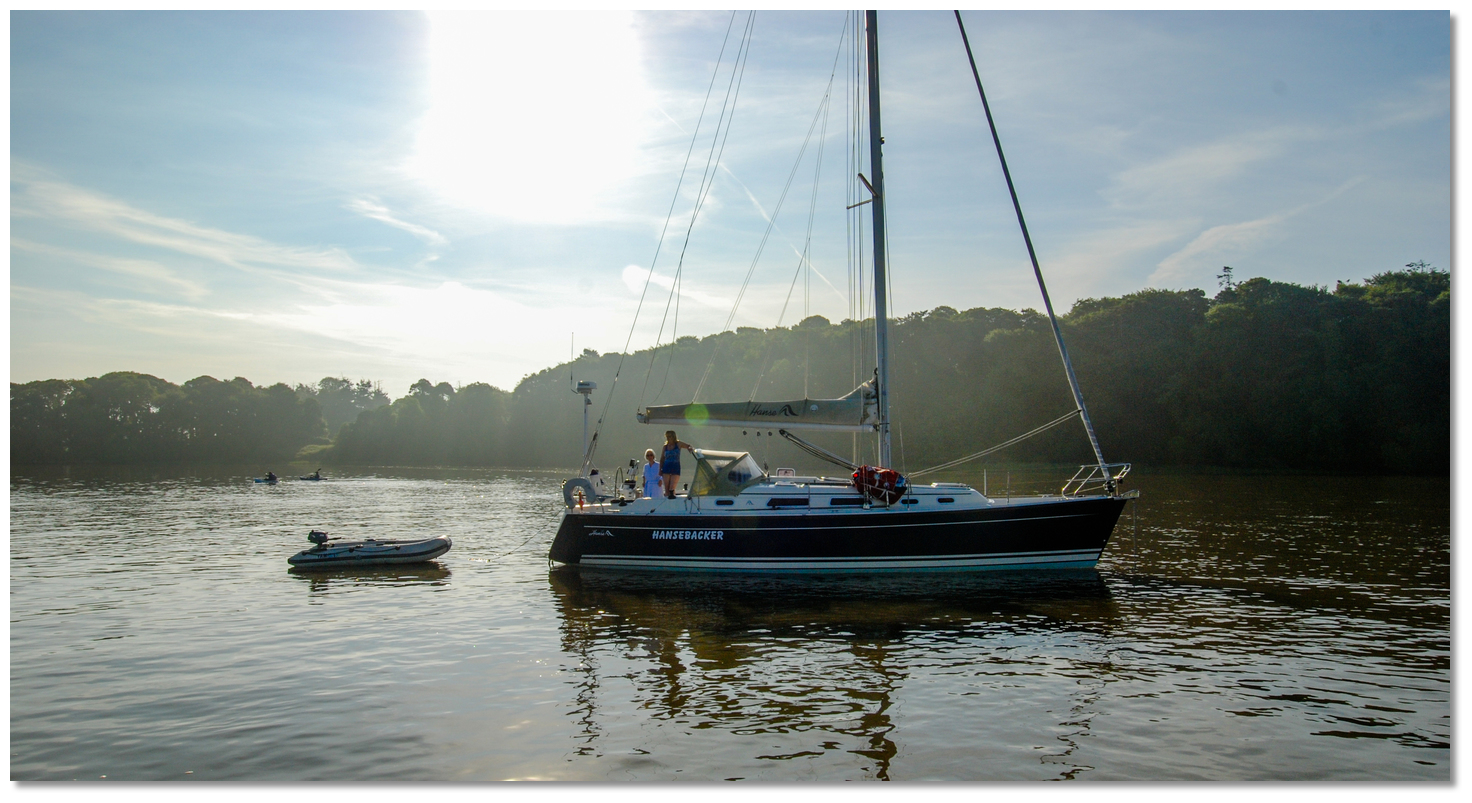 Yacht anchored on the west side of Little Island
 Image: Burke Corbett
On the west side of Little Island
 and within the King’s Channel there are several anchoring possibilities.
 Several boats on the final run-up to the Port of Waterford
Image: Burke Corbett
After passing the Queen’s Channel and Dirty Tail, a vessel may continue on without danger or obstruction to Waterford, a distance of 2 miles. As the city is approached, a series of pontoons will be encountered. The first is the privately owned Granagh pontoon. This is named after nearby Granagh Castle – a large, square, walled enclosure with cylindrical corner towers that stands dramatically on the north bank of the Suir, about 5km from Waterford. The next is the Waterford Boat Club pontoon, which appears at the head of the estuary of the St John’s river on the port side. Again, no visitor berths are available here.
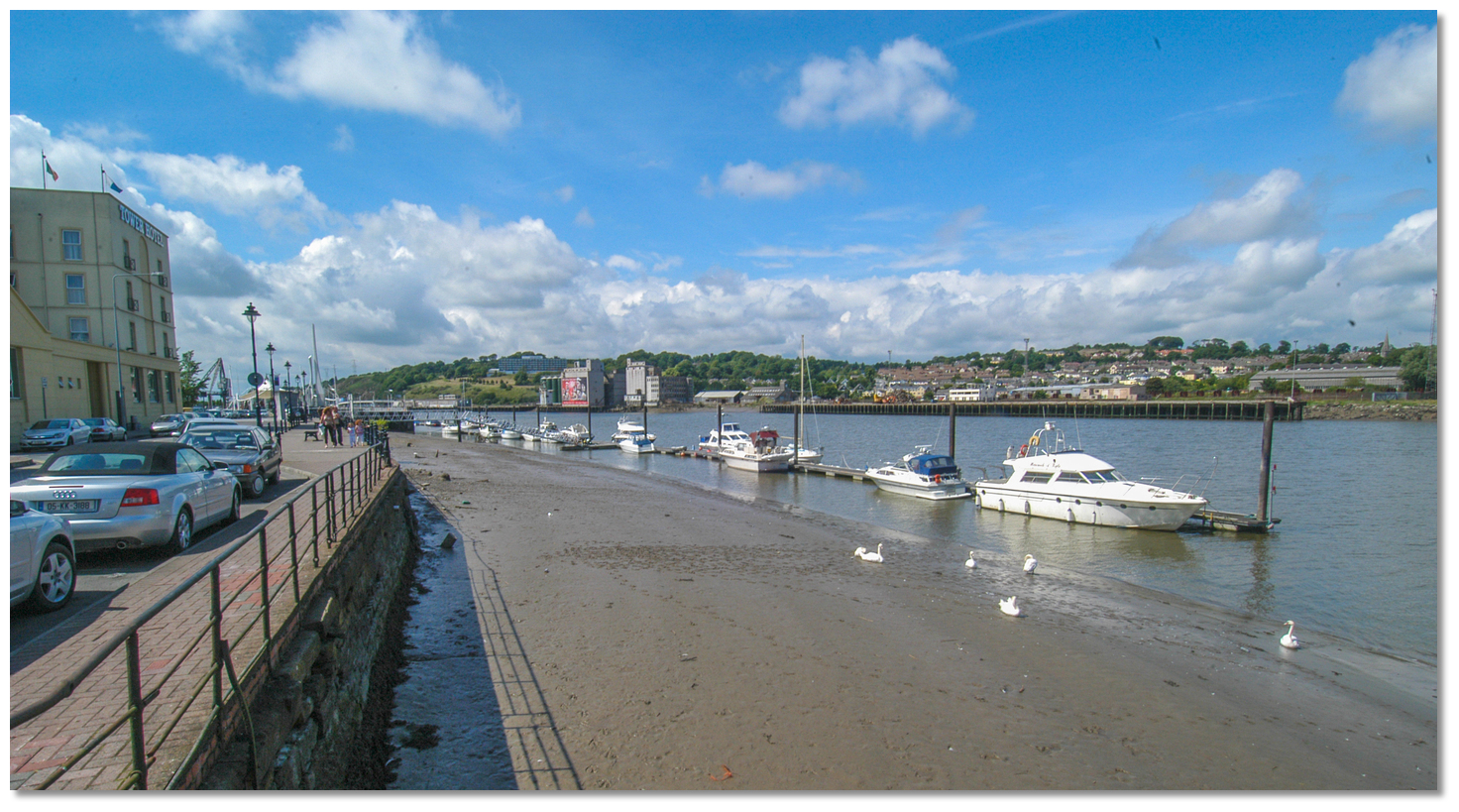 The first Waterford pontoons
Image: Michael Harpur
 Waterford City follows quickly, with quays on both sides of the river that extend a considerable distance along the river bank. The depths alongside the commercial berths are 5.2 to 7.5 metres. The first marina pontoons encountered are at the Adelphi Quay and Tower Hotel on the south side of the river. From here the pontoons stretch for 360 metres and all of the initial berths are held by long-term berth holders.
 The visitors’ pontoons can be found upriver immediately west of the William Vincent Wallace ‘Millennium’ Plaza on the quay. A tall, white structure (reminiscent of masts) can be seen on the approach, but more conspicuous is a restored dockside crane (blue, set on three white pedestals) situated close after, which provides a better approach mark.
 The restored dockside crane provides a good mark for the visitor area
Image: William Murphy via CC BY SA 2.0
Beware of the strong tidal streams past the city when coming alongside. Currents can attain 3.5kt on the ebb alongside Waterford quays and an approach into the flow is essential. Likewise, moor securely and when casting off do not untie from the marina until the river’s tidal flow rate has been assessed, as boats very quickly get pushed down onto other vessels here.
An access fob card is available from City Hall or alternatively from the reception desk of the Tower Hotel to enable the return through the security gate.
Yachts must use the council berth and should not attempt to anchor, which is entirely prohibited in the harbour area. Depending on a vessel’s air draught, the River Suir’s upper reaches are navigable for a further 9 miles, making Carrick-on-Suir accessible from Waterford. Local advice should be sought if considering this, as there are two bridges to be passed. More detailed information on the upper reaches of Waterford Harbour are available in the Inland Waterways Association of Ireland (IWAI) Three Sisters Guide.
Why visit here?
Waterford, in Irish Port Láirge, meaning ‘Lárag’s port’, derives its English name from Old Norse Veðrafjǫrðr, or Vadre-fjord, meaning ‘weather-protected fjord’. It is a nationally significant, being Ireland’s oldest city, with its settlements dating back to 856 AD. Today it is the fifth most populous city in the country.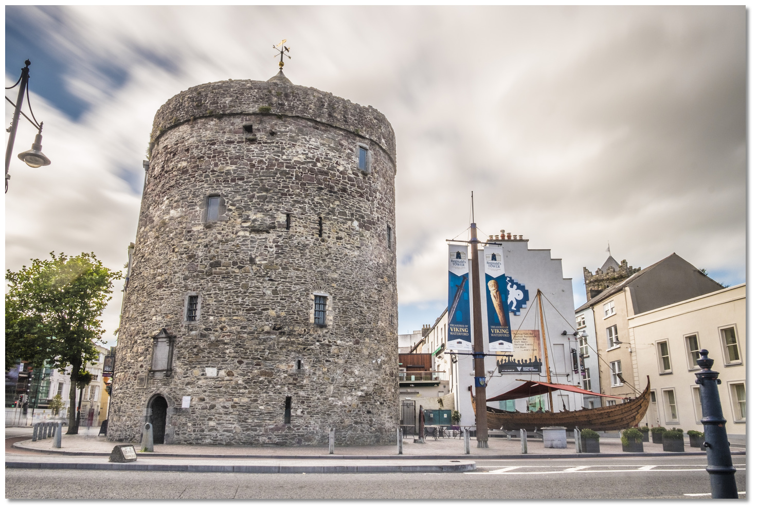 Reginald’s Tower
Image: Tourism Ireland
Viking raiders first came to the Waterford area in 853. In 902 the Danes were driven out of all their ‘longboat’ ports along this coast by the native Irish, but re-established themselves in Waterford in 914. They were first led by Ottir Iarla, and Jarl Ottar until 917, and after that by Ragnall Ua Ímair and the Uí Ímair dynasty. It was the latter who went on to build what would be Ireland's first city, and surrounded it by a fortified city wall. Six city towers and large sections of the city walls remain intact today. The best and oldest example is Reginald's Tower, on The Quay, which dates back to 1003. It was these very walls that in 1169 withstood the first Norman-supported attempt on the city, by the cruel (but by-then deposed) King of Leinster, Diarmait Mac Murchada.
 Strongbow and Aoife Bronze Statues in Waterford City
Image: Tourism Ireland
English King Henry II, the first Plantagenet King of England, had provided Diarmait with an army and the right to retake Leinster under his authority. In 1170 a large army returned with Norman, Welsh and Flemish mercenary forces led by The Earl of Pembroke, Richard de Clare, known as Strongbow. He landed at Passage East on the August 23, 1170 and was the fifth of the landing parties to bear down on Ireland that year. Strongbow then combined his force of 200 knights and 1,000 men with those of Raymond Fitz-William le Gros, who had led the fourth landing, on May 1, on Baginbun, with 100 heavily armoured knights. They had already destroyed a large Danish/Irish force despatched against them from Waterford. The combined armies of Strongbow and Raymond le Gros then advanced towards the walled city of Waterford and the conquest of Ireland began in earnest.
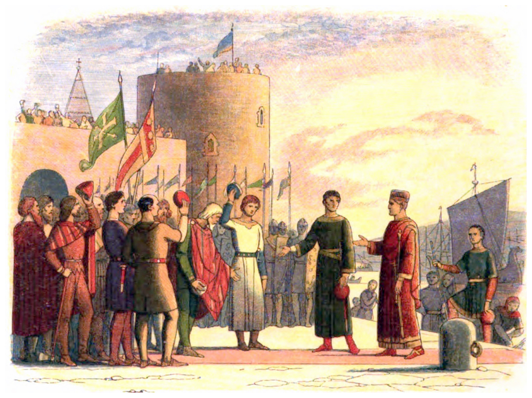 Henry II at Waterford
Image: Public Domain
Forces under Dermot MacMurrough, Robert FitzStephen and Maurice FitzGerald arrived on August 25 after the fall of the city. The next task for the combined armies was to take command of the province of Leinster by capturing the strategic, political and trade centre of Dublin. Dublin fell before them just as quickly and before long all of Leinster was conquered.
 The Watch Tower is one of the six surviving towers
 of the city walls of Waterford
Image: Nmwalsh via ASA 4.0
Strongbow then married Diarmait’s daughter Aoife and was named heir to the Kingdom of Leinster. This latter development caused consternation to Henry II, who feared the establishment of a rival Norman state in Ireland. Accordingly, he resolved to visit Leinster to establish his authority. In 1171 Henry landed at Waterford with a large fleet and 4,000 men, becoming the first King of England to set foot on Irish soil. This would mark the beginning of English and then British rule in Ireland. Later, Henry II proclaimed Waterford and Dublin Royal Cities, and also declared Dublin capital of Ireland.
 Bishop's Palace Museum
Image: Nmwalsh via ASA 4.0
 Waterford today is synonymous with Waterford Crystal
Image: Tourism Ireland
The name Waterford is synonymous with Waterford Crystal, the world-famous hand-crafted cut-glass. Glass, or crystal, was manufactured in the city from 1783 until 2009, when the factory was sadly shut down after the receivership of Waterford Wedgwood plc. Glass-making has since started up again in the city. The Waterford Crystal visitor centre opened in the Viking Quarter in June 2010, following an intervention by Waterford City Council and Waterford Chamber of Commerce.
 Reginald’s Tower is the oldest working civic building in Ireland
Image: Vadrefjord via CC BY SA 4.0
From a boating perspective, the city has to be seen as the jewel in the crown of what is the magnificent Waterford Harbour. Set into the southeastern corner of Ireland, near the entrance of St George’s Channel, the harbour as a whole provides an invaluable safe haven and a truly wonderful cruising ground. Formed by the estuaries of the River Suir and the River Barrow, on which the large commercial towns of Waterford and New Ross are situated, Waterford Harbour offers a wide variety of well-sheltered anchorages in beautiful settings. Moreover, harbour passages take vessels through diverse and ever-changing scenery that makes for very interesting cruising.
The city berth has an extensive selection of shops, including a choice of supermarkets a short walk from the pontoon, making it an ideal location for provisioning. It is also a designated as a port of entry that may be used for clearing vessels entering territorial waters of the Republic of Ireland from outside the EU and UK territories. It should also be considered as a useful bolthole in bad weather as it provides a safe berth from where the amenities of this interesting city would prove a welcome diversion. Being well served by bus and rail transport, plus the international airport located 9km outside the city, it is also a convenient drop-off or collection point for crew.
What facilities are available?
The pontoons have water and electricity and a large quantity diesel is available by arrangement with a road tanker; smaller quantities are available from the filling station along the road behind the Tower Hotel. Gas bottles can be refilled in Waterford and showers are available in the shower block, which incorporates a coin-operated launderette. Rubbish may be disposed of on the quayside walkway. All boat services and equipment are available, except for a sailmaker and boat repairs, which are best catered for in New Ross.Waterford is the primary city of the southeast region and the fifth largest in the country, and the pontoon is central to all its amenities. The location offers the cruising vessel an excellent opportunity to stock up on supplies of food plus almost all other requirements. An extensive selection of shops, a choice of three department stores and three supermarkets, plus several pharmacies are available within a few hundred metres of the marina. A post office can be found at 100, The Quay, while banks and ATMs are located throughout the city centre.
Waterford is well connected to other major centres via the N9 to Dublin, the N25 to Cork (west) and Rosslare (east), and the N24 to Limerick. Waterford City rail station, Plunkett Station, is located across the (Edmund) Rice bridge on the north side of the Suir, a short walk from the pontoons. There are seven daily connections to Dublin, four daily connections to Limerick Junction and one direct daily connection each way to Rosslare Europort and onwards to Wexford and Enniscorthy.
Bus services are provided by Bus Éireann to all major Irish centres and the station is located on the quays opposite Dooleys Hotel.
Waterford Airport, or South East Regional Airport, serves Waterford and the south east region. It is not currently operational but continues to pursue the reinstatement of services.
Any security concerns?
Pontoons have secure fob access.With thanks to:
John Diamond the Three Sisters Marina manager. Photography with thanks to Burke Corbett, Athena, Eirian Evans, nmwalsh, Tony Quilty and Michael Harpur.
Port of Waterford, County Waterford, Ireland
Image: eOceanic thanks Michael Harpur

City Pontoon, Port of Waterford
Image: eOceanic thanks Michael Harpur

The Quay, Waterford City
Image: eOceanic thanks Michael Harpur
Bulk ship passing up through the harbour and discharging at Belview Bulk Terminal
Add your review or comment:
Alain Place wrote this review on May 27th 2023:
NO Visitors pontoon available until 2025 due to work on bridge
Notice read at Dunmore East HM office the 26/05/2023
Alain
Please log in to leave a review of this haven.
Please note eOceanic makes no guarantee of the validity of this information, we have not visited this haven and do not have first-hand experience to qualify the data. Although the contributors are vetted by peer review as practised authorities, they are in no way, whatsoever, responsible for the accuracy of their contributions. It is essential that you thoroughly check the accuracy and suitability for your vessel of any waypoints offered in any context plus the precision of your GPS. Any data provided on this page is entirely used at your own risk and you must read our legal page if you view data on this site. Free to use sea charts courtesy of Navionics.


 portofwaterford.com/
 Ch.14/10/13 [Waterford Port]


