
The sound provides good shelter from north round through east, south and west and is only open to wind and swell from the northwest. It can, however, become uncomfortable at high water when strong south to south by southwest winds make themselves felt between the islands and particularly so during wind-against-tide at Springs. New Grimsby Sound requires attentive navigation for access during daylight, as there are local offlying dangers and no lit marks, but it may be accessed from the north at any stage of the tide.
Keyfacts for New Grimsby
Facilities


Nature


Considerations


Protected sectors
Approaches


Shelter


Last modified
December 13th 2019 Summary
A good location with attentive navigation required for access.Facilities


Nature


Considerations


Position and approaches
Expand to new tab or fullscreen
Haven position
 49° 57.663' N, 006° 21.026' W
This is in the anchoring position close southwest of Cromwell's Castle.
What is the initial fix?
The following New Grimsby Sound Initial Fix will set up a final approach:
 49° 58.265' N, 006° 21.480' W
 What are the key points of the approach?
Offshore details are available in southwestern England’s coastal overview from Land's End to Isles of Scilly 

- The primary approach dangers are Kettle and Kettle Bottom, just off the point of Tresco that normally make themselves known.
- Star Castle Hotel on the west side of Hangman Island on 157° T leads safely past them.
- The western headland is steep-to and may also be followed in 100 to 200 metres off its foot.
Not what you need?
Click the 'Next' and 'Previous' buttons to progress through neighbouring havens in a coastal 'clockwise' or 'anti-clockwise' sequence. Below are the ten nearest havens to New Grimsby for your convenience.
Ten nearest havens by straight line charted distance and bearing:
- Green Bay - 0.6 nautical miles S
- Old Grimsby - 0.8 nautical miles E
- St Helen's Pool - 1.1 nautical miles ENE
- Tean Sound - 1.7 nautical miles E
- Higher Town Bay - 2.7 nautical miles E
- St Mary's Pool - 2.9 nautical miles SSE
- Bull's Porth - 2.9 nautical miles E
- Windmill Cove - 3 nautical miles SE
- Bread & Cheese Cove - 3.1 nautical miles E
- Perpitch - 3.3 nautical miles E
These havens are ordered by straight line charted distance and bearing, and can be reordered by compass direction or coastal sequence:
- Green Bay - 0.6 miles S
- Old Grimsby - 0.8 miles E
- St Helen's Pool - 1.1 miles ENE
- Tean Sound - 1.7 miles E
- Higher Town Bay - 2.7 miles E
- St Mary's Pool - 2.9 miles SSE
- Bull's Porth - 2.9 miles E
- Windmill Cove - 3 miles SE
- Bread & Cheese Cove - 3.1 miles E
- Perpitch - 3.3 miles E
Chart
What's the story here?
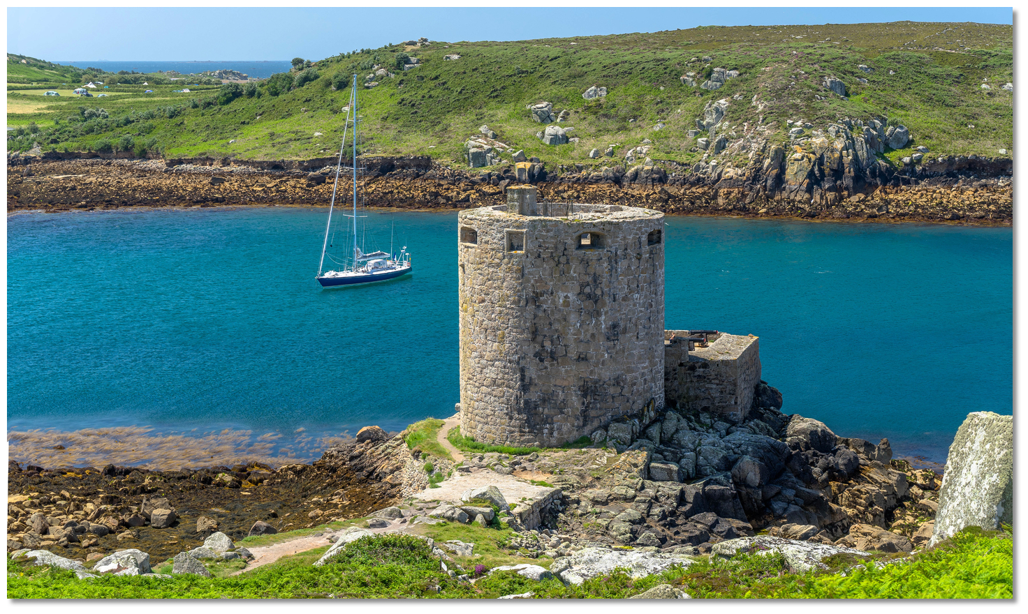 Yacht moored off Cromwell's Tower
Image: Michael Harpur
New Grimsby lies in the north end of the channel Bryher and Tresco about midway along the island's western coast. It is one of two principal settlements on the island of Tresco with Old Grimsby being the other. There is a quay, as well as a public house and a small art gallery. The southern portion of the settlement, on the site of Abbey Farm, includes the Tresco Estate's Island Office, the island's convenience store with a post office sub-branch inside and a restaurant. On the opposite side of the sound is Bryher Village the principal settlement of the smallest populated island of the group that comprises a scattering of houses just up from its two quays, a cafe, and a pub.
 New Grimsby Sound as seen from the Tresco
Image: Michael Harpur
New Grimsby Sound's deep waters offer one of the best Scilly all-weather havens. The seaward entrance is at the north end of the island group but it also may be approached from the south from St Mary’s Road over Tresco Flats typically 2 hours either side of high water. The primary dangers for a northern approach are two rocks, called the Kettle and Kettle Bottom, just off the point of Tresco, which may be passed by a natural well-charted transit. As the rocks normally make themselves known and there are no outliers off the western headland, they may also be easily avoided by keeping to the prominent western headland. There is a choice of piers to land at on Tresco and Bryher but all dry at low water leaving flat white sand beaches.
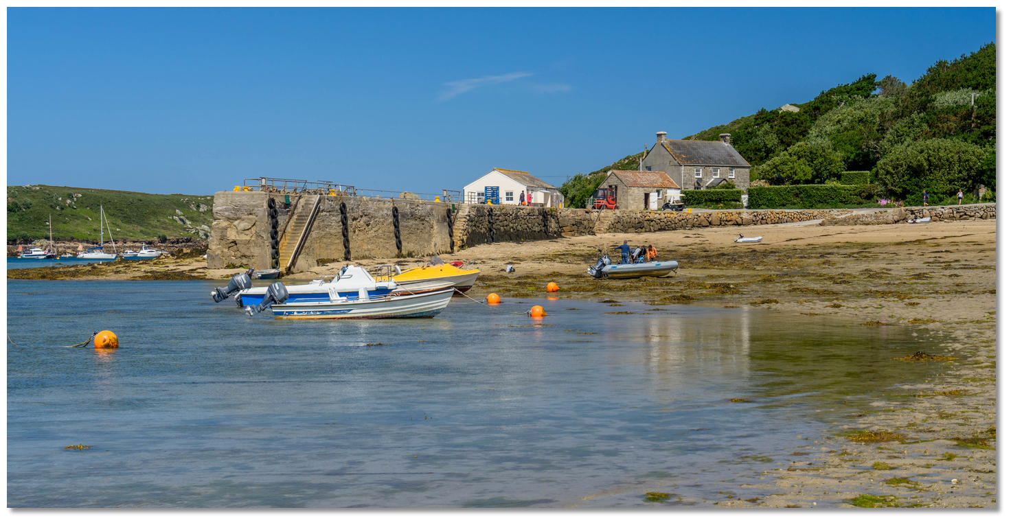 New Grimsby Quay at low water
Image: Michael Harpur
It is possible to anchor before Hangman Island and the Tower in 7 to 12 metres, or further down the channel beyond the moorings in 0.5 metres or take to the ground at low water. Between these, there are 20 swing moorings, including two large buoys at the north end of the trot for yachts of up to 25 metres (80ft) long. No bookings are taken for moorings and they are allocated on a first-come-first-served basis. Further information available from the Harbourmaster, Adam O’Neill
 +44 1720 423653,
  +44 7778 601237,
  harbourmaster@tresco.co.uk,
  www.tresco.co.uk/arriving/moorings.
  Bryher Quay and Anneka's Quay on Bryher at low water
Image: Michael Harpur
Prices [2019] are £20 per boat per night or £30 for the large moorings and harbour dues of £5 per night are charged to anchor. All of these fees include refuse disposal and water on Tresco. Vessels stay for two nights get the third free. The mooring fee is collected by Adam when he does his rounds or can be paid at the New Inn and Island Office.
 New Grimsby Sound as seen from the south
Image: Michael Harpur
How to get in?
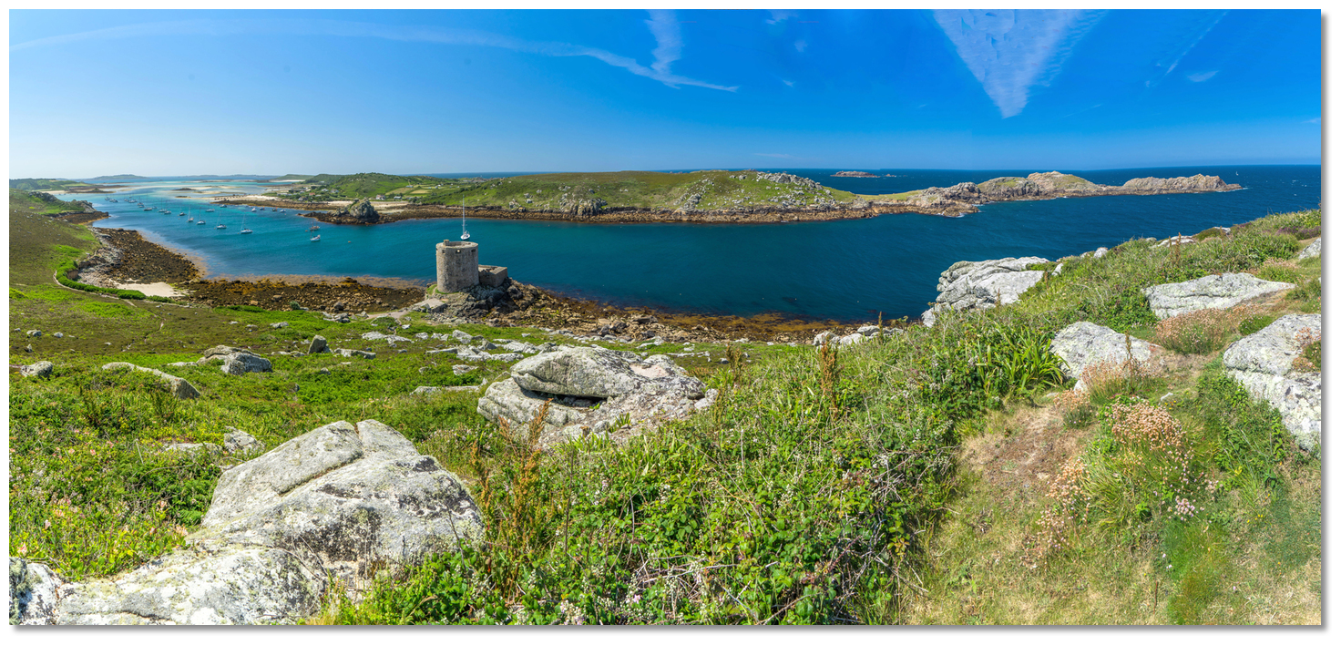 New Grimsby Sound as seen from Tresco
Image: Michael Harpur
New Grimsby Sound may be approached from seaward by rounding the island group from the west or the east or via a direct approach from the mainland. It may also be approached from St Mary's Road or over Tresco Flats.
 Tresco Flats as seen from Bryher
Image: Michael Harpur
The cut through the flats requires moderately good visibility and an adequate rise of tide. Conservatively planning for a maximum drying height of 1.7 metres, this would provide adequate water for most leisure craft 2 hours either side of high water, with the prudent making the approach during the rise. It can provide an enjoyable piece of navigation in suitable conditions and this approach is described in the route Tresco Channel crossing the Tresco Flats
 .
. Round Island's white lighthouse makes an excelent daymark
Image: Michael Harpur
 Use southwestern England’s coastal overview from Land's End to Isles of Scilly
  for approaches. Make an approach from the mainland, or for those going around the group east-around or anticlockwise being the easier option, that passes more than a ¼ of a mile north of White Island. Round Island is positively identifiable by its prominent all-white lighthouse, Fl.10s55m18M, that provides an excellent daymark for the north end of the archipelago.
 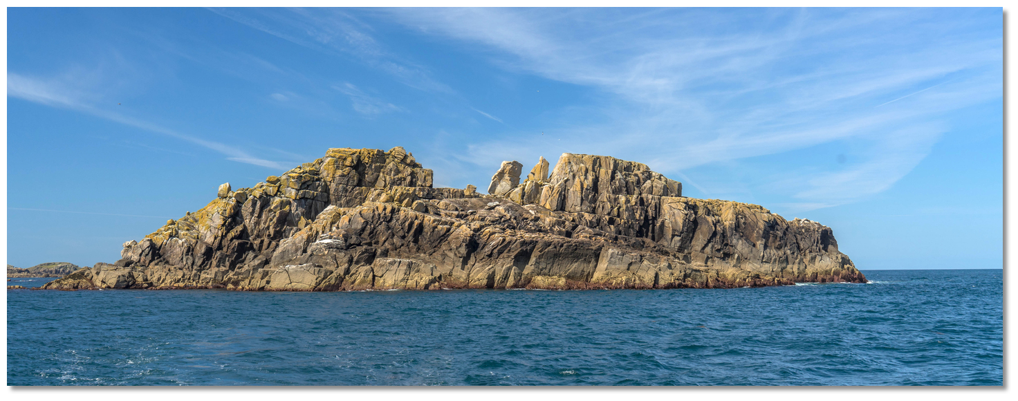 Men-a-vaur
Image: Michael Harpur
Proceed westward past Men-a-vaur at a sensible distance. Although appearing as one isolate rock is a cluster of three tall and peculiarly symmetrical rocks 19, 31 and 35 metres high respectively. Shipman Head will be clearly visible a mile to the southwest at this stage but do not cut in, stay to seaward to avoid the Kettles.
 Shipman Head as seen from close northeast
Image: Michael Harpur
A back-bearing of about 066° T of the north end of Men-a-vaur keeping it in-line with the north end of Round Island behind clears all dangers for this leg. After about a mile, prepare to pick up the haven’s charted leading mark that leads into New Grimsby Sound between Bryher and Tresco.

 The entrance between Shipman Head and Kettle Bottom Ledge
Image: Michael Harpur
The entrance to New Grimsby Sound lies between Shipman Head to the west and Kettle Bottom Ledge. Shipman Head is the northernmost point on Bryher. It stands at the head of a long, undulating and rocky promontory that is steep-to and it presents a very visible head to the channel. The waters inside the head are deep and ships can sail in under Shipman Head.
 Kettle with Men-a-vaur and Round Island in the backdrop
Image: Michael Harpur
The primary dangers are Kettle and the outer Kettle Bottom part of a drying rocky ledge that extends a ¼ of a mile to the northwest point of Tresco. Kettle always shows, standing 3 metres above water, but Kettle Bottom, situated about 200 metres west by northwest of Kettle, covers and uncovers to dry to 3.2 metres. However, at high water, if there is the remotest groundswell Kettle Bottom will make itself known by its surge. From 3 to 4 hours after HW Dover overfalls can also occur off Kettle Bottom Ledge.
 Yachts exiting northward to safely pass Kettle Bottom
Image: Michael Harpur
400 metres southward of Kettle Bottom, at the entrance to the Sound on the Tresco side, there is a separate danger called the Little Kettle rocks. Drying to 1.4 metres, they extend out 150 metres north-westward of Gimble Point.
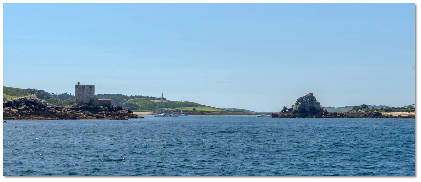 Star Castle Hotel on the west side of Hangman Island on 157° T
Image: Michael Harpur
 The initial fix is set on the well-charted Star Castle Hotel on the west side of Hangman Island that is visible from some distance to seaward. Hangman Island is a prominent 16 metres high pyramid-shaped islet that stands almost central in the sound but it is joined to Bryher at low water on the western side. The transit is formed when the Star Castle Hotel, on St Mary’s Garrison Hill the westernmost part of the island and close west of Hugh Town, is on the west side, right-hand side, of Hangman Island, presenting a bearing of 157° T. From the initial fix steer in on 157° T but do not pass the 50-metre contour until the alignment can be identified.
 The transit not only clears all the dangerous rocks on the west side of the sound but it also helps the helm not to be set off by the tide that attains rates in excess of 2 knots at springs and sets across the entrance, running east at HW Dover +0115, and west HW Dover -0510.
 The promontory leading out to Shipman Head as seen from Tresco
Image: Michael Harpur
If visibility is poor and the transit cannot be easily seen there is another safe approach. Should there be absolute confidence that the vessels is positioned over the entrance to the sound, the flat-topped rounded stone tower of Cromwell's Castle is clearly identifiable opposite Hangman Island, then simply passing in 100 to 200 metres of the steep-to Shipman Head is an alternate safe approach. The Kettles are the primary dangers and although relatively narrow, the Kettles always show themselves and the entrance to the Sound is deep and clean. Ease into the centre of the sound when Cromwell's Castle is about 100 metres off.
 Yacht anchored off Cromwell's Castle
 Image: Michael Harpur
 The anchorage lies above the moorings. Depths range between 7 to 11 metres with good mostly sand holding.
  The main trot of moorings off the Tresco shore
Image: Michael Harpur
The first of the pair of large boat moorings will be encountered mid-channel between Cromwell’s Castle and Hangman Island, the latter soon after. Opposite this and close to the Tresco shore eastward of Hangman Island, where the depths reduce to between 3 to 4 metres, the main trot of moorings commences. These are rated for craft under 15 metres (50ft) and 15 tons and carry LAT of 5 metres descending to 2.1. The moorings have a short length of chain attached which can be brought up with the pick-up buoy and made fast. If it gets in any way rough it is advisable to run additional lines with chain and or shackles through this.
.jpg) Shallower draught vessels anchored below the moorings (right)
Shallower draught vessels anchored below the moorings (right)Image: Michael Harpur
It is also possible for shallower draft vessels to anchor beyond moorings in 0.5 metres or take to the bottom at low water.
Land on Anneka's Quay at Tresco, or on the quay on Bryher but pull the dinghy well clear of the seaward end of the pier as these are actively used by the island ferries. Alternatively New Grimsby Harbour on Tresco. All piers dry at low water with Bryher's northernmost Anneka's Quay carrying water for the longest.
Why visit here?
New Grimsby most likely derives its name from the Norse Grims-by, meaning a person's name such as 'Grimr's' or 'Grim' with the suffix of by the Old Norse word for village. It is thought that the name comes from the Vikings who were significant early occupants of the islands. King Olaf Trygvasson
Image: Public Domain
It was no great invasion and some of the incidents are mentioned in the famous Norse historical narrative the Orkneyinga saga. The most significant record surrounds King Olaf Trygvasson of Norway in and around 993 AD. The sagas record how he and his fleet of ninety-three ships were harrying the coasts of England when a contrary wind brought them offshore. This brought them to Scilly, referred to in the Orkneyinga saga as Syllingar, where he came upon "a famous abbot, the head of a great cloister". Most probably this was the remnants of a settlement that had been founded on St Helen's during the 8th to 10th Century, the ruins of which known as St Elidius Hermitage can be visited today, see St Helen's Pool. It probably only amounted to a cell of one or at most two Benedictine monks living among the granite rocks of the small island. Nevertheless, one of the monks believed to be the hermit monk Saint Lide, more regularly known by its Latinization Elidius, reputedly a bishop also the son of a king, possessed the power of prophecy that was so convincing he converted Olaf and all his company to Christianity. Departing Scilly, Olaf devoted his energies to preaching the gospel and was credited with building the first Christian church in Norway, in 995 AD, as well as founding the city of Trondheim in 997 AD. In time Elidius became the patron saint of the Isles of Scilly.
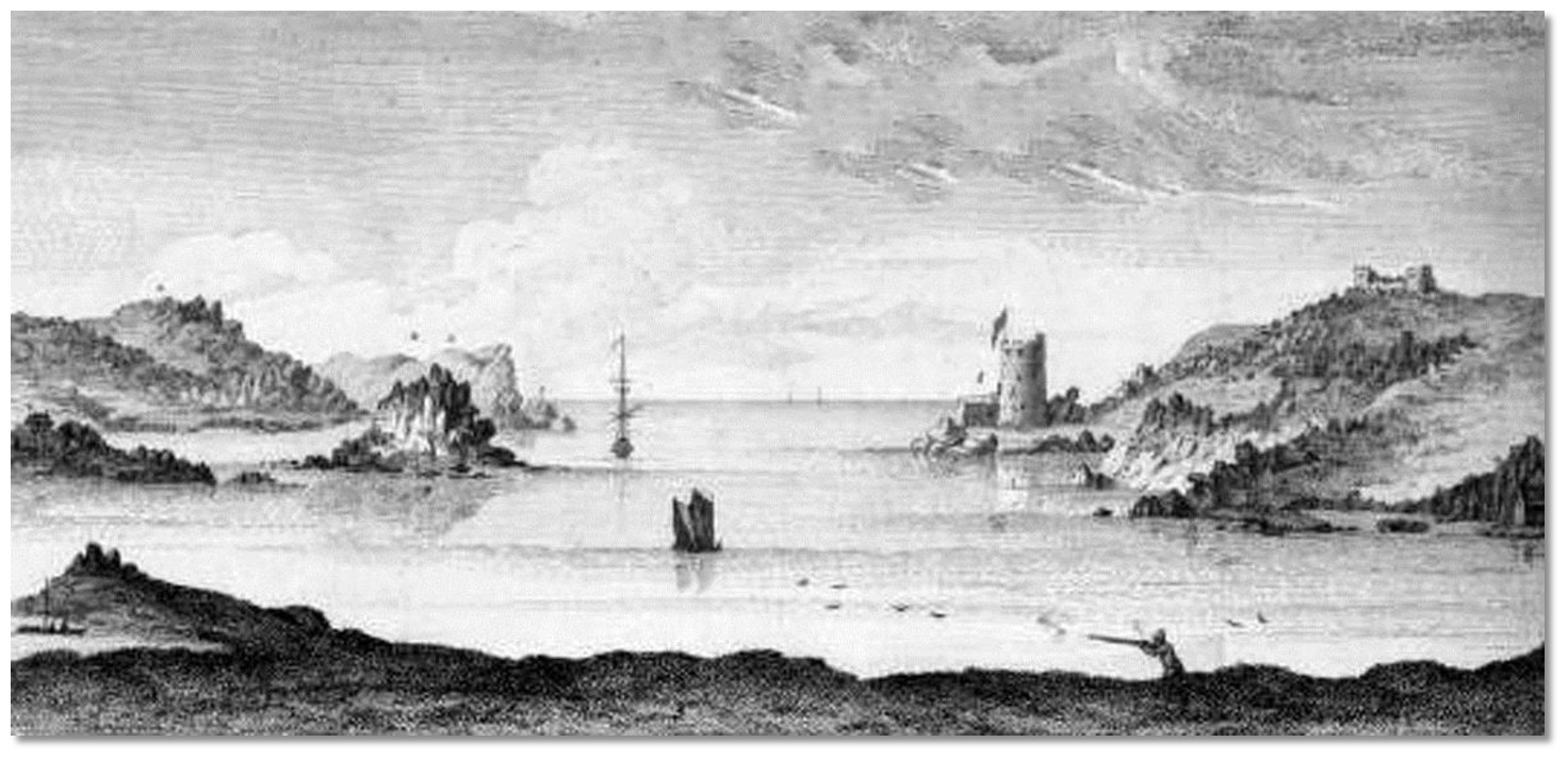 New Grimsby Harbour in 1756
Image: Public Domain
However, the word 'Viking' in old Norse means 'pirate raid' and not all such visits were so inclined towards theology. The Orkneyinga saga also described a later raid by Thorbjorn Clerk who "won a great victory and a massive share of plunder" by attacking the island of St Mary’s, recorded as Maríuhöfn, and Tresco in 1151. Tavistock Abbey records noted in 1209 that the locals from Tresco were sick of such raids and after capturing a band of 112 raiders or pirates, who called themselves the "Sea Kings", beheaded then all in a single day. But the battles with the pirates and raiders raged on until by 1351 they had destroyed most of the Abbey property.
 The remains of the Benedictine priory of St Nicholas in Tresco Abbey Gardens
Image: Visit Isles of Scilly
Although it may well have closed earlier, what would finally put pay to the Abbey was the Dissolution of the Monasteries. This was the case for the island group too, as from this time onward it was England's wars and the strategic importance of the island group positioned at the mouth of the Western Approaches that would shape the island's destiny thereafter.
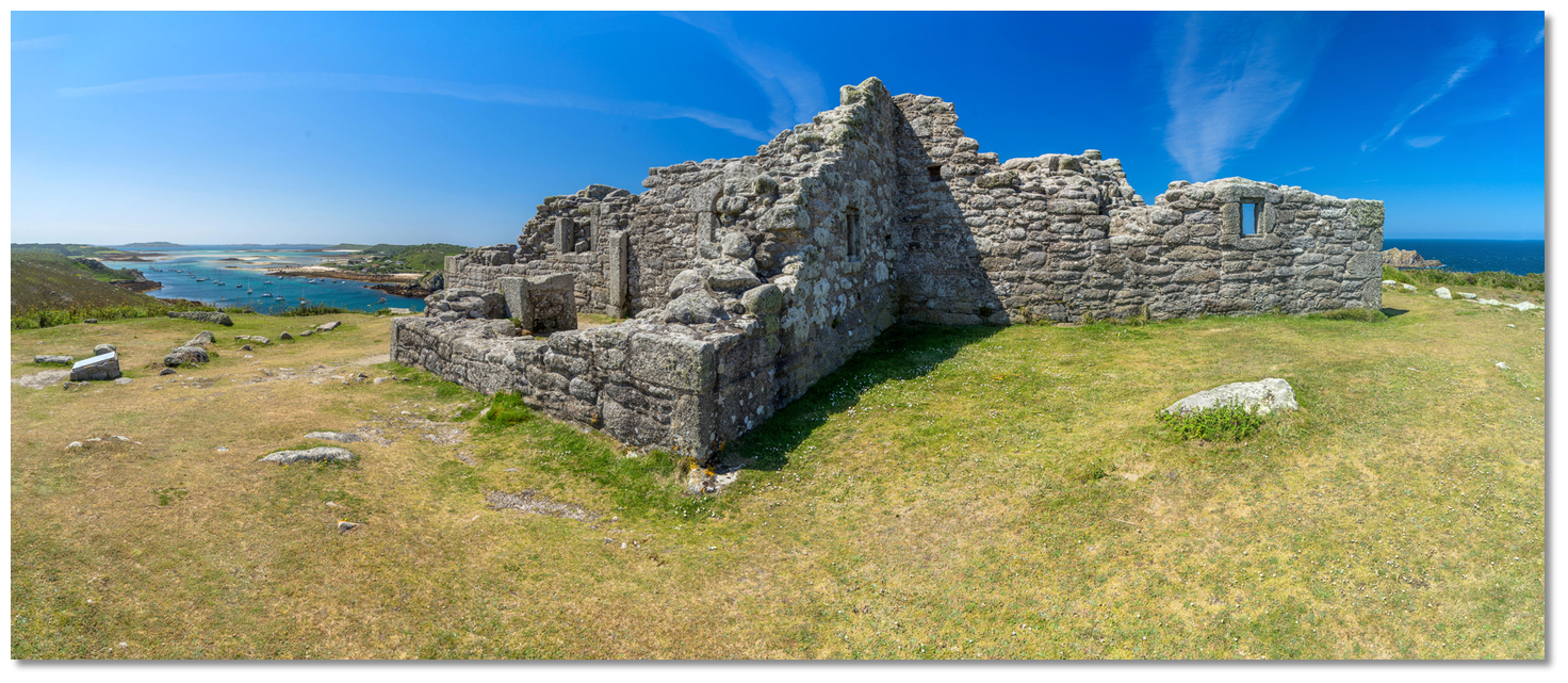 The remains of King Charles’ Castle
Image: Michael Harpur
The first fortification on the islands, in the first years of Edward VI’s reign, 1547 – 1553, seemed to have been focussed on Tresco. King Charles’ Castle, overlooking New Grimsby, and the Old Blockhouse, overlooking Old Grimsby, were built from 1548 onwards to protect the islands from French attack. Then the focus was switched to Saint Mary’s and the formidable multi-period developments on Garrison Hill which became the main fort in the Isles of Scilly. The island's major conflict was to occur during the Civil War in which Tresco changed hands twice and Scilly was to remain the last Civil War Royalist stronghold. Because St Mary’s defences were superior, it was upon Tresco that one of the Civil Wars final battles was to play out in 1651. This was when the Parliamentarians sent Sir Robert Blake, the most successful admiral of the 17th century, with a naval task force to recapture the isles as discussed in St Mary’s
 story.
 Northwithiel as seen from Tresco with St Helen's and St Helen's Pool behind, Tean right
Image: Michael Harpur
The pivotal days of the campaign occurred after Blake's arrived at St Helen's Pool and set about taking the harbour of Old Grimsby by an amphibious assault. His initial attack proved a dismal failure. One group who landed on a rocky section of the shore were driven back by heavy fire from Royalist musketeers and another section was said to be unable to land owing to strong tides so they came ashore instead on the islet of Northwithiel 300 metres from Tressco's Merchant's Point. When the effort was finally abandoned the main body retreated to the island of Tean.
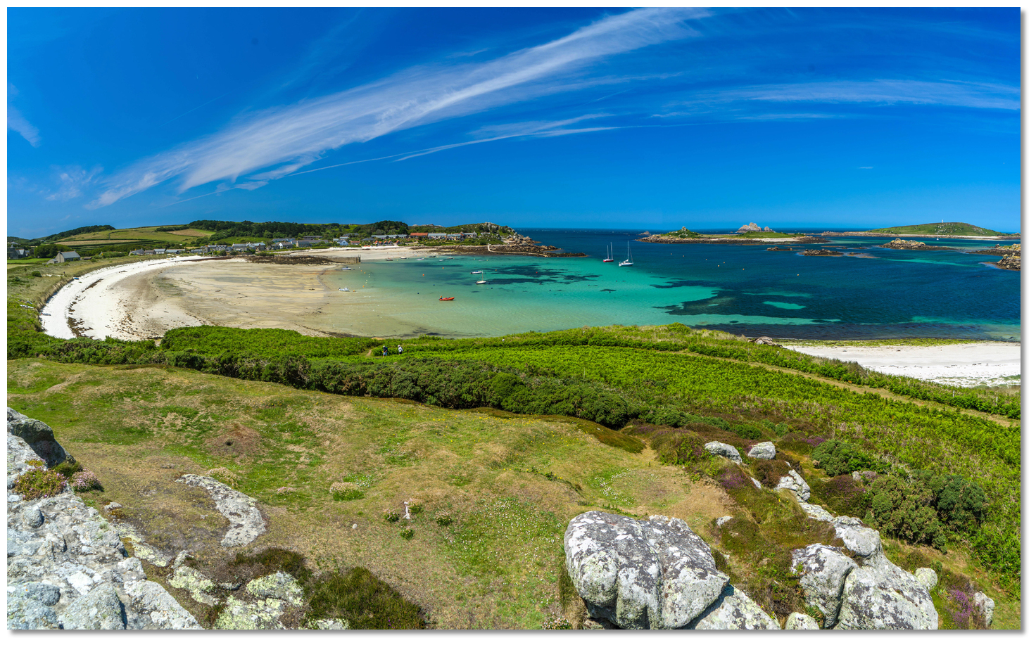 The beach where the Commonwealth troops overpowered the Royalists
Image: Michael Harpur
However, that night they quietly regrouped left their cam fires burning as decoys and under the cover of dark the soldiers started to land on the beach of Old Grimsby. A Royalist counter-attack forced the Commonwealth troops back to the water's edge but as Blake’s soldiers started to land in numbers the Royalists were gradually overwhelmed and routed. They retreated to the stronghold on St Mary's in such haste that forty of their number drowned in the process, three times the number lost in the battle upon the beach.
 Cannons in King Charle's Castle's could not be dipped to engage vessels
in the harbour
Image: Michael Harpur
Blake then simply bypassed King Charles' Castle and marched south to use Carne Near, the southwesternmost point of Tresco, as a position to bombard St Mary’s Pool and St Mary's. With this in hand, he sent a detachment to address the castle. Despite its name was truly an artillery fort designed to guard the entrance channel leading into the New Grimsby and was entirely exposed to a land assault. To counter this weakness the fort had an earthwork bank and a ditch featuring two bastions added to defend itself. But in the event, these defences proved of little use when the Parliamentary soldiers attacked it. Cut off and providing no strategic advantage the Royalist gave it up chose to blow it up to prevent its capture as they fought their retreat. With the fort taken, Blake moved his fleet into New Grimsby Sound. St Mary's faired little better. With no hope of relief, St Mary’s Pool and the island under bombardment from Carne Near, proceedings came to a quick end there too although via an amicable treaty.
 Cromwell's Castle and King Charles Castle on the hill above
Image: Michael Harpur
Much of the infrastructure from the time can be seen from the anchorage today. The remains of King Charles's Castle stand on the hill above. A hike up shows it was a position of great strength from which to defend the harbour from a near enemy if not the north end of the island group. But it was not without its flaws and not just its exposure to a land attack. Sited 40 metres (130 ft) above sea level its guns could only fire at enemy ships approaching the harbour but not within it. At the time cannons could not be dipped to point downwards as the front-loading cannonballs would simply roll out of their muzzles. This made the siting of the castle much less effective in defending Tresco Sound. To compensate for this weakness a Tudor blockhouse was constructed by 1554, where Cromwell’s Castle now stands, overlooking the harbour site to command the New Grimsby Channel. It took the form of a circular tower similar in type to the core block of the large Henrician castles and it would have easily engaged any ships that managed to evade fire from King Charle’s Castle.
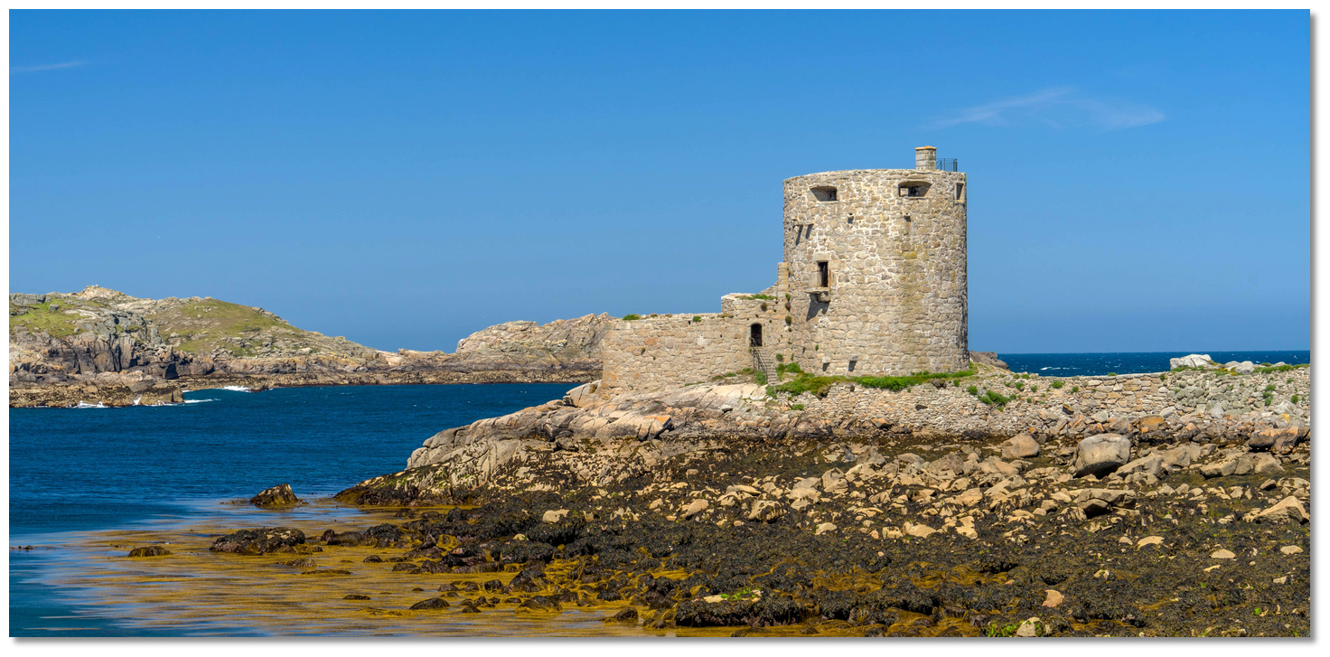 Cromwell's Castle
Image: Michael Harpur
The signature piece of the anchorage is, of course, Cromwell's Castle situated below on rocks at water's edge on the east side of the entrance to the harbour. Built in 1652, it following swiftly on Blake’s success to reinforce his base, it defended the islands against invasion by the Dutch and guarded one of the main routes of entry to the heart of the islands. Sadly, much of its stone was scavenged from King Charles’ Castle above.
 View from the original gun platform in the roof of Cromwell's Tower
Image: Michael Harpur
Cromwell's Castle was sited in a much better position to defend the harbour. It was an efficient cannon tower with its guns originally mounted on the roof and above the living quarters. The tower is 18 metres (60 feet) high, and about a 45 metres (150 feet) in circumference. The walls are nearly 4 metres (12 feet thick) with raised on arches. The roof is flat, and bomb-proof and has a battery for small cannon, with a parapet wall nearly 2 metres (6 feet) in height. No fleet could hope to land troops on this side of Tresco unless it had first destroyed or captured the castle. However, constructed in the most substantial manner, paved with stone, and defended by a thick parapet, with its guns sweep the harbour in every direction, the chances of destroying the castle by gunfire from the sea were very remote. The fort was so well constructed, with an appearance that appears to anticipate the later Martello towers, that it was worthy of an update a century later. It was in the mid-18th-century that the lower gun platform was added on the seaward side.
 View over the entrance to New Grimsby Sound from the lower gun platform
Image: Michael Harpur
Standing opposite the castle in the channel between Bryher and Tresco, Hangman’s Island acquired its macabre name during the retaking of the island by the Parliamentary forces. It was here that Blake grimly dispatched the most ardent Royalists he encountered on the island. It remained in service to dispatch ultimate punishment for captured pirates and royalists attempting to flee England.
 Tresco in bloom
Image: Visit Isles of Scilly
Today it is a much more relaxed environment. Cromwell's Castle and King Charles Castle are managed by English Heritage and open to visitors. Hangman's Island is still home to a set of gallows, a grim reminder of its pas purpose as if the name wasn't enough. All of this can be enjoyed from the anchorage and taken in with a pint in the tiny Fraggle Rock Inn, reputedly England's westernmost public house.
 The scattering of houses that make up Bryher village as seen from Tresco
Image: Michael Harpur
The anchorage offers two fabulous islands to explore Tresco on the east side and Bryer on the west. Measuring two miles by one mile, Tresco is the second-largest island of the archipelago, and the second most visited after St Mary’s. Today the sparse ruins of the Benedictine priory of St Nicholas are home to Tresco Abbey Gardens which is an oasis of exotic greenery that contains 3000 species from around the world. Some of the best beaches in the country can be found around its shores, including the sand and shell beach of Appletree Bay, and the more grandiose curve of sand at Pentle Bay, both near the Abbey Garden. Tresco in late summer to see huge clumps of witchy belladonnas pushing through bramble and bracken it is a spectacular island.
 View over St Mary's Pool from the south end of Bryher
Image: Michael Harpur
Bryher to the west is a tough, independent little island that is open to the full force of Atlantic. With a population of just over 70 people, it is the Scilly’s smallest and wildest inhabited island. Most of the houses are near the harbour in Bryher Village on the shoreline near the anchorage. Bryher’s western side is exposed to the full force of the Atlantic weather, and the appropriately named Hell Bay makes a powerful sight during a winter gale. Blanketed with heather and bracken, and topped by a range of miniature hills at various points along its eastern side from which you can drink in some of the finest views in all of Scilly, it’s a walker paradise.
 Sunset over New Grimsby Sound
Image: Graham Loveland via CC BY-SA 2.0
From a boating point of view, this is one of the best anchorages Scilly has to offer. Its protection is very good, the water is deep and clear and it has moderately good supplies and facilities. All of this in an absolutely beautiful setting, steeped in tangible history, with two magnificent islands that can be explore on foot on either side. Or you can just sit in the cockpit and take in a picture-perfect historic vista from the anchorage awaiting it to be capped off by a wonderful sunset over Shipman Head. Add some sunshine of which Scilly is disproportionately blessed, and in sailing terms, it does not get much better than this.
What facilities are available?
Drinking water is available from a tap located on New Grimsby Quay and next to the Ruin Beach Cafe at Old Grimsby. Showers and internet are available at The New Inn. Diesel, petrol, laundry by arrangement at Tresco Island Office. Waste disposal in the dedicated facilities on New Grimsby and Old Grimsby Quays. Please ensure you separate your waste into food waste, glass, metal, paper and cardboard, and other waste before disposal. England's most westerly pub the Fraggle Rock Café close ashore on Bryer, +44 1720 422 222, provides a daily lunch and evening meals, drinks, snacks (including the famous crab double-decker Sandwich).Marine engineering services are available from Bryher Marine Engineering on Bryher - please call +44 1720 423047.
With thanks to:
Michael Harpur, eOceanic.Add your review or comment:
Please log in to leave a review of this haven.
Please note eOceanic makes no guarantee of the validity of this information, we have not visited this haven and do not have first-hand experience to qualify the data. Although the contributors are vetted by peer review as practised authorities, they are in no way, whatsoever, responsible for the accuracy of their contributions. It is essential that you thoroughly check the accuracy and suitability for your vessel of any waypoints offered in any context plus the precision of your GPS. Any data provided on this page is entirely used at your own risk and you must read our legal page if you view data on this site. Free to use sea charts courtesy of Navionics.


