
Although not quite as good as its near neighbouring New Grimsby Sound, Old Grimsby provides a good berth that is one of the best the island group has to offer. Good shelter may be had here from north round through east through south to the west but it is open to swell if the wind veers north of west. It is also slightly more challenging to enter than New Grimsby Sound as it has a shoal in its entrance and there is no easily recognisable sightline to provide safe access. Attentive daylight navigation is therefore required to make any approach and although it can be accessed at any stage of the tide the ideal time to enter is at low water when its dangers all show themselves.
Keyfacts for Old Grimsby


Nature


Considerations

Protected sectors


Summary
A good location with attentive navigation required for access.


Nature


Considerations

Position and approaches
Haven position
 49° 57.742' N, 006° 19.807' W
THis is the position of the first mooring in the channel.
What is the initial fix?
 49° 58.430' N, 006° 20.845' W
 What are the key points of the approach?
 .
.- Approach from the northwest between Kettle Bottom and Golden Ball.
- Steer south by southeastward to pass 100 to 150 metres off the Tresco shoreline to avoid the Sound's primary hazard which is the Little Kittern ledge.
- With Little Kittern to port, it is safe to steer to pass midway between Norwethal and Merchant’s Point and into the anchoring and mooring area.
Not what you need?
- St Helen's Pool - 0.4 nautical miles NE
- New Grimsby - 0.8 nautical miles W
- Tean Sound - 1 nautical miles ENE
- Green Bay - 1 nautical miles SW
- Higher Town Bay - 1.9 nautical miles E
- Bull's Porth - 2.1 nautical miles E
- Bread & Cheese Cove - 2.3 nautical miles E
- Windmill Cove - 2.5 nautical miles SE
- Perpitch - 2.5 nautical miles E
- St Mary's Pool - 2.7 nautical miles SSE
- St Helen's Pool - 0.4 miles NE
- New Grimsby - 0.8 miles W
- Tean Sound - 1 miles ENE
- Green Bay - 1 miles SW
- Higher Town Bay - 1.9 miles E
- Bull's Porth - 2.1 miles E
- Bread & Cheese Cove - 2.3 miles E
- Windmill Cove - 2.5 miles SE
- Perpitch - 2.5 miles E
- St Mary's Pool - 2.7 miles SSE
Chart
What's the story here?
 Old Grimsby as seen from Merchant's Point
Image: Michael Harpur
Old Grimsby is one of the two principal settlements on the island of Tresco with New Grimsby being the other. It is located on the east side of the island and fronted by a harbour with a drying quay. The harbour is set into a bay that comprises Raven's Porth and Green Forth, that are separated by its central Quay and both dry to 2.3 and 2.2 metres respectively. The island's community centre and adjacent to it the primary school for Tresco and Bryher lie ashore. There is also a café, Ruin Beach, by the beach in the main part of the settlement. At the southern end of the bay is a 16th-century Blockhouse that has guarded the historic anchorage since Tudor times and beyond this are a string of wide white sand beaches.
 Old Grimsby Quay
Image: Michael Harpur
Old Grimsby provides a very well sheltered anchorage during south-westerlies and it is the best Tresco alternative to New Grimsby Sound. The anchoring area lies on either end but well clear of the moorings in 2.5 metres of water. The moorings consist of 7 swing moorings laid directly offshore of the harbour bay. It also is a means to enter into the group from seaward and then, in good conditions, with sufficient rise of tide, preferably flooding, use the inner channels of Old Grimsby Sound from St Mary’s Road
 and Crow Sound to Tean Sound
  to access to all the havens to the northeast, east as well as connecting to St Mary's Road. With sufficient tide, it is possible to cross south of Peashopper and Foreman's, Tide Rock and the southern end of the Long Ledge to cut into Helens Pool and Tean Sound.
 Shoal draught vessels anchored inside the moorings
Image: Michael Harpur
Moorings are allocated on a first-come-first-served basis and no advanced bookings are taken. Further information available from the Harbourmaster, Adam O’Neill
 +44 1720 423653,
  +44 7778 601237,
  harbourmaster@tresco.co.uk,
  www.tresco.co.uk/arriving/moorings.
 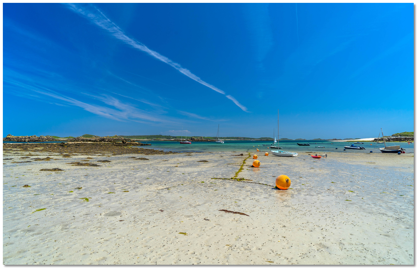 Raven's Porth at low water
Image: Michael Harpur
Prices [2019] are £20 per boat per night with harbour dues of £5 per night are charged to anchor. All of these fees include garbage disposal and water on Tresco. Vessels that stay for two nights get a third free. The mooring fee is collected by Adam when he does his rounds or they can be paid at the Ruin Beach Cafe and Island Office.
How to get in?
 The entrance to Old Grimsby Sound with Gimble Porth opening opposite Little Kittern
Image: Michael Harpur
 Use southwestern England’s coastal overview from Land's End to Isles of Scilly
  for local approaches. Local directions are available in the New Grimsby Sound
  for general approaches. Similar to New Grimsby, Old Grimsby Sound may be approached at high water from the south but in suitable weather with reasonable seas, the easiest approach is from the north and seaward.
 Old Grimsby Sound is entered between the rock formations of Kettle Bottom and Golden Ball situated just over a ½ mile east northeast.
 Kettle with Shipman Head in the backdrop
Image: Michael Harpur
Kettle Bottom is part of a drying rocky ledge that extends a ¼ of a mile to the northwest point of Tresco. Kettle always shows, standing 3 metres above water, but Kettle Bottom, situated about 200 metres west by northwest of Kettle, covers and uncovers to dry to 3.2 metres.
 Golden Ball, Men-a-vaur, Round Island and Golden Ball Brow as seen from Tresco
Image: Michael Harpur
Golden Ball is a small 8 metres high islet near the northwest extremity of an extensive drying ledge that extends a ¼ of a mile southward. Tempting though it may be, it is essential that a vessel approaching from the northeast should not cut in tight around Golden Ball as there are several isolated off-lying rocks to this extensive area of foul ground.
Between this and Saint Helen’s Island, a distance of nearly ½ a mile, is an area of foul ground called Golden Ball Brow upon which the Atlantic normally breaks. From 3 to 4 hours after HW Dover overfalls can also occur across the entrance to the sound between Kettle Bottom and Golden Ball Brow. The helm needs to be watchful for a strong cross-tides off the north entrance to Old Grimsby Sound. At springs they can attain rates of up to 2 kn.
 Golden Ball and Golden Ball Brow as seen over Little Kittern showing its head
Image: Michael Harpur
Inside the entrance, the primary danger of Old Grimsby Sound is the drying Little Kittern shoal that lies close to the centre of the channel, about 300 metres eastward of the small Norwethal. It is important to note that this position is from the islet itself and not the drying rocks and that extend a further 300 metres northwestward of Norwethal at low water. It is a rocky ledge that dries to dries 1.9 metres. But similar to New Grimsby once again, deep water with no outlies lies on the southern or starboard side of Old Grimsby Sound, to within about 100 – 150 metres of the Tresco shore.
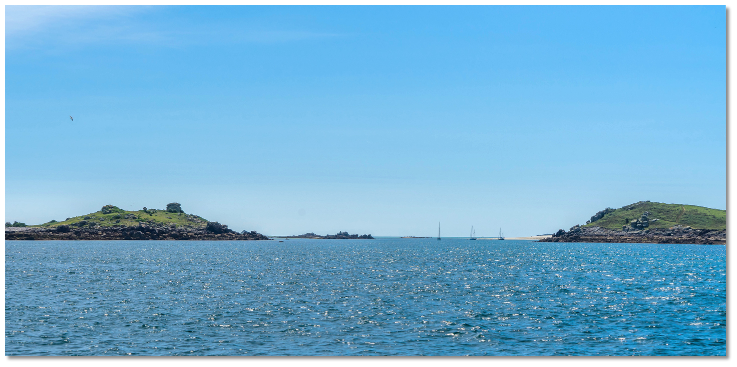 Norwethal, left, with its flat topped rock at its crest, Little Kittern just
showing and Merchant’s Point
Image: Michael Harpur
 This is set 200 metres outside a line joining Kettle Bottom and Golden Ball, with the ruins of the old blockhouse in line with the eastern edge of Merchant’s Point.
 Before proceeding it is essential that there is absolute confidence that the vessel is positioned over the entrance to Old Grimsby Sound and the key marks are identifiable. Kettle Bottom and Golden Ball should be seen either side and it should be possible to see clearly into the Sound. The small island of Norwethal, on the eastern side, will be seen to have a distinctive squarish rock formation with a convex top at its highest point, 22 metres. Merchant's Point should be seen on the opposite and the beach with the ruins of the old battery above it further within.
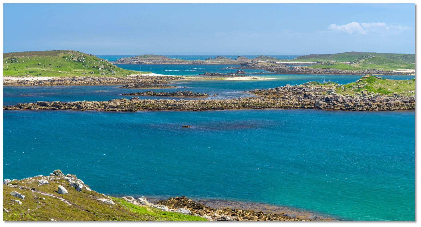 The Little Kittern shoal showing its head
Image: Michael Harpur
All these positively identified steer south by southeastward to pass 100 to 150 metres off the Tresco shoreline under Tregarthen Hill. Be watchful for the cross tide at the entrance and keep a sharp eye on the sounder to follow the 5-metre contour of the Tresco shore.
When the sandy bay of Grimble Porth opens to starboard Little Kittern is to port. It lies on a line drawn from the centre of Grimble Porth bay out to the lighthouse on Round Island.
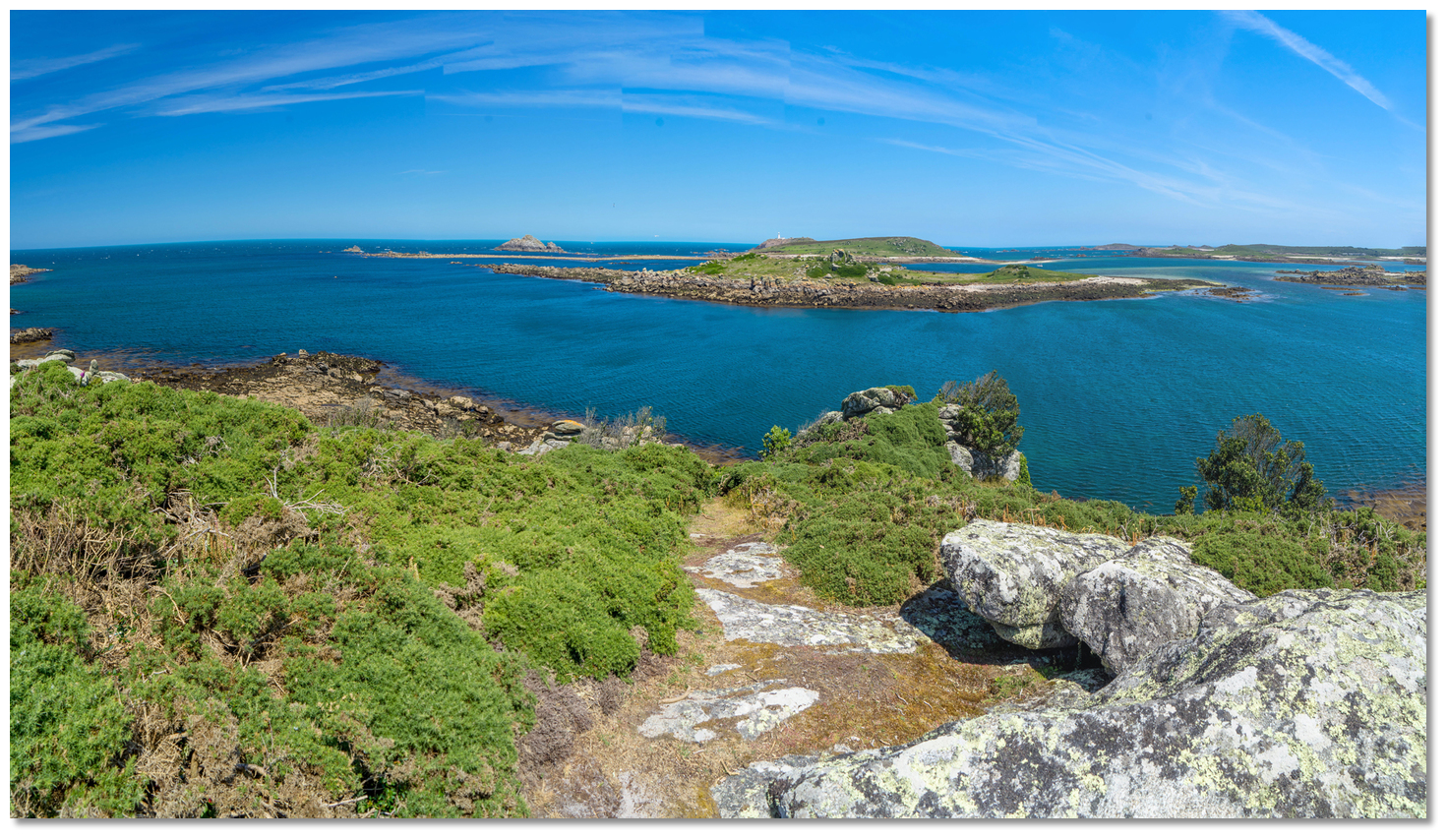 The channel between Norwethal and Merchants Point as seen from Tresco
Image: Michael Harpur
With Grimble Porth open and Little Kittern to port, it is safe to steer to pass midway between Norwethal and Merchant’s Point. Once between these, the line of moorings will be seen in the channel ahead.
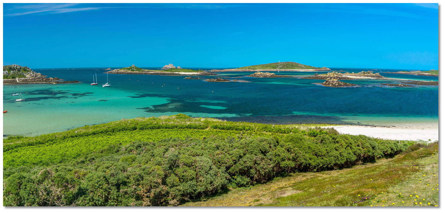 Middle Ledge, Peashopper, Crow's Island and Foreman's as seen from the Old
Blockhouse
Image: Michael Harpur
The channel is only about 300 metres wide lying in a northeast/southeast direction. It is hemmed in by the Middle Ledge that has a couple of heads that are always 0.3 metres above water. To the northeast round to east are the rock islands of Peashopper (8 metres high), Crow's Island (7 metres high) and Foreman's (8 metres high) which dry to connect to each other by a series of rock ledges at low water.
 Yacht approaching the moorings between Norwethal and Merchants Point
Image: Michael Harpur
 Pick up one of the moorings or anchor either side in 2.5 metres. The bottom is sand with some patches of weed that will be clearly visible in the crystal clear waters.
 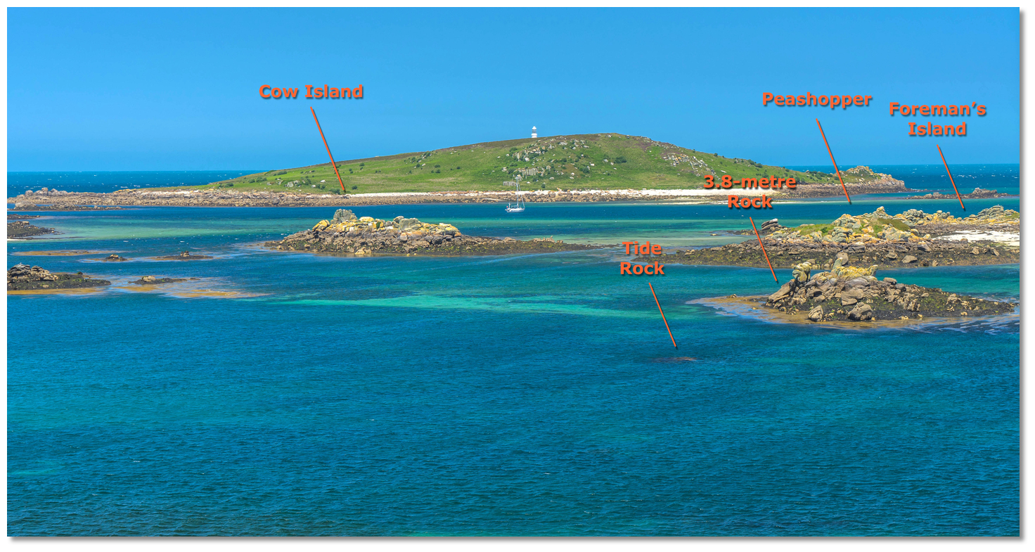 Tide Rock just visible beneath the surface
Image: Michael Harpur
Those anchoring in the southern end should be watchful for Tide Rock that drys to 1.4 metres LAT and lies on the southwest end of the channel, about 200 metres northward of Block House Point. It is the primary covered hazard at the southern end of the harbour. It lies about 100 metres inshore of the 3.8-metre rock on the western extremity of Long Ledge on a line between Block House Point and Peashopper. After this 2 metres may be had for a further 200 meters southeastward. But note the position of a cable that passes out across Green Porth, close south of the quay and lies close south of Tide Rock.
 The view southward over the harbour
Image: Michael Harpur
The moorings are rated for craft under 15 metres (50ft) and 15 tons and carry a LAT of about 3.6 metres. The moorings have a short length of chain attached which can be brought up with the pick-up buoy and made fast. If it gets in any way rough it is advisable to run additional lines with chain and or shackles through this. It is possible to dry out on the beach with the prior consent of the harbourmaster.
Land on the beach by tender on the beach.
Why visit here?
 Augustus Smith
Image: Public Domain
The original name for the island, which included Bryher at the time, was the Cornish Ryn Tewyn meaning 'promontory of sand-dunes'. After receiving the island in 1193 the abbot of Tavistock renamed it 'St. Nicholas's Island' but by 1305 it was called Trescau, meaning 'farm of elder-trees'. By 1540 this had changed to Iniscaw, 'island of elder-trees' before being recorded in an 1814 official publication as Trescaw the origins of its current name.
From a navigation perspective, the 'island of elder-trees' is an appropriately descriptive title, as when approaching from the westward Tresco can be distinguished from Bryher or Samson by having trees. Surprisingly, scarcely a gorse bush grew on the island before a man called Augustus Smith arrived in 1834. He planted sycamore, elm, ilex and Monterey pine throughout the island to provide shelterbelts, mark out the boundaries of fields and to provide tall windbreaks for the private garden he was establishing around his home adjacent to the Abbey. His influence went well beyond growing trees as when it comes to Scilly, Augustus Smith stands foremost amidst three men who would alter the landscape of the island group medieval times.
 The Old Blockhouse overlooking Old Grimsby Harbour
Image: Michael Harpur
The three men in question are Francis Godolphin, Augustus Smith and his nephew Algernon Dorrien Smith who succeeded him to live on Tresco. Francis Godolphin made his mark on the group in the 16th-century during Elizabeth’s reign. This began peacefully, despite the new Queen presiding over a Protestant country encircled by potential Catholic enemies. But in 1570 the first major invasion threats of her reign took place and fearing the Spanish Armada, she granted Godolphin a 38-year lease of Scilly for an annual rent of £20 provided he defended them.
 The commanding view of the harbour from the old Blockhouse gun platform
Image: Michael Harpur
Up to this point, most of the defensive works of the island group were focussed on Tresco King Charles’ Castle on the west side of the island and the Old Blockhouse gun platform guarding Old Grimsby harbour were built from 1548 onwards. Establishing himself as a military commander and Lord Proprietor of Scilly, it was Francis Godolphin who commenced the defences on Garrison Hill, St Mary’s Island that overlook St Mary's Pool and become the island group's primary stronghold. This was at first a defensive position but it had the eight-pointed Star Castle, seen above the harbour today, added as its concluding piece. The military works of Garrison Hill precipitated the development of the quay, now Saint Mary's Harbour, which in turn lead to the Hugh Town settlement to become the capital.
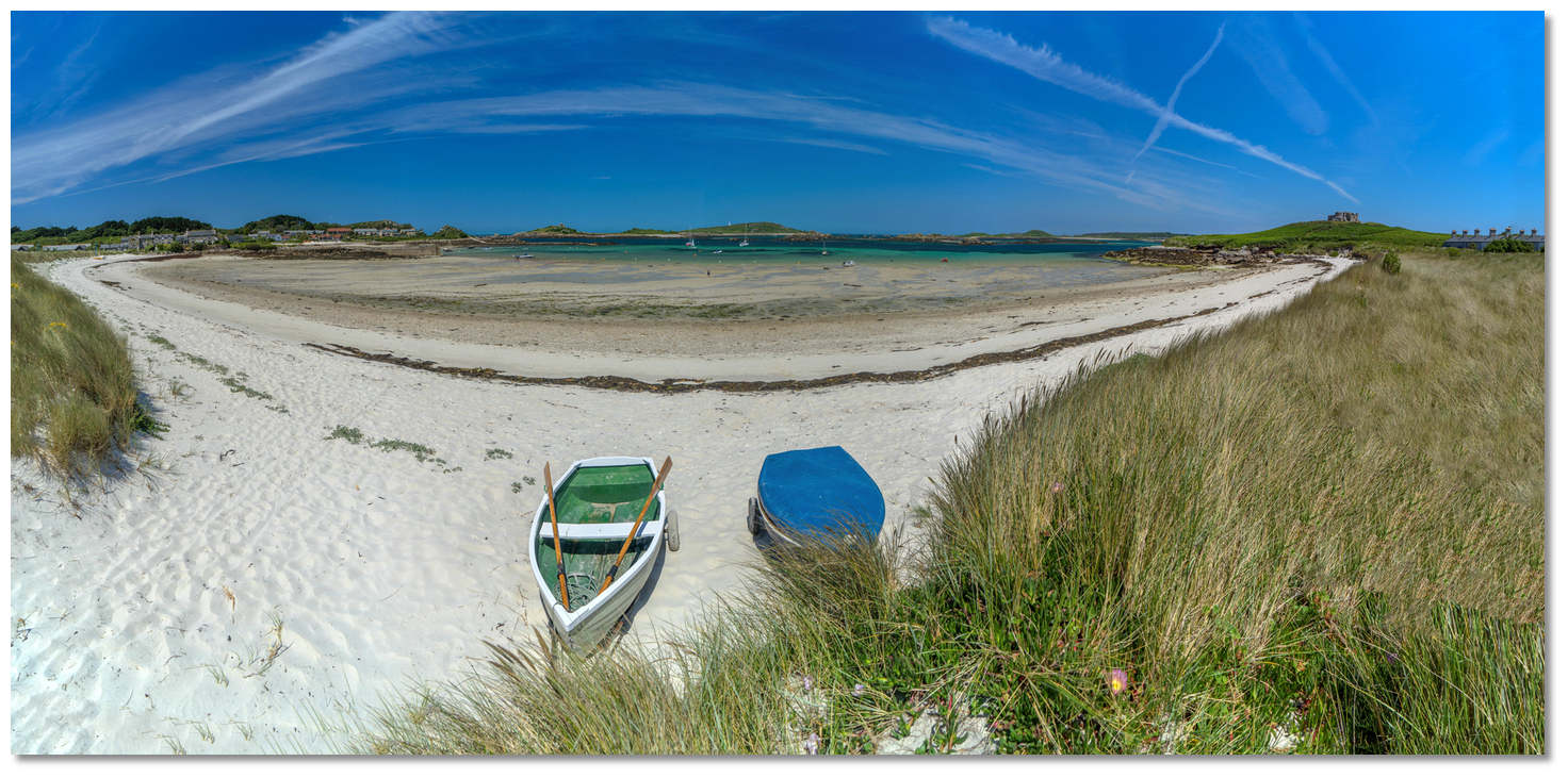 Green Porth and the The Old Blockhouse were at the heart of the battle for
Tresco in 1651
Image: Michael Harpur
The Godolphins and their Osborne relatives would go on to hold the lease for 281 years until 1831 when the islands returned to the direct control of the Crown and the stewardship of the Duchy of Cornwall. During their time the family encouraged Cornish people to settle in Scilly, notably on St Martin’s and they left a sizable mark on the island group. It was, however, Augustus Smith, who took up the lease soon after and, being largely responsible for the economy of the islands as it is today, it was he that would singularly leave the largest mark on Scilly.
 Long Point Landing Ravens Porth
Image: Michael Harpur
Smith was a member of an old Hertfordshire family Smith acquired the lease on the Isles of Scilly in 1834 for £20,000. Erecting his house adjacent to the remains of the 12th-century Benedictine Priory of St Nicholas on Tresco, he created the quasi-aristocratic title Lord Proprietor for himself. Once established he immediately set about the purpose of a reforming governor with some vigour having every intention of changing the islanders' way of life, for the better, as he saw it.
 Grimsby Channel as seen from Cradle Point
Image: Michael Harpur
This was far from universally popular amongst the islanders, but after the Napoleonic Wars, their fortunes were at a low ebb. Previous governors had been absentee landlords who took little interest in the islanders and this lead to misrule by their agents. Farms had become minute and scattered by intergenerational sub-division. This, accompanied by underinvestment, left the population in a state of subsistence where famine was a constant threat. The bottom had also fallen out of the once-reliable kelp burning industry cheaper as imported foreign supplies of soda ash and new industrial chemical processes for the manufacture of alkali mate it obsolete. Some eaked a meagre living out of fishing and a few lucky ones made a small income from pilotage fees, but this was limited, at best. Many resorted to smuggling to make ends meet. Distress was so widespread that a relief committee was set up on the mainland and a fund of £9,000 raised for the islanders.
 Rushy Point
 Image: Michael Harpur
These economic conditions represented the ideal challenge for Smith and he set about his self-appointed role as 'benevolent despot' with some zeal. In fulfilment of a condition of his lease, he was required to build a new quay, connecting Hugh Town’s Old Quay with Rat Island, and he was also obliged to construct the church of St Mary’s in Hugh Town. He quickly tackled the problem of smuggling and then set about reforming the long-neglected leaseholds of the smaller islands. To deal with the scattered by sub-division of farms he introduced a system of inheritance by which land passed only to the eldest son. These he persuaded to grow better varieties of potatoes to capitalise on the island’s natural advantages.
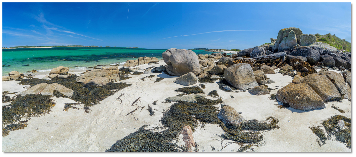 Rushy Point
Image: Michael Harpur
This was the major disruption that cut across society and families. All other offspring, he forced to find alternative employment which he encouraged by financing existing and new local industries. Chief amongst these was shipbuilding where he developed three yards in Hugh Town and he also supported public works such as the removal of rocks from the channel between Tresco and Bryher to make it more navigable. But most of all he sought to enhance the islander’s prospects by education.
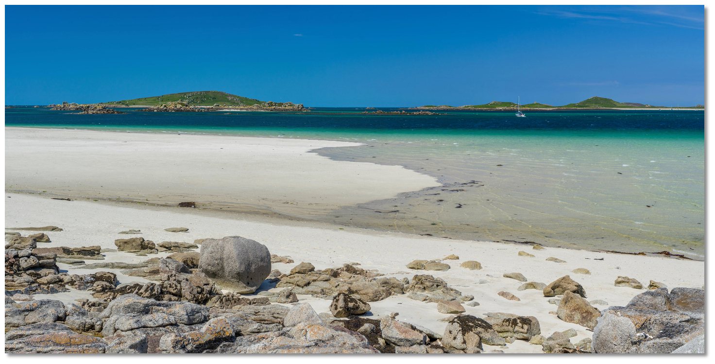 Old Grimsby Channel
Image: Michael Harpur
Before arriving in Scilly Smith was well-known as a Herefordshire philanthropist who used his private wealth to open several non-denominational schools. These were all targeted at 'improving the lot of the labouring classes' and he brought this to the islands to improve the prospects of the young Scillonians. Schools were constructed on St Mary’s, St Martin’s and St Agnes which effectively made education compulsory more than thirty years ahead of the law being introduced on the mainland.
 Beach southward of Rushy Point
 Image: Michael Harpur
But not all of his actions could be described as being beyond critique. Seeing on the island of Samson a vulnerable small population suffering from chronic water shortage and near to starvation, he decided it ceased to be viable for inhabitation. Having a better idea, as he saw it for its use, namely the creation of a deer park. From 1855 he started to encourage those who lived there to leave and, in 1861, he had the remaining families, three or four impoverished households that amounting to ten people in all, hauled out and re-housed elsewhere. Once evicted, he set about grazing his cattle on the island and attempted to establish a deer park on it. This forcible approach did not enjoy much approval and the deer park was a failure. The deer did not like the habitat Samson presented and soon they took advantage of a low tide to escape across the channel to Tresco.
 View over the entrance from wild and rocky northern end of the island
Image: Michael Harpur
Remarkably he remained in charge for 38 years, until his death in 1872, where he left a prosperous island community. He never married but is believed to have had illegitimate children by several of his female servants. Smith was succeeded by his nephew, Thomas Algernon Smith-Dorrien-Smith, who took over as 'Proprietor of the Isles of Scilly' in 1872 and continued the development of the Tresco Abbey Gardens and his uncles' good works.
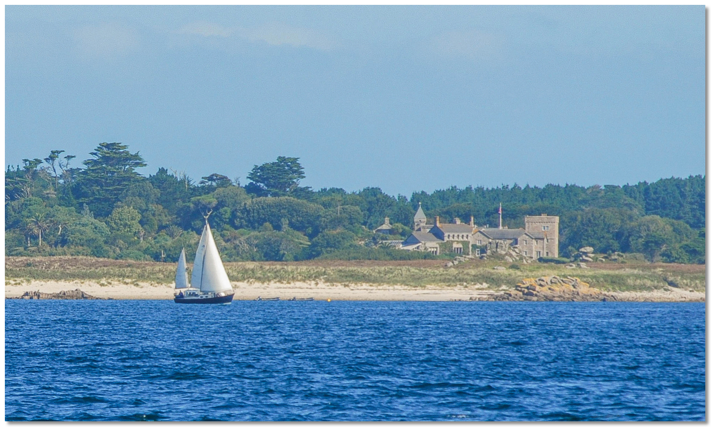 Tresco Abbey as seen from St Mary's Road
Image: Tim Dobson via CC BY-SA 2.0
His mark on the island group was being the first to recognise that frost-free winters with a variation of only 10° C in the mean monthly temperature made it possible to produce flowers earlier here than anywhere on the UK mainland. This potential and, in 1859, the arrival of the railway to Penzance, and its link with a steamer service that begun the previous year, made the transportation of flowers to market within a day viable.
 The Tresco Abbey home of the home Dorrien-Smith family to this day
Image: Burke Corbett
It all started around 1879 when an experimental consignment of cut flowers that were sent to Covent Garden in a hatbox. A lot rode on that small delivery for Scilly as shipbuilding and piloting in the islands had largely come to an end at this juncture and the early potato harvests were failing. Fortunately, the delivery was a success and a Scillonian cut flower industry would blossom that would turn the islands' fortune around for a second time. The long-term success of the industry was largely due to T. A. Dorrien-Smith dedication and direction. He studied the Dutch system of cultivation and, at his own expense, imported thousands of new kinds of bulbs for the islanders to plant in shelterbelts. By the end of the 19th-century, the cut flower trade was flourishing and has made an important contribution to the economy of Scilly ever since. The rail/ferry link also marked the beginning of the tourist industry that now forms the largest part of Scilly’s economy.
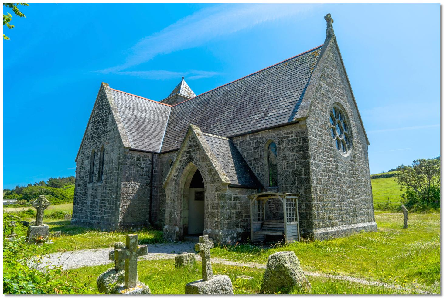 St Nicholas's Church
Image: Michael Harpur
During 1918 the Dorrien-Smith family gave up the lease on all the islands except Tresco which is managed separately from the other islands, under a long-term lease to the family from the Duchy. The remains of steam-heated glasshouses and packing sheds can be seen on many farms. St Nicholas's Church, just in from the beach, was designed and built by him between 1877 and 1879. The open arch-braced roof is supported on stone corbels and it is said that it was designed by a local carpenter who based it on an upturned boat. The subtropical botanical gardens of Tresco Abbey Gardens that the family built are the archipelago's most popular attraction. It remains an oasis of exotic greenery built around the ruins of an old priory. The walls of his uncle's ill-fated deer park, as well as the ruins of the houses belonging to the families he evicted, may also be seen today on Samson.
 Yachts in Old Grimsby Channel
Image: Michael Harpur
From a boating perspective, overlooked at its southern end by the old 16th-century blockhouse, the anchorage is one of the islands best berthing locations. Although access is more difficult than New Grimsby and the anchorage is somewhat more exposed, once you are safely in, you lie land-locked and can go to sea again with any wind. In fine weather, it is often quieter and less crowded than the very popular New Grimsby.
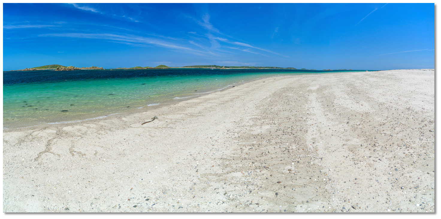 Looking southward alongside the Old Grimsby Channel
Image: Michael Harpur
Walks to the northern part of the island present a wild and rocky and uncultivated, with bare brown downs stretching across from shore to shore. Ashore are magnificent beaches progressing southward to a succession of wide strands that end at the glorious curve of Pentle Bay, which is probably the island's finest beach.
What facilities are available?
Drinking water is available at the side of the Ruin Beach Café. Old Grimsby has showers in the public toilets at the community centre (previous showers no longer available in The New Inn New Grimsby). Diesel, petrol, laundry by arrangement at Tresco Island Office Tresco Stores, New Grimsby +44 1720 422806, Monday – Saturday 0900-1730 and 1000-1300 on Sunday. Waste disposal in the dedicated facilities on New Grimsby and Old Grimsby Quays. Please ensure you separate your waste into food waste, glass, metal, paper and cardboard, and other waste before disposal. Ruin Beach Café ashore serves food and drink with views over the anchorage. The Island Hotel, which is cited in many older pilots, has been taken down and replaced with holiday cottages.With thanks to:
Michael Harpur, eOceanic.Add your review or comment:
Derek Hathaway wrote this review on Jun 9th 2022:
The New Inn on Tresco has undergone some modifications and the showers previously available to yacht crew no longer exist. In Old Grimsby however there are showers in the public toilets at the community centre.
Average Rating: UnratedMichael Harpur wrote this review on Jun 15th 2022:
Thank Derek, updated ;-)
Average Rating: UnratedPlease log in to leave a review of this haven.
Please note eOceanic makes no guarantee of the validity of this information, we have not visited this haven and do not have first-hand experience to qualify the data. Although the contributors are vetted by peer review as practised authorities, they are in no way, whatsoever, responsible for the accuracy of their contributions. It is essential that you thoroughly check the accuracy and suitability for your vessel of any waypoints offered in any context plus the precision of your GPS. Any data provided on this page is entirely used at your own risk and you must read our legal page if you view data on this site. Free to use sea charts courtesy of Navionics.


