

Unlike any other anchorage in the island group, St Helen’s Pool provides nearly all-round good shelter. Although having little in the way of air cover, the surrounding islands and reefs that ring the anchorage keep it free of swell at all times, save for at high tide. The approach requires careful pilotage and there is a moderately shallow inner bank that requires a sufficient rise of tide to cross to finally access the pool. Attentive daylight navigation in good visibility is therefore required to make any approach, preferably during settled or light offshore winds. It should never be attempted in strong winds with a big swell.

Keyfacts for St Helen's Pool
Facilities


Nature


Considerations


Protected sectors

Approaches

Shelter

Last modified
May 8th 2020 Summary* Restrictions apply
A good location with attentive navigation required for access.Facilities
Nature
Considerations
Position and approaches

Expand to new tab or fullscreen
Haven position
 49° 58.056' N, 006° 19.463' W
This is in the centre of Saint Helen's Pool in about 7 metres LAT.
What is the initial fix?
The following Bab's Carn with Pednebean Initial Fix will set up a final approach:
 49° 59.000' N, 006° 19.040' W


What are the key points of the approach?
Offshore details are available in southwestern England’s coastal overview from Land's End to Isles of Scilly 
- Steer south by southeastward to pass 150 metres off Saint Helen’s easternmost extremity of Didley’s Point.
- Locate the Gaps, then steer for the West Gap, finally bearing off to pass midway between West and East Gaps.
- Continue southward for 250 metres to pass south around a drying sand spit that extends southeastward from the island.
- Cross the inner bank if there is a sufficient rise of the tide to adequately cover 0.5 metres LAT for a vessel’s draught.
Not what you need?
Click the 'Next' and 'Previous' buttons to progress through neighbouring havens in a coastal 'clockwise' or 'anti-clockwise' sequence. Below are the ten nearest havens to St Helen's Pool for your convenience.
Ten nearest havens by straight line charted distance and bearing:
- Old Grimsby - 0.4 nautical miles SW
- Tean Sound - 0.7 nautical miles E
- New Grimsby - 1.1 nautical miles WSW
- Green Bay - 1.4 nautical miles SW
- Higher Town Bay - 1.8 nautical miles ESE
- Bull's Porth - 1.9 nautical miles E
- Bread & Cheese Cove - 2.1 nautical miles E
- Perpitch - 2.3 nautical miles ESE
- Windmill Cove - 2.6 nautical miles SE
- St Mary's Pool - 3 nautical miles S
These havens are ordered by straight line charted distance and bearing, and can be reordered by compass direction or coastal sequence:
- Old Grimsby - 0.4 miles SW
- Tean Sound - 0.7 miles E
- New Grimsby - 1.1 miles WSW
- Green Bay - 1.4 miles SW
- Higher Town Bay - 1.8 miles ESE
- Bull's Porth - 1.9 miles E
- Bread & Cheese Cove - 2.1 miles E
- Perpitch - 2.3 miles ESE
- Windmill Cove - 2.6 miles SE
- St Mary's Pool - 3 miles S

Chart

What's the story here?
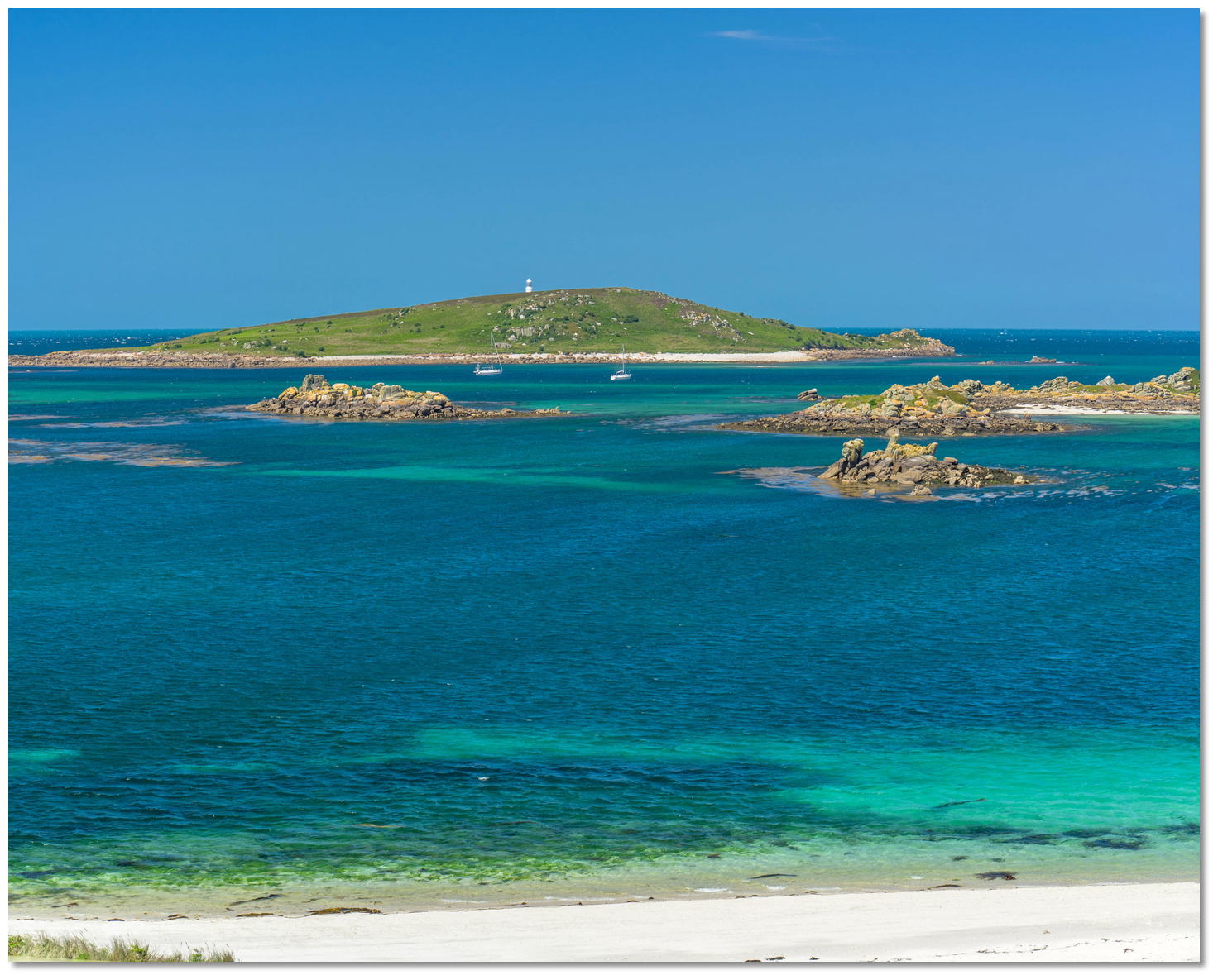 St Helen's Island with yachts anchored in St Helen's Pool, as seen from Tresco
Image: Michael Harpur
St Helen's is the third largest of the uninhabited islands in the Scilly archipelago. Comprising a total area of 20 hectares, it features a smooth 42-metre-high rounded hill covered in grass and heather. St Helen's Pool is a spacious stretch of water lying close south of the island that in the past provided a well-used anchorage for sailing ships. Surrounded by islands and ledges, it is virtually landlocked at low water, whilst at high water, it has a range of alternative entrances and exits that enabled sailing vessels of old to arrive or depart in most wind directions.
It remains an excellent leisure boat anchorage today, with a unique property of enjoying near all-round protection. It is somewhat exposed only at high water, when the tide overtops its surrounding ledges, but the vast majority of any waves have already been broken up and only some swell remains, particularly from the northwest or south. It is an ideal anchorage for larger boats that are less subject to the swell and want to avoid constantly moving to find protection against wind shifts.
How to get in?
 Round Island and St Helen's as seen from the north end of Tresco
 Image: Michael Harpur
At high water, there are several alternative approaches to permit access from St Mary’s Road and Old Grimsby Sound. Much of the area between Tresco, Tean and St Martin’s uncovers at LAT, but the principal small boat channels dry to just 1 metre at their shallowest. So, with MHWS being 5.7m and MHWN 4.3m, high water provides ample depth for leisure craft to move freely about. Pilotage through the channels, however, requires some care and, on a first visit, should be attempted only with the benefit of a rising tide. Seaward entry into St Helen’s pool is via St Helen’s Gap, located between St Helen’s and Tean. It is largely seen as the easiest approach and we describe this here.
 St Helen's Pool may be approached from neighbouring Old Grimsby Sound at high water
Image: Michael Harpur
Unmarked and running in between two flanking rocky ledges, Helen’s Gap may look thoroughly uninviting on the chart, but it is deep and readily navigable in daylight during moderate conditions. Helen’s Gap and Tean Sound are the two most frequently used passages from the north into the main anchorages to the west of St Martin's.
 St Helen's Gap
Image: Graham Rabbits
However, unlike Tean Sound, Helen’s Gap has an inner shallow bank between it and the Pool of 0.5 metres LAT that requires a sufficient height of tide to provide clearance. This cannot be crossed at LWS, but being only moderately shallow, it should be available to cross more often than not by leisure vessels.
The seaward approaches may be positively identified by Round Island and its prominent all-white lighthouse, Fl.10s55m18M, which provides an excellent daymark for the north end of the archipelago. There is also plenty of sea room in the approaches and entrance.
 Round Island as seen from the southeast with the Eastward Ledge breaking
Image: Michael Harpur
 Use southwestern England’s coastal overview from Land's End to Isles of Scilly for local approaches. Vessels approaching from the east should keep north of a latitude of 49 59.000 N to clear White Island, Lion Rock and Deep Ledges. Vessels approaching from the west or north, keep up towards Round Island, taking care to avoid the Eastward Ledge, drying to 2.9 metres, located 150 metres northeastward of the island.
 Didley’s Point, with the Gaps opening in the backdrop
Image: Michael Harpur
 From the Bab’s Carn initial fix, located 600 metres northeastward of Round Island, steer southward to pass midway between Saint Helen’s prominently rocky easternmost extremity of Didley’s Point, and Pollard Rock, which dries to 1.7 metres.
 The gap between Round Island and Eastward Ledge and Deep Ledges, Tide Rock, Black Rock and Black Rock Ledges, passed to port in succession, is more than ⅓ mile wide. Maintain a careful watch, nevertheless, as the tide runs strongly across the approach.
 Pollard Rock showing itself at low water
Image: Michael Harpur
The gap between Didley’s Point and Pollard Rock is about 300 metres. However, Pollard Rock will most likely be covered, but the midway point is about 150 metres eastward of Didley’s Point on the 10-metre contour.
 East Gap and West Gap forming the gatepost to Saint Helen's Gap
Image: Michael Harpur
From here, the rocks of the 2.3-metre-high East Gap, to port, and 0.9-metre West Gap, to starboard, will clearly be visible. Situated at its narrowest part, the rocks are like a pair of entrance gateposts to Saint Helen’s Gap. They stand close to the edges of their respective reefs, at about 100 metres from ledge to ledge, and there is at least 3 metres at low water springs midchannel. Steer towards West Gap Rock until about 100 metres off, to avoid a rocky ledge that extends about 50 metres northwest from East Gap Rock; then turn to pass just to the West Gap Rock side of centre.
 The inner sand spit can be seen over West Gap Rock
 Image: Michael Harpur
Continue south by southwest for 250 metres, resisting the temptation to turn towards vessels already moored in Saint Helen’s Pool. A drying sand spit extends more than 300 metres southeastward from the island shore adjoining the West Gap reef, which should be visible.
 The sand spit seen from St Helen's over the site of the early Christian Hermitage
Image: Graham Rabbits
After 250 metres, the edge of the inner shallow bank lying between Old Man and St Helen's should be reached. Before proceeding, check the tidal height to ensure you have enough clearance to pass over the charted LAT of 0.5 metres. With a sufficient rise, steer southwestward to cross the final 300 metres leading into the centre of St Helen’s Pool, where 7 metres LAT will be found.
 The Gaps and the drying sand spit as seen from Tresco to the southwest
Image: Michael Harpur
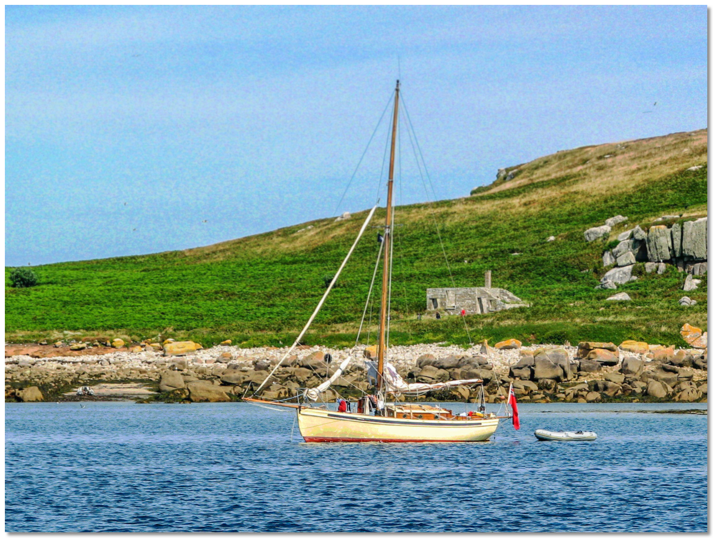
Anchor according to conditions in sand with good holding from 2m to 7m of water. There is ample deep water in the main pool. Keep clear of the area to the southeast of St Helen's Island as it dries out to West Gap Rock. A sandy spit drying to 2.9 metres LAT hooks round to the south and west from the island, and it dries to 1.1 metres around it. A deepwater section extends ½ mile southeastward from 150 metres off the southern end of Saint Helen’s Island to the distinctive 14-metre-high Hedge Rock islet.  Yachts in St Helen's Pool
Image: Michael Harpur
Land by tender on the island, which is uninhabited and has no resources. Alternatively, the neighbouring Old Grimsby Harbour (on Tresco) and St Martin’s Tean Sound are a ½-mile dinghy run for further exploration and facilities.
Why visit here?
Known in Cornish as Enys Elidius, as with many of the religious names for the group, St Helen’s most likely got its name from its long history of hermits and monks. The monk in question was Cornish hermit monk St Lide, known variously as Elid, Elida, Elide, Lyda, Lyde and, more regularly, Elidius, which is most likely a Latinisation of the saint's original Cornish name. The English name is a religious corruption of the Cornish name. A yacht in St Helen's Pool
Image: Michael Harpur
St Helen’s is home to Scilly’s oldest Christian site, probably founded during the 8th to 10th centuries. Known as St Elidius Hermitage, it is thought to have been home to the saint. The remains can be seen on the southern slope of the island today and comprise a small complex with a circular living cell. The site grew from what is believed to be Elidius' original hermit dwelling, with a single round hut and oratory. Reputedly a bishop and also the son of a king, he was renowned for his psychic powers and ability to foresee the future. During his time here St Elidius is is said to have converted Viking king Olaf Trygvasson of Norway to Christianity in AD 988, when he came to raid the islands (see New Grimsby).
 The 18th-century Pest House, used to detain people with infectious diseases ashore
Image: Graham Rabbits
Over time, the dwelling increased in importance and was later converted into a simple chapel. It spread out to be a communal hermitage, with a number of rectangular huts for individual accommodation surrounding the church and oratory buildings. In the early 11th century, a small Christian chapel named St Elidius was built on the northeast side of the island, and was granted to Tavistock Abbey around 1120. This attracted more pilgrims to the burial site of Elidius and it is said that there was once a causeway from Tresco's Abbey Church across the downs to the small church on St Helen's. During the late-medieval period, St Helen's Pool was considered the main harbour of the island group – off Old Grimsby, with good holding ground, reasonable depth of water, the possibility to depart or access from many points and excellent shelter from the prevailing southwesterlies. There is even evidence to suggest that the monks of Tresco may have collected mooring fees from ships anchoring in St Helen's Pool. It was here that Admiral Blake brought his fleet when retaking the islands at the end of the civil war.
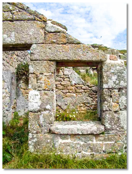 Robust walls of the Pest House
Image: David Lally via CC BY-SA 2.0
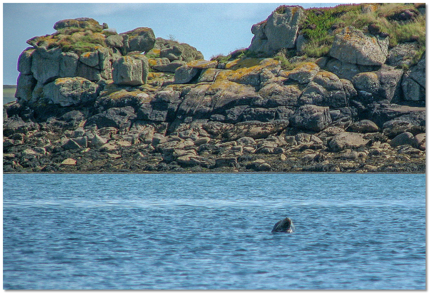
Few recovered because people with relatively harmless disorders, such as rosacea or acne, had to share bedstraw with those suffering serious, highly contagious diseases, including bubonic plague and cholera. The associated graveyard includes passengers from Africa and Asia who died at the station. In Old Town Church is the gravestone of a Lt James Allen Corsse, a naval surgeon sent to treat the sick. He died of cholera within a week, aged just 27. Later, in happier times, the commander of a guardship moored at St Helen's Pool during the Napoleonic Wars made a garden on the island. Mesembryanthemum, characterised by long-lasting flower heads, and Hottentot-fig, a ground-creeping plant with succulent leaves, escaped and naturalised. Some deer and goats were placed on the island and their descendants can be occasionally seen today.
 St Helen's is today a Site of Special Scientific Interest
Image: Graham Rabbits
Today the island is the major part of St Helen's Site of Special Scientific Interest (inclusive of Northwethel and Men-a-vaur) and is designated for its rare flora and breeding seabirds. Some of its features have been given the designation of scheduled ancient monuments and it is currently managed by the Isles of Scilly Wildlife Trust. The remains of Pest House's granite quay can be seen alongside the sandy beach bay. The slipway to land the patients and stores, a quarter of a millennium later, has remained clear of rocks. The ruined Pest House is just behind the dunes. Its massive granite walls and red brick chimney have stood the test of time in its exposed position. With the help of English Heritage funding, It has recently been repaired and stabilised to prevent its collapse. The early medieval religious complex can be seen nearby. Open-air services are still held here once a year during August for Elidius, now the patron saint of the Isles of Scilly.
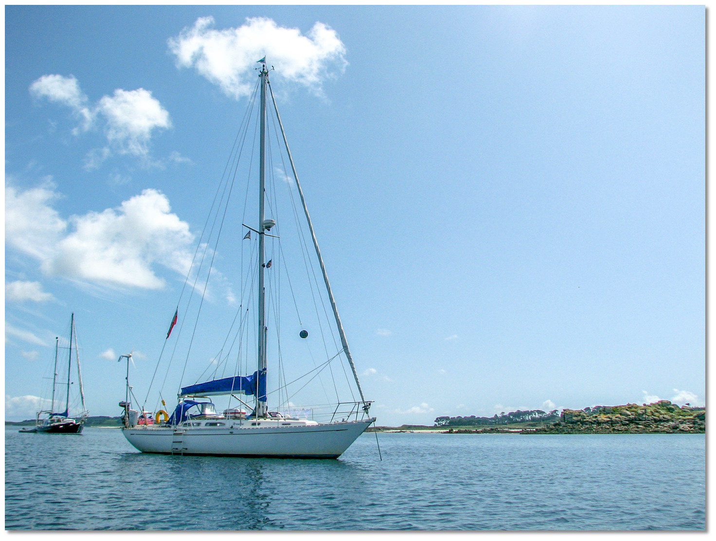 Yachts anchored in St Helen's Pool
Image: Graham Rabbits
From a boating perspective, St Helen’s Pool's formidable surrounding reefs provide wonderful protection from the Atlantic swell rolling in from the west. Here, throughout most of the tide, perfect tranquillity can be enjoyed whilst listening to the thunder of breaking surf on Golden Ball and Golden Ball Brow to the northwest. It is a picturesque expanse of water, crystal clear and aquamarine when the sun is out, with verdant islands and spectacular rocky outcrops all round. What it offers most is solitude, without the constant threat of having to move in the event of a wind shift. For those in the possession of a stalwart engine, there are countless fine sandy beaches all round and inhabited islands to explore.
What facilities are available?
The uninhabited island has no resources whatsoever. However, neighbouring Old Grimsby Harbour, on Tresco, and St Martin’s Tean Sound are a ½-mile dinghy run.With thanks to:
Michael Harpur, eOceanic.

Add your review or comment:
Please log in to leave a review of this haven.
Please note eOceanic makes no guarantee of the validity of this information, we have not visited this haven and do not have first-hand experience to qualify the data. Although the contributors are vetted by peer review as practised authorities, they are in no way, whatsoever, responsible for the accuracy of their contributions. It is essential that you thoroughly check the accuracy and suitability for your vessel of any waypoints offered in any context plus the precision of your GPS. Any data provided on this page is entirely used at your own risk and you must read our legal page if you view data on this site. Free to use sea charts courtesy of Navionics.