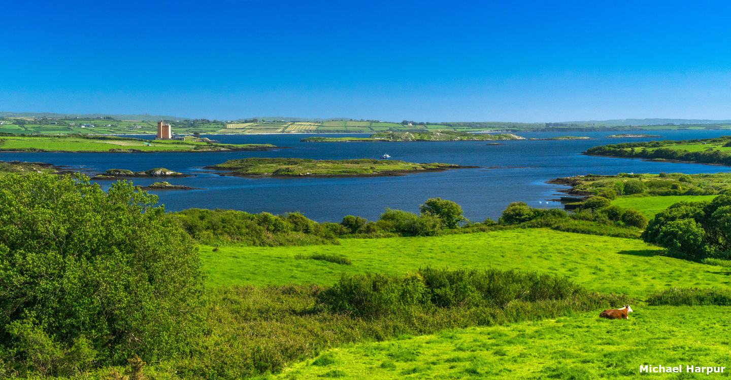
Located on Ireland’s southwest coast, Poulgorm Bay lies at the head of the extensive shallow Roaringwater Bay inlet. It offers a secluded anchorage in a remote area that is overlooked by the tower of a historic castle.
Sheltered from the sea by rocks and islands to the westward of it, Poulgorm Bay provides a good well-sheltered anchorage. Access is available at all stages of the tide requires attentive daylight navigation to find and pass through a fairway leading to the bay through extensive marine farms in the head of the bay.
Keyfacts for Poulgorm Bay
Last modified
November 3rd 2021 Summary
A good location with attentive navigation required for access.Facilities

Nature


Considerations

Position and approaches
Expand to new tab or fullscreen
Haven position
 51° 32.781' N, 009° 25.135' W
The northeastern corner of Poulgorm Bay.
What is the initial fix?
The following Roaringwater Bay Initial Fix will set up a final approach:
 51° 31.438' N, 009° 25.960' W
 What are the key points of the approach?
Offshore details are available in southwestern Ireland’s Coastal Overview for Cork Harbour to Mizen Head  .
.
 .
.- The clearest channel into Roaringwater Bay is between Carthy and Castle Islands. Steer about 70° through the fairway passing within 250 metres of Horse Island and onward to the initial fix.
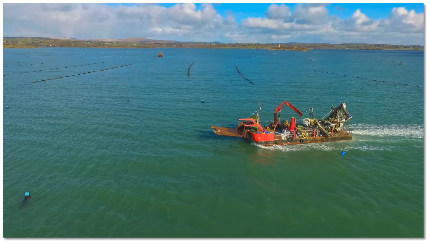
- Find the North/South fairway through mussel farms that occupy the entire north end of Roaringwater Bay.
- Pass over the mouth of Ballydehob Bays to round the northern end mussel beds and enter Poulgorm Bay.
Not what you need?
Click the 'Next' and 'Previous' buttons to progress through neighbouring havens in a coastal 'clockwise' or 'anti-clockwise' sequence. Below are the ten nearest havens to Poulgorm Bay for your convenience.
Ten nearest havens by straight line charted distance and bearing:
- Ballydehob Bay - 0.5 nautical miles WSW
- Rossbrin Cove - 2.3 nautical miles SW
- Reena Dhuna - 2.3 nautical miles SE
- Rincolisky Harbour - 2.6 nautical miles S
- Inane Creek - 2.7 nautical miles SE
- Horse Island - 2.7 nautical miles SW
- East Pier - 2.8 nautical miles S
- Trá Bán - 3 nautical miles S
- Quarantine Island - 3.1 nautical miles SSE
- Turk Head - 3.2 nautical miles S
These havens are ordered by straight line charted distance and bearing, and can be reordered by compass direction or coastal sequence:
- Ballydehob Bay - 0.5 miles WSW
- Rossbrin Cove - 2.3 miles SW
- Reena Dhuna - 2.3 miles SE
- Rincolisky Harbour - 2.6 miles S
- Inane Creek - 2.7 miles SE
- Horse Island - 2.7 miles SW
- East Pier - 2.8 miles S
- Trá Bán - 3 miles S
- Quarantine Island - 3.1 miles SSE
- Turk Head - 3.2 miles S
What's the story here?
 Poulgorm Bay with its entrance overlooked by Kilcoe Castle
Image: Michael Harpur
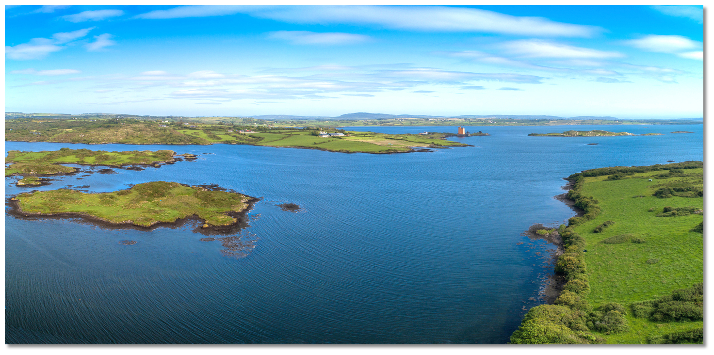
Poulgorm Bay is situated at the head of the extensive Roaringwater Bay that lies at the northeastern extreme of Long Island Bay. It is a secluded anchorage set into a rural landscape overlooked by the magnificent Kilcoe Castle. There is the semblance of a small improvised slip on the western shore inside of Oileanruadhbeag, the smaller of Poulgorm Bay's two islands, and another disused quay close northward. Both are set at the end of a farm track that leads to the main road but apart from that, there is little else here.
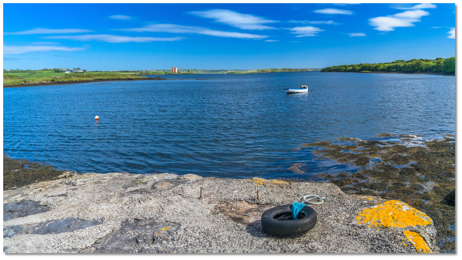 The small improvised Quay on the east side of Reen Point peninsula
 Image: Michael Harpur
Despite its forbidding name the bays at the head of Roaringwater Bay, Poulgorm Bay and Ballydehob Bay ½ a mile westward, provide quiet and well-sheltered anchorages to leisure vessels. Set deep into the bay they are completely sheltered from the sea by the rocks, islands and fish farms to the southwestward. Of the two Poulgorm Bay, offers better options to find protection around its shoulders.
How to get in?
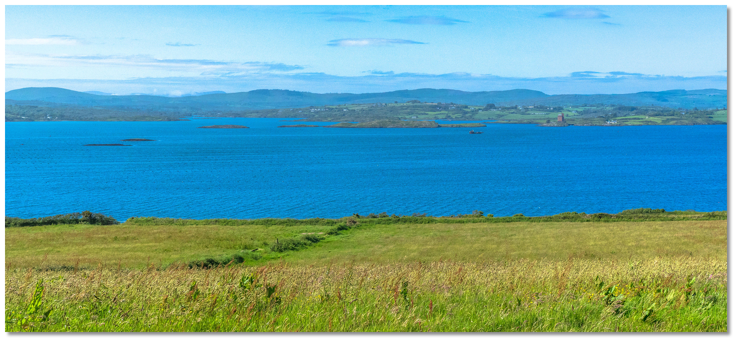 Roaringwater Bay's Carrigviglash Rocks, Mannin & islets and Kilcoe Castle
Image: Michael Harpur
 Offshore details are available in southwestern Ireland’s Coastal Overview for Cork Harbour to Mizen Head
  seaward approaches. Roaringwater Bay is entered between Horse Island and West Skeam Island, about 0.6 miles to the south southeast of Horse Island.
  The clearest and most direct channel into Roaringwater Bay is between Carthy and Castle Islands, steering about 70° through the fairway. Then pass within 250 metres of Horse Island and onward to the initial fix. A back-bearing is available on the north point of Carthy Island, open northward of Illaunnbinneey Islet bearing 238° T, which leads directly to the Initial Fix clear northward of Moores Rock, which has 2.7 metres over it and the awash Rowmore cluster.
 A vessel may also approach Roaringwater Bay from the southward of Calf Islands, passing eastward of, or between them; but these channels are beset with dangers, and should not be used by newcomers unless compelled by necessity to do so. A clearing line can be availed of for vessels approaching east of Calf Island East. This is on the alignment on 190° T of a prominent white chapel, in the centre of Clear Island, and the west point of Illauneana. It passes the Toorane Rocks, Anima Rock and then between Moores Rock and Rowmore. Both of these clearing lines are best seen on Admiralty Chart 2129.
 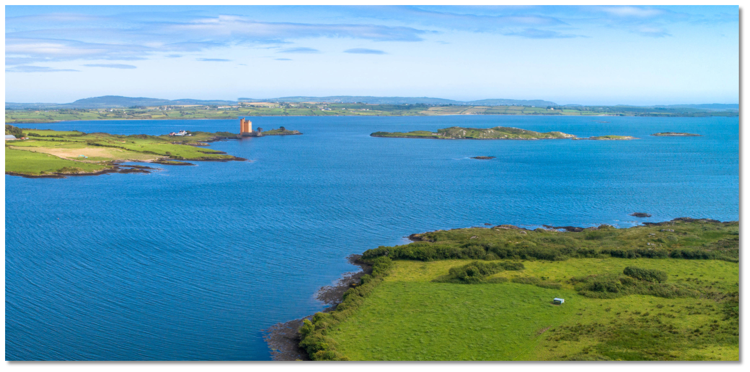 The entrance into Poulgorm Bay
Image: Michael Harpur
 The initial fix sets up an approach to the north/south corridor that leads up between the extensive fish farms in Roaringwater Bay. The entire north end of the bay, east of Horse Island, is now largely given over to this aquaculture with the fairway leading through to Poulgorm Bay and Ballydehob Bays. This is usually marked by private marks that cannot be relied upon but the north-south channel through the mussel beds should be clearly visible from the initial fix.
The south end of the channel is entered about ½ a mile west of the Carrigviglash Rocks that consist of two continuously dry heads, 2.1 and 1 metre high, lying about ½ a mile south of Mannin Island. Proceed up the channel giving the grey bulk of the mussel farm barrels on either side a wide berth.
The channel passes to the west of the 16 metres high Mannin Island that lies close offshore at the head of the bay. It then turns past the mouth of Ballydehob Bay towards Poulgorm Bay which is entered to the north of the mussel Rafts and Truchara Rock.
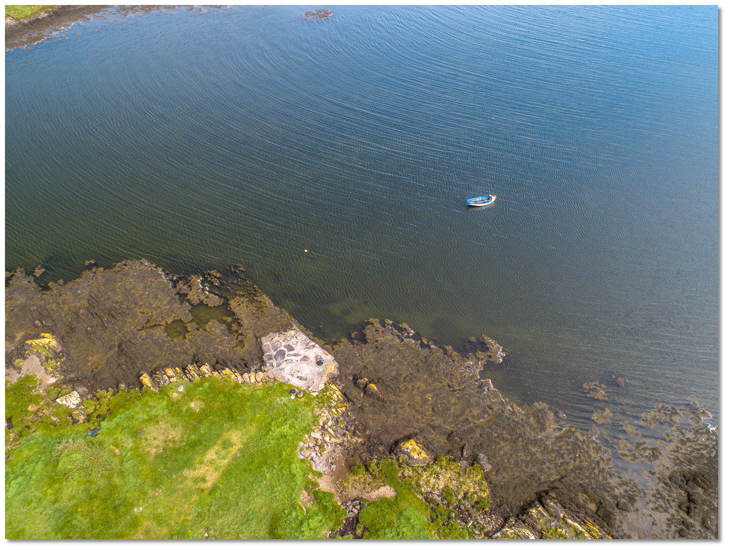 Small slip set into the northwest corner
Image: Michael Harpur
 Anchor according to draught and conditions in Poulgorm Bay. The bay has excellent mud holding.Land at a small slip set into the northwest corner opposite the smaller island of Oileanruadhbeag.
 Alternatively the small quay at the end of a lane from Skeaghanore West in the mouth of Ballydehob Bay. Ballydehob's quay is also possible on the rise.
Why visit here?
Poulgorm retains its appropriate Irish name meaning 'the blue pool'. The water is so clear here that any weed on the level bottom can be seen. Likewise, its two principal islets Oileanruadhmor, from Oilean Ruadh Mor (14 acres) big red island, and Oileanruadhbeag Oilean Ruadh Beag (4 acres) little red island have retained their original Gaelic names. This is because, to the largest part, the area has remained untouched by time since they acquired their Gaelic names. Save that is for the magnificent Kilcoe Castle that overlooks the entire bay.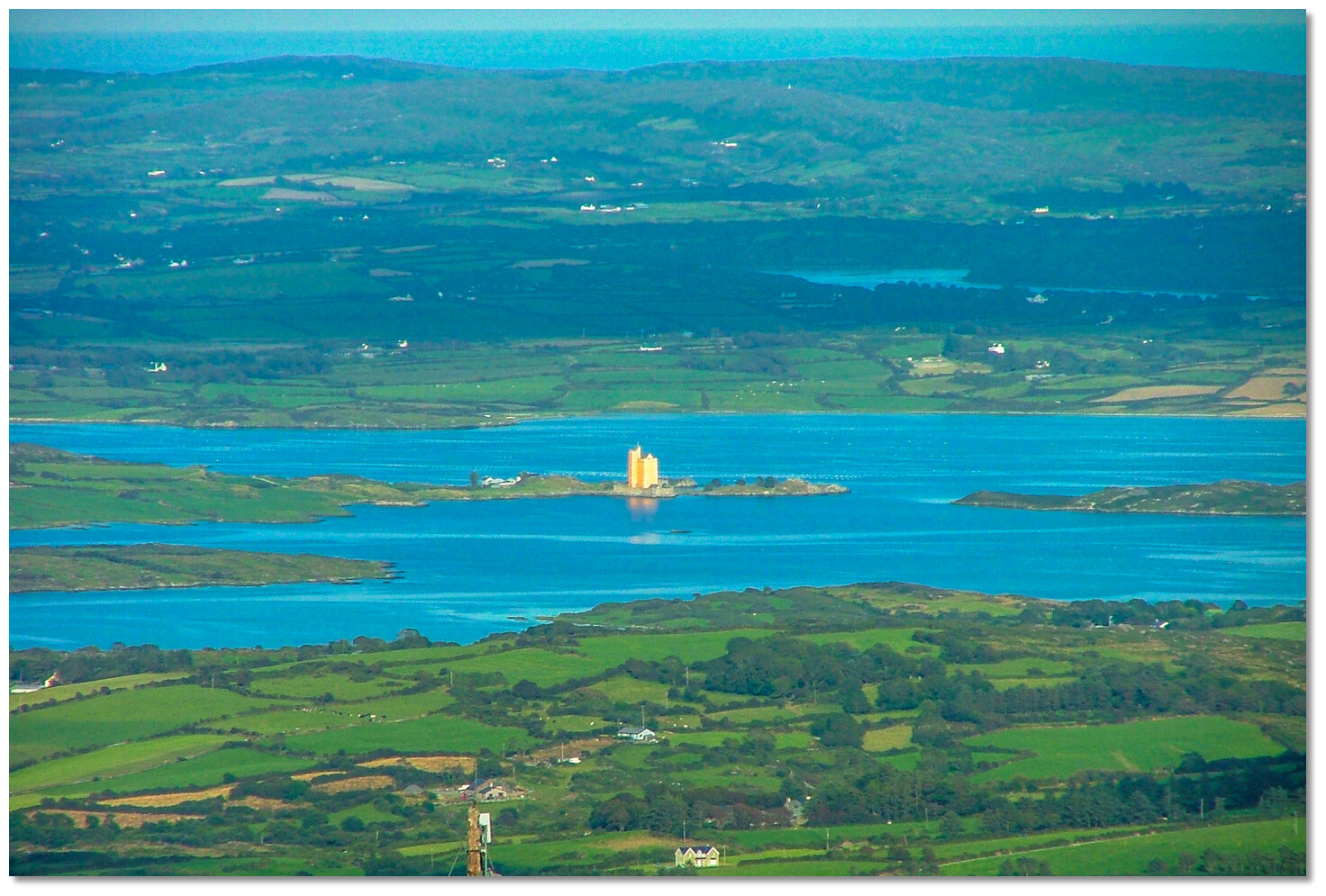 Kilcoe Castel dominating the north end of Roaringwater Bay
Image: oli xilo via CC BY 2.0
Kilcoe Castle stands on a small tidal island that is attached to the mainland at low tide but outside of that the castle was only reachable by boat. Although it has always been called Kilcoe Castle it is, strictly speaking, a tower house. The Kilcoe part of its name is that of the townland in which it stands. First recorded as Killicogh, in a pardon of 1601, the name is derived from 'Cill Coiche' meaning 'Church of St Coch'. St Coch, or Cellcohi as her name was spelt in a Decretal Letter of 1199, was a nun who was supposed to have been a companion of the legendary St Kieran of Cape Clear. Ruins of her old parish church and graveyard can still be seen near the castle.
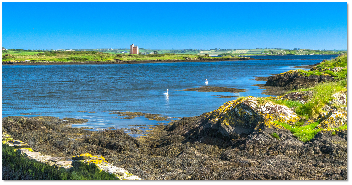 Poulgorm Bay overlooked by Kilcoe Castle
Image: Michael Harpur
Little is known of Kilcoe Castle's history prior to 1610. In the early historic period, various clans fought for dominance, until the eventual emergence of the McCarthys and O'Mahonys as the rulers of the region. Kilcoe Castle is thought to have been built by the Dermod McCarthy in about 1450 at the height of Clan Dermod’s prosperity. These MacCarthys were a sub-tribe of the McCarthy Riabhach of Kilbrittan, who had originated in the Blarney area. Kilcoe Castle was the McCarthy's most westerly stronghold and their only coastal foothold. The tower was the residence of the chief who derived great wealth from the control of both the fisheries in Dunmanus Bay and the resources of the hinterland behind his castle. He could therefore afford to indulge his taste for a high-status residence which was the principal purpose of Kilcoe Castle. For nearly 150 years, the castle thrived in West Cork.
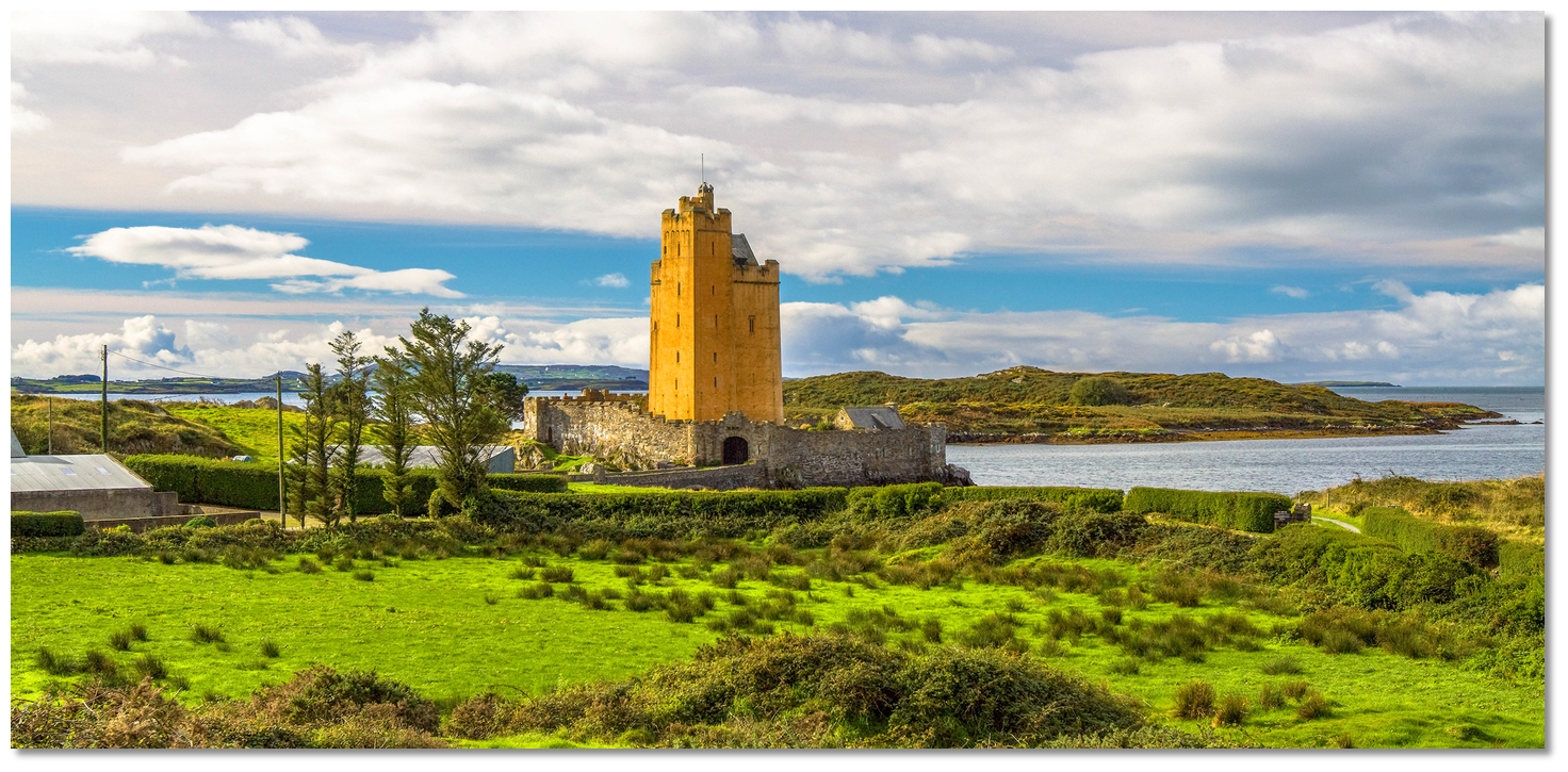 Kilcoe Castle
Image: Mike Searle via CC BY SA 2.0
But by the 16th century, the English forces were making their grip on the country felt and were running significant campaigns to take control of Irish castles. They would convert them into garrisons or simply destroy them so that they could not be used by the clans trying to defend their land. Many of these castles were taken over by Captain Harvey, a cousin to Sir George Carew, Lord President of Munster, and he tried many times to take Kilcoe Castle. It nevertheless managed to hold out against all these attempts. Built on an island, with surrounds too shallow for ships and Mannin Island to the south, an invading army could never gett close enough to effectively use cannons against its tower walls.
But this would come to an end at the dawn of the 17th century when between 1600 and 1602 Kilcoe Castle was besieged by various forces. In 1598, after the English forces were defeated by Hugh O'Neill's Gaelic army at the Battle of the Yellow Ford, Sir Henry Power the English commander gave orders to Captain George Flower to 'burn and spoil all such as would not come in'. In April of 1600, he learned that some representatives of the western sept of the O'Mahonys had visited O'Neill at his camp at Inishcarra. He immediately ordered a raid on Kilcoe to finally put pay to the castle. Sir Richard Perry marched with some of the Kinsale garrisons to reduce Kilcoe. But he never breached the castle walls and took 300 heads of cattle instead.
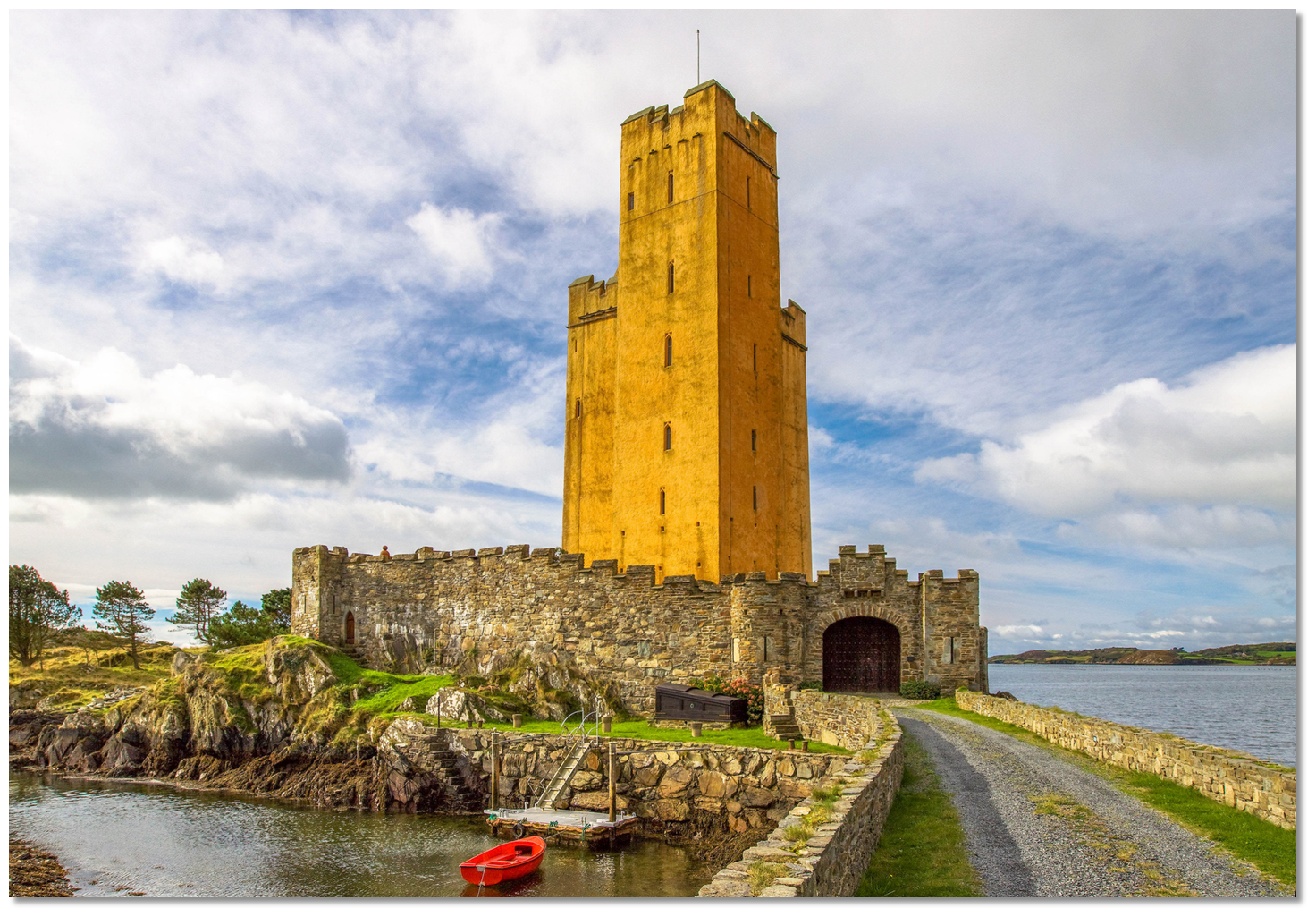 Kilcoe Castle as seen from the causeway constructed in 1978
 Image: Mike Searle via CC BY SA 2.0
Meanwhile, Captain Flower was leading a punitive expedition into Carbery to destroy rebels and deter potential rebels from joining them by destroying crops. Captain Flower's account of his action runs: 'From Rosse, we marched over the Leape into O'Donovan's Country where we burned all those parts and had the kylling of many of their churles and poor people, leaving not therein any one grain of corn wthn ten myles of our way wherever we marched; and toke a prey of 500 cows wch I caused to be drowned, for that we would not trouble ourselves to dryve them in that journey. Beyond the Leap, we stayd three dayes; in which time we borned and spoyled all the sept of the Clan Dermondes... '.
Despite this, the O'Driscolls succeeded in creating a united force to resist the reconquest of the West. As part of his strategic design, he installed a ward at Kilcoe Castle presumably with the co-operation of the Kilcoe chief. After the concluding Battle of Kinsale that finished this war, the 'Pacata Hibernia', written by Thomas Stafford from the invaders' point of view, noted that… "all the castles in Carbery had quickly surrendered to the much superior English forces with the exception of two Cloghan and Kilcoe" (Cloghan castle also belonged to the McCarthy clan). The English recognised Kilcoe was a 'place of great strength' and in May or early June 1602, Sir George Carew, descended on the area in his final bid to break the power of the Gaelic chieftains. On his way to attack Dunboy Castle, hecamped at Rincolisky where he noted it was 'near unto Kilcoa [where] the Rebell Cnogher, eldest sonn to Sr. FFynine 0 Driscoll, Knight, held a ward'.
 Kilcoe castle is now home to Jeremy Irons
 Image: El Hormiguero via CC BY 2.0 (2014)
The last Chieftain of Kilcoe joined the Flight of the Earls to the continent in July of 1608. According to Pacata Hibernia - there were two brothers…'Dermond MacConnor and Dermond MacConnor Oge, of the Cartys of Kilcoe', but there were more likely father and son than brothers. He brought his wife and children with him and finally ended up in Sicily. Sadly his wife and children were killed in an accident, probably drowned. Their graves were by chance found in Sicily in the last century. After their departure, the castle was occupied for a few decades by English forces and then abandoned to fall into disrepair and gradually became a ruin.
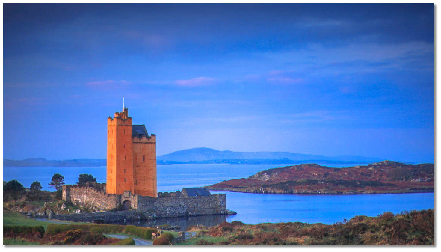 Kilcoe Castle as seen at dusk
Image: Seán Venn
In 1978 a causeway was built connecting the islet to the mainland where it is thought a drawbridge may have existed in the past. In 1998 the ruin of Kilcoe Castle was bought by the actor Jeremy Irons. He started a restoration that would take over two decades to convert the crumbling tower into what is now his family home. He has made some controversial changes as it just takes one glance to realize that the colour of Kilcoe Castle is far from traditional. Instead of the usual castle hue, Kilcoe has been painted a peach colour that was the personal choice of Irons and it has stirred some criticism. Nevertheless, thanks to his investment, Kilcoe Castle has to be one of the finest remaining tower houses on the Cork coast today.
From a boating point of view, this is an excellent sequestered berth for those who would like some peace and quiet in a beautiful rural setting overlooked by a historic medieval castle.
What facilities are available?
There are no facilities, save for the slip in this remote rural backwater. Ballydehob, 30 minutes by tender at high water, has a water tap 300m from the quay, a bottle bank and litter bins. A service station fuel and groceries, as does a small shop up the main street. There is a laundrette and hardware, health and gourmet food stores and a good second-hand bookshop. The town has a golf range with a five-hole course.Any security concerns?
Never an issue known to have occurred to a vessel anchored in Poulgorm.With thanks to:
Michael Harpur, eOceanic Research.Aerial views of Kilcoe Castle
Jeremy Irons shows the castle interior today
About Poulgorm Bay
Poulgorm retains its appropriate Irish name meaning 'the blue pool'. The water is so clear here that any weed on the level bottom can be seen. Likewise, its two principal islets Oileanruadhmor, from Oilean Ruadh Mor (14 acres) big red island, and Oileanruadhbeag Oilean Ruadh Beag (4 acres) little red island have retained their original Gaelic names. This is because, to the largest part, the area has remained untouched by time since they acquired their Gaelic names. Save that is for the magnificent Kilcoe Castle that overlooks the entire bay.
 Kilcoe Castel dominating the north end of Roaringwater Bay
Image: oli xilo via CC BY 2.0
Kilcoe Castle stands on a small tidal island that is attached to the mainland at low tide but outside of that the castle was only reachable by boat. Although it has always been called Kilcoe Castle it is, strictly speaking, a tower house. The Kilcoe part of its name is that of the townland in which it stands. First recorded as Killicogh, in a pardon of 1601, the name is derived from 'Cill Coiche' meaning 'Church of St Coch'. St Coch, or Cellcohi as her name was spelt in a Decretal Letter of 1199, was a nun who was supposed to have been a companion of the legendary St Kieran of Cape Clear. Ruins of her old parish church and graveyard can still be seen near the castle.
 Poulgorm Bay overlooked by Kilcoe Castle
Image: Michael Harpur
Little is known of Kilcoe Castle's history prior to 1610. In the early historic period, various clans fought for dominance, until the eventual emergence of the McCarthys and O'Mahonys as the rulers of the region. Kilcoe Castle is thought to have been built by the Dermod McCarthy in about 1450 at the height of Clan Dermod’s prosperity. These MacCarthys were a sub-tribe of the McCarthy Riabhach of Kilbrittan, who had originated in the Blarney area. Kilcoe Castle was the McCarthy's most westerly stronghold and their only coastal foothold. The tower was the residence of the chief who derived great wealth from the control of both the fisheries in Dunmanus Bay and the resources of the hinterland behind his castle. He could therefore afford to indulge his taste for a high-status residence which was the principal purpose of Kilcoe Castle. For nearly 150 years, the castle thrived in West Cork.
 Kilcoe Castle
Image: Mike Searle via CC BY SA 2.0
But by the 16th century, the English forces were making their grip on the country felt and were running significant campaigns to take control of Irish castles. They would convert them into garrisons or simply destroy them so that they could not be used by the clans trying to defend their land. Many of these castles were taken over by Captain Harvey, a cousin to Sir George Carew, Lord President of Munster, and he tried many times to take Kilcoe Castle. It nevertheless managed to hold out against all these attempts. Built on an island, with surrounds too shallow for ships and Mannin Island to the south, an invading army could never gett close enough to effectively use cannons against its tower walls.
But this would come to an end at the dawn of the 17th century when between 1600 and 1602 Kilcoe Castle was besieged by various forces. In 1598, after the English forces were defeated by Hugh O'Neill's Gaelic army at the Battle of the Yellow Ford, Sir Henry Power the English commander gave orders to Captain George Flower to 'burn and spoil all such as would not come in'. In April of 1600, he learned that some representatives of the western sept of the O'Mahonys had visited O'Neill at his camp at Inishcarra. He immediately ordered a raid on Kilcoe to finally put pay to the castle. Sir Richard Perry marched with some of the Kinsale garrisons to reduce Kilcoe. But he never breached the castle walls and took 300 heads of cattle instead.
 Kilcoe Castle as seen from the causeway constructed in 1978
 Image: Mike Searle via CC BY SA 2.0
Meanwhile, Captain Flower was leading a punitive expedition into Carbery to destroy rebels and deter potential rebels from joining them by destroying crops. Captain Flower's account of his action runs: 'From Rosse, we marched over the Leape into O'Donovan's Country where we burned all those parts and had the kylling of many of their churles and poor people, leaving not therein any one grain of corn wthn ten myles of our way wherever we marched; and toke a prey of 500 cows wch I caused to be drowned, for that we would not trouble ourselves to dryve them in that journey. Beyond the Leap, we stayd three dayes; in which time we borned and spoyled all the sept of the Clan Dermondes... '.
Despite this, the O'Driscolls succeeded in creating a united force to resist the reconquest of the West. As part of his strategic design, he installed a ward at Kilcoe Castle presumably with the co-operation of the Kilcoe chief. After the concluding Battle of Kinsale that finished this war, the 'Pacata Hibernia', written by Thomas Stafford from the invaders' point of view, noted that… "all the castles in Carbery had quickly surrendered to the much superior English forces with the exception of two Cloghan and Kilcoe" (Cloghan castle also belonged to the McCarthy clan). The English recognised Kilcoe was a 'place of great strength' and in May or early June 1602, Sir George Carew, descended on the area in his final bid to break the power of the Gaelic chieftains. On his way to attack Dunboy Castle, hecamped at Rincolisky where he noted it was 'near unto Kilcoa [where] the Rebell Cnogher, eldest sonn to Sr. FFynine 0 Driscoll, Knight, held a ward'.
 Kilcoe castle is now home to Jeremy Irons
 Image: El Hormiguero via CC BY 2.0 (2014)
The last Chieftain of Kilcoe joined the Flight of the Earls to the continent in July of 1608. According to Pacata Hibernia - there were two brothers…'Dermond MacConnor and Dermond MacConnor Oge, of the Cartys of Kilcoe', but there were more likely father and son than brothers. He brought his wife and children with him and finally ended up in Sicily. Sadly his wife and children were killed in an accident, probably drowned. Their graves were by chance found in Sicily in the last century. After their departure, the castle was occupied for a few decades by English forces and then abandoned to fall into disrepair and gradually became a ruin.
 Kilcoe Castle as seen at dusk
Image: Seán Venn
In 1978 a causeway was built connecting the islet to the mainland where it is thought a drawbridge may have existed in the past. In 1998 the ruin of Kilcoe Castle was bought by the actor Jeremy Irons. He started a restoration that would take over two decades to convert the crumbling tower into what is now his family home. He has made some controversial changes as it just takes one glance to realize that the colour of Kilcoe Castle is far from traditional. Instead of the usual castle hue, Kilcoe has been painted a peach colour that was the personal choice of Irons and it has stirred some criticism. Nevertheless, thanks to his investment, Kilcoe Castle has to be one of the finest remaining tower houses on the Cork coast today.
From a boating point of view, this is an excellent sequestered berth for those who would like some peace and quiet in a beautiful rural setting overlooked by a historic medieval castle.
Other options in this area
Click the 'Next' and 'Previous' buttons to progress through neighbouring havens in a coastal 'clockwise' or 'anti-clockwise' sequence. Alternatively here are the ten nearest havens available in picture view:
Coastal clockwise:
Ballydehob Bay - 0.3 miles WSWHorse Island - 1.7 miles SW
Rossbrin Cove - 1.4 miles SW
Dereenatra - 2 miles WSW
Castle Island (South Side) - 2.4 miles SW
Coastal anti-clockwise:
Calf Island East - 2.7 miles SSWTrá Bán - 1.9 miles S
East Pier - 1.7 miles S
Rincolisky Harbour - 1.6 miles S
Turk Head - 2 miles S
Navigational pictures
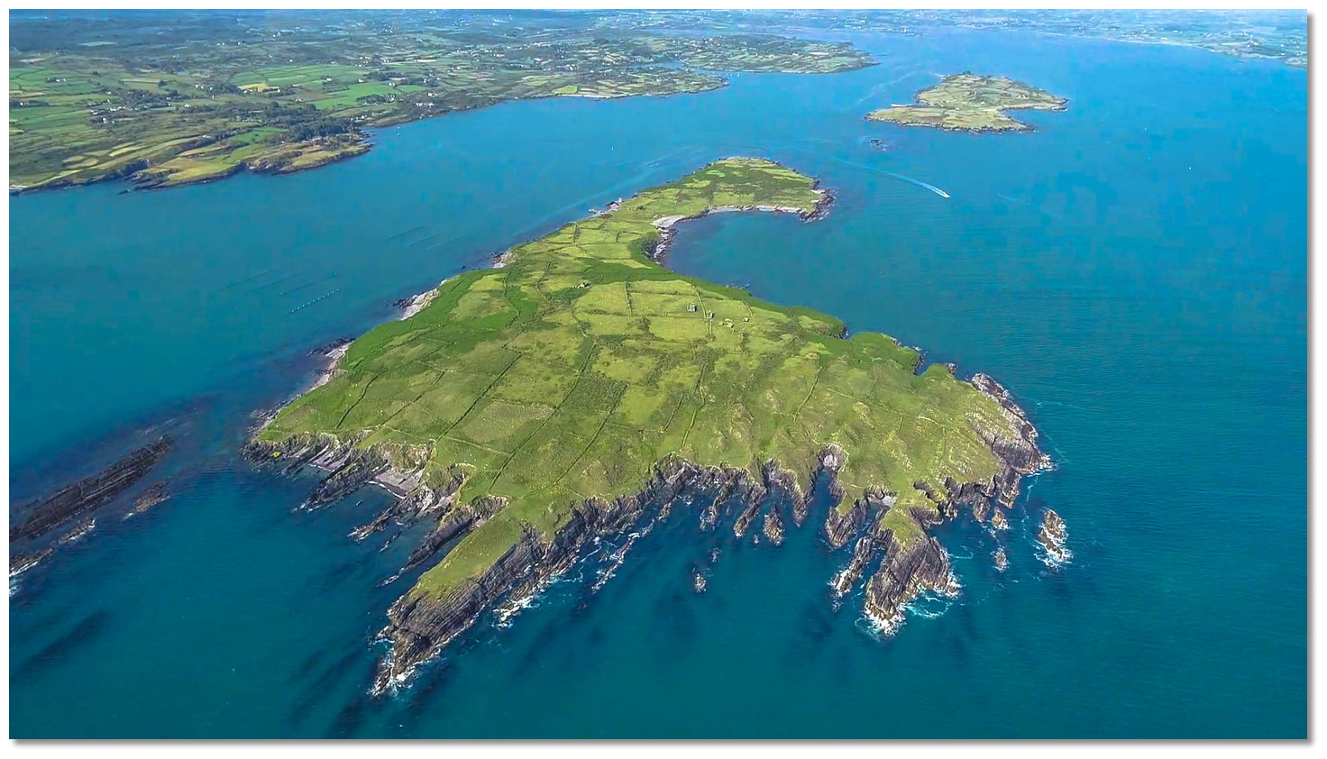
These additional images feature in the 'How to get in' section of our detailed view for Poulgorm Bay.




| Detail view | Off |
| Picture view | On |
Aerial views of Kilcoe Castle
Jeremy Irons shows the castle interior today
Add your review or comment:
Please log in to leave a review of this haven.
Please note eOceanic makes no guarantee of the validity of this information, we have not visited this haven and do not have first-hand experience to qualify the data. Although the contributors are vetted by peer review as practised authorities, they are in no way, whatsoever, responsible for the accuracy of their contributions. It is essential that you thoroughly check the accuracy and suitability for your vessel of any waypoints offered in any context plus the precision of your GPS. Any data provided on this page is entirely used at your own risk and you must read our legal page if you view data on this site. Free to use sea charts courtesy of Navionics.


