_county_cork_ireland_DJI_0659_stitch.jpg)
Castletown Bearhaven is a completely protected inner harbour set within the extensive safe harbour of Bearhaven. Safe access is provided in all reasonable conditions, on any state of the tide, day or night with the support of illuminated transits and a well-marked deep fairway.

Keyfacts for Castletownbere (Castletown Bearhaven)


Nature


Considerations
Protected sectors


Summary
A completely protected location with attentive navigation required for access.


Nature


Considerations
 +353 27 70220 HM
  +353 87 2155432
  Martin.mylotte@agriculture.gov.ie
  castletownbereport.com/index.html
  Ch.14, 16
 Position and approaches
Haven position
 51° 39.019' N, 009° 54.344' W
This is in the anchoring area to the north of Dinish Island
What are the initial fixes?
The following waypoints will set up a final approach:(i) Bearhaven East Entrance Initial Fix
 51° 38.725' N, 009° 45.901' W
This position is approx 600 metres east of Carrigavaddra Perch and 200 east of the East Cardinal.
(ii) Castletownbere Harbour Initial Fix
 51° 38.410' N, 009° 54.532' W
This is about a ⅓ of a mile outside of the entrance on the intersection of both harbour transits.
(iii) Bearhaven West Entrance (Pipers Sound) initial fix
 51° 36.850' N, 009° 55.680' W
This position is approx 600 metres east of Fair Head, half a nautical mile from the entrance, situated on the 024° leading light and beacon on Dinish Island.

What are the key points of the approach?
 .
. - Castletownbere is approached through one of Bearhaven two entrances: one round the western end of Bear Island, and the other from the eastern end.
- From the Western Entrance, follow supporting beacons and leading lights for the distance of about 2 miles into the harbour from the entrance.
- From the Eastern Entrance, approach between Roancarrigmore, passing it to starboard or east, and the Carrigavaddra reef to port, or west.
- Then proceed down the centre of Bearhaven, leaving in order, the George Buoy to starboard, the Bardini Reefer Buoy to port, the Hornet Buoy to starboard and the Walter Scott Buoy to starboard.
Not what you need?
- Dunboy Bay & Traillaun Harbour - 1.2 nautical miles SW
- Mill Cove - 1.5 nautical miles E
- Lawrence Cove - 3.1 nautical miles ESE
- Lonehort Harbour - 4.1 nautical miles E
- Ballycrovane Harbour - 4.2 nautical miles NNW
- Ardgroom Harbour - 6.3 nautical miles N
- Adrigole - 7.2 nautical miles ENE
- Kilmakilloge Harbour - 7.4 nautical miles NNE
- Ballynatra (Trá Ruaim) Cove - 7.8 nautical miles SE
- Dooneen Pier - 8.4 nautical miles SE
- Dunboy Bay & Traillaun Harbour - 1.2 miles SW
- Mill Cove - 1.5 miles E
- Lawrence Cove - 3.1 miles ESE
- Lonehort Harbour - 4.1 miles E
- Ballycrovane Harbour - 4.2 miles NNW
- Ardgroom Harbour - 6.3 miles N
- Adrigole - 7.2 miles ENE
- Kilmakilloge Harbour - 7.4 miles NNE
- Ballynatra (Trá Ruaim) Cove - 7.8 miles SE
- Dooneen Pier - 8.4 miles SE
Chart
What's the story here?
 Castletown Bearhaven Harbour
Image: Tourism Ireland
Castletown Bearhaven, or Castletownbere which is the town built around it, is a major fishing port and the main town on the Beara peninsula. The large harbour is situated close northwest of Dinish Island which is located on the north side of the protected Bearhaven that is formed by the strait that separates Bear (Bere) Island from the mainland. Dinish Island is connected by a bridge to the mainland. The harbour area occupies a space of about ¼ mile long and the same broad and it is home to a local fleet of sixty fishing boats and many others that berth here from around the world.
_with_the_dinish_wharf_expansion_underway.jpg) Castletownbere (2021) with the Dinish Wharf Expansion underway
Castletownbere (2021) with the Dinish Wharf Expansion underwayImage: Michael Harpur
The excellent harbour, nestled within the protected waters of outer Bearhaven Harbour, provides shelter against all winds. As part of the new development, it has a maintained navigation channel of 6.5 metres. Although the harbour welcomes leisure craft it is principally a fishery port with limited dedicated facilities for leisure craft. An 80-metre-long pontoon is available at the west end of the town quay where leisure vessels can be accommodated but it is usually occupied by small fishing vessels. As such it is better thought of as an anchoring location with a spacious area available, dredged to 2.4 meters, centred about 150 metres east of the quay, or in strong southerly close to the north of Dinish Island. Visitor moorings are also provided outside the harbour in Bearhaven. These are 4 seasonal moorings, laid Apr-Sep, situated close west of Minane Island and about 600 metres east of Dinish Island. At the east end of the quay, there is a pontoon that makes dinghy landings convenient.
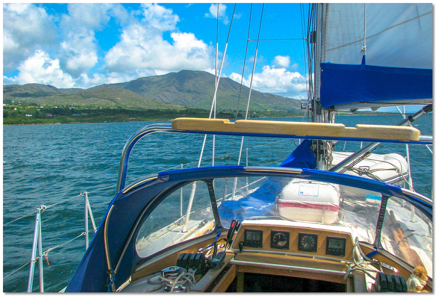 Yacht cruising in the protected waters of the outer Bearhaven Harbour
Image: Graham Rabbits
The central part of the quay is very busy but a temporary berth may be available at its western end or at the northeastern end with permission from the Harbour Master Martin Mylotte. It is advisable to contact the HM in advance of arrival and take advice. [VHF] [Castletown Bearhaven Harbour] Ch. 16 and 14,
 +353 (0)27 70220,
  +353 (0)87 2155432,
  martin.mylotte@agriculture.gov.ie,
  castletownbereport.com. This is especially the case if the intention is to come alongside the pontoon. It may be possible to come alongside a fishing boat when it does not impede commercial operations and with the permission of the HM.
 How to get in?
_island_and_bearhaven_with_the_eastern_entrance_(left)_and_the_western_(right).jpg) Bear (Bere) Island and Bearhaven,
Bear (Bere) Island and Bearhaven, with the eastern entrance (left) and the western (right)
Image: Michael Harpur
 Use Ireland’s coastal overview for Mizen Head to Loop Head
  for seaward approaches. The harbour is approached through the sheltered and spacious body of water that is Bearhaven which has two entrances. One round the western end of Bear Island, and the other from the eastern end between Carrigavaddra Reef and Roancarrigmore Island.
  The West Entrance to Bearhaven as seen from within
Image: Michael Harpur
The shortest route from the seaward to Castletownbere is via the West Entrance to Bearhaven which lies between the high precipitous shores of Fair Head, to the west, and Ardnakinna Point with a lighthouse on the eastern Bere Island side. This is the most direct as Dinish Island is about 1¾ miles north by northeast of Ardnakinna Point. The entrance, also known as Pipers Sound it is as little as 350 metres wide at its narrowest point. This approach has the benefit of a lighthouse, lit buoys and illuminated transits making it the best option for a night approach. However it can be subject to baffling winds, and a heavy ground swell and its stronger currents can make it uncomfortable in a strong southwesterly against the ebb.
 The eastern end and entrance to Bearhaven as seen from Mill Cove
Image: Michael Harpur
The East Entrance to Bearhaven is the wider choice. It is ¾ of a mile wide and very deep making sailing access very easy. It is better used by day as the entire eastern area of Bear Island is low, shelving, ill-defined and as such should be given ample respect. Moreover, Bear Island’s eastern point is unlit and dark save for the Lighted Carrigavaddra East Cardinal Buoy moored a little over a ½ mile off the island.
 Yacht making its way westward from the Bearhaven's eastern entrance
Image: Graham Rabbits
The passage up Bearhaven, about 5 miles in an east/west direction, has well-marked mid-channel rocks but uncharted marine farms could present difficulty. With daylight, a sailing vessel may work through all these without difficulty as there is little tidal stream to contend with.
 The West Entrance to Castletownbere
 Image: Burke Corbett
 The main approach to the harbour lies between Fair Head and Ardnakinna Point Fl (2) WR.10s on the western end of Bear Island. Ardnakinna Point Lighthouse is a conspicuous white 20 metres high round tower 62 metres above MHWS.
 Ardnakinna Point Lighthouse - Fl (2) WR 10s 62m 17/14M position: 51° 37.104’N 009° 55.092’W
 Ardnakinna Point lighthouse marking the Western Entrance to Castletownbere
Image: Burke Corbett
The Western Entrance has supporting beacons and leading lights all the way into the harbour from the entrance. The first set leads up to Dinish Island then, the second set, into the inner harbour itself. The first set of leading lights are on a bearing of 024°T and lead up to the Castletownbere Lighthouse situated on the south end of Dinish Island. By day the beacons are front; Red with White vertical stripes on Castletownbere Lighthouse, and rear; white hut, red stripe, 6 metres high, 4 above MHWS, on the mainland beyond.
Castletownbere Lighthouse - Dir. Oc. WRG 5s position: 51° 38.792’N 009° 54.312’W
In the daytime, this first set is barely distinguishable from Ardnakinna. However, a mid-channel path provides more than adequate water for leisure craft, with little or no danger to a leisure vessel. The single obstacle at the entrance is the 3.6 metres deep Harbour Rock situated a ½ mile within the entrance which presents no issue to leisure craft. By the time a vessel is in its vicinity, the leading line will have been safely acquired so all that is required at night is to simply keep in the white sector Dir. Oc WRG 5s.
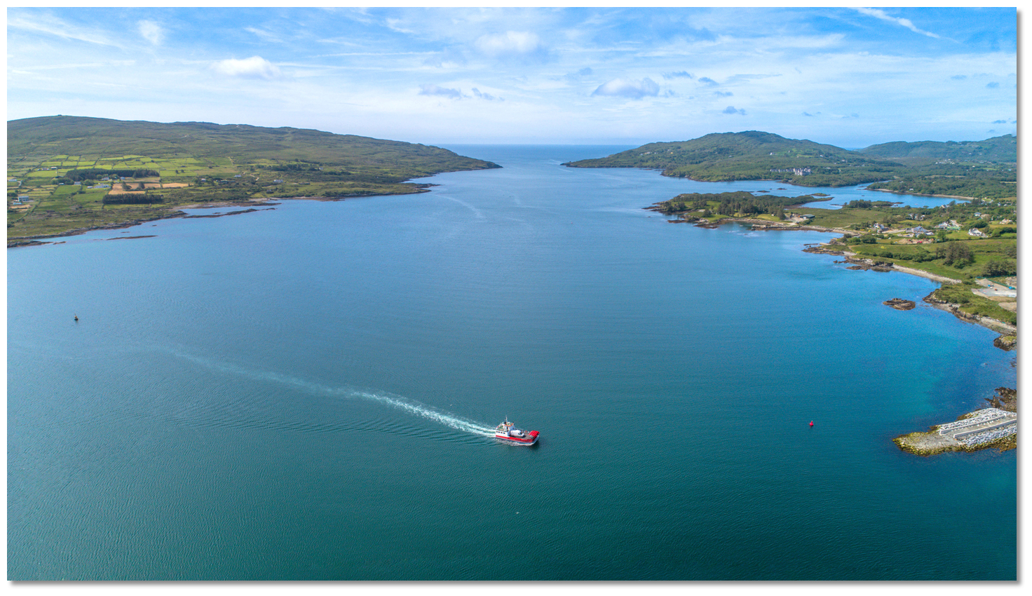 The run in from the western entrance to Castletownbere Harbour
Image: Michael Harpur
Follow this bearing up the north by northeast-facing Western Entrance fairway, also known as Pipers Sound. The fairway leads between Naglas Point, to starboard, and the forested Pipers Point, to port, and narrows to about 350 metres.
 Dunboy Bay and Traillaun Harbour opening within Colt Rock
Image: Michael Harpur
The fairway opens out to the west at Dunboy Bay & Traillaun Harbour
 . Colt Rock which uncovers on the last quarter ebb and dries to 2.1 metres, with a lited red perch, lies abreast of the northwestern side of the fairway here.
 Colt Rock Perch - Fl(2)R.10s, position: 51° 38.068’N 009° 55.087’W
The fairway channel is to the east of it, between the rock and Fort Point. The latter, distinguished by the No.1 starboard mark, and a battery and square blockhouse ashore, is foul to nearly a cable off, as is the shore to the east of it as far as Sheep Island.
No. 1 Starboard marker – Q.G position: 51° 38.078’N 009° 54.702’W
Continue up to the No. 2 Port marker where the least depth from the entrance is no less than 7.9 metres staying on transit.
No. 2 Port marker – Q.R position: 51° 38.345’N 009° 54.689’W
 Roancarrigmore
Image: Graham Rabbits
 Vessels approaching from the east will find the east entrance, ¾ of a mile wide between the dangers on either side, with a depth of 31.0 metres, is easy to access. It passes to the southwest of the conspicuous island of Roancarrigmore, situated 1¼ miles eastward of Bear Island's low eastern extremity of Lonehort Point.
  Roancarrigmore light tower
Image: Graham Rabbits
The island is flat-topped, 6.1 metres high, 270 metres long in an east and west direction, and 90 metres broad, and is topped with Roancarrigmore lighthouse, a white round tower, a black band, and 18 metres above MHWS.
Roancarrigmore Lighthouse - Fl WR 3s 18m18/14M position: 51° 39.180’N 009° 44.820’W
 Roancarrigmore to starboard making the approach
Image: Burke Corbett
The approach to Bearhaven is then between Roancarrigmore, passing it to starboard or east, and the Carrigavaddra reef to port, or west. Carrigavaddra, just covered on neap tides, extends a ½ mile eastward from Bear Island and is situated 800 metres southeast of Lonehort Point which may be recognised by the remains of an old pile lighthouse on the point.
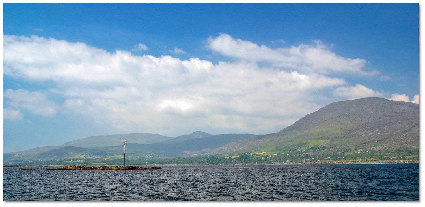 Carrigavaddra Reef marked by a south perch
Image: Burke Corbett
Carrigavaddra reef is very much in the way of a vessel going into Bearhaven by the east entrance, and especially to vessels rounding from the south. The highest part of a reef dries to 2.7 metres and it is marked by an unlit perch.
Carrigavaddra Perch – South Cardinal (unlighted) position: 51° 38.670’N 009° 46.330’W
The lit Carrigavaddra East Cardinal Buoy is moored ¼ of a mile east by northeast of Carrigavaddra rocks. It makes for the ideal point of approach into the entrance and it is here that the initial fix is placed.
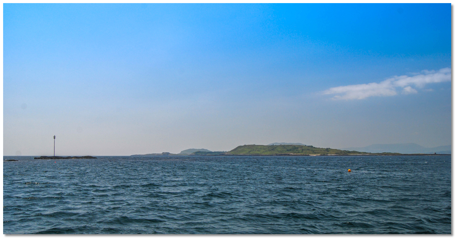 Carrigavaddra and Lonehort Point
Image: Burke Corbett
After rounding Carrigavaddra stand off the north side of Lonehort Point that is foul out to 150 metres. The opposite shore of the mainland is also foul, with a bank 150 metres to the southeast of Carriglea Point which must be approached with caution by boats reaching over from Lonehort Point.
 Yacht to the north of Lonehort Point
Image: Burke Corbett
Proceed down the centre of Bearhaven, leaving in order, the George Buoy to starboard, the Bardini Reefer Buoy to port, the Hornet Buoy to starboard and the Walter Scott Buoy to starboard.
George Buoy - Fl (2) 10s position: 51° 39.024’N 009° 49.695’W
The entrance to Lawrence Cove Marina
 will be seen ¾ of a mile to the south of the George Buoy.
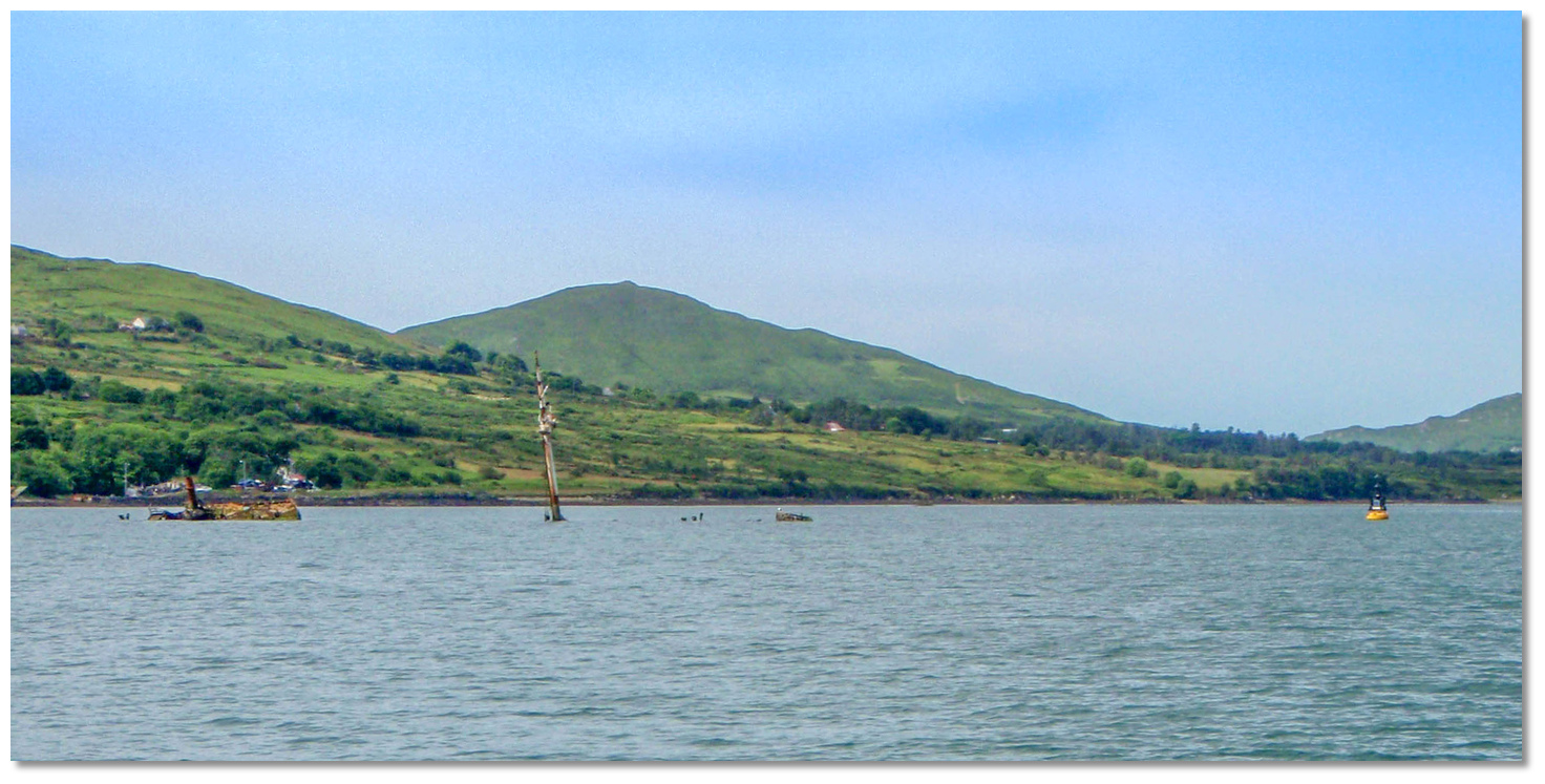 Bardini Reefer and its Buoy to north cardinal
Image: Burke Corbett
Bardini Reefer Buoy – North Cardinal Q position: 51° 38.821’N 009° 51.406’W
Hornet Buoy – South Cardinal VQ (6) + LFl 10s position: 51° 38.859’N 009° 52.171’W
About a ⅓ of a mile northward of the Hornet south cardinal mark the anchorage of Mill Cove
 will be seen on the north shore.
  Bearhaven as seen from Mill Cove on the north shore
Image: Michael Harpur
Caution is required here as an aquafarm lies about 400 meters north of the Hornet south cardinal between it and Mill Cove.
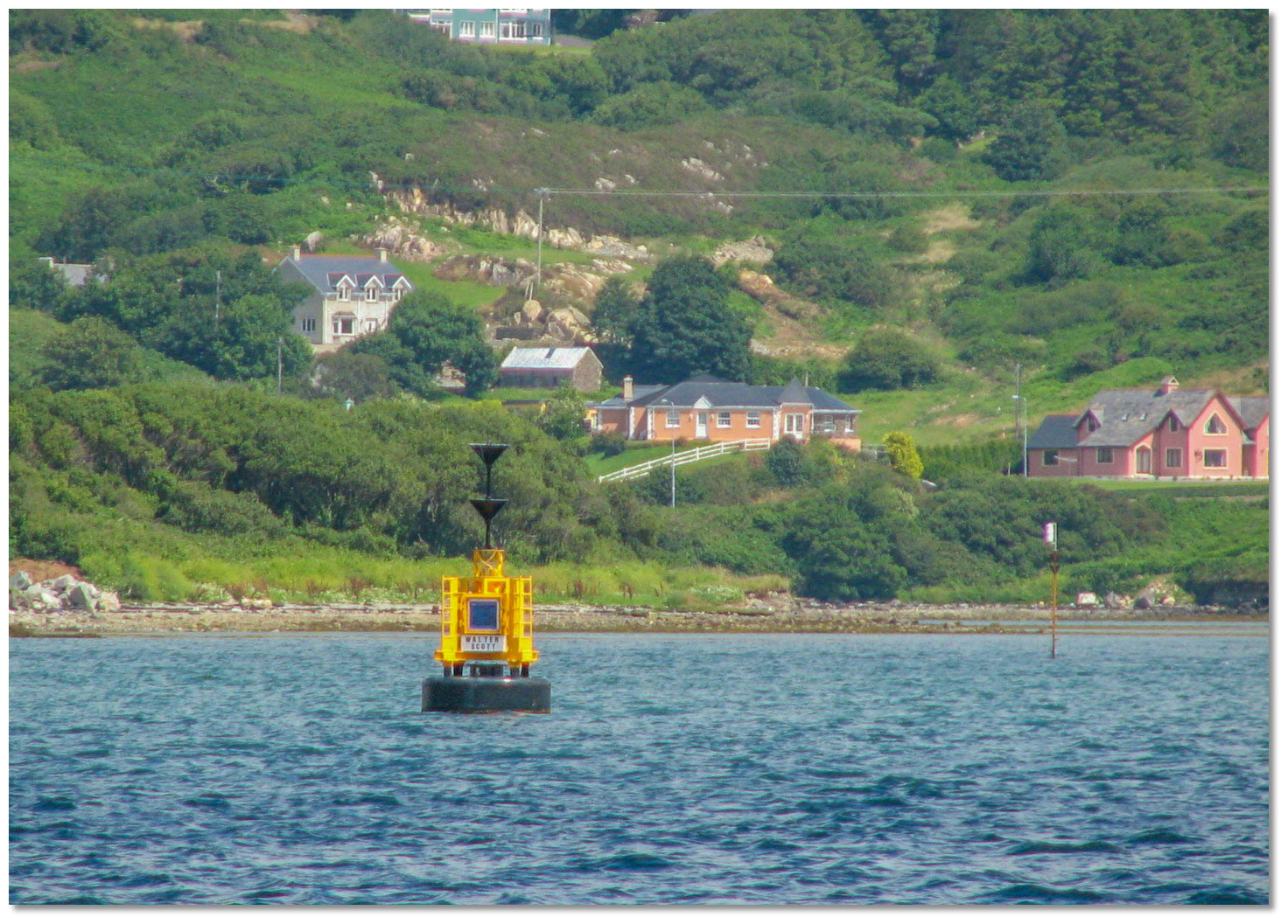 Walter Scott Buoy
Image: Graham Rabbits
Midway between Hornet Buoy and the Walter Scott Buoy is the option to break off to the north for Castletownbere’s mooring buoys outside the harbour and close west of Minane Island.

Walter Scott Buoy – South Cardinal Q (6) + LFl 15s position: 51° 38.541’N 009° 54.234’W
Proceed west from the Walter Scott Buoy until approximately 600 metres south by southwest of Dinish when the 010° will appear by night, Occulting W.3s, or by day the harbour beacons on Castletownbere’s north shore leading to the inner harbour.
 Privateer Rock off Dinish Island
Image: Michael Harpur
During daylight, it is possible to cut in between the Walter Scott Buoy and Privateer Rock off Dinish Island. Privateer Rock dries to 1.5 metres close south of Dinish Island and it is marked by an unlit south cardinal mark.
.jpg) Castletownbere Harbour (2021)
Castletownbere Harbour (2021)Image: Michael Harpur
 From the Castletownbere initial fix, just before the No. 2 Port marker, the inner harbour will be clearly seen and its leading marks easily picked up. On the alignment of 010°T, they are situated on the north shore of the harbour and are marked by red and white striped leading marks Oc. Bu. 6s (blue) by night. These lead into the west of the Walter Scott south cardinal mark, then Dinish Island and into Castletownbere’s inner harbour.
Those intending to pick up the moorings alter course to starboard. Pass close southeast of Walter Scott south cardinal mark, then southeast of Privateer Rock, and continue about 250 metres off and parallel to Dinish Island's southeast shore to avoid the covered rock - as described above.
 Bear Island ferry passing in through the entrance to the harbour
Image: Michael Harpur
Keep a lookout for the frequent Bear Island ferry that passes out through the harbour entrance and then between the Walter Scott Cardinal mark and the Privateer Rock for the northwest corner of Bear Island.
 Buoys leading into Castletownbere Harbour
Image: Michael Harpur
The inner harbour entrance channel is situated between Came Point and the quays on DInish Island. It is marked by buoys and a single red concrete column on the inside, Q.R. by night, off the western shore. The 010° leading lights lead a path between both beacons on a mid-channel route.

 The mid channel view up Castletownbere Harbour
Image: Michael Harpur
Castletownbere stands on the shore of a little creek in the northwest arm of the harbour. The east side of the harbour is enclosed by the highly industrialised Dinish Island, which extends into Bearhaven and is connected to the mainland by a low bridge.
 The inner quay on the Dinish Island side as seen from the fairway
Image: Burke Corbett
The inner harbour is divided into two halves. On the Dinish Island side, there is about 120 metres on the northwest side of the island.
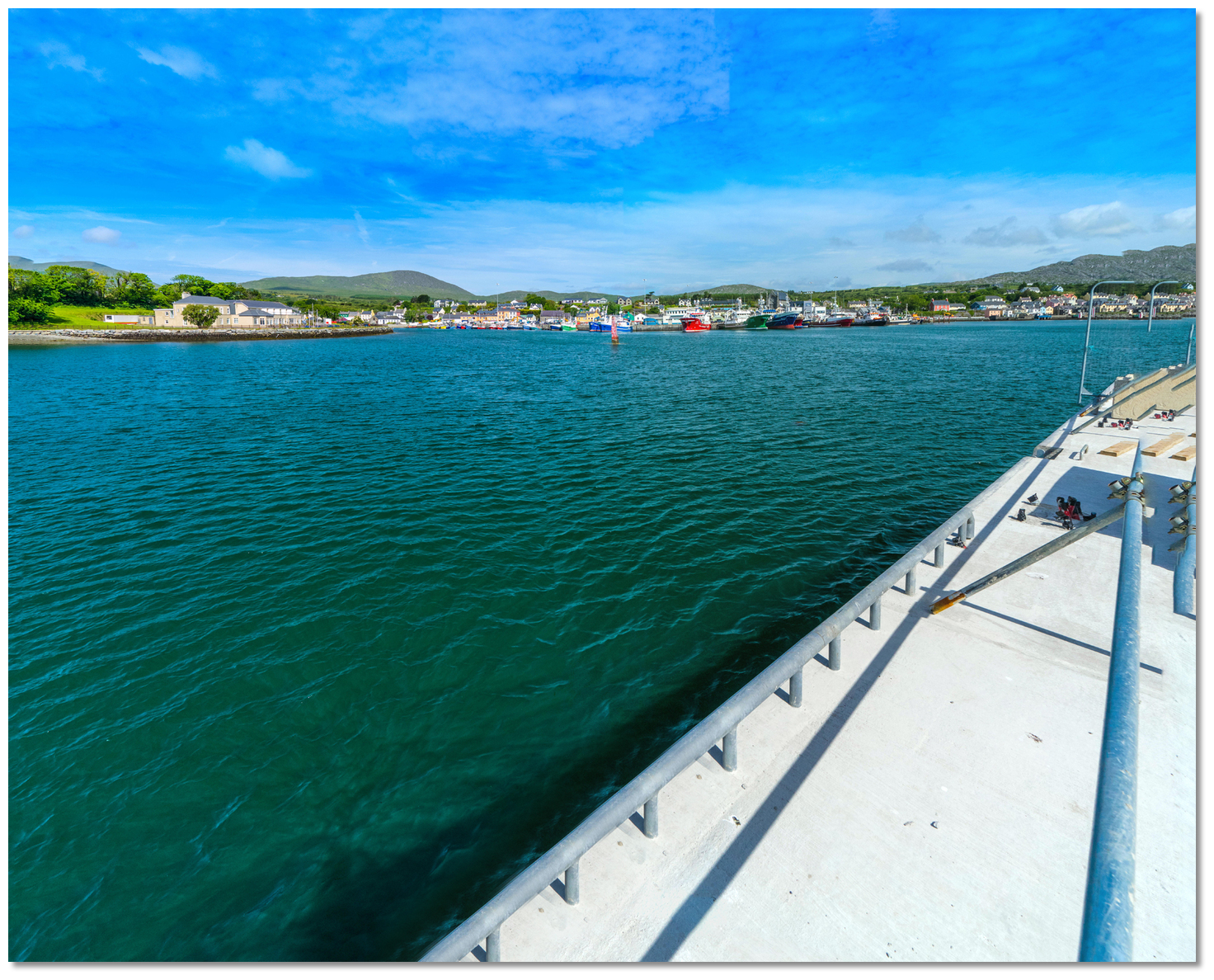 The new Dinish Wharf Expansion quay alongside the fairway
Image: Michael Harpur
This is now been dramatically extended by the Dinish Wharf Expansion project. This sets in place a new quay structure alongside the fairway that is approximately 216 metres long with a draught of 8 metres. On the opposite town side, there is 350 metres of berthage with the pontoon on its western end.
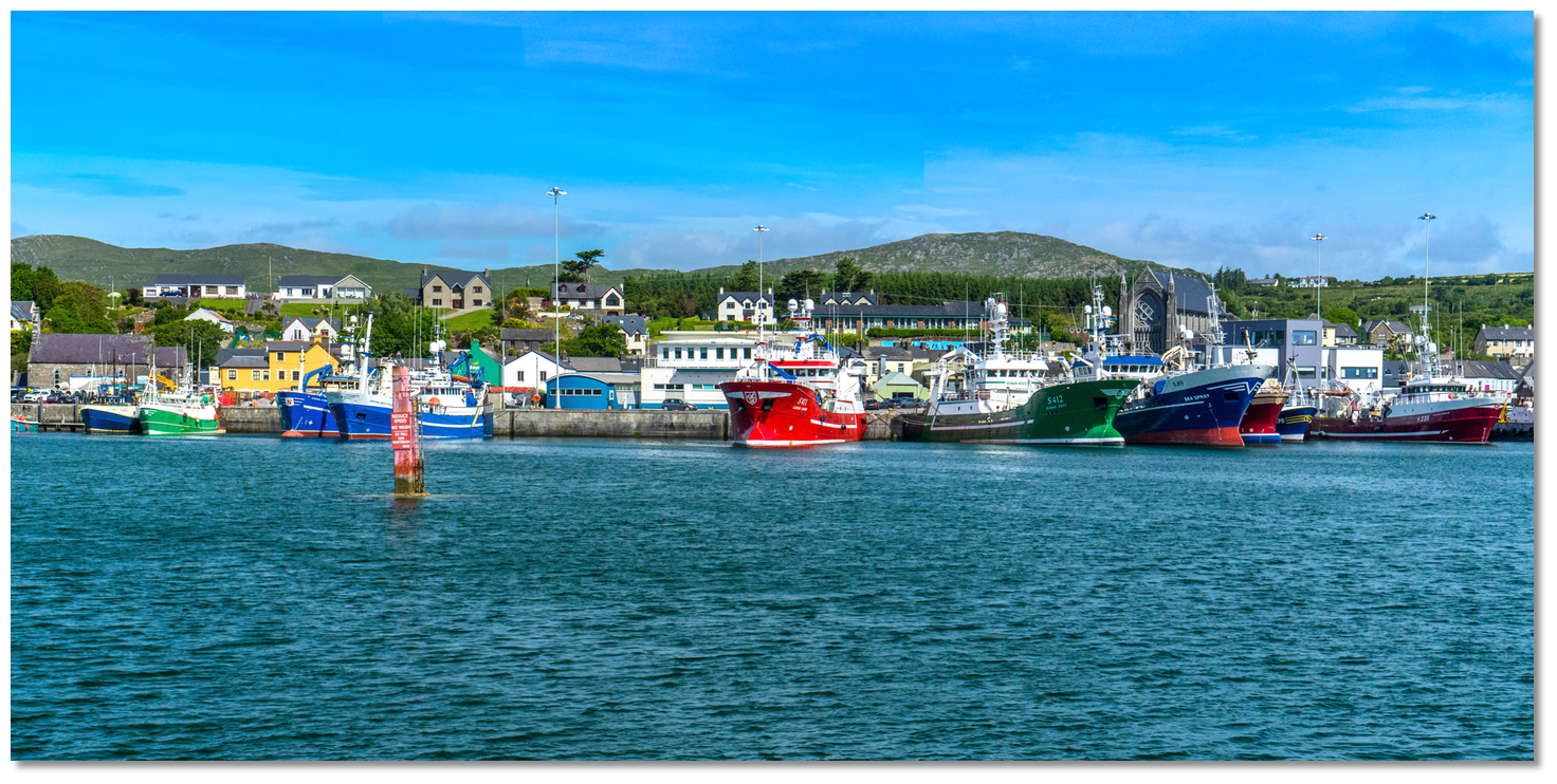 Castletownbere town quay
Image: Michael Harpur
 The anchoring area is on the east side of the harbour between the lifeboat and the quays on Dinish Island. It is centred about 250 metres west of the quay close to but avoiding the RNLI mooring over soft mud. If a southern blow develops moving in closer to Dinish Island provides better shelter or using Bearhaven that provides numerous sheltered anchorages.
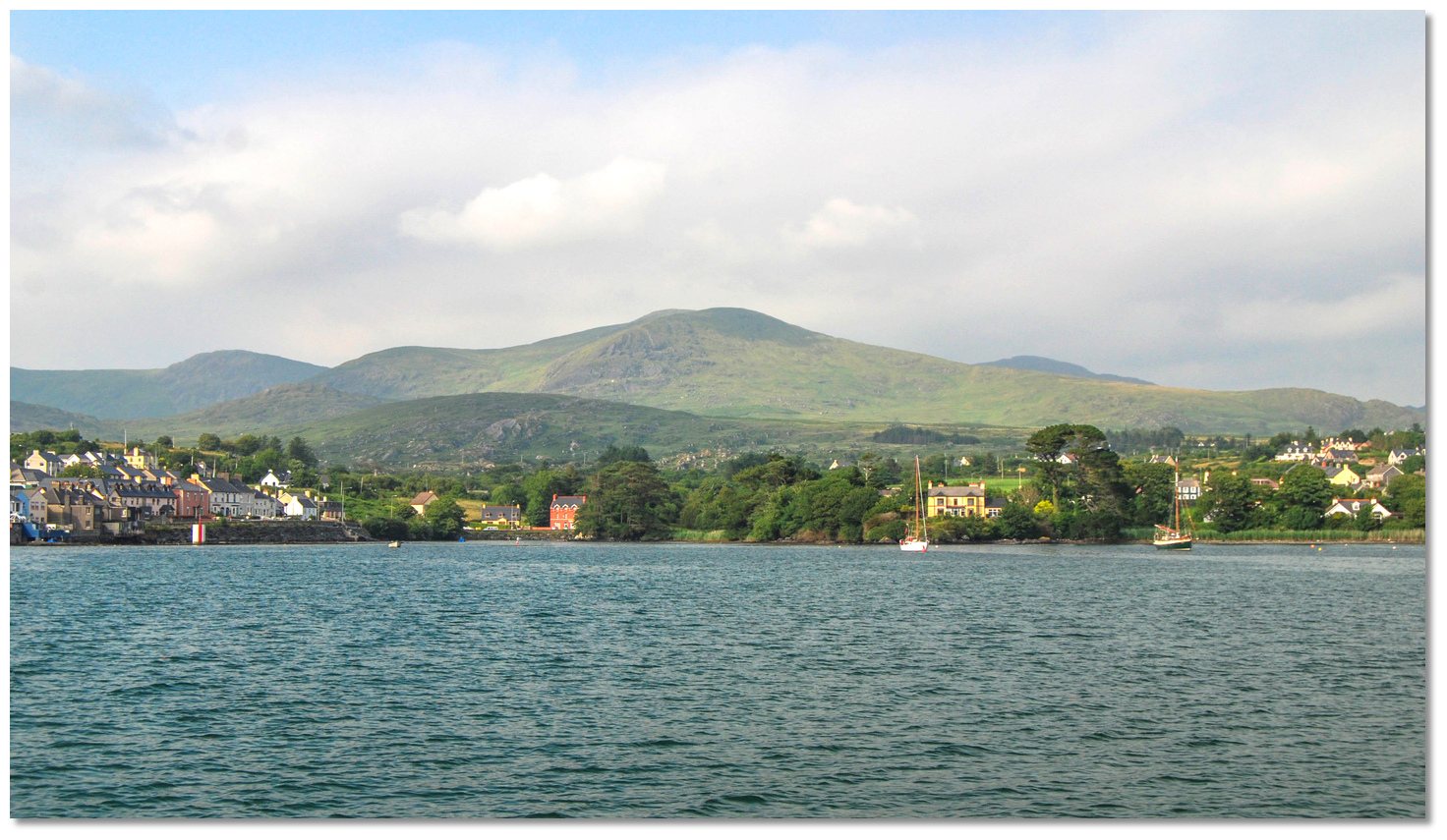 The anchoring area in Castletownbere Harbour
Image: Burke Corbett
It is possible, by arrangement with the harbour master, to come alongside the pontoon if available. Also, the wall if a slot is available or to raft up alongside a fishing boat. The northeast quay is usually the best place to find a berth. Avoid the central part of the quay where there is an ice plant that is in continuous use by fishing vessels.
Why visit here?
Castletownbere, also known as Castletown Berehaven and in Irish 'Baile Chaisleáin Bhéarra', derives its name from the Gaelic baile meaning 'townland, town, or homestead' of the caisleán meaning 'castle' of [O'Sullivan] Bere.The town of Castletownbere developed around Castle Dermot which is said to have been built by Dermod Donn MacCarthy around 1474 that has not survived. By the 16th century, Beara was the traditional seat of power of O'Sullivan Beare (sub-lords to the McCarthy's) that encompassed the areas of Castletownbere and Bere Island. The O'Sullivan Lordship was one of the last points of native Irish resistance after the Battle of Kinsale. However, the impressive ruins of Dunboy Castle, two miles west of the town, are still visible - see Dunboy
 .
.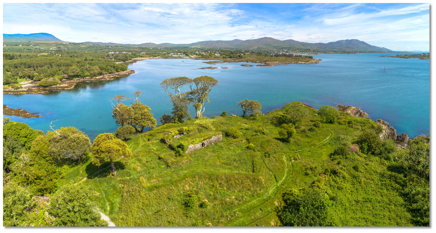 The remains of Dunboy Castle, two miles west of Castletownbere
Image: Michael Harpur
Up to the 19th century, the deep-water harbour was very much the domain of smugglers and fishermen exchanging pilchards for contraband French brandy. But this all changed at the dawn of the 19th century. In 1796 Theobald Wolfe Tone and his confederates arrived into Bantry Bay in French 'men o'war' ships. They anchored off Ahabeg situated just five miles east of Castletownbere, but the foul weather at the time of their arrival was so violent that they could not land. Wolfe Tone raged that he was so close to Ireland that he could almost have thrown a ship's biscuit onto the shore. He reflected, justifiably, that "England has not had such an escape since the Armada" alluding to the fact that adverse winds frustrated England's mighty enemies on both occasions.
 The Martello Tower's commanding view on Ardagh Hill (right)
Image: Neville Goodman via CC BY-SA 2.0
But England would never rely upon the weather again and the entire area was fortified in the 19th century. The Martello Tower on Ardagh Hill was built in 1798 as one of a series constructed by the British in a rush to defend Ireland in the aftermath of the attempted invasion. Most of the stone for Ardagh Tower was quarried on the south side of Ardagh Hill, while the limestone blocks are believed to have been brought from Ballintemple in Cork City. An associated gun battery was built about two hundred metres east of the tower. The Martello tower and gun battery were garrisoned until after the 1815 Battle of Waterloo when the threat from Napoleon no longer existed. But Bearhaven went on to become a key Royal Navy asset used to defend the Atlantic shipping routes and further gun batteries were added. It came into its own in the early part of the 20th century in the age of the dreadnoughts (also spelt dreadnaught).
 2nd Battle Squadron Royal Navy Orion class super dreadnoughts in line c. 1914
Image: Public Domain
This class of battleship was named after the Royal Navy's 1906 HMS Dreadnought. Her two revolutionary features of an 'all-big-gun armament scheme, with an unprecedented number of heavy-calibre guns, and steam turbine propulsion had such an impact that similar battleships built after her were referred to as 'Dreadnoughts'. The arrival of these new warships renewed the naval arms race worldwide, but particularly between the United Kingdom and Germany, which lasted up to the beginning of World War I. Such was the race that within five years, new battleships outclassed Dreadnought herself. The extensive batteries around Bear Island were set in place to protect the fleet of dreadnoughts that used Berehaven. Once anchored these boats could take as long as two days to 'get up steam' and make their way out to sea. Hence the need for wide-ranging fortifications to protect them at anchor.
 Bere Island's two 6" guns as seen at dusk
Image: © Bere Island
In the case of Berehaven, it was not just the odd destroyer that briefly dropped anchor in the strait. It was battleships, and indeed whole battle squadrons, were regular visitors, for these were home waters to the British Home Fleet, and the Atlantic was the exercise ground and playground of all the great ships of which HMS Dreadnought was only the most famous. Castletownbere, with a population of less than a thousand in 1914, would have been overwhelmed by the influx of such a fleet, given that the peacetime complement of one of the smaller, older battleships was somewhere in the region of 600 men. With liberated sailors arriving ashore almost proverbially free with their money, there was much to be made for anyone selling anything, from bottled beer to rides in a jaunting car. And it was not only British sailors as after the USA joined WWI in 1917, the US Navy also stationed some vessels in Castletownbere.
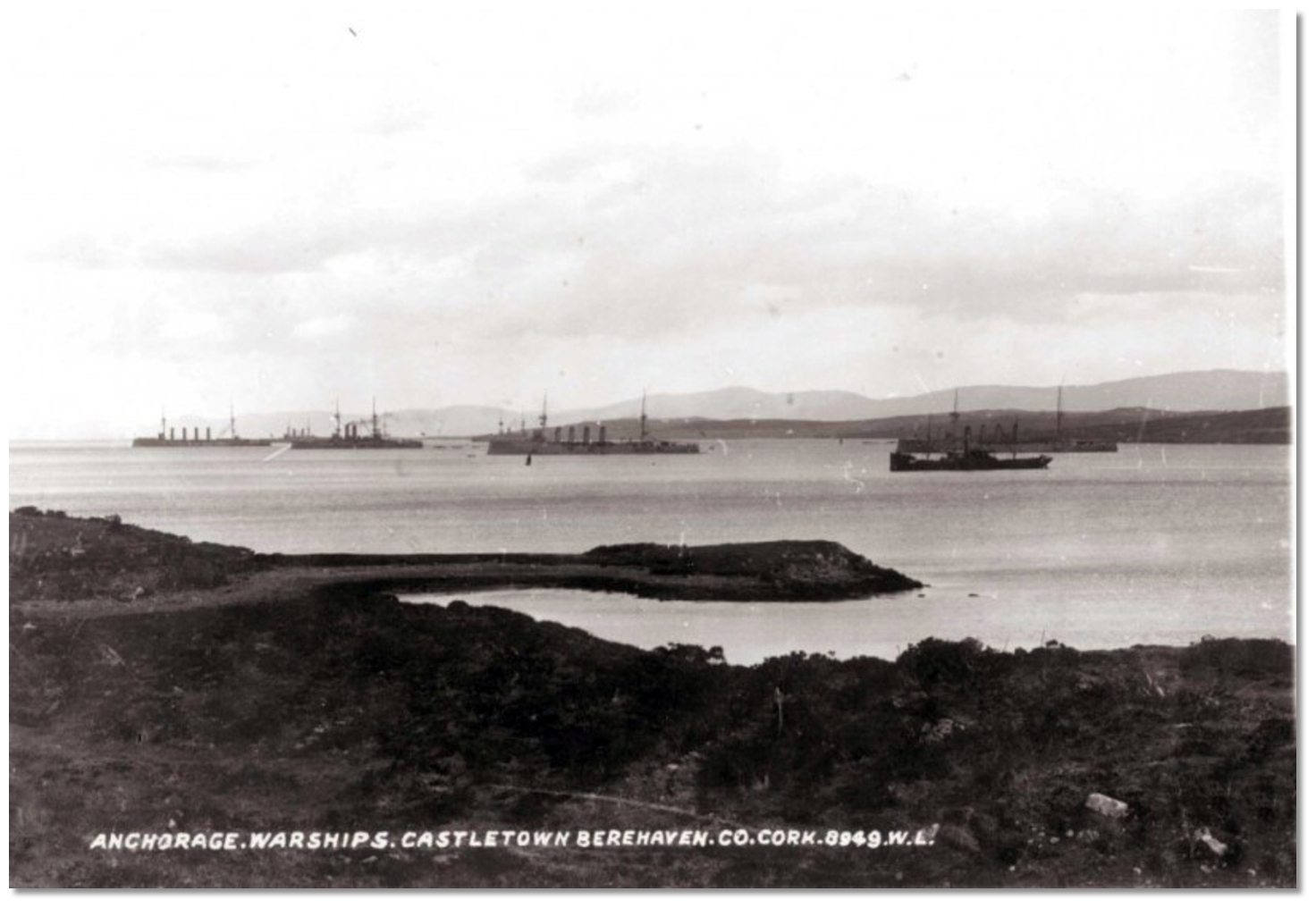 Dreadnoughts in Bearhaven 1914
Image: Public Domain
However, it was a close-run thing as four days before the planned handover date of September 26th Chamberlain met Hitler at Godesberg. At 12.00 noon, on the day of handover, the Union Jack was taken down from Berehaven. One minute later, at 12.01, the Irish Tricolour was raised over the fort. Then, inexplicably, at 13.00, the embarkation of British troops was suspended and they received orders to prepare to retake possession of the forts. The Irish soldiers were ordered out of Lonehort and back to their billets. However, a communication from the Irish Government insisted that the handover be completed by nightfall and so it was. On September 30 the final British detachment sailed from Bere Island on the Marquis of Harrington and on October 1st the Sudetenland was occupied by Germany.
 Castletownbere is the largest white fish port in Ireland
Image: James Stringer via CC BY 2.0
The British government would deeply regret the sacrifice of the Treaty Ports later when the second world war broke out. Winston Churchill was subsequently appalled by the decision, and in an address to Parliament in that year he called it a 'folly': …When the Irish Treaty was being shaped in 1922 I was instructed by the Cabinet to prepare that part of the Agreement which dealt with strategic reservations. I negotiated with Mr Michael Collins, and I was advised by Admiral Beatty who assured me that without the use of these ports it would be very difficult, perhaps almost impossible, to feed this Island in time of war. Queenstown and Berehaven shelter the flotillas which keep clear the approaches to the Bristol and English Channels, and Lough Swilly is the base from which the access to the Mersey and the Clyde is covered… These ports are, in fact, the sentinel towers of the western approaches, by which the 45,000,000 people in this Island so enormously depend on foreign food for their daily bread, and by which they can carry on their trade, which is equally important to their existence… However, had Berehaven and the other treaty ports remained in British hands, Ireland would have found it very difficult to remain neutral throughout the war. So this was very much a pivotal moment in the faith of the nation.
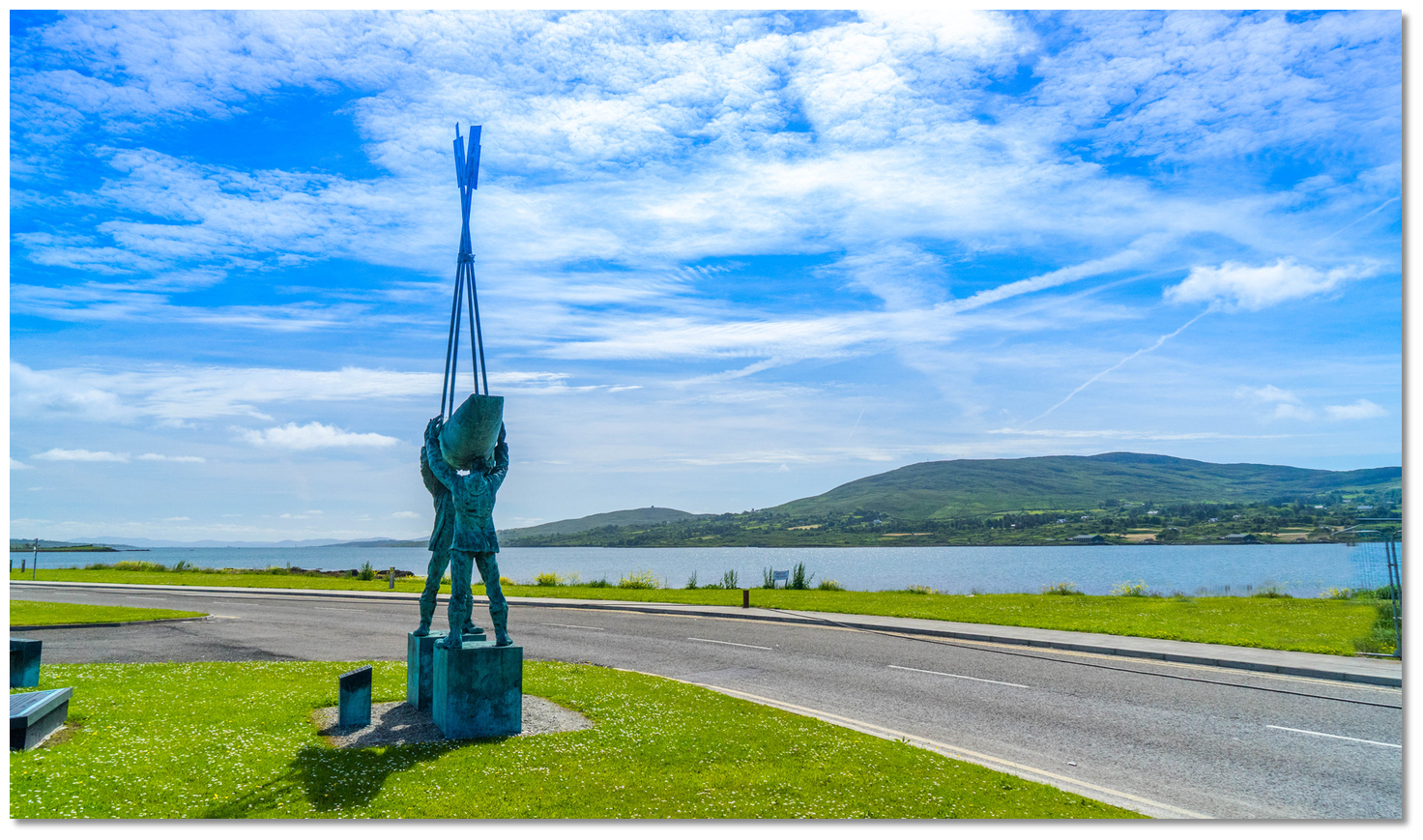 'Twilight Haul' the memorial to those from the community who have been lost at
sea
Image: Michael Harpur
Today, almost burrowed into the foothills of the Caha Mountains, Castletownbere is the principal town of the area. Being the largest white fish port in Ireland it is the headquarters for the Irish fishing fleet port and is awash with foreign fishing trawlers. Despite its isolated position and small permanent population, of around 875, the town managed to re-establish itself as a commercial centre that is a fishing port first and a tourist town second. That gives it great appeal for those looking for the 'real' Ireland, with its market square and traditional Irish town streetscape that is lined with low-lying architecture.
 McCarthy’s Bar on Town Square
Image: McCarthy’s Bar
Although the busy fishing town could never be described as attractive, it is nonetheless a lovely little town to visit and immerse oneself in the history and the area's beautiful surrounding scenery. This is not to say it doesn’t have a bustling waterfront that is lined with a reasonable supply of grocery stores, restaurants, inns, and pubs with most notably the world-famous pub McCarthy’s Bar on Town Square. It features an authentic matchmaking booth, where local families previously used to agree to marriage terms.
 Hiker exploring the Beara Peninsula
Image: Tourism Ireland
Castletownbere is a good place to set down the anchor for touring the magnificent Beara Peninsula. For hikers, the area offers spectacular mountain treks that afford breathtaking views of the counties of Cork and Kerry and out over the sea, and it is an ideal access point to 'The Beara Peninsula'. This beautiful peninsula has two mountain ranges running down its centre, the Caha Mountains and the Slieve Miskish Mountains, and is bounded by the Kenmare 'river', actually a bay, to the north side and Bantry Bay to the south. It is truly worth hiring a car to follow the Ring Route and cut across the Beara from Castletownbere for spectacular mountain scenery.
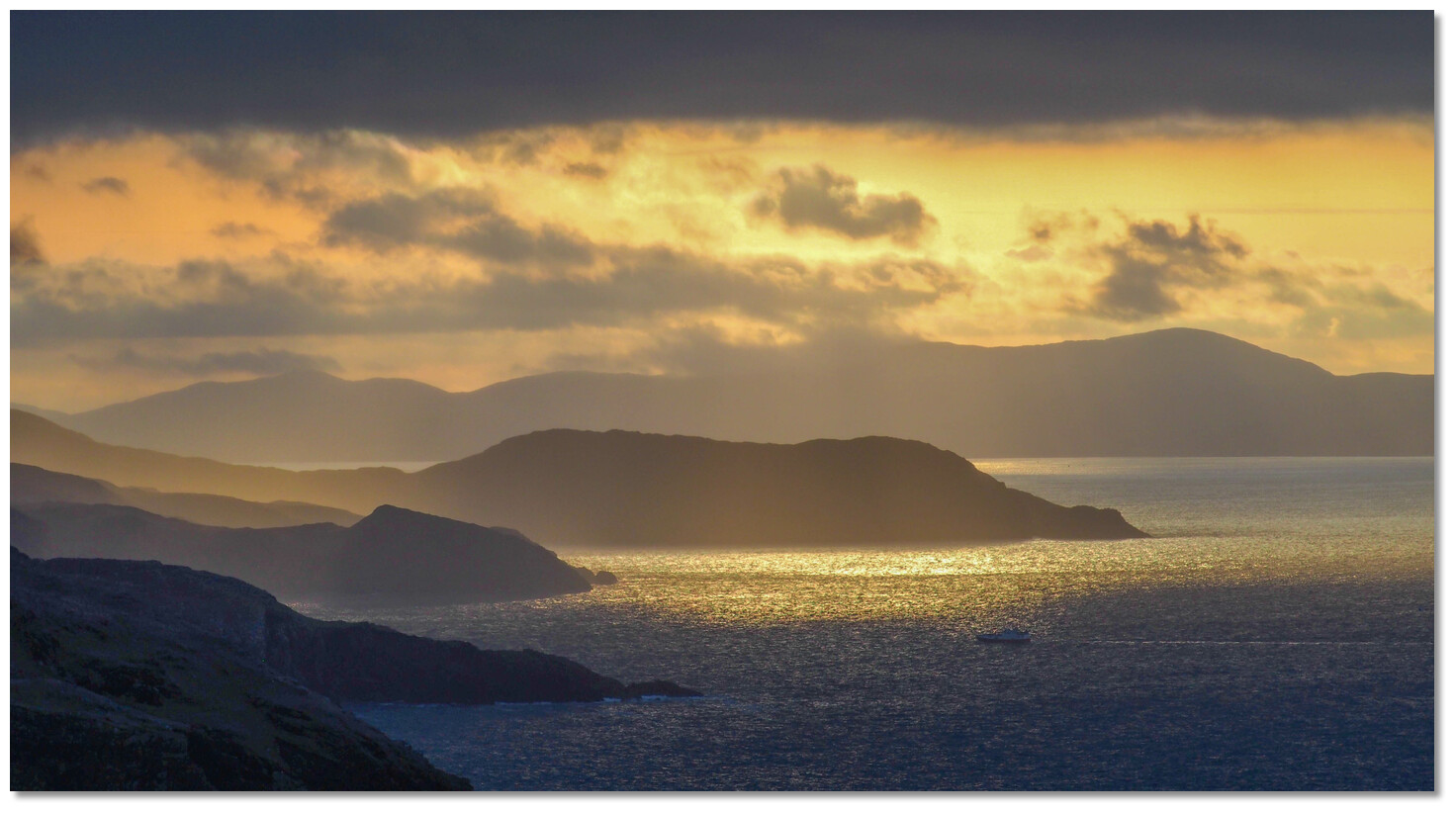 Beara Peninsula sunrise
Image: Olivier Riché via CC BY-SA 2.0
From a boating point of view, it is a perfectly protected harbour that should not be overlooked. Sitting near the outer end of Bantry Bay, Castletownbere offers total protection, a great arrival point to commence a visit on Bearhaven, an ideal provisioning point and the resources of the commercial port town make it a great place to attend to boat repairs.
What facilities are available?
Being the headquarters of the Irish fishing fleet Castletown Berehaven as you would expect has all the facilities that a visiting cruiser is likely to require. These range from a 200-tonne syncrolift with 30 metres of quay space around it for repairs, several marine engineering firms, electronic and radio repairs, ships chandlers, and water and diesel available on the pier for refuelling.For all other enquiries contact the Harbour Master Cormac McGinley at the Harbour Office on the main pier tel. 027/70220 or mob. 087/2155432.
On Main St and the Square, you’ll find ATMs as well as cafes, pubs and grocery stores. The town has all the main facilities that you might require including two supermarkets, a general supply store, two chemists, half a dozen pubs and the same number of restaurants that range from take-aways to meals at the Bearhaven Golf Club. Bus 236 (Bus Éireann) connects the town to Cork City, Bantry, and Dunmanway. Beara Tourism (www.bearatourism.com) provides all the information you need to make the most of a visit. Visitor Information Beara Tourist Office. St. Peter’s Church Castletownbere, Beara 027/70054
Any security concerns?
It is difficult to find a spot that is not in the way of commercial fishing. Always leave someone on board to shift the boat in the event of a problem whilst others are off shopping. It is a friendly location and you are unlikely to encounter a security problem there.With thanks to:
Burke Corbett, Gusserane, New Ross, Co. Wexford.Aerial views of a fishing boat arriving into Castletownbere
Aerial views of Castletownbere Harbour area
Entering Berehaven Castletownbere from the western
Eastern Castletownbere entrance from a time-lapse sequence
Add your review or comment:
Mary Stabbins wrote this review on Jun 2nd 2022:
We went into the harbour to provision and take on water but it was not possible to use any of the pontoon facilities and we anchored in the harbour. There was water available on the life boat pier but no space to go alongside so we were only able to fill containers with water.
Average Rating: UnratedPlease log in to leave a review of this haven.
Please note eOceanic makes no guarantee of the validity of this information, we have not visited this haven and do not have first-hand experience to qualify the data. Although the contributors are vetted by peer review as practised authorities, they are in no way, whatsoever, responsible for the accuracy of their contributions. It is essential that you thoroughly check the accuracy and suitability for your vessel of any waypoints offered in any context plus the precision of your GPS. Any data provided on this page is entirely used at your own risk and you must read our legal page if you view data on this site. Free to use sea charts courtesy of Navionics.


