

Balbriggan Harbour is a small fishing port on the east coast of Ireland, situated on the north County Dublin coastline, about three miles northwest of Skerries and six miles south of the River Boyne. It offers a small artificial harbour that dries out well beyond its head. It is only suitable for vessels that are prepared to work the tides and take to bottom in the harbour.
Vessels that can dry alongside the wall or rafted to a fishing vessel will find this a good protection in offshore westerlies or moderate onshore conditions. But this is not a place where a vessel will be comfortable in any onshore conditions or general heavy weather. Access is straightforward as there are no immediate dangers to be avoided on a direct eastward approach and the pierhead is lit for a night entry.


Keyfacts for Balbriggan Harbour


Last modified
November 25th 2020 Summary* Restrictions apply
A good location with straightforward access.Facilities


Nature

Considerations

Position and approaches

Expand to new tab or fullscreen
Haven position
 53° 36.741' N, 006° 10.673' W
This is inside the pierhead close to the white pierhead light on the north corner of the pier Fl (3) WRG 20s 10M
What is the initial fix?
The following Balbriggan initial fix will set up a final approach:
 53° 37.090' N, 006° 10.207' W


What are the key points of the approach?
Offshore details are available in eastern Ireland’s coastal overview for Strangford Lough to Dublin Bay  .
.
.- Balbriggan harbour is only suitable for vessels that can take to the hard.
- All vessels must await the rise to near high water to proceed into the harbour.
- The entrance is approached from northeast.
Not what you need?
Click the 'Next' and 'Previous' buttons to progress through neighbouring havens in a coastal 'clockwise' or 'anti-clockwise' sequence. Below are the ten nearest havens to Balbriggan Harbour for your convenience.
Ten nearest havens by straight line charted distance and bearing:
- Skerries Bay and Harbour - 3 nautical miles ESE
- Loughshinny - 5.3 nautical miles SE
- Rush Harbour - 6.4 nautical miles SSE
- Rogerstown Inlet - 6.5 nautical miles SSE
- Drogheda & The River Boyne - 8.5 nautical miles NW
- The Boat Harbour - 8.8 nautical miles SE
- Saltpan Bay - 8.9 nautical miles SE
- Talbot’s Bay - 9.2 nautical miles SE
- Malahide - 9.6 nautical miles S
- Seal Hole Bay - 9.6 nautical miles SE
These havens are ordered by straight line charted distance and bearing, and can be reordered by compass direction or coastal sequence:
- Skerries Bay and Harbour - 3 miles ESE
- Loughshinny - 5.3 miles SE
- Rush Harbour - 6.4 miles SSE
- Rogerstown Inlet - 6.5 miles SSE
- Drogheda & The River Boyne - 8.5 miles NW
- The Boat Harbour - 8.8 miles SE
- Saltpan Bay - 8.9 miles SE
- Talbot’s Bay - 9.2 miles SE
- Malahide - 9.6 miles S
- Seal Hole Bay - 9.6 miles SE


What's the story here?
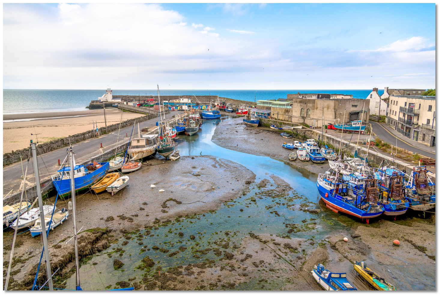
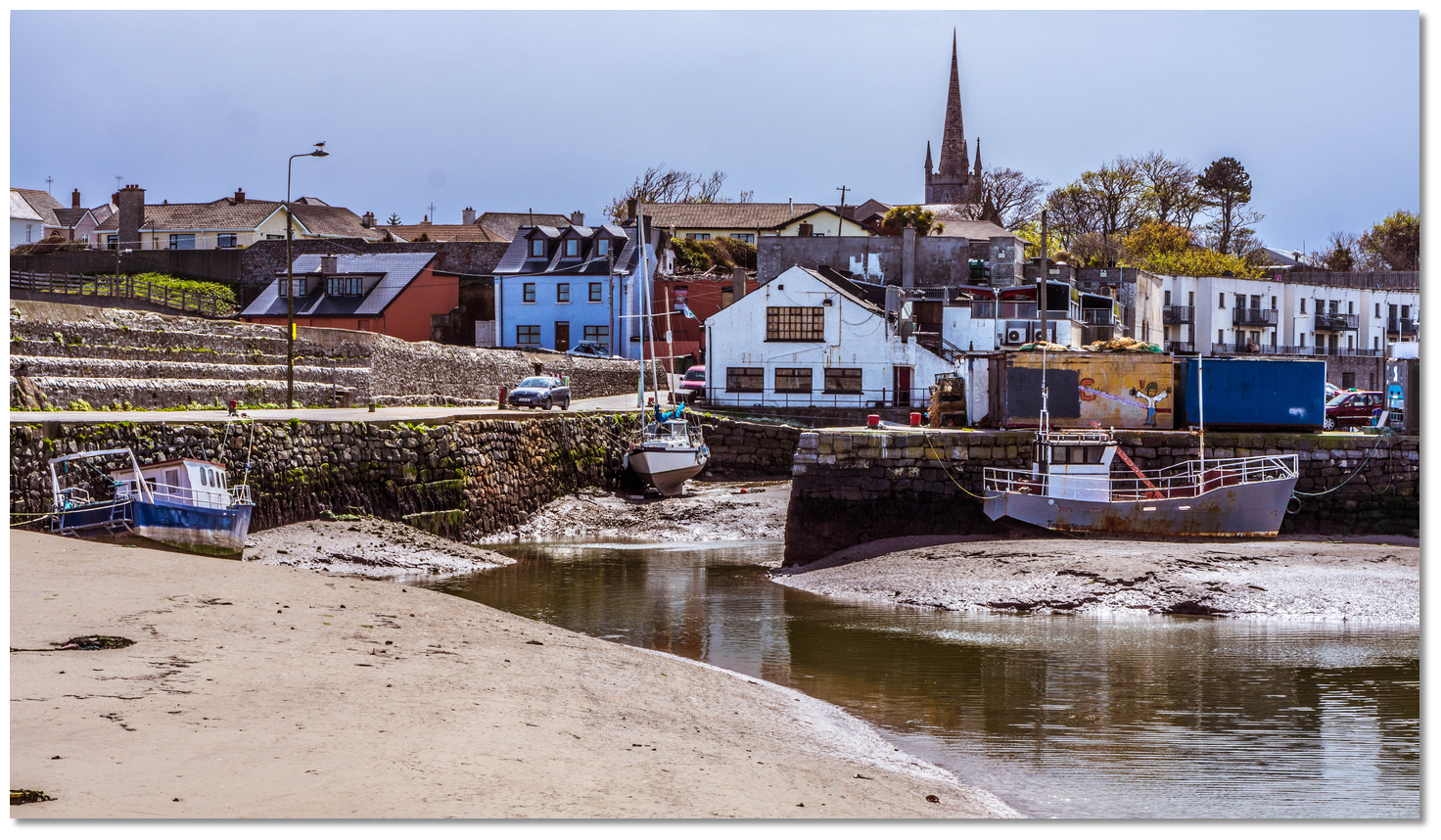
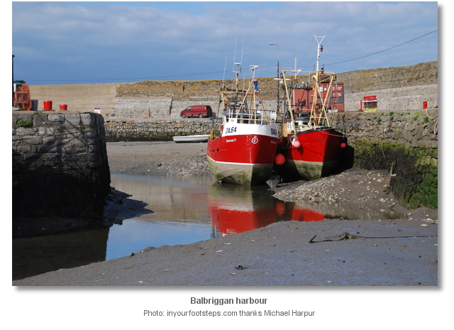
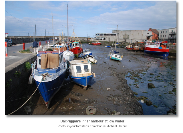
Balbriggan is a large town, with a population of about 20,000 in its environs, fronted with a small tidal harbour set on a ledge of rock. Entered about 3 miles northwestward of Skerries, the harbour is formed by a pair of piers that project 150 metres north-northeast from the shore. Within the piers there is an inner and outer harbour areas. The railway to Dublin runs along the shore here creating the head of the harbour.
 The inner harbour as seen from its head
Image: Jonjobaker via CC BY 2.0
The harbour dries out 180 metres beyond its entrance and a stream runs through it that tends to drop sand deposits outside the entrance. Balbriggan Harbour dries to about 1 metre but has depths of up to 3.7 metres at MHWS.
 Balbriggan Harbour
Image: William Murphy via CC BY-SA 2.0
Vessels drawing up to 2.5 metres can usually enter at High Water ± 02:00. The bottom is fairly level and of mud when the tide is away. The harbour is however often crowded with fishing boats so space may be tight.
How to get in?
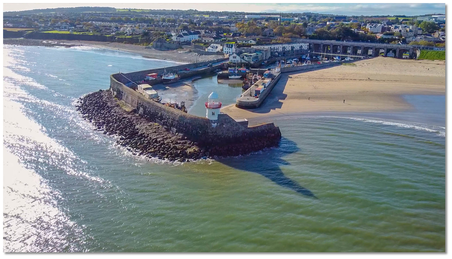 Balbriggan's Light Tower at the seaward end of the pier makes an unmistakable
seamark
Image: Drone Views Media

 Seaward approaches are detailed in eastern Ireland’s coastal overview for Strangford Lough to Dublin Bay . A circular white tower on the pierhead, with a corresponding Martello Tower set upon a rocky ledge ½ a mile northwestward, make the harbour readily apparent from seaward. A clean sandy beach between it and the pier also usable by craft taking the ground.
 Martello Tower on the headland at the north end of the beach
Image: William Murphy via CC BY SA 2.0
The principal danger in the area is the outlying half-tide patch called the Cardy Rocks. Very much in the way of vessels approaching along the coast from the north they are situated 800 metres out from the rocky Breymore Point and 1 mile north of Balbriggan Lighthouse.
Cardy Rocks that are marked by an unlit port hand beacon and a narrow pass, carrying more than 5 metres, lies between them and the point. This cut is the domain of the local boatman and should not be considered by those unfamiliar.
Cardy Rocks, port hand beacon, position: 53° 37.912’N, 006° 10.859’W
 Cardy Rocks as seen from Braymore Point
Image: Kieran Campbell via CC BY-SA 2.0
Keeping Balbriggan on no less than a bearing of 195°T, or to the east of this, clears the Cardy Rocks. By night these rocks are covered by the green sector of Balbriggan Light.
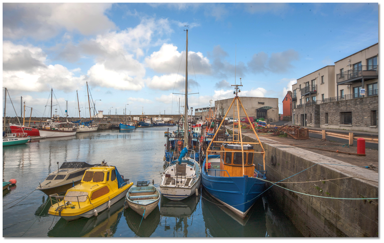
 Balbriggan's outer and inner harbour areas
Image: Brian Lennon
 From the initial fix await the rise in the tide until there is sufficient depth of water to proceed into Balbriggan Harbour.
  The entrance inside the outer pierhead
Image: Jonjobaker via CC BY 2.0
Vessels drawing 1.5 metres or less can normally enter the harbour two hours before HW. The tower is at the seaward end of the pier where the entrance is.
Balbriggan White tower - Fl (3) WRG 20s 10M position: 53° 36.778’N 6° 10.702’W
The tower hosts a sectored light; GREEN from 159° to 193° over Cardy Rocks, WHITE from 193° to 288°, RED from 288° to 305° over the Skerries.
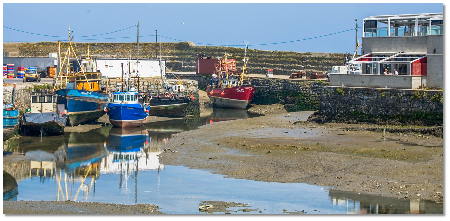
 The view up through the harbour from the entrance
Image: Michael Harpur
Approach the harbour bearing southwest tracking in towards the beach immediately north of the pierhead light, and enclosed to the north by a Martello Tower. On closer approaches, the harbour’s 20-metre wide mouth will open between its pierheads. Then the track leads east and southeast to pass in through the entrance close to the light on the pierhead.
 The outer harbour immediately within the entance
Image: Michael Harpur
The harbour itself is segmented into an inner and outer harbour. Once inside the outer harbour a short spur, projecting east from the about the midpoint of the north pier, creates the inner harbour. Make way for the 15-metre wide gap at the end of the spur to enter into the inner harbour.  The inner harbour opening up from its entrance
Image: Michael Harpur
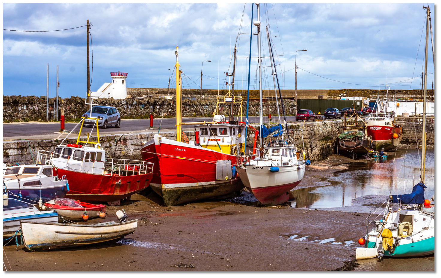
Come alongside on the south-western quay after the slip. Depths of 3.7 metres can be found at high water and a level bottom of mud alongside at low water. The depth is not consistent throughout the harbour and the best pathway to adopt is only visible at low water.
 The channel up through the inner harbour as seen from the head
Image: William Murphy via CC BY SA 2.0
Why visit here?
The origins of the name Balbriggan, in Irish 'Baile Brigín', is uncertain. 'Baile Brigín' or 'Breacain' literally means 'Breacain's Town'. 'Brecan' was a common medieval first name but there is also the possible link to the local 'Bracken River'. In this case, the name could have been derived from 'breicín' that means 'little trout'. Locals, on the other hand, believe that the Irish version 'Baile Brigín' means 'town of the little hills' due to the relatively low hills that surround the town. Whichever the case, the area’s history of inhabitation is extremely long and has been traced to as far back as 2500 BC. Balbriggan's Light Tower built by Dublin Ballast Board
Image: Michael Harpur
The town itself, however, has no chronological foundation consensus. History records that there seems to have always been a small settlement of fishermen and some sort of agricultural trading post here. Standing, on the main east coast pathway, the annals of the nation’s history have passed its way through this townland. St Patrick stopped to baptise people in the River Delvin, near Balbriggan, around 436 AD. Around 600 AD St Molaga, a beekeeper who introduced farming to the area founded a monastery in Bremore. It is recorded that in 1014, after his victory in the Battle of Clontarf that he never lived to see, the slain body of Brian Boru passed through Balbriggan on its way to be buried in Armagh. Likewise, after defeating James the Second in the Battle of the Boyne, the victorious William of Orange set up camp in Balbriggan in 1690. At that time, it was recorded that the population of Balbriggan was 30, 26 native Irish and 4 English.
 Balbriggan's inner harbour at high water
Image: William Murphy via CC BY SA 2.0
It was the introduction of the harbour, new weaving technologies and a new coach road, which ran through Balbriggan, that caused the town to rapidly develop in the 18th-century. The outer Balbriggan Harbour area was built by Baron Hamilton in 1763 for a cost of £15,000, a sum that was further aided by a government grant of £1,500. The harbour brought about a coastal trade in grain and a sea-fishery quickly developed. Alongside the harbour, Baron Hamilton also introduced weaving to the area in the guise of 'Smyth and Company' or 'Smyco', as it was also known and it was for this Balbriggan became famous.
 The eleven arche Balbriggan Viaduct
 Image: Jonjobaker via CC BY 2.0
The firm became famous as the finest linen weavers in Ireland and had customers from all over the world. They supplied linens to the Vatican, Embassies of Ireland and the US, and fine hotels worldwide. One of its most noteworthy clients was Queen Victoria who had silk stockings made for her on a special loom here. 'Smyco' built an enviable world brand and a mark of their success was 'Long Johns' being called 'Balbriggan's' with the synonym being introduced into the dictionary. The term is often heard in classic cowboy movies featuring John Wayne where he often says he has to 'put his balbriggans on'. It was this business that would become the mainstay of the town for 200 years and the area’s biggest employer.
 Balbriggan Viaduct arch
Image: William Murphy via CC BY SA 2.0
Some of the town’s major features were constructed during the 19th-century whilst 'Smyco' was in its heyday. The Martello tower, overlooking the King’s Strand, was one of a number built as a defence against Napoleon's army under the 'national defence Act of 1804'. The inner harbour dock was added in 1829 and the Dublin Ballast Board built the picturesque little lighthouse on the pierhead. In 1838 the construction of the Dublin to Drogheda railway was started. The massive Balbriggan Viaduct of eleven arches carrying the line across the harbour, over four roads and the town’s small river, was completed to facilitate this in 1844. The rail service opened in 1844 and with it came direct contact with other commercial centres that further spurred the town’s development. The railway link combined with Balbriggan’s extensive beaches to make it a holiday getaway for Dublin 'bathers' in the early 20th century.
 Balbriggan beach drew Victorian 'bathers' from Dublin
Image: William Murphy via CC BY SA 2.0
The 20th-century was less fortunate for the town and it is sadly noted for one of the more infamous acts of the Irish War of Independence. The event, known as the 'Sack of Balbriggan', took place in at the beginnings of a civil war in September of 1920. This was just after the signing of the controversial Anglo-Irish Treaty which caused a split in public opinion. Civil War was looming between those who were Pro-Treaty and those who were Anti-Treaty and Ireland was a powder keg. At the time the British government assisted the Royal Irish Constabulary (RIC) police force to take on the IRA by recruiting and shipping in a force of Temporary Constables. Most of the recruits were soldiers who had been brutalised by the trenches of the First World War. They made no attempt to hide their military nature and held a notorious reputation for violence. Owing to a shortage of RIC uniforms on arrival they wore a mixture of black and tanned uniforms as well as dark green police hats and belts over khaki army uniforms. For this reason, they received the nicknamed the British 'Black and Tans' after a famous pack of hounds in County Limerick.
 A Black and Tan on guard duty
Image: National Library of Ireland on The Commons
Similar to the better known 'Burning of Cork', the 'Sack of Balbriggan' was a 'reprisal' by British forces for a Republican shooting. This was the murder of two off-duty RIC members who were shot dead at point-blank range whilst drinking in a town pub the afternoon preceding the attack. An estimated force of above one hundred 'Black and Tans', who were stationed 3 miles away in Gormanston, were then ordered to take control of the town under the cover of darkness. They arrived in lorries at 11 pm and disembarked to commence a 4-hour orgy of destruction. Soldiers ran through the streets of the town, shouting and smashing in windows whilst firing their weapons. They then threw petrol through windows and started to set houses and businesses on fire. The vast majority of the town's then population of 2500 ran before them and hid in the fields surrounding the village. From there they could hear, as the night went on, 'Black and Tans', having looted the public houses, became more and more intoxicated as… 'They surged through the town singing 'We are the boys of the Bulldog Brigade'.
 Motorised Black and Tans followed by marching RIC at a funeral
Image: National Library of Ireland on The Commons
By then they had arrested Séamus Lawless, a town barber and Sean Gibbons, a young dairy farmer. This was largely because of their known involvement in the Fingal Brigade as well as supporting the town’s republican courts. The two men were taken to Gormanston barracks where they were questioned by the RIC. When the RIC was not able to obtain any information the Tans took both men out and put against a wall as part of a mock execution where they shot around them. Revealing nothing more the RIC then told the Tans to take both men back home as no charges could be made. The Tans then drove them back to the corner of Quay Street across from Gibbons’ home where they thought the better of it and they beat the two men to death on the street corner.
 Burnt out cottages in Balbriggan
Image: Public Domain
Two days later Lawless and Gibbons were buried in Balscadden Cemetery, their funeral was huge. In the end, 54 houses and the hosiery factory were burnt to the ground putting hundreds out of their homes and out of work. Various business were looted including the towns four public houses. The sack of Balbriggan sparked outrage in both Ireland and England and, owing to Balbriggan's close position to foreign news correspondents based in Dublin, the event received much international attention. In a speech in the House of Commons, the former Prime Minister, H.H Asquith reprimanded Lloyd George’s government describing the village as looking like a Belgian town that had been wrecked by the Germans in the war. A subsequent delegation from the United States pledged to rebuild the homes in the village, and a local factory. A plaque on Bridge Street near the place of the death of the two men reads 'Near this spot Seamus Lawless and Sean Gibbons were brutally done to death by British Forces while in their custody 20th September 1920'.
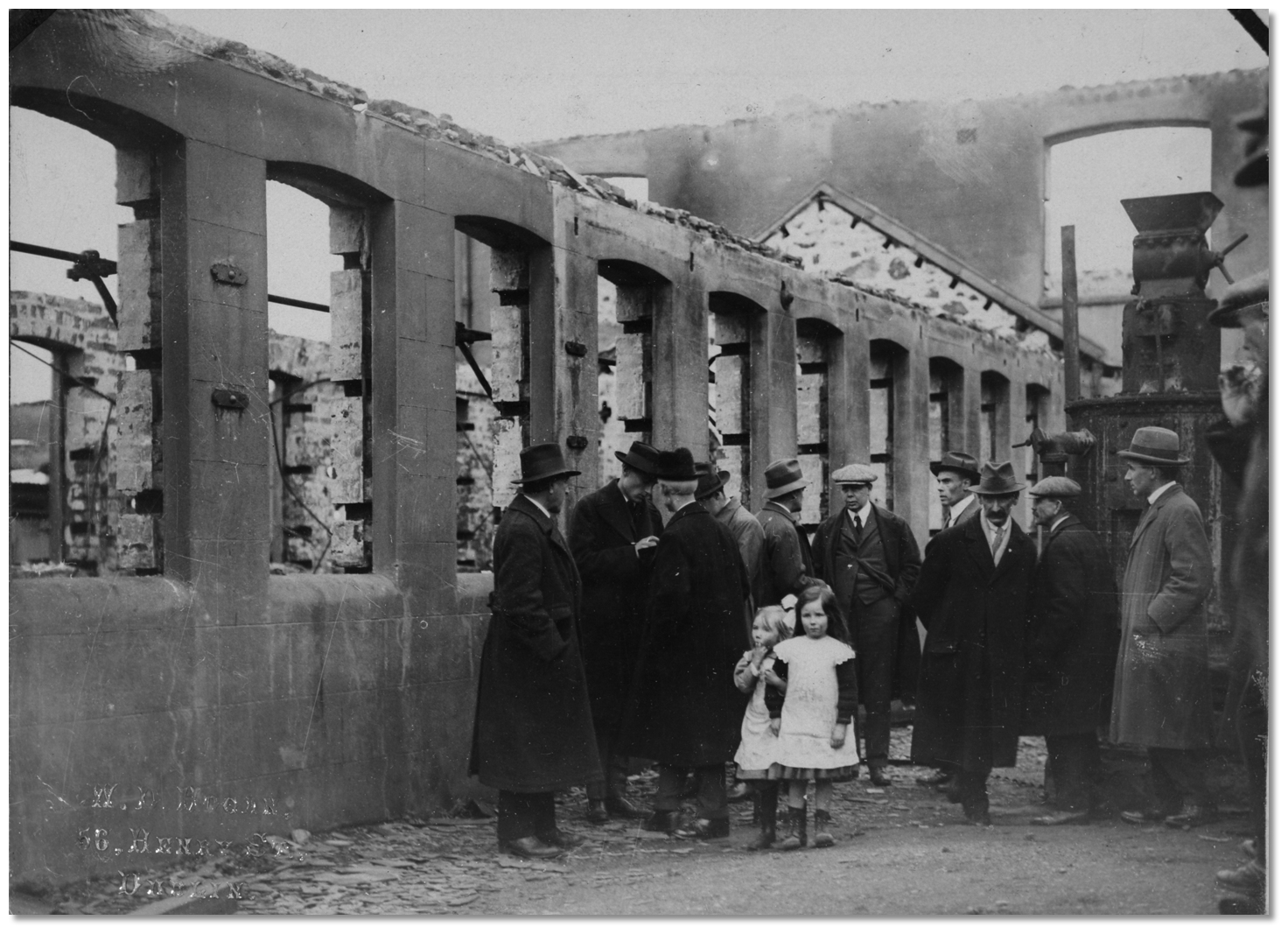 The American Committee for Relief in Ireland inspecting the factory ruins
Image: National Library of Ireland on The Commons
Sadly, the time came for the demised of 'Smyco' in the 20th century and it closed in 1980 to the devastation of Balbriggan. To that year it held the record of being the second longest-standing member of the Dublin Stock Exchange, the oldest being Guinness. The business continues today from another location as the old mill in the town centre has been redeveloped.
 Ardgillan Castle
Image: Jonjobaker via CC BY 2.0
Today the railway continues to play a very important role in the life of Balbriggan, taking a large commuting population to work north and south each day. Its population has exploded in the last few decades with the construction of new housing estates, and this continued into recent years during recent times it has been recorded as been amongst the fastest-growing towns in the country. It is a busy fishing harbour with many fishing-related activities taking place on the harbour quays.
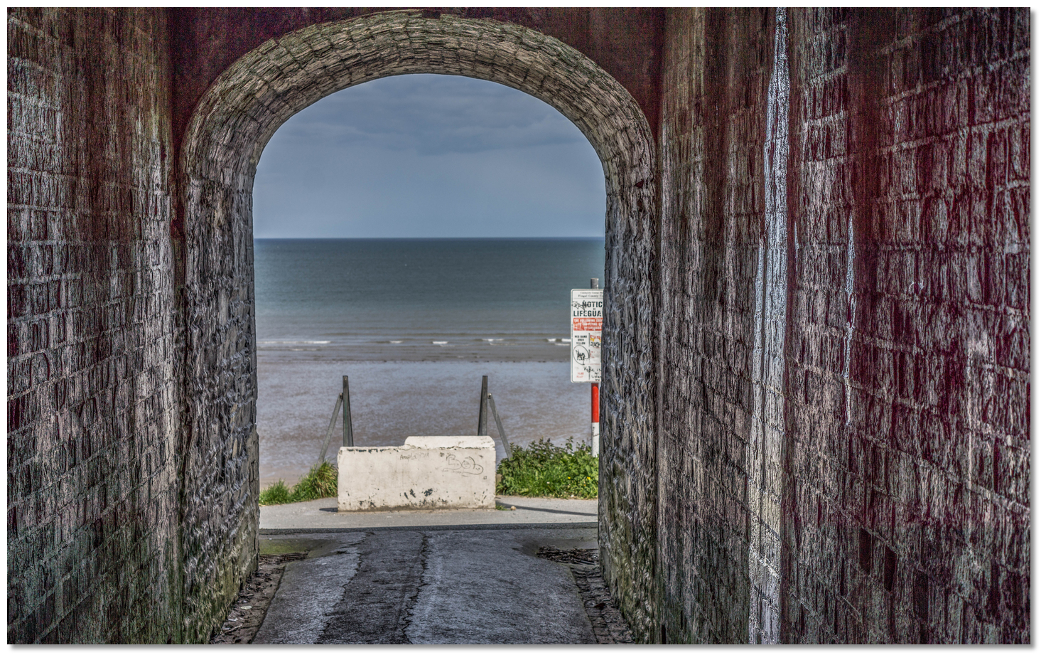
 Balbriggan beach between the harbour and Marterllo
Image: William Murphy via CC BY SA 2.0
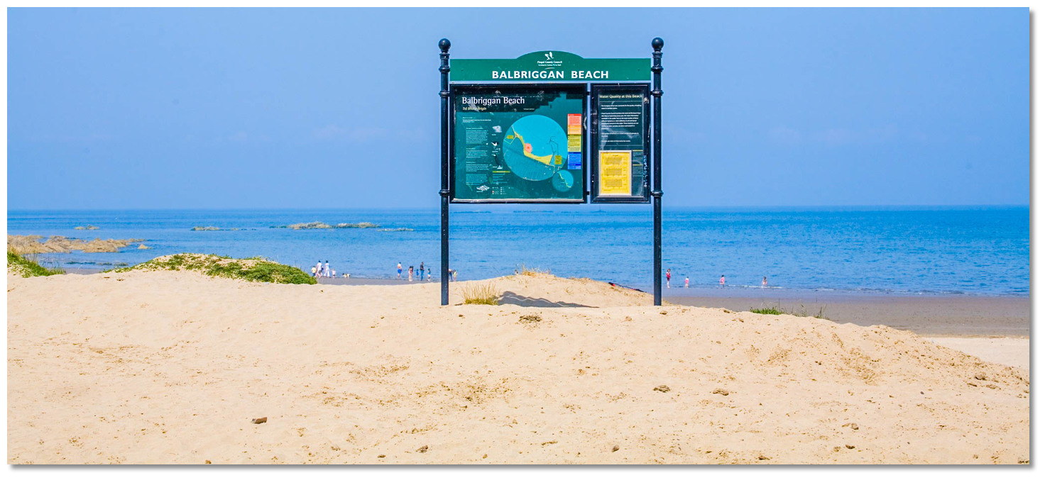
The town offers visitors pleasant seaside walks and secure bathing off its sandy, lifeguard patrolled, principal beach. The River Delvin is said to be the christening site of St Benignus, the successor to St Patrick, is well stocked with trout. A visit to Ardgillan Castle is recommended, as this 18th-Century Manor is renowned for its beautiful gardens. The Balbriggan Viaduct represents a strong identifying element within the town. It has footpaths along each side of the line from which there is a commanding view west, towards the town and beyond, plus off its eastern side over the harbour.
 Yacht alongside the wall in the inner harbour
Image: William Murphy via CC BY SA 2.0
From a boating perspective, Balbriggan is principally a fishing harbour, but it is also popular with leisure craft that can make use of its shore facilities. This is an excellent location for shallow-draft vessels, or long keels that can take-to-the hard, to easily provision or take advantage of an extended stay. Balbriggan, as a town, is also worthy of a visit from a tourist perspective.
What facilities are available?
Fresh water, fuel, gas and electric power are all available at the quay. In addition to this there are excellent engineering facilities that support the fishing vessels plus a nine ton travel-lift and laying up facilities. There are basic provisions available in the immediate vicinity of the harbour along with restaurants and bars.Balbriggan is 32 km north of Dublin city, on the Belfast–Dublin main line of the Irish rail network. Dublin Bus routes 33, 33A and 33X as well as Bus Eireann routes 101 (Dublin-Drogheda) and 104 (Balbriggan Town service). The town is also located next to the M1 motorway and Dublin International Airport is a taxi ride away.
Any security concerns?
Normal security provisions should be carried out if leaving a vessel unattended alongside this unsecured public quay.With thanks to:
Charlie Kavanagh - ISA/RYA Yachtmaster Instructor/Examiner. Photography Michael Harpur and Brian Lennon.


.jpg)
High aerial view of the town
High aerial views of the harbour
Low aerial sweep of Balbriggan Harbour
About Balbriggan Harbour
The origins of the name Balbriggan, in Irish 'Baile Brigín', is uncertain. 'Baile Brigín' or 'Breacain' literally means 'Breacain's Town'. 'Brecan' was a common medieval first name but there is also the possible link to the local 'Bracken River'. In this case, the name could have been derived from 'breicín' that means 'little trout'. Locals, on the other hand, believe that the Irish version 'Baile Brigín' means 'town of the little hills' due to the relatively low hills that surround the town. Whichever the case, the area’s history of inhabitation is extremely long and has been traced to as far back as 2500 BC.
Balbriggan's Light Tower built by Dublin Ballast BoardImage: Michael Harpur
The town itself, however, has no chronological foundation consensus. History records that there seems to have always been a small settlement of fishermen and some sort of agricultural trading post here. Standing, on the main east coast pathway, the annals of the nation’s history have passed its way through this townland. St Patrick stopped to baptise people in the River Delvin, near Balbriggan, around 436 AD. Around 600 AD St Molaga, a beekeeper who introduced farming to the area founded a monastery in Bremore. It is recorded that in 1014, after his victory in the Battle of Clontarf that he never lived to see, the slain body of Brian Boru passed through Balbriggan on its way to be buried in Armagh. Likewise, after defeating James the Second in the Battle of the Boyne, the victorious William of Orange set up camp in Balbriggan in 1690. At that time, it was recorded that the population of Balbriggan was 30, 26 native Irish and 4 English.
Balbriggan's inner harbour at high waterImage: William Murphy via CC BY SA 2.0
It was the introduction of the harbour, new weaving technologies and a new coach road, which ran through Balbriggan, that caused the town to rapidly develop in the 18th-century. The outer Balbriggan Harbour area was built by Baron Hamilton in 1763 for a cost of £15,000, a sum that was further aided by a government grant of £1,500. The harbour brought about a coastal trade in grain and a sea-fishery quickly developed. Alongside the harbour, Baron Hamilton also introduced weaving to the area in the guise of 'Smyth and Company' or 'Smyco', as it was also known and it was for this Balbriggan became famous.
The eleven arche Balbriggan Viaduct Image: Jonjobaker via CC BY 2.0
The firm became famous as the finest linen weavers in Ireland and had customers from all over the world. They supplied linens to the Vatican, Embassies of Ireland and the US, and fine hotels worldwide. One of its most noteworthy clients was Queen Victoria who had silk stockings made for her on a special loom here. 'Smyco' built an enviable world brand and a mark of their success was 'Long Johns' being called 'Balbriggan's' with the synonym being introduced into the dictionary. The term is often heard in classic cowboy movies featuring John Wayne where he often says he has to 'put his balbriggans on'. It was this business that would become the mainstay of the town for 200 years and the area’s biggest employer.
Balbriggan Viaduct archImage: William Murphy via CC BY SA 2.0
Some of the town’s major features were constructed during the 19th-century whilst 'Smyco' was in its heyday. The Martello tower, overlooking the King’s Strand, was one of a number built as a defence against Napoleon's army under the 'national defence Act of 1804'. The inner harbour dock was added in 1829 and the Dublin Ballast Board built the picturesque little lighthouse on the pierhead. In 1838 the construction of the Dublin to Drogheda railway was started. The massive Balbriggan Viaduct of eleven arches carrying the line across the harbour, over four roads and the town’s small river, was completed to facilitate this in 1844. The rail service opened in 1844 and with it came direct contact with other commercial centres that further spurred the town’s development. The railway link combined with Balbriggan’s extensive beaches to make it a holiday getaway for Dublin 'bathers' in the early 20th century.
Balbriggan beach drew Victorian 'bathers' from DublinImage: William Murphy via CC BY SA 2.0
The 20th-century was less fortunate for the town and it is sadly noted for one of the more infamous acts of the Irish War of Independence. The event, known as the 'Sack of Balbriggan', took place in at the beginnings of a civil war in September of 1920. This was just after the signing of the controversial Anglo-Irish Treaty which caused a split in public opinion. Civil War was looming between those who were Pro-Treaty and those who were Anti-Treaty and Ireland was a powder keg. At the time the British government assisted the Royal Irish Constabulary (RIC) police force to take on the IRA by recruiting and shipping in a force of Temporary Constables. Most of the recruits were soldiers who had been brutalised by the trenches of the First World War. They made no attempt to hide their military nature and held a notorious reputation for violence. Owing to a shortage of RIC uniforms on arrival they wore a mixture of black and tanned uniforms as well as dark green police hats and belts over khaki army uniforms. For this reason, they received the nicknamed the British 'Black and Tans' after a famous pack of hounds in County Limerick.
A Black and Tan on guard dutyImage: National Library of Ireland on The Commons
Similar to the better known 'Burning of Cork', the 'Sack of Balbriggan' was a 'reprisal' by British forces for a Republican shooting. This was the murder of two off-duty RIC members who were shot dead at point-blank range whilst drinking in a town pub the afternoon preceding the attack. An estimated force of above one hundred 'Black and Tans', who were stationed 3 miles away in Gormanston, were then ordered to take control of the town under the cover of darkness. They arrived in lorries at 11 pm and disembarked to commence a 4-hour orgy of destruction. Soldiers ran through the streets of the town, shouting and smashing in windows whilst firing their weapons. They then threw petrol through windows and started to set houses and businesses on fire. The vast majority of the town's then population of 2500 ran before them and hid in the fields surrounding the village. From there they could hear, as the night went on, 'Black and Tans', having looted the public houses, became more and more intoxicated as… 'They surged through the town singing 'We are the boys of the Bulldog Brigade'.
Motorised Black and Tans followed by marching RIC at a funeralImage: National Library of Ireland on The Commons
By then they had arrested Séamus Lawless, a town barber and Sean Gibbons, a young dairy farmer. This was largely because of their known involvement in the Fingal Brigade as well as supporting the town’s republican courts. The two men were taken to Gormanston barracks where they were questioned by the RIC. When the RIC was not able to obtain any information the Tans took both men out and put against a wall as part of a mock execution where they shot around them. Revealing nothing more the RIC then told the Tans to take both men back home as no charges could be made. The Tans then drove them back to the corner of Quay Street across from Gibbons’ home where they thought the better of it and they beat the two men to death on the street corner.
Burnt out cottages in BalbrigganImage: Public Domain
Two days later Lawless and Gibbons were buried in Balscadden Cemetery, their funeral was huge. In the end, 54 houses and the hosiery factory were burnt to the ground putting hundreds out of their homes and out of work. Various business were looted including the towns four public houses. The sack of Balbriggan sparked outrage in both Ireland and England and, owing to Balbriggan's close position to foreign news correspondents based in Dublin, the event received much international attention. In a speech in the House of Commons, the former Prime Minister, H.H Asquith reprimanded Lloyd George’s government describing the village as looking like a Belgian town that had been wrecked by the Germans in the war. A subsequent delegation from the United States pledged to rebuild the homes in the village, and a local factory. A plaque on Bridge Street near the place of the death of the two men reads 'Near this spot Seamus Lawless and Sean Gibbons were brutally done to death by British Forces while in their custody 20th September 1920'.
The American Committee for Relief in Ireland inspecting the factory ruinsImage: National Library of Ireland on The Commons
Sadly, the time came for the demised of 'Smyco' in the 20th century and it closed in 1980 to the devastation of Balbriggan. To that year it held the record of being the second longest-standing member of the Dublin Stock Exchange, the oldest being Guinness. The business continues today from another location as the old mill in the town centre has been redeveloped.
Ardgillan CastleImage: Jonjobaker via CC BY 2.0
Today the railway continues to play a very important role in the life of Balbriggan, taking a large commuting population to work north and south each day. Its population has exploded in the last few decades with the construction of new housing estates, and this continued into recent years during recent times it has been recorded as been amongst the fastest-growing towns in the country. It is a busy fishing harbour with many fishing-related activities taking place on the harbour quays.
Balbriggan beach between the harbour and MarterlloImage: William Murphy via CC BY SA 2.0
The town offers visitors pleasant seaside walks and secure bathing off its sandy, lifeguard patrolled, principal beach. The River Delvin is said to be the christening site of St Benignus, the successor to St Patrick, is well stocked with trout. A visit to Ardgillan Castle is recommended, as this 18th-Century Manor is renowned for its beautiful gardens. The Balbriggan Viaduct represents a strong identifying element within the town. It has footpaths along each side of the line from which there is a commanding view west, towards the town and beyond, plus off its eastern side over the harbour.
Yacht alongside the wall in the inner harbourImage: William Murphy via CC BY SA 2.0
From a boating perspective, Balbriggan is principally a fishing harbour, but it is also popular with leisure craft that can make use of its shore facilities. This is an excellent location for shallow-draft vessels, or long keels that can take-to-the hard, to easily provision or take advantage of an extended stay. Balbriggan, as a town, is also worthy of a visit from a tourist perspective.
Other options in this area
Click the 'Next' and 'Previous' buttons to progress through neighbouring havens in a coastal 'clockwise' or 'anti-clockwise' sequence. Alternatively here are the ten nearest havens available in picture view:
Coastal clockwise:
Skerries Bay and Harbour - 1.8 miles ESELoughshinny - 3.3 miles SE
Rush Harbour - 4 miles SSE
Rogerstown Inlet - 4 miles SSE
The Boat Harbour - 5.4 miles SE
Coastal anti-clockwise:
Drogheda & The River Boyne - 5.3 miles NWPort Oriel (Clogher Head) - 7 miles N
Dundalk - 15.5 miles NNW
Giles Quay - 13.9 miles N
Carlingford Harbour - 16 miles N
Navigational pictures
These additional images feature in the 'How to get in' section of our detailed view for Balbriggan Harbour.
.jpg)


| Detail view | Off |
| Picture view | On |
High aerial view of the town
High aerial views of the harbour
Low aerial sweep of Balbriggan Harbour
Add your review or comment:
Please log in to leave a review of this haven.
Please note eOceanic makes no guarantee of the validity of this information, we have not visited this haven and do not have first-hand experience to qualify the data. Although the contributors are vetted by peer review as practised authorities, they are in no way, whatsoever, responsible for the accuracy of their contributions. It is essential that you thoroughly check the accuracy and suitability for your vessel of any waypoints offered in any context plus the precision of your GPS. Any data provided on this page is entirely used at your own risk and you must read our legal page if you view data on this site. Free to use sea charts courtesy of Navionics.