
_county_louth_ireland_DSC01109.jpg)
Port Oriel is a good anchorage in all winds except those from northeast round to east by northeast. It is subject to a good deal of swell within the harbour when conditions are strong from these quarters. Access is straightforward, night or day and at any stage of the tide, as the harbour is open to the north and there are no immediate offshore dangers.


Keyfacts for Port Oriel (Clogher Head)


Nature


Considerations
Protected sectors


Summary
A good location with straightforward access.Nature
Considerations
 +353 86 8518818
  Ch.16 [Kilfinor]
 Position and approaches

Haven position
 53° 47.967' N, 006° 13.404' W
This is the head of Port Oriel pier.
What is the initial fix?
 53° 48.100' N, 006° 12.900' W


What are the key points of the approach?
 .
.- There are no outlying obstructions so a vessel may come straight in and round the pierhead.
- Keep half a boat length to port of the pier passing between it and a starboard buoy that marks the shallows off the shoreline.
Not what you need?
- Drogheda & The River Boyne - 6.5 nautical miles SW
- Giles Quay - 11.1 nautical miles N
- Balbriggan Harbour - 11.3 nautical miles S
- Skerries Bay and Harbour - 13.5 nautical miles SSE
- Dundalk - 13.9 nautical miles NNW
- Carlingford Harbour - 14.7 nautical miles N
- Greencastle - 15 nautical miles NNE
- Carlingford Marina - 15.2 nautical miles N
- Loughshinny - 16.1 nautical miles SSE
- Greer’s Quay - 16.4 nautical miles N
- Drogheda & The River Boyne - 6.5 miles SW
- Giles Quay - 11.1 miles N
- Balbriggan Harbour - 11.3 miles S
- Skerries Bay and Harbour - 13.5 miles SSE
- Dundalk - 13.9 miles NNW
- Carlingford Harbour - 14.7 miles N
- Greencastle - 15 miles NNE
- Carlingford Marina - 15.2 miles N
- Loughshinny - 16.1 miles SSE
- Greer’s Quay - 16.4 miles N

Chart

What's the story here?
 Port Oriel pier and dry dock
Image: Michael Harpur
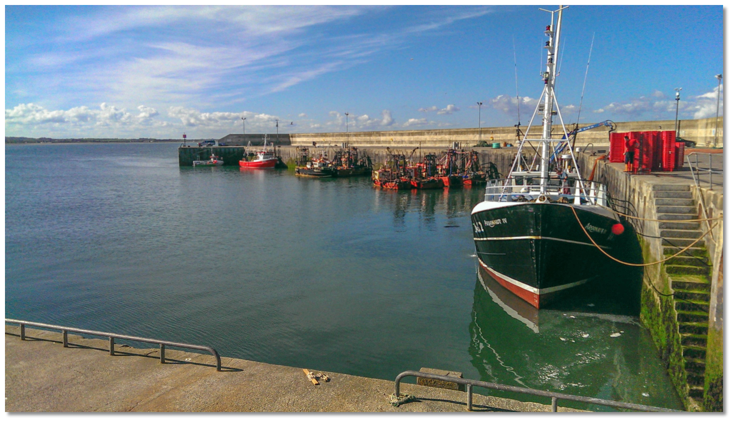
Port Oriel, often referred to as Clogherhead or simply as Clogher, is a fishing village and harbour tucked into a small cove on the northern face of the bold rocky promontory of Clogher Head. The harbour is situated 4½ miles northeastward of the entrance to the Boyne, 4 miles south of Dunany Point, the southern limit of Dundalk Bay, and its village is a mile away. The harbour is mostly used by fishing boats but leisure vessels may also come alongside.
The recently enhanced harbour area consists of a small drying inner basin from which a pier protrudes 200 metres north from the shore. The outer head of the pier has a depth of 4 metres that decreases towards the mouth of the drying inner harbour.
 The entrance into the inner basin with the crane for the storm boards
Image: Michael Harpur
The natural bay provides an anchorage north of the slip and west of the quay head with fairly good holding but it is exposed to the swell of the bay. Berthing alongside the pier depends on the activities of the local fishing boats. This is difficult to predict, as at times the harbour could be full of fishing boats whilst at other times a visiting boat could have the entire harbour area to itself. Best advice is to check in with the harbour master is available on
Ch. 16 [Kilfinor], +353 86 86 8518818. 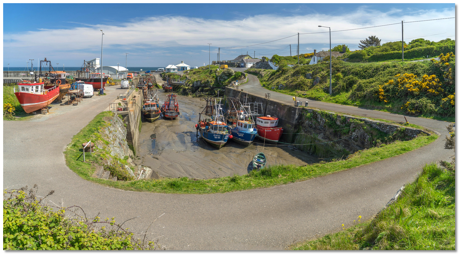 Boats dried out in the inner basin
Image: Michael Harpur
Those entering the inner basin can expect to find 2 metres at its entrance at half tide. The drying inner basin is however usually crowded, particularly so at weekends. The best opportunity for those planning to dry out alongside in the basin is to try and secure a berth during the week. Those intending on doing this should contact the harbour master in advance. The inner basin offers complete protection as its entrance can be closed by storm boards in bad weather, but that is unlikely in the sailing season.
Any available mooring buoys are mostly occupied by local boats and are accessible only to shallow to moderate drafts. But there may be a possibility if one asks about along the pier.
How to get in?
 Port Oriel with Dunany Point in the backdrop
Image: Michael Harpur
 Seaward approaches are detailed in eastern Ireland’s coastal overview for Strangford Lough to Dublin Bay . Clogher Head is moderately bold-to and clear of danger with depths of 5 metres about 300 metres the shore. Offshore it is moderately bold-to and clear of danger, with 5 to 10 metres of water within 400 metres of its shoreline.
  Starboard buoy inside the pierhead
Image: Michael Harpur
 From the initial fix a vessel may come straight in for the pierhead. Expect 1 knot of current to stream east across the head of the pier. This eastbound stream is a constant pierhead occurrence except for the first two hours of the flood tide.
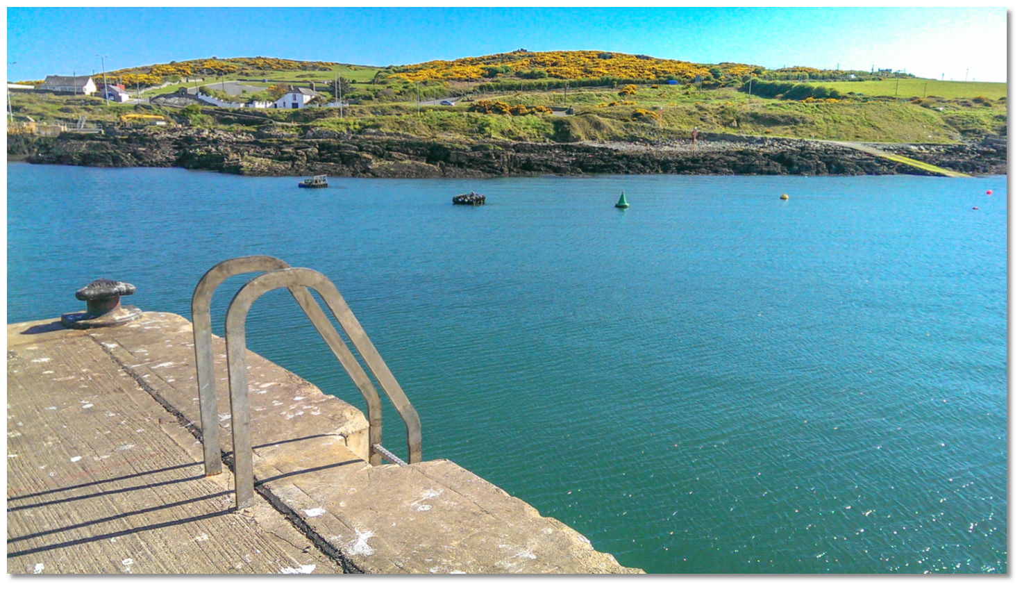 Starboard buoy as seen from the pierhead
Image: Michael Harpur
On closer approach, follow the head of the pier around until the inner harbour area opens to port, and turning for the entrance before the starboard buoy that indicates the shallows off the shore. There is ample space between the pier and the starboard buoy to manoeuvre a boat without any difficulty.
By night the pier head is lit, Mo(A)R.9s, and the there are leading lights at the head of the cove, 2Fl.3s4M, which provides for safe nighttime access aligned on a bearing of 179°T.
 Port Oriel pier pier wall
Image: Michael Harpur
Expect a depth of 4 metres alongside the outer pierhead gradually decreasing towards the southern end of the wall where it dries. Berth as available. The bollards on the pier are set apart at some distance so any vessel that is not rafting up alongside a fishing boat should prepare long warps. The pier has well-recessed ladders to come aloft. 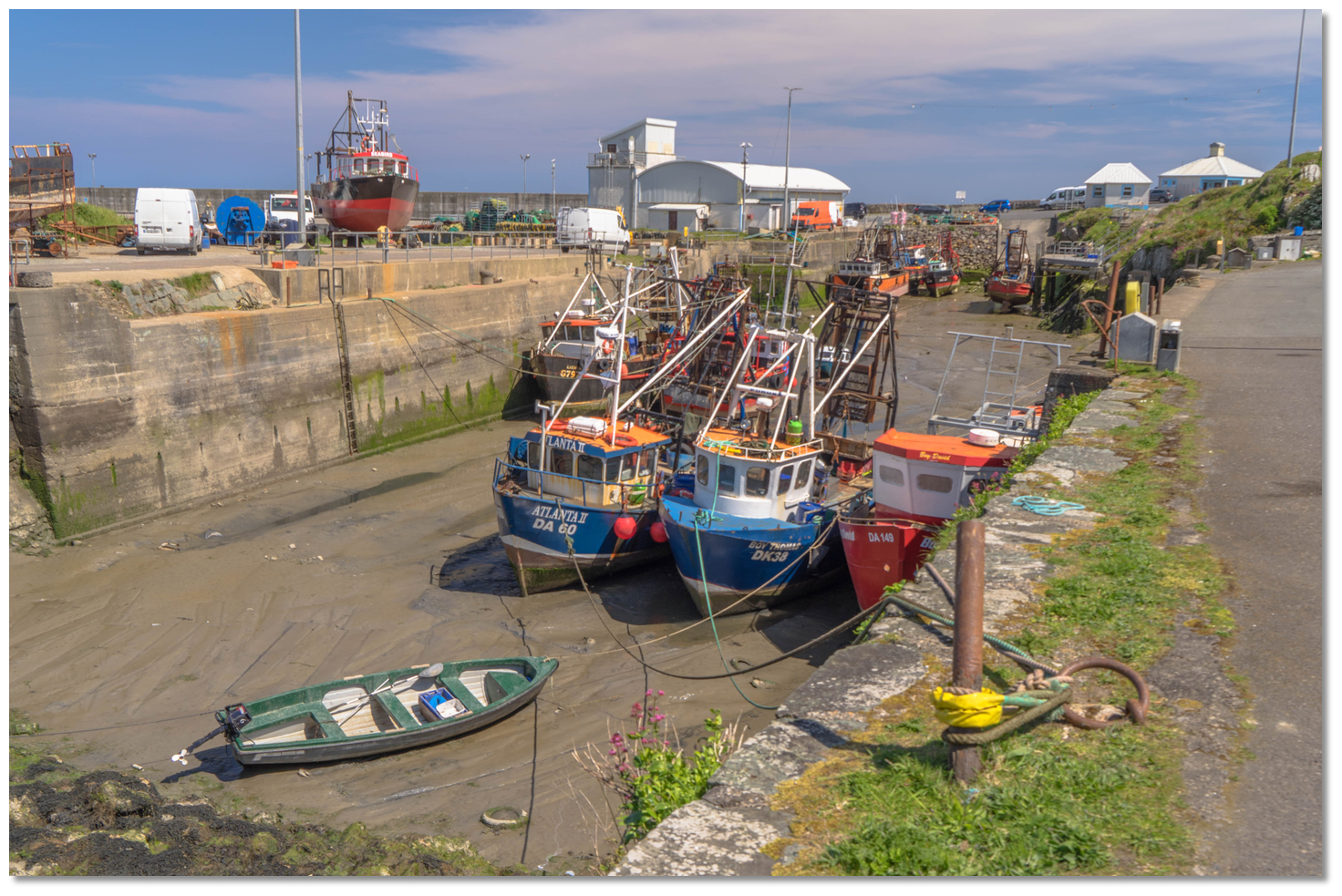 Fishing boats in the inner drying basin
Image: Michael Harpur
Why visit here?
Port Oriel, in Irish 'Poirt Oirialla', takes its name from a group of people collectively called the 'Airgíalla'. In modern Irish they are called 'Oirialla' which was anglicised to 'Oriel', so 'port of the Oriel'. The 'Airgíalla' consisted of nine main tribal groups that occupied the area around the Sperrin Mountains in the north of Ireland and in the midlands. The port along with the distinctive uplands in the southwest of County Louth also named Oriel, commemorate their ancient area princedom. The nearby village of Clogherhead derives its name from its headland Clogher Head. In Irish 'Ceann Chlochair', the 'Ceann' meaning head or headland and 'cloichear', derived from 'clochar', meaning 'stony place'. Clogher Head standing prominent on the coast
Image: Kieran Campbell via CC BY-SA 2.0
Situated twenty minutes’ walk inshore of the pier, the friendly village was known as Clogher and before that in the 19th-century as 'Killclogher'. This was derived from 'Cill Chlochair', 'church of the stony place' and was most likely named after the late-medieval or 17th-century church that is situated on a hill above the village today. Immediately alongside the church and graveyard are the remnants of a Norman motte-and-bailey that underscored the importance of the area militarily. The village developed through the centuries safely hidden from the sea marauders behind its sheltering headland. However, legend has it that the area of rocks, known as Red Man’s Cave, or Dead Man's Cave, that lie at the side of the head may have been the site of ancient butchery.
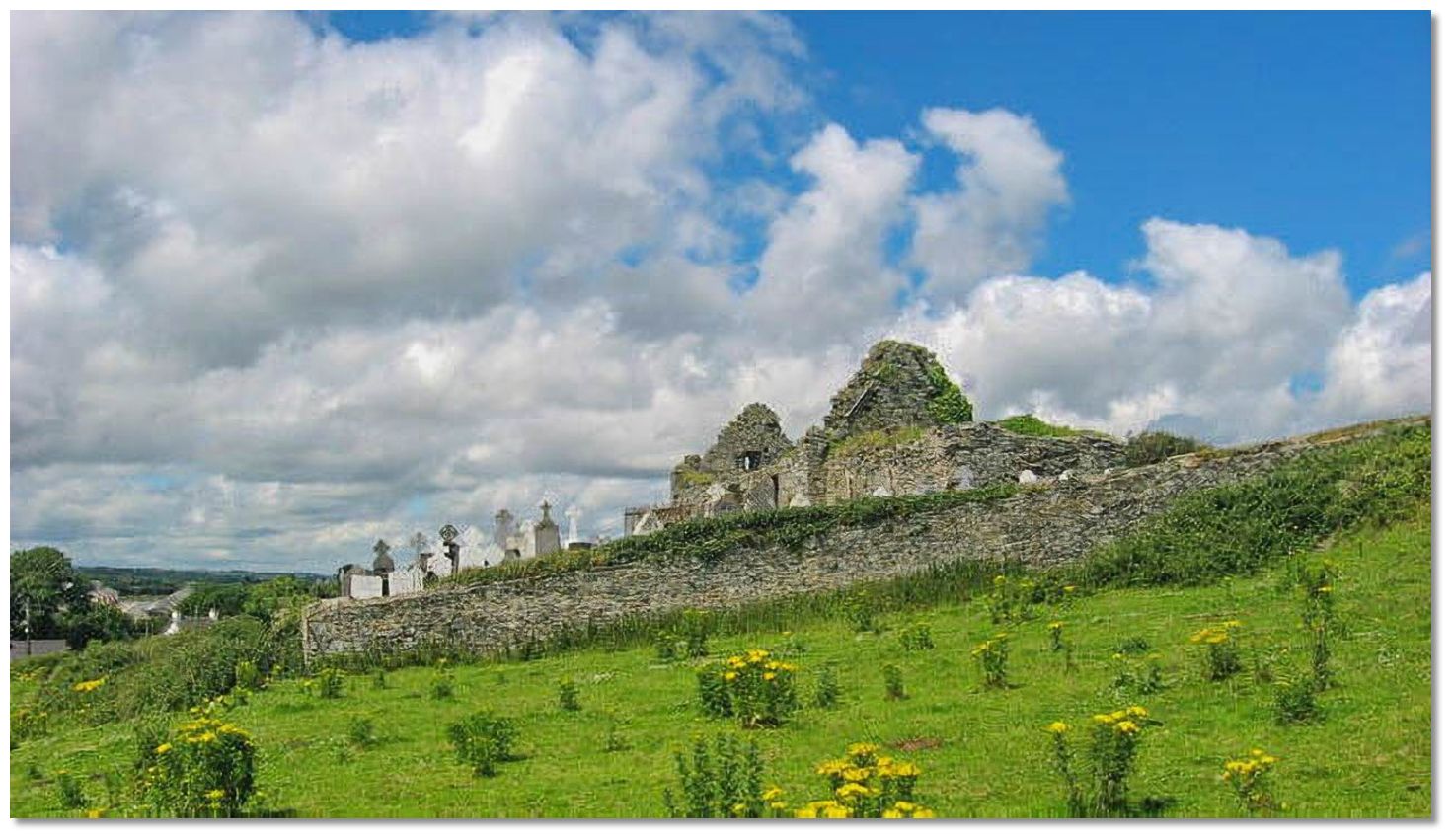 Church ruins on a hill above the village
Image: Kieran Campbell via CC BY-SA 2.0
There are many stories attached to Red Man’s Cave. The most famous has it that a number of clergymen took refuge in the cave during the 1649-53 Cromwellian invasion. The sanctuary was short-lived and they were soon discovered by Cromwell’s soldiers who massacred them in cold blood. The name Red Man’s Cave is said to come from the slaughter’s aftermath. When the bodies were discovered the cave walls were coated in the blood of the slain.
 Port Oriel as seen from the inner slip
Image: Michael Harpur
Another popular local story is of a mysterious 'Captain Redman' who helmed his vessel and crew to this cave from Spain. The journey was plagued by ill luck from the outset, foul weather, odd occurrences and disease. Most of the crew had died from scurvy before the vessel hauled up in the lee of Clogherhead to take shelter from a storm. Believing the vessel to be cursed the remaining crew and Captain Redman came ashore and took sanctuary in the cave. With no sign of the abating of the storm, the men were forced to camp in the cave for several nights. But each night another member of the crew mysteriously died. When only two remained they began to suspect Captain Redman must be responsible. The final two ambushed the captain and cut off his head and stuck it on a spike at the mouth of the cave entrance. Legend has it that anyone who ventures to the cave at night might catch a glimpse of the headless ghoul of Captain Redman in search of his head. Locals on the cliffs have reportedly heard him singing and whistling at the mouth of the cave. More evidence of the supernatural lies in the unusual preponderance of red seaweed that uniquely thrives near the cave.
 Fishing boats alongside Port Oriel
Image: Michael Harpur
It is, however, the martyring of the Catholic priests by Cromwellian soldiers is the most likely explanation for the cave’s name. The 18th-century storyline of 'Captain Redman' has all the hallmarks of a convenient smuggler’s tale. Smuggling was very active along this coast during this period. With a largely superstitious population, a story like this would prove a useful deterrent for the curious who could chance upon a location that made for a perfect natural cache. In recent times the inside of the cave has been painted red to commemorate the event. However, time and the forces of nature have made the cave largely inaccessible from the land today.
 Fishing boats alongside Port Oriel
 Image: Michael Harpur
Today Port Oriel is Louth’s main fishing port and plays host to one of the largest fleets in the country. In 2007 the harbour received the benefit of an investment in excess of €2 million that has made it one of the finest piers nationally. The area is also a popular tourist destination with its surrounding hills and the port area boasting some of the finest countryside on Ireland’s east coast. The headland above Port Oriel has a magnificent walk along steep sea cliffs that offer breathtaking views of Ireland's east coast. Below the coast from the mouth of the Boyne can be seen to present a broad level strand, stretching several miles to the foot of the projecting promontory. Its outward vista stretches from the distance blue northern peaks of the Mourne and Cooley Mountains to as far south as Lambay Island and the Rockabill Lighthouse. The views are even better for a short walk up to the well-preserved ruins of the church and walled graveyard above the village.
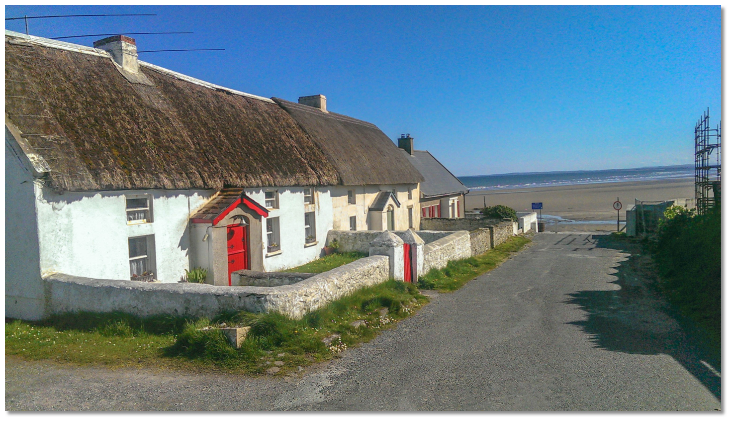 Traditional thatched Cottages on the road down to the beach
Image: Michael Harpur
Clogherhead is notable for that sandy beach that extends from the Boyne valley to near the lifeboat station, past the centre of the village. A second beach, on the north of the village, is known as the 'Big Strand'. Recently designated Blue Flag beaches, both boast excellent water sports conditions and safe bathing facilities with a lifeguard on duty at the village beach during summer months. In bad weather, visitors with families aboard can make use of the Neptune watersports centre in the village, which is run by the local Council. Anglers will find the area frequented by shoals of mackerel during July, August and September with some of the best fishing to be had from its pier. Other species caught here include mullet, codling, plaice and dabs.
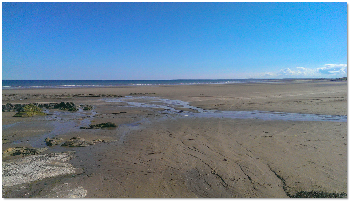 The broad beach leading down to the Boyne Entrance
Image: Michael Harpur
From a purely boating point of view, Port Oriel offers easy access, good provisions and onshore dining. This makes it a convenient and interesting stop for a boat making a passage up the east coast of Ireland.
What facilities are available?
Diesel fuel is available on the quay in the basin. Fresh water is reportedly available by the toilets at the southern end of the pier - but visitors have found it difficult to locate. There is no electricity available except a three phase provided for the fishing boats. Fresh provisions and stores can be found at the village of Clogherhead. The village caters for a permanent population of about a thousand and is twenty minutes’ walk to the southwest. There are three public houses in the village offering comfortable surroundings in which to while away the day and night, with music available at weekends. The village offers a number of restaurants including a pizzeria, a seafood and meat dish restaurant, a Chinese restaurant and a takeaway. The village is 12 km north of the provincial town of Drogheda which offers more services.Bus Éireann route 189 serves Clogherhead several times a day (but not Sundays) linking it to Drogheda, Duleek and Ashbourne. Drogheda also offers very good connections to Dublin city, on the Belfast–Dublin main line of the Irish rail network. Drogheda is located close to the M1, E1 Euro Route 1, the main Dublin to Belfast motorway.
Any security concerns?
If moored alongside you should not leave the vessel unattended, in case you are required to move so as not disrupt fishing activity.With thanks to:
Richard McGoveran - ISA/RYA Yachtmaster Instructor/Examiner._county_louth_ireland_IMAG0317.jpg)
_county_louth_ireland_IMAG0298.jpg)
_county_louth_ireland_IMAG0307.jpg)
_county_louth_ireland_IMAG0345.jpg)
_county_louth_ireland_IMAG0327.jpg)
_county_louth_ireland_IMAG0341.jpg)
_county_louth_ireland_Jai via Ceann Chlochair Tra CC BY_SA 2.0.jpg)
_county_louth_ireland_Kieran Campbell via CC BY_SA 2.0 .jpg)
_county_louth_ireland_Kieran Campbell via CC BY_SA 2.0 .jpg)


Add your review or comment:
Rodolphe Thimonier wrote this review on Jun 25th 2016:
The mooring buoys are partly occupied by local boats. Furthermore they are accessible only to shallow to moderate drafts. The anchorage North of the slip and West of the quay head has a fairly good holding and is exposed to the swell of the bay.
Average Rating:

Michael Harpur wrote this review on May 22nd 2018:
Thank you Rodolphe,
I have updated the body text as you suggested.
Ron Lub wrote this review on Jun 11th 2019:
Nice little harbour, with a smooth wall to moor the boat
Average Rating:Please log in to leave a review of this haven.
Please note eOceanic makes no guarantee of the validity of this information, we have not visited this haven and do not have first-hand experience to qualify the data. Although the contributors are vetted by peer review as practised authorities, they are in no way, whatsoever, responsible for the accuracy of their contributions. It is essential that you thoroughly check the accuracy and suitability for your vessel of any waypoints offered in any context plus the precision of your GPS. Any data provided on this page is entirely used at your own risk and you must read our legal page if you view data on this site. Free to use sea charts courtesy of Navionics.