
Wicklow Harbour offers complete protection. In strong northeasterly to easterly winds a heavy swell develops in the outer harbour but a vessel can proceed upriver for further protection with the permission of the harbourmaster. The harbour offers secure access day or night, on any tide in all reasonable conditions and there are no immediate offlying dangers.

Keyfacts for Wicklow Harbour


Nature


Considerations

Protected sectors


Summary
A completely protected location with straightforward access.Nature
Considerations
 wicklowsailing.com
 Ch.37
Ch.37Position and approaches

Haven position
 52° 58.999' N, 006° 2.126' W
This is the middle of the entrance between the heads of the East and West piers.
What is the initial fix?
 52° 59.150' N, 006° 2.130' W


What are the key points of the approach?
 .
.- Beware of strong tides off Wicklow Head
- Stand off the outside of the East Pier
Not what you need?
- Greystones - 10.2 nautical miles N
- Arklow - 12 nautical miles SSW
- Bray Harbour - 13.8 nautical miles N
- Sorrento Point - 17.3 nautical miles N
- Dalkey Island - 17.5 nautical miles N
- Dún Laoghaire Harbour - 19.4 nautical miles N
- Courtown Harbour - 21.5 nautical miles SSW
- Dublin Port - 22.6 nautical miles NNW
- Balscadden Bay - 24.3 nautical miles N
- Howth - 24.7 nautical miles N
- Greystones - 10.2 miles N
- Arklow - 12 miles SSW
- Bray Harbour - 13.8 miles N
- Sorrento Point - 17.3 miles N
- Dalkey Island - 17.5 miles N
- Dún Laoghaire Harbour - 19.4 miles N
- Courtown Harbour - 21.5 miles SSW
- Dublin Port - 22.6 miles NNW
- Balscadden Bay - 24.3 miles N
- Howth - 24.7 miles N

Chart

What's the story here?
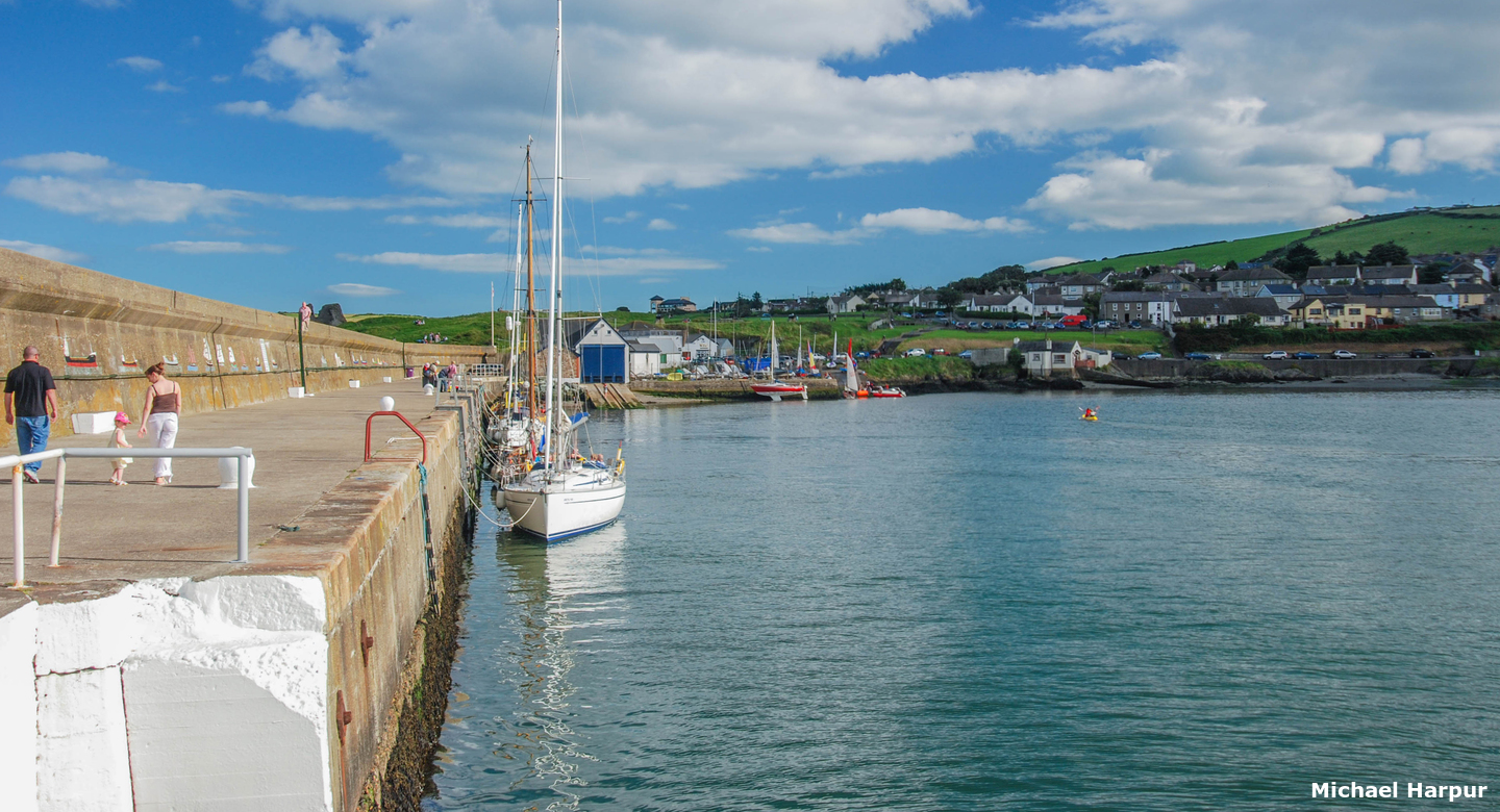
 Wicklow Harbour
Image: Michael Harpur
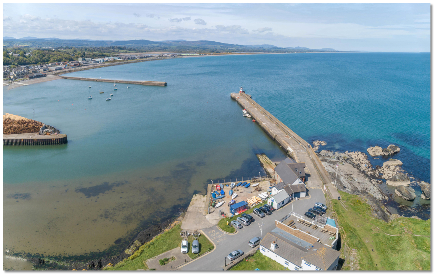
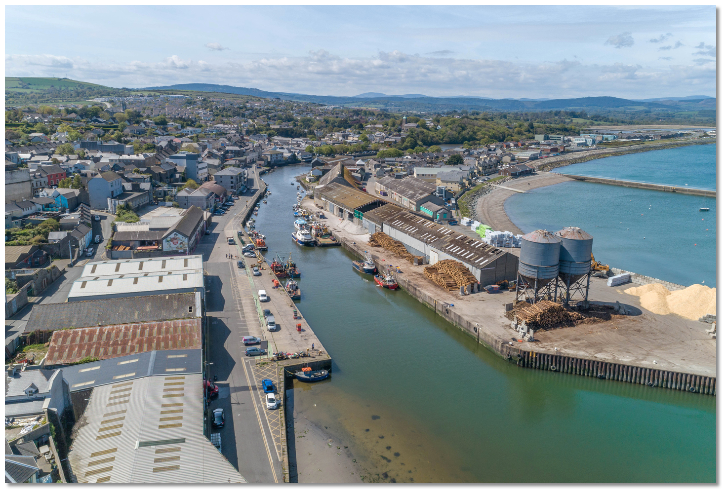
Wicklow Harbour is a small commercial harbour set into the mouth of the Leitrim River through which the waters of Broad Lough, lying parallel to the coast northward of it, discharges into the sea. It is formed by the arms of two breakwaters named West and East Piers. Commercial vessels utilise the port's facilities for cargos such as timber, glass and scrap metal and an active and vibrant fishing sector operates alongside this. The sizeable provincial and county town of Wicklow forms a semicircle around the south side of the harbour.
 Yachts alongside in Wicklow Harbour's East Pier
Image: Michael Harpur
The harbour is operated by Wicklow County Council
 and Paul Ivory, Senior Marine Officer, is contactable via
  +353 (0)404 67455,
  +353 (0)87 057 5938 (Mon-Fri 9-5). Visiting yachts are expected to berth on the inside wall of East Pier where the wall has been boarded. It is 91 metres long and has depths alongside of up to 3.1 metres LAT. The wall space is limited but a place will always be found and visitors should expect to raft up if it is busy.
  The South and North quays in the River Leitrim
 Image: Michael Harpur
Anchoring is not permitted inside the harbour but there is an excellent anchorage immediately outside the harbour to the north of the West Pier and well clear of the commercial fairway. Those who prefer to move inside the arms of the harbour, but do not want to go alongside the wall, might find a vacant mooring by approaching Wicklow Sailing Club
to see if they have a vacant mooring available +353 (0)404 67526. Berths at Packet Quay or the North and South quays may also be available subject to the Harbourmaster's discretion.How to get in?
 Wicklow Harbour set into the mouth of the Leitrim River
Image: Michael Harpur
 Use southeast Ireland's coastal overview Dublin Bay to Rosslare Harbour for seaward approaches. Wicklow Harbour lies a 1½ to the northwest of the 71 meters high and prominent Wicklow Head that is conspicuous from all directions. The head is readily identified by its two old lighthouses on its summit, plus the white walls and buildings on the seaward slope near the present lighthouse.
 Wicklow Head Lighthouse - Fl (3) 15s 23M position: 52° 57.947’N, 005° 59.889’W
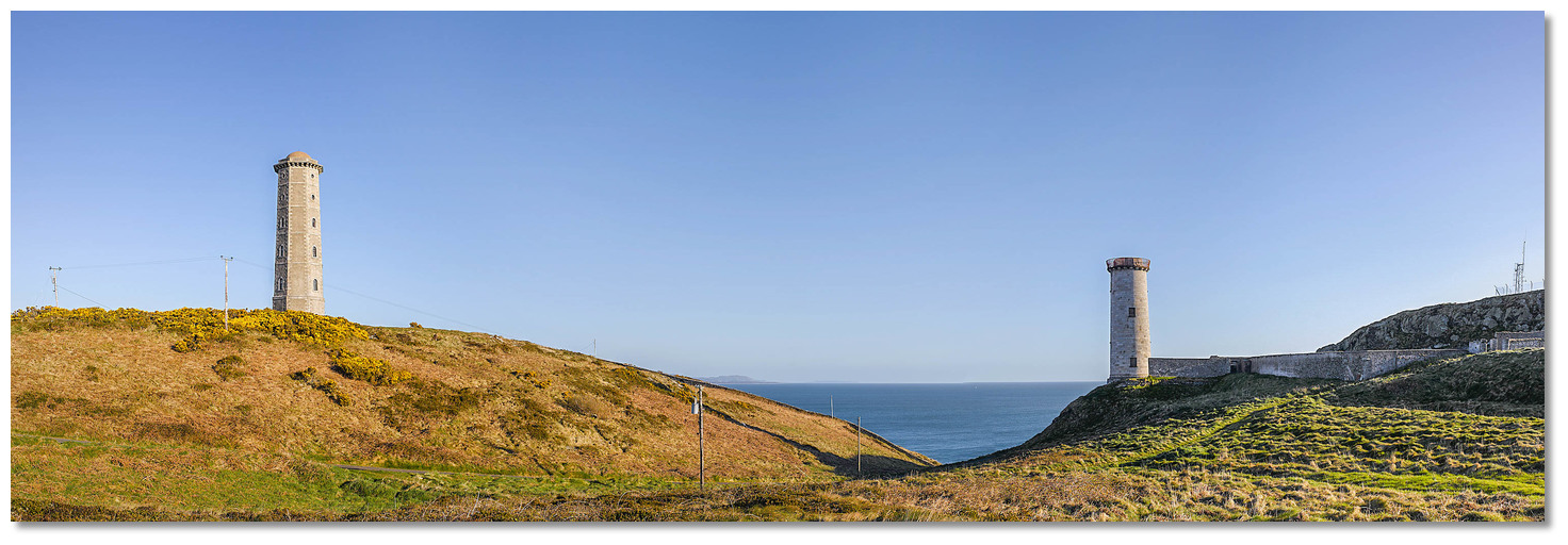 The two disused lighthouses on the summit of Wicklow Head
Image: Tourism Ireland
The currents which set strongly off Wicklow Head attain a velocity of about 4 kn in both directions and it is import to stand off a sensible distance for fear that the vessel should be set ashore. If on a fair tide keep east of the Horseshoe marker to make the best of it as there are lots of back-eddies to slow progress inside.
 Wicklow Head's present lighthouse on the seaward slope
Image: Paul O'Donnell via CC BY 2.0
There is also a light buoy marking an outfall pipeline situated almost a mile northeast from the shore.
Wicklow Outflow Buoy - Fl (4) Y 10s position: 52° 59.541’N, 006° 01.295’W
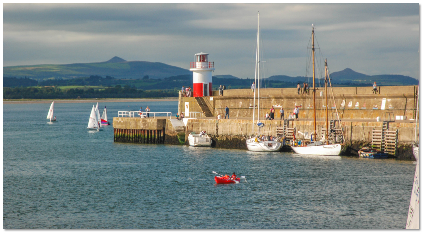
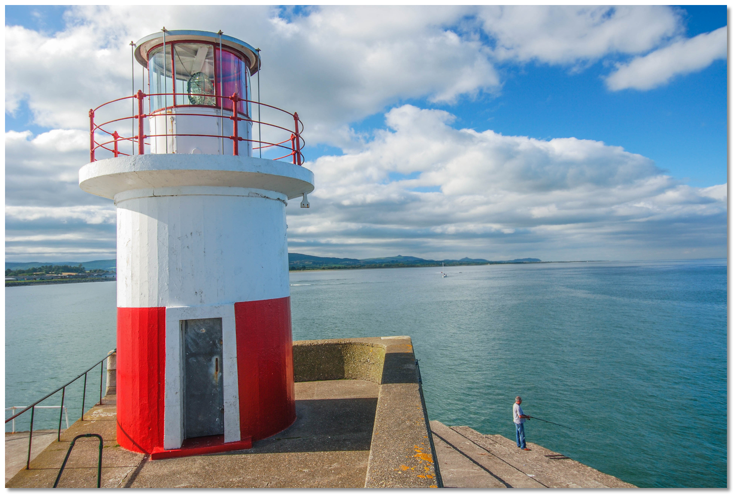 Light tower on the extremity of the East Pier
Image: Michael Harpur
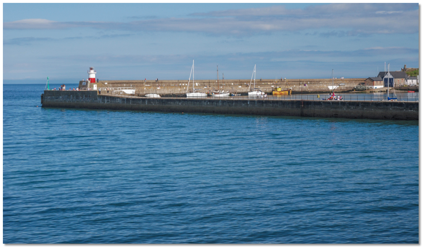
The extremity of the East Pier has a cast-iron light tower that makes the position of the harbour unmistakable. It has a white tower red base, gallery and cupola, 7 metres in height and 11 metres above high water. It exhibits a red light seaward flashing every 5s that is visible for 6 miles and shows a white light over the harbour.
 The outline of Planet and Pogreen rocks visible beneath the surface
Image: Michael Harpur
Vessels approaching from the south should not be tempted to come in close to the East Pier as the area immediately outside of it is foul with the outermost Planet Rock, with 0.8 metres of cover, and Pogreen Rock, with 0.6 metres of cover at LAT. Both these lie about 100 metres to seaward from the inner half of the breakwater and very much in the path of a southerly approaching boat proceeding close to the shore to the entrance.

 Wicklow Harbour's north facing entrance
Image: Michael Harpur
 From the initial fix, immediately outside and to the northeast of the harbour entrance, the harbour will be readily apparent. It has two 250 metre long breakwaters extending from its shores; the West Pier to the northwest and the East Pier to the northeast that has the 7-metre high red and white tower standing at its head.
 The entrance is located between the heads opening to the northeastward. It is 120 metres wide and has a least depth of 3.2 metres at Mean Low Water. When approaching, two large silos standing on Packet Quay immediately inside the harbour will appear in the middle of the entrance. By night the head of the East Pier shows Fl. WR 5s 6M, the head of the West Pier is ISO G 4s, and Packet Quay has a light on a metal column Fl WG 10s 5m 6M. The harbour is almost always accessible.
 Wicklow Harbour's East Pier
Image: Michael Harpur
Come alongside the East Pier upon entry. Vessels should not be left unattended alongside the East Pier and care should be taken not to obstruct the lifeboat slip. The West Pier is not used as the area inside and to the south of this pier is largely occupied by local boat moorings.  Yacht alongside the East Pier
Image: Michael Harpur
An excellent anchorage may be found immediately outside the harbour to the north of the West Pier and well clear of the commercial fairway in sand and mud with 2.5 metres or more. This anchorage is protected from everything except northeasterly or easterly conditions – the weather in this area is predominantly southern to westerly winds. The shore here is steep-to shelving rapidly at the water’s edge so it is possible to come in close to make the best of it. Moreover, the closer in the vessel goes the better is the gravel and sand holding.
 Wicklow Harbour's West Pier as seen from the northwest
Image: Michael Harpur
Those electing to berth outside should avoid anchoring over an outfall pipeline that enters the sea 200 metres to the northwest of the West Pier. It tends to the northeast with the seaward end of the outfall being indicated by the above-mentioned light buoy.
 No berthing should take place inside the West Pier as this area is reserved for
local boat moorings
Image: Michael Harpur
Anchoring inside the harbour is not permitted as it is constrained by the fairway and the established moorings. It would be unwise to attempt to anchor inside the harbour as the likely outcome would be that the ground tackle will foul in the ancient mooring grounds. However, the club may be able to furnish a vacant mooring.
 Leisure craft alongside the vacant Packet Quay
Image: Damian Synnott via CC BY 2.0
When northeast and east gales occur a heavy swell runs into the harbour that will subject all the outer berths to a heavy roll. The Commercial Harbour, inside the river mouth, is usually busy with ships unloading their cargos or fishing vessels but it may be vacant and not have an imminent arrival pending. Beyond this are the North and South quays that do provide protection from north-easterlies and in such an event it is worthwhile contacting the Harbourmaster to see if it is possible to accommodate a vessel further in.
 The South and North quays in the River Leitrim
Image: Michael Harpur
The quay is accessed via the dredged channel that leads along the inner side of East Pier Head and then into the river mouth. From there, pass close along the east side of Packet Quay where a berth may be available or alongside the North and South quays according to the Harbour Master's directions.
Why visit here?
Established by the Vikings, the name Wicklow comes from the Old Norse words 'Vyk' and 'Lo'. Most believe this to mean 'Viking meadow' or 'Viking's lake' but some etymologists believe it means 'bay of the meadow'. In either case and akin to Arklow, its name stems from the Vikings established a base here in the mid-9th century taking advantage of the natural harbour that was created by the River Leitrim and its fertile lands. Earlier spellings of the town's name include Wykinglo in 1173, Wygingelow in 1185, Wykinglo in 1192, Wykinglowe in 1355. Black Castle with Wicklow Head in the backdrop
Image: Michael Harpur
The natural advantages of the area were however identified much earlier than this period and it has been inhabited since the Bronze Age. This has been evidenced by a cooking pit and hut that were uncovered in the lower area of the town in 2010. Radiocarbon-dating aged the discovery to 900 BC. Much later, Ptolemy's map, referred to as 'Menapi' from 130 AD, showed that the area was settled by a Celtic tribe called the Cauci, or Canci. They originated from today's Belgium/German border and arrived in Ireland via Britain. The towns Irish name 'Cill Mhantáin', which means, rather unusually, 'church of the toothless one', indicates a 5th-century Gaelic settlement existed here.
 Black Castle's natural defensive position as seen from the beach below
Image: Tourism Ireland
Legend has it that this name goes back to an attempted landing by St Patrick, circa AD 385 - 461, and his followers on the beach to the south of the harbour. The locals saw this as one of the regular incursions that happened during this period and set to driving off the party by throwing rocks. Before the pious party could effect a hasty retreat one of Patrick's party took a rock directly to the face causing him to lose all his front teeth. Later Patrick returned and, over time, assuaged the tribe then finally converted them to Christianity. He later founded a church that he dedicated to his injured follower calling it Cill Mhantáin so hence 'church of the toothless one'. Over time this became the name used to describe the area and although it was anglicised to Kilmantan it gradually fell out of use.
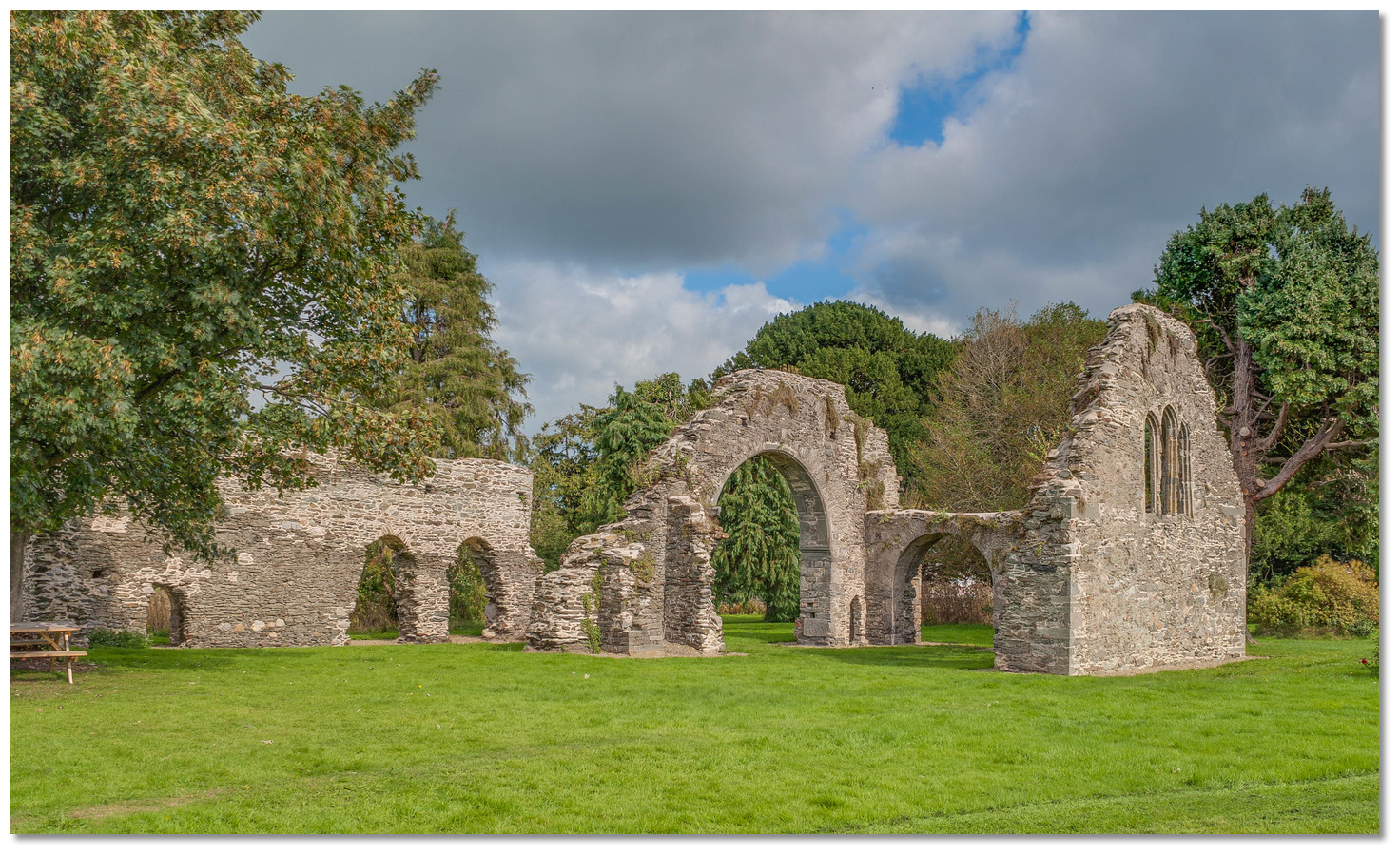 The modest remains of the 13th-century Franciscan Friary locally as 'the Abbey'
Image: Andreas F. Borchert via CC BY-SA 2.0
The Danish influence then dominated for centuries. During this period the Viking used it as a base from which to raid different parts of the country. In 1019, they plundered Kells, slew a great number of people in the midst of the church, and carried off great booty and many captives. In 1021, they plundered the shrine of St Patrick, at Down. Throughout this time there was long and bitter animosity between them and the people of Leinster. Although the people of Leinster resisted them at length and secured a decisive victory over the Danes at nearby Delgany, the Danes were never driven out of their base here until the Norman Conquest.
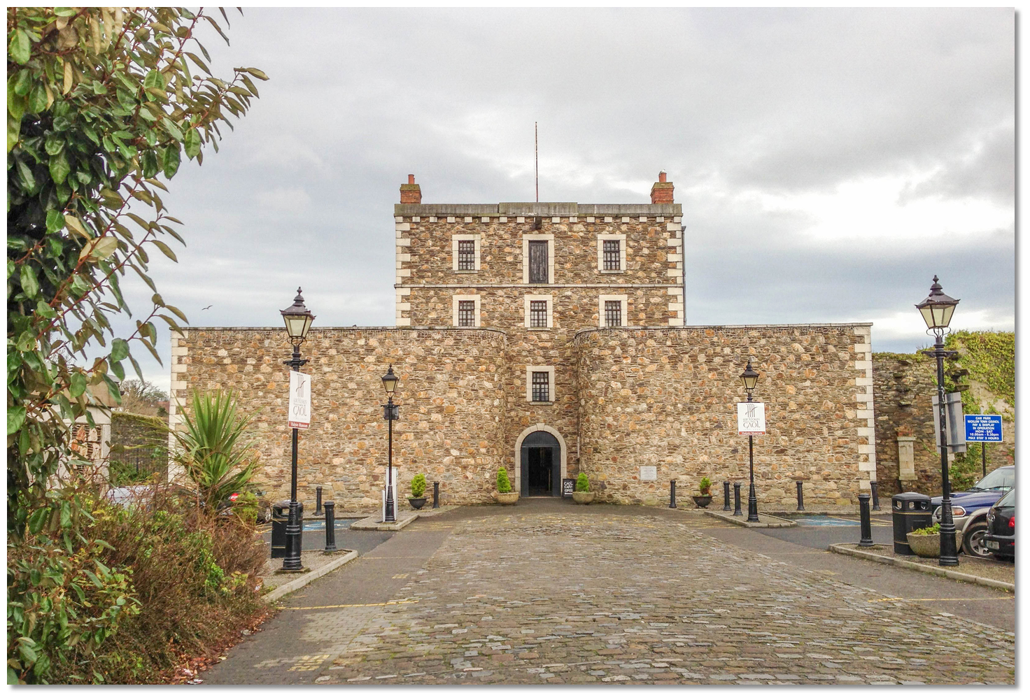 Wicklow Gaol
Image: Andreas F. Borchert via CC BY-SA 2.0
The area was originally taken by Strongbow, the invasion leader and the Normans quickly built castles at key points to secure their hold and provide focal points for their rule. The more important areas had stone castles, as opposed to motte-and-baileys, and as such soon after the invasion the King’s Castle of Wickloe, now The Black Castle, was constructed on the rocky headland just south of the river estuary. The first reference to the castle dates from 1174 when it was mentioned in a grant made by King Henry II. The land-facing fortification was built by the Norman Maurice Fitzgerald who received a grant of the area from Strongbow in exchange for the town of Ferns. It was a significant structure on a well-chosen site, as it is surrounded by the sea on three sides leaving only one point of access from the land, with the underlying rock cut through so it could be defended by a large ditch spanned by a drawbridge. The Fitzgeralds also built a Franciscan Abbey during the reign of Henry III (1216-72) probably in the year 1265.
 Billy Byrne Memorial in Market Square
Image: Andreas F. Borchert via CC BY-SA 2.0
In 1606 County Wicklow became the last county to be created in Ireland. Wicklow town became the county town and soon took on administrative functions in fields such as local government and law and order. But a period of national bloodshed and rebellion ensued and the 1641 rebellion saw the castle and town besieged by Luke O'Toole. His band of insurgents retreated on the approach of a zealous Sir Charles Coote with English forces. Coote is then recorded as engaging in an act of revenge by visiting "savage and indiscriminate" slaughter upon the townspeople that were sympathetic to the rebels. Local oral history contends that one of these acts of "wanton cruelty" was the entrapment and deliberate burning to death of an unknown number of people in a building in the town. The street where Coote's men carried out this horrendous massacre is known to this day as Melancholy Lane.
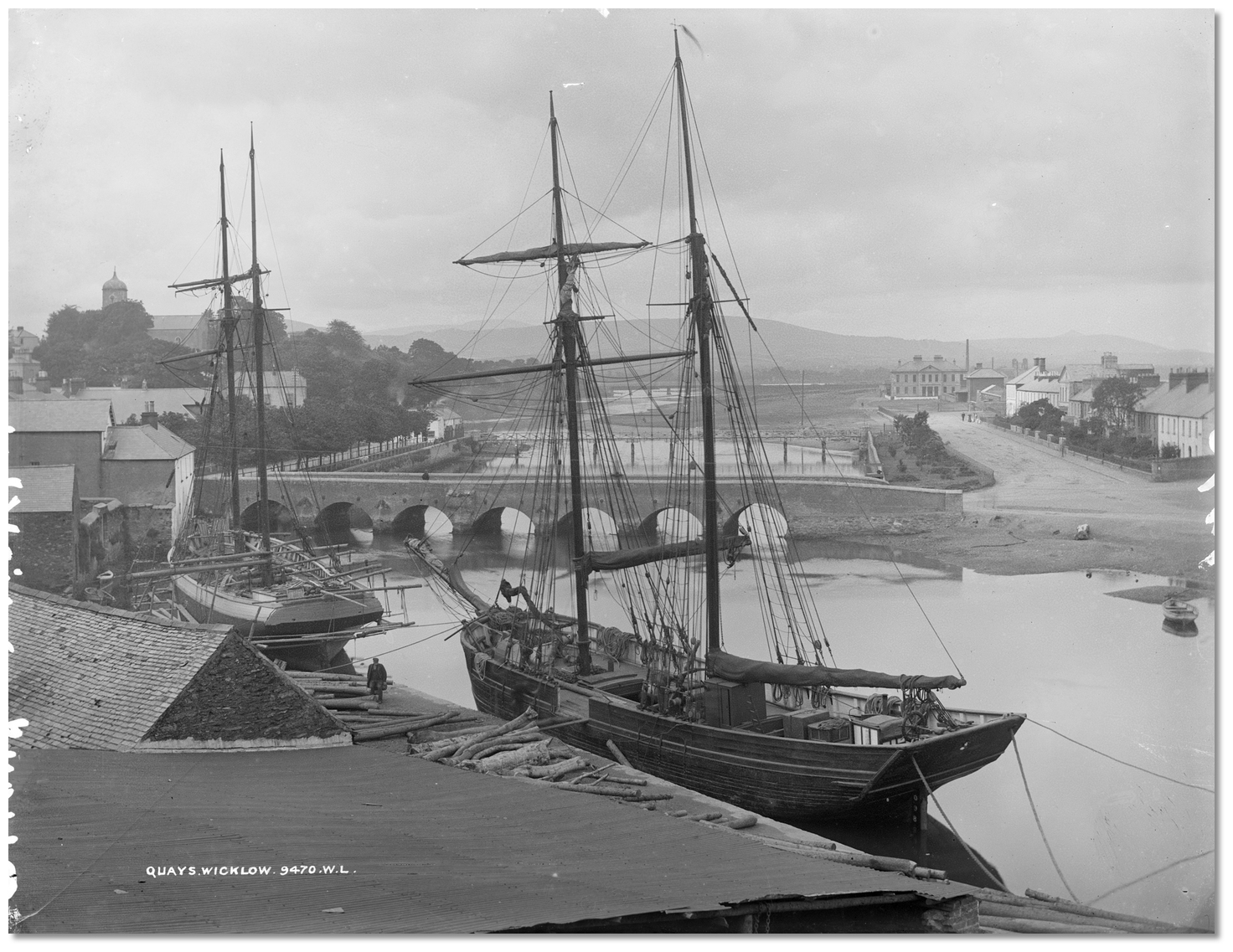 Vessel alongside the quays near the River Leitrim Bridge during Victorian times
Image: National Library of Ireland on The Commons
This did not deter the clans and in 1645 the O’Byrne’s were back attacking the castle during which it finally caught fire and burned to the ground. It was never fully rebuilt and although a partial restoration was attempted it was neglected and the castle went into terminal decline. Following the introduction of the Penal Laws, the building of Wicklow Gaol commenced in 1702 and it would be this that became the focal point for the county's crime, cruelty, exile and misery. Wicklow Gaol received many of Wexford’s 1798 rebels, who were executed here and disposed of from fishing boats into waters offshore to eliminate memorial grounds. Amongst their number was Billy Byrne of Ballymanus, a rebellion leader, who met his end in Gallows Lane in 1799. Wicklow Gaol remained a place of execution up to the end of the 19th-century.
 Wicklow's Packet Quay during Victorian times
Image: National Library of Ireland on The Commons
But despite these turns of fortune the small town of Wicklow continued to grow as its port activity increased. The building of the Stone Bridge in the 1690s gave access to the Murrough but it was the coming of the railway to Wicklow in 1855 that was transformative to the town's importance as a port. It spurred on a major development of the town and most of Wicklow’s important buildings were constructed during the 19th-century including the Courthouse, the County Infirmary, The Marine on the Murrough, St. Patrick’s Catholic Church, the Halpin Memorial, Fitzwilliam Square and the Market Square. The substantive pier and harbour area and its old warehouses largely date from this period and the town is still a working port with a long-standing seafaring tradition.
 The Wicklow Way walking trail
Image: Joe King via CC BY-SA 3.0
Today Wicklow is a tourist town with a wealth of historic sites such as the Norman heritage buildings of the Black Castle, that lies as a ruin overlooking the south of the East Pier, and the ruins of the Franciscan Friary located behind a high stone wall at the northwestern end of Wicklow Town. Notable town buildings include the Town Hall are other fine public buildings such as the courthouse and churches from its Victorian heyday. Wicklow's historic gaol dominates this section of the town and it is now a heritage centre and tourist attraction. Close to the old prison and in the town centre, there is now a statue of 1798 rebel leader Billy Byrne. Another monument in Fitzwilliam Square commemorates Captain Robert Halpin one of the town’s most celebrated mariners. He was responsible for laying the first underwater cable communications between Europe and America in the 19th-century.
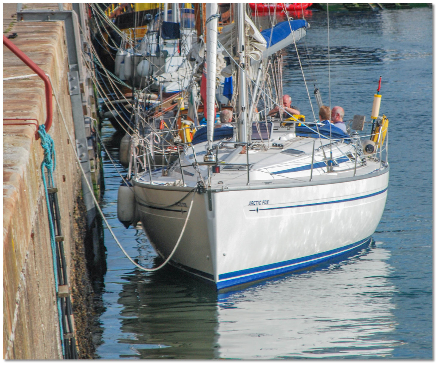 Crew enjoying the late afternoon sunshine alongside the east pier
Image: Michael Harpur
Wicklow is today known as 'The Garden of Ireland', and is one of Ireland's scenic treasures with its magnificent hills and mountains, long sandy beaches, rivers and lakes. The dominant features are the Wicklow Mountains and their foothills. These are the largest highland area of Ireland with the highest summit being Lugnaquillia at 926 metres. This is an unspoilt wilderness of towering mountains and hidden valleys with fantastic views out to the Irish Sea, and north to Dublin from which the capitals famous River Liffey rises. The county's interesting ruins and many deep glens, especially Glendalough, are suitable for tours, and arrangements to visit the area can easily be made from the town via the tourist office.
 The start of a Round Ireland Yacht Race
Image: With thanks to ©grumpygit2009
From a sailing perspective, Wicklow is an excellent harbour, with first-class provisioning and an abundance of things for the visiting yachtsman to see and do. It is in Irish sailing circles a very important yachting harbour being the host to Ireland's premier offshore yacht race, the Round Ireland Yacht Race
. This is the second-longest race in the Royal Ocean Racing Club calendar. The first race took place in 1980 with only thirteen boats. Since then, held biannually, the fleet has grown steadily, attracting a record 60 entrants from all over Ireland and the British Isles in 1992. The town also boasts the Regatta Festival in August. What facilities are available?
Visitors are welcome at Wicklow Sailing Club where male and female toilets/showers (for a small fee) and a handicapped toilet are available. The clubhouse is situated on the South Quay adjacent to the RNLI station. The bar is open seven nights a week during the summer months (Jun/Aug) and from Thursday to Sunday the rest of the year, usually from 8.30 pm. Live music, meals or snacks are often available there, and also in the town any night of the week.Gas Oil is available and other fuels by prior arrangement, also water is available at the Packet Pier and the North Quay. There are three major supermarkets within ten minutes walk from the East pier so it is an excellent location for provisions. You can usually find resources for rigging, engine and hull repairs.
Wicklow is a provincial town where there are shops, banks, an internet cafe, dentist, doctor, hospital, chemists, and a range of restaurants to choose from, all of which are three to four minutes walk from the East Pier. It also has a good Tourist Office to assist you to make the best use of your leisure time.
Bus Éireann and Irish Rail both operate through the town. Bus Éireann provides an hourly service, which is half-hourly at peak time, to Dublin City Centre and Airport. A train service operates northbound to Dublin's Connolly Station and southbound to Rosslare Harbour with ferry connections to the UK and mainland Europe. Dublin International Airport is 40 miles away and accessible via the above-mentioned bus service or via the train service utilising the airport Bus from BusÁras (Central Bus Station) less than 5 minutes walk from Connolly Station.
Any security concerns?
Never an issue known to have occurred in Wicklow Harbour. However as with any provincial area secure and lock up your vessel if leaving it unattended.With thanks to:
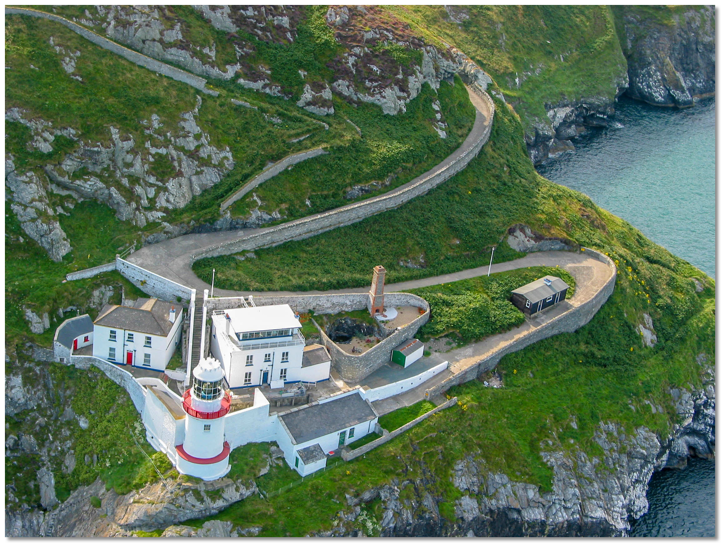
Frank Murphy, Local sailor and member of Wicklow Sailing Club, and Roisin Hennessy, Vice Commodore WSC.Aerial views of Wicklow Harbour and The Black Castle (i)
Aerial views of Wicklow Harbour and The Black Castle (ii)
A summary of the life of Robert Hapin one of Wicklow's greatest mariners.


Add your review or comment:
Ron Lub wrote this review on Jun 7th 2019:
Great place, we had showers at the yacht club, we didn't pay any fee for mooring etc.. there is a good bus connection (new this year) with the Wicklow mountains https://visitwicklow.ie/new-bus-service-wicklow-town-glendalough/ and cost you just 3 euro's.
Also nice walk nearby to the lighthouse there is a Tesco and a Lidle

Please log in to leave a review of this haven.
Please note eOceanic makes no guarantee of the validity of this information, we have not visited this haven and do not have first-hand experience to qualify the data. Although the contributors are vetted by peer review as practised authorities, they are in no way, whatsoever, responsible for the accuracy of their contributions. It is essential that you thoroughly check the accuracy and suitability for your vessel of any waypoints offered in any context plus the precision of your GPS. Any data provided on this page is entirely used at your own risk and you must read our legal page if you view data on this site. Free to use sea charts courtesy of Navionics.