
This is the shortcut around the Dingle Peninsula taking a cut inside the Blasket Island Group. The route utilises Blasket Sound which occupies the space that lies between the northeastern end of Great Blasket Island and the mainland shore.

Why sail this route?
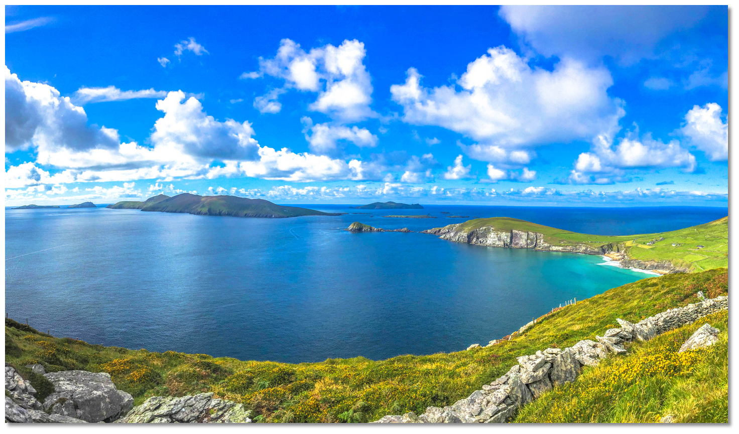
Blasket Sound is a very attractive option for a leisure craft passing north or south along this coastline as it cuts at least 20 miles off any passages between Valentia and the River Shannon. It is also very easily navigated being, at its narrowest point, ½ mile wide and having the benefit of a natural leading line on the mainland’s coastal features. This makes daylight pilotage through the sounds fairway very straightforward and it provides a convenient route that avoids the extensive rocks and shoals that lie to the west of Great Blasket. Blasket Sound as seen from the Dingle Penninsula
Image: Tourism Ireland
As such, in reasonable weather, with fair wind or tide, Blasket Sound is the preferred leisure boat passage. But, in unsettled weather or at night, with its exposed position, uneven bottom and strong tides, it is best to pass to the seaward of the island group and its dangers.
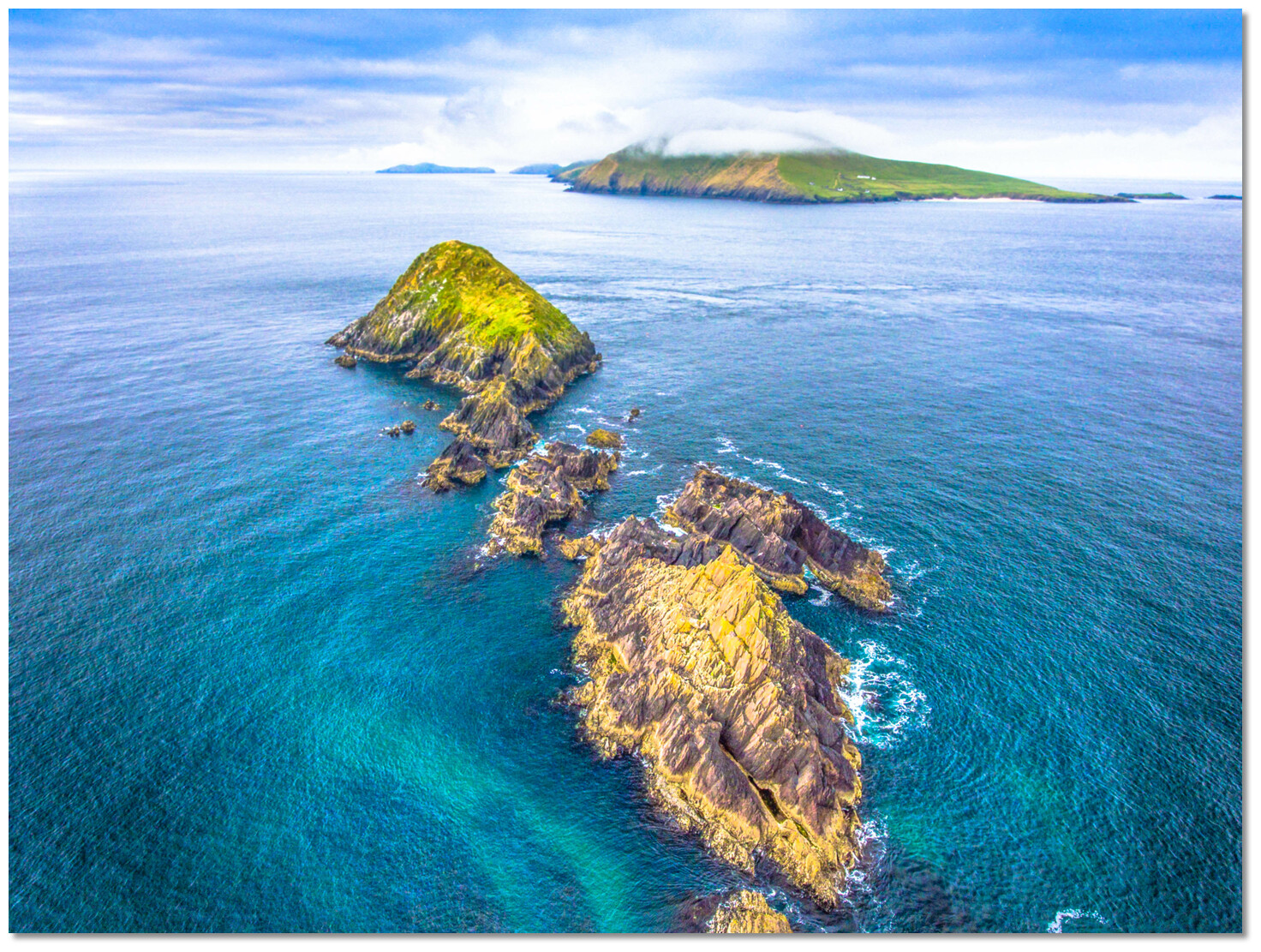
 The southern approach to Blasket Sound
Image: Chris Brooks via CC BY-SA 2.0
Likewise, its tidal streams can be confused and unpredictable at times so a vessel taking this route should be able to avail of a reliable engine.
Tidal overview
Today's summary tidal overview for this route as of Saturday, April 20th at 10:43. The speed of the tidal streams in the main channels varies but is generally about 1 to 3 kn that can cause occasional overfalls and eddies. As such it is advisable to make a transit with a favourable tide or at least before it reaches its maximum rate.Tides in the Blasket Sound turn in line with the channels. The flood streams northward commencing at HW Dover -0120 (Cobh +0430), and ebb streams southward commencing at HW Dover +0440 (Cobh -0035). The tide turns approximately half an hour ahead of the local HW and LW which is approximately Cobh -0110. Sustained southerlies make the flood run for longer and stronger.
South Going Stream
(HW Dover +0430 to -0130)

Starts in 04:13:30
(Sat 14:57 to 21:22)
North Going Stream
(HW Dover -0120 to +0440) Now
(Tidal flow )
Ends in 04:23:30
(Sat 09:07 to 15:07)
What are the navigational notes?

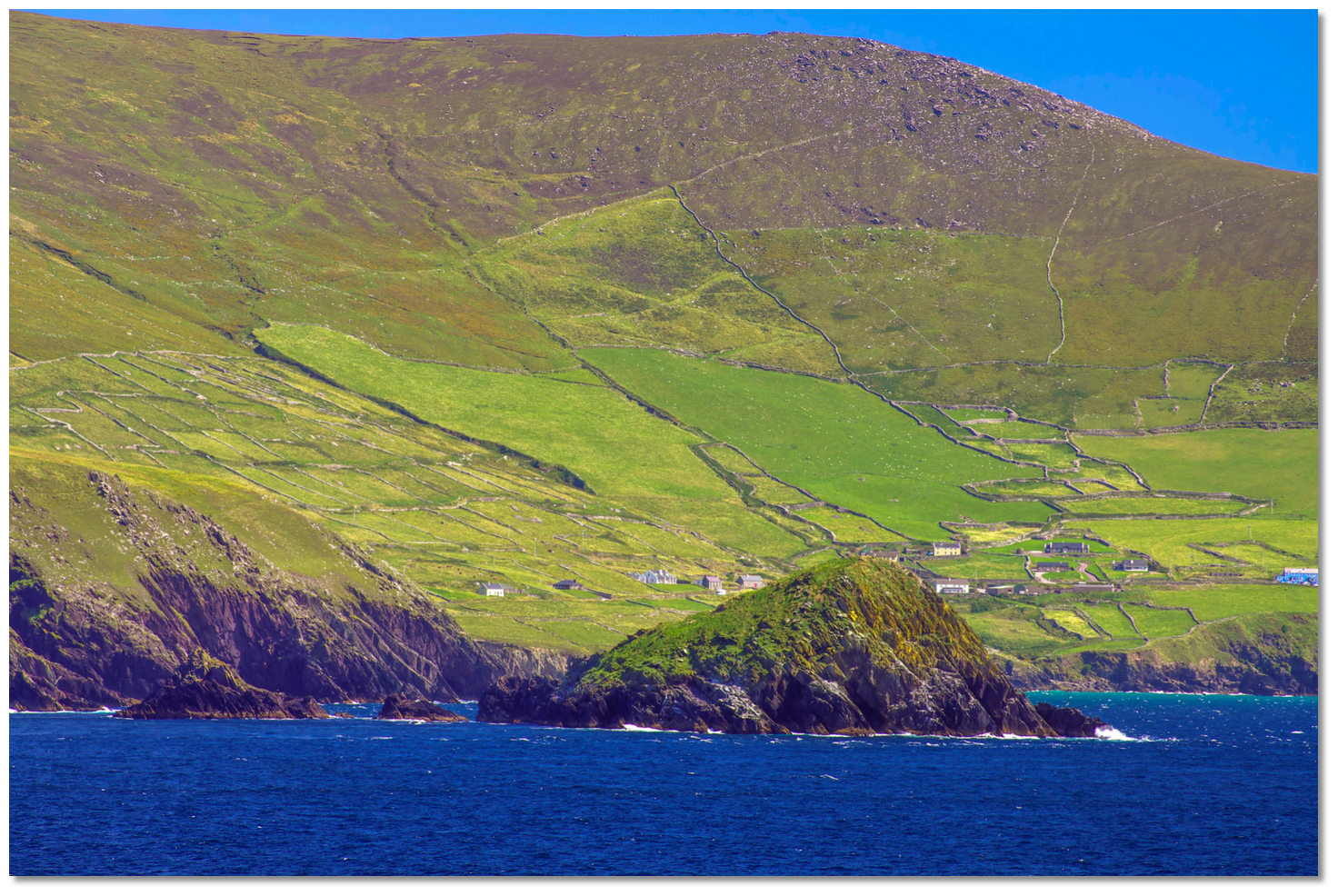
 Great Blasket Island as seen from the northeast
Image: Maciej Brencz via CC BY 4.0
Three miles long, less than ½ a mile wide, and lying in a northeast direction, Great Blasket Island is the largest of the Blasket group. It is situated a mile to the west of Dunmore Head which is the nearest point of the mainland. The island rises from a narrow base to the height of 289 metres at its highest point, at 'An Cró Mór', and is very steep presenting a wall of vertical cliffs along its northwest side. It can be further identified by the ruined Eask Tower on the summit of a 229 metres high ridge 1½ miles northeastward of the summit of 'An Cró Mór'.
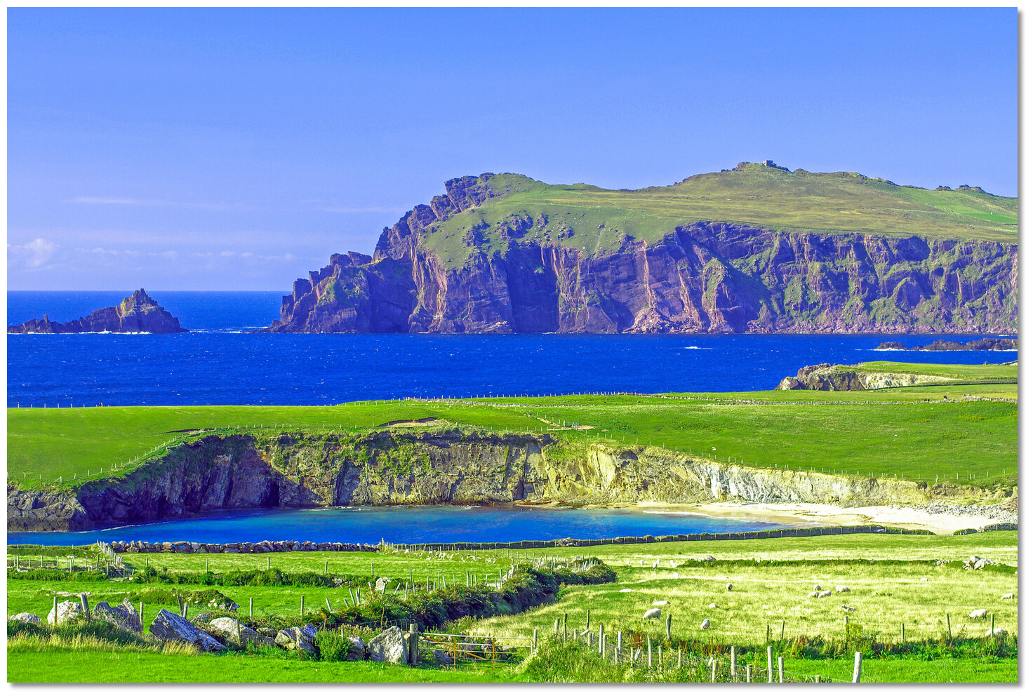
 Dunmore Head
Image: Tourism Ireland
Blasket Sound lies between the north-eastern end of Great Blasket Island, the dangers to the north of it, and the mainland to the east. The sound’s narrowest part resides between the easternmost extremity of Great Blasket Island, called Garraun Point, and the mainland’s Dunmore Head.
 Blasket Sound as seen from Great Blasket Island
Image: Janek Kloss
The channel is then reduced to less than ¾ of a mile in width by a remarkable narrow strip of rock that extends from Dunmore Head to terminate on its western side by a 44 metres high conical rock called the Lure. From a short distance, this strip of rock appears as an island.
 The Lure extending from Dunmore Head with Great Blasket in the backdrop
Image: Tourism Ireland
Beyond The Lure and Garraun Point, almost half of the distance across from the former, is a series of several dangerous covered and drying rocks. The drying rock, called Scollage Rock, lies 150 metres out from the Lure’s extremity. It is covered at high water and dries to 3.7 metres.
.jpg) The Lure as seen from the sound with Scollage Rock just breaking (far right)
The Lure as seen from the sound with Scollage Rock just breaking (far right)Image: Burke Corbett
The Stromboli Rocks lie in the channel about six hundred metres west-southwest of Scollage Rock and consist of several small pinnacles with a least depth of 1.8 metres over them. These all break heavily in bad weather and reduce the fairway to a width of ½ a mile on the western or island side.
 The Lure as seen from Blasket Sound
Image: Tourism Ireland
The complete course is 7.89 miles from the waypoint 'Southern Approach to Blasket Sound' to '½ a mile west of Sybil Points outliers' tending in a northerly direction (reciprocal southerly).
Southern Approach to Blasket Sound, 52° 2.916' N, 010° 31.527' W
This is on the alignment of the sharp pointed Clogher Rock, on 015° T with the ruins of the tower, or the summit on which it stands, that leads clear of the dangers in the sound.
► Next waypoint: 3.44 miles, course ⇓ 15.36°T (reciprocal ⇑ 195.36°T)
Middle Blasket Sound waypoint, 52° 6.234' N, 010° 30.043' W
Safe mid-point fix to Blasket Sound passage
► Next waypoint: 1.51 miles, course ⇓ 15.34°T (reciprocal ⇑ 195.34°T)
Northern Approach to Blasket Sound, 52° 7.689' N, 010° 29.393' W
This is the point where a southbound vessel picks up the alignment, or a northbound vessel breaks off transit to clear Sybil Point’s outliers.
► Next waypoint: 2.94 miles, course ⇓ 355.28°T (reciprocal ⇑ 175.28°T)
½ a mile west of Sybil Points outliers, 52° 10.614' N, 010° 29.787' W
This is ½ a mile west the Maher-aneig rocks off Sybil Point.
 Sybil Point as seen from the south with the hump and tower on top (top right)
 Bringing Clogher rock into line with the tower from the north
 The northern side of Blasket Sound
 . Close northwest of Garraun Point and upon the shore facing the mainland, there is a beach called An Trá Ban. In fine weather, a vessel may anchor off the beach in 3 metres over a sandy bottom and land on the beach or at the island slip close southeast of the beach.
 An Trá Ban anchorage overlooked by the ruins of the old settlement