
This is a set of waypoints for rounding Carnsore Point, Ireland’s south-eastern corner, by the 'offshore route'. The sequence of description is from south and westward or coastal clockwise, passing:

- • Outside the Lucifer Bank
- • Seaward of Tuskar Rock and through the Inshore Traffic Zone of the Tuskar Rock Trafic Separation Scheme
- • South of the Barrels East Cardinal Mark
- • South of the Coningbeg Super Buoy.
Those looking for the 'inshore route' may find it detailed in Ireland's South Coast Description Rosslare Harbour to Cork Harbour
 . The preceding east coast waypoints and coastal description are available in the Dublin to Rosslare Harbour .
 Why sail this route?
Boats approaching from Saint George's Channel, or the east coast of Ireland, and rounding Carnsore Point, Ireland’s south-eastern corner, have two primary options:- • The 'offshore route', detailed here, that rounds the corner outside, or on the eastern or seaward side, of Tuskar Rock using the Inshore Traffic Zone, of the Tuskar Rock Traffic Separation Scheme. This the continues southwestward to pass the Barrels East Cardinal Mark Light Buoy, to pass around the Saltee Islands to the south of Coningbeg Super Buoy.
- • The 'inshore route' that comes close in and around Carnsore Point and heads almost directly west to pass through St. Patrick’s Bridge, between the Saltee Islands and the mainland.
The 'inshore route' is the preferred leisure craft route for many reasons. It avoids the complications of the Inshore Traffic Zone, shortens the approach distance and secures smoother inshore waters. In reasonable conditions, with the benefit of good visibility plus a good breeze, or a reliable engine, the inshore option offers the leisure boats the better option and more interesting passage. Waypoints and coastal directions are available in the Southern Ireland coastal description Rosslare Harbour to Cork Harbour
.But this 'offshore route' is much more straightforward and the best approach to take at night, with poor visibility or in uncomfortable weather.
Tidal overview
Today's summary tidal overview for this route as of Friday, April 19th at 15:46. Tidal stream around the southeast corner of Ireland generally run in a north by northeast / south by southwest direction. Close northeast of Tuskar Rock the tides turn northeast at Dover -0500 (Dublin -0530), southeast at Dover +0100 (Dublin +0030) and attaining rates of up to 3 - 3½ kn. The direction of streams are affected by those from South Shear Channel further northward and timing, direction and rate vary considerably between Tuskar Rock and the mainland coast.Southeast Steam
(HW Dover +0100 to -0500)
Now
(Tidal flow )
Ends in 01:24:37
(Fri 10:46 to 17:11)
Northeast Stream
(HW Dover -0500 to +0100) 
Starts in 01:07:36
(Fri 16:54 to 22:54)
What are the navigational notes?

The offshore route is a straightforward and open water approach to rounding Carnsore Point, Ireland’s south-eastern corner. But it is a seaway that has to be treated with the utmost of respect as between Coningbeg Super Buoy, situated four miles south of the Saltee Islands, and Tuskar Rock there are many rocks, shoals and shallows.
The complete course is 33.40 miles from the waypoint '¼ of a mile east of Southeast Blackwater East Cardinal' to '½ a mile south of the Coningbeg Lighted Buoy ' tending in a south westerly direction (reciprocal north easterly).
¼ of a mile east of Southeast Blackwater East Cardinal, 52° 25.644' N, 006° 7.980' W
Eastern Cardinal Mark, Q(3) 10S, for the Blackwater Bank that resides to the north of the Lucifer Bank.
► Next waypoint: 13.59 miles, course ⇓ 187.31°T (reciprocal ⇑ 7.31°T)
1 mile east of Tuskar Rock , 52° 12.175' N, 006° 10.800' W
Tuskar Rock Lighthouse Q(2) 7.5s situated on a 5-metre high rock islet which is the outermost danger of this corner of Ireland, residing 6 miles east by north-east of Carnsore Point. This position is in about the middle of the Inshore Traffic Zone to seaward of the rock, of the Tuskar Rock Traffic Separation Scheme.
► Next waypoint: 1.56 miles, course ⇓ 208.63°T (reciprocal ⇑ 28.63°T)
½ a mile east of the South Rock Buoy, 52° 10.810' N, 006° 12.015' W
South Rock East Cardinal Q (6) + LFl 15 is moored 1½ miles South of Tuskar Rock marking the South Rock with 2.4 metres of water over it.
► Next waypoint: 6.86 miles, course ⇓ 244.63°T (reciprocal ⇑ 64.63°T)
½ a mile south of the Barrels, 52° 7.865' N, 006° 22.108' W
Barrels East Cardinal Q (3) is marked by a buoy moored about 2 miles south of Carnsore Point. It marks the drying Barrels Rock situated about 1.8 miles south by south-west of Carnsore Point.
► Next waypoint: 11.39 miles, course ⇓ 242.78°T (reciprocal ⇑ 62.78°T)
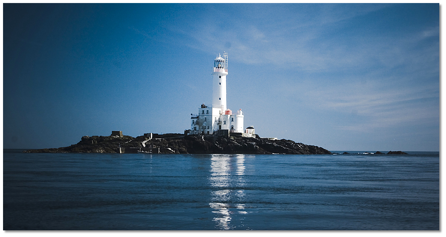 Tuskar Rock
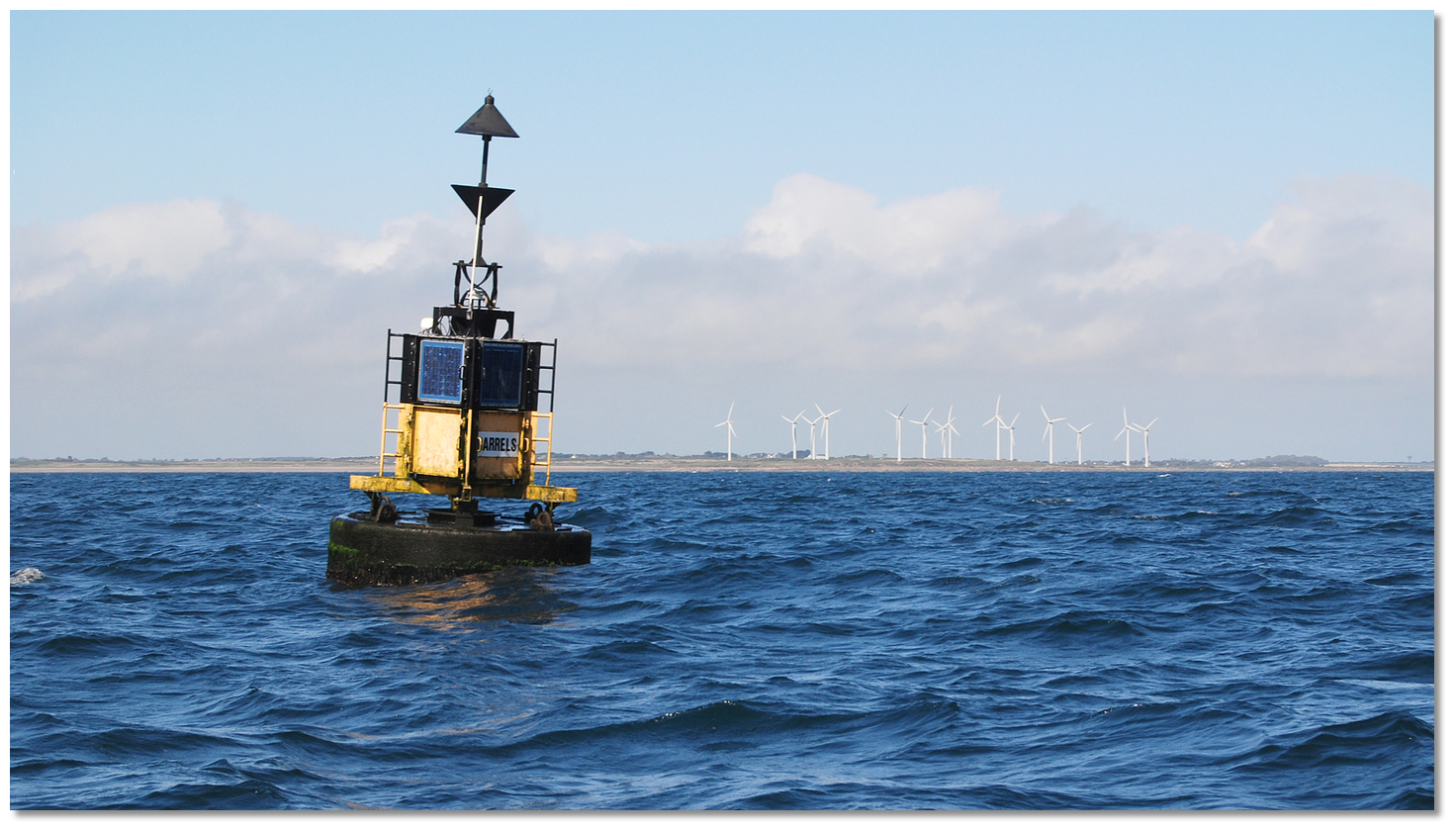 Barrels East Cardinal with Carnsore Point in the backdrop
 Bore Rocks East Cardinal with Great Saltee in the backdrop