
This is the coastal overview for Lizard Point to Start Point. Detailed coastal overviews are intended to be read alongside local area charts so that the key considerations may be noted and pencilled in well in advance. The intention is not only to make passages safer by highlighting coastal dangers but also to make them more enjoyable by unavailing all the Havens along the way so that the occasional coastal gem might not be overlooked.

Why sail this route?
This is the primary coastal overview for vessels cruising the West Country providing coastal overviews and the directions to visit the many havens along this sailing area. Cruising encompasses a combination of long passage runs, to move between coastal sailing grounds and more detailed inshore navigation within the sailing areas. Coastal overviews strive to meet both these needs by providing a combination of the key coastal characteristics for the passages passage and immediate offshore area dangers to assist in local approaches. They serve to provide the overview information to lead a vessel to the initial fixes of the desired havens. The route, as shown, need not be adhered to if sections of the coast are being bypassed.Tidal overview
Today's summary tidal overview for this route as of Wednesday, April 24th at 23:22. Tidal Streams at Lizard Point.
Southwest & west-going
(HW Dover -0145 to +0330)

Starts in 11:42:57
(Wed 11:40 to 16:55)
Northeast & east-going
(HW Dover +0330 to -0245)
Starts in 06:27:57
(Wed 16:55 to 23:05)
What are the navigational notes?

From Lizard Point to Land’s End is a passage of about 20 miles. The Lizard peninsula extends into the English Channel, forming the most southerly point of England. Invariably referred to as 'The Lizard', it is surrounded on three sides by the sea and is a bold rugged headland with a classically conspicuous lighthouse near its summit. It is matched in appearance by the Penwith peninsula that lies opposite, and is itself is home to England’s most westerly point of Land’s End. Both of these peninsulas jut out into the Atlantic like pincers holding between them Mounts Bay with Penzance Bay at its head.
This is the first real taste of Cornwall’s wild and remote character, steep ink-black storm-washed cliffs, lovely coves and workaday harbours all backed by wild expanses of undeveloped moorland cordoned off by drystone walls with churches and pretty farmhouses. A scenically spectacular coastal area but one where attention to weather forecasts becomes essential.
As westward of Lizard Point, the peninsulas offer little if any protection to the prevailing winds and Mounts Bay is wide open to the Atlantic. Any Atlantic swell that should be accompanied by an elevation of the prevailing winds can make this stretch of coast a very unpleasant if not dangerous place. The two most important harbours to bear in mind are Penzance and Newlyn that lie in on the western side of Penzance Bay. Total security can be had locked-in within Penzance's wet basin but it should be accessed promptly before bad conditions have established themselves. It is limited by its opening hours, 3 hours per tidal cycle, and cannot be not considered a 'harbour of refuge' during strong southerly round to easterly winds. At these times waves break across its shallow entrance that Newlyn Harbour, preferably at high water, provides the only safe option. Newlyn offers an all-tide harbour of refuge and although primarily a busy fishing harbour it will take in leisure craft in bad weather. Some of the minor harbours might be able to provide some shelter but if it gets rough a heavy surge will make for some unwanted bouncing off harbour walls.
But if the wind is light or moderate or from between north and east, there are several useful anchorages and vessels that can take to the bottom in the small tidal harbours such as Mousehole, at Saint Michael's Mount or Porthleven will have the best of it. Keep a sharp eye out for fishing pots as they can be encountered up to 6 miles offshore along this coastline.
 Lizard Point as seen from the east over Housel Bay
Image: Andrew via CC BY 2.0
The bold and precipitous promontory of Lizard Point is the southern extremity of the mainland of England. Visible from a distance of about 24 miles, and easily distinguished by its two white lighthouses, vessels generally make Lizard Point their landfall when proceeding into the channel from the southwest.
 Lizard Point Lighthouse
Image: Andrew via CC BY 2.0
Occupying such a significant position Lizard Point has historically had two white octagonal lighthouses, an eastern and western tower, that stand about a ½ mile east of the point. In 1903 the western tower’s lantern was removed and the eastern tower alone now guides shipping up the channel. This is a 19 metres high white tower that exhibits a light, Fl 3s, 70 metres above Mean High Water that can be seen in clear weather from a distance of 26 miles which includes the vicinity of Wolf Rock. It is however obscured by Bass Point from the north until west-northwest.
 The two white octagonal eastern and western towers of Lizard Point lighthouse
Image: Michael Harpur
On closer approaches, a conspicuous large hotel will be seen ¼ of a mile to the northeast of the light and at the head of the small Housel Bay. on Goonhilly Downs, 5 miles north of the light, there are several dish-shaped antennas that are also conspicuous from seaward.
 Lizard Point as seen from the west
 Image: Nilfanion via ASA 4.0
The headland is very dangerous as a cluster of rocks, collectively known as The Stags, extend up to ½ a mile south of Lizard Point. The outer rocks cover at from half to three-quarters flood and terminate in Men Hyr, a rock which dries to 1.2 metres. Within them are masses of detached rock that nearly join the shore at low water. Beyond this is an extensive race laying to the southeast of Lizard Head that is brought about by the confluence of the tides on either side of the headland and shallow uneven soundings that extend southwards from the head. The tidal race extends up to 2 miles south of these rocks and during south-westerly gales, the sea in this area is short and heavy. Vessels are advised to pass well to the south of all of these.
 The old Lizard Lifeboat station in Polpeor Cove close west of the lighthouse
Image: Eugene Birchall via CC BY-SA 2.0
From Lizard Point to Predannack Head, 3⅓ miles north-westward, the cliffs are 60 to 75 metres in height. About 1-mile northwest of Lizard Point and ¾ of a mile southeastward of Rill Point is the beautiful stack surrounded Kynance Cove
 .
.  Kynance Cove
 Image: Jon Watts
Set between Lion and Gull Rock as well as Asparagus Island the cove’s white sand beach, turquoise waters and serpentine rock towers produces a breathtaking sight that makes it, without doubt, the 'jewel' of the Lizard Peninsula. Anchor over sand off the mouth of the cove and between the outer stacks in about 5 metres. From a boating perspective, fringed with rocks on an already exposed coastline that is wide open to the Atlantic, it could never be described as the best of anchorages.
 Kynance Cove at low water when it looks its best
Image: Joost via ASA 4.0
But for a family boat, should a good stable window of sunny weather occur, this is a spectacular beauty spot. In northerlies and when the swell from the Atlantic is modest, it also makes good tide-wait location to round the Lizard.
 Anchor between the outer stacks
Image: Andrew
A couple of miles offshore, 1½ miles from Rill Point or 3 miles northeastward from Lizard Head, is a rocky shoal called The Boa. With only 11 metres of water over it the sea breaks heavily on it in southwesterly gales. The irregular bottom in its vicinity also causes strong tide rips.
 Predannack Head from Vellan Head
Image: Nilfanion via ASA 4.0
Predannack Head, a rocky and cliffy headland that rises sharply to a height of 61 metres. Vradden, with 2.6 metres over it, lies about 400 metres southwest of the headland and is steep-to on its seaward side.
 Mullion Island
Image: Ian via CC BY-NC 2.0
Mullion Island, about a ½ mile north of Predannack Head, rises 29 metres above high water and is precipitous on its western side. There is a good anchorage on its northwest side, in strong easterly or southeasterly gales, but be prepared to weigh anchor if the wind shifts to westward. The island was given to the National Trust in 1945 and landing on the island is prohibited.
 Mullion Cove
Image: Nana B Agyei
Mullion Cove
, with its small drying boat harbour of Porth Mellin, lies about ⅓ of a mile northwest of Mullion Island. A conspicuous hotel stands on the steep cliffs above the harbour and cove providing an excellent seamark. An anchorage is possible to the southwest of the entrance to the small harbour in settled conditions or in any condition with an easterly component. The cove is partially sheltered from the prevailing winds by the island but entirely open to the west. Mullion Island as seen out through the entrance to the small pier
Image: Nilfanion via ASA 4.0
From Predannack Head the cliffs are 30 to 60 metres high, and the low-water rocks extend about 100 metres offshore. The cliffs then vary from 15 to 60 metres in height and the shore becomes sandy approaching Pedngwinian Point.
 Pedngwinian Point to Predannack Head
Image: mike193823319483 via CC BY-SA 2.0
The coast is then to Porthleven is low. A deep inlet blocked up by a bar of shingle that rises 10 metres above low water, called Loo Pool is passed about a mile south of Porthleven for which it has sometimes been mistaken.
 Porthleven
Image: Michael Harpur
Porthleven
is a small and drying harbour situated in the northeastern part of Mounts Bay. The entrance is entirely open to the west and southwest so that it may only be approached in offshore winds or during settled conditions. When necessary, heavy timbers are lowered into a tide gate entrance to its inner harbour to provide storm protection. It should not be considered a refuge in rough weather as it is dangerous to approach and is closed in any strong southerly or southwesterly conditions.  Porthleven clock town and mast
Image: Michael Harpur
The outer pier has a prominent clock tower at its root that is fronted by a flagstaff. If there is nothing on the mast, the harbour is open, but the inner harbour is closed off when a red or black ball is displayed. At night, the closure of the harbour is signalled by switching off its fixed green leading lights.
.jpg) Porthleven with its drying East Quay (left)
Porthleven with its drying East Quay (left)Image: Michael Harpur
Accessible from half-tide onwards and the harbour has 3.7 metres MHWS at the tide gate to the inner harbour and 2.4 metres at MHWN. The inner harbour has a depth of about two meters at half tide, although it is shallower at the northern end, where there is a slipway.
Between Porthleven and Mount St. Michael's the coast is foul, with many outlying dangers, that vessels should stand well off and especially so in rough weather.
 Trewavas Head with its two prominent derelict engine houses
Image: Nilfanion via ASA 4.0
From Porthleven to Trewavas Head, about 1¾ miles west by northwest, the cliffs rise to about 45 metres. Trewavas Head slopes to a seaward cliff 10 metres high. It is readily identified by its two derelict 19th-century engine houses that are perched precariously on the cliffs to the east of Trewavas Head. These form the remains of Wheal Trewavas mine worked four copper lodes which ran in a southeasterly direction under the seabed. There was also a tin lode that ran across the other lodes from east to west.
 Wheal Trewavas Mine engine-houses
Image: Tim Green
Rinsey Head, less than ½ a mile northwest, then rises to 25 metres above high water and has a prominent house perched on its extremity.
 Rinsey Head as seen from Trewavas Head over Porthcrew
Image: Andrew via CC BY 2.0
Rinsey Head has two rocks, a rock close to the head about 60 metres from the shore, and the other has flat rocks within, and sand outside, extending off 100 metres at low-water mark. The dangerous offshore Welloe Rock, which dries to 0.8 metres, lies ¾ of a mile southwest of the head and almost a mile southwestward of Trewavas Head.
 Praa Sands
Image: Andrew via CC BY 2.0
From Rinsey Head the cliffs lower and continue with little variation from the mainland for a mile westward to form a small bay bordered by the Praa Sands. The northwest part of the Praa Sands bight is formed by Hoe Point where the land again rises to 15 to 20 metres high. They gradually decrease in height to the low point fronted by The Enys enclosing Kenneggy Sand.
 Kenneggy Sand and The Enys
Image: Andrew via CC BY 2.0
Between Hoe Point and The Enys lies Prussia Cove which is sometimes also referred to as Bessy's Cove. From the eastern limit of Prussia Cove to the end of the cliffs a series of high, detached rocks extends some distance offshore; those off Hoe Point lie nearly 200 metres from the cliff. Nearly a ½ mile south of Prussia Cove lies the dangerous The Stone rock that dries to 0.3 metres and has shallows close south with 0.8 metres of water over it. To pass north of this shoal, shut the Mount Tower in with Cuddan Point.
 Prussia Cove
Image: Andrew via CC BY 2.0
At about ½ a mile further southwest, and just short of a mile southward from Cuddan Point, is the Mountamopus Shoal a rocky shoal patch which contains the shallowest rocks of Mountamopus with 1.4 metres of water over it. It is about 200 metres long and nearly the same wide and its southern edge is marked by a lit South Cardinal Q(6)+LFl.15s. Another rocky bank called Cam Mallows, with depths ranging from 2.8 metres to 6.3, lies a ½ mile southeast from the shallowest part of the Mountamopus.
 Cudden Point as seen from the northwest over Greeb Rock
Image: James Stringer
From the vicinity of The Enys to Cuddan Point, ¾ of a mile to the westward, the cliffs do not vary. A conspicuous 84 metres high water tower stands at Saint Hilary, 1.4 miles north of Cudden Point.
 St Michael's Mount
Image: CC0
Mounts Bay is between the Runnel Stone and Lizard Point, which are distant from each other by 18 miles, in a northwest-by-west and southeast-by-east direction. This spacious bay receives its name from the remarkable and picturesque isle, Mount St. Michael's, lying at its head. St. Michael's Mount is of a conical form, 80 metres high, and about one mile in circumference, and bears a striking resemblance to the Mount of the same name in Normandy.
 St Michael's Mount at low water
Image: Chensiyuan via CC BY-SA 4.0
Penzance Bay is located in the northwest corner of Mounts Bay and entered between the inner points of the bay, Cuddan on the east side and Carn-du Point on the westward, bearing east/west, 5½ miles. The best anchorages lie within this bay during summertime, with shelter from all winds except those between south by southwest and southeast, which send in a heavy breaking sea.
 Buildings on the summit of St. Michael's Mount
Image: Andrew via CC BY 2.0
There are five tidal harbours in Penzance Bay. Porthleven on the eastern shore and Mount St. Michael's Harbour on the northern side of the mount in the north. Penzance, Newlyn and Mousehole harbour on the western shore of the bay. These all dry out at low water and should not be run for with a ground swell on or during on-shore gales. The principal anchorage in the bay is in Gwavas Lake, off Newlyn Harbour. Both Mounts Bay and Gwavas Lake afford good anchorage and are sheltered from all offshore wind. The bay should be avoided during winter. No attempt should be made to enter any of the harbours within the bay, except Newlyn, when a groundswell is running or with onshore winds.
Cudden Point is located on the northeast side of Mounts Bay, 2.2 miles east-southeast of St. Michael’s Mount. The cliff's around Cuddan Point are high and rocky. To the northwestward of the point is the Western Shag Rock standing well out of the water, about 50 metres off the shore, and about the same distance to the southwest of the extreme point is the Eastern Shag Rock, which barely covers at high water.
 Perran Sands with Cuddan Point in the backdrop
Image: Andrew via CC BY 2.0
Northward of Cuddan Point, the shore is flat and rocky for a ½ mile where Perran Sands opens up before a low shore. At Maen-du Point, which is high and rocky, the cliffs once again ascend abruptly. A church, with a prominent tower, is situated at Perranuthnoe, a ¼ of a mile north of
Maen-du Point.
Maen-du Point is foul with a large masses of rock extending in a southwesterly direction from it. The rocks outer extreme is nearly ¼ of a mile from the shore and has a detached rock called Greeb Rock, 7 metres above high water, that is separated from the main reef. Another cluster of rocks, covering at two-thirds flood, called the Bears Rock lies close southeast. The outermost lies about 200 metres southeastward from the hummock of The Greeb.
 Trenow Cove
Image: Jim Champion via CC BY-SA 2.0
Between Greeb Rock and Saint Michael’s Mount the coast forms a small bay, that contains Trenow Cove and Venton Cove, with several shoal patches in it. Goldsithney water tower, about 2½ miles away on Perran Downs stands prominent.
Off its low and rugged shores the low-water rocks extend for 150 metres, and for a further 150 metres outside of them at several points lie detached rocks. On the eastern side of St Michael’s Mount, about 400 metres offshore, is a small cluster of rocks awash at low water.
 St. Michael's Mount
Image: Michael Harpur
Saint Michael's Mount
is a conical islet about a mile in circumference and 80 metres high. It has a small drying Saint Michael’s Harbour, formed by two piers, on the northern side of the mount, with its entrance between the pier-heads facing to the northeast and shoreward. The harbour dries to 2.1 metres but has a depth of 3.3 metres at high-water springs and 2.1 metres at neaps. In settled or gentle offshore winds, it is possible to anchor just outside the harbour in depths of 2 to 3 metres.  Mount St. Michael's small harbour
 Image: Michael Harpur
The small harbour and anchorage should only be approached from the south or southwest and no attempt should be made to come in from the east or north of the Mount where there are extensive rocky ledges that dry to 3 metres. Vessels approaching from the south need to navigate around the dangerous Maltman Rocks, that dry to 0.8 metres and covers at one-quarter flood, which lie about 150 metres offshore of the southern point of the island. Then the Guthen Rocks, a shoal patch with 2.3 metres LAT, that lies 300 metres west of the island. Both are very much in the way of anyone following the island in from the south.
 Yacht anchored close west of St. Michael's Mount
Image: Michael Harpur
The shore to the westward of Mount Saint Michael forms a bay called Longrock Beach, with Long Rock nearly a mile westward, marking its western end. On the eastern side of this are the Penzeath and Hogus Rocks.
 Sunrise over Longrock Beach
 Image: Jim Champion via CC BY-SA 2.0
The Penzeath Rock is a small patch lying 300 metres offshore, which dries to 1.4 metres and covers at one hour’s flood. The Great Hogus is a rocky cluster that is up to 5.5 metres in parts and lies up to a ⅓ of a mile offshore between the Penzeath and the mount. The Little Hogus, which covers at three-quarters flood, is about ¼ of a mile offshore between the Great Hogus and the Penzeath.
Outer Penzeath Rock, with from 1.4 to 0.1 metres of water over it, lies ⅓ of a mile southwestward from Hogus rocks, and from the shallowest part of the rock, the tower of Mount St. Michael's bears 114° T and is a ½ a mile distance.
Image: Jim Champion via CC BY-SA 2.0
The shore at the head of Mounts Bay, from the bridge at Marazion to Penzance, is low and flat and composed of sand and shingle, which runs off from high-water mark to the Long Rock, marked by an unlit south cardinal beacon, a distance of nearly 400 metres from the shore. The Bloon or Ryeman Rock lies nearly a ½ mile from the shore, its north extreme nearly touching Long Rock. It is marked by a south cardinal beacon.
 The shore at the head of Mounts Bay looking towards Penzance
Image: Garetn James via CC BY-SA 2.0
A ½ mile from the beacon on the Ryeman Rock and nearly ¾ of a mile eastward of Penzance Harbour, and about ⅓ of a mile from the high water mark, is the south extreme of the Cressars Rocks, which cover at two-thirds flood. Their western limit called Western Cressar lies a ⅓ of a mile eastward of the harbour and is marked by a south cardinal beacon and Cressar’s southern tip is 400 metres eastward.
 Penzance Harbour
Image: Michael Harpur
Penzance Harbour
is situated in the extreme northern part of Mounts Bay. This small port is used by coasters, fishing vessels, and pleasure craft. It is also the terminal of the Scillonian ferry which runs to the Scilly Islands. The harbour is formed by two outer piers, within which is a tidal basin and a wet dock basin. The northern pier, called Albert Pier, runs out 250 metres in a southwesterly direction from the inner wall and the southern pier, called the Ferry Berth, for 100 metres on the extremity of which is an iron lighthouse.  Penzance Harbour lighthouse on the head of South Pier
Image: Michael Harpur
The lighthouse is 11 metres high and coloured white with a black bottom band. It Fl. WR.5s and can be seen for 17/12 miles with the red sector showing over The Gear and the Cressars. The entrance between the pier heads facing northeastward and is 110 metres wide. Inside the harbour, the tidal basin mostly dries but the ro-ro berth has a maximum depth of 4.7 metres.
 Penzance's tidal basin as seen from the head of Albert Pier
Image: Michael Harpur
The wet dock opens from HW-0200 to HW+0100 and is entered through a gate, 15.3 metres wide, and accepts vessels up to 14.8m wide and 96 metres LOA. It usually has a depth of 4.3 metres, but at HWS there is a depth of 5.3 metres.
 Penzance Harbour's wet basin
Image: Michael Harpur
A drying rocky ledge known as the Battery Rocks extends ¼ of a mile southward of the southern arm of the south pier of Penzance Harbour. 300 metres further southward of them are some detached rocks, which narrow the channel between them and the Gear Rock to 160 metres.
Image: Michael Harpur
The Gear, on which is an isolated danger beacon, lies almost ½ a mile south from the lighthouse on the south pier of Penzance Harbour and covers at one-third flood.
 The shore between Penzance and Newlyn at high water
Image: Tom Bastin
The shore between Penzance and Newlyn has some flat, stony shores that extend off for about 200 to 300 metres from high to low water mark. Close north of Gwavas Cliff, about 12 metres high, is the clearest and safest place to land on a beach.
 Newlyn Harbour
Image: Michael Harpur
Newlyn Harbour
is situated on the west side of Penzance Bay, within a cove known as Gwavas Lake. Although home to a wide variety of yachts and pleasure boats, it is one of the largest fishing ports in the UK and gives priority to its fishing fleet. The harbour authority does its best to accommodate visiting leisure craft especially so in rough weather. The small port is formed by two piers that have a north-facing entrance. There is a metal lighthouse 10 metres high and coloured white with a red bottom band on the head of the South Pier. It Fl5s and can be seen for 9 miles. The entrance between the pier heads, at its foot, is northeast facing and 47 metres wide.  Visitor berths are usually at the head of the Newlyn Harbour Pontoon
Image: Michael Harpur
Inside it then runs in a northerly direction to the village of Newlyn divided in half by the Mary Williams Pier. Most of the harbour dries at low water over a gravel bottom, but the outer part, including the extremities of the piers, can be entered by small craft at any stage of the tide and drafts up to 5.5 metres at MHWS and 5.2 metres at MHWN, can be handled. Sections of the harbour have maintained depths of from 1.9 to 2.4 metres.
 The disused Penlee Lifeboat Station situated close north of Penlee Point
Image: © John Fielding
Penlee Point, the site of a disused lifeboat station close north of the point, is located a mile south of Newlyn and a ½ mile north of St Clement’s Isle. The cliffs here are 18 metres high and a church, with a prominent tower, stands at Paul, ½ a mile west of Penlee Point. The cliffs are about 10 metres high south of Newlyn Point with the land behind gradually sloping down to them. Then at Penlee Point, the land rises abruptly to 76 metres before it descends to as little as 6 metres high near Mousehole.
 Fishing boat passing Low Lee Rock east cardinal Newlyn bound
Image: Nilfanion via CC ASA 4.0
Low Lee Rock, with 2.1 metres over it, lies ⅓ of a mile east-northeastward of Penlee Point. The 'Low Lee' east cardinal marker buoy is moored about 150 metres eastward of the rock, Q(3)10s. Carn Base Rock, with 2.1 metres, lies nearly a ⅓ of a mile northwestward from Low Lee Rock and about the same distance from the shore. Both Low Lee and Carn Base Rocks are weed-covered rocks, of small extent and steep-to on all sides.
 Saint Clement's Isle situated about a ¼ of a mile offshore of Mousehole
Image: Michael Harpur
From Penlee Point to Mousehole the shore is rugged, consisting of heavy masses of loose rocks. Near the eastern side of the harbour's mouth are some detached rocks, extending nearly 150 metres from the land.
 Saint Clement's Island as seen over Mousehole's North Pier
Image: Michael Harpur
The 8 metres high Saint Clement's Isle is located about a ⅓ of a mile southward of Penlee Point and about a ½ mile north by northeast of Carn du. The low-lying black rocky outcrop can be difficult to identify as it tends to get lost against the land until much closer in. It has an obelisk daymark (unlit) on its southern highest point but its 7 metres above MHWS including the island itself so it is little more than a rectangular block. Vessels approaching from the south will see it separate from the land. The small island provides shelter to Mousehole Harbour which is located on the mainland about 300 metres west by northwest of the island.
 Mousehole Harbour
Image: Michael Harpur
The drying oval-shaped boat harbour of Mousehole
, pronounced 'Mowzel' and never 'mouse hole', is formed by two granite piers with an entrance 11 metres wide. It dries to a bottom of clean sand with some small boulders and has depths of 2.7 metres at high-water springs and 1.8 metres at high-water neaps. The foot of the South Pier, where its visitors typically come alongside, dries to 1.9 metres. An anchorage may be had outside with good holding and some protection from the west but only in the absence of swell that tends to swing around the peninsula. The anchorage is entirely open to the south and southeast.  Huge oak baulks seal the harbour entrance for winter storms
Image: Michael Harpur
It protects itself from winter storms by sealing off the harbour entrance with huge oak baulks. The entrance may occasionally be closed by strong east or south easterlies. Green lights, 2 F.G. Vert, exhibited from a metal mast 3 metres high and at the head of the north pier, at the entrance, indicates the harbour is open; 3 F.R. Vert from the same mast indicates it is closed.
From Mousehole to Penzer Point, ¾ of a mile south, the cliffs range from 30 to 40 feet, the high land sloping directly to them. A conspicuous hotel is situated ¼ of a mile south of Mousehole.
 Penzer Point
Penzer Point is abrupt and surmounted by a prominent building. It has 25 metres high cliffs with the land rising steeply behind them. From Penzer Point the cliffs then decrease in height, varying from 18 to 12 metres, until near Flat Point, which is only 12 metres high, and then they rise to Carn-du Point, which is precipitous and 14 metres above high water.
 Carn-du Point as seen over the small stone pier in Lamorna Cove
Image: Bob Jones via CC BY-SA 2.0
Carn-du, the eastern entrance point of Lamorna Cove, lies about 1-mile northeast of Tater-du Light. The Gull Rock, 24 metres high and precipitous, lies close off this point. Lying off 100 metres west by southwest from it is a small rock called the Little Hayer, which dries to 0.3 metres and covers at a quarter flood. At nearly 400 metres eastward of Carn-du Point, and about half that distance southward of Flat Point, is the Lelland (or Rennell) Rock, which covers at a quarter flood.
 Lamorna Cove
Image: James Emmans via CC BY-SA 2.0
From Carn-du Point, the northern side of Lamorna Cove rises to 25 to 30 metres and then descends to the southern side of the cove where the cliffs vary from 18 to 25 metres in height. From there it abruptly drops down to Tetter-du Point, which slopes gradually to cliffs not more than 15 metres high.
 Tater-du Point with its prominent lighthouse as seen from the east
Image: Nilfanion via ASA 4.0
At nearly 400 metres eastward of Tetter-du Point, and at about the same distance offshore, are the Buck Rocks, which dry to 3.3 metres and cover at three-quarters flood.
 Tater-du Point Lighthouse
Image: Tom Bastin
Tater-du Point has a lighthouse that was built in 1965 to warn shipping of the Runnelstone Rocks. It exhibits a light Fl (3) 15s from a prominent white tower, 15 metres high, standing on the coast. The light can be seen for 20 miles and it also shows a red sector over the Runnel Stone Rocks. A church, with a conspicuous tower, is situated at St. Buryan, about 2 miles northwest of the light.
 Tater-du lighthouse as seen from the west
Image: Paul Gillard
Nearly 400 metres east of Tetter-du Point, and about the same distance offshore, are the Buck Rocks, which dry to 3.3 metres cover at three-quarters flood. A ½ mile west of Tetter-du Point is the Tregiftian Rock, with only 1.5 metres on it. Carn-du Point, open of Tetter-du Point east leads south of it.
Between Tetterdu and Castle Treveen Points, 2½ miles westward, the coast is cliffy and craggy from 30 to 45 metres in height, with the exception of the low rocky shore of St. Loy Cove, the western extremity of which is Merthen Point. From Merthen Point the low-water rocks extend up to 200 metres offshore.
 Penberth Cove
Image: Jim Champion via CC BY-SA 2.0
Penberth Cove is a small fishing Hamlet a ½ mile eastward of Castle Treveen Point. It was once home to a pilchard fishing industry and is one of the last remaining traditional fishing coves in Cornwall, with a handful of local fishermen still making their living from fishing for mackerel, lobster and crab.
 Local fishing boats hauled out in Penberth Cove
Image: Gillie Rhodes
The cove has an old horse-drawn windlass to pull boats up a hard slipway. This has been replaced by an electric winch and still serves the small hamlet today. The unspoilt cove is now owned by the National Trust.
 The slip at Penberth Cove
 Image: Dennis White via CC ASA 4.0
Two detached rocks lie southwestward from Castle Treveen Point, the outermost of which is 200 metres offshore, and to the eastward is the high-water rock, named the Seghys.
 Porth Curno beach with Logan Rock on Castle Treveen Point in the backdrop
Image: © Miles Cowton
From Castle Treveen Point to Carn Guethensbras Point, 2 miles westward, the shore runs westward before bending round to the northwest at Gwennap Head. The cliffs between are 200 to 250 feet high, and the shore forms a number of little inlets.
 Porthcurno Beach
Image: Andrew via CC BY 2.0
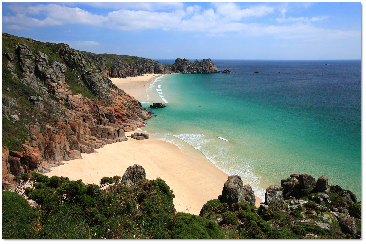
Porth Curno lies between Castle Treveen Point and Minack Point. It has a small village servicing a small valley and beach. With fine soft white sand washed by a sea that turns turquoise in the sun and high cliffs on both sides providing shelter, it’s thought by many to be one of Cornwall's most stunning natural beaches. Today it's in the care of the National Trust so that it retains its natural beauty. Castle Treveen Point, made notable by the 30 metres high Logan Rock, has two outlies Great and Little Goulard the latter and outer of which dries to 1.8 metres.
 Pedn-men-an-mere Point
Image: Andrew Foster via CC BY-NC 2.0
Pedn-men-an-mere Point has a rock that also lies 100 metres out from its extremity. Close west of Pedn-men-an-mere Point lies Port Chapel Bay. Not being as picture-perfect as Porth Curno and requiring a hike for access it tends to be a lot quieter and a favourite with local families. It is another sheltered cove that is surrounded by weathered granite cliffs. Seals are regular visitors to the beach and are often seen swimming just offshore.
 Porth Chapel Bay and the coast leading westward
Image: Andrew via CC BY 2.0
The western limit of Port Chapel Bay, which is the eastern limit of a bight named Porthgwarra Cove, has a ledge of rocks called Vessacks that extends nearly 200 metres seaward and dries to 1.9 metres.
 Carn Scathe with Hella Point in the backdrop
Image: Andrew Foster via CC BY-NC 2.0
Hella Point, ¾ of a mile westward Pedn-men-an-mere Point, has a reef called Hella Rock that extends 400 metres southeast by east from the point and dries to 1.1 metres.
 Porthgwarra Cove
Porthgwarra is a small coastal village and cove approaching Carn Scathe with Hella Point. It has a small shop and café. The cove and slipway are privately owned, but the public is permitted to quietly and respectfully enjoy them.
 Gwennap Head with its prominent coast guard station
Image: Andrew via CC BY 2.0
Gwennap Head is the southwest extremity of the Cornwall Peninsula. It is a cliffy headland rising in places to heights over 60 metres. A coast guard station, from which storm signals are displayed, stands on this headland. The low-water Gannel Rock and Three Brothers rocks lie 200 metres off Gwennap Head.
Image: Andrew via CC BY 2.0
The Runnel Stone is an exceedingly dangerous rock lying ¾ of a mile south from Gwennap Head. It dries to 0.9 metres and covers at two-thirds flood. It is only a few metres in extent but the Lee Mean rock, awash at low water, lies 100 metres eastward of the Runnel and the Carn Stone, with 2.2 metres over it, 200 metres northwest.
Two beacons standing in line on the Gwennap headland mark the position of this danger in-line on 352°. It is marked by the lit ‘Runnel Stone’ south cardinal, Q(6)+ LFl.15s, moored 350 metres southward. The Runnel Stone and the dangers in its vicinity are also covered by the red sector, 060°-072°, of Tater-du auxiliary Light, shown from the same tower, 3 m below the main light, and the red sector, 189°-327°, of Longships Light.
 Runnel Stone moored to the south of the dangerous rock
Image: Goatchurch CC0
The channel leading between the shoal and the headland is foul a rocky patch called the Lee Ore, with 2.7 metres over it. It lies about midway between the Runnel Stone and the shore, directly in the passage between it and the coast. The Lee Ore may be passed on either side in good weather, but in bad weather, newcomers should not attempt the passage inside the Runnel Stone. To pass between the Lee Ore and the Runnel Stone, bring the Longships lighthouse well open of Carn Guethenbras Point. When St. Levan Church comes open of the land the vessel will be southwest of all danger in the vicinity of the Runnel Stone.
The outlying Carn Base is a rocky shoal that lies about 2 miles westward from Carn Guethensbras Point and the same distance southward from the Longships lighthouse. Heavy seas will be found in this area and it is marked by the lit ‘Carn Base’ west cardinal, Q(9)15s, moored ½ to the southwest.
 View towards Gwennap Head from Pordenack Point
Image: Andrew via CC BY 2.0
From Carn Guethensbras Point to Peal Point, which is the north-western extreme of the Land's End, the coast trends northwestward for 2¼ miles to, and the cliffy range in height from 45 to 60 metres. Off Carn Guethensbras Point low-water rocks extend westward for nearly 400 metres, the outermost being covering at a quarter flood. Off all the intervening points from Carn Guethensbras Point to the Armed Knight islet, 2 miles northward, are a number of outlying rocks extending about 100 metres offshore and covering from a quarter to half flood.
 The Armed Knight
Image: Andrew via CC BY 2.0
Armed Knight is a rocky islet that is 27 metres high and lies 260 offshore. A rocky patch and shoal extend 150 metres westward of the Armed Knight that dries to 1.2 metres.
 Peal Point and the Peal Rocks
Image: Andrew via CC BY 2.0
Slightly over a ⅓ of a mile northward is Peal Point and 200 metres from Peal Point, are The Peal Rocks which are awash at low water.
Image: Andrew via CC BY 2.0
Land's End, the western extremity of England, consists of a bold precipitous headland, 69 metres high, fronted by foul ground. From seaward, it may be seen in clear weather from a distance of 25 miles. When first viewed, from the southwestward and south, has the appearance of two detached hummocks. On nearing the land, another hammock, with buildings on it, will appear to westward. Then Cape Cornwall, to the north, will appear above the horizon and ultimately the whole will form a continuous line of coast.
 Land's End
Image: CC0
The most conspicuous buildings in the vicinity of the Land's End is the church steeple of St. Sennan, 110 metres, situated nearly a mile eastward of Peal Point and a coast guard station that stands ½ a mile northeast.
 Land's End arches, stacks and reefs with Longships in the background
Image: Andrew via CC BY 2.0
A foul area with above and below-water detached rocks, called the Longships lies about 1 mile west of Land’s End. On the largest and most elevated of this group stands a lighthouse. The other principal rocks vary from 6 to 13 metres in height.
 Longships
Image: Andrew via CC BY 2.0
Longships Lighthouse stands on the west side of the area 1.2 miles west of Land End. The Longships lighthouse is a circular tower of grey granite, 35 metres high, and exhibits a fixed bright light, 35 metres above mean high water, which is visible in clear weather from a distance of 15 miles.
 Longships Lighthouse and rocks
Image: Michael Day
By day, the Longships may be passed at a distance of ¼ of a mile as the westernmost rock does not lie more than half that distance from the lighthouse. The soundings are irregular, from 2 to 3 miles southward from the Longships lighthouse.
_as_seen_from_over_gamper_bay.jpg) The passage between Peal Rocks and Kettle's Bottom (showing) as seen from over
The passage between Peal Rocks and Kettle's Bottom (showing) as seen from overGamper Bay
Image: Andrew via CC BY 2.0
A channel also lies between Longships and Land’s End. It carries 10 to 12 metres of water and is nearly a ½ mile wide between the Kettle’s Bottom and Peal Point. But it has some danger that requires specific navigation.
 The breakers in the seaway showing Kettle's Bottom and southern extending shoal
Image: CC0
A rocky shoal named the Kettle’s Bottom lies about a ½ mile eastward from the lighthouse. It dries to 5 metres and covers at three-quarters flood. Shoal water extend a ¼ of a mile in a southwest-by-south direction from its highest part.
At the distance of ⅔ of a mile northeast by east from the lighthouse lies Sharks Fin Rock. This isolated rock dries to 0.9 metres and covers at two-thirds flood. It is steep-to, except off its western side, where a shoal, with only 2.5 metres over it projects off for about 60 metres.
Between the Kettle’s Bottom and Shark’s Fin is a small rock named the Filles that dries to 0.6 metres and covers at a quarter flood with deep water around it.
 Longships sunset
Image: CC0
The complete course is 30.07 miles from the waypoint 'Lizard Point' to 'Longships' tending in a west north westerly direction (reciprocal east south easterly).
Lizard Point, 49° 54.502' N, 005° 13.950' W
This is almost 3⅓ miles southwestward of Lizard Point Light and clear of the rocks and extensive race laying to the southeast of Lizard Head.
► Next waypoint: 12.64 miles, course ⇓ 321.12°T (reciprocal ⇑ 141.12°T)
Mountamopus Shoal, 50° 4.325' N, 005° 26.305' W
This is a ⅓ of a mile south of the lit 'Mountamopus' shoal south cardinal, Q(6)+LFl.15s. The cardinal is moored a ½ a mile southward of the shallowest rocks of Mountamopus that has 1.4 metres of water over it. The track leads between the cardinal and the Iron Gates shoal, with 5.8 metres of water over it.
► Next waypoint: 3.25 miles, course ⇓ 292.16°T (reciprocal ⇑ 112.16°T)
Low Lee, 50° 5.549' N, 005° 30.995' W
This is ½ a mile east of the lit ‘Low Lee’ east cardinal marker buoy, Q(3)10s, that moored about 150 metres eastward of the Low Lee rock, that has 2.1 metres of water over it.
► Next waypoint: 2.96 miles, course ⇓ 192.89°T (reciprocal ⇑ 12.89°T)
Carn-du Point, 50° 2.667' N, 005° 32.022' W
This is ½ a mile southeast of Carn-du Point, the eastern entrance point of Lamorna Cove, lies about 1 mile northeast of Tater-du Light.
► Next waypoint: 5.66 miles, course ⇓ 249.55°T (reciprocal ⇑ 69.55°T)


