
Saint Mary's Road, at the heart of the Isles of Scilly, may be approached from seaward through five entrances, Saint Mary's Sound, Broad Sound, North West Passage (formerly known as the 'North Channel'), Smith Sound and the tidal Crow Sound. Of these Saint Mary's Sound is the primary route that leads onward to Saint Mary's Pool.

It passes in through Saint Mary's Sound that lies between St Mary's Island and the tiny island of Gugh situated about a mile southwestward and attached to St Agnes by an isthmus. It then continues through Saint Mary's Road to set up the approaches to Saint Mary's Pool
 . The sequence of description here is of entry but it may be reversed to exit.
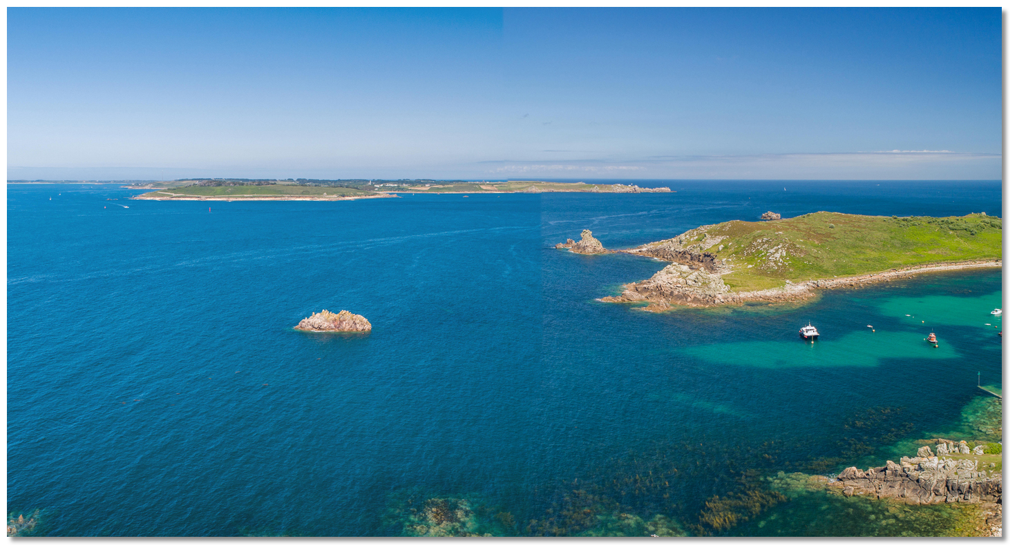 St Mary's Sound as seen from the southwest with Gugh right
Image: Michael Harpur
Why sail this route?
Saint Mary's Pool, situated near the southwestern end of St Mary’s Island, is the principal harbour of Scilly with Hugh Town, immediately ashore, the Isles of Scilly largest settlement, the administrative centre and capital. Both of these factors serve to make it the usual point of arrival for visiting yachts and the centre of all commercial shipping.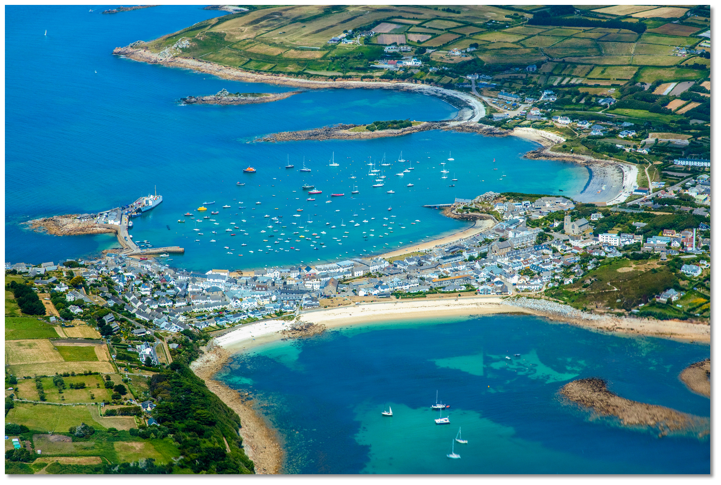 St Mary's Pool and Hugh Town
Image: Visit Isles of Scilly
What makes St Mary's Sound a highly attractive point of arrival is that it offers a clearly identifiable pass between two substantive landmasses in a scattered archipelago of rocks. Both of the landmasses feature lighthouses although the one on the summit of Agnes is no longer in service but continues to serve as an official daymark.
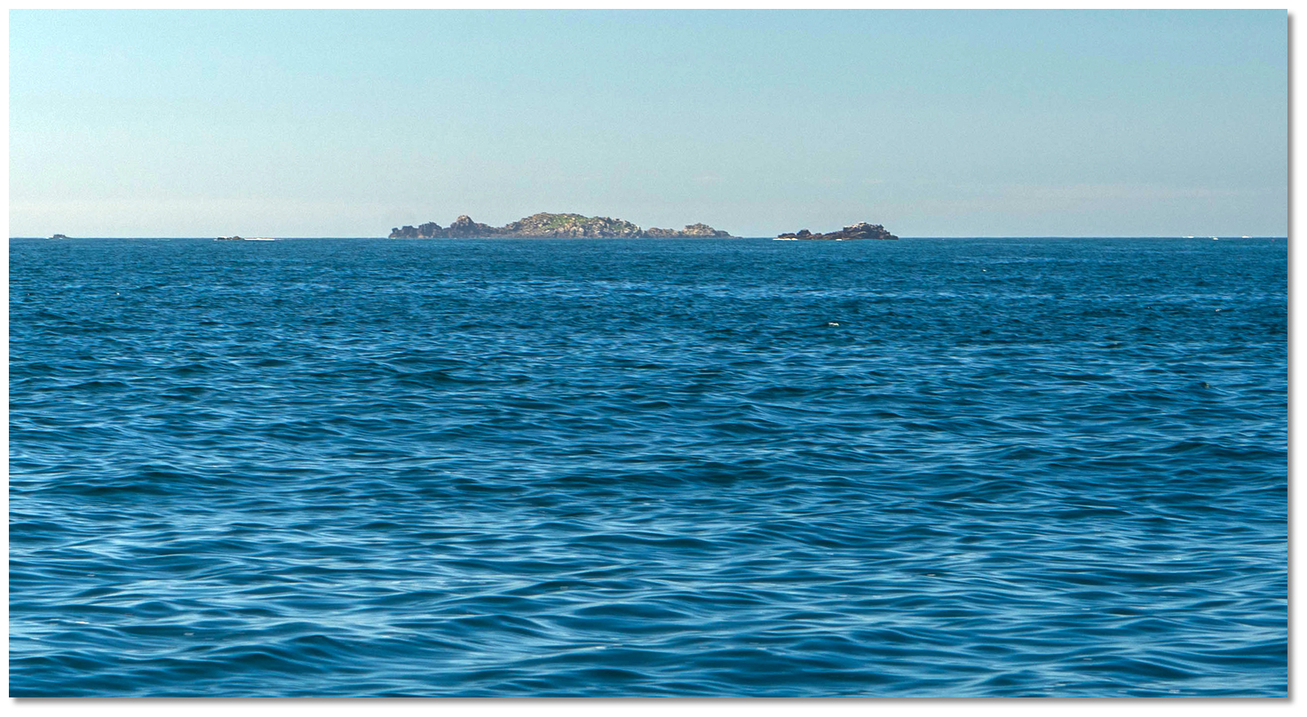
 St Mary's Sound can be positively identified from some distance
Image: Michael Harpur
It is also wide, deep, and because it is the principal approach it is further supported by several lit buoys and beacons so that it may be approached at night. This all makes it the easiest route to confidentially navigate into the centre of the island group and the prefered path for newcomers. With the exception of the tidal Crow Sound approach, it is considered the default for vessels approaching the island group from the south and east.
Tidal overview
Today's summary tidal overview for this route as of Wednesday, April 24th at 08:22. From Saint Mary's HW-4 through to HW-2 the first flood flows from the south through southwest into St Mary’s Sound and leaves via all other exits. From HW-2 to HW+2 the water continues to enter St Mary’s Sound until after HW when there is little flow into St Mary’s Sound until the flow reverses, in the Bar Point area, then carrying water southwards. Maximum rates of nearly 2 knots can be attained at Springs and about three-quarters of a knot at neaps. For those with a Dover tide table the ingoing begins at HW Dover -0310 the outgoing stream begins at HW Dover +0245.
South-going Tide St Mary Sound
(HW ST. MARY'S +0200 to -0400)
Now
(Tidal flow )
Ends in 05:52:24
(Wed 07:50 to 14:15)
Northwards Tide St Mary Sound
(HW ST. MARY'S -0400 to +0200) 
Starts in 05:43:24
(Wed 14:06 to 20:06)
What are the navigational notes?
Although this is the principal route to enter Saint Mary's Pool replete with ample marks it is not without hazard for the unwary. The hidden danger for a vessel cutting in from the east, well clear of this route, is the unmarked Gilstone rock located on the southern end of foul ground extending from Tolman Point 0.4 of a mile eastward from Peninnis Light. It uncovers and dries to 4 metres.
 Carrickstarne and Gilstone rocks as seen from Peninnis Head
Image: Michael Harpur
The flanking island landmasses that serve to provide ready assurance of correct navigation can also serve to make it one of the more challenging approaches when it comes to adverse tides. The narrow channel making Saint Mary's Sound a rough and unpleasant body of water at times on account of the funnelling effect between the large islands. Tidal streams can attain rates of up to 2kn and winds and swell from southwest round through west to northwest and a strong east-to-southeast wind-against-tide can make it very unpleasant. Likewise, heavy southwest round through west to northwest winds can create a rough sea over the shoals at the northwest end of the passage.
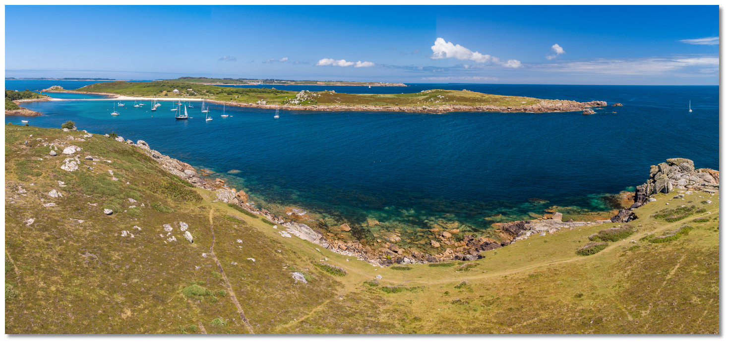 The Cove, around the south end of Gugh, is an ideal wait point when the Sound is unfavourable
Image: Michael Harpur
Nevertheless, it is more than manageable in all reasonable conditions. Should the seas in the sound happen to look uncomfortable during an approach there is always the option to duck into the adjacent The Cove
. This provides an ideal anchorage to get squared away and await a turn of the tide or change of conditions. As such this route can be relied upon by all newcomers and all vessels approaching from east or south. Finally, although we have linked this directly to the Coastal Overview for Land's End to Isles of Scilly
 we do not want to suggest this is the defacto approach that should be taken to Saint Mary's Road. Alternative approaches can be made, given suitable weather and state of tide, via Crow Sound to St Mary's Pool from the east and the Scillonian III passenger ferry takes this path at high water. Likewise, Broad Sound or the North West Passage provide well-marked approaches from other directions.
Garrison Hill
Image: Michael Harpur
As discussed in the Coastal Overview for Land's End to Isles of Scilly
, the Admiralty transits that mark St Mary's Sound and Road can be exceedingly difficult to make out for newcomers and the buoyed channel is well marked so they are no longer needed.Image: Michael Harpur
Nevertheless, the St Mary's Sound transit, if spotted, keeps a vessel well clear of any dangers. It also offers a good confirmatory eyeball check for navigation and serves as a useful gauge for the helm to counter a tidal cross-set when making way up the sound. So hence we have plotted the course of this route along the Admiralty 307° T St Mary's Sound alignment of the charted western extremity of Great Minalto with North Carn of Mincarlo for the first leg.
 Great Minalto and Mincarlo open of each other as seen from the sound
Image: Michael Harpur
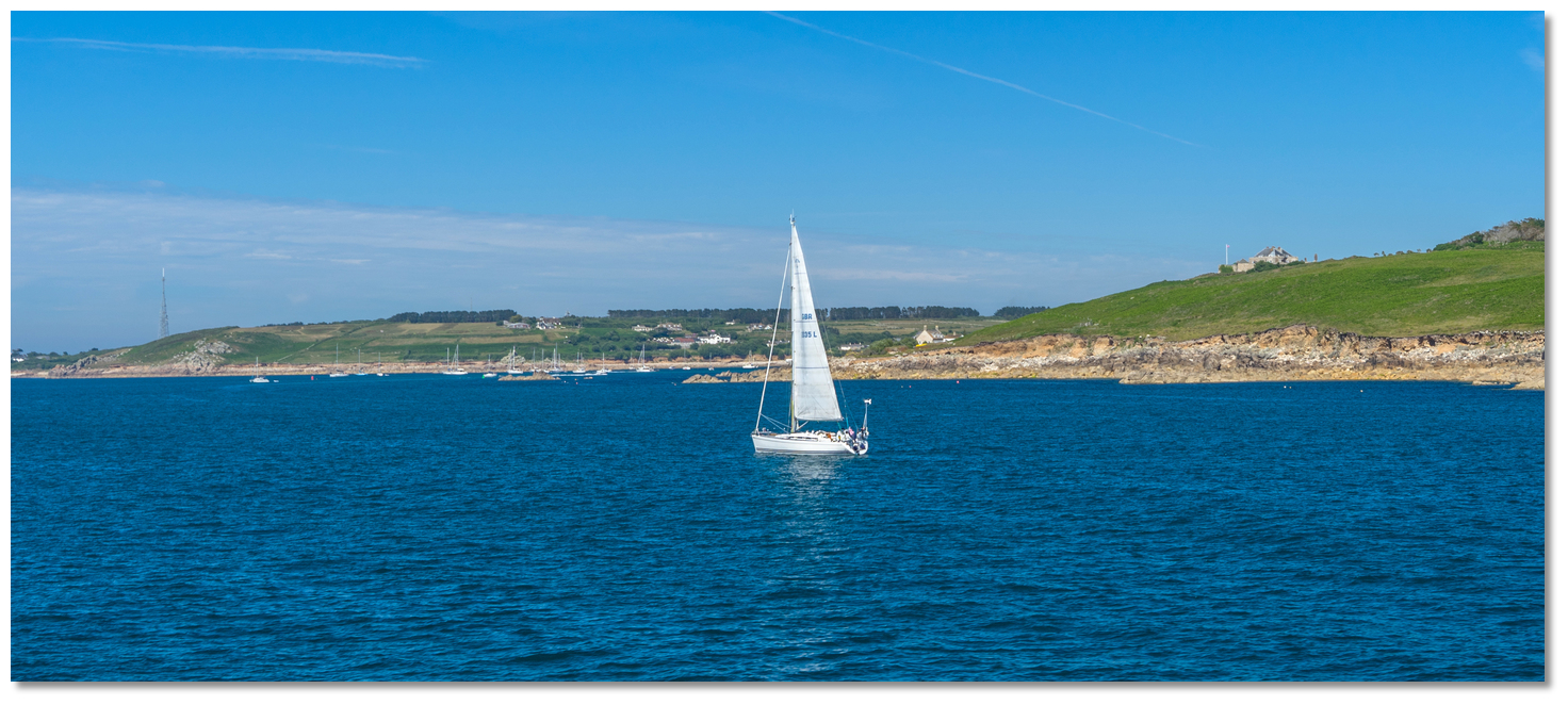
We chose not to use the charted Admiralty transit, of St Martin's daymark in line with the northern summit of Creeb Rock on 040.5° T as it added unnecessary distance to a leisure craft route.
 Yacht passing close south of Peninnis Head
Image: Michael Harpur
From the Saint Mary's Sound Waypoint, Peninnis Light, Fl.20s36m17M a white round metal tower on a black metal framework tower, will be clearly visible and the lit 'Spanish Ledge' East Cardinal Mark, Q(3)10s, about a mile away should be visible.
The waypoint is on the 307° T alignment of the western extremity of Great Minalto with the North Cam of Mincarlo that leads through the Sound. These are the first substantive rocks that will be seen up St Mary's Sound, to the westward of the Isle of Samson, Great Minalto, 7 metres front, and Mincarlo, 16 metres rear, should be in line. The handful of rocks close west and around them is a scattering of small heads at best at low water.
Image: Michael Harpur
If the transit is difficult to discern steer for the 'Spanish Ledge' East Cardinal Mark that is passed to port
as it is moored very close southwestward of the leading line through the sound.
 Spanish Ledge cardinal mark as seen over Inner Head on Peninnis Head with Gugh in the backdrop
Image: Michael Harpur
Peninnis Light Fl.20s36m17M, a white round metal tower on a black metal framework tower, will be clearly visible on Peninnis Head. The head is steep too but it has Pollard Rock, that dries 1.8 metres at low-water springs, lying about 60 metres south of its inner head so stand a couple of hundred metres out from it.
 Peninnis Head and Carrickstarne with the Gilstone Rock visible outside
Image: Michael Harpur
This approach is well clear of the Gilstone, which is about 400 metres eastward of the 8 metres high Carrickstarne, which uncovers and dries to 4 metres.
 Spanish Ledge east cardinal mark as seen from Morning Point
Image: Michael Harpur
A ½ mile in is the 'Spanish Ledge' East Cardinal Mark, Q(3)10s that is passed to port. It is moored north-eastward of Spanish Ledges which are 400 metres in extent and awash at low-water springs. On the approaches to shallower waters keep a sharp eye for lobster pots.
Image: Michael Harpur
Leaving Spanish Ledge to port steer to pass the starboard beacon 'Woolpack' FL.G.5s well to starboard - note that this may be listed as a cardinal mark on older charts. The beacon stands on one of two heads of Woolpack Rock that projects nearly 300 metres southwestward from Woolpack Point on St Mary’s Woolpack Point. The rock dries to 0.6 meters a little before low water. Northwestward of Woolpack Point, the coast of St. Mary's Island is foul to a distance of 150 metres.
Image: Michael Harpur
Then leave the lit Bartholomew red beacon, Q.R, and red can buoy on 'N. Bartholomew' Fl. R.5s, lying about a ½ mile north-westward of Spanish ledges, to port. The Bartholomew ledges consist of two shoals 400 metres in extent and include several rocky heads near the beacon dry at low-water springs to 0.6 metres.
Image: Michael Harpur
The 'N Bartholomew' port buoy Fl. R.5s, marks an isolated northern section called North Bartholomew. It is separated from the southern shoal by a deep channel and with 3.4 metres over it which is more of a concern for commercial shipping. However, during a westerly swell, the sea rolls heavily in the vicinity of these shoals, and boats should keep well clear of them.
Image: Michael Harpur
 St Mary's Road opening around Steval Rock
Image: Michael Harpur
Passing between 'N Bartholomew' and the 3-metre Steval Rock, which represents the western extremity of St Mary's Island, leads into Saint Mary's Road. It lies westward of the island of St Mary's and at this point it is possible to simply turn northward and continue standing out 300 metres from the shoreline to clear its dangers. With the exception of the deep Woodcock Ledge, with 2.7 metres over it LAT, there are no hazards from the Bartholomew Ledge buoy.
Image: Michael Harpur
The Woodcock Ledge is more of a concern for deep commercial vessels so it is not necessary to continue offshore to the charted Admiralty Transit, of St Martin's daymark in line with the northern summit of Creeb Rock on 040.5° T that leads north-westward of this rock. Our waypoints cut inside it, passing between it and the shore and if there is any concern, or deep-draught yachts arriving at the bottom of the tide with a surge, feel free to continue to the Admiralty turn point where St Martin's Daymark on the summit of Creeb 040° T intersects the Admiralty 307° T alignment of the charted western extremity of Great Minalto with North Carn of Mincarlo. The following St. Mary's Road transit intersection waypoint is on this transit.
St. Mary's Road transit intersection waypoint Position: 49° 55.196' N, 006° 19.460' W
 St Mary's Harbour lateral marks visible after rounding Steval
Image: Michael Harpur
Either way the harbour is about ¾ a mile away at this point and its two lateral marks of the entrance channel will soon become visible. The harbour's port 'Bacon Ledge' buoy, Fl(4)R.5s, is moored 100 metres southwest of the shoal called the Bacon Ledge that is the final hazard on the approach on the approach to Saint Mary's Pool
.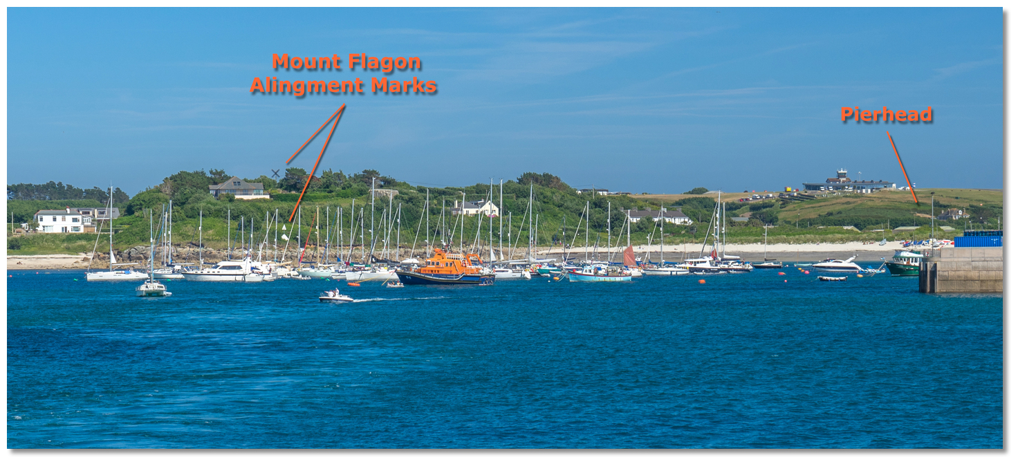 The Mount Flagon 097.3° leading marks
Image: Michael Harpur
The path through the lateral marks is also supported by a charted entry transit that leads south of Beacon Ledge. This is set on Mount Flagon on the line of bearing 097.3° T of white beacons, with a triangle top mark pointing upward, and an 'X' topmark on the skyline. The final waypoint is set upon this transit.
The complete course is 2.31 miles from the waypoint 'Saint Mary's Sound' to 'St Mary's Harbour' tending in a north north westerly direction (reciprocal south south easterly).
Saint Mary's Sound, 49° 53.647' N, 006° 18.190' W
Southeast of the entrance to Saint Mary's Sound and a ½ mile out from the lit Spanish Ledge East Cardinal Mark, Q(3)10s. It is on the 307° T alignment of the western extremity of Great Minalto with North Cam of Mincarlo that leads through Saint Mary's Sound.
► Next waypoint: 1.55 miles, course ⇓ 307.24°T (reciprocal ⇑ 127.24°T)
Saint Mary's Road, 49° 54.584' N, 006° 20.105' W
A ¼ of a mile southwest of the western extremity of St Mary's Island marked by the 3-metre high Steval rock.
► Next waypoint: 0.76 miles, course ⇓ 36.89°T (reciprocal ⇑ 216.89°T)
St Mary's Harbour, 49° 55.192' N, 006° 19.396' W
This is set on Mount Flagon alignment of 097.3° T of white beacons, with a triangle top mark pointing upward, and an 'X' topmark on the skyline. The alignment leads into the St Mary's Harbour through the lateral marks and south of Beacon Ledge.
What is the best sailing time?
May to September is the traditional UK Sailing season with June-July offering the best weather. The British Isles weather is highly variable, and the amount of bad weather varies quite widely from year to year. This is because they are islands positioned between the Atlantic Ocean and the large landmass of continental Europe. As a result, the entire area lays under an area where five main air masses meet and alternate:- • Tropical Maritime Air Mass - from the Atlantic
- • Polar Maritime Air Mass - from Greenland
- • Arctic Maritime Air Mass
- • Polar Continental Air Mass - from central Europe
- • Tropical Continental Air Mass - from North Africa
Depending on the movements of the jet stream, any and all of these air masses can come in over the isles, creating weather fronts where they meet and bringing with them all types of weather.
The prevailing winds for the British Isles as a whole are from the western quarter which generally blows for two-thirds of the year predominantly from the southwest. Gales from the westward are felt in all seasons, but from November to March, inclusive, they are most frequent and generally last three or four days. Of these, a southwest gale is considered to be the most powerful system. The winter period is largely characterised by wind and rain.
The fine summer weather of the sailing season is typically punctuated by the passage of an Atlantic depression that bringing periods of strong wind and rain, and sometimes poor visibility. These gales rarely cause surprises as they are usually forecasted well in advance. Good weather windows of 48 hours are easy to predict but any longer than that there's an increasing chance of change.
Fogs are frequent in all parts of the Channel and are formed both on the English and French coasts. In summer they only obscure the land in the morning and are readily dispersed by heat or a light breeze. But the moist haze, driven in by westerly winds from the sea, tends to linger and is only dispersed by strong winds. In the eastern part of the Channel, it is rare for the land to be completely free from mists. The only exception is when the wind is from the northeast which makes the mist free coastline highly distinctive from a great distance.
With thanks to:
Micheal Harpur eOceanic.