
Saint Mary's Road, at the heart of the Isles of Scilly, may be approached from seaward through five entrances, Saint Mary's Sound, Broad Sound, North West Passage (formerly known as the 'North Channel'), Smith Sound and the tidal Crow Sound. The North West Passage provides an entrance to vessels approaching from the north and west. It is approached and entered from the western side of the Isles of Scilly, to the west of the Northern Rocks, Bryher and Samson, heading southeastwardly before turning towards Saint Mary’s Sound, to the north of Annet, to set up the approaches to Saint Mary's Pool

 .
. Why sail this route?
Although not explicitly marked by lateral marks, the North West Passage is wide, deep and a primary commercial route that has supporting lit cardinal markers at key points. It is simply a matter of following two range marks into Saint Marys Road. The first is dedicated to supporting the close approaches to the entrance and leading a direct path to the second range mark. This later range mark is the main route into Saint Mary’s Road that is shared with Broad Sound. So, with the support of good navigation and position, in good weather, the North Channel presents no difficulties to leisure craft, night or day at any stage of the tide._rocks_make_for_a_fearsome_lee_shore_in_bad_conditions.jpg) The Northern (Norrard) Rocks make for a fearsome lee shore in bad conditions
The Northern (Norrard) Rocks make for a fearsome lee shore in bad conditionsImage: Michael Harpur
It is the ideal route for vessels arriving/departing to or from Ireland and Irish Sea havens. Although the western side of the islands have the greater number of isolated offshore hazards, in good conditions from the above locations, it is a far better approach than defaulting to the principal Saint Mary’s Sound entrance. More often than not, the confidence of its obvious landmasses, crowned by prominent lighthouses, make this the preferred approach of all newcomers. But for a vessel approaching from the northwest and north, Saint Mary’s Sound only servers to add about 15 miles, required to round the islands, more complexity and the possibility of additional tidal issues that can be experienced between the landmasses of Saint Mary’s and St Agnes.
But this is not an option in any boisterous weather as the Northern Rocks and the shoals and outliers to the west of Bryer and Sampson make for a formidable lee shore. These collide with the Atlantic swell three or four miles offshore and with groundswell, strong tidal streams and eddies threw into the mix, large areas of breaking seas result. Add any other weather elements to this and things can get ugly here very quickly. Likewise, though the fairway is wide, should any vessel accidentally stray from its margins they will quickly find themselves in great peril amidst shoals and hidden rocks.
So this is best considered a fair-weather route as with the nearby Broad Sound
 route, though it could be said to be slightly better.
Tidal overview
Today's summary tidal overview for this route as of Friday, April 26th at 00:05. The southeast-going stream in the North West Passage, spring rate 1.5 knots, begins -0415 Devonport (+0230 Dover). The northwest-going stream, spring rate 2 knots, begins + 0115 Devonport (-0425 Dover). Westward of Steeple rock at spring tides during the northwest-going stream, a strong tidal ripple may be experienced.Northwest-going Stream
(HW Dover -0425 to +0230)

Starts in 08:15:51
(Fri 08:21 to 15:16)
Southeast-going Stream
(HW Dover +0230 to -0425)
Starts in 15:10:51
(Fri 15:16 to 20:46)
What are the navigational notes?
The North West passage is entered from the western side of the Isles of Scilly. This means that most vessels approaching from the west and northwest will cross a traffic separation scheme on the early approaches about ten miles offshore. If there is poor visibility or any issue it is entirely possible to steer into New Grimsby Sound
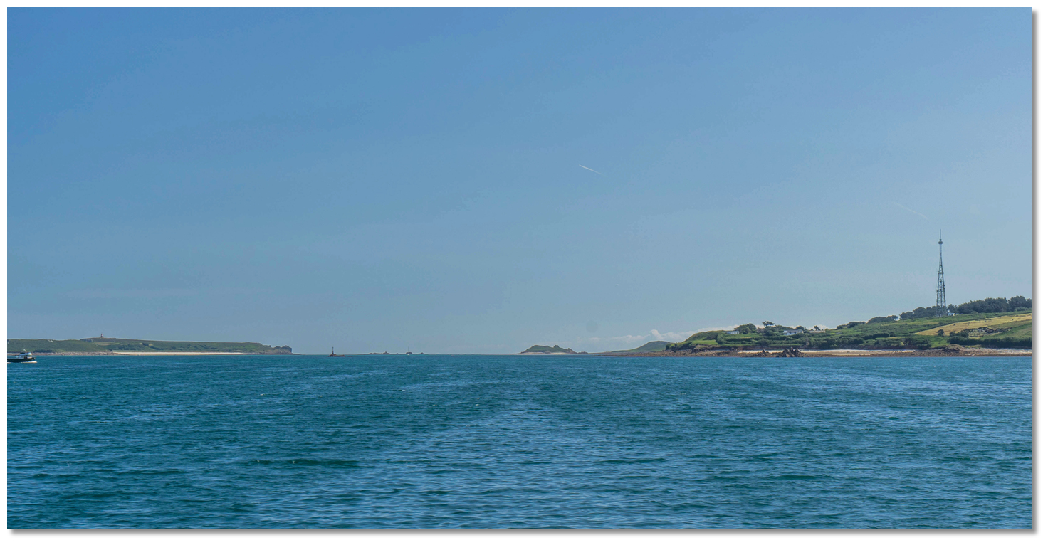
and pick up a mooring but this is the only available berth in its vicinity. As always, beware of lobster pot buoys when closing Scilly. 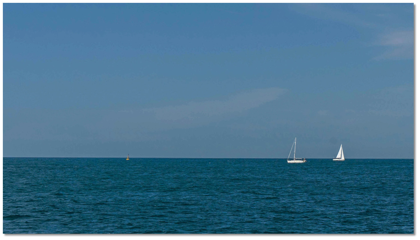 South bound and northbound yachts at the entrance near 'Steeple Rock' West
Cardinal
Image: Michael Harpur
The entrance to the passage lies about 1¼ miles south by southwestward of Maiden Bower and just under a mile southwestward of Mincarlo. It is entered between Steeple Rock, which remains covered with a least depth of 0.1 metres, and Carnbase Shoal, with a least depth of 3.7 metres, lying ¾ of a mile southwestward of Steeple Rock. This is the narrowest point of the entire route and the route as a whole is deep having as much as 10.4 metres LAT at its shallowest point. The lit 'Steeple Rock' west cardinal marker buoy, Q(9)15s, is moored about 350 metres southwest of the rock and serves to mark the entrance to the passage.
Steeple Rock – West Cardinal Q(9)15s position: 49° 55.461' N 006° 24.236' W
Long before the cardinal mark is reached the leading marks will be visible. This is a disused white lighthouse, standing on the highest point of St Agnes, in line with a pointed stone wall, white with a black stripe and situated ½ a mile in front on Tins Walbert islet. Inline these present a bearing of 127° T, as best seen on a chart. It is important to pick up the alignment and the helm should continuously monitor for cross-track error as strong turbulence can be experienced to the northwest of Steeple Rock when the current streams northwestwardly during spring tides. The set of the current in the entrance is also across the range so it must be guarded against at all times during this leg.
 Stone obelisk on Tins Walbert islet with St Agnes just visible centre
Image: Michael Harpur
Continue along this alignment for 1½ miles through the North West passage until it intersects with the entrance range that leads through Broad Sound. Then the vessel should steer on this mark towards the centre of Saint Mary’s Road. This range mark is the Summit of Great Ganilly just open north of Bant’s Carn Point on 059° T. Great Ganilly is one of the Eastern Isles situated about 2 miles northeastward of the northern extremity of St. Mary's and 5 miles away from the intersection point. Bant’s Carn is a 28-metre mound located about a ¼ of a mile southwestward of the northern extremity of St. Mary's.
 The summit of Great Ganilly just open north of Bant’s Carn Point
Image: Michael Harpur
This intersection point lies just under a ½ mile north of the northern extremity of Annet and between the 'Spencers Ledge' south cardinal marker buoy, Q(6)+ LFl.15s, and the 'Old Wreck' north cardinal marker buoy, VQ, positioned ¾ of a mile southwest/northwest of each other respectively.
 The southern end of Sampson
Image: Michael Harpur
It is a little over a mile along this alignment to the southwest end of Saint Mary’s Road where it is safe to steer for the lateral marks of Saint Mary's Pool
. The helm should keep a sharp eye to the marks when passing to the north of Great Smith. The tidal streams from North West Passage, St Mary's Sound and Smith Sound converge here and can interact unpredictably. Be particularly careful not to wander north towards Sampson as a drying area known as the Southern Wall lies nearly ½ a mile south of Samson. Although there is a dependence on long-distance rang marks, with perfect position and the ability to gauge cross-track, it is perfectly possible to use the North West Passage at night in good conditions. Make landfall on the lit Steeple Rock Cardinal, leaving it then pass Spencer's Ledge well to port. Circle south around Spencer's Ledge cardinal and it is safe to steer for the Saint Mary's Harbour's lit lateral marks.
The complete course is 3.74 miles from the waypoint 'St Agnes Lighthouse & Tins Walbert alignment' to 'St Mary's Sound' tending in a east south easterly direction (reciprocal west north westerly).
St Agnes Lighthouse & Tins Walbert alignment, 49° 56.000' N, 006° 25.763' W
1.7 miles west of Mincarlo and on the alignment of the disused white lighthouse on St Agnes with the white and black stripe pointed wall situated ½ a mile in front on Tins Walbert islet. This leads in on a bearing of 127° T.
► Next waypoint: 2.58 miles, course ⇓ 127.10°T (reciprocal ⇑ 307.10°T)
Range marks intersection point, 49° 54.444' N, 006° 22.570' W
This is the intersection of the 127° T alignment of the aforementioned St Agnes / Tins Walbert with the main Broad Sound alignment of the northern summit of Great Ganilly Island just open north of the slope of Bants Carn on St. Mary's Island, bearing 059° T.
► Next waypoint: 1.16 miles, course ⇓ 58.85°T (reciprocal ⇑ 238.85°T)
St Mary's Sound, 49° 55.042' N, 006° 21.033' W
On the Broad Sound 059° T alignment of the northern summit of Great Ganilly Island just open north of the slope of Bants Carn on St. Mary's Island and in the southwest end of Saint Mary's Road.
What is the best sailing time?
May to September is the traditional UK Sailing season with June-July offering the best weather. The British Isles weather is highly variable, and the amount of bad weather varies quite widely from year to year. This is because they are islands positioned between the Atlantic Ocean and the large landmass of continental Europe. As a result, the entire area lays under an area where five main air masses meet and alternate:- • Tropical Maritime Air Mass - from the Atlantic
- • Polar Maritime Air Mass - from Greenland
- • Arctic Maritime Air Mass
- • Polar Continental Air Mass - from central Europe
- • Tropical Continental Air Mass - from North Africa
Depending on the movements of the jet stream, any and all of these air masses can come in over the isles, creating weather fronts where they meet and bringing with them all types of weather.
The prevailing winds for the British Isles as a whole are from the western quarter which generally blows for two-thirds of the year predominantly from the southwest. Gales from the westward are felt in all seasons, but from November to March, inclusive, they are most frequent and generally last three or four days. Of these, a southwest gale is considered to be the most powerful system. The winter period is largely characterised by wind and rain.
The fine summer weather of the sailing season is typically punctuated by the passage of an Atlantic depression that bringing periods of strong wind and rain, and sometimes poor visibility. These gales rarely cause surprises as they are usually forecasted well in advance. Good weather windows of 48 hours are easy to predict but any longer than that there's an increasing chance of change.
Fogs are frequent in all parts of the Channel and are formed both on the English and French coasts. In summer they only obscure the land in the morning and are readily dispersed by heat or a light breeze. But the moist haze, driven in by westerly winds from the sea, tends to linger and is only dispersed by strong winds. In the eastern part of the Channel, it is rare for the land to be completely free from mists. The only exception is when the wind is from the northeast which makes the mist free coastline highly distinctive from a great distance.
With thanks to:
Micheal Harpur eOceanic.