
The Tresco Channel is a narrow stretch of shallow water that lies between the islands of Tresco and Bryher. Large sections of the route dry and it is best made during the rise 2 hrs after LW for vessels carrying up to 1.3 metres and at half flood for vessels of 1.8 metres.

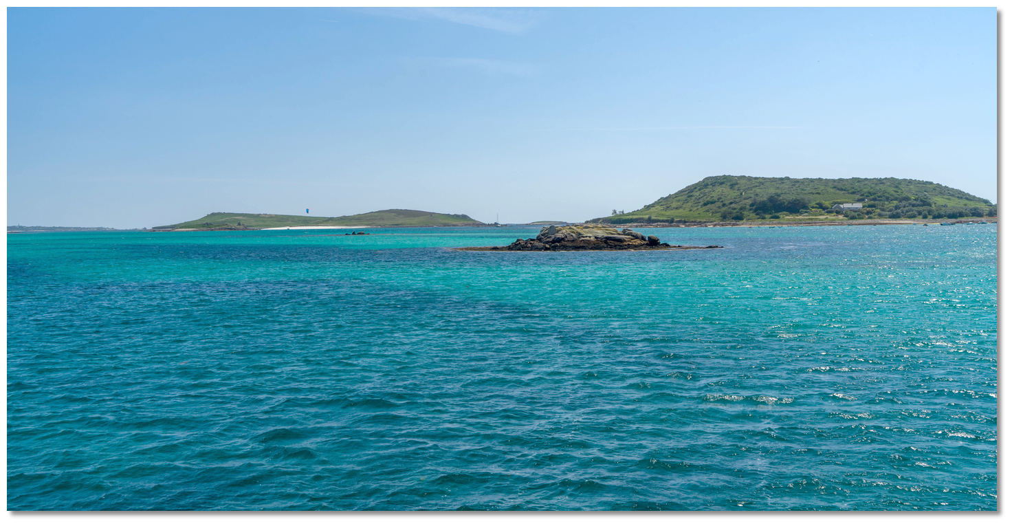
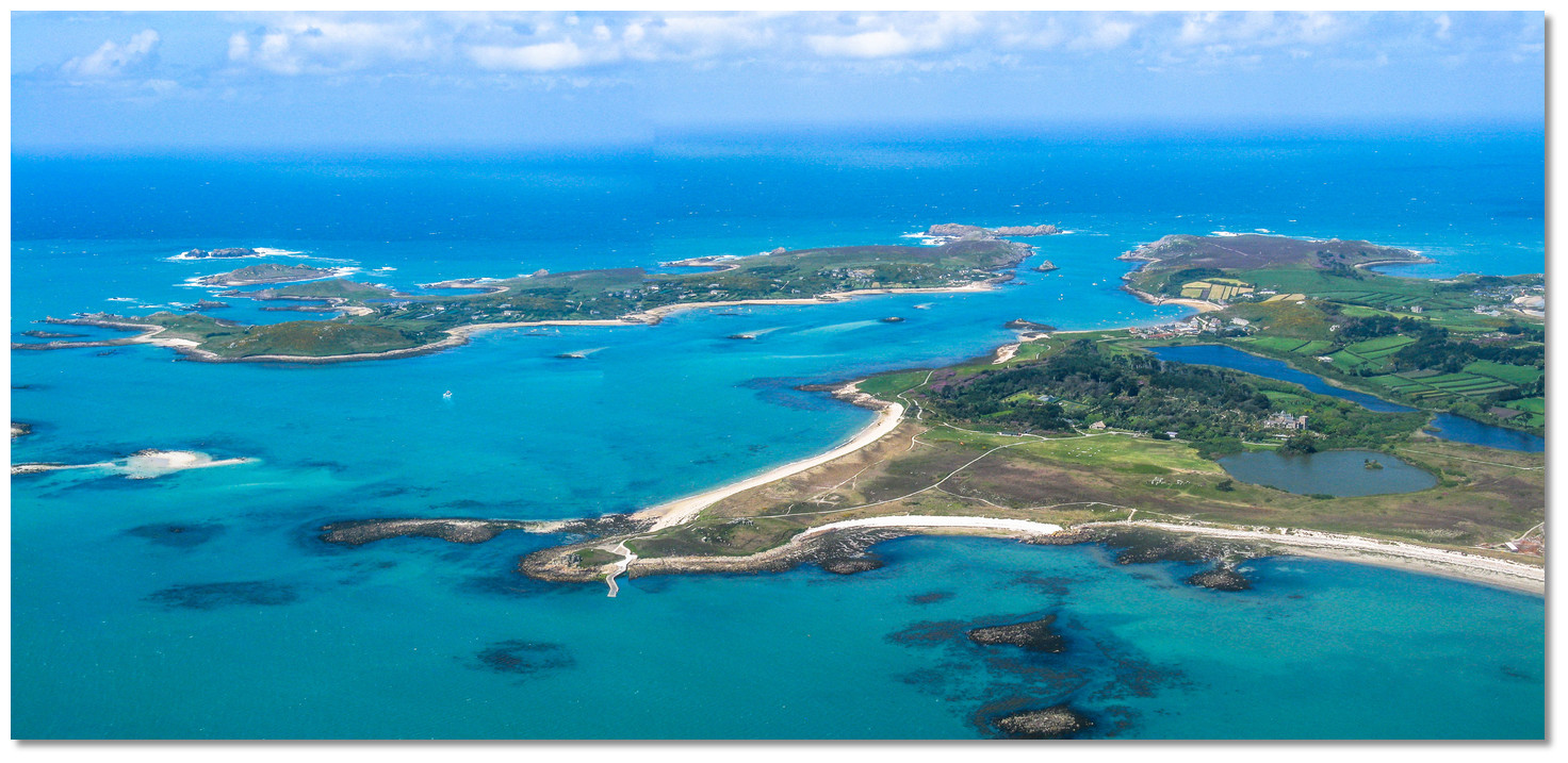 The Tresco Channel between Bryher and Tresco
Image: Michael Day via CC BY-NC 2.0
The route is sequenced from St Mary’s to the deep water in the south end of New Grimsby Sound
 cutting across Tresco Flats but is available both ways. If there is any concern that there is not sufficient depth to cross its shallowest point of Tresco Flats a slight detour is also available to gain better water by circumventing the flats.
 Why sail this route?
This interior cut saves hours of sailing for vessels planning to pass between two of the group’s principal berthing locations of St Mary’s Harbour and New Grimsby Sound not to mention Green Bay on Bryher that is a perennial favourite location for vessels that can take to the bottom. It also may provide an easier exit out of New Grimsby during fresh winds from northwest, round through north, to northeast when it can be difficult to depart. It can provide an enjoyable piece of pilotage in suitable conditions.Tidal overview
Today's summary tidal overview for this route as of Friday, April 26th at 18:54. With large sections of this route drying height of tide is essential. Vessels carrying up to 1.3 metres can as a general rule proceed 2 hrs after LW, which the timer is set for, with vessels of 1.8 metres waiting for half flood. For more detailed work.MHWS 5.7m MHWN 4.3m MLWN 2.0m MLWS 0.7m
Highest Astronomical Tide (HAT) 6.4m, Mean Sea Level (MSL) 2.91m
HW St Mary’s is HW Dover – 0630, Devonport -00.55, Duration 0600
Tides are considerably affected by wind conditions and barometric pressure.
In New Grimsby Sound the streams change direction four times in a half-day controlled by the uncovering of Tresco Flats:
- • The southeast-going stream begins + 0530 Devonport (-0010 Dover)
- • The northwest-going stream begins -0520 Devonport (+0125 Dover)
- • Southeast-going stream begins -0230 Devonport (+0415 Dover)
- • Northwest-going stream begins +0200 Devonport (-0340 Dover).
The spring rate in each direction is one knot.
The south-going stream across Tresco flats begins -0400 Devonport (+0245 Dover). The north-going stream begins +0200 Devonport (-0340 Dover).
Shallow (HW +2 to -4 Hours)
(HW ST. MARY'S +0200 to -0400)

Starts in 02:11:01
(Fri 21:06 to 03:31)
Tidal Window (HW -4 to +2 Hours)
(HW ST. MARY'S -0400 to +0200) Now
(Tidal flow )
Ends in 02:11:01
(Fri 15:06 to 21:06)
What are the navigational notes?

The cut through the flats requires moderately good visibility and an adequate rise of tide. Conservatively planning for a maximum drying height of 1.7 metres over Tresco Flats provides adequate water for most leisure craft 2 hours either side of high water, with the prudent making the approach during the rise.
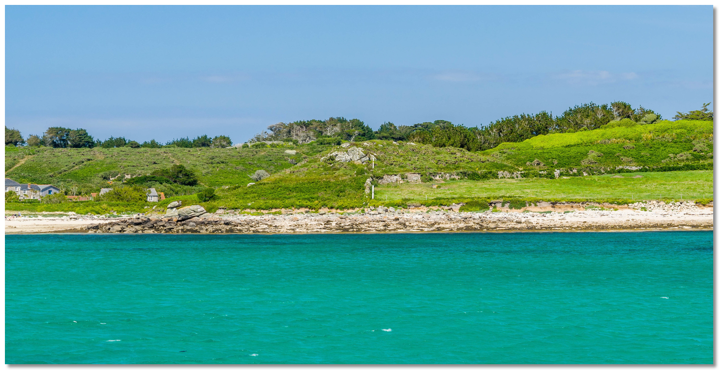
 The view southward from Merrick Island to St Mary's
 Image: Michael Harpur
The waypoints provided are only intended to assist in identifying the key turning points in the passage and should not be used in isolation. It is essential to understand that this route relies primarily upon eyeball navigation with clear visibility, moderate conditions and as much of this area dries at LAT with close-lying rocks, good charts/plotters. Be prepared to take this route under power, in a steady fashion identifying the rocks and marks through the channels along the way. Although the principal marks are lit this is not a passage a newcomer should attempt night nor on the ebb.
 The north end of the Tresco Channel
 Image: Michael Harpur
Above all do not be tempted to follow the local St Mary’s Boatmen’s Association ferries and trip boats. More often than not they will be seen cutting many of the corners listed on this route. But the boats are surprisingly shallow most notably the Bryher ferry. Despite the LOA and passenger carrying capability, it draws a little over a half metre. The helm also avails of deep and intimate knowledge of these waters ad cut through tight channels within meters of covered rocks. Follow these boats at your peril.
 South bound boat passing Hulman
Image: Michael Harpur
Finally, although it looks complicated and contains large drying sections with numerous rocks, it really is very straightforward for vessels of average draught. The vast majority of it is in protected crystal clear waters with the dangers are covered in weed so they stand out clearly amidst the clean white sands. Outside of the rocks and ledges, the bottom is all sand so should the boat touch on a rising tide it will come to no harm. Should there be any concern that there is not be enough water over the Tresco Flats they may be circumvented by a brief dogleg, detailed below, or by avoiding the whole southern section of this route by using the North West Passage
 and the Western cut into the Tesco Channel .
Leave St Mary's taking care to avoid Bacon Ledge that dries to 0.3 metres LAT. Bacon Ledge is easily avoided by passing through the harbour's lateral marks. The port 'Bacon Ledge' buoy, Fl(4)R.5s, is moored 100 metres southwest of the shoal.
 Exiting via St Mary's lateral marks avoids the Bacon Ledge
Image: Michael Harpur
The path through the lateral marks is also supported by a charted entry transit that leads south of Beacon Ledge. This is set on Mount Flagon on the line of bearing 097.3° T of white beacons, with a triangle top mark pointing upward, and an 'X' topmark on the skyline. The two white beacons may be difficult to distinguish behind the rigs of visiting yachts.
 The Mount Flagon 097.3° leading marks in St Mary's Harbour
Image: Michael Harpur
The best approach is to first look for the lifeboat, then to the skyline for the 'X' topmark close right of a prominent bungalow, and then finally triangle top mark pointing upward. The transit leads out between the lateral marks and to the north of Woodcock Ledge. This is are not the easiest transit to pick out during the day, particularly in poor light or with the morning sun behind.
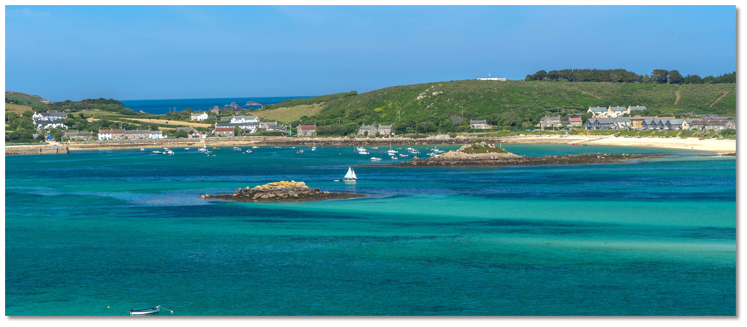
 The Tresco Channel as seen from the south
 Image: Michael Harpur
Once in Saint Mary's Road shape a course on around 315° T towards the isolated 1.5 metres high Nut Rock sitting east of Samson steering to pass it about 200 meters east of it. Be mindful of a cross tide on the approach.
 Nut Rock on a bearing of 260° T in line with the summit of the South Hill on
Sampson
Image: Michael Harpur
The alignment is useful for vessels approaching from Crow Sound as it clears The Pots, that dry to 1.8 metres, and Round Rock, that dries to 1.5 metres, which both lie close together nearly a ½ mile off the southern shore of Tresco.
 Hulman ledge exposed
Image: Michael Harpur
Image: Michael Harpur
 North and southbound boats approaching the marks
Image: Michael Harpur
Similar to the Hulman it is important not to steer directly for the perch so as to avoid north-eastward extending reef, that dries 1. 3 metres, that lies south-eastward of it. But keep a shape eye eastward to avoid the isolated patch Chinks rocks that also dry 1.3 metres and wait there for the unwary.
.jpg) Merrick Island just open of Hangman Island (for identification)
Merrick Island just open of Hangman Island (for identification)Image: Michael Harpur
Once Little Rag Ledge Beacon is abeam, and there is sufficient rise of tide, it is safe to proceed directly across Tresco Flats keeping the unmistakeable pyramid-shaped profile of Hangman Island, 16 metres in New Grimsby Sound, over Merrick Island, on 340° T. This alignment clears all the isolated rocks but passes a tad unnecessarily close to rocks that extend from Appletree Point that drying 1.1 metres. Hence the additional conservative Appletree Point waypoint.
 Southbound yacht passing Appletree Point as seen from Bryher
Image: Michael Harpur
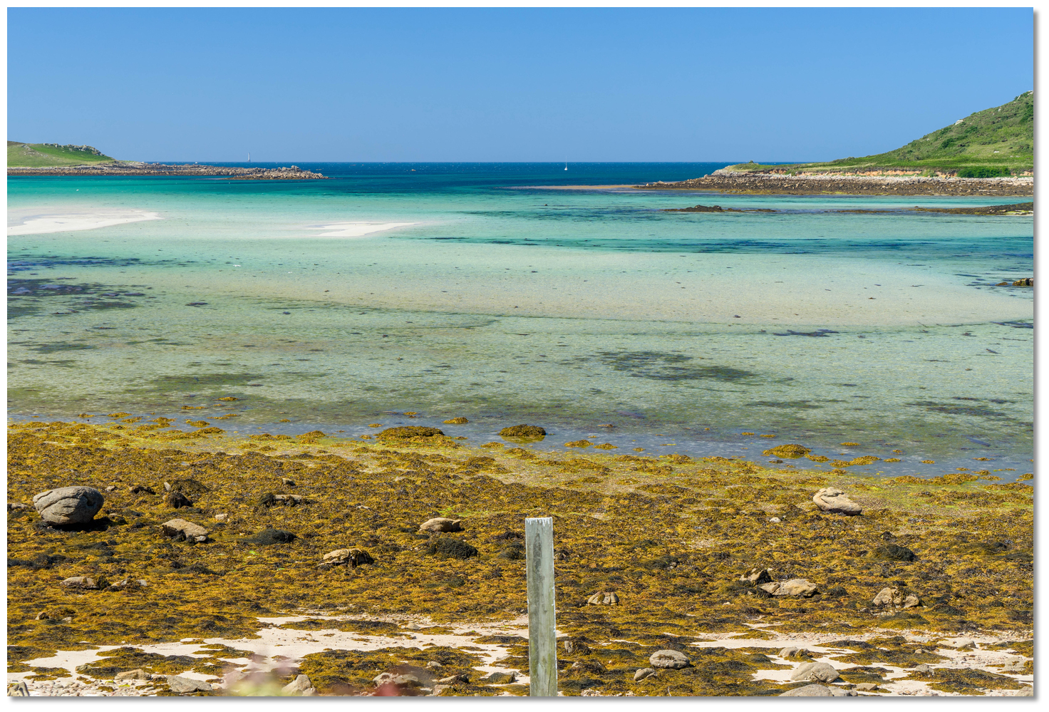
 Tresco Flats drying as seen from Tresco Island
Image: Michael Harpur
The large sandy spit dries to as much as 1.7 metres in places and is the shallowest part of the journey – this may be circumvented with some additional pilotage set out below. The Tresco harbourmaster has placed two white pole alignment marks on the south of Plumb Hill.
 The two white poles aligned on the south of Plumb Hill
Image: Michael Harpur
Once in line, the vessel is clear of the north side of the sandbank and rocks running southwestward from Appletree Point - the marks also providing a leading line to clear Lubber's Rock as set out below. After crossing Tresco Flats keep an eye out for the Plump Rocks, that dry to 2.2 metres, on the east side of the route between Plump Island and Appletree Point.
 South bound yacht passing between Merrick and Plump Island
Image: Michael Harpur
 Passing Merrick Island with Great Crabs Ledge in the backdrop
Image: Michael Harpur
Vessels intending upon drying in Green Bay
should simply round Merrick Island’s northern side at a sensible distance and proceed into the north end of the bay. Continuing northward towards the lower end of the moorings the final danger to keeping an eye out for Queen’s Ledge, that dries 2.5 metres, on the Bryher side of the channel.
 Anneka’s Quay
Image: Michael Harpur
 The commencement of the moorings in New Grimsby Sound
Image: Michael Harpur
It is in 2 metres of water close south of the yacht moorings and the water continues to deepen northward into New Grimsby Sound.
With the use of the Admiralty indicated course, available on our eOceanic Go chart pack and other good plotters, it is possible to make a small dog-leg a ½ mile north-westward after Little Rag. Steer towards Samson Hill on a bearing of 302°T (astern 122°T) to turn around the head of the Tresco Flats bank. This should provide at least one additional metre of water.
 The front of the harbour master's posts, with yellow rock coming into alignment
with the Bishop in the backdrop
Image: Michael Harpur
Once the distant Bishop Rock lighthouse is over the centre of Yellow Rock, a small rocky islet midway between Samson and Bryher, it is time to turn northeastward. The key hazard for this added leg is the isolated Lubbers Rock that dries 1.7 metres on the Bryher side. Mincarlo open of Works Point, the southern extremity of Bryher, clears Lubbers Rock.
 Tresco Harbourmaster's alignment marks
Image: Michael Harpur
The harbour master has also placed two white posts in Cliff Field, beneath Plum Hill on the Tresco shore, which provide a transit to clear Lubbers Rock. It will also keep Little Crab Ledge, that dries 2.4 metres and Great Crab Ledge, dries 5.3m and just covers at HW, as does Hangman Island over Merrick Island, on 340° T once it is rejoined.
The complete course is 1.62 miles from the waypoint 'Nut Rock' to 'Anneka’s Quay' tending in a north north westerly direction (reciprocal south south easterly).
Nut Rock, 49° 55.899' N, 006° 20.000' W
On the alignment of Nut Rock on a bearing of 260° T in line with the summit of the South Hill on Sampson. This alignment is useful for vessels approaching from Crow Sound as the alignment clears The Pots and Round Rock situated nearly a ½ mile off the southern shore of Tresco.
► Next waypoint: 0.45 miles, course ⇓ 326.43°T (reciprocal ⇑ 146.43°T)
Hulman, 49° 56.276' N, 006° 20.389' W
60 metres westward of the Hulman beacon, Fl.G.4s green triangle top mark, in order to clear its rock ledge that dries 3.7 metres and extend well beyond the perch.
► Next waypoint: 0.16 miles, course ⇓ 16.86°T (reciprocal ⇑ 196.86°T)
Little Rag Ledge, 49° 56.429' N, 006° 20.317' W
70 metres east of the Little Rag beacon, a small with a red square top mark Fl(2)R.5s. It is midway between the Little Rag Ledge and the Chinks on the east side.
► Next waypoint: 0.35 miles, course ⇓ 331.91°T (reciprocal ⇑ 151.91°T)
Appletree Point, 49° 56.740' N, 006° 20.575' W
80 metres clear of the weed-covered rocks that extend from Appletree Point. It also marks the commencement of the Tresco Flats, the large sandy spit which extends nearly mile westwards from Appletree Point at the northern end of Appletree Bay.
► Next waypoint: 0.39 miles, course ⇓ 356.07°T (reciprocal ⇑ 176.07°T)