
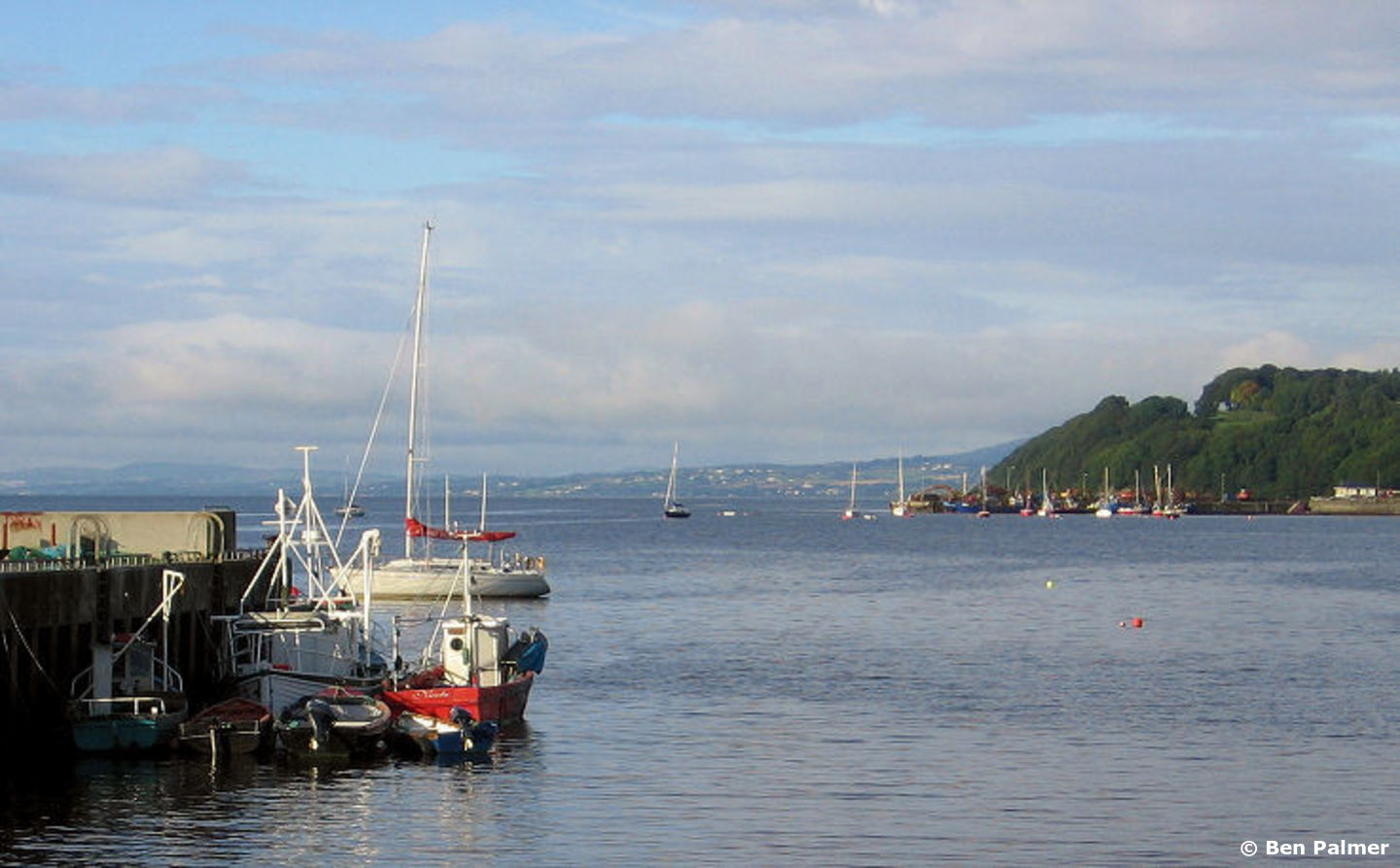
Moville is a small town located on the north coast of Ireland close inside the entrance to Lough Foyle and on the east side of the Inishowen Peninsula. Boats may come alongside the town's pier or anchor off using visitor moorings in the immediate vicinity.
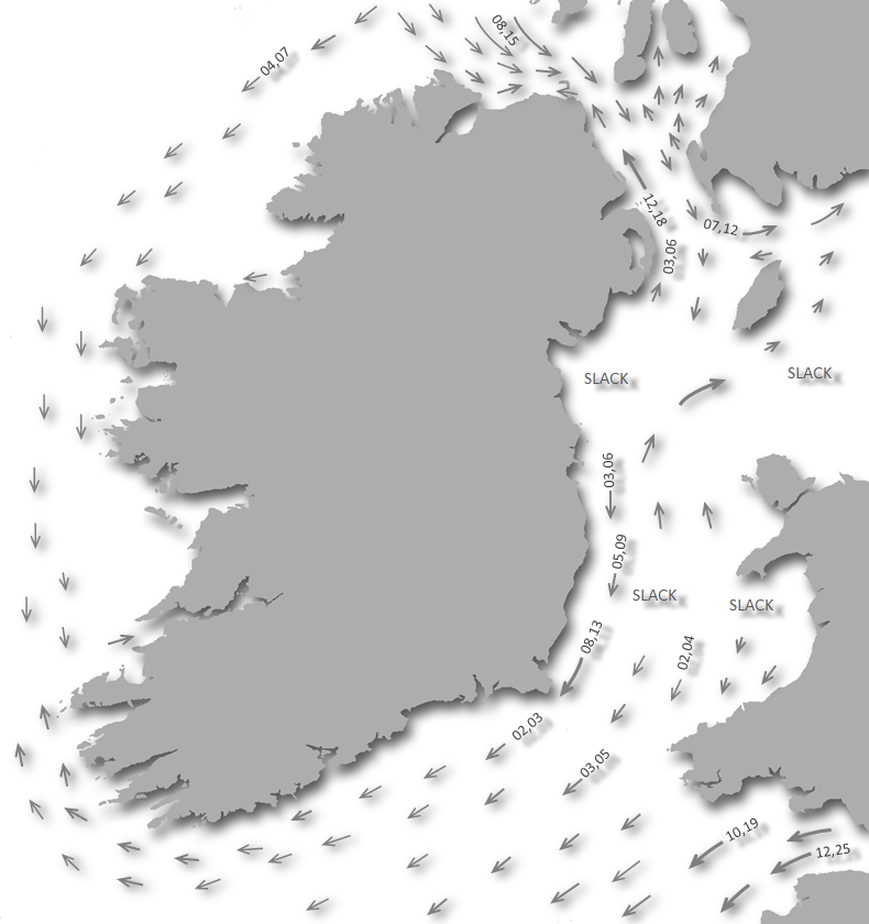
Situated on the western shore at the northern end of the Lough Foyle estuary, under the lee of the Inishowen Peninsula, Moville is a good anchorage in west through north to northeast winds, but it would be exposed to strong winds from the east and south. Although tidal streams are occasionally strong Moville affords a safe access in all reasonable conditions and at all states of the tide. The anchorage lies close to the ¾ of a mile wide Port of Londonderry Commercial Shipping Channel, which is well marked and supported by a lighthouse with a sectored light, enabling a night access.


Keyfacts for Moville


Summary
A good location with safe access.


Nature


Considerations

 +353 77 81315
 movilleboatclub@gmail.com
Position and approaches

Haven position
 55° 11.166' N, 007° 2.534' W
This is the location of Moville Pier head.
What are the initial fixes?
The following waypoints will set up a final approach:(i) Lough Foyle North Channel Initial Fix
 55° 14.155' N, 006° 53.700' W
One mile east of Inishowen Head and 400 metres northwest of Red Tuns Light (port hand) Buoy F1. R.3s. It is set on the 222° line of bearing of the Martello tower on Magilligan Point that leads into the North Channel.
(ii) Lough Foyle South Channel Initial Fix
55° 11.760' N, 006° 57.084' WMidway between the shore and the southern edge of the Tuns Bank in the narrowest part of the South Channel in approximately 10 metres of water.




What are the key points of the approach?
 .
.- Lough Foyle’s approaches, the run up the lough to the River Foyle and beyond are detailed in the Foyle Port Marina (Derry City)
 entry.
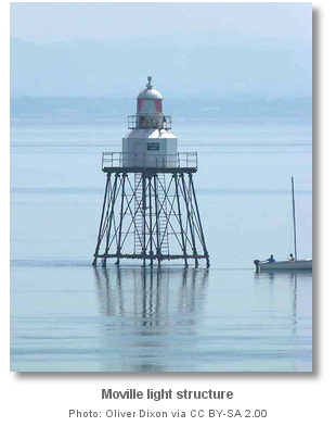
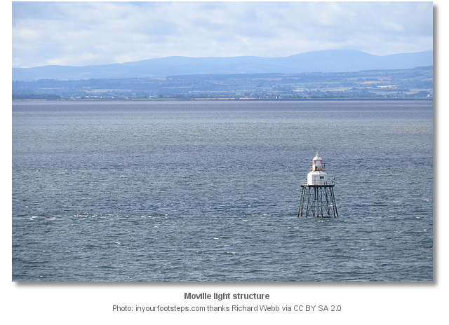
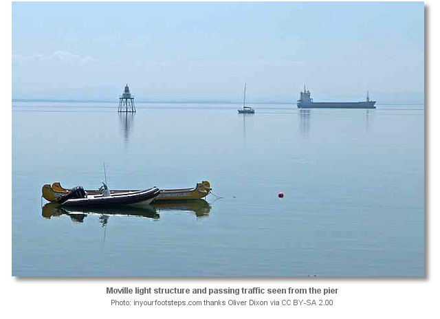
 - Follow the Lough Foyle channel to the Moville Bank Light structure. Pass it close southeast, to starboard, and proceed directly to the pier. Do not be tempted to cut in directly for Moville without rounding the Moville Light beacon.
Not what you need?
- Carrickarory Pier - 0.6 nautical miles WSW
- Greencastle - 2.2 nautical miles ENE
- Magilligan Point - 2.5 nautical miles E
- Silver Strand - 3.1 nautical miles ENE
- Cornashamma Bay - 3.5 nautical miles ENE
- Kinnagoe Bay - 4.6 nautical miles NNE
- White Bay - 4.7 nautical miles ENE
- Portnocker - 4.8 nautical miles NE
- Portkill - 5 nautical miles NE
- Tremone Bay - 5.3 nautical miles N
- Carrickarory Pier - 0.6 miles WSW
- Greencastle - 2.2 miles ENE
- Magilligan Point - 2.5 miles E
- Silver Strand - 3.1 miles ENE
- Cornashamma Bay - 3.5 miles ENE
- Kinnagoe Bay - 4.6 miles NNE
- White Bay - 4.7 miles ENE
- Portnocker - 4.8 miles NE
- Portkill - 5 miles NE
- Tremone Bay - 5.3 miles N


What's the story here?
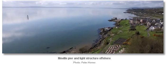
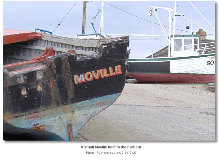
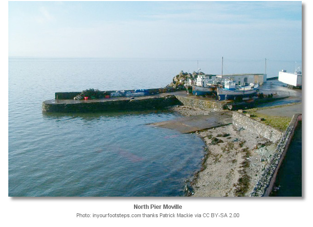
Moville is a small town and coastal resort situated on the Inishowen shoreline 2½ miles within the entrance to Lough Foyle. It has a pier that is used by fishing vessels and small craft plus visitor boat moorings between it and Carrickarory Pier to the southwest.
How to get in?
 Entered between Magilligan Point and the Inishowen shore, Lough Foyle’s approaches, the run up the lough to the River Foyle and beyond are detailed in the Foyle Port Marina (Derry City) entry. Once inside Lough Foyle, it is simply a matter of following the northwest shoreline to Moville.
 Do not be tempted to cut in directly towards Moville from the approach channel without rounding the Moville Light beacon. The shallow Moville Bank lies directly in this path. Keeping the Inishowen lighthouse open of Greencastle astern, will comfortably clear the Moville Bank until the Moville Bank Light structure is identified.
When approaching the Moville Bank Light structure Moville will be seen a quarter of a mile northward of the mark. From a position close southeast of Moville Light beacon, passed to starboard, it is safe to proceed directly to Moville Pier.
Moville Light beacon – Fl WR. 2.5s 11m4M position: 55°11.993'N, 007°02.129'W
The spire of Moville church, located 600 metres northeast of the quay, will be visible above the treetops along with a second smaller Presbyterian church spire situated at the west end of Moville.
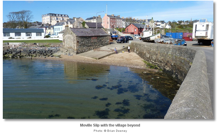 Anchor to the south of the pier head in sand and mud in depths of two metres. Small boats and tenders may land inside the pier where a slip may be found. It is possible to come alongside the wall on the outside or southeast side of the pier where 1.5 metres is available at LWS.
 Eight seasonal moorings for visiting yachts are also available in the vicinity. These are situated 600 metres southwest of Moville Pier Head between Moville and Carrickarory.
Visitor Moorings ‘Yellow’ – position: 55°11.000'N, 007°03.000'W
There are typically ten to fifteen local boats moored in the area where the moorings are located, making it easy to locate the position on approach.
Why visit here?
Moville goes by two Irish names Magh Bhille or Bun an Phobail with Magh Bhille meaning ‘plain of the ancient or notable tree’ and Bun an Phobail meaning ‘foot of the Foyle’.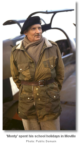
By the early to mid-C19th, the town became the dominant centre for markets, trade and milling in the east Inishowen peninsula with a bustling maritime trade. By the second half of the 19th century, it had grown to become a major point of embarkation for many travellers, especially emigrants to the new world. Steamships of the Anchor Line, of Glasgow, and others en route from Glasgow to New York City regularly called at Moville to pick up additional passengers. The Lough Foyle harbour pilots were stationed here and the Moville Coastguard Station was established in 1856 to prevent unnecessary loss of life and improve maritime safety. The port played an important role in the town up until the middle of the twentieth century.
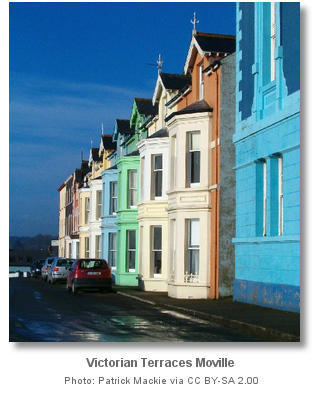
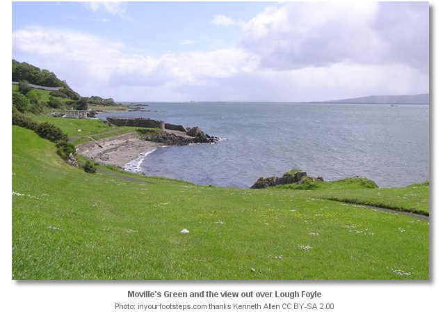
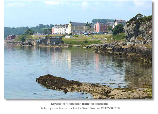
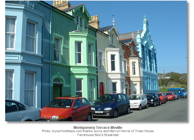
During the Victorian period, the town enjoyed popularity as a seaside resort. It was ‘Monty’s’grandfather ‘Robert’ who built Montgomery Terrace in 1884. This period has left Moville with a handsome 'green' and a large seaside park in the Victorian style. The park features classic Victorian bandstands, walking trails, playgrounds, a coastal footpath and sweeping views east across the waters of the lough to Northern Ireland.
Lough Foyle and Moville Sailing Club host an annual regatta at Moville in August that dates back to the 19th century. Historically the one-man punt was the popular craft, nowadays, however, the race has come to be that of home-made rafts from a wide variety of competitors. The town is also noted for two major music festivals, Dylan Fest and Beatles Fest. These are held in the summer, early July for Dylan Fest and August for Beatles Fest and these festivals draw bands and visitors from all over Europe. Festival-goers congregate, play and listen to the bands in pubs and streets of the town, and also on the shores of the lough. So depending upon timing, Moville could provide a dramatically different experience for a visiting boatman.
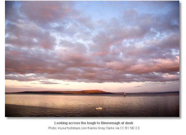
From a boating perspective, Moville presents another interesting berthing opportunity on beautiful Lough Foyle. It has all the convenience of it historic village immediately to hand with a scenic outlook. The view across the lough has the escarpment of Binevenagh dominating the hinterland eastward. Westward the land gradually rises from the shore to the mountain summits of Crucknanonian, Crunlieve, Drung, and Leemacrosson. All of which lie within a few sea miles of the entrance to Lough Foyle.
Moville is also a designated a port of entry that may be used for clearing in purposed by vessels arriving entering territorial waters of the Republic of Ireland from outside of the EU & UK territories.
What facilities are available?
Fresh water is available from a tap on the pier, plus a slip. Most provisions are available from the small town of Moville that caters for a community of 4000. Moville is 26 kilometres by road, or 14 nautical miles, from the separately covered Derry City which lies across the border in Northern Ireland and this has all facilities plus excellent transport links. It is reported that a Marina is to be built just south of Moville.Any security concerns?
Never an issue known to have occurred to a vessel anchored off Moville Pier.With thanks to:
Bill McCann, Londonderry Harbour Master. Photography with thanks to Dan Kearney, Patrick Mackie, Oliver Dixon, Kenneth Allen, Andrew Hurley, Richard Webb, Greg Clarke, Putneypics, Peter Homer, Ben Plamer, Brian Deeney of Donegal Cottage Holidays, Joyce and Mervyn Norris of Trean House Farmhouse Bed & Breakfast.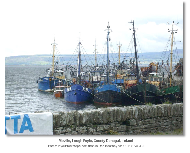
.jpg)

An aerial overview of the town and coastal walk.
A photo montage of the area.
Dolphins and a currach off Moville
About Moville
Moville goes by two Irish names Magh Bhille or Bun an Phobail with Magh Bhille meaning ‘plain of the ancient or notable tree’ and Bun an Phobail meaning ‘foot of the Foyle’.
By the early to mid-C19th, the town became the dominant centre for markets, trade and milling in the east Inishowen peninsula with a bustling maritime trade. By the second half of the 19th century, it had grown to become a major point of embarkation for many travellers, especially emigrants to the new world. Steamships of the Anchor Line, of Glasgow, and others en route from Glasgow to New York City regularly called at Moville to pick up additional passengers. The Lough Foyle harbour pilots were stationed here and the Moville Coastguard Station was established in 1856 to prevent unnecessary loss of life and improve maritime safety. The port played an important role in the town up until the middle of the twentieth century.
During the Victorian period, the town enjoyed popularity as a seaside resort. It was ‘Monty’s’grandfather ‘Robert’ who built Montgomery Terrace in 1884. This period has left Moville with a handsome 'green' and a large seaside park in the Victorian style. The park features classic Victorian bandstands, walking trails, playgrounds, a coastal footpath and sweeping views east across the waters of the lough to Northern Ireland.
Lough Foyle and Moville Sailing Club host an annual regatta at Moville in August that dates back to the 19th century. Historically the one-man punt was the popular craft, nowadays, however, the race has come to be that of home-made rafts from a wide variety of competitors. The town is also noted for two major music festivals, Dylan Fest and Beatles Fest. These are held in the summer, early July for Dylan Fest and August for Beatles Fest and these festivals draw bands and visitors from all over Europe. Festival-goers congregate, play and listen to the bands in pubs and streets of the town, and also on the shores of the lough. So depending upon timing, Moville could provide a dramatically different experience for a visiting boatman.
From a boating perspective, Moville presents another interesting berthing opportunity on beautiful Lough Foyle. It has all the convenience of it historic village immediately to hand with a scenic outlook. The view across the lough has the escarpment of Binevenagh dominating the hinterland eastward. Westward the land gradually rises from the shore to the mountain summits of Crucknanonian, Crunlieve, Drung, and Leemacrosson. All of which lie within a few sea miles of the entrance to Lough Foyle.
Moville is also a designated a port of entry that may be used for clearing in purposed by vessels arriving entering territorial waters of the Republic of Ireland from outside of the EU & UK territories.
Other options in this area
Culmore Bay - 7 miles SW
Foyle Port Marina (Derry City) - 8.9 miles SW
Magilligan Point - 1.6 miles E
Coleraine - 7.9 miles E
Silver Strand - 1.9 miles ENE
Cornashamma Bay - 2.2 miles ENE
White Bay - 2.9 miles ENE
Portnocker - 3 miles NE
Navigational pictures
These additional images feature in the 'How to get in' section of our detailed view for Moville.


| Detail view | Off |
| Picture view | On |
An aerial overview of the town and coastal walk.
A photo montage of the area.
Dolphins and a currach off Moville
 A photograph is worth a thousand words. We are always looking for bright sunny photographs that show this haven and its identifiable features at its best. If you have some images that we could use please upload them here. All we need to know is how you would like to be credited for your work and a brief description of the image if it is not readily apparent. If you would like us to add a hyperlink from the image that goes back to your site please include the desired link and we will be delighted to that for you.
Add your review or comment:
Jim Williamson wrote this review on Jun 16th 2012:
Not sure that the visitors moorings are still there? We were still some way from the pier when water depth fell to 2 metres. With a north easterly blowing it didn't look an attractive anchorage. We did not identify any visitors moorings. Several of the yachts tied up in Greencastle were from Moville but their owners don't keep them there.
Average Rating: UnratedPlease log in to leave a review of this haven.
Please note eOceanic makes no guarantee of the validity of this information, we have not visited this haven and do not have first-hand experience to qualify the data. Although the contributors are vetted by peer review as practised authorities, they are in no way, whatsoever, responsible for the accuracy of their contributions. It is essential that you thoroughly check the accuracy and suitability for your vessel of any waypoints offered in any context plus the precision of your GPS. Any data provided on this page is entirely used at your own risk and you must read our legal page if you view data on this site. Free to use sea charts courtesy of Navionics.