
Tucked well into the bight of Red Bay Cushendall offers a good anchorage that offers shelter from westerly component conditions round to north-northwest and it is well out of the run of the current. Nevertheless, it is an open bay that is exposed to the north and east. Access is straightforward thanks to the absence of offshore dangers or any tidal restrictions although poorly marked marine farms are in the area.

Keyfacts for Cushendall
Facilities


Nature


Considerations


Protected sectors

Approaches

Shelter
Last modified
January 11th 2023 Summary
A good location with straightforward access.Facilities
Nature
Considerations
 csbc.co.uk/
Position and approaches

Expand to new tab or fullscreen
Haven position
 55° 4.530' N, 006° 3.020' W
100 metres east of the end of the public slipway, known locally as the Waterford Slipway, where Cushendall Sailing and Boat Club and the Red Bay RNLI station is located. This is just outside Cushendall village on the Coast Road.
What is the initial fix?
The following Red Bay Initial Fix will set up a final approach:
 55° 4.071' N, 006° 0.592' W


What are the key points of the approach?
Offshore details are available in northeast Ireland’s Coastal Overview for Malin Head to Strangford Lough  with local approaches available in the Red Bay Pier
  entry.
with local approaches available in the Red Bay Pier entry.- Keep an eye out for the fish farm in the south end of Red Bay and the outfall buoy.
- Approach the piers and slips from the east.
Not what you need?
Click the 'Next' and 'Previous' buttons to progress through neighbouring havens in a coastal 'clockwise' or 'anti-clockwise' sequence. Below are the ten nearest havens to Cushendall for your convenience.
Ten nearest havens by straight line charted distance and bearing:
- Red Bay Pier (Glenariff Pier) - 0.6 nautical miles S
- Cushendun - 3.1 nautical miles N
- Carnlough - 5.4 nautical miles SSE
- Torr Head - 7.1 nautical miles N
- Glenarm - 7.2 nautical miles SSE
- Murlough Bay - 8.4 nautical miles NNW
- Ballycastle - 10.3 nautical miles NW
- Ballygalley Bay - 12.4 nautical miles SSE
- Church Bay - 13.9 nautical miles NNW
- Ballintoy Harbour - 14.9 nautical miles NW
These havens are ordered by straight line charted distance and bearing, and can be reordered by compass direction or coastal sequence:
- Red Bay Pier (Glenariff Pier) - 0.6 miles S
- Cushendun - 3.1 miles N
- Carnlough - 5.4 miles SSE
- Torr Head - 7.1 miles N
- Glenarm - 7.2 miles SSE
- Murlough Bay - 8.4 miles NNW
- Ballycastle - 10.3 miles NW
- Ballygalley Bay - 12.4 miles SSE
- Church Bay - 13.9 miles NNW
- Ballintoy Harbour - 14.9 miles NW

Chart

What's the story here?
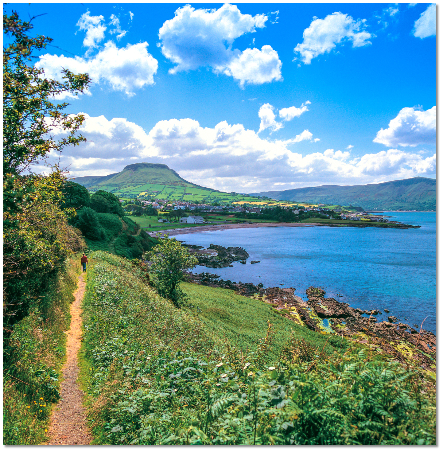
 Cushendall overlooked by the flat-topped Lurigethan
Image: Michael Harpur
The small coastal settlements of Cushendall and Waterfoot are located within the picturesque and sheltered Red Bay. The extensive bay is entered between the southern Garron Point and Limerick Point situated 3¼ miles to the northwest. The village of Cushendall is located on the north side of the bay set back a ⅓ of a mile inshore of its quay which is situated on the southern face of Limerick Point. It is an attractive conservation village small, with a population of about 1,500 people. Sitting at the foot of Glenaan and being on the convergence of Glenballyemon and Glencorp the settlement is known as the 'Capital of the Glens and is a popular visitor attraction.
.jpg) Cushendall Pier (also known as Dalriada Pier)
Cushendall Pier (also known as Dalriada Pier)Image: Michael Harpur
About a ½ mile southward of the village pier is a second small pier with a large slip that is shared by the Cushendall Sailing & Boating Club and the Red Bay RNLI station.
 The southern pier and slip shared by the Cushendall Sailing & Boating Club and
the Red Bay RNLI station
Image: Michael Harpur
Red Bay is a clean bay that provides good anchorage with excellent fine sand holding decreasing gradually to the shore. The bight's deep recess enables vessels to step in out of the coastal current and it can be considered the best anchorage on this part of the coast. It is possible to anchor off the Cushendall village pier or off the site shared by the club and RNLI where visitor moorings are also available.
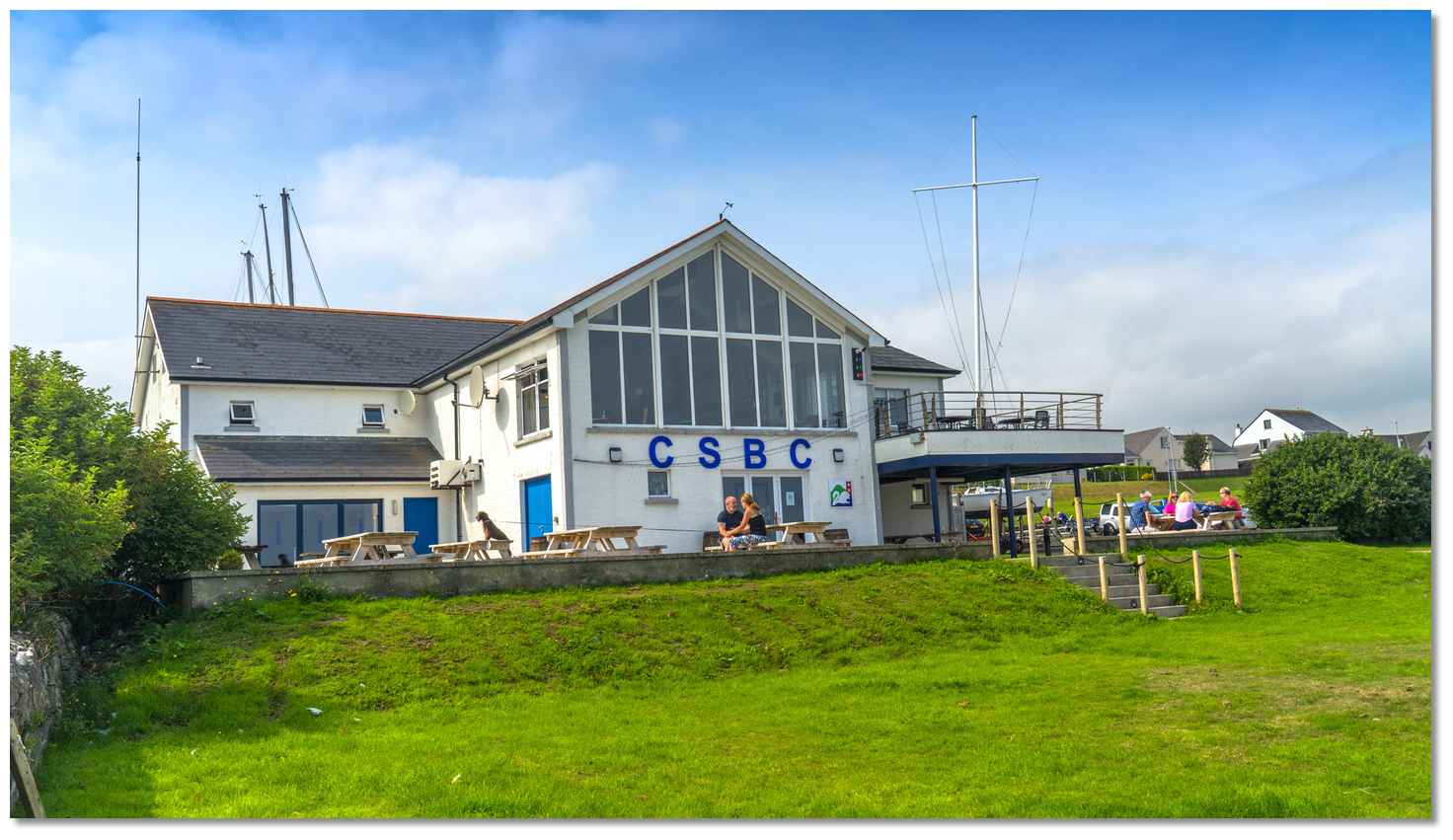 The clubhouse of the Cushendall Sailing & Boating Club
Image: Michael Harpur
Contact Cushendall Sailing & Boating Club for details:
 +44 (0)28 2177 1673,
  secretary@csbc.co.uk and via their website contact form
  for the latest details. The club is a small, young and very active that open most evenings throughout the summer months and they are particularly welcoming. Visiting Yachtsmen may come in to freshen up and use the club bar which provides stunning north and south views of headlands plus, on a clear day, Scotland and some of its western islands.
How to get in?
 Flat-topped Lurigethan, 1½ mile southwest, redilly identifies Cushendall
Image: Michael Harpur
 Approaches to Red Bay are available in the Red Bay Pier entry. The direction and velocity of the tide should be the central feature of any navigation planning in this area. Red Bay is made unmistakable by its bold and precipitous southern entrance Garron Point which rises abruptly to a height of 230 metres. It is a highly conspicuous headland with no outlying dangers and good depths close in. A berth of 400 metres clears all dangers off the southern entrance.
  Garron Point
 Image: Tourism NI
The village lies 3 miles northwestward of the point and is overlooked by the spectacular mainland summits of the flat-topped Lurigethan and Tievebulliagh that are easily identified from seaward.

_and_cushendall_as_seen_from_seaward.jpg) Lurigethan, Tievebulliagh (left) and Cushendall as seen from seaward
Lurigethan, Tievebulliagh (left) and Cushendall as seen from seawardImage: Burke Corbett
 Southern approaching vessels should steer west by northwest for 1¾ miles to the anchorage from the Red Bay Initial Fix. Vessels approaching from all other directions may steer directly for the anchorage as, apart from the well-marked aquaculture on the south side of Red Bay between the pier and Garron Point, there are no off-lying dangers in the bay.
Keep an eye out for a yellow outflow marker, Fl(4) Y12s, that will be passed on approach about 600 metres east of the Cushendall Sailing & Boating Club and the RNLI station slip. It is marked with a standard yellow buoy with a yellow 'X' on top. The outflow is on the seabed so it is safe to pass the buoy on all sides as there is deep water, in excess of 16 metres all around it.
 Red Bay shoals gradually to the shore
Image: Michael Harpur
The sandy bottom shoals gradually to the shore at Cushendall. Anchor in 2 to 4 metres outside the moorings to the east of the piers off of the Cushendall village or the Cushendall Sailing & Boating Club and the RNLI station shared site..jpg) Vessels anchored off Cushendall Pier (Dalriada Pier)
Vessels anchored off Cushendall Pier (Dalriada Pier)Image: Michael Harpur
In the case of the latter, there are five visitor moorings. The yellow moorings have a weight limit of 10 tonnes and are located about 300 metres from the club and RNLI station.
 The large slip and pier of the site shared by the club and RNLI
Image: Michael Harpur
A payment of £10 per night should be made to Red Bay Boats whose premises are nearby.
Red Bay Moorings - position: 55° 04.565’N 006° 02.865’W.
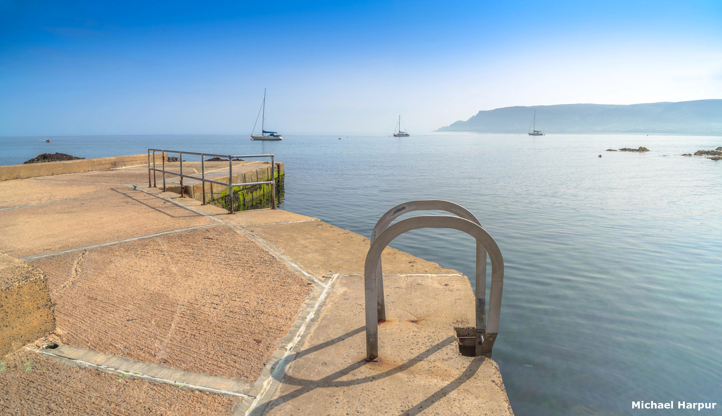
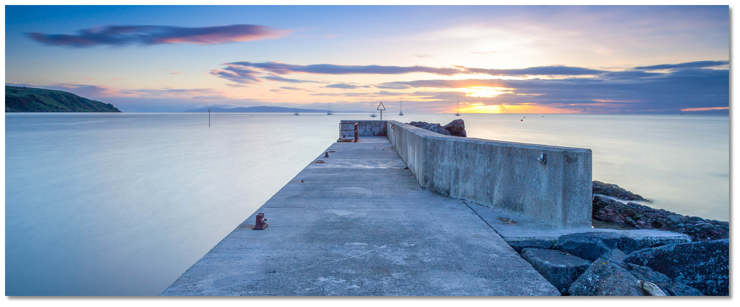
The head of the pier on the south side of the slip has a depth of 1.7 metres ±3 hours of high water. Those wishing to come alongside should seek local advice.
 The marked rock north-by-northeast of the slipway
Image: Burke Corbett
Approach the pier and slip from eastward as there is a rock situated 50 metres north-by-northeast of the slipway. It is clearly marked with a yellow triangular beacon.
Why visit here?
Cushendall derives its name from the Irish, 'Cois Abhann Dála'. The prefixes 'cosh' and 'cush' are derived from the Irish 'cos' meaning 'a foot, a leg', and signify 'at the foot of'. It is a commonly used part of a placename and in the Cushendall it means 'foot of the River Dall'. The Dall, which flows into the sea here, is formed by the convergence of the Glenaan River with the Ballyemon River located 1km to the west. The name Dall is believed to be derived from the Irish 'bun an dalla' meaning the 'dark one'. Lurigethan as seen from the north end of Cushendall strand
Image: Tourism NI
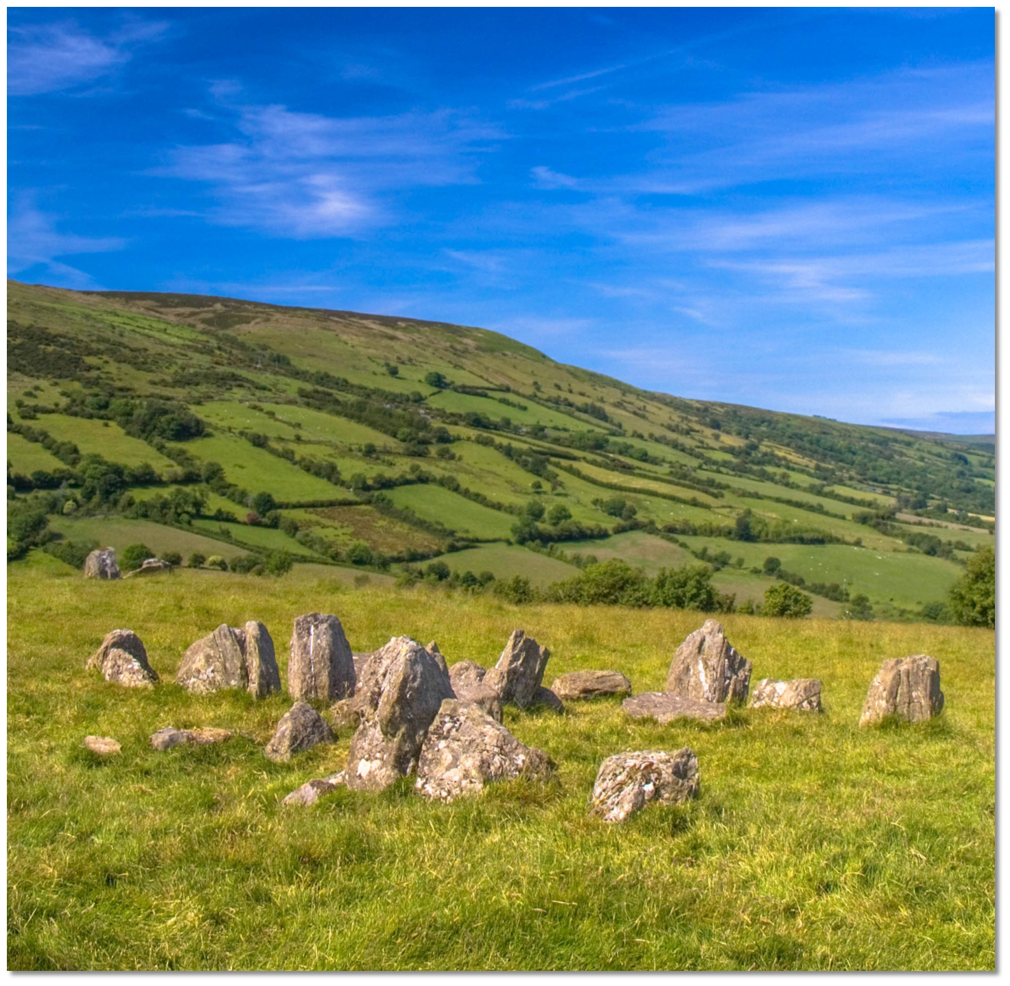
The nine glens are scattered with traces of Neolithic man, but none are more significant than those at Cushendall. Tievebulliagh, situated close inland, was host to a prodigious Stone Age flint factory. The 401 metres high mountain forms part of the watershed between Glenann to the north and Glenballyeamon to the south and was formed from a volcanic plug. The intense heat generated in this process gave rise to the formation of a special kind of flint that is called 'porcellanite' because of its blue-grey porcelain-like colour. Unlike the commonly available flint, porcellanite is an extremely tough rock capable of taking a keen edge, especially when polished with sandstone. Not being brittle it was the ideal and preferred Neolithic material for axes employed in forest clearances, but it also made excellent arrows and spearheads that could pierce effectively.
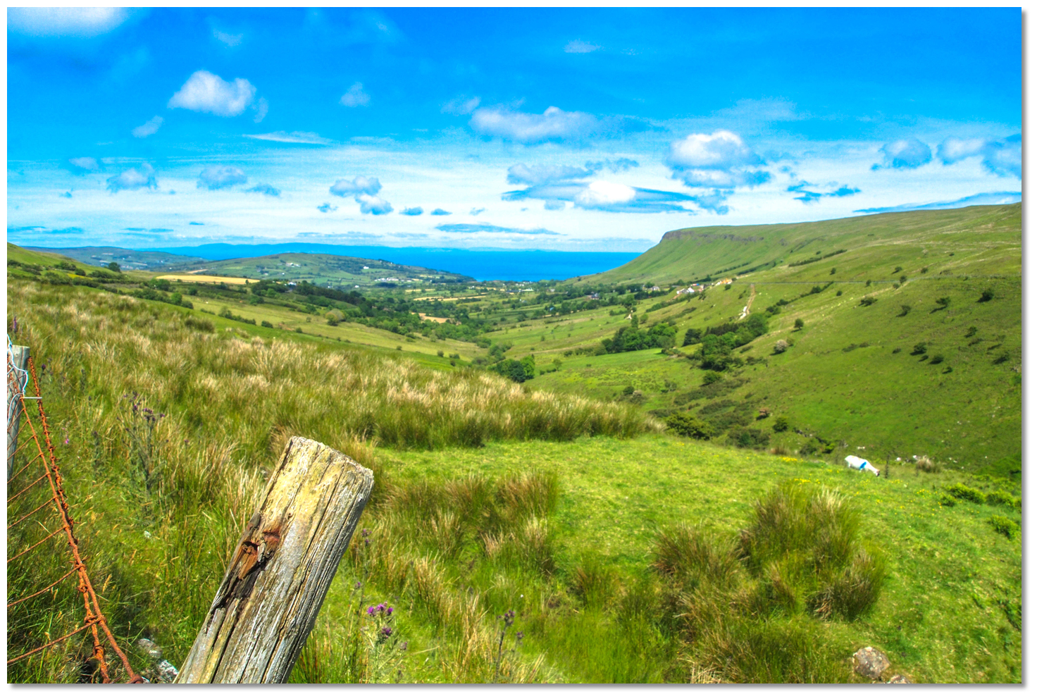 Glenann
Image: Lindy Buckley via CC BY 2.0
It was this Tievebulliagh porcellanite that formed the geological basis for the Neolithic axe factory here. Around five to six thousand years ago, stone-age settlers produced axes on the mountain en mass. The hard, blue-grey porcellanite, found here and on Ratlin Island accounted for 53.8% of Irish stone axe production during this period. Besides being used for everyday purposes such as chopping down trees and building timber structures, some large, highly polished axes may also have been made for prestige and ritual purposes. Several axes were found locally on the mountain but they were also traded throughout Britain and Ireland with some discovered as far away as Greece. More than 10,000 beautifully polished and highly distinctive Antrim porcellanite axes have been discovered to date. The most famous of these is the hoard of eighteen axes found on Malone Ridge in Belfast sometime between 1869 and 1918. The collection of 16 large porcellanite axes are all nearly 300 millimetres in length. This is by far the largest number from an identified source in the British Isles. A rich collection of Tievebulliagh porcellanite artefacts are displayed today in the Ulster Museum, some of them exquisite in form and texture.
 Malone Hoard Neolithic axes dating to 4,500-2,500 BCE
Image: Notafly via CC ASA 3.0
The focus however would shift to Lurigethan from 500 B.C. to 500 A.D. when technological advancements led to a move from stone to bronze. The magnificent mountain Lurigethan, overlooking the village from the south, then hosted one of the most spectacularly situated Stone Age promontory forts in Ireland. The promontory fort encloses 30 acres of the mountain and is discussed in the Red Bay
entry. The Normans seized the glens from local chieftains and held power here until the late 1300s. Then John Mor MacDonald, 3rd chief of Dunnyveg, married into the Norman Bissett family and the area came into the possession of the McDonnell clan. Over time the clan expanded their power base right along the north coast and held the Glens by force of arms for over 200 years, most famously under the leadership of 'Sorley Boy', 1505-89.  Lurigethan hosted a Stone Age promontory fort
Image: Brendan Rankin via CC BY SA 3.0
The village's oldest ruin is the Layde Old Church which is also one of the oldest and most important historical sites in the Glens. Layde Church means 'Church of the broad place' and it was founded by the Franciscans in 1306 on the site of an earlier religious house. The exact origins of the earlier structure are unknown but it probably began life as a holy place in the Iron Age or before. The long narrow structure of Layde Old Church was built of local red sandstone and schist and had a thatched roof. It was in ruins in 1622 but was rebuilt about 1696 and remained the site of Protestant worship until 1790 when it was replaced by a new building in Cushendall. It has a graveyard that has some lovely Celtic crosses alongside which is a fast-flowing stream that cascades into the sea at Port Obe. Many of the MacDonald clan are buried in this graveyard or at Bonamargie Friary at Ballycastle and the site contains many monuments to the local chieftains.
 Layde Old Church and grave yard
Image: Tourism NI
The village of Cushendall commenced during the plantation period of the 1600s and was driven by water power and the migration of Scottish settlers. Then came the turbulent years when the estate was lost and regained. Finally, following the 1690 Williamite victory, the area around Cushendall was forfeited by the clan and sold to the 'Hollow Sword Blade Company' which acquired large tracts of Irish land after the Williamite victory. But the company failed and Cushendall was subsequently bought by a Dr Richardson who is chiefly remembered for changing its name to 'Newtown Glens'.
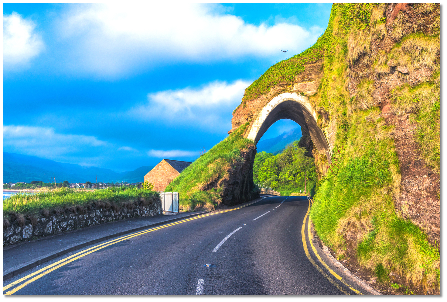 The Red Arch open up the coast
Image: Tourism NI
In the early 19th century Francis Turnly, (1765/6–1845) an official of the East India Company was to transform the fortunes of the village. After the company made him wealthy from the trade in China he returned to buy the village. Living in Carnlough, he set about improving the coast road creating the Red Arch. In its day the Red Arch between Glenariff and Cushendall was a magnificent engineering feat that not only allowed him access but also connected many isolated communities along the coast. Indeed until then, Cushendall would have looked towards Scotland as its neighbour, as it was easier to travel across the sea than across the mountainous areas which closed off access to the village.
 Cushendall's Curfew Tower
Image: Tourism NI
Today, Cushendall is a delightfully understated village of charming colour-washed buildings closely grouped on a spectacular shore. Situated at the convergence of three Glens - Glenaan, Glenballyemon and Glencorp - Cushendall is known as the 'Capital of the Glens'. Add to this the magnificent summits of Lurigethan and Tievebulliagh that overlook the village and it is fair to say that the views here are spectacular, both ashore and afloat. In addition to its natural beauty, Cushendall is endowed with such exceptional architecture that it was also made a conservation town in 1973. Much of the town's development, particularly the Georgian buildings of the town's four original streets on the north bank of the River Dall, remains entirely intact today. The town also keeps its historical 'fair days' tradition alive for ten days each August with the 'Heart of the Glens' festival which takes place over August every year in and around the village of Cushendall. This features traditional Irish music sessions and friendly pubs, and it would be an ideal time to plan a visit.
 Ossian's Grave on the lower slopes of Tievebulliagh
Image: Philip Hay via CC ASA 3.0
There is, of course, plenty here for walkers. Layde Old Church is about 1.5 km (1 mile) north of the village and can be reached by a pretty walk along the cliffs. The ancient church and graveyard is a quiet place from which to enjoy spectacular views of Lurigethan, Red Bay Castle and Garron Plateau. The round trip to the church and back can be accomplished comfortably in an hour, but please note the path is steep in places. Just over 3 km (2 miles) west of Cushendall, on the slopes of Tievebulliagh Mountain, lies Ossian’s Grave, named after the legendary warrior-poet and son of the giant Finn McCool.
 The northern face of Lurigethan
Image: Lindy Buckley via CC BY 2.0
Today it has been identified as being a Neolithic court tomb that shows a great deal of similarity to Scottish Chambered Tombs. Once again it indicates that very similar societies must have existed on both sides of the sea during this period. Legend has it that the caves in nearby Tiveragh Hill are said to be occupied by the 'little people'. There is also a golf course a short walk from the town. For the more energetic a hike to the top of Lurigethan will reward a walker with unforgettable views over the surrounding glens and small hamlets laid out like patchwork below. Likewise across the North Channel to the Scottish Islands of North Islay, Mull of Kintyre, Rhins of Galloway, Paps of Jura and Paddy's Milestone or Ailsa Craig can be seen, as the North Channel is scarcely 11 miles wide here.
 Boat at Cushendall Pier
Image: Michael Harpur
The path to it strikes up from Parkmore Road and direct access to the summit is from the northern foot of the mountain along the zigzag paths, clearly visible from the bottom but difficult enough to follow on the ground. A race is held annually from the watchtower on the beach at Cushendall to the summit. The record currently stands at an astounding 26 minutes. Needless to say, the climb time will be much longer but no visitor should omit to see the fine and extensive view from its plateau-like top.
 The club and RNLI pier at dawn
Image: Jonathan Tweed via CC BY-ND 2.0
From a boating perspective, Cushendall offers a stop-off point for boats bound in either direction through the North Channel. Likewise, as the crow flies, you are nearer to Scotland than to Belfast here, so it is ideal for those crossing from the Western Isles of Scotland which will be visible all the way. Access to Cushendall is straightforward as it is non-tidal and available at all times plus free of off-lying dangers. And, being set well into the bight of the bay, Cushendall is a good anchorage with the added option of availing of secure moorings. Hence it serves as a tide wait location to allow vessels to take full advantage of favourable tidal streams that are the dominant feature of this area of the coast.
 A great anchorage overlooked by the Cushendall Sailing & Boating Club
Image: Burke Corbett
But those who bring up here will see that those who plan to stop here will have the best of Antrim here. For this is an excellent base to penetrate this cliff-bound coast and enjoy a picturesque coastal village surrounded by a designated Area of Outstanding Natural Beauty. From a coastal cruising point of view, it is excellently positioned almost midway between Larne and the Causeway, and extremely picturesque in itself encircled by charming scenery.
 The entire area is a hiker's paradice
Image: Tourism NI
It commands, at a radius of five miles, all the prettiest glens in Antrim, some of this county's pleasantest villages, and most of its finest mountains. Add to this that it affords every convenience for exploring this very interesting coast at minimum expense and trouble with the facilities of the Cushendall Sailing & Boating Club immediately ashore and it all adds up to a perfect coastal cruiser location.
What facilities are available?
Cushendall is a coastal village with a population of 1,250 people and as such has ample provisions. Visitors will find shops, a garage, a hotel, and a hospital, but no shelter or landing facilities except a beach. Water is available at the slipway and diesel at nearby Red Bay Boats. Alighting by dingy, water and diesel will have to be carried in containers. The Moyle District Council provides and maintains public toilets, two large car parks, and a slipway. CSBC clubhouse sits on its own grounds to the side of the RNLI station. The Club is open all summer (weekends only in winter) and visitors are welcome, and showers/changing facilities are available free of charge. Less than ten minutes from the club is the home of the very helpful Red Bay Boats and boat yard.From the club, it is only a fifteen-minute walk to Cushendall where all the usual shops, post office and restaurants are to be found. Cushendall’s tourist information office is open all day during the summer months and mornings only in the winter and is based in the Old School House on Mill Street. P: 028 21771180. It is well stocked with maps, information on local attractions, and a wide selection of books for sale on local history, heritage, and culture. The village is situated on the A2 coast road between Larne and Portrush.
Any security concerns?
Never an issue known to have occurred to a vessel anchored off Cushendall.With thanks to:
Burke Corbett, New Ross, County Wexford.Aerial overview of Cushendall


Add your review or comment:
Please log in to leave a review of this haven.
Please note eOceanic makes no guarantee of the validity of this information, we have not visited this haven and do not have first-hand experience to qualify the data. Although the contributors are vetted by peer review as practised authorities, they are in no way, whatsoever, responsible for the accuracy of their contributions. It is essential that you thoroughly check the accuracy and suitability for your vessel of any waypoints offered in any context plus the precision of your GPS. Any data provided on this page is entirely used at your own risk and you must read our legal page if you view data on this site. Free to use sea charts courtesy of Navionics.