

Duncannon is good harbour but exposed to everything from northeast round to northwest, where Dunmore East (on the opposite shore) would be a better option. The wide, unhindered and well-marked Waterford Harbour estuary provides safe access night or day, and at any stage of the tide; the harbour is less than 100 metres from the channel.


Keyfacts for Duncannon
Facilities


Nature


Considerations


Protected sectors

Approaches

Shelter
Last modified
March 10th 2022 Summary* Restrictions apply
A good location with straightforward access.Facilities
Nature
Considerations
 +353 51 301400
 +353 87 2598297
 Ch.14/10/13 [Waterford Port]
Position and approaches

Expand to new tab or fullscreen
Haven position
 52° 13.327' N, 006° 56.283' W
At the end of the pier.
What is the initial fix?
The following Waterford Harbour marked channel initial fix will set up a final approach:
 52° 10.740' N, 006° 56.320' W


What are the key points of the approach?
Offshore details are available in southeastern Ireland’s coastal overview for Rosslare Harbour to Cork Harbour  . Seaward approaches and the run up the harbour are covered in the Port of Waterford
  entry.
. Seaward approaches and the run up the harbour are covered in the Port of Waterford entry.Not what you need?
Click the 'Next' and 'Previous' buttons to progress through neighbouring havens in a coastal 'clockwise' or 'anti-clockwise' sequence. Below are the ten nearest havens to Duncannon for your convenience.
Ten nearest havens by straight line charted distance and bearing:
- Arthurstown - 1.2 nautical miles NNW
- Passage East - 1.7 nautical miles NW
- Ballyhack - 1.8 nautical miles NW
- Dollar Bay - 1.9 nautical miles SSE
- Creadan Head - 2.5 nautical miles SSW
- Seedes Bank - 2.6 nautical miles NW
- Buttermilk Point - 2.9 nautical miles NW
- Templetown Bay - 2.9 nautical miles SSE
- Cheekpoint - 3.7 nautical miles NW
- Lumsdin's Bay - 4 nautical miles SSE
These havens are ordered by straight line charted distance and bearing, and can be reordered by compass direction or coastal sequence:
- Arthurstown - 1.2 miles NNW
- Passage East - 1.7 miles NW
- Ballyhack - 1.8 miles NW
- Dollar Bay - 1.9 miles SSE
- Creadan Head - 2.5 miles SSW
- Seedes Bank - 2.6 miles NW
- Buttermilk Point - 2.9 miles NW
- Templetown Bay - 2.9 miles SSE
- Cheekpoint - 3.7 miles NW
- Lumsdin's Bay - 4 miles SSE

Chart

What's the story here?
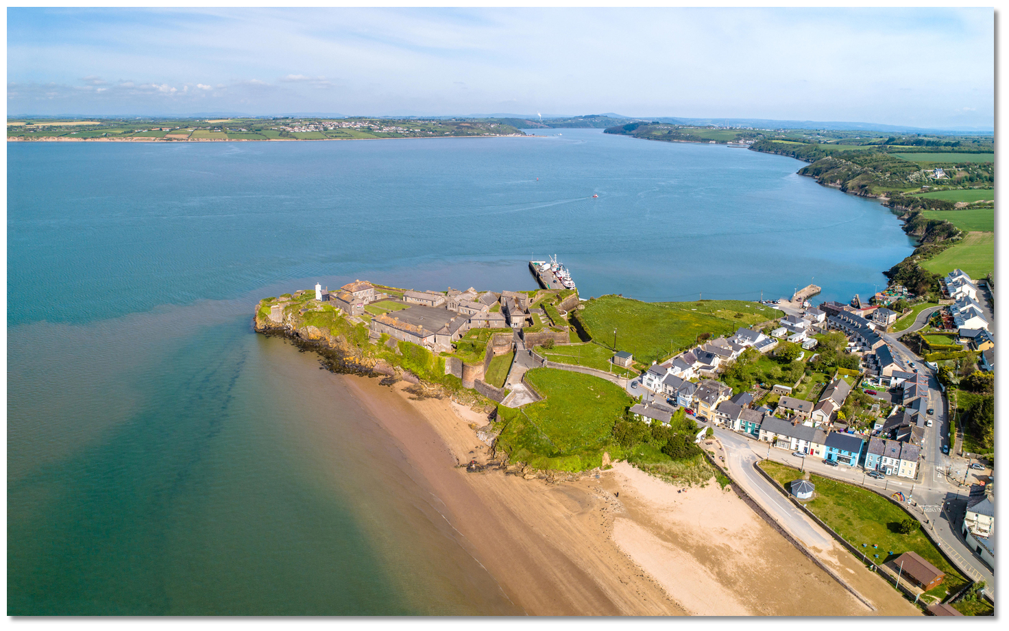
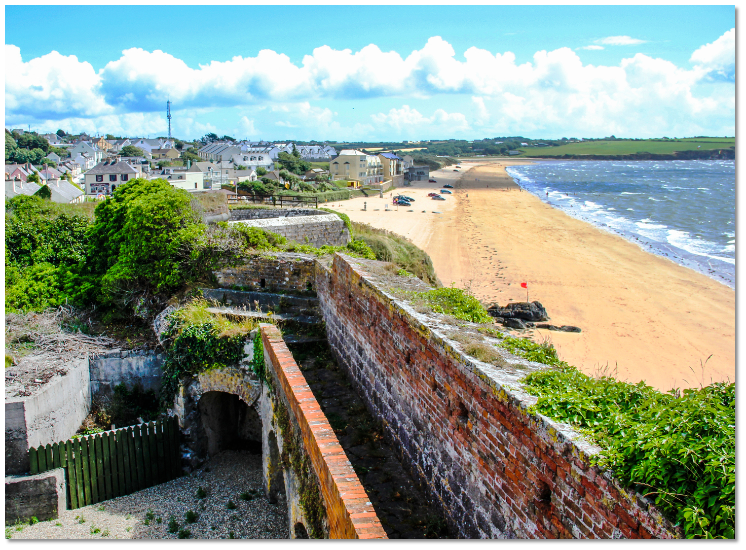
 Duncannon with its conspicuous fort on a rocky promontory
Image: Michael Harpur
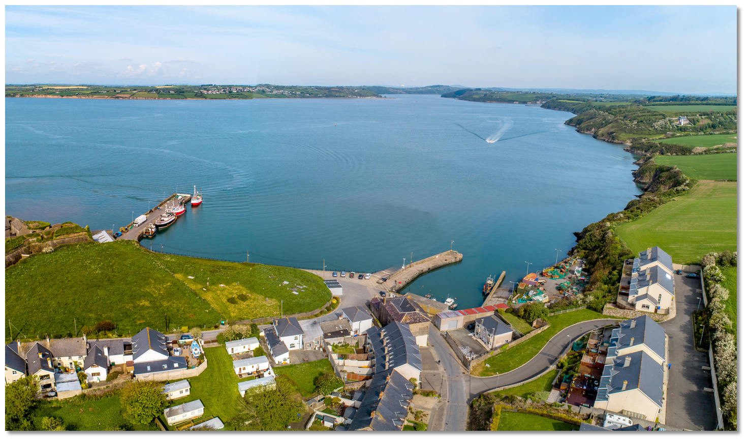
Duncannon is a tourist and fishing village situated on the east bank of the River Suir. The village is made unmistakable by its lofty rocky promontory that juts out into the channel, upon which there is a 16th-century fort. In the corner of the bight, immediately to the northeast of the fort, is a small fishing harbour comprising two piers. The inner pier encloses an old drying dock and the outer is the commercial quay used by fishing boats.
 The commercial quay and old drying dock to the northeast of the fort
Image: Michael Harpur
A vessel visiting Duncannon has several mooring possibilities. Vessels that can take to the mud will find the old drying dock, situated in the northeast corner, offers excellent protection. It has a good sandy bottom to dry upon, while 3 metres will be found at high water.
 The old drying dock
Image: Michael Harpur
The outer, commercial quay offers minimum depths of as little as 0.5 metres on low water springs, but a minimum of 1.5 metres on low water neaps at the very end of the pier. Depending on a vessel’s draught, with a spring 4.7-metre and neap 2.4-metre tidal range added, it provides reasonable pier access most of the time. Fishing vessels have priority access to the commercial quay, so leisure craft should fit any berthing around their operations.
Deep-keel vessels may anchor close north of the quay in 3 to 4 metres. This is not an ideal long-term anchoring point as it is subject to wash, being immediately off the main channel. It also has strong and confused tidal streams that wrap around the headland and is subject to poor holding ground.
How to get in?
 Duncannon
Image: Michael Harpur
 Use the Port of Waterford for details of seaward approaches, entry to Waterford Harbour and the run up the estuary.
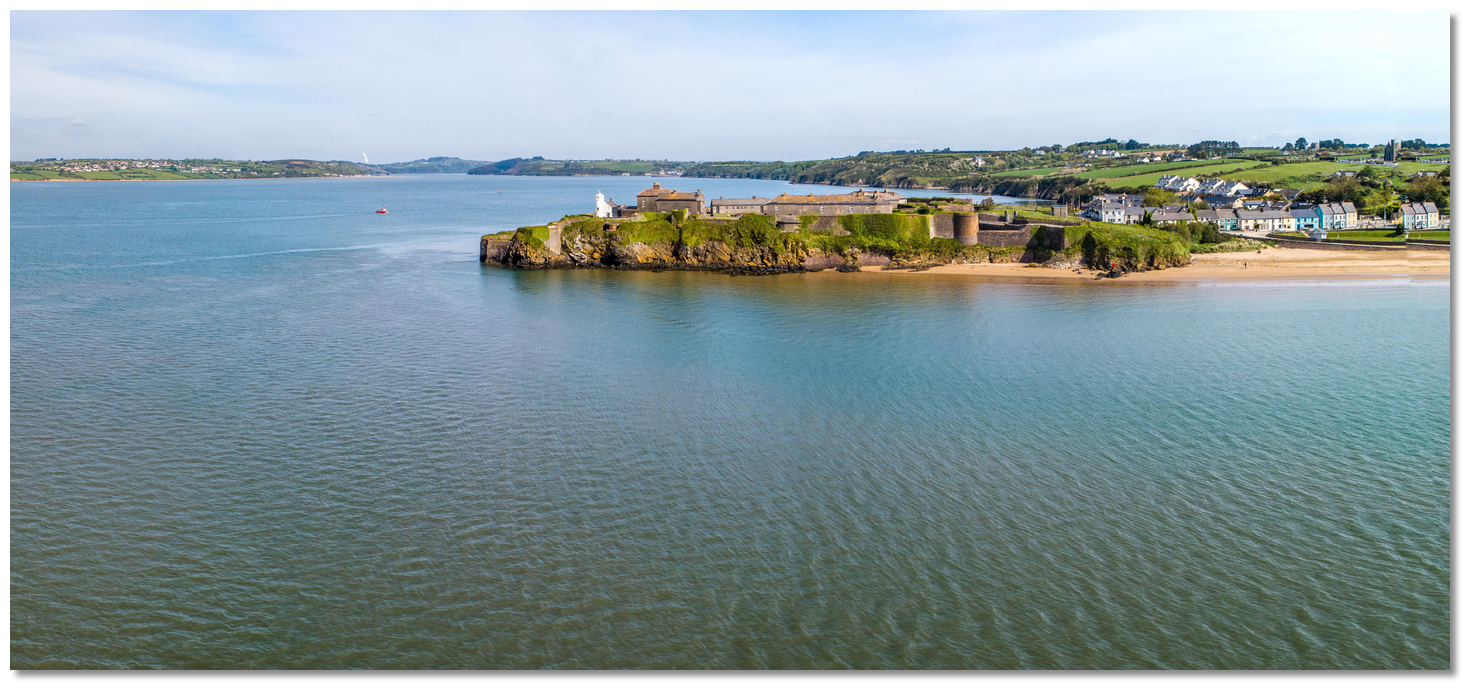 Duncannon’s highly distinctive fort can be seen from the entrance
Image: Michael Harpur
 From the initial fix, set in the middle of the entrance, head northeast for the ‘Waterford’ port marker buoy, then pick up the No.1 and 2 buoys of the fairway and follow the marks up the harbour. Duncannon’s highly distinctive fort on the headland with its prominent white light tower will be visible all the way. At night the tower exhibits a directional light, F WRG 13m 10M, leading up the entrance channel. Duncannon point is steep-to, but the bight close south is filled by a mud flat.
  Duncannon Fort’s Lighthouse, with Hook Head in the background
Image: Michael Harpur
Once past the fort, the wall of the commercial quay will be seen extending northwestward from the north face of the peninsula. Round the head of the pier to address the harbour.
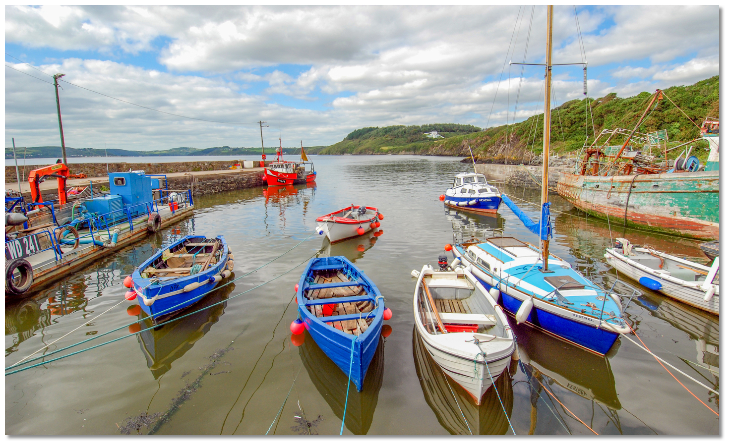
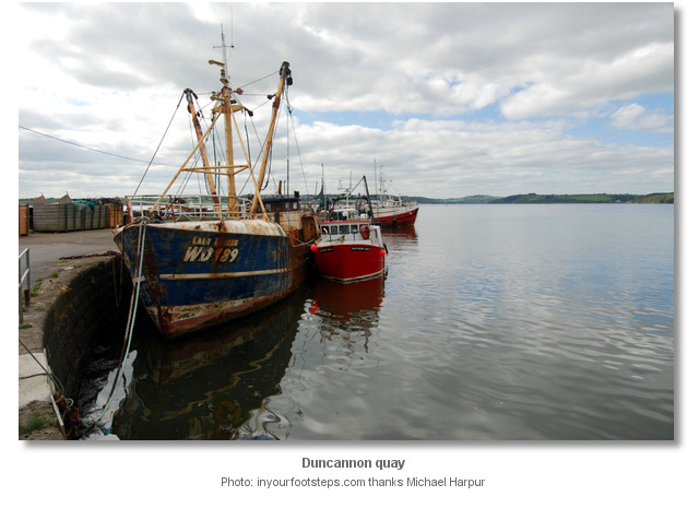
 Duncannon Harbour
Image: Michael Harpur
The old drying harbour is tucked into the northeast corner. A small, privately owned shallow-water pontoon moored just outside the old dock may be a possibility for some craft when the dock is full, but check locally. 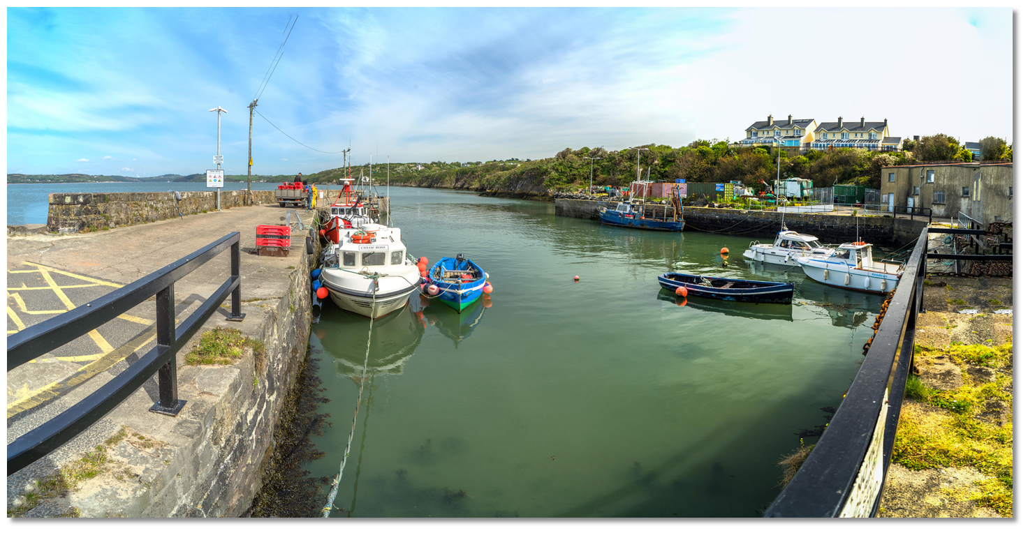 The old drying dock
 Image: Michael Harpur
If coming alongside the commercial quay for a short stay, note that fishing vessels have priority access. Please seek agreement before rafting up to fishing vessels and be ready to move at short notice. The quay suffers from a limited number of stepping points, making it difficult to scale the wall at low water.
 Duncannon as seen from the north, with yachts alongside the commercial quay
Image: Michael Harpur
Deeper-keel vessels may anchor close north of the quay in 3 to 4 metres, and at the public boat slip alongside its pier. This is not an ideal long-term anchoring point as, being just off the main channel, it is subject to wash, has strong and confused tidal streams wrapping around the headland, and has poor holding.
Why visit here?
Duncannon, in Irish Dún Conan, derives its name from the Irish ‘Fort of Conán’, with Conán thought to be the 3rd-century Conán mac Morna of the Fianna. The Fianna were a small, semi-independent warrior band in Irish mythology that featured in the stories of the Fenian Cycle. They were led by mythical hunter-warrior Fionn mac Cumhaill, known in English as Finn McCool or Finn MacCoul. Duncannon Fort, once the site of a Celtic fort and a Norman castle
Image: Michael Harpur
The strategically prominent headland sits on a rocky promontory that juts out into the Waterford harbour channel, whilst overlooking and defending the harbour entrance. As such, it is unsurprising that it retained military importance for 16 centuries after the time of Fianna. It became the site of a Celtic and then Norman fortress, and work on the imposing star-shaped citadel fort that consumes the headland today was commenced by the British in 1588. The construction of Duncannon Fort was motivated by both security and economic concerns, but it was certainly initiated as a defence against the Spanish Armada. The Armada never arrived, but for four centuries the fort was to play a crucial part in the trials and tribulations of the region.
 Sentry’s walk, Duncannon Fort
Image: Marion Coady, Duncannon Fort Trust
During the Irish Confederate Wars (1641-1652), the fort was besieged three times before it was taken by an Irish Confederate army in 1645. During the Cromwellian conquest of Ireland, Oliver Cromwell lay siege to Duncannon in 1649, under which the fort’s Irish garrison held out. After the fall of Waterford, however, the fort and town finally surrendered in July 1650. It was during this siege that Cromwell is reputed to have coined the timeless expression that Waterford would fall “by Hook or by Crooke”, ie, by landing his army at Hook Head or at Crooke, on the opposite, Waterford shore.
 James II fled from the old harbour to Kinsale, from where he went into exile in France
Image: Michael Harpur
Following Cromwell’s successful Irish campaign, Duncannon was designated one of the principal forts of the Kingdom, being described as ‘The Second Fort of the Realm’ and bearing the title ‘The Royal Fort of Duncannon’. In around 1684, armed with more than 30 cannons, Robert Leigh noted of the fortress: “About a mile from Ballihack to the south-east nearer the mouth of the river of Waterford lies the fort of Duncannon, accounted of considerable strength and well manned with a sufficient number of great guns and other armour, and commands the mouth of the river so that no ship can go in or out but shall be called to account by those in the fort.”
 View of the harbour from a Duncannon gun position
Image: Michael Harpur
In 1690 Duncannon Fort hosted two kings of England. Routed from his defeat at the Battle of the Boyne, in the Williamite War in Ireland (1689-91), James II set sail from Duncannon for Kinsale, from where he went into exile in France.
 Depiction of the flight of King James II to France
Image: Public Domain
His son in law and enemy, William of Orange, later marched on the fort to receive its surrender without resistance. Bad weather then delayed his return to England and William stayed at the fort in September 1690 before returning home as the victor. The site where James’s boat departed bears the name King James’ Hole.
 Duncannon Fort’s lighthouse dates back to 1774
Image: Michael Harpur
The fort was one of the few places in County Wexford that did not fall to the rebels during the 1798 rebellion, becoming a sanctuary for fleeing loyalists and troops in south Wexford. It was also used as a prison and place of execution for suspected rebels. The gruesome dungeon, seemingly a munitions store, served as a prison to the young 1798 rebels, who were held in the Croppy Boy cell. The name croppy referred to the closely cropped hair that was the badge of the 1798 rebels, the croppy boys being those aged between 14 and 21. The fashion came from French revolutionaries of the period, who saw the crop cut as anti-wig, hence anti-aristocrat. The croppys were subjected to torture by flogging, picketing and half-hanging, but the reactive contemporary torture pitch-capping was specifically invented to target them. The Croppy Boy is one of the saddest ballads of the rebellion, describing the despair of a doomed young croppy processed in Duncannon Fort.
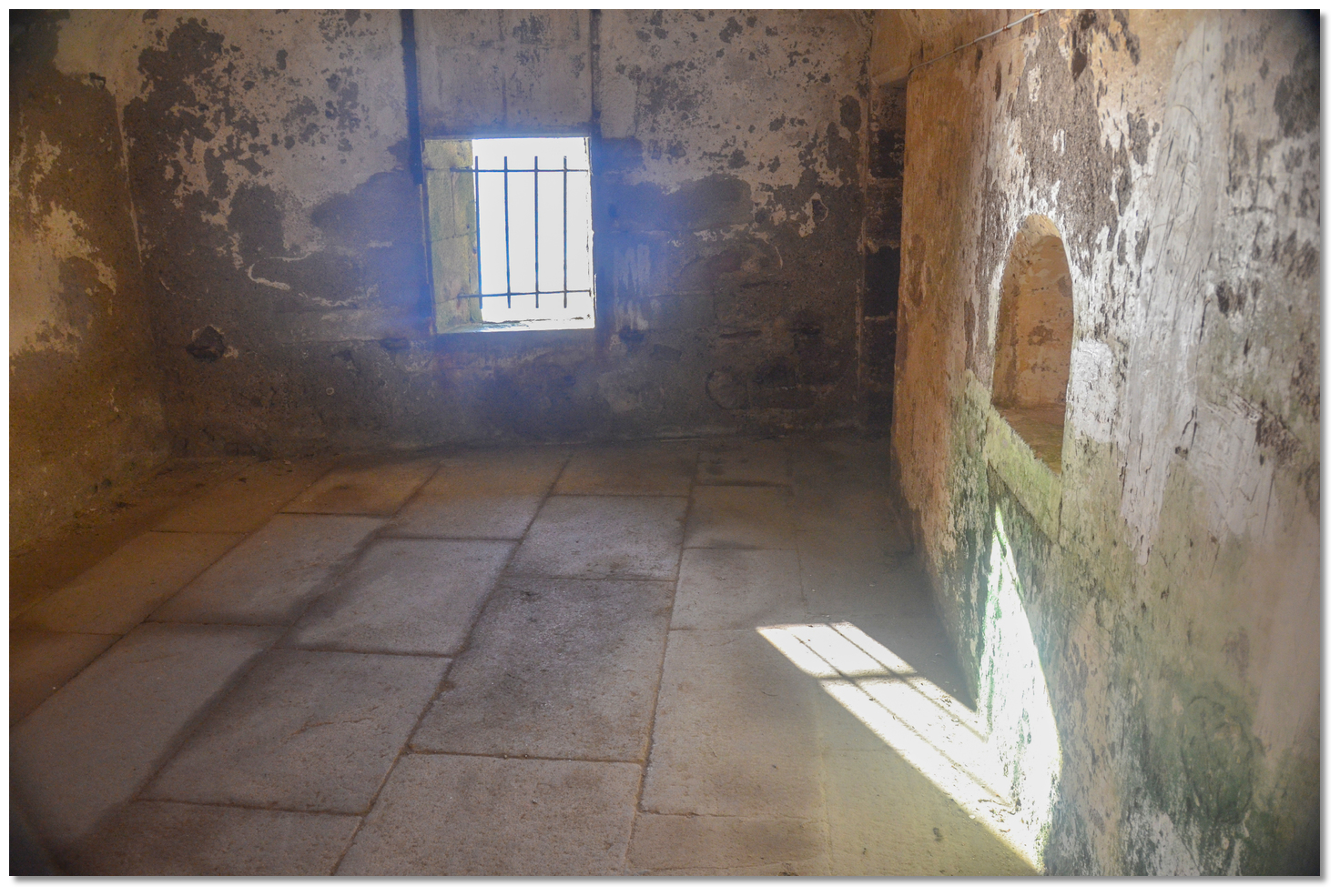 Gun port alongside the Croppy Boy cell
Image: Michael Harpur
During the early years of the 19th century, two Martello towers were built on high ground above the fort. It remained in the control of the British Government until the War of Independence in 1919. In 1922 it was set alight by the old IRA and lay in ruins until the outbreak of World War II. Then it was rebuilt and occupied by the Army, who used it as an observation base during the war. Though its military significance had greatly diminished, it was used as a modest Irish army post mainly for summer training until 1986. In 1993 the Department of Defence handed the fort over to Wexford County Council and it is currently being refurbished by the Duncannon Heritage Group.
 Yacht race under the fort
Image: Michael Harpur
Today the fort is open to visitors seven days a week from June to September and features a café, craft shop, maritime and war museum, craft centre and artist studio. A guided tour around the outer ramparts is a must visit. The inner-facing star-shaped walls are protected by an unusual 10-metre-high dry moat. All the major buildings are arranged around its central parade ground. The white lighthouse, which hosts the harbours leading lights, was constructed in 1774, making it one of the oldest lighthouses of its kind in Ireland. Not only does it look over the fortress’s much-noted dry moat, but also provides spectacular views across the estuary down to Hook Head, over to Creadan Head and up to Passage East.
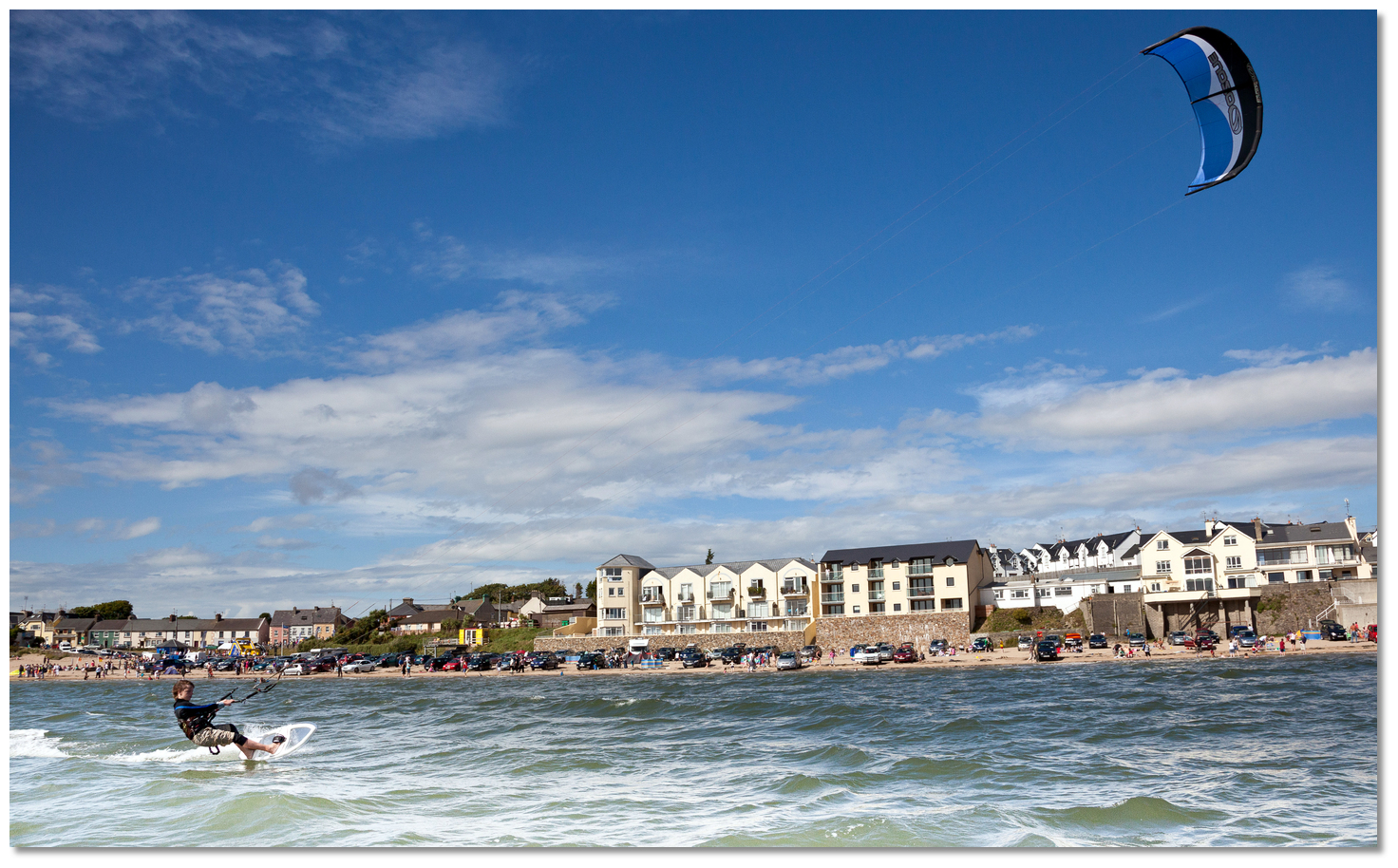 Kitesurfing festival, Duncannon
Image: Tourism Ireland
Today Duncannon is primarily a fishing village, but also relies heavily on tourism. Situated on the very scenic ‘Ring of Hook’ drive, it bustles with life during the summer. Duncannon’s popular mile-long golden beach ‘The Strand’ has Blue Flag status. It is very safe for families and a favourite for kitesurfing, hosting Hooked Kitefest and the Duncannon Sand Sculpting Festival every August. Likewise, it has all the amenities you would expect as a prime tourist destination. However, the village of Duncannon owes its existence to its fortress and military history, making it a stand-out destination for visitors to the area.
What facilities are available?
Duncannon has all the pubs, restaurants and shops that you would expect from a prime tourist destination, all within a short stroll from the quay.Any security concerns?
Never an incident is known to have happened to a visiting yacht in Duncannon. If leaving the vessel unattended, however, make sure it is secure.With thanks to:
John Carroll, Ballyhack, Co.Wexford, Ireland. Photography with thanks to Burke Corbett, Michael Harpur and Marion Coady, Manager, Duncannon Fort Trust.


Aerial overview of Duncannon
The tenor Anthony Kearns sings 'The Croppy Boy'


Add your review or comment:
Please log in to leave a review of this haven.
Please note eOceanic makes no guarantee of the validity of this information, we have not visited this haven and do not have first-hand experience to qualify the data. Although the contributors are vetted by peer review as practised authorities, they are in no way, whatsoever, responsible for the accuracy of their contributions. It is essential that you thoroughly check the accuracy and suitability for your vessel of any waypoints offered in any context plus the precision of your GPS. Any data provided on this page is entirely used at your own risk and you must read our legal page if you view data on this site. Free to use sea charts courtesy of Navionics.