

The anchorage offers good protection from all conditions except those from the northerly quadrants. It can be subject to some swell when its outer fringing rocks, leading out to Doonagaun islet, cover at high water. Access to Scraggane Bay is straightforward in daylight at any stage of the tide.


Keyfacts for Scraggane Bay
Facilities


Nature


Considerations


Protected sectors

Approaches

Shelter
Last modified
April 29th 2022 Summary* Restrictions apply
A good location with straightforward access.Facilities
Nature
Considerations
Position and approaches

Expand to new tab or fullscreen
Haven position
 52° 18.607' N, 010° 1.953' W
This is off the northwest end of Scraggane Bay off the head of the pier.
What is the initial fix?
The following Scraggane Bay initial fix will set up a final approach:
 52° 19.080' N, 010° 1.640' W


What are the key points of the approach?
Offshore details are available in southwestern Ireland’s Coastal Overview for Mizen Head to Loop Head  and Navigating through Magharee Sound south of the Islands for local approaches.
and Navigating through Magharee Sound south of the Islands for local approaches.Not what you need?
Click the 'Next' and 'Previous' buttons to progress through neighbouring havens in a coastal 'clockwise' or 'anti-clockwise' sequence. Below are the ten nearest havens to Scraggane Bay for your convenience.
Ten nearest havens by straight line charted distance and bearing:
- Illauntannig - 1.2 nautical miles NNE
- Castlegregory - 3 nautical miles SSE
- Brandon Bay - 5.3 nautical miles WSW
- Barrow Harbour - 6 nautical miles E
- Fenit Harbour - 6.8 nautical miles ESE
- Dingle Harbour - 13.7 nautical miles SW
- Smerwick Harbour - 15.7 nautical miles WSW
- Kilbaha Bay - 16.7 nautical miles NNE
- Ventry Harbour - 16.9 nautical miles SW
- Kells Bay - 17.2 nautical miles S
These havens are ordered by straight line charted distance and bearing, and can be reordered by compass direction or coastal sequence:
- Illauntannig - 1.2 miles NNE
- Castlegregory - 3 miles SSE
- Brandon Bay - 5.3 miles WSW
- Barrow Harbour - 6 miles E
- Fenit Harbour - 6.8 miles ESE
- Dingle Harbour - 13.7 miles SW
- Smerwick Harbour - 15.7 miles WSW
- Kilbaha Bay - 16.7 miles NNE
- Ventry Harbour - 16.9 miles SW
- Kells Bay - 17.2 miles S

Chart

What's the story here?
 Scraggane Bay
Image: Michael Harpur
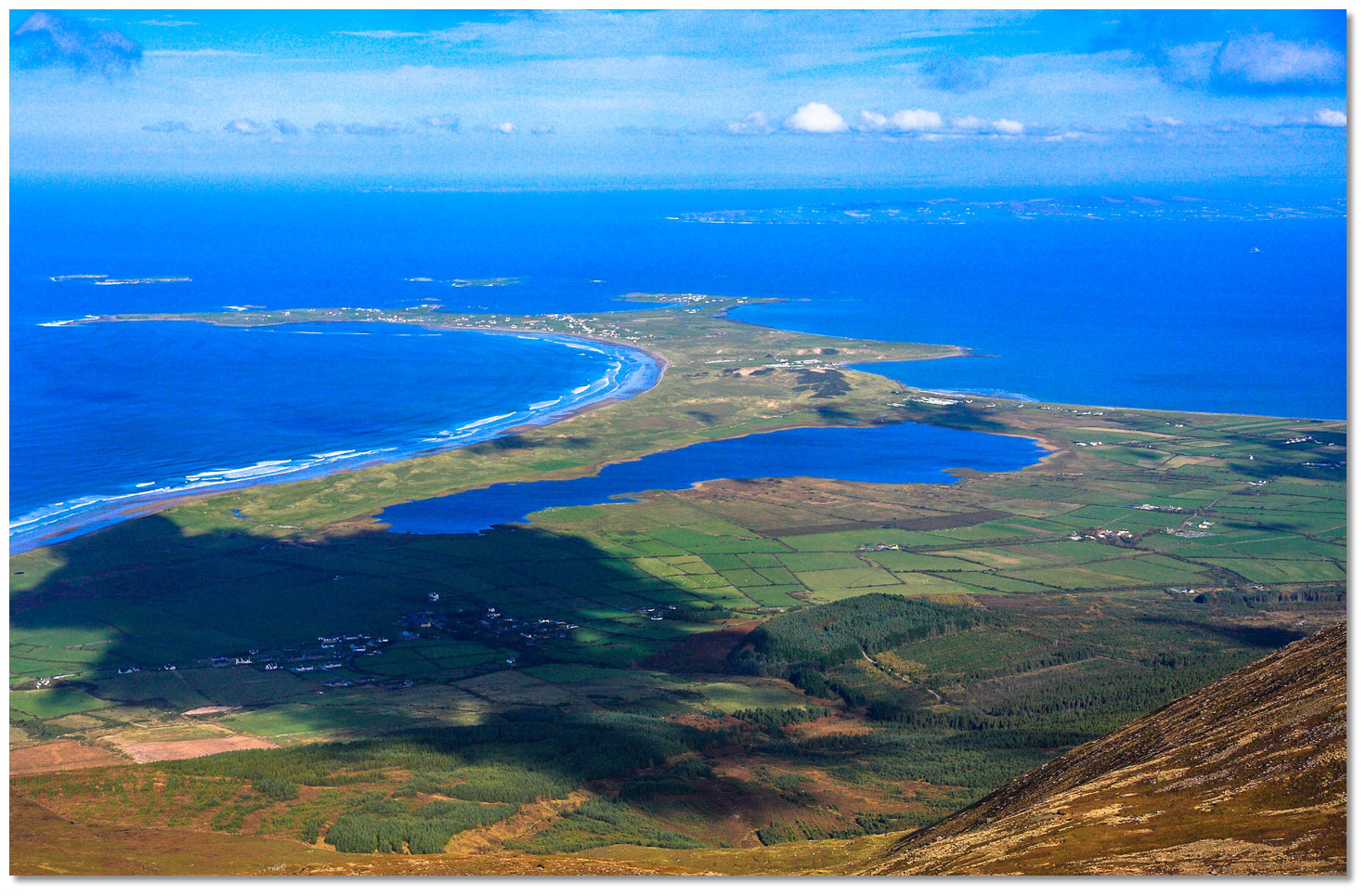
Scraggane Bay is located within a horseshoe-shaped bight at the head of the peninsula that lies directly south of Illauntannig and separates Brandon Bay from Tralee Bay. There is a pier on the west side with two slipways. The small village of Fahamore is located 1km away on the Brandon Bay side of the peninsula.
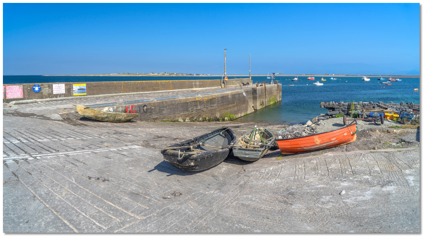
 The two slips and anchorage on the west side of Scraggane Bay
Image: Michael Harpur
The bay offers a good berth in 2 - 3 metres of water east of the pier. The bay's protection is best in southwesterly winds and at its best as close as draught permits to the pier.
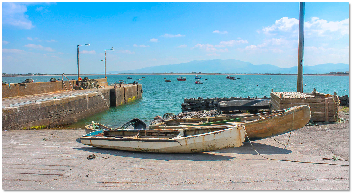
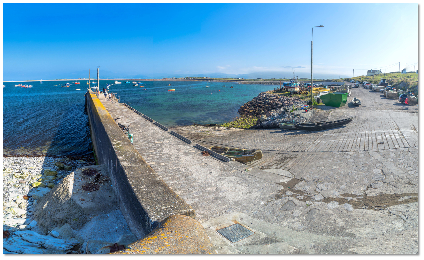 Scraggane Bay Pier
Image: Michael Harpur
Some swell may enter the harbour when the outer rocks, that lie between Scraggane Point and Doonagaun Island, cover at high water. Occasional gusts may also come down from the mountains. But outside of that, it is a very pleasant berth.
How to get in?
 Scraggane Bay at the head of the peninsula separating Brandon Bay from Tralee
Bay
Image: William Glasgow Howe
 Use Ireland’s coastal overview for Mizen Head to Loop Head for seaward approaches and Navigating through Magharee Sound south of the Islands for east/west approaches. This leads to the initial fix positioned close southeast of a line joining Illauntannig and Doonagaun islands where it is safe to break off south for the harbour.
_with_illaunboe_and_illauntannig_(right)_and_doonagaun_in_the_foreground.jpg) Illaunimmil (left) with Illaunboe and Illauntannig (right) and Doonagaun in the
Illaunimmil (left) with Illaunboe and Illauntannig (right) and Doonagaun in theforeground
Image: Michael Harpur
 Vessels approaching from the north can pass between Illaunimmil and the west shore of Illaunboe, situated close northwest of Illauntannig, to connect with the route. The pass between the northern islands is deep, more than a ½ mile wide and clean save for an easily avoided reef that has 0.3 metres LAT of cover extending 300 metres out from the southwest end of Illauntannig.
 The approaches to Scraggane Bay
Image: Michael Harpur
 From the Scraggane Bay initial fix steer south into the bay. The bay is entered between Doonagaun Island, a small island off the north end of Scraggane Point on the west side, and the reefs and shallows that extend about a ⅓ of a mile from Rough Point on the east side.
 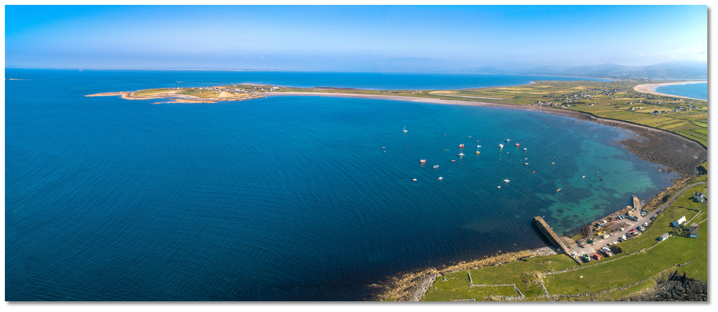 Rough Point has reefs and shallows extending westward
Image: Michael Harpur
Doonagaun Island is low but always visible and Rough Point may be also distinguished by an old telegraph tower standing on the point. Doonagaun Island has deep water close by and it is best to prefer this side of the entrance keeping between 100 and 200 metres off the island upon approach. The entrance is a distance of about a ⅓ of a mile and has more than 7 metres of water.
Once inside the entrance proceed south for ¼ of a mile to anchor outside of the moored fishing vessels.
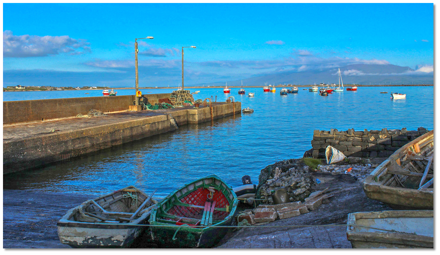
 Anchor off the pier
Image: Michael Harpur
Anchor according to draught and conditions. 2 metres will be found with the pierhead bearing 287° T and the east side of Illauntannig bearing 023° T. 3 metres can be found 150 metres east from the pier and shallower draft vessels will find about 1 metre with swing room just southeast of the pier. 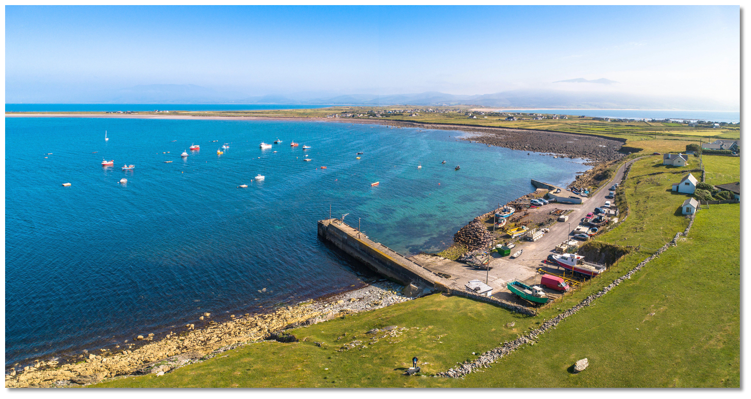 The south southern end of the bay is shallow
Image: Michael Harpur
Continuing further southward of the pier requires a high great degree of care. A reef of large boulders extends from the pier to occupy the southwest corner of the bay. Likewise, a shoal occupies nearly the entire southern half of the bay with a small central part awash in low water springs.
 The slipway inside the pier
Image: Michael Harpur
The pier is best avoided as it is subject to swell and has a foul bottom. Even at the best of times it and its slips are actively used by fishermen mooring and slipping large lobster crates. The lobster crates are generally moored, almost submerged, off the pier and amongst the fishing vessels.
 The new inner slipway
Image: Michael Harpur
There is also a very active dive school operating from the pier so it is not worth the trouble of coming alongside. The harbour makes up for it with a pair of good slips that make for convenient landings but keep an eye out for lobster crates.
Why visit here?
Scraggane Bay, locally 'Scraggies', takes its name from its Irish name 'An Scragán' which appropriately means 'rocky'. Likewise, its local village Fahamore, further in on the wider part of the peninsula, is derived from the Irish 'An Fhaiche Mhór' meaning 'the big green' which is believed to reference the big open space in front of the famous Spillane’s Pub. A Curragh used for fishing
Image: Terry Ballard via CC BY SA 4.0
The bay is a small fishing port that is home to a fleet of about twenty fishing boats. The main local catch consists of lobster, flat-back crab, spider crab, Atlantic crayfish, Atlantic salmon and mackerel. What is particularly unusual here is that nearly all the fishermen use traditional Irish curraghs for trawler tenders and the traditional boats will be seen all around the pier and its slips. This is because the master curragh builder Monty O'Leary is located in Fahamore, busily constructing curraghs, or 'Naomhóg'as they are referred to in Kerry, Cork and Waterford.
 The Curraghs of Ireland from Mariner's Mirror, 1938
Image: CC0
Traditionally the curragh was constructed with ribs made of sally rods with the ends being brought up through holes in a strong gunwale frame. Over the ribs were placed longitudinal pieces of thin deal and this was then covered with canvas or hides. This was all then blackened and made water-tight with bitumen (tar). The ancient boats could be managed with great dexterity as the traditional design provided qualities that are only seen today in modern craft made from advanced technologies. The boat’s natural elasticity enabled a curragh to recoil from a shock that would stove in a heavily structured vessel and their lightness provided such buoyancy that they floated like ducks on the water. Tim Severn tested, and proved possible, the legend that Irish St Brendan discovered America in a curragh almost a millennium before Christopher Columbus.
 Curraghs are the most popular tenders in Scraggane Bay
Image: Terry Ballard via CC BY 2.0
These craft are still in use today but are more likely to have an outer skin of fibreglass to replace the hide. They still look delicate but are surprisingly strong and resilient when used on this, often, rough Atlantic coast. Having the boats constructed in the area has made this bay a centre for curragh enthusiasts and this love of the boats reaches a climax each July. Then the bay hosts a currach racing regatta where currach racing teams from Ireland’s entire western seaboard, from Kerry to Galway, come to compete in the All-Ireland Currach racing series.
 A traditional curragh skinned with a fibreglass on the slip at Scraggane Bay
Image: Michael Harpur
The local economy of the village and bay area is underpinned by tourism through holiday home rentals, pubs and restaurants, particularly for watersport enthusiasts as Scraggane Bay is used extensively for flat water windsurfing. The areas consistent wind and protection from the Atlantic waves makes it sailable in almost any condition, regardless of wind direction. This capability was recently observed by the Sunday Times when it voted it the No.1 windsurfing destination in the World. Scuba diving, sea angling and walking are other popular leisure activities here. Those who enjoy a hike should plan a visit to the 14ft high standing stone with a cross situated in a field at Candiha at the southern end of the bay.
 Dusk at Scraggane Bay
Image: Dwane Doyle via ASA 4.0
From a boating perspective, Scraggane Bay is another interesting and very pleasant anchoring opportunity in this area of outstanding natural beauty. It is the perfect destination should a big high approach, for when the sun shines here, this area looks more like the Caribbean than the west coast of Ireland.
What facilities are available?
There is a water tap on the pier outside a basic but well cared for public lavatory. The small village of Fahamore, at Brandon Bay less than 10 minutes’ walk, has pubs and some basic shopping serving about 50 houses.Any security concerns?
Never an incident known to have occurred in Scraggane Bay.With thanks to:
Mark Murray, Yacht 'Motivator'.

Add your review or comment:
Please log in to leave a review of this haven.
Please note eOceanic makes no guarantee of the validity of this information, we have not visited this haven and do not have first-hand experience to qualify the data. Although the contributors are vetted by peer review as practised authorities, they are in no way, whatsoever, responsible for the accuracy of their contributions. It is essential that you thoroughly check the accuracy and suitability for your vessel of any waypoints offered in any context plus the precision of your GPS. Any data provided on this page is entirely used at your own risk and you must read our legal page if you view data on this site. Free to use sea charts courtesy of Navionics.