_england_DSC07664.jpg)
Hope Cove lies about ten miles southeast of the approaches to Plymouth and a quarter of a mile eastward of Bolt Tail on England's south coast. It offers an anchorage off a small village with a breakwater and slip.
This a tolerable anchorage in settled conditions or moderate winds with an easterly component. Seaward access is straightforward as a central path presents no danger. But a measure of caution is required when anchoring to avoid rocky fingers that extend seaward and an isolated drying rock.
Keyfacts for Hope Cove
Last modified
January 7th 2019 Summary
A tolerable location with attentive navigation required for access.Facilities


Nature


Considerations
Position and approaches
Expand to new tab or fullscreen
Haven position
 50° 14.637' N, 003° 51.787' W
The anchoring area west-southwest of the pierhead.
What is the initial fix?
The following Hope Cove Initial Fix will set up a final approach:
 50° 14.735' N, 003° 51.890' W
 What are the key points of the approach?
Offshore details are available in southwestern England’s coastal overview from Start Point to Lizard Point 

- Steer for the centre of the bay on 130° M untill the old lighthouse can be seen in the southeast corner.
- Adjust on 135° M of the old lighthouse keeping a sharp eye out for the rocks on both sides and anchor on this line-of-baring.
- Confirm the Half Tide Rock is outside of the vessel's swing range.
Not what you need?
Click the 'Next' and 'Previous' buttons to progress through neighbouring havens in a coastal 'clockwise' or 'anti-clockwise' sequence. Below are the ten nearest havens to Hope Cove for your convenience.
Ten nearest havens by straight line charted distance and bearing:
- River Avon - 2.2 nautical miles N
- Salcombe - 3.4 nautical miles ESE
- Starehole Bay - 3.5 nautical miles ESE
- Kingsbridge - 4 nautical miles ENE
- River Erme - 5.1 nautical miles NW
- Hallsands - 7.9 nautical miles E
- River Yealm - 8.3 nautical miles WNW
- Plymouth Harbour - 12.7 nautical miles NW
- Dartmouth Harbour - 12.9 nautical miles ENE
- Dittisham & The River Dart - 13.2 nautical miles NE
These havens are ordered by straight line charted distance and bearing, and can be reordered by compass direction or coastal sequence:
- River Avon - 2.2 miles N
- Salcombe - 3.4 miles ESE
- Starehole Bay - 3.5 miles ESE
- Kingsbridge - 4 miles ENE
- River Erme - 5.1 miles NW
- Hallsands - 7.9 miles E
- River Yealm - 8.3 miles WNW
- Plymouth Harbour - 12.7 miles NW
- Dartmouth Harbour - 12.9 miles ENE
- Dittisham & The River Dart - 13.2 miles NE
What's the story here?
 Hope Cove
Image: Michael Harpur
Hope Cove lies in the southeast corner of Bigbury Bay which stretches between Bolt Tail and Stoke Point, 6½ miles west-northwest. Bolt Tail rises to a height of 87 metres and the coast then falls back eastward from the promontory before turning northward, all the time high, rocky and precipitous. Tucked into this protective corner, a ¼ mile within Bolt Tail, is the small seaside village of Hope Cove with a breakwater, boat slip, and two sandy beaches at its head.
This is a traditional anchorage for vessels confronted by northeasterly winds whilst making their way up the channel. It affords a safe anchorage only with offshore winds but the holding-ground is not the best. Admiralty chart 1613 ‘Eddystone Rocks to Berry Head’ at a scale of 1:75,000 is the best available survey so a high degree of eyeball pilotage will be required.
How to get in?
 Hope Cove is readily identified by Bolt Tail
Image: Michael Harpur
 Use southwestern England’s coastal overview from Start Point to Lizard Point
  for seaward approaches. The prominent seamark of Bolt Tail that rises to a height of 87 metres about a ⅓ of a mile within its extremity makes the location of the bay unmistakable. Follow the Bolt head promontory keeping at least 200 metres from the shore which clears all dangers.
  Principal danger of the cove as seen at low water
Image: Michael Harpur
Steer for the centre of the bay on 130° M and then, when the old lifeboat house can be picked out in the southeast corner of the cove, align on a bearing of 135°M of it. This keeps a vessel off the principal hazards which are:
- (i) To the southwest, the Half Tide Rock that lies about 100 metres off the southern shore and dries to 2.5 metres.
- (ii) To the northeast, a 45 metres rock tail that extends from Shippen and the Barney Bank.
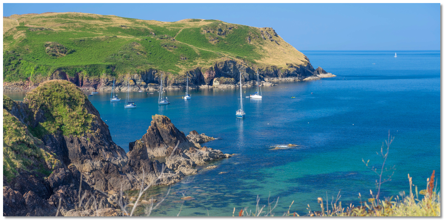 The rocky finger extending from Shippen
Image: Michael Harpur
 Anchor according to draft anywhere along the 135° M of the old lighthouse clear of local moorings. The cove is subject to poor holding so make certain the anchor is well tested. Likewise, those anchoring in the vicinity of Half Tide Rock should make sure it has been sited and can be confirmed to be outside the scope of the swing range.
  Yachts anchored outside the harbour
Image: Michael Harpur
Land by tender on the Harbour Beach.
Why visit here?
Hope Cove's name is believed to derive from the Old Norse word ‘hóp’ meaning ‘bay’ or ‘small inlet’. The headlands of Bolt Head and Bolt Tail were recorded as ‘Boltesberie’ and ‘Boteberie’ in Domesday with their present names first recorded in the 16th-century. The Bolt, is presumed to be the stretch of high coastland between the two.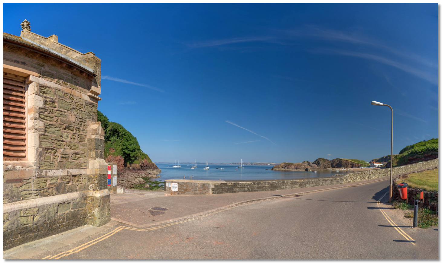 The old lifeboat house overlooking the Cove from the southeast corner
Image: Michael Harpur
History of inhabitation runs deep on this useful promontory, as evidenced by the Palaeolithic handaxe recovered from Outer Hope, and flint tools that have been discovered here dating from the late Mesolithic, 6000 BC to 4000BC, and also the Neolithic period, 4000 to 2200BC. Almost ten barrows close southwest of Hope Cove, form part of two round barrow cemeteries that date to the Bronze age. The area's primary feature comes from the Iron Age in the form of an Iron Age promontory fort located to the west of Hope Cove.
It was the southernmost element of the Bigbury Bay coastal complex of Iron Age forts. The defensive enclosure used a single rampart, believed to have been 20 feet thick and 16 feet high with an outer ditch, that ran 260 metres across the headland to defend, or restrict access to, Bolt Tail. Called the Bolt Tail Camp it is today designated as a Scheduled Monument. Two other forts were sited above the mouths of the estuaries of the Erne and Avon, that offered safe haven to vessels.
 Hope Cove as seen from Outer Hope
Image: Michael Harpur
The only Spanish ship to be wrecked in England, as distinct from Scotland and Ireland, broke up in the middle of Hope Cove. THis was the San Pedro El Mayor which served as a hospital ship carrying a crew of 30 sailors and 100 soldiers. After coming off worst for wear from those first skirmishes with the English fleet in the channel the ship attempted to escape pursuing English warships and reach Cadiz by undertaking an unfortunate circumnavigation of the British Isles. Sadly she had to return back to where she had started three months previously, off Plymouth, in terrible shape having being battered by gales almost all the way.
 The only Spanish Armada shipwrecked in England was in Hope Cove
Image: Public Domain
Without the remaining strength to fight off another south-westerly gale that blew her into Bigbury Bay the ship steered her final course into Hope Cove on the 6 November 1558. Running up on the Barney Bank she soon broke up and sank. As the prisoners later retold the ship was unseaworthy and was driven ashore and wrecked at a place called Hope Cove. 158 survivors came ashore thinking themselves lucky to be alive, and they watched in a sad cluster as the looting and pillaging began. They were soon rounded up, separated by rank and imprisoned. Narrowly avoiding being hanged, they suffered hideous conditions for years before some managed to secure a ransom that allowed them to make it back to Spain.
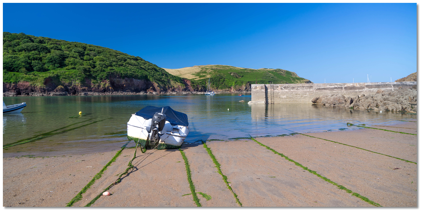 Local boat Hope Cove
Image: Michael Harpur
Hope Cove was home to a small fishing community at this time to which Pilchard fishing was particularly important. At the end of the summer, great shoals of pilchards, the mature sardine, arrived off the South Devon coast and ‘offered themselves to the fishers’ nets’. The Hope Cove men were highly skilled and it was recorded that in 1583, 900,000 pilchards were caught by just five Hope Cove men.
The income of Hope Cove’s local fishing community would be heavily supplemented by smuggling in the 18th century which is generally regarded as the golden age of smuggling. High customs and excise duties on imports, such as tea, tobacco, wine or spirits, made smuggling highly lucrative. With only a handful of Customs officers based between Plymouth and Dartmouth, the remote community of Hope Cove was more than ready to run the risks associated with the illegal practice.
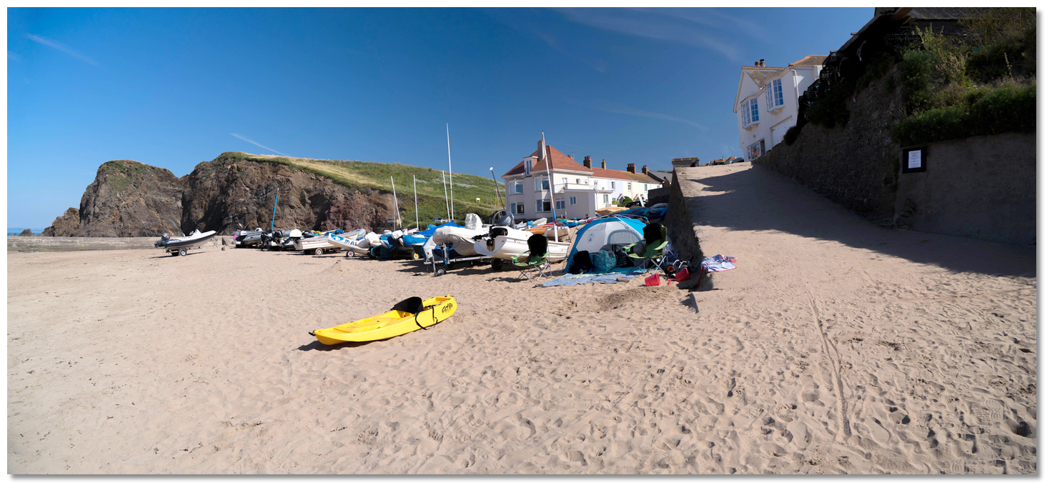 Harbour Beach
Image: Michael Harpur
Euphemistically called ‘free-trade’, it was in truth a rough, vile trade and in 1785 a customs officer was murdered by smugglers at Hope Cove. They threw him over a cliff and the perpetrators got away with it as the community would not say who was behind it. Three years later, Hope Cove was the scene of further violence when, in May 1788, two customs men were savagely assaulted by smugglers and were lucky to escape alive. The perpetrators were later captured in Teignmouth in this case. As late as 1823, much later than the practice had been halted elsewhere, it was still continuing on an industrial scale in Hope Cove. Then eighteen fishermen’s wives from Hope were imprisoned in Exeter gaol having assaulted a coast guard officer. He had interrupted them getting their donkeys ready to carry contraband inland. They were no shrinking violets and on their release, it is said that the women returned to Hope Cove with the prison’s copper kettles.
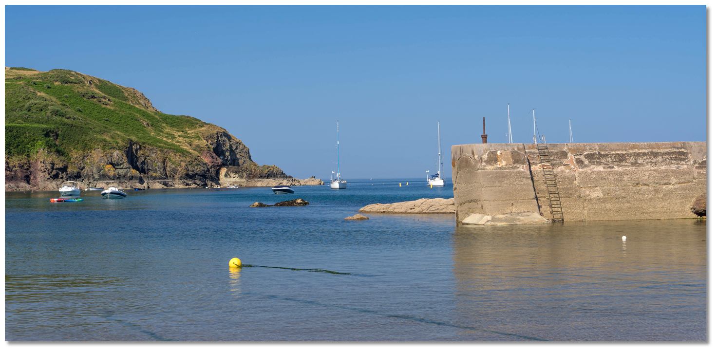 Yachts anchored off the pier Hope Cove
Image: Michael Harpur
Nowadays the village has thankfully become a respectable place where folk who have made their money by fair means like to retire to by the sea. Set into the South Devon Area of Outstanding Natural Beauty, Hope Cove is a very attractive proposition as the picture-perfect village has charming thatched cottages, clean sandy beaches and a peaceful, relaxed atmosphere. There are two pubs in the cove, the Hope Inn and the Anchor Inn and a post office, and wonderful walks to explore.
 Thatched Cottages Inner Hope
Image: Nilfanion via CC BY-SA 2.0
As is the case with any beach in the southwest, land on a beach and turn left or right and you’ll be on the South West Coastal Path with 630 miles of amazing scenery to experience. This is particularly good at Hope Cove with a circular walk following the towering cliffs with stunning sea views through to winding green lanes. Alternatively, one can kick back and enjoy live music at The Cove Cafe Bar or a cream tea at The Cottage Hotel.
 The cove offers safe family bathing
Image: Michael Harpur
From a boating point of view, Hope Cove and Chesil Bay are the traditional weather wait locations for vessels confronted by easterlies or north-easterlies when working their way 'up Channel'. In the days of commercial sail, dozens of vessels would be found off Hope Cove waiting for a favourable wind shift so they may continue on their way, and this still applies today. But in settled conditions, it also makes a delightful anchorage and especially so for boats with family aboard. With seasonal lifeguards and water quality designated as excellent, Hope Cove’s beaches are great for families to visit.
What facilities are available?
There are two pubs in the cove, Hope Inn and Anchor Inn and a post office. The cove is served by local buses.With thanks to:
eOceanic_england_Jason Ballard.jpg)
Hope Cove, Devon, England
Image: eOceanic thanks Jason Ballard
_england_DSC07628.jpg)
Hope Cove, Devon, England
Image: eOceanic thanks Michael Harpur
_england_DSC07613.jpg)
Yachts anchored outside the harbour as seen at low water
Image: eOceanic thanks Michael Harpur
_england_DSC07426.jpg)
Anchored yachts seen over the concrete breakwater linking the Barney Bank to the
shore
Image: eOceanic thanks Michael Harpur
_england_DSC07649.jpg)
Local boats at low water
Image: eOceanic thanks Michael Harpur
_england_DSC07607.jpg)
Harbour Beach at low water
Image: eOceanic thanks Michael Harpur
_england_DSC07709.jpg)
Mouthwell Sands beach
Image: eOceanic thanks Michael Harpur
_england_DSC07526.jpg)
Inner Hope thatched cottage
Image: eOceanic thanks Michael Harpur
_england_DSC07659.jpg)
Pubs at Outer Hope
Image: eOceanic thanks Michael Harpur
About Hope Cove
Hope Cove's name is believed to derive from the Old Norse word ‘hóp’ meaning ‘bay’ or ‘small inlet’. The headlands of Bolt Head and Bolt Tail were recorded as ‘Boltesberie’ and ‘Boteberie’ in Domesday with their present names first recorded in the 16th-century. The Bolt, is presumed to be the stretch of high coastland between the two.
 The old lifeboat house overlooking the Cove from the southeast corner
Image: Michael Harpur
History of inhabitation runs deep on this useful promontory, as evidenced by the Palaeolithic handaxe recovered from Outer Hope, and flint tools that have been discovered here dating from the late Mesolithic, 6000 BC to 4000BC, and also the Neolithic period, 4000 to 2200BC. Almost ten barrows close southwest of Hope Cove, form part of two round barrow cemeteries that date to the Bronze age. The area's primary feature comes from the Iron Age in the form of an Iron Age promontory fort located to the west of Hope Cove.
It was the southernmost element of the Bigbury Bay coastal complex of Iron Age forts. The defensive enclosure used a single rampart, believed to have been 20 feet thick and 16 feet high with an outer ditch, that ran 260 metres across the headland to defend, or restrict access to, Bolt Tail. Called the Bolt Tail Camp it is today designated as a Scheduled Monument. Two other forts were sited above the mouths of the estuaries of the Erne and Avon, that offered safe haven to vessels.
 Hope Cove as seen from Outer Hope
Image: Michael Harpur
The only Spanish ship to be wrecked in England, as distinct from Scotland and Ireland, broke up in the middle of Hope Cove. THis was the San Pedro El Mayor which served as a hospital ship carrying a crew of 30 sailors and 100 soldiers. After coming off worst for wear from those first skirmishes with the English fleet in the channel the ship attempted to escape pursuing English warships and reach Cadiz by undertaking an unfortunate circumnavigation of the British Isles. Sadly she had to return back to where she had started three months previously, off Plymouth, in terrible shape having being battered by gales almost all the way.
 The only Spanish Armada shipwrecked in England was in Hope Cove
Image: Public Domain
Without the remaining strength to fight off another south-westerly gale that blew her into Bigbury Bay the ship steered her final course into Hope Cove on the 6 November 1558. Running up on the Barney Bank she soon broke up and sank. As the prisoners later retold the ship was unseaworthy and was driven ashore and wrecked at a place called Hope Cove. 158 survivors came ashore thinking themselves lucky to be alive, and they watched in a sad cluster as the looting and pillaging began. They were soon rounded up, separated by rank and imprisoned. Narrowly avoiding being hanged, they suffered hideous conditions for years before some managed to secure a ransom that allowed them to make it back to Spain.
 Local boat Hope Cove
Image: Michael Harpur
Hope Cove was home to a small fishing community at this time to which Pilchard fishing was particularly important. At the end of the summer, great shoals of pilchards, the mature sardine, arrived off the South Devon coast and ‘offered themselves to the fishers’ nets’. The Hope Cove men were highly skilled and it was recorded that in 1583, 900,000 pilchards were caught by just five Hope Cove men.
The income of Hope Cove’s local fishing community would be heavily supplemented by smuggling in the 18th century which is generally regarded as the golden age of smuggling. High customs and excise duties on imports, such as tea, tobacco, wine or spirits, made smuggling highly lucrative. With only a handful of Customs officers based between Plymouth and Dartmouth, the remote community of Hope Cove was more than ready to run the risks associated with the illegal practice.
 Harbour Beach
Image: Michael Harpur
Euphemistically called ‘free-trade’, it was in truth a rough, vile trade and in 1785 a customs officer was murdered by smugglers at Hope Cove. They threw him over a cliff and the perpetrators got away with it as the community would not say who was behind it. Three years later, Hope Cove was the scene of further violence when, in May 1788, two customs men were savagely assaulted by smugglers and were lucky to escape alive. The perpetrators were later captured in Teignmouth in this case. As late as 1823, much later than the practice had been halted elsewhere, it was still continuing on an industrial scale in Hope Cove. Then eighteen fishermen’s wives from Hope were imprisoned in Exeter gaol having assaulted a coast guard officer. He had interrupted them getting their donkeys ready to carry contraband inland. They were no shrinking violets and on their release, it is said that the women returned to Hope Cove with the prison’s copper kettles.
 Yachts anchored off the pier Hope Cove
Image: Michael Harpur
Nowadays the village has thankfully become a respectable place where folk who have made their money by fair means like to retire to by the sea. Set into the South Devon Area of Outstanding Natural Beauty, Hope Cove is a very attractive proposition as the picture-perfect village has charming thatched cottages, clean sandy beaches and a peaceful, relaxed atmosphere. There are two pubs in the cove, the Hope Inn and the Anchor Inn and a post office, and wonderful walks to explore.
 Thatched Cottages Inner Hope
Image: Nilfanion via CC BY-SA 2.0
As is the case with any beach in the southwest, land on a beach and turn left or right and you’ll be on the South West Coastal Path with 630 miles of amazing scenery to experience. This is particularly good at Hope Cove with a circular walk following the towering cliffs with stunning sea views through to winding green lanes. Alternatively, one can kick back and enjoy live music at The Cove Cafe Bar or a cream tea at The Cottage Hotel.
 The cove offers safe family bathing
Image: Michael Harpur
From a boating point of view, Hope Cove and Chesil Bay are the traditional weather wait locations for vessels confronted by easterlies or north-easterlies when working their way 'up Channel'. In the days of commercial sail, dozens of vessels would be found off Hope Cove waiting for a favourable wind shift so they may continue on their way, and this still applies today. But in settled conditions, it also makes a delightful anchorage and especially so for boats with family aboard. With seasonal lifeguards and water quality designated as excellent, Hope Cove’s beaches are great for families to visit.
Other options in this area
Click the 'Next' and 'Previous' buttons to progress through neighbouring havens in a coastal 'clockwise' or 'anti-clockwise' sequence. Alternatively here are the ten nearest havens available in picture view:
Coastal clockwise:
River Avon - 1.3 miles NRiver Erme - 3.2 miles NW
River Yealm - 5.2 miles WNW
Plymouth Harbour - 7.9 miles NW
River Tamar & Tributaries - 8.5 miles WNW
Coastal anti-clockwise:
Starehole Bay - 2.2 miles ESESalcombe - 2.1 miles ESE
Kingsbridge - 2.5 miles ENE
Hallsands - 4.9 miles E
Dittisham & The River Dart - 8.2 miles NE
Navigational pictures
These additional images feature in the 'How to get in' section of our detailed view for Hope Cove.


| Detail view | Off |
| Picture view | On |
Add your review or comment:
Please log in to leave a review of this haven.
Please note eOceanic makes no guarantee of the validity of this information, we have not visited this haven and do not have first-hand experience to qualify the data. Although the contributors are vetted by peer review as practised authorities, they are in no way, whatsoever, responsible for the accuracy of their contributions. It is essential that you thoroughly check the accuracy and suitability for your vessel of any waypoints offered in any context plus the precision of your GPS. Any data provided on this page is entirely used at your own risk and you must read our legal page if you view data on this site. Free to use sea charts courtesy of Navionics.


