Nested in the northeast corner of the bay and tucked in around an island the harbour offers good protection. Access is straightforward at any state of the tide but with the benefit of daylight when all its alignments and islets are visible.
Keyfacts for Ballycrovane Harbour
Facilities

Nature


Considerations


Protected sectors
Approaches


Shelter


Last modified
February 12th 2022 Summary
A good location with attentive navigation required for access.Facilities

Nature


Considerations


Position and approaches
Expand to new tab or fullscreen
Haven position
 51° 42.751' N, 009° 57.300' W
this is the position at the anchorage in Ballycrovane Harbour
What is the initial fix?
The following Kilmakilloge Harbour initial fix will set up a final approach:
 51° 41.209' N, 010° 3.548' W
 What are the key points of the approach?
Offshore details are available in southwestern Ireland’s Coastal Overview for Mizen Head to Loop Head  .
.
 .
.- The astern alignment 238° T, of The Bull and the northwest side of Cod's Head leads into the south Inishfarnard clear of all the outer dangers of Coulagh Bay.
- Then steer to pass midway between Reen Point and Eyeries Island.
- Give the red beacon on Illaunnameanla a sensible berth when passing in.
Not what you need?
Click the 'Next' and 'Previous' buttons to progress through neighbouring havens in a coastal 'clockwise' or 'anti-clockwise' sequence. Below are the ten nearest havens to Ballycrovane Harbour for your convenience.
Ten nearest havens by straight line charted distance and bearing:
- Ardgroom Harbour - 3.8 nautical miles NE
- Castletownbere (Castletown Bearhaven) - 4.2 nautical miles SSE
- Mill Cove - 4.8 nautical miles SE
- Dunboy Bay & Traillaun Harbour - 4.8 nautical miles SSE
- West Cove - 5 nautical miles NW
- Kilmakilloge Harbour - 5.4 nautical miles NE
- Sneem Harbour - 6.2 nautical miles NNE
- Lawrence Cove - 6.7 nautical miles SE
- Lonehort Harbour - 7.4 nautical miles SE
- Darrynane Harbour - 7.8 nautical miles WNW
These havens are ordered by straight line charted distance and bearing, and can be reordered by compass direction or coastal sequence:
- Ardgroom Harbour - 3.8 miles NE
- Castletownbere (Castletown Bearhaven) - 4.2 miles SSE
- Mill Cove - 4.8 miles SE
- Dunboy Bay & Traillaun Harbour - 4.8 miles SSE
- West Cove - 5 miles NW
- Kilmakilloge Harbour - 5.4 miles NE
- Sneem Harbour - 6.2 miles NNE
- Lawrence Cove - 6.7 miles SE
- Lonehort Harbour - 7.4 miles SE
- Darrynane Harbour - 7.8 miles WNW
Chart
What's the story here?
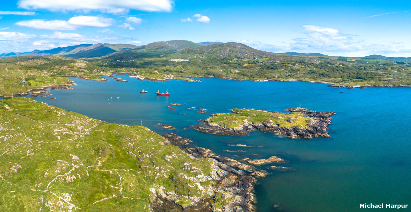
 Ballycrovane Harbour as seen from westward
Image: Michael Harpur
Ballycrovane Harbour is located on the north side of the Beara Peninsula which separates Bantry Bay from the Kenmare River. It is set into a niche in the eastern head of Coulagh Bay about 6 miles east by northeast of Cod’s Head. The small harbour is entered between an islet and the mainland on the north side and a rock off the southern shore. It contains an area of about 180 metres wide and 270 metres long and has a small quay with a slip at its head which is busy with local fishing boats.
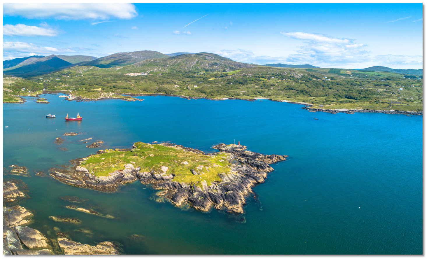
 Ballycrovane Harbour as seen from the east
Image: Michael Harpur
Ballycrovane Harbour offers Coulagh Bay's only sheltered anchorage which, otherwise, is a dangerous body of water that is exposed to winds from the west. The anchorage can be taken in depths of 3.7 to 9.1 metres in the middle of the harbour over stiff mud but be careful of kelp.
 Ballycrovane Quay set into an inlet in the back of the harbour
Image: Michael Harpur
A 50 metres wide fairway leads to the pier in the northeast corner of the bay and 2 metres will be found at its outer end.
 Local fishing boats alongside the Ballycrovane Harbour's quay
Image: Michael Harpur
It may be possible to temporarily alongside but do not impede harbour activity as, despite the out-of-the-way feeling, the working space is much used by fishing vessels.
How to get in?
 The approaches to Ballycrovane Harbour through Coulagh Bay
Image: Michael Harpur
 Use Ireland’s coastal overview for Mizen Head to Loop Head
  for seaward approaches. Ballycrovane Harbour is entered through Coulagh Bay that is a large open bay with rocky shores on the south shore of Kenmare River. Its rocky shores, backed by high mountain ranges, terminate to the northwest in the green island of Inishfarnard, 45.1 metres high, and Cod Head marks the southern point of the bay. Coulagh Bay opens into view upon rounding Cod Head.
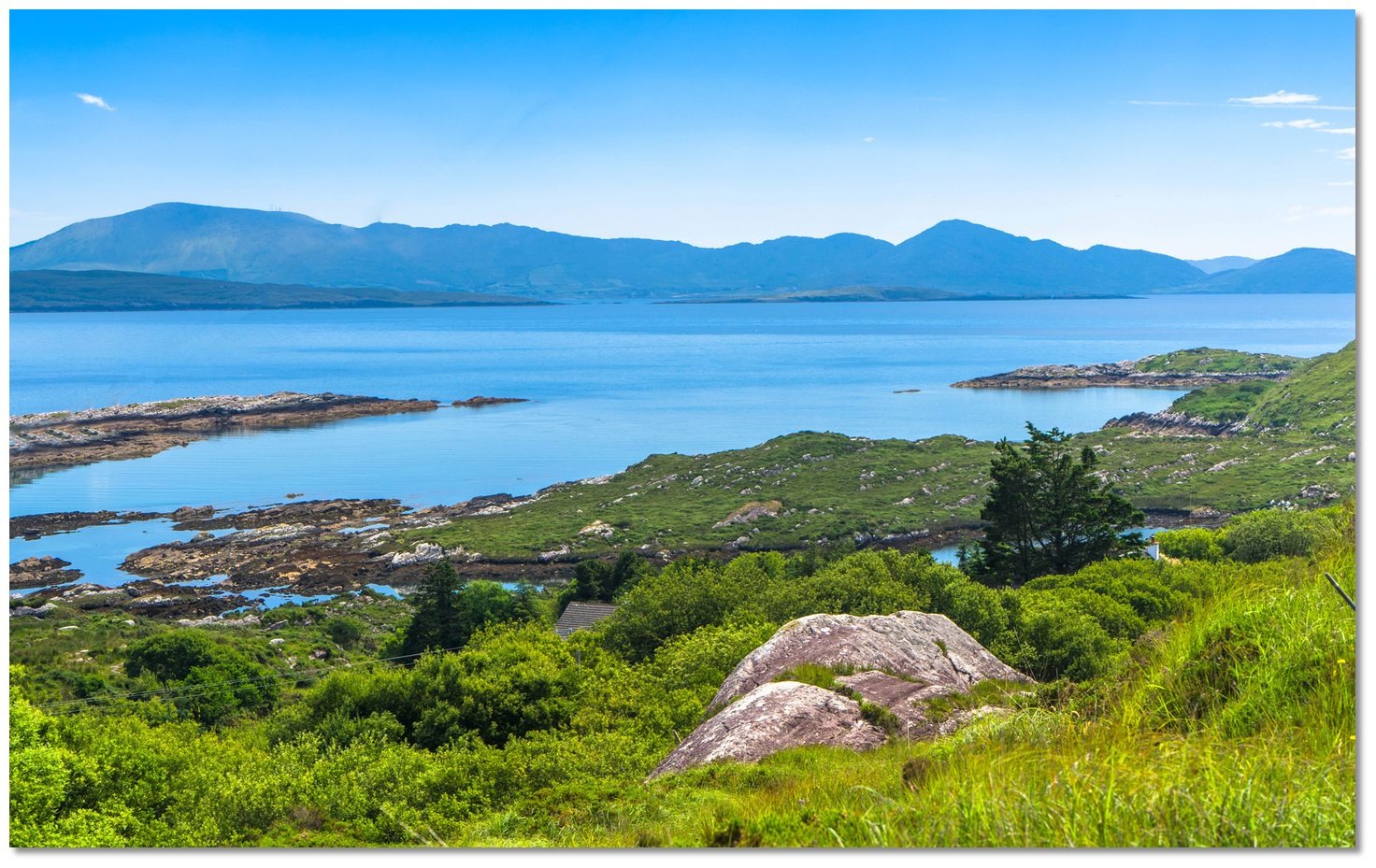
 Inishfarnard and Kilcatherine Point as seen from the north shore
Image: Michael Harpur
 The Ballycrovane Harbour Initial Fix is set about midway between Reenmore Point and Stickeen Rock. It is on the astern alignment 238° T, of The Bull and the northwest side of Cod's Head. This leads northeastward clear of all the outer dangers of Coulagh Bay into the south Inishfarnard.
 Coulagh Bay as seen from the southwest with breakers on Carrigeel and Stickeen
rocks
Image: Upupa4me via CC BY-SA 3.0
These include all the dangers on the south side from Carrigeel, drying to 2.4 metres, to Eyeries Island. This part of the bay is covered with dangerous outlying rocks, which are seldom free from breakers. Bulligmore, with 2.1 metres of cover, is one of the outermost of these, and a patch of 4.6 metres beyond it that breaks in gales, stretches halfway across the bay towards Inishfarnard.
Stickeen Rock, with 1.8 metres of water, is the outer danger on the north side of this line of approach. It lies just over a ½ mile southwestward of Inishfarnard. About midway between it and the Inishfarnard is Bulligabridane that dries to 1.2 metres.
South of the summit of Inishfarnard the course turns onto 081° T (R261°) for the final 2¼ miles into Ballycrovane Harbour. This passes to the south of the mainlands Kilcatherine Point and Reen Point. South of Kilcatherine Point and to the east of Inishfarnad Island, there is a large fish farm installation that it is best to steer well clear of.
 Eyeries Island and Reen Point
 Image: Michael Harpur
Proceeding in this part of the bay leaders between Reen Point and 4 metres high grass-topped Eyeries Island ½ a mile southwestward of the former. Eyeries Island has rocks around that step out to a distance of 300 metres.
 Trawler passing in between Eyeries Island and Reen Point
Image: Michael Harpur
Simply steering to pass midway between Reen Point and Eyeries Island may be a more convenient option. There is ample water and the charted track of 261° T tends unnecessarily north-of-middle towards the rocky shoreline beyond Reen Point.
 Boat making a final approach on the harbour
Image: Michael Harpur
The final approach to the harbour narrows to a width of about 200 metres wide between Illaunnamenla, a rocky islet 7 metres high, and Gurteen Rock opposite, that dries to 3.4 metres, and lies 100 metres off the southern shore. A red beacon, Fl.R.3s, will be seen on the southern extremity of Illaunnameanla. Give the red beacon on Illaunnameanla a good berth when passing in. Keep central in the harbour area as the shores are foul out to 200 metres.
 The final approach between the rocky island of Illaunnamenla and Gurteen Rock opposite
Image: Michael Harpur
 Anchor about 250 metres east of Illaunnamenla making note of the reef that extends 100 metres from the island. Its northeastern point has a head that is usually dry. It can be subject to weedy so make sure the holding is sound.
 The anchoring area east of the reef extending from Illaunnamenla
Image: Michael Harpur
The foreshore is weed-covered rock but at HW there is a landing at Ballycrovane Quay. This is surprisingly busy with local fishing boats.
 The slipway in Ballycrovane Harbour
Image: Michael Harpur
For this reason, it may not be possible to come alongside although a dinghy landing at the adjacent slip, on the west side of the pierhead, should always be possible.
Why visit here?
Ballycrovane takes its name from the Irish Baile cró bháin, 'town of a fortified holding for calves'. A quick glance around the surrounding sloping fields that fall down to the harbour's little sandy coves makes the name seem appropriate. All around are drystone walls that enclose quietly grazing sheep and cattle. The vale leading down to Coulagh Bay
Image: Michael Harpur
Although extremely quiet today, Ballycrovane was not so in ancient times judging by the number of ancient monuments in the area. The Beara Peninsula which separates Bantry Bay from the Kenmare River has over 500 historical sites that date back to 2000 BC making it one area that has the highest number of antiquities nationally. Two of them are a short walk from the harbour.
 The Ballycrovane Ogham Stone
Image: Robert Freeman via CC BY 3.0
First and foremost is the tall thin granite Ballycrovane Ogham stone that is clearly visible from the bay when sailing in. Ogham is an Early Medieval alphabet and rune-like writing system used primarily to write the early Irish language (4th to 6th-centuries), and later the Old Irish language (6th to 9th-centuries). Although the use of ogham in stone inscriptions seems to have flourished in here the 5th and 6th centuries the alphabet predates the 5th century and is believed to be the only known written language of the pre-Roman Celts. The carved stones were largely named memorials, possibly grave markings or boundary marks that indicated land ownership. There are roughly 400 surviving orthodox inscriptions on stone monuments throughout Ireland and western Britain, the bulk of which are in southern Munster. Of these, the Ballycrovane Ogham stone is one of the most impressive.
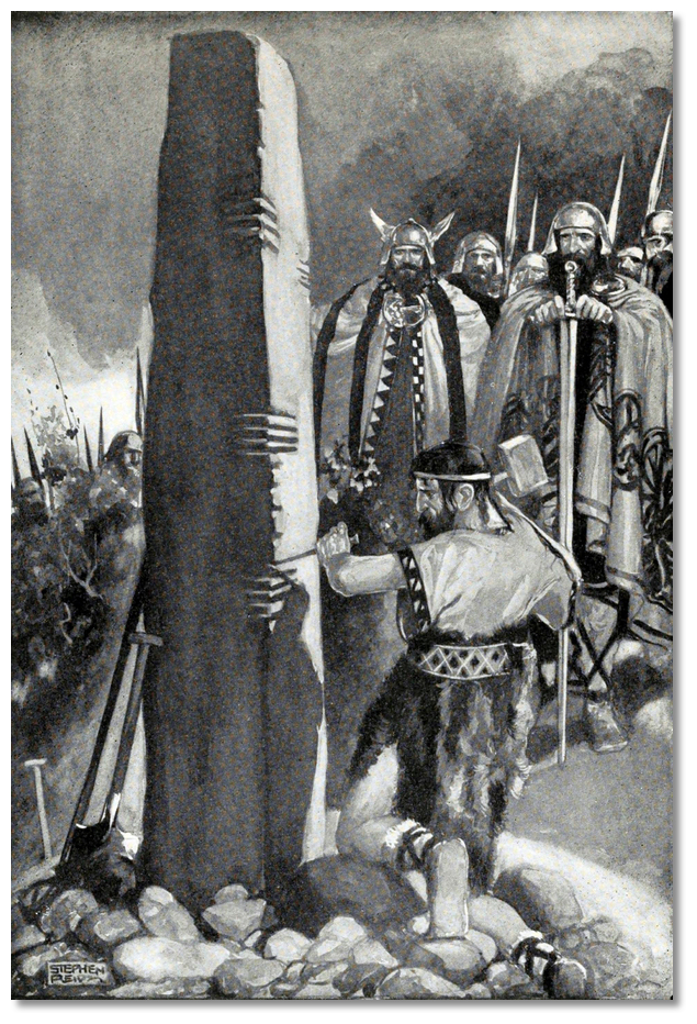
 Depiction of Ogham Stone marking in 'Myths and legends; the Celtic Race'
Image: Public Domain
Very much the opposite in every way and on the opposite side of the bay near the top of a steep hill is the legendary resting place of An Cailleach Beara or the 'The Hag of Beara' that is steeped in legend. 'Cailleach' being the Gaelic word for a hag or old crone literally meaning 'veiled one' - caille means 'hood'. An Cailleach Beara is one of the oldest mythological beings associated with Ireland and legend has it that it was in this area where she mostly lived.
Legend has it that An Cailleach Beara grew younger and more powerful throughout the winter until the spring of May 1st when she is a beautiful maiden. However, during summer, her powers wane and she grows old again. As the myth goes, she had seven periods of youth one after another, so that every man who had lived with her came to die of old age. Her grandsons and great-grandsons were so many that they made up entire tribes and races and as a result, she was known in many parts of Ireland and up along the west coast of Scotland.
 An Cailleach Beara, the 'The Hag of Beara' overlooking Ballycrovane Harbour
Image: Michael Harpur
Tradition states that this divine hag is thought to bring winter, long a time of great struggle in Ireland. Therefore, the locals both feared and respected her. As the goddess of winter, she held the fate of the people in her hands, including the power of life and death during Ireland’s harshest season. They were concerned that her mood might affect the productivity of their winter crops. Hence, she was considered a goddess of sovereignty, giving the Kings the right to rule their lands. Therefore she considered the arrival of Naomi (Saint) Caitiarin, the 7th-century nun, who preached Christianity in Kilcatherine and the surrounding districts, as a new belief system that was a threat to her powers.
 Cill Chaitighearn Church
Image: Michael Harpur
One day after gathering seafood along are shore of Whiddy Island Bantry Bay, the hag returned to Kilcatherine to find the saint asleep on a hillock. She approached quietly, grabbed her prayer book, and ran off. A nearby cripple saw what happened and hailed Naomi Caitiarin who awoke and saw the hag running off. The saint ran after her and caught up with her on the hill overlooking the harbour, which would be called Ard na Cailli the 'headland of the veil', thereafter. She recovered her prayer book and then turned the hag to stone, her back to the hill and her face to the sea. Here her head remains to this day, looking out to sea and awaiting the return of her husband Manannan Mac Lir Irish for 'Manannan son of the sea'. He is the legendary warrior, king and otherworld sea god who will come and set her free again.
 View out over Reen Point from Cill Chaitighearn
 Image: Michael Harpur
The stone in no way looks like the petrified head of a pre-Christian goddess turned to stone. But there is no denying that the strange grey stone, perched on a rocky outcrop overlooking Ballycrovane Bay looks distinctly odd in its setting. It now attracts many offerings from locals asking An Cailleach Beara for indulgences and blessings. The ruin of St Caitiarin's medieval church is a short walk along the road overlooking Reen Point. The earliest historical references to which go back to the 12th century and it was abandoned in the 17th-century. The earliest inscribed grave markers date from the 19th-century but the site is likely to contain burials from much earlier periods in unmarked graves. The numerous low un-inscribed grave markers are a typical feature of West Cork graveyards. They indicate the burial place of those who could not afford a carved headstone.
 Ballycrovane offers a quiet anchorage on a peninsula that is much visited
Image: Michael Harpur
Ballycrovane is a very much less visited harbour which makes it a quieter alternative for visitors to the Berra Peninsula. The Beara Peninsula is incredibly beautiful here and has the spectacular scenery of the Slieve Miskish mountains overlooking Coulagh Bay as a backdrop. The ancient sites of the Ogham stone is a short walk, as is the petrified stone of An Cailleach Beara and Kilcatherine Church with its views over the bay it is very worthwhile.
 Ballycrovane Quay
Image: Michael Harpur
From a boating perspective, Ballycrovane Harbour is an ideal location to drop into for an overnight stop whilst passing the mouth of the Kenmare River. Although it has no facilities it is a very good harbour that is easily accessed.
What facilities are available?
there are no facilities at Ballycrovane Harbour save for the Quay. Shops and pubs will be found at the small village of Eyeries is less than 3km by road from the quay.With thanks to:
eoceanic.comAerial View
Add your review or comment:
Please log in to leave a review of this haven.
Please note eOceanic makes no guarantee of the validity of this information, we have not visited this haven and do not have first-hand experience to qualify the data. Although the contributors are vetted by peer review as practised authorities, they are in no way, whatsoever, responsible for the accuracy of their contributions. It is essential that you thoroughly check the accuracy and suitability for your vessel of any waypoints offered in any context plus the precision of your GPS. Any data provided on this page is entirely used at your own risk and you must read our legal page if you view data on this site. Free to use sea charts courtesy of Navionics.


